Volume III of the monumental atlas, ‘L’Orbe Cattolico ossia Atlante Geografico Storico Ecclesiastico’. |
||||||||||||||||||||
|
||||||||||||||||||||
|
|
||||||||||||||||||||
$25000 / ≈ €21997This item is available for immediate sale! Questions before Buying ?
We are happy to answer your questions.
25000.00
|
Virtual Collection - Save and collect your favorite items in one place.
Unless logged in, the item is only saved for that session. If you want to save the items permanently, please Login first Learn more [+] |
|||||||||||||||||||
Description
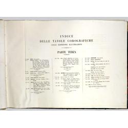
Volume three contains 40 large-format, Plano copper-engraved maps, original full-color hand-colored, on fine-wove paper watermarked with ‘Pietro Miliani Fabriano’. Published in Rome: Tipografia della Reverenda Camera Apolostica, 1858.
The atlas is bound in contemp. half vellum, boards covered with marbled paper. (needs restoration)
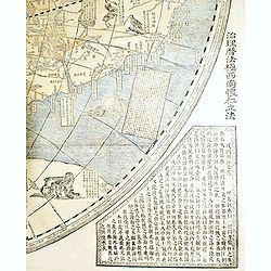
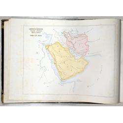
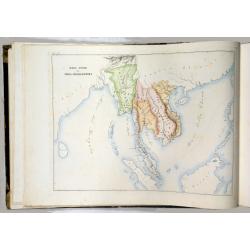
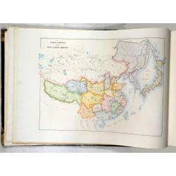
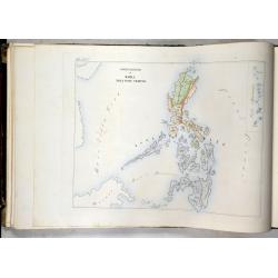
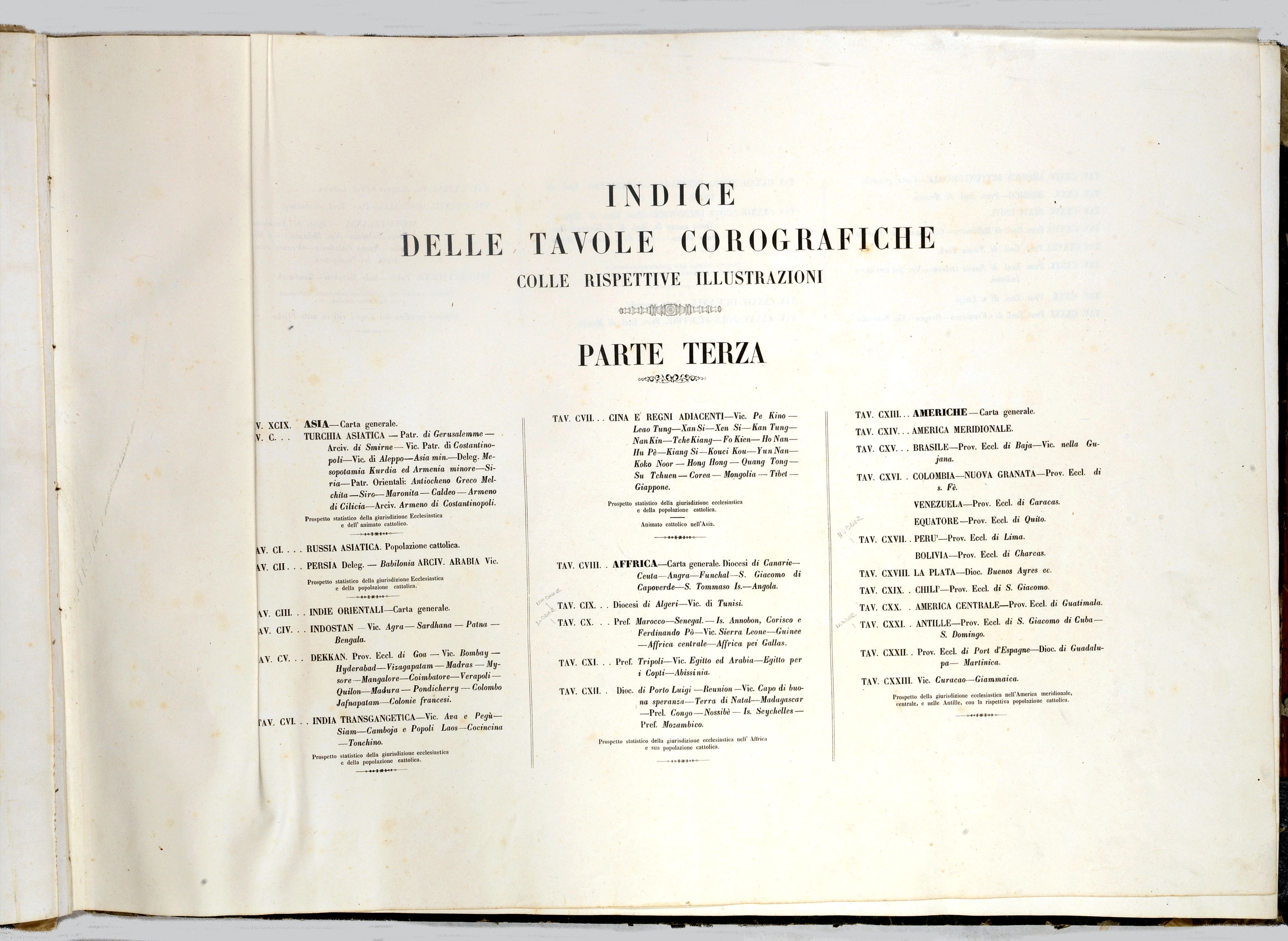
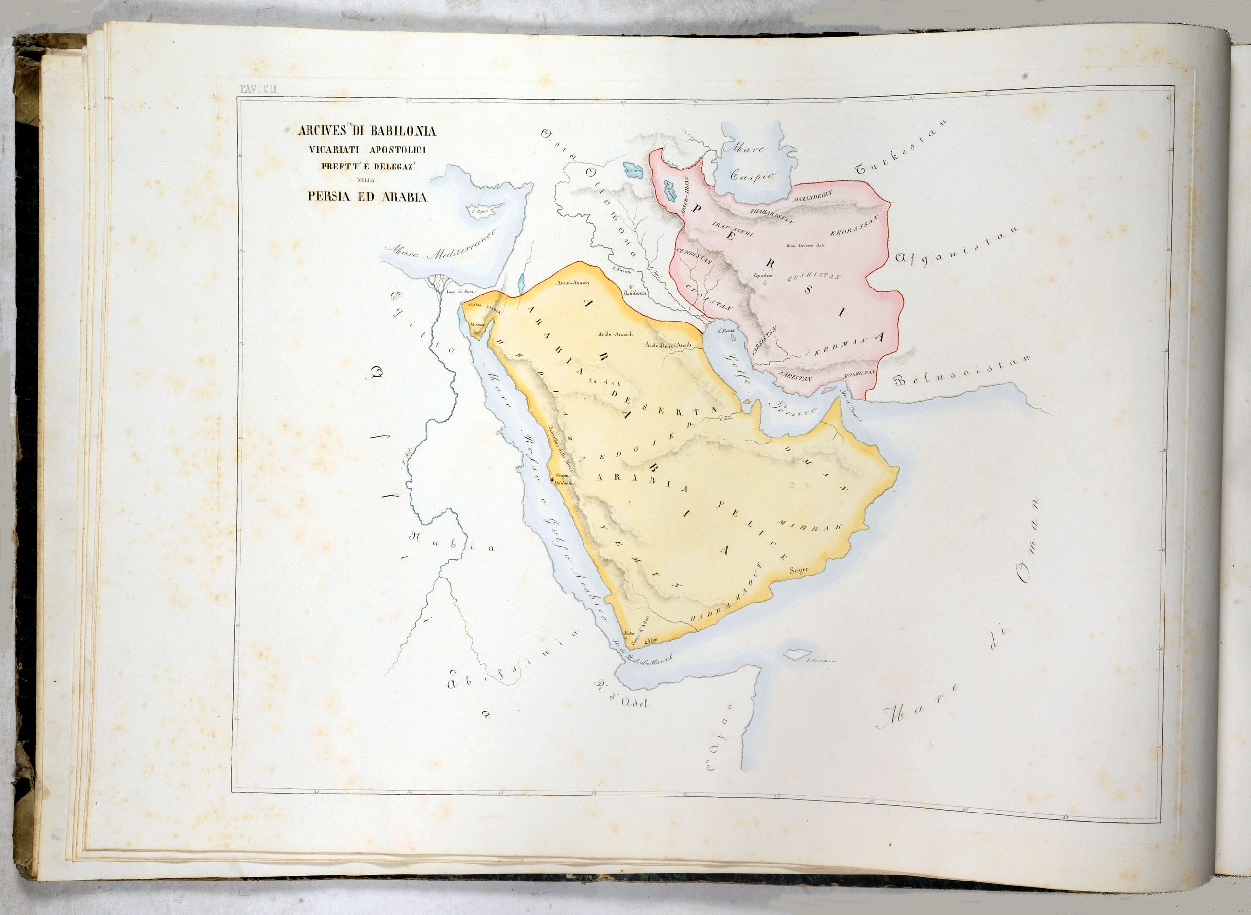
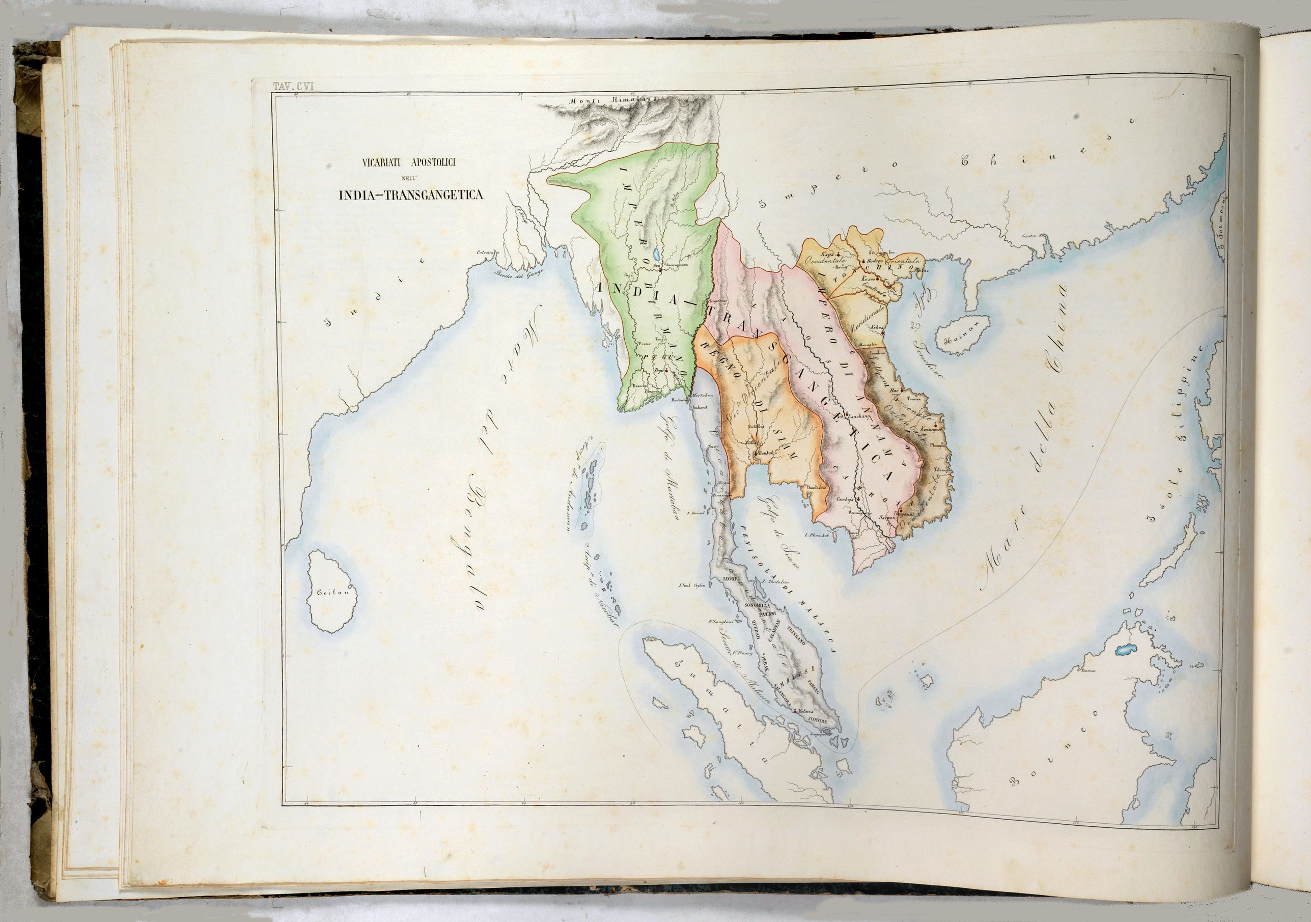
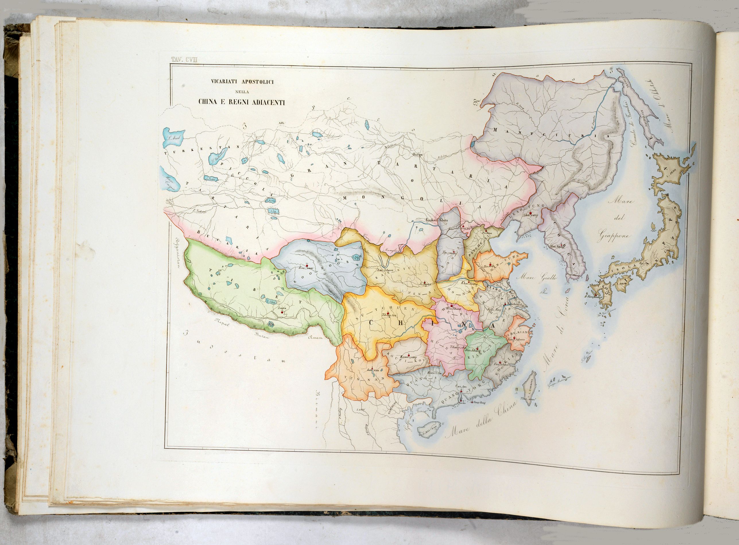
Asia: This part contains nine plano maps, each followed by a 2-page descriptive text in 4 columns.
Africa: contains five plano maps, each accompanied by a 2-page descriptive text in 4 columns.
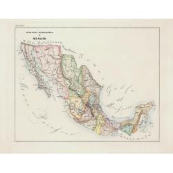
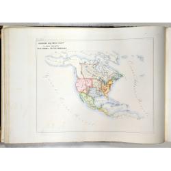
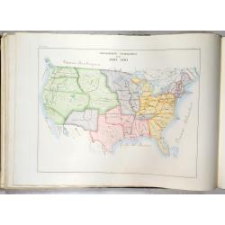
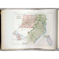
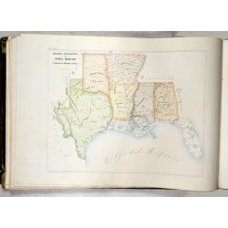
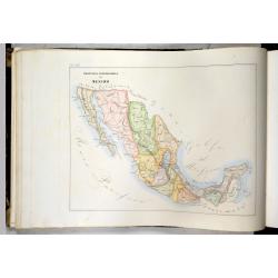
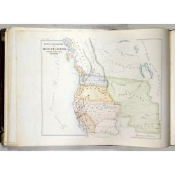
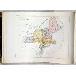
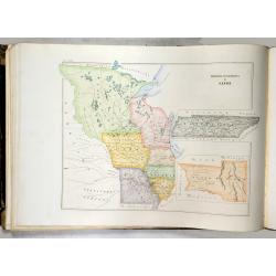
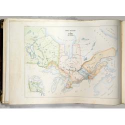
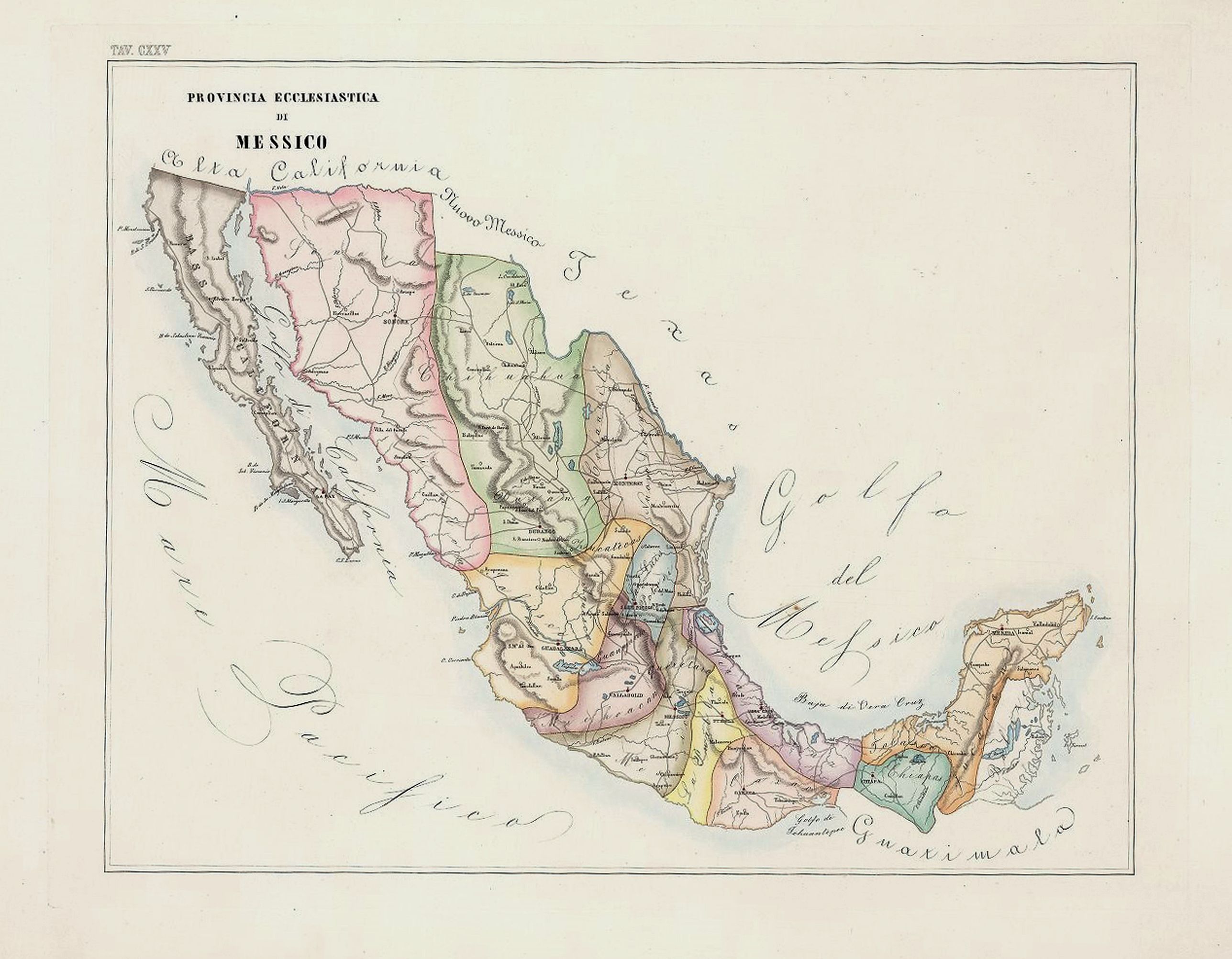
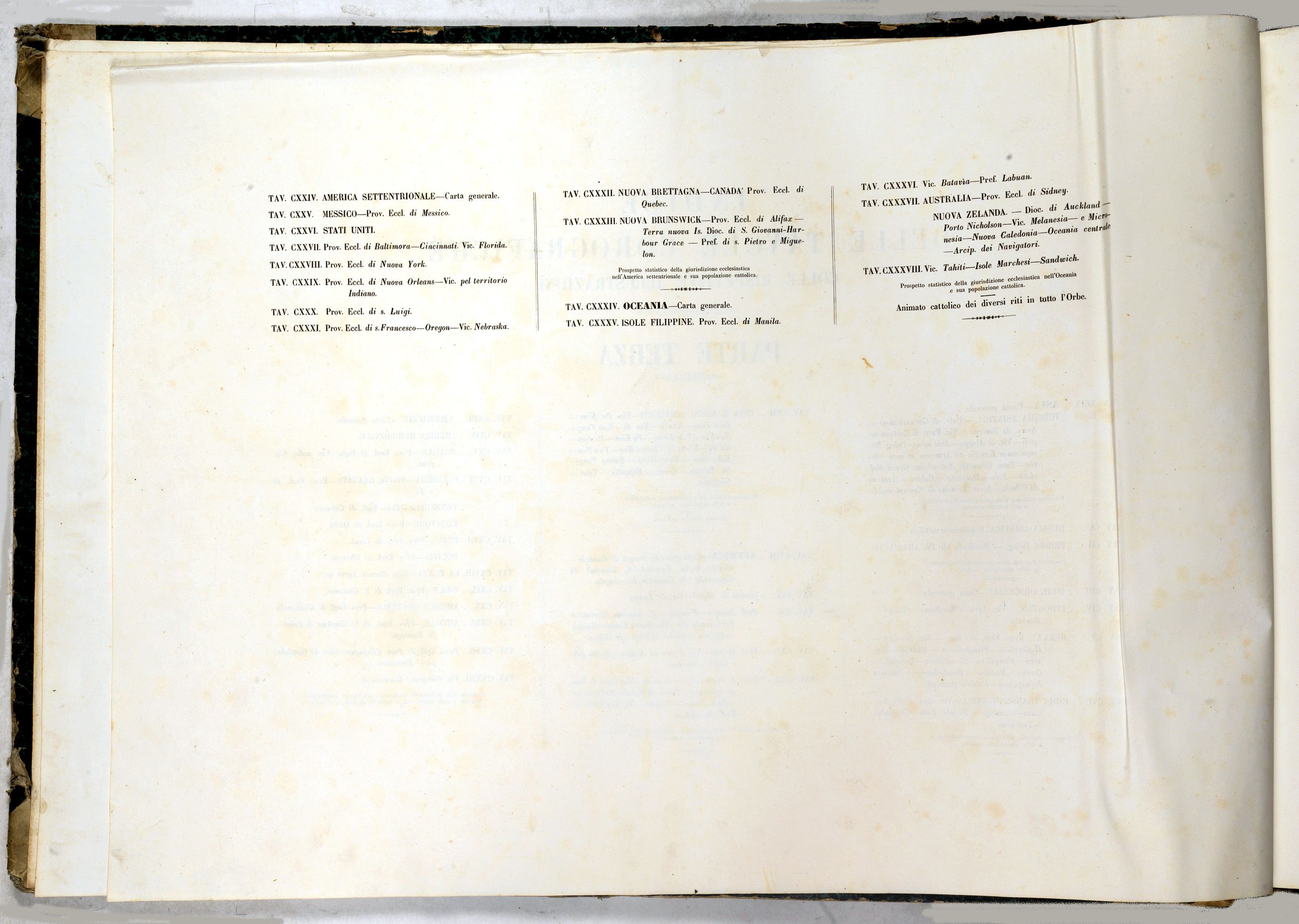
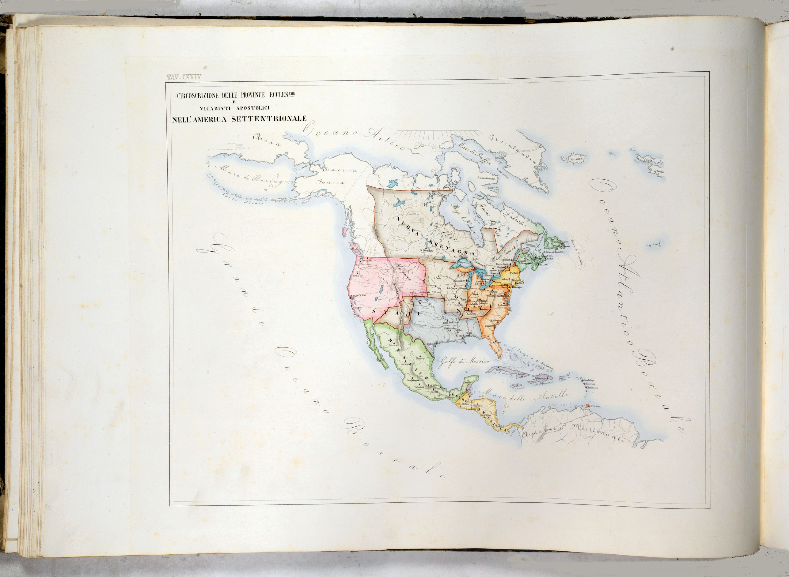
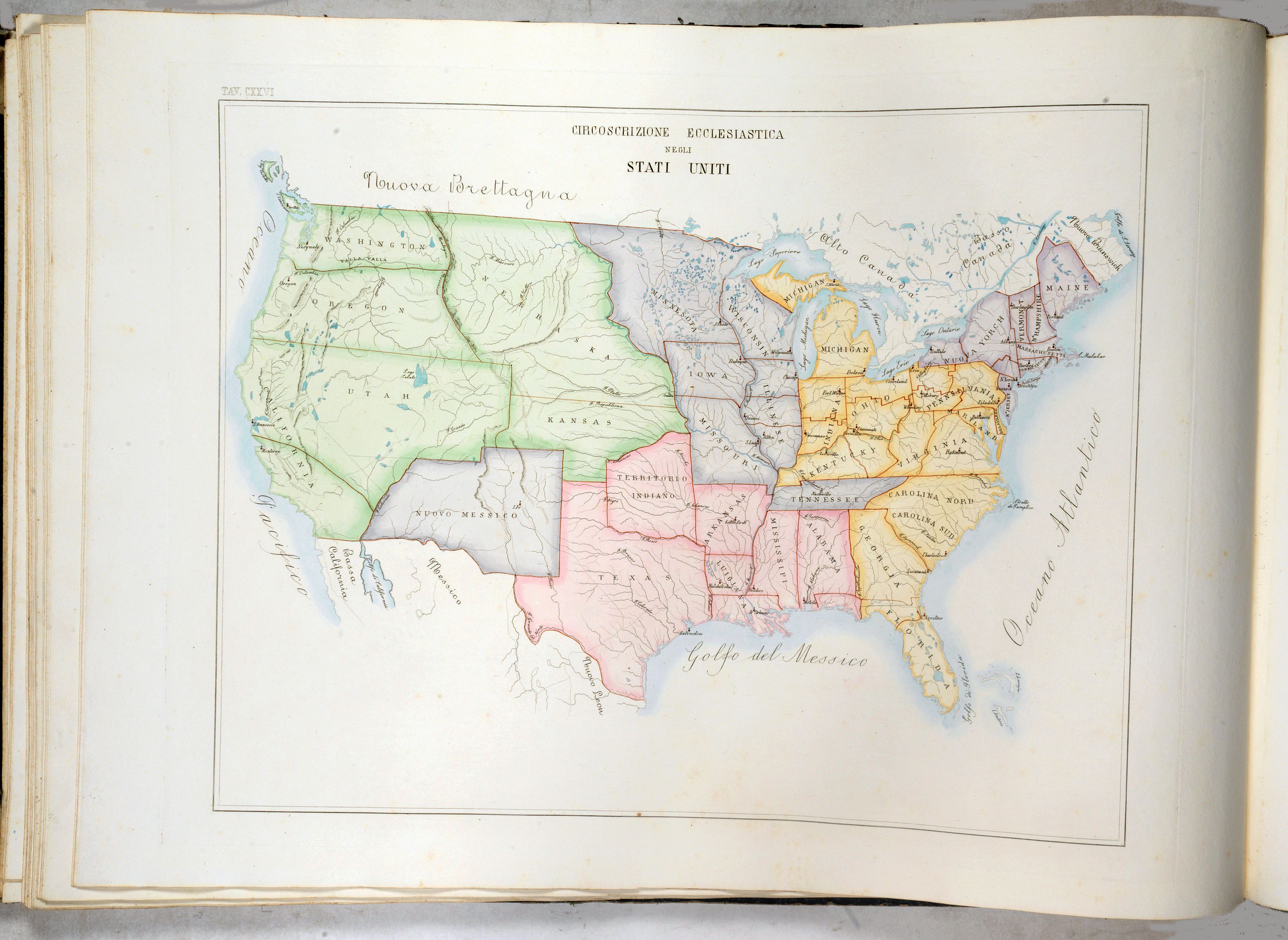
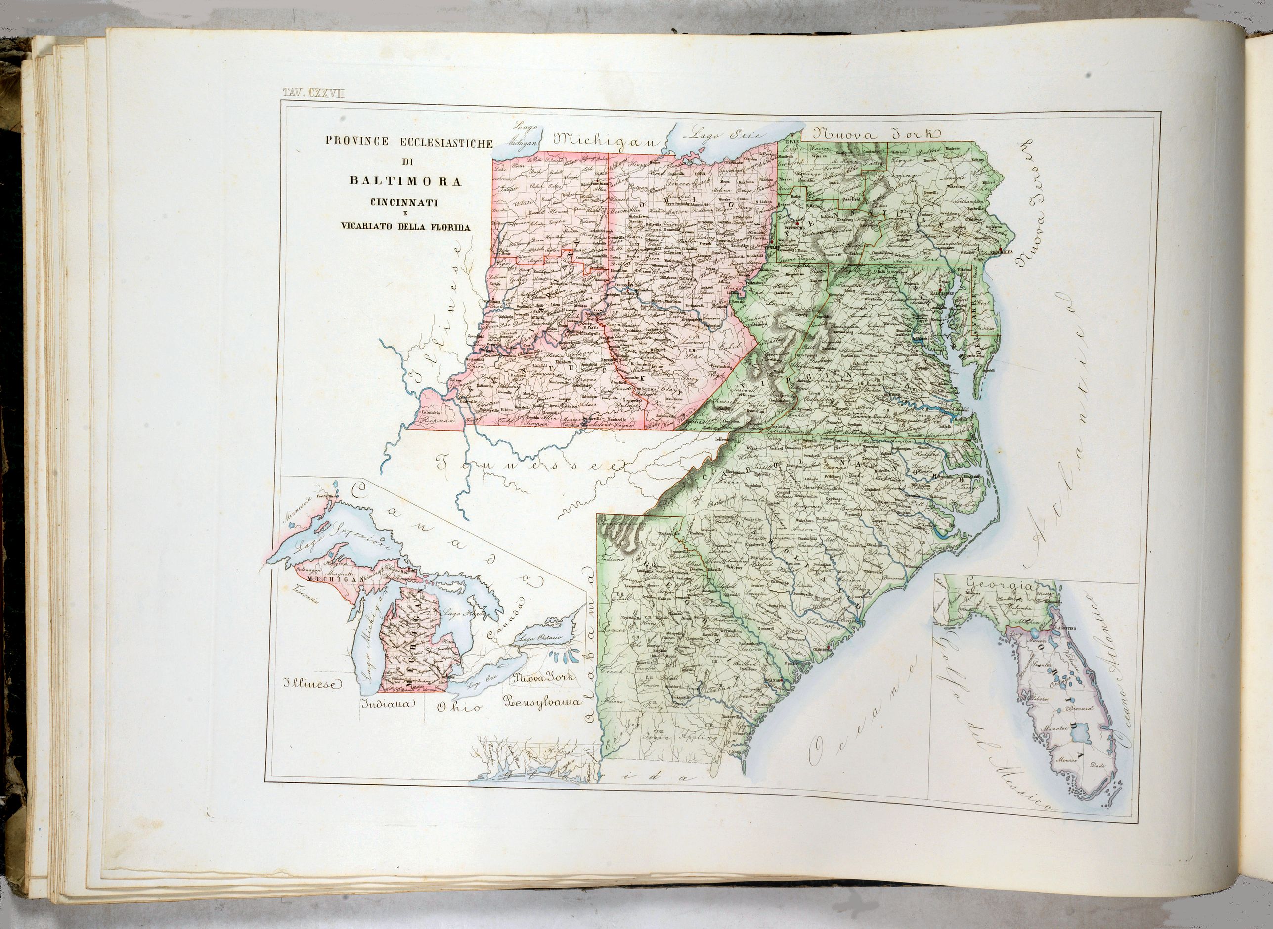
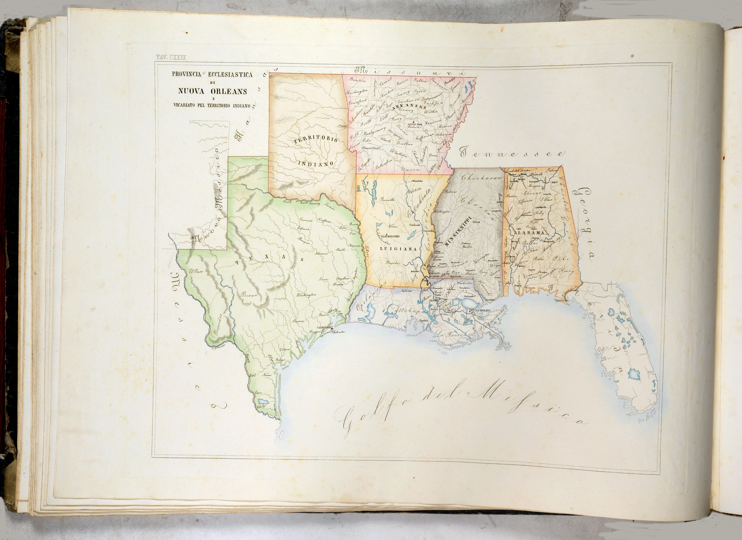
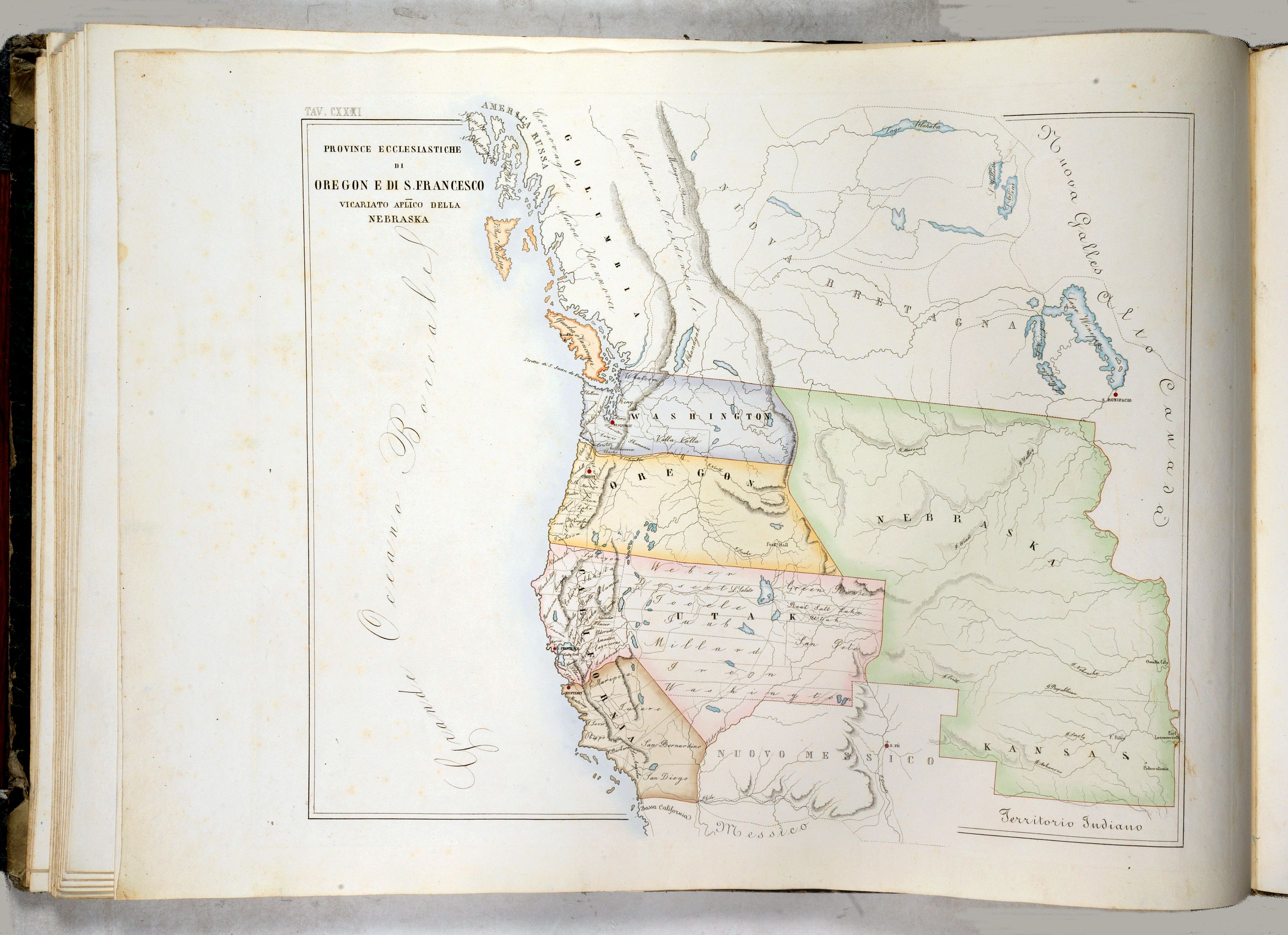
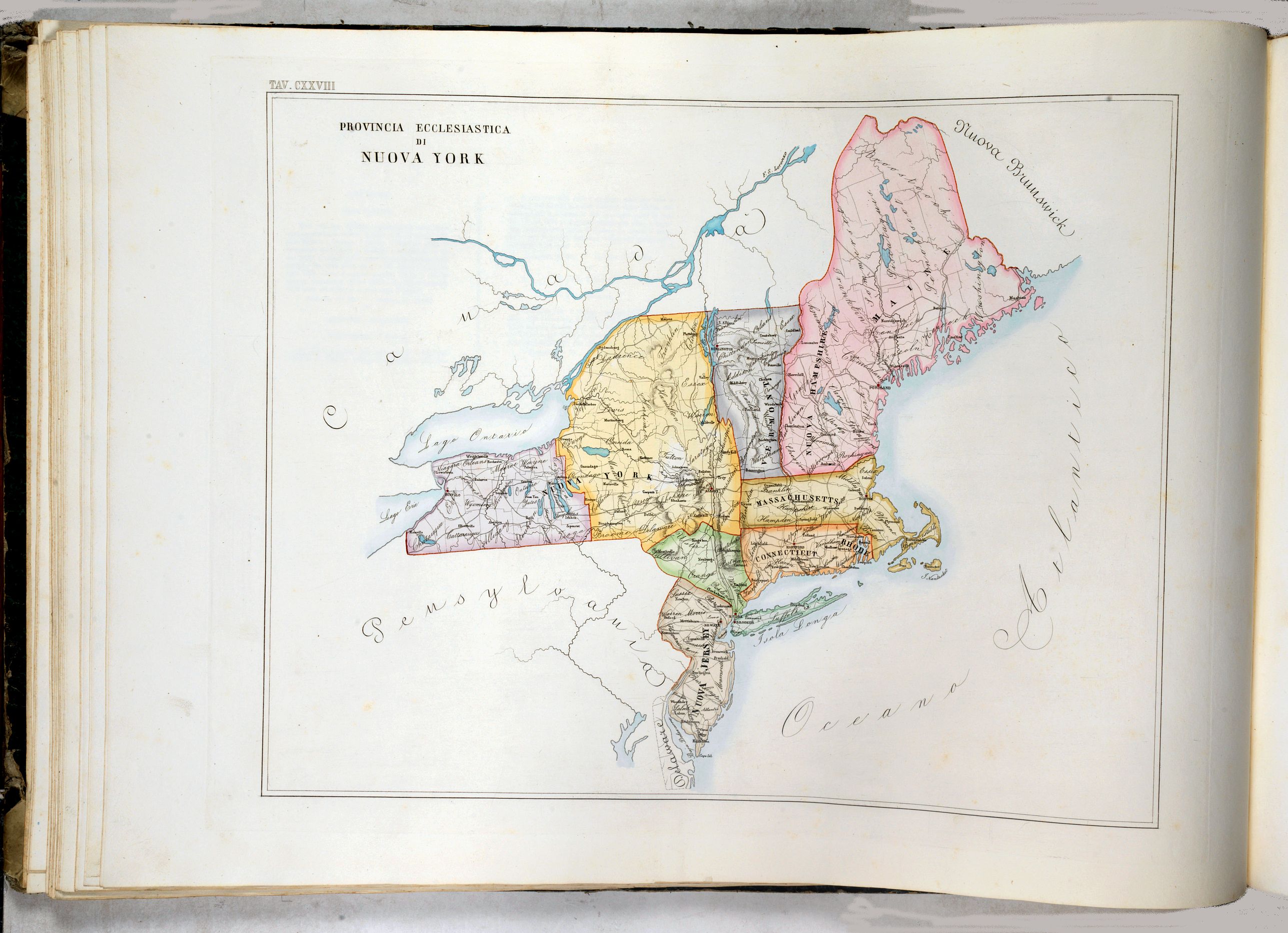
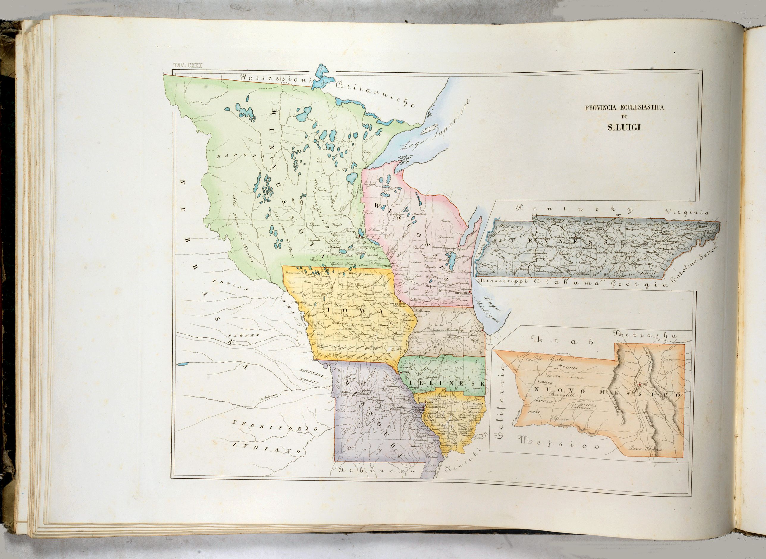
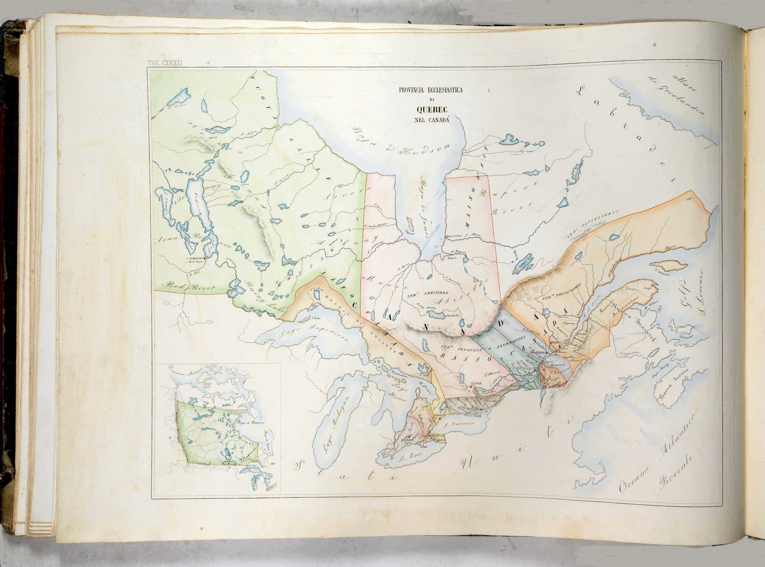
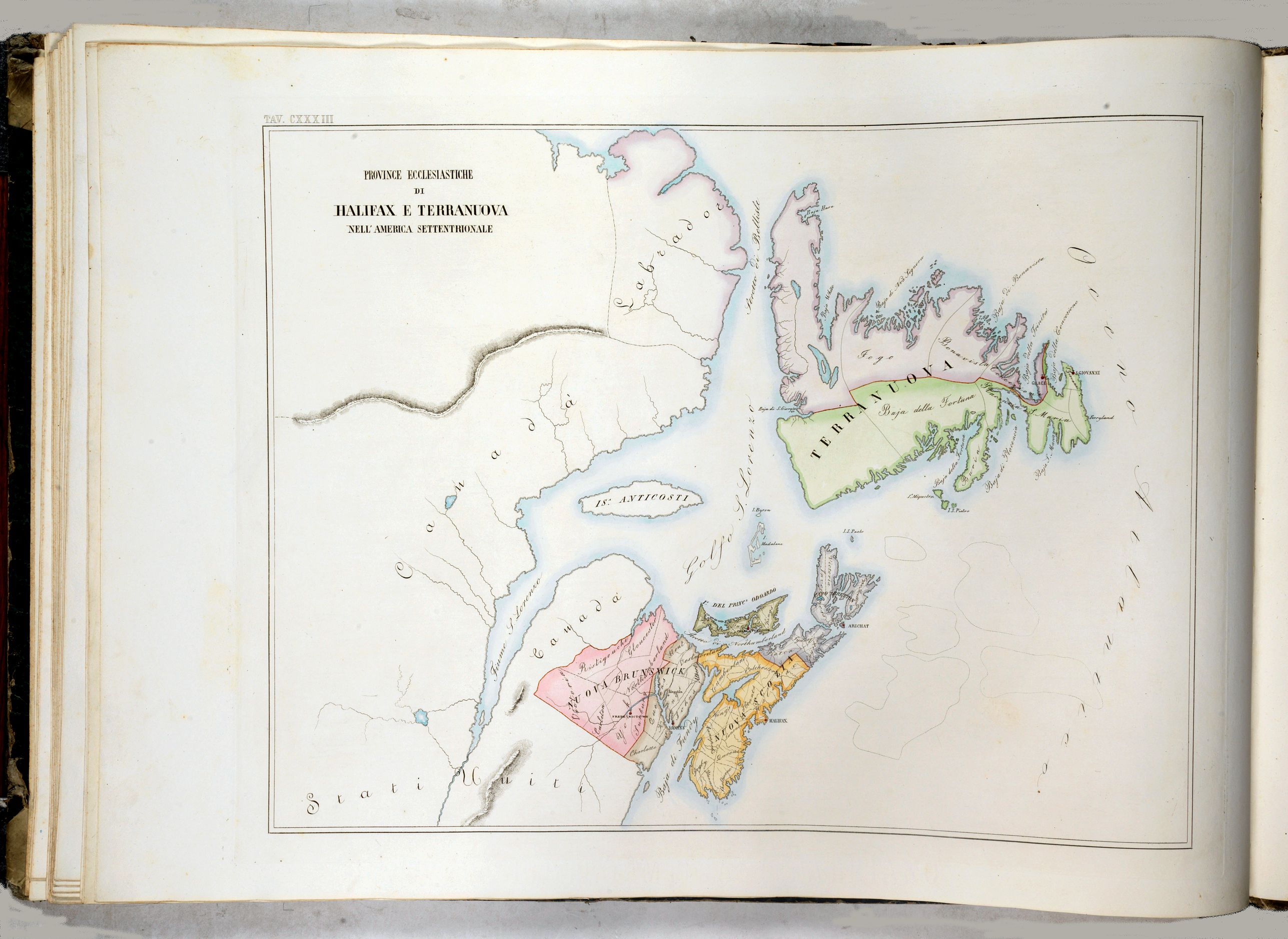
America: The American section contains 21 Plano maps, each accompanied by a 2-page descriptive text in 4 columns. The American section includes a map of the United States depicting five Ecclesiastical Provinces. Perhaps most curious is that the Ecclesiastical Province of St. Louis, including New Mexico, Tennessee, and the three parts of “Illinese,” was all then part of the Ecclesiastical Province of San Luigi (St. Louis).
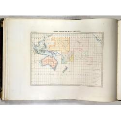
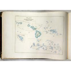
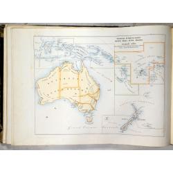
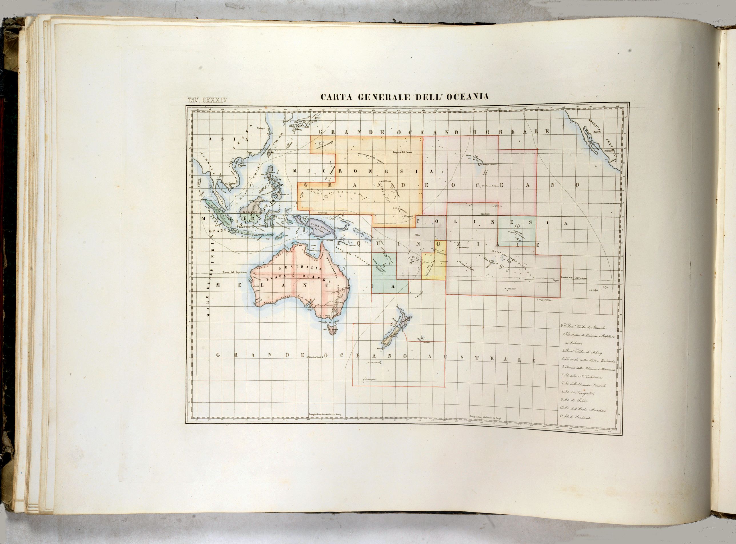
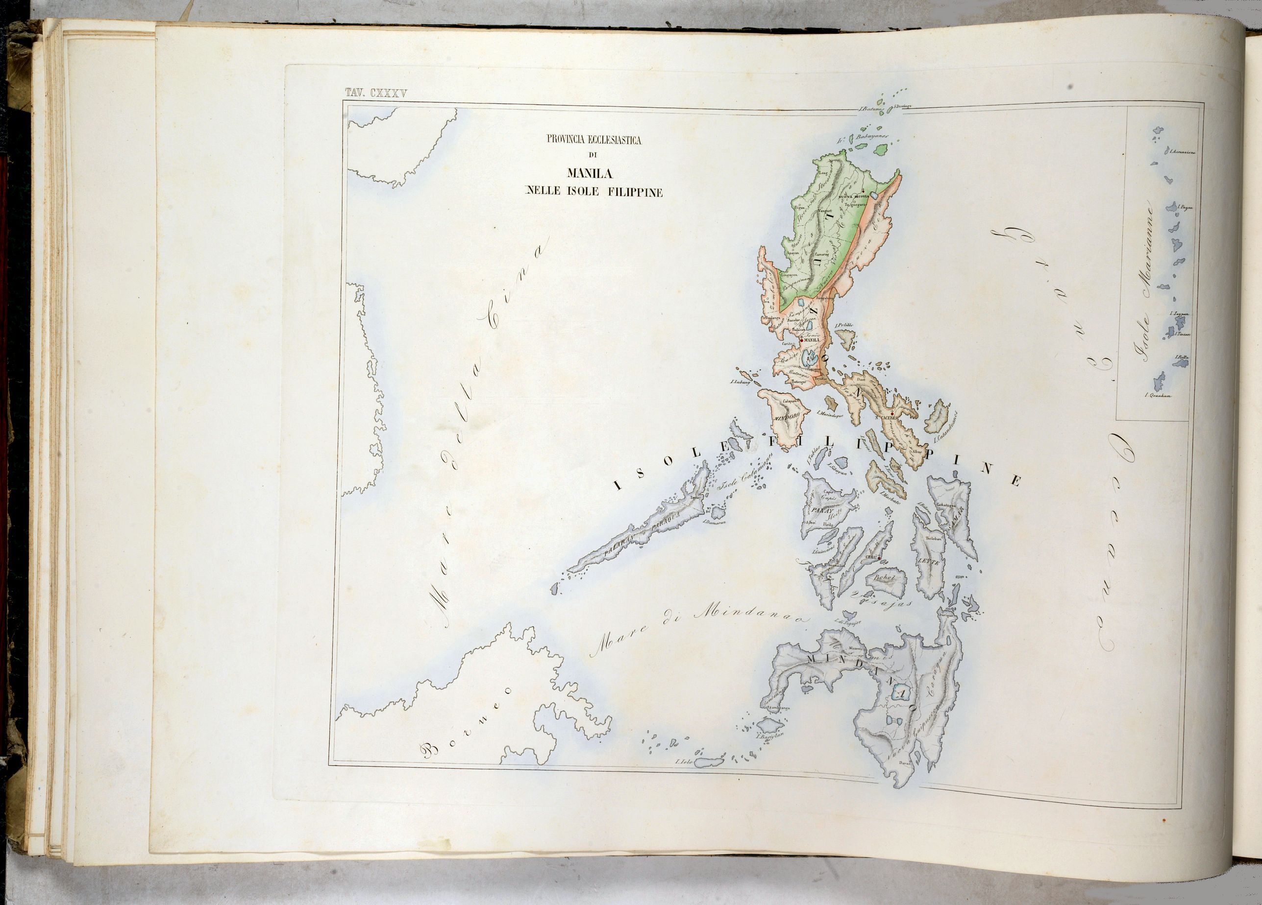
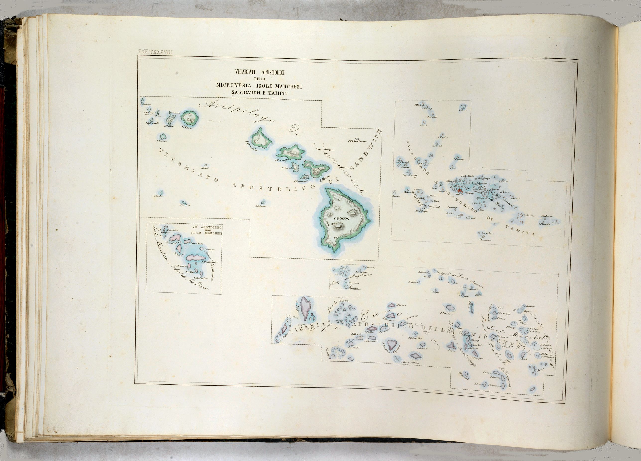
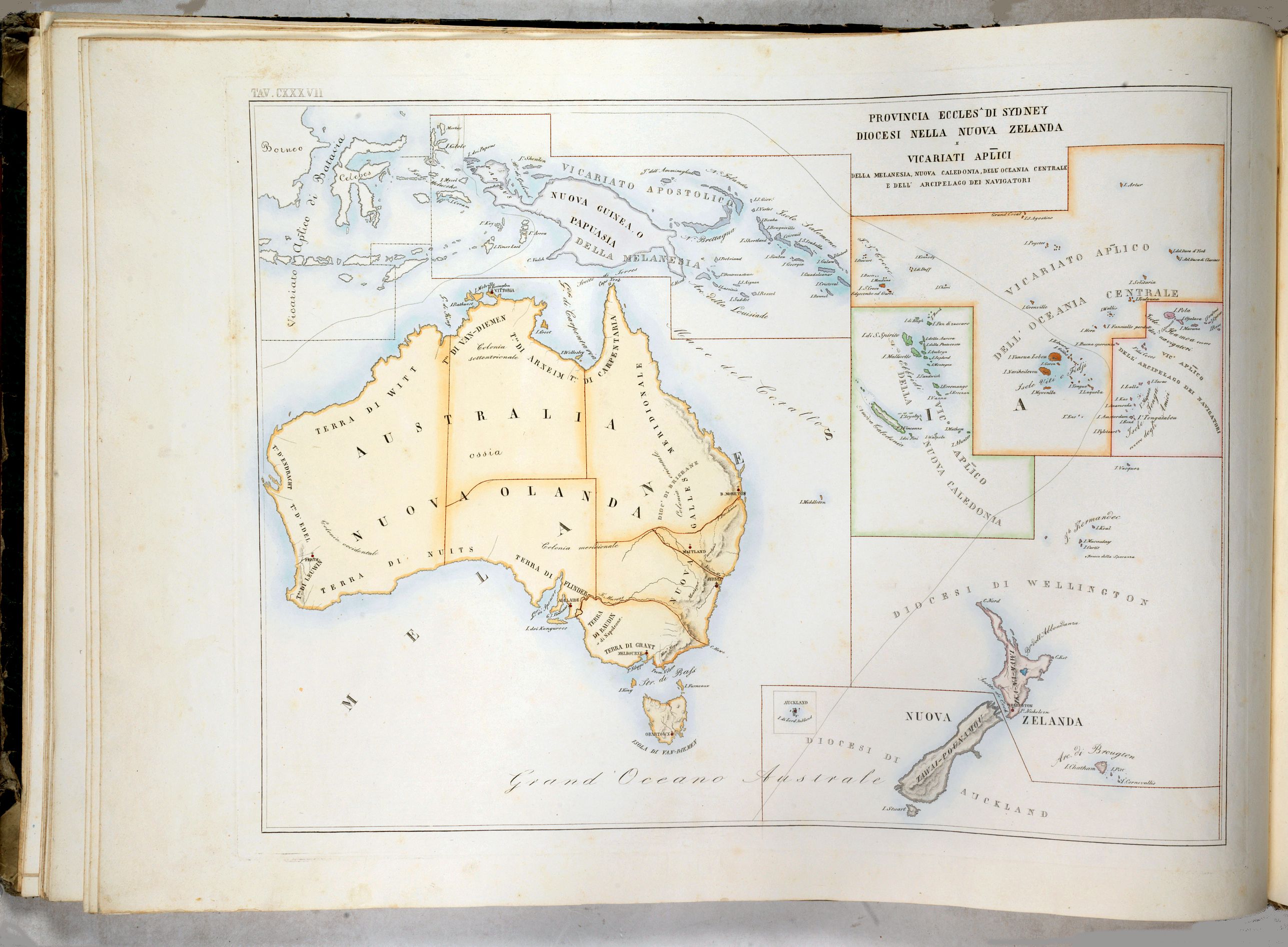
Oceania : 5 maps. Including Maps of Australia.
The large-format maps are finely engraved and beautifully colored and were prepared by Girolamo Petri, a lawyer who served as a senior official within the Vatican’s State Secretariat, the arm of the Holy See responsible for managing its relationships with foreign powers.
The atlas is a testament to the artistry of the engravers and the publisher's relative indifference to the work's commercial success. It is undoubtedly one of the most finely engraved and elegant works of the mid-19th Century.
The uncommonly beautiful atlas was published in only a very small number of examples for the exclusive use of Cardinals and high-ranking administrators, which accounts for its great rarity today.
Petri’s monumental atlas of the Church’s worldwide ecclesiastical divisions was published in Rome in three volumes from 1858 to 1859. Volume I contains maps of Italy. Volume II with maps of European countries, containing 47 maps of the European countries and a World map). Volume III with maps of countries in Asia, Africa, America and Oceania.
The maps show the various dioceses, each distinguished by bright colors marking their seats, as well as other major towns. While key geographical features are expressed throughout, the maps are intentionally sparing of detail so as not to visually detract from their purpose, which is to show the ecclesiastical divisions.
Petri was commissioned by Pope Pius XI (reigned 1846-78), the longest ever reigning pontiff, to create this magnificent atlas during a time when the Church was under siege within Europe, but, conversely, while it had major ambitions for expansion overseas, particularly in Asia and Africa.
Pope Pius IX (1792 - 1878)
was born Giovanni Maria Mastai-Ferretti. His reign as Pope ran from 1846 until his death in 1878, the longest pontificate in the Catholic Church's history. Among the pontificate's historically significant events was the end of the Papal States.
Beginning with the unrest in Rome, which led to the declaration of a Roman Republic in 1849, through the period of Austrian and French protection under Napoleon III of France, and culminating with Victor Emmanuel II's reunification of Italy and arrest of the Pope in 1870.
Petri, who was commissioned by Pope Pius XI, was thus created during a time when the Church was under siege within Europe. Conversely, it had major ambitions for expansion overseas, particularly in Asia and Africa.
The mid-19th Century was a period of dramatic change in Rome. The atlas was undoubtedly part of the Vatican's last-ditch efforts to understand and control its vast influence worldwide. It resurrected the popular concept of ecclesiastical provinces popularized in works by Nicholas Sanson and others during the 17th Century.
Girolamo Petri: Merging Church and Cartography.
Girolamo Petri (1806 - 1871) was an important figure in the administration of the Roman Catholic Church during the reign of Pius IX. He was born in Onano (Viterbo, Lazio), the son of a Vatican civil servant who subsequently became the Governor of Frascati. Petri trained as a lawyer and took on many cases for the Church until being appointed, in 1847, to serve as a senior official in the State Secretariat. This curia body oversaw the Church’s overseas operations. Petri was a great cartography enthusiast, and it was only fitting that Pius IX charged him with creating the magnificent atlas, L’Orbe Cattolico.
In creating the atlas, Petri noted that he drew only upon the “most trusted sources”, including maps from the Vatican archives and overseas dioceses. The atlas was by far and away the finest ecclesiastical atlas created during the 19th Century, featuring exceptionally beautiful examples of thematic cartography.
A Note on Rarity
The atlas L’Orbe Cattolico is a great rarity—we cannot find any examples of it appearing in the market during the last 30 years, although a number of examples have been held in institutional collections since the 19th Century.
References: Walter Goffart, Historical Atlases: The First Three Hundred Years, 1570-1870 (Chicago, 2003), p. 427-8; J.A.B. Jongeneel, Philosophy, Science, and Theology of Mission in the 19th and 20th Centuries: A Missiological Encyclopedia (1995), p. 264
EXTRA SHIPPING COSTS APPLYING DUE TO WEIGHT AND SIZE.
FAQ - Guarantee - Shipping
Buying in the BuyNow Gallery
This item is available for immediate purchase when a "Add to Cart" or "Inquire Now" button is shown.
Items are sold in the EU margin scheme
Payments are accepted in Euros or US Dollars.
Authenticity Guarantee
 We provide professional descriptions, condition report (based on 45 years experience in the map business)
Paulus Swaen warrants the authenticity of our items and a certificate of authenticity is provided for each acquired lot.
Condition and Coloring
We indicate the condition of each item and use our unnique HiBCoR grading system in which four key items determine a map's value: Historical Importance, Beauty, Condition/Coloring and Rarity.
Color Key
We offer many maps in their original black and white condition. We do not systematically color-up maps to make them more sellable to the general public or buyer.
Copper engraved or wood block maps are always hand colored. Maps were initially colored for aesthetic reasons and to improve readability. Nowadays, it is becoming a challenge to find maps in their original colors and are therefor more valuable.
We use the following color keys in our catalog:
Original colors; mean that the colors have been applied around the time the map was issued.
Original o/l colors; means the map has only the borders colored at the time of publication.
Colored; If the colors are applied recently or at the end of the 20th century.
Read more about coloring of maps [+]
Shipping fee
A flat shipping fee of $ 30 is added to each shipment by DHL within Europe and North America. This covers : International Priority shipping, Packing and Insurance (up to the invoice amount).
Shipments to Asia are $ 40 and rest of the world $50
We charge only one shipping fee when you have been successful on multiple items or when you want to combine gallery and auction purchases.
Read more about invoicing and shipping
FAQ
Please have a look for more information about buying in the BuyNow gallery
Many answers are likely to find in the general help section.
Virtual Collection
![]()
With Virtual Collection you can collect all your favorite items in one place. It is free, and anyone can create his or her Virtual map collection.
Unless you are logged in, the item is only saved for this session. You have to be registed and logged-in if you want to save this item permanently to your Virtual Collection.
Read More[+]
Register here, it is free and you do not need a credit card.
Add this item to
Virtual Collection
or click the following link to see my Virtual Collection.
| High-Resolution Digital Image Download | |
|
Paulus Swaen maintains an archive of most of our high-resolution rare maps, prints, posters and medieval manuscript scans. We make them freely available for download and study. Read more about free image download |
Click this image for a free HR-image download. |

In accordance with the EU Consumer Rights Directive and habitually reside in the European Union you have the right to cancel the contract for the purchase of a lot, without giving any reason.
The cancellation period will expire 14 calendar days from the day after the date on which you or a third party (other than the carrier and indicated by you) acquires, physical possession of the lot. To exercise the right to cancel you must inform Paulus Swaen Europe bv, which is offering to sell the lot either as an agent for the seller or as the owner of the lot, of your decision to cancel this contract by a clear statement (e.g. a letter sent by post, or e-mail (amsterdam@swaen.com).
To meet the cancellation deadline, it is sufficient for you to send your communication concerning your exercise of the right to cancel before the cancellation period has expired.