Description
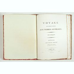
First edition of the second part of the atlas by Freycinet, part of his important book "Voyage de découvertes aux Terres Australes".
Illustrated with two folding maps of Australia (with two small tears) and the southeastern part of the continent, called Terre Napoléon. Other maps are full, half, or quarter-page charts. Maps are, in general, very clean, with only very minor spotting.
The second part, established by Freycinet (Paris, 1811) contains 14 maps and plans, including 2 large folding maps of New Holland and Terre Napoléon, of the Bonaparte and Josephine Gulfs, of the Bay of Chiens-Marins (Seadogs), etc.
In 1800, the First Consul ordered a scientific expedition to reconnoiter the coasts of the Southern Lands and the southern coast of Australia (Terre Napoléon). Captain Nicolas Baudin left Le Havre with many scientists on board, among them the naturalist François Péron (1775-1810), Louis Freycinet (1779-1842), and the painter Charles-Alexandre Lesueur.
This scientific voyage, "the apogee of 18th-century voyages", was an undeniable success in natural history: a collection of 2,500 new species was added to the Museum. The navigators explored the southern coast of Australia, which they named "Terre Napoléon". The report of the voyage was started by the naturalist Péron and completed by Freycinet.
List of maps :
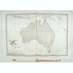
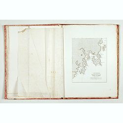
1/ Carte générale de la Nouvelle Hollande.
Freycinet's map of New Holland was the first 'complete' map printed of the Australian coast.
In
the bottom left corner are shown the three ships of the Baudin voyage, Géographe, Naturaliste, and Casuarina. The longitude is calculated from Paris. Engraved by P.A.F. Tardieu, Paris, Place de l'Estrapade No.1.
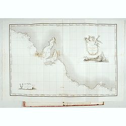
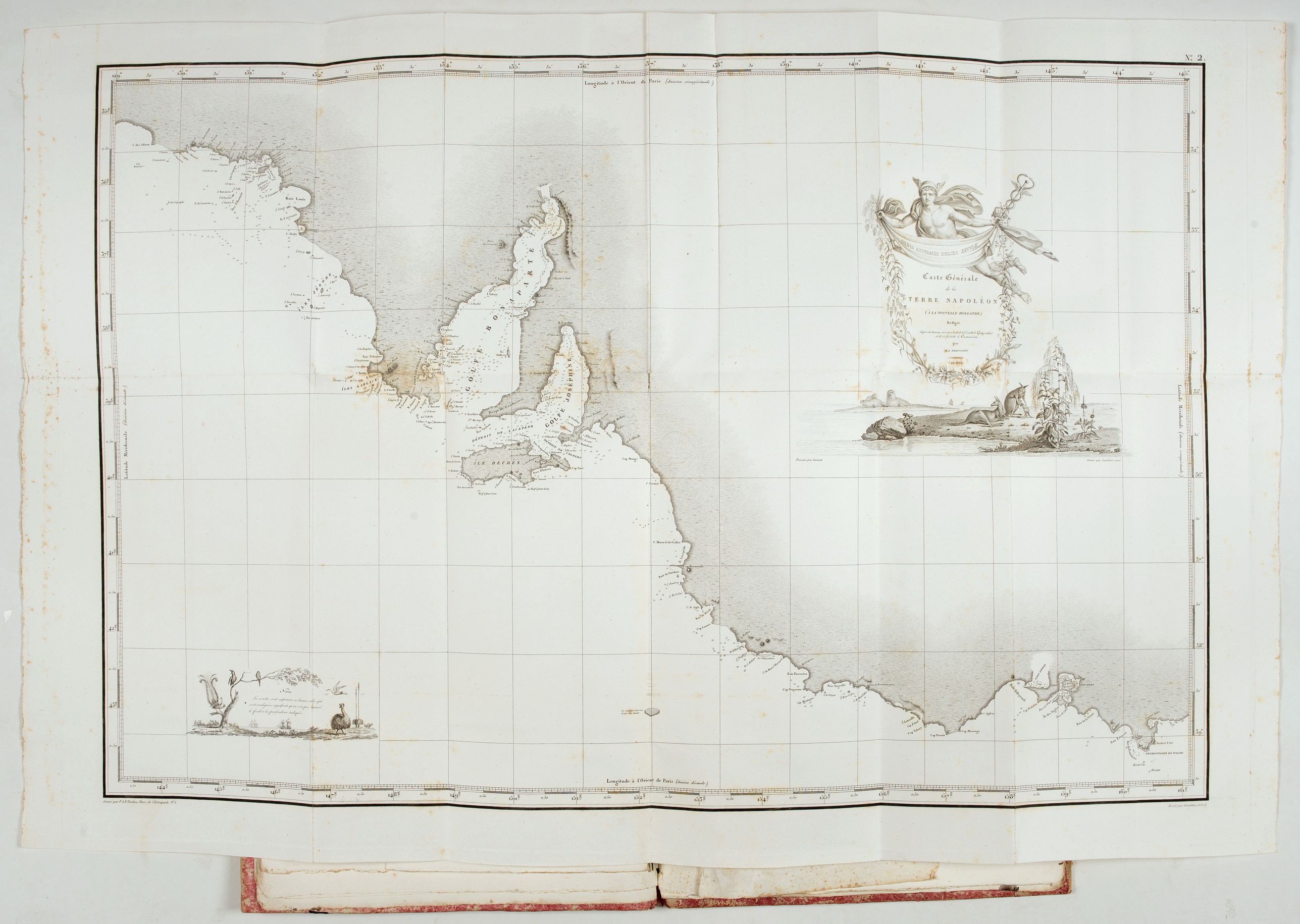
2/ Carte générale de la Terre Napoléon.
The cartouche on this map features Napoleon himself in the upper right-hand corner and a natural history scene revealing the wonders of this
previously un-recorded coastline in the lower left-hand corner, including the La Geographe and La Naturalist sailed during the voyage. Engraved by P.A.F. Tardieu, Paris, Place de l'Estrapade No.1.
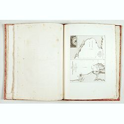
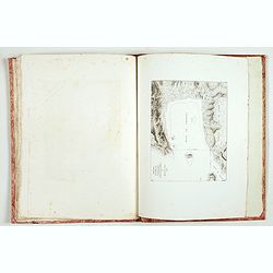
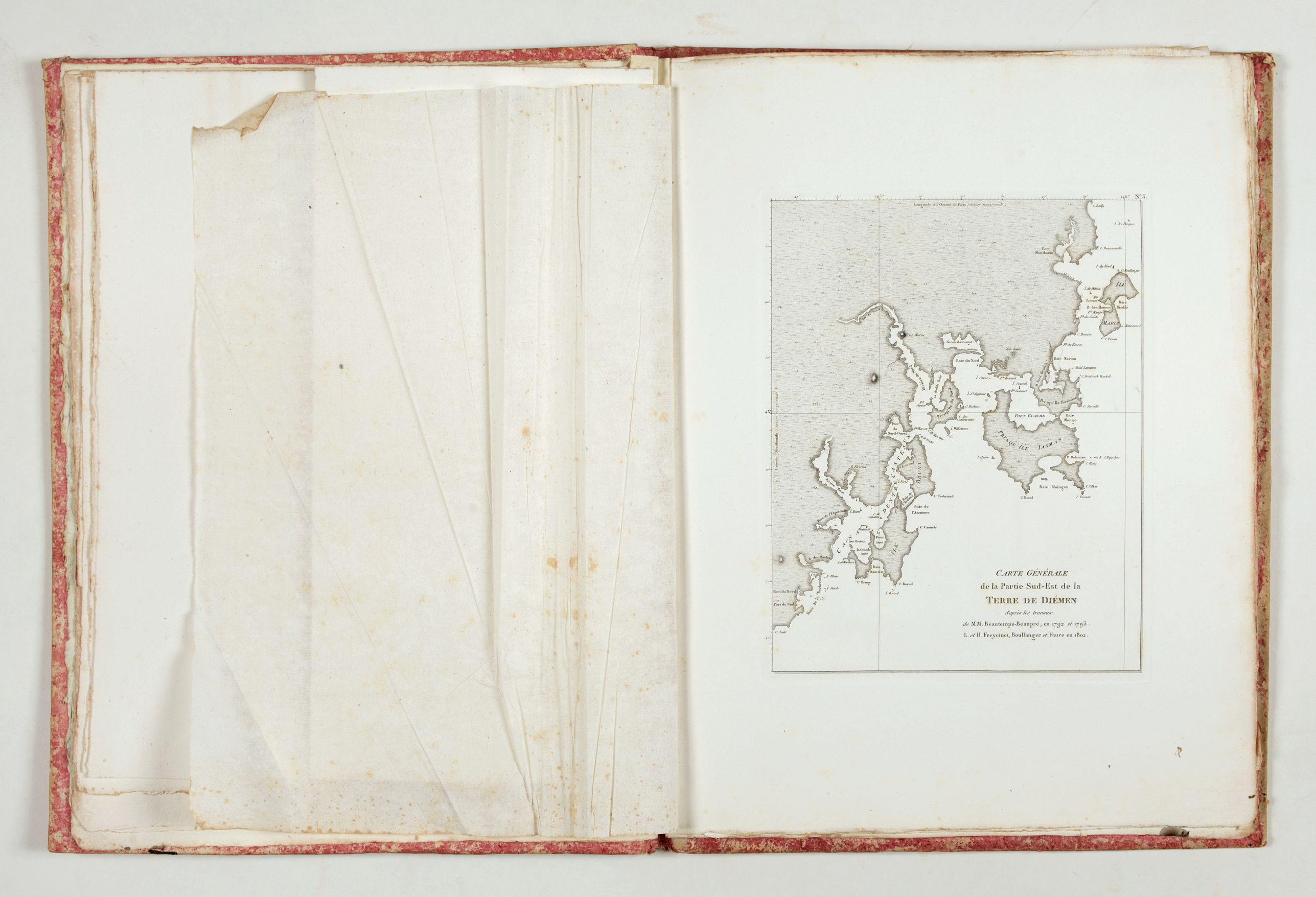
3/ Terre de Diemen
4/ Îles Furneaux and partie de la Côte Orientale de la Terre de Diemen
5/ Îles Hunter, King, Maria and Partie de l’Archipel Bonaparte
6/ Partie de la Terre Napoléon and Îles Joséphine et baie Murat
7/ Golfes Bonaparte et Joséphine
8/ Îles Decrès, de l’Institut
9/ Comté de Cumberland, Îles Jérôme, Berthier
10/ Baie du Géographe, Port du Roi-Georges
11/ Baie Laplace, Îles Forestier, Ports Western et Champagny
12/ Îles Louis-Napoléon et de la Rivière des Cygnes
13/ Baie des Chiens-Marins
14/ Baie de Coupang.
Although Matthew Flinders was the first person to circumnavigate
Australia, in Her Majesty’s ship the Investigator between 1801-03, ironically, the French lay claim to publishing the first complete map of the Australian continent. Freycinet’s map was published
in France in 1811 three years before Flinders’ own chart and appeared in the official account of the 1801-1804 French voyage to Australia commanded by Nicolas Baudin.
Baudin’s exploits in Australia
commenced some seven months before Flinders arrived from Spithead in the Investigator. Rather than head for the uncharted southeast coast, Baudin instead sailed north up the west coast of Australia, occasionally
landing at points previously uncharted by the earlier 17th-century Dutch navigators, finally arriving at Timor.
Meanwhile, Flinders had set out from Cape Leeuwin in an easterly direction with the intention of circumnavigating the continent. When Baudin eventually made it to the
southern coast of Australia, Flinders had already charted a great deal
of the previously uncharted south-eastern coast.
The two parties
finally crossed paths at Encounter Bay (east of Adelaide) on 8 April
1802. Baudin had managed to chart only a small 200-mile section of the
coast west of Wilson’s Promontory.
Although France was at war with England at this time, Flinders had been promised safe passage back to
England. On his return, however, he was imprisoned by the French on Mauritius and held captive there for six and a half years.
Meanwhile,
the Baudin expedition had returned to France and the subsequent account
of the voyage was published from 1807 onwards by Peron. In 1810, Peron
died and Freycinet took over the task of completing the account. In
1811, Freycinet released the second part of the atlas, which contained
this general chart of Australia. Flinders on the other hand, had to wait
until 1814 before he could publish his own general Australian map.
Reference: Sabin, 60998. Ferguson, 978 et 523.
Illustrated with two folding maps of Australia (with two small tears) and the southeastern part of the continent, called Terre Napoléon. Other maps are full, half, or quarter-page charts. Maps are, in general, very clean, with only very minor spotting.
The second part, established by Freycinet (Paris, 1811) contains 14 maps and plans, including 2 large folding maps of New Holland and Terre Napoléon, of the Bonaparte and Josephine Gulfs, of the Bay of Chiens-Marins (Seadogs), etc.
In 1800, the First Consul ordered a scientific expedition to reconnoiter the coasts of the Southern Lands and the southern coast of Australia (Terre Napoléon). Captain Nicolas Baudin left Le Havre with many scientists on board, among them the naturalist François Péron (1775-1810), Louis Freycinet (1779-1842), and the painter Charles-Alexandre Lesueur.
1/ Carte générale de la Nouvelle Hollande.
Freycinet's map of New Holland was the first 'complete' map printed of the Australian coast.
In the bottom left corner are shown the three ships of the Baudin voyage, Géographe, Naturaliste, and Casuarina. The longitude is calculated from Paris. Engraved by P.A.F. Tardieu, Paris, Place de l'Estrapade No.1.
2/ Carte générale de la Terre Napoléon.
The cartouche on this map features Napoleon himself in the upper right-hand corner and a natural history scene revealing the wonders of this previously un-recorded coastline in the lower left-hand corner, including the La Geographe and La Naturalist sailed during the voyage. Engraved by P.A.F. Tardieu, Paris, Place de l'Estrapade No.1.
3/ Terre de Diemen
4/ Îles Furneaux and partie de la Côte Orientale de la Terre de Diemen
5/ Îles Hunter, King, Maria and Partie de l’Archipel Bonaparte
6/ Partie de la Terre Napoléon and Îles Joséphine et baie Murat
7/ Golfes Bonaparte et Joséphine
8/ Îles Decrès, de l’Institut
9/ Comté de Cumberland, Îles Jérôme, Berthier
10/ Baie du Géographe, Port du Roi-Georges
11/ Baie Laplace, Îles Forestier, Ports Western et Champagny
12/ Îles Louis-Napoléon et de la Rivière des Cygnes
13/ Baie des Chiens-Marins
14/ Baie de Coupang.
Baudin’s exploits in Australia commenced some seven months before Flinders arrived from Spithead in the Investigator. Rather than head for the uncharted southeast coast, Baudin instead sailed north up the west coast of Australia, occasionally landing at points previously uncharted by the earlier 17th-century Dutch navigators, finally arriving at Timor.
The two parties finally crossed paths at Encounter Bay (east of Adelaide) on 8 April 1802. Baudin had managed to chart only a small 200-mile section of the coast west of Wilson’s Promontory.
Although France was at war with England at this time, Flinders had been promised safe passage back to England. On his return, however, he was imprisoned by the French on Mauritius and held captive there for six and a half years.
Meanwhile, the Baudin expedition had returned to France and the subsequent account of the voyage was published from 1807 onwards by Peron. In 1810, Peron died and Freycinet took over the task of completing the account. In 1811, Freycinet released the second part of the atlas, which contained this general chart of Australia.
Reference: Sabin, 60998. Ferguson, 978 et 523.
FAQ - Guarantee - Shipping
Buying in the BuyNow Gallery
This item is available for immediate purchase when a "Add to Cart" or "Inquire Now" button is shown.
Payments are accepted in Euros or US Dollars. We accept most major credit cards, PayPal and bank transfer.
Authenticity Guarantee
 We provide professional descriptions, condition report and HiBCoR rating (based on 45 years experience in the map business)
We fully guarantee the authenticity of items we sell. We provide a certificate of authenticity for each purchased item.
Condition / Coloring
We indicate the condition of each item and use our unnique HiBCoR grading system in which four key items determine a map's value: Historical Importance, Beauty, Condition/Coloring and Rarity.
We offer many maps in their original black and white condition. We do not systematically color-up maps to make them more sellable to the general public or buyer.
Copper engraved or wood block maps are always hand colored. Maps were initially colored for aesthetic reasons and to improve readability. Nowadays, it is becoming a challenge to find maps in their original colors and are therefor more valuable.
We use the following color keys in our catalog:
Original colors; mean that the colors have been applied around the time the map was issued.
Colored; If the colors are applied recently or at the end of the 20th century, then "colored", or "attractive colors" will be used.
Original o/l colors; means the map has only the borders colored at the time of publication.
Read more about coloring of maps [+]
FAQ
Please have a look for more information about buying in the BuyNow gallery.
Many answers are likely to find in the general help section.
Virtual Collection
![]()
With Virtual Collection you can collect all your favorite items in one place. It is free, and anyone can create his or her Virtual map collection.
Unless you are logged in, the item is only saved for this session. You have to be registed and logged-in if you want to save this item permanently to your Virtual Collection.
Read More [+]
If you want to save the items permanently, please sign in
or create account first. ![]()
Registering Here, it is and you do not need a credit card.
Add this item to
Virtual Collection
or click the following link to see my Virtual Collection.
Invoice
The invoice and certificates of authenticity are available in the client center >Invoices
| Digital Image Download | |
|
Paulus Swaen maintains an archive of most of our high-resolution rare maps, prints, posters and medieval manuscript scans. We make them freely available for download and study. Read more about free image download |
Click the image for a free small image download. |


In accordance with the EU Consumer Rights Directive and habitually reside in the European Union you have the right to cancel the contract for the purchase of a lot, without giving any reason.
The cancellation period will expire 14 calendar days from the day after the date on which you or a third party (other than the carrier and indicated by you) acquires, physical possession of the lot. To exercise the right to cancel you must inform Paulus Swaen Inc, of your decision to cancel this contract by a clear statement (e.g. a letter sent by post, or e-mail (amsterdam@swaen.com).
To meet the cancellation deadline, it is sufficient for you to send your communication concerning your exercise of the right to cancel before the cancellation period has expired.