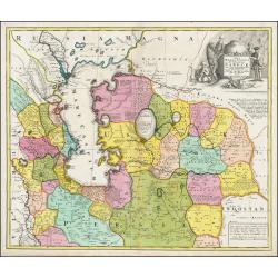
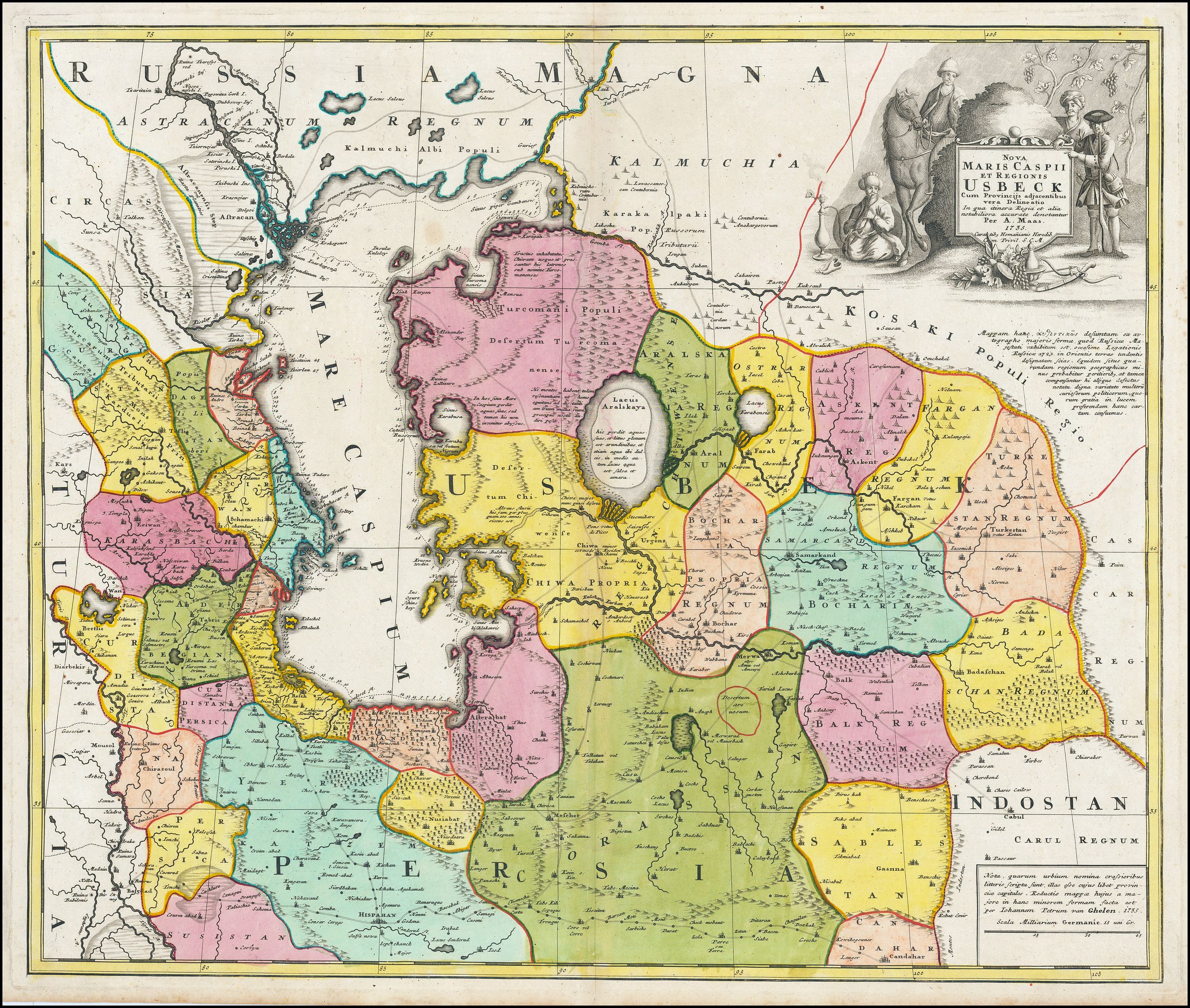
Nova Maris Caspii et Regionis Usbeck cum Provincijs adjacentibus vera Delineatio |
||||||||||||||||||||
|
||||||||||||||||||||
|
|
||||||||||||||||||||
$1000 / ≈ €880This item is available for immediate sale! Questions before Buying ?
We are happy to answer your questions.
1000.00
|
Virtual Collection - Save and collect your favorite items in one place.
Unless logged in, the item is only saved for that session. If you want to save the items permanently, please Login first Learn more [+] |
|||||||||||||||||||
Description
A finely engraved, uncolored title piece showing costume figures decorates the map which identifies towns such as Astrakan, Eriwan, Isphahan, Samarkand, and Cabul, and, unusually, shows trade routes.
Oriented east to the top.
The map was prepared by Abraham Maas and edited by Johann Peter von Ghelen and published by Homann Heirs in 1735. Following Tsar Peter's 1723 annexation of the western coast of the Caspian Sea, an embassy was sent to Khiva, Bukhara and Balkh of which Abraham Maas is thought to have been included. The embassy produced a map published in Moscow that year, and submitted in a manuscript to the Tsar preserved the library of the Russian Academy of Sciences in St. Petersburg. Maas produced a faithful copy of that Russian map, translated to Latin. Von Ghelen's edition, committed to print here by Homann Heirs, presents for the first time indigenous toponymy east of the Caspian Sea. And indeed, Maas' map reveals a catalog of new place names: countries, administrative regions, deserts, seas, mountains, and towns which not previously known to western geographers. In addition, a network of roads between linking the Caspian to Kabul is shown.
The map is of interest as the Silk Road Route passing the area is included. The route starts in the west with Baghdad and the major route reaching east can be seen running to Isfahan, and ultimately Kandahar. Northern branches link Samarkhand, Kabul, and Kashgar.
The map is also of interest as it is one of the first maps to detail the Aral Sea: once a massive lake, now an infamous desert. It is one of the earliest maps to distinguish the Aral as separate from the Caspian. Running east-to-west are the Amu and the Syr rivers, both flowing into the Aral. An ancient diversion of the Amu from the Aral Sea into the Caspian can also be seen.
The map has rich detail and copious notations, forests, mountains, and wetlands are shown pictorially. The Caspian shoreline is marked with depth soundings. An attractive cartouche depicts three Uzbeks and a Streltsy - a Muscovite infantryman - situated in a vineyard. At the base of the cartouche are laid a scimitar, a bow and arrow, and bunches of grapes. One of the Uzbeks is seated, his shoes removed, leisurely smoking a shisha pipe.
FAQ - Guarantee - Shipping
Buying in the BuyNow Gallery
This item is available for immediate purchase when a "Add to Cart" or "Inquire Now" button is shown.
Items are sold in the EU margin scheme
Payments are accepted in Euros or US Dollars.
Authenticity Guarantee
 We provide professional descriptions, condition report (based on 45 years experience in the map business)
Paulus Swaen warrants the authenticity of our items and a certificate of authenticity is provided for each acquired lot.
Condition and Coloring
We indicate the condition of each item and use our unnique HiBCoR grading system in which four key items determine a map's value: Historical Importance, Beauty, Condition/Coloring and Rarity.
Color Key
We offer many maps in their original black and white condition. We do not systematically color-up maps to make them more sellable to the general public or buyer.
Copper engraved or wood block maps are always hand colored. Maps were initially colored for aesthetic reasons and to improve readability. Nowadays, it is becoming a challenge to find maps in their original colors and are therefor more valuable.
We use the following color keys in our catalog:
Original colors; mean that the colors have been applied around the time the map was issued.
Original o/l colors; means the map has only the borders colored at the time of publication.
Colored; If the colors are applied recently or at the end of the 20th century.
Read more about coloring of maps [+]
Shipping fee
A flat shipping fee of $ 30 is added to each shipment by DHL within Europe and North America. This covers : International Priority shipping, Packing and Insurance (up to the invoice amount).
Shipments to Asia are $ 40 and rest of the world $50
We charge only one shipping fee when you have been successful on multiple items or when you want to combine gallery and auction purchases.
Read more about invoicing and shipping
FAQ
Please have a look for more information about buying in the BuyNow gallery
Many answers are likely to find in the general help section.
Virtual Collection
![]()
With Virtual Collection you can collect all your favorite items in one place. It is free, and anyone can create his or her Virtual map collection.
Unless you are logged in, the item is only saved for this session. You have to be registed and logged-in if you want to save this item permanently to your Virtual Collection.
Read More[+]
Register here, it is free and you do not need a credit card.
Add this item to
Virtual Collection
or click the following link to see my Virtual Collection.
| High-Resolution Digital Image Download | |
|
Paulus Swaen maintains an archive of most of our high-resolution rare maps, prints, posters and medieval manuscript scans. We make them freely available for download and study. Read more about free image download |
Click this image for a free HR-image download. |
In accordance with the EU Consumer Rights Directive and habitually reside in the European Union you have the right to cancel the contract for the purchase of a lot, without giving any reason.
The cancellation period will expire 14 calendar days from the day after the date on which you or a third party (other than the carrier and indicated by you) acquires, physical possession of the lot. To exercise the right to cancel you must inform Paulus Swaen Europe bv, which is offering to sell the lot either as an agent for the seller or as the owner of the lot, of your decision to cancel this contract by a clear statement (e.g. a letter sent by post, or e-mail (amsterdam@swaen.com).
To meet the cancellation deadline, it is sufficient for you to send your communication concerning your exercise of the right to cancel before the cancellation period has expired.