Description geographique, historique, chronologique, politique, et physique de l'empire de la Chine et de la Tartarie chinoise. |
||||||||||||||||||||
|
||||||||||||||||||||
|
|
||||||||||||||||||||
$12000 / ≈ €10571Feel free to contact us if you have a question about this item.
Or do you like to be notified about newly added items? Add your name to our mailing list. |
||||||||||||||||||||
Description
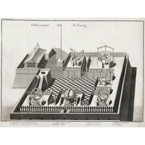
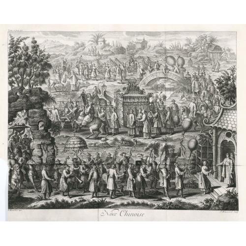
This, "the first definitive European work on the Chinese empire" (Hill), was compiled by Du Halde, Jesuit former confessor to the duc d'Orléans, from the accounts, published and unpublished, prepared by 27 Jesuit missionaries during their travels.
Illustrated with 65 maps and plates engraved by Delahaye, Desbrulins, and Fonbonne after Humblot, Lucas, Le Parmentier and others.
This encyclopaedic work not only provided valuable information on Chinese political institutions, education, language, medicine, science, customs and artefacts - importantly it is one of the earliest European sources on Chinese ceramics - but also marked the first appearance of 43 maps by Jean Baptiste Bourguignon d'Anville, internationally recognized as "the finest cartographer of his time" (Moreland & Bannister).
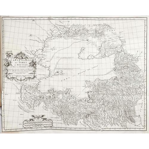
Drawn from recent surveys commissioned by the Emperor Kang-hi from the Jesuits, these maps represented an immense improvement on existing knowledge and are considered by Tooley to be "the principal cartographic authority on China during the 18th century". For certain remote parts of northern China, Mongolia and Tibet, this work was the only adequate reference until the technological revolution in surveying in the 20th century.
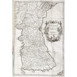
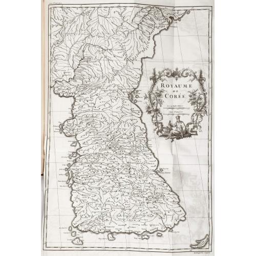
The work also contains the first separate map of Korea, together with a previously unpublished account of that country by Jean-Baptiste Régis. The book is also of considerable interest in terms of the exploration of America. Printed here for the first time is the eponymous Vitus Bering's account of his 1728 traverse of the Strait, "Relation succinte du voyage du capitaine Beering dans la Siberie."
Of comparable importance is the map "Carte des pays traversees par le Capne. Beering depuis la ville de Tobolsk jusqu'a Kamtschatka" bound between pp. 452–3, based on Bering's manuscript map, and containing the first representation of any part of Alaska, St. Lawrence Island. The manuscripts followed a circuitous route to Du Halde. Bering, a Dane who had risen in the ranks of the Russian navy, was sponsored on his expedition by Peter the Great, and when he finally returned to St. Petersburg in 1730, five years after Peter's death, his account was sent as a gift to the King of Poland, who in turn "gave them to Du Halde with permission to do with them 'as he saw fit'" (Hill).
An excellent example of this fine work of 18th-century encyclopaedism, here in the superbly printed and engraved first French folio edition, considered by Lada-Mocarski to be "the most desirable and significant."
References Cordier, Sinica 46–47; Cox I, p. 335; Hill 498; Howes 546; Lada-Mocarski, Books on Alaska II, pp. 20-22; Lust 12; Moreland & Bannister Antique Maps; Sommervogel iv 35.11; Tooley Maps and Mapmakers, p.107; Wagner p. 156; Wroth: Early Cartography of the Pacific, 91.
FAQ - Guarantee - Shipping
Buying in the BuyNow Gallery
This item is available for immediate purchase when a "Add to Cart" or "Inquire Now" button is shown.
Items are sold in the EU margin scheme
Payments are accepted in Euros or US Dollars.
Authenticity Guarantee
 We provide professional descriptions, condition report (based on 45 years experience in the map business)
Paulus Swaen warrants the authenticity of our items and a certificate of authenticity is provided for each acquired lot.
Condition and Coloring
We indicate the condition of each item and use our unnique HiBCoR grading system in which four key items determine a map's value: Historical Importance, Beauty, Condition/Coloring and Rarity.
Color Key
We offer many maps in their original black and white condition. We do not systematically color-up maps to make them more sellable to the general public or buyer.
Copper engraved or wood block maps are always hand colored. Maps were initially colored for aesthetic reasons and to improve readability. Nowadays, it is becoming a challenge to find maps in their original colors and are therefor more valuable.
We use the following color keys in our catalog:
Original colors; mean that the colors have been applied around the time the map was issued.
Original o/l colors; means the map has only the borders colored at the time of publication.
Colored; If the colors are applied recently or at the end of the 20th century.
Read more about coloring of maps [+]
Shipping fee
A flat shipping fee of $ 30 is added to each shipment by DHL within Europe and North America. This covers : International Priority shipping, Packing and Insurance (up to the invoice amount).
Shipments to Asia are $ 40 and rest of the world $50
We charge only one shipping fee when you have been successful on multiple items or when you want to combine gallery and auction purchases.
Read more about invoicing and shipping
FAQ
Please have a look for more information about buying in the BuyNow gallery
Many answers are likely to find in the general help section.
Virtual Collection
![]()
With Virtual Collection you can collect all your favorite items in one place. It is free, and anyone can create his or her Virtual map collection.
Unless you are logged in, the item is only saved for this session. You have to be registed and logged-in if you want to save this item permanently to your Virtual Collection.
Read More[+]
Register here, it is free and you do not need a credit card.
Add this item to
Virtual Collection
or click the following link to see my Virtual Collection.
| High-Resolution Digital Image Download | |
|
Paulus Swaen maintains an archive of most of our high-resolution rare maps, prints, posters and medieval manuscript scans. We make them freely available for download and study. Read more about free image download |
In accordance with the EU Consumer Rights Directive and habitually reside in the European Union you have the right to cancel the contract for the purchase of a lot, without giving any reason.
The cancellation period will expire 14 calendar days from the day after the date on which you or a third party (other than the carrier and indicated by you) acquires, physical possession of the lot. To exercise the right to cancel you must inform Paulus Swaen Europe bv, which is offering to sell the lot either as an agent for the seller or as the owner of the lot, of your decision to cancel this contract by a clear statement (e.g. a letter sent by post, or e-mail (amsterdam@swaen.com).
To meet the cancellation deadline, it is sufficient for you to send your communication concerning your exercise of the right to cancel before the cancellation period has expired.
