Lot #: 49052
(China Atlas) Novus Atlas Sinensis, A Matino Martinio... Seste Deel van de Nieuwe Atlas, oft Toonneel des Aerdrijck, Uytgegeven door Joan Blaeu. |
||||||||||||||||||||
|
||||||||||||||||||||
|
||||||||||||||||||||
This item is available for immediate sale
Questions before Buying ?
We are happy to assist. Do you like to be notified about newly added items?
Add your name to our mailing list.
15000.00
|
Description
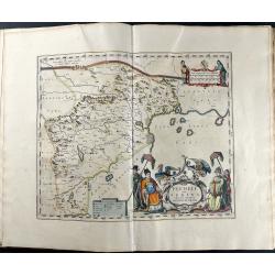
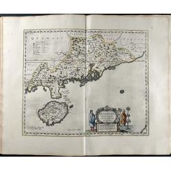
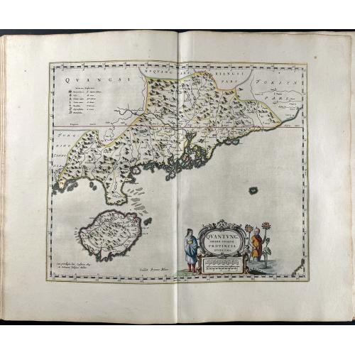
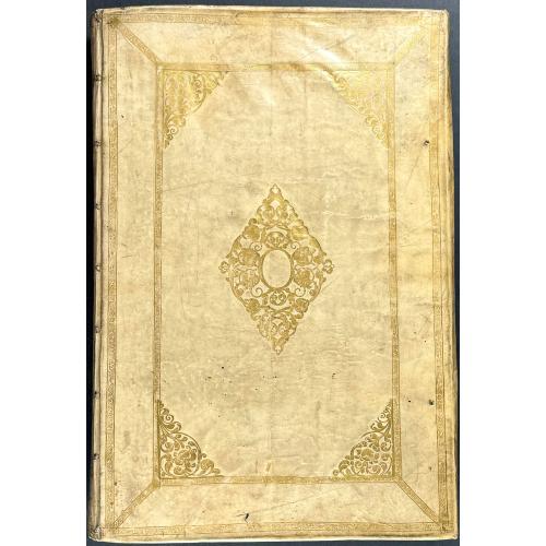
Dutch text edition of the First European Atlas of China. 17 engraved maps in original hand-color, and engraved title pages in original hand-color, heightened in gold. [6], 213, [19], xviii, 40 pages of text in Dutch.
The present work is based on Father Martinus Martini, the Jesuit Superior of Hangzhou, 's surveying and compiling work.
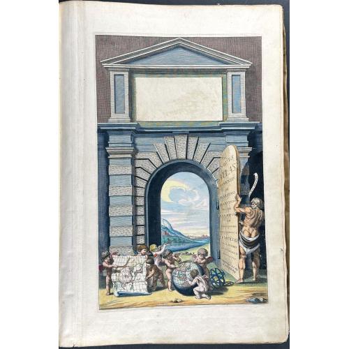
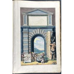
The title page has a facade with an opening giving a view of a landscape. In the foreground putti with a map and a globe, both of which exhibit a map of China. At the top a fronton, with a panel, where the title label was to be pasted. (Similar to an example of this atlas in the libriry of Nijmegen the letterpress label is wanting.
Martini's atlas of China includes the following parts:
1. A lengthy preface by Martinus Martini with an explanation of how he compiled his maps from the Chinese originals.
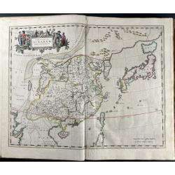
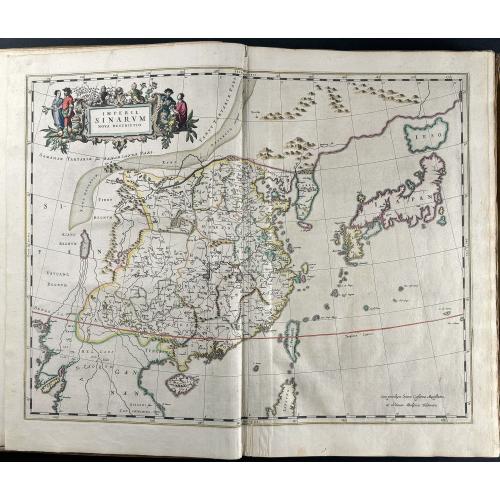
2. A general map of China (map 1).
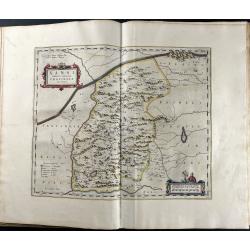
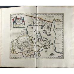
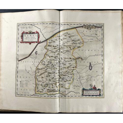
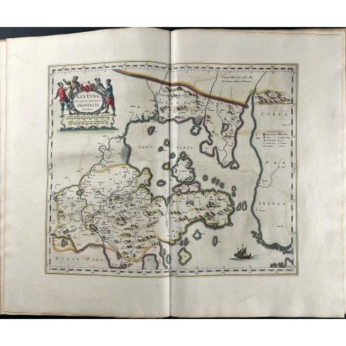
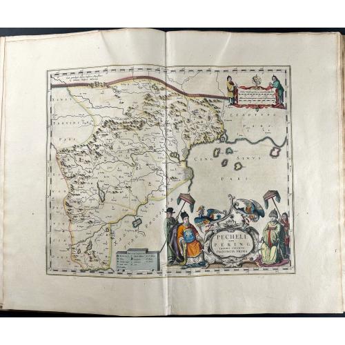
3. A geographical description of the 15 provinces of China, each description preceded by a map of that province (maps 2-16).
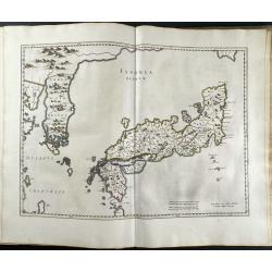
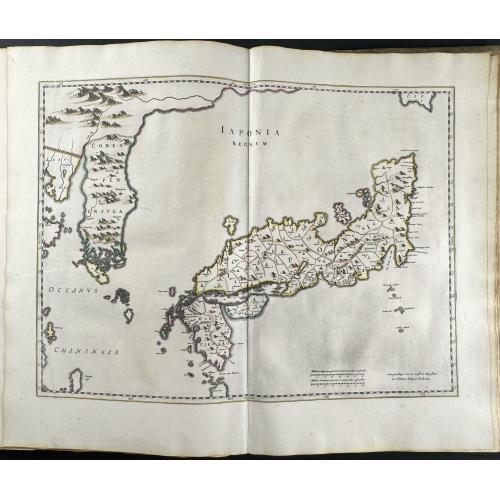
4. A geographical description of Japan with a map (map 17).
5. The "Catalogus Longitudinum ac Latitudinem," a list of towns with their geographical coordinates.
6. A supplement to the geographical description by Jacob Golius, "De Regno Catayo Additamentum lacobus Golius Lectori."
The volume was later bound up with the other maps and text of Asia to form the Asia volume of the Atlas Maior.
There is only one edition of the Dutch text edition in China. This is the first western atlas of China, including sixteen engraved maps of Chinese subjects, and one general map of Japan, all in beautiful original outline hand-color.
The seventeen maps are noteworthy not only for their accuracy, remarkable for the time, but also for their highly decorative cartouches featuring vignettes depicting regional Chinese dress, activities, and animals. In addition, it is one of the first true Sino-European publications, based on Chinese land surveys but presenting geographic data in a highly visual European cartographic format. - Reed & Demattè.
In 1654, in the foreword to the Dutch edition of the Atlas of Scotland, Joan Blaeu announced that he was preparing town books of Italy, a volume of charts, and a volume of historical maps and that these were delayed.
But while he was working on these volumes, wrote Blaeu:Father Martinus Martini had come from the Indies, bringing with him his sketches and descriptions of the Chinese empire. Martini persisted in his attempt to have Blaeu engraved and published these, so Blaeu postponed the work on the other volumes to prepare the Atlas of China and published it about a year later.
Martinus Martini (1614-1661) began working in 1642 as a Jesuit missionary in various provinces of China. When he was ordered to Rome in 1651, he took with him more than 50 Chinese books and maps, among them a copy of the manuscript atlas of the Chinese provinces by Zhu Siben, compiled in 1311/12, with revisions from the printed atlas by Lo Hongxian (1555).
Martini's ship was captured by the Dutch and brought to Java. Martini was sent to Amsterdam where he arrived in 1654. During the voyage to Europe aboard the Dutch East-Indiamen, Martini made a Latin translation of the text and wrote his own description of China.
In 1659, Joan Blaeu published the Latin translation, "Sinicae historiae decas prima", separately without maps.
The text in Blaeu's atlas of China is Martini's own account, written in the first person, of the geography and history, the manners and customs of the Chinese empire and its peoples.
Martini's atlas of China includes the following parts:
1. A lengthy preface by Martinus Martini with an explanation of how he compiled his maps from the Chinese originals.
2. A general map of China (map 1).
3. A geographical description of the 15 provinces of China, each description preceded by a map of that province (maps 2-16).
4. A geographical description of Japan with a map (map 17).
5. The "Catalogus Longitudinum ac Latitudinem," a list of towns with their geographical coordinates.
6. A supplement to the geographical description by Jacob Golius, "De Regno Catayo Additamentum lacobus Golius Lectori."
7. A history of the Manshu War by Martinus Martini, "De Bello Tartarico Historia," originally published in 1654 in Antwerp, with an additional letter by Francisco Brancaro from Shanghai, 14 November 1651.
Joan Blaeu published the Atlas of China in five different languages: Latin, French, Dutch, German, and Spanish. It was published separately and added as the sixth volume to the Theatrum Orbis Terrarum, the only difference being in the engraved title page.
Title page (v.d.Krogt 2:26A) which was used for the Theatrum edition, has a blank panel for the letterpress volume title.
Another title page was used for the separate editions of the atlas.
Both title pages have the title of the atlas and the author's name in Latin, but strangely enough, the publisher's name does not appear on the title page or anywhere else in the volume.
The volume was later bound up with the other maps and text of Asia to form the Asia volume of the Atlas Maior.
FAQ - Guarantee - Shipping
Buying in the Buy-or-Bid sale
To buy or bid in this Buy-or-Bid sale you must register with us. It is free, and we automatically update you about future auctions.
During the Buy-or-Bid sale you can buy or bid on 1500 - 2000 antique, rare maps, town views, old master prints, decorative prints, atlases, posters and Medieval manuscripts.
FAQ
Please have a look at more details about the Buy-or-Bid sale.
Authenticity Guarantee
We provide professional descriptions, condition report and HiBCoR rating (based on 45 years experience in the map business)
We fully guarantee the authenticity of items we sell. We provide a certificate of authenticity for each purchased item.
Shipping fee
A flat shipping fee of € $ 30 is added to each shipment within Europe and North America. This covers : International Priority shipping, Packing and Insurance (up to the invoice amount).
Shipments to Asia are $ 40 and rest of the world $50
We charge only one shipping fee when you have been successful on multiple items or when you want to combine gallery and auction purchases.
Read More about invoicing and shipping
YOUR RIGHT TO CANCEL THE PURCHASE OF A LOT
In accordance with the EU Consumer Rights Directive and habitually reside in the European Union you have the right to cancel the contract for the purchase of a lot, without giving any reason.
The cancellation period will expire 14 calendar days from the day after the date on which you or a third party (other than the carrier and indicated by you) acquires, physical possession of the lot. To exercise the right to cancel you must inform Paulus Swaen Europe bv, which is offering to sell the lot either as an agent for the seller or as the owner of the lot, of your decision to cancel this contract by a clear statement (e.g. a letter sent by post, or e-mail (amsterdam@swaen.com).
To meet the cancellation deadline, it is sufficient for you to send your communication concerning your exercise of the right to cancel before the cancellation period has expired.
To buy or bid in this Buy-or-Bid sale you must register with us. It is free, and we automatically update you about future auctions.
During the Buy-or-Bid sale you can buy or bid on 1500 - 2000 antique, rare maps, town views, old master prints, decorative prints, atlases, posters and Medieval manuscripts.
- Items will be listed for 7 days. In the first day of the sale, users are only able to add items to their "My Buy or Bid" page".
- Starting at 4.00 PM EST (Amsterdam 22.00) the following day up to the closing you may purchase an item at the Buy price.
- Once the Buy price is paid the sale for this item has closed.
- We show the "Bid & Ask spread" (to define the gap between the minimum accepted bid and Buy price.)
- Items that have received bids within the BidAsk spread are sold at the highest bid at closing.
- For bids entered within the BidAsk spread, we use the proxy-bidding process, so you are getting the item at the lowest possible price.
- You may also bid lower than the BidAsk spread, but the seller is not obliged to accept such a bid.
- A buyer outside the European Union pays, on top of the sale price, a premium of 18 % on the first € 30,000 (or $35,700 ) and 10% on the excess.
- Outbid notifications and zoomable images will be disabled 30 minutes before the closing.
- Items are found in the catalog. The item is automatically added to the My Buy-or-Bid Watch List once you pay the Buy price or place a offer.
- An invoice is available in My Invoice center two hours after the closing and is send the next day by email.
FAQ
Please have a look at more details about the Buy-or-Bid sale.
Authenticity Guarantee
We provide professional descriptions, condition report and HiBCoR rating (based on 45 years experience in the map business)
We fully guarantee the authenticity of items we sell. We provide a certificate of authenticity for each purchased item.
Shipping fee
A flat shipping fee of € $ 30 is added to each shipment within Europe and North America. This covers : International Priority shipping, Packing and Insurance (up to the invoice amount).
Shipments to Asia are $ 40 and rest of the world $50
We charge only one shipping fee when you have been successful on multiple items or when you want to combine gallery and auction purchases.
Read More about invoicing and shipping
High-Resolution Digital Image Download | |
Paulus Swaen maintains an archive of most of our high-resolution rare maps, prints, posters and medieval manuscript scans. We make them freely available for download and study. Read more about free image download |
In accordance with the EU Consumer Rights Directive and habitually reside in the European Union you have the right to cancel the contract for the purchase of a lot, without giving any reason.
The cancellation period will expire 14 calendar days from the day after the date on which you or a third party (other than the carrier and indicated by you) acquires, physical possession of the lot. To exercise the right to cancel you must inform Paulus Swaen Europe bv, which is offering to sell the lot either as an agent for the seller or as the owner of the lot, of your decision to cancel this contract by a clear statement (e.g. a letter sent by post, or e-mail (amsterdam@swaen.com).
To meet the cancellation deadline, it is sufficient for you to send your communication concerning your exercise of the right to cancel before the cancellation period has expired.