
PAULUS SWAEN OLD & RARE MAPS
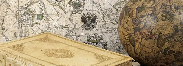
We specialize in rare maps, atlases, globes, travel posters, master prints, and decorative prints from the 16th to 18th centuries and offer antique maps from all parts of the world, produced by renowned cartographers such as Ortelius, Mercator, Blaeu, Janssonius, Hondius, Visscher, and de Wit.
The items listed in our BuyNow catalogare available for immediate sale and every sold item will receive a certificate of authenticity. We offer a lifetime guarantee on all our items.
The high standards of our map and atlas collection are world-renowned.
Swaen BuyNow CATALOG
Our BuyNow-catalog offers immediate sale items, and no commission is charged. The catalog includes old maps of the World - America - Asia - Europe - Africa - Medieval Manuscripts - Nuremberg Chronicle - Prints - Posters, atlases, globes, etc.
Our stock is updated weekly, and our most recent additions are conveniently displayed in our "Latest Listings".
Have a look at our Gallery highlights or our Curated Collection of carefully selected old and rare maps, all graded 8-10 stars in the HiBCoR grading system.
Latest Listings & Updates
You can always check our latest listings page. It is updated daily and you see what we’ve recently added. Let's take a look at some rare maps we've recently acquired.Join our newsletter and be the first to be notified of new acquisitions and get exclusive offers.
Gallery Highlights
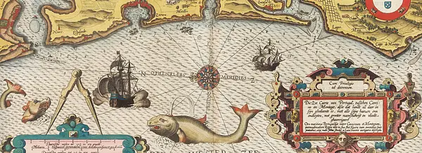
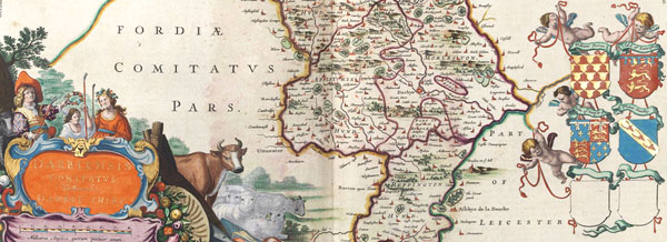
In this highlights section of the BuyNow catalog, we present some personal favorites from our large stock of authentic maps, atlases, prints, globes, posters and Medieval manuscripts.
The items are immediately available, and no commission is charged.
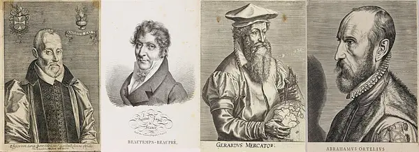
Mapmakers and explorers
Sometimes, maps become more famous than their makers. Many cartographers only become famous after they’ve created a masterpiece.
Still, others make a famous map, then disappear from history forever.
My Collection+
Now you can save any of your favorite items from our BuyNow catalog, Latest Listings or Archive in one place. Build your own Virtual Collection. It is free and you can delete an item at any time. Previously acquired items are automatically added to the My Collection+ list.
The Mapping of . . .
We have created some short articles on the mapping of Arabia, Australia, Canada, China, Hungary, the Invasion of Minorca, Japan, Korea, Malta, the Mer de l'Ouest, the Northwest Passage, Poland, Russia, Southeast Asia, Taiwan, and Ukraine, among other regions.

Archive of sold items
Paulus Swaen maintains an archive of sold items, including images. Most map images are not subject to copyright and can be used freely, as they are in the public domain. These historically achieved prices can help understand the pricing development of old maps.

Read our short articles
If you are interested in the backgrounds of antique maps, prints, mapmakers, etc. then you should read our short but informative articles >>>>
Or about posters, old prints, Nuremberg Chronicle, optical prints, medieval manuscripts, etc.
Featured Listings
![Kantong [The Dutch Folly Fort off Canton]](/uploads/cache/05714-250x250.jpg)
Kantong [The Dutch Folly Fort off Canton]
Charming 18th water color on paper depicting The Dutch "Folly Fort" off Canton. Probably made by a western artist visiting China.Forts were built in several pla...
Date: Canton?, c.1750
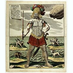
Colossus Monarchic. Statua Danielis
Fantastic double page allegorical map of a colossus figure representing the great world empires as Daniel interpreted in Nebuchadnezzar's dream. The warrior stands stolid...
Date: Augsbourg, 1730
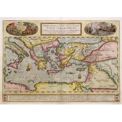
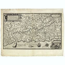
Peregrinationis Divi Pauli Typus corographicus. . .
A splendid map depicting the travels of Paulus. With two fine scenes in top. Showing the countries along the Mediterranean, including Cyprus and Italy. A first edition wi...
Date: Antwerp, 1595
Selling price: ????
Please login to see price!
Sold in 2026
Peregrinatie Jesu Christu Een ordentliche beschrijvinge des Heijligen landts....
Very rare separately map of the Holy Land engraved by Joannes van Doetecum Jr. Oriented to the east. The shoreline runs from "Antaradus" in Syria to "Rhino...
Date: Amsterdam, ca. 1595

Norwegia.
An attractive and important miniature map Norway. The map is orientated to the west. The earliest map showing Norway.Prepared by Petrus Bertius, published in Amsterdam at...
Date: Amsterdam, 1606

A Plan of the city and harbour of Macao : a colony of the Portugueze, situated at the southern extremity of the Chinese Empire. . .
A large chart of Macao engraved by Benjamin Baker (fl. 1766-1824) and published by George Nicol. The town of Macao is shown in detail, with a 37-point key in English list...
Date: London, 1796
Popular Listings

Chinese advertising poster for Red Lion cigarette brand.
This poster, an advertisement for the Red Lion Cigarettes brand from the 1930s, melds the meticulous detail of traditional Chinese painting with the craft of color lithog...
Date: Shanghai, 1950/1960
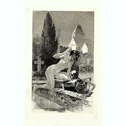
A rare suite of 12 original etchings by Martin van Maele to the famous work by Edmond Haracourt.
A rare suite of 12 original etchings by Martin van Maele to the famous work by Edmond Haracourt. The series was published anonymously in a small edition. These etchings a...
Date: Nevers, Brussels, 1882,1883
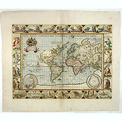
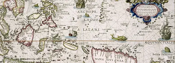
Nova Totius Terrarum Orbis Geographica ac Hydrographica Tabula.
A beautifully decorative world map taken from the 'English Atlas' by Moses Pitt and Steven Swart, based on an earlier engraved world map by Pieter van den Keere ca. 1630,...
Date: Oxford, 1680
![[Anti capitalism Soviet Union propaganda poster]](/uploads/cache/47032-250x250.jpg)
[Anti capitalism Soviet Union propaganda poster]
Propaganda mini anti-capitalism poster published in Russia during The Cold War. By the 1960’s and 1970’s, outrageous practices in Soviet bureaucracy flourished. Poor plan...
Date: Leningrad, 1974
