Browse Listings
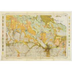
Soil map - New York, Syracuse sheet
Early color lithographed soil map by Julius Bien & Co. in New York for Department of Agriculture. Legends at side give detail on soil type, etc. They also include int...
Place & Date: New York 1903
Selling price: $40
Sold
Soil map - Connecticut. - Massachusetts, (Hartford) Springfield sheet.
Early color lithographed soil map by Julius Bien & Co. in New York for Department of Agriculture. Legends at side give detail on soil type, etc. They also include int...
Place & Date: New York, 1903
Selling price: $85
Sold in 2008

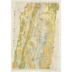
Soil map - Massachusetts, Amherst sheet
Early color lithographed soil map by Julius Bien & Co. in New York for Department of Agriculture. Legends at side give detail on soil type, etc. They also include int...
Place & Date: New York, 1903
Selling price: $40
Sold in 2009

Soil map - Alabama, Fort Payne sheet.
Early color lithographed soil map by Julius Bien & Co. in New York for Department of Agriculture. Legends at side give detail on soil type, etc. They also include int...
Place & Date: New York, 1903
Selling price: $40
Sold in 2011

Soil map - Alabama, Huntsville sheet
Early color lithographed soil map by Julius Bien & Co. in New York for Department of Agriculture. Legends at side give detail on soil type, etc. They also include int...
Place & Date: New York 1903
Selling price: $40
Sold

Louisiana, New Orleans sheet.
soil map printed by Julius Bien & Co in New York for Department of Agriculture. The map is giving great detail of the area in the east of New Orleans, Louisiana, in t...
Place & Date: New York, 1903
Selling price: $85
Sold in 2013

Soil map - Louisiana, Acadia Parish sheet.
Early color lithographed soil map by Julius Bien & Co. in New York for Department of Agriculture. Legends at side give detail on soil type, etc. They also include int...
Place & Date: New York, 1903
Selling price: $35
Sold in 2009
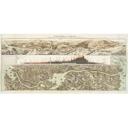
Panama Canal, Topographic, Diagramatic, and Illustrative.
Drawn in 1903, this "Topographic, Diagramatic, and Illustrative Map of the Panama Canal" illustrates the project for U.S. readers. The top panel depicts the exc...
Place & Date: Washington, D. C., 1903
Selling price: $300
Sold in 2009

A Humorous Diplomatic Atlas of Europe and Asia. / 滑稽欧亜外交地図 / Kokkei O-A Gaiko Chizu.
A wonderful example of the rare 1904 Kisaburo Ohara satirical 'Octopus Map' of Europe. Composed at the outbreak of the Russo-Japanese War (1904 – 1905), it was modelled...
Place & Date: Tokyo, March, 1904
Selling price: $5000
Sold
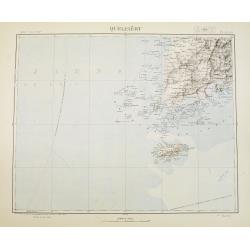
Quelpaërt Séoul.
Very detailed (1:1.000.000) map showing the southern tip of Korea with the island Jeju and southern Jeolla province with Gwangju, showing soundings.Heliogravure was initi...
Place & Date: Paris, 1898 updated for june 1904
Selling price: $550
Sold in 2009
Nord-Korea Auf grundlage des offiziellen russischen kartenmateriales ausgeführt im k.u.k. miltärgeographischen institute zu Wien. . .
Detailed folding map of North Korea. Text in German, with a key in lower right giving references to the road and rail road and military objects as forts and batteries. Ac...
Place & Date: Vienna, 1904
Selling price: $250
Sold in 2009
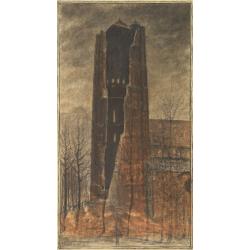
Church of Oirschot after a lightning stroke of 1904.
Fine pastel drawing by Piet Panhuizen of the church of Oirschot after it was hit by a lightning stoke in 1904. Piet Panhuizen was born in Helmond and started as designer ...
Place & Date: Oirschot, 1904
Selling price: $350
Sold in 2009

Environs de Hanoi.
Detailed map of Hanoi and its viccinities, scale 1:50.000. Published by the Service geographique de l'Indochine and prepared by Commander Friquegnon.The French Dutreuil d...
Place & Date: Hanoi, 1904
Selling price: $90
Sold in 2011

Map of Alaska, YukonTerritory and British Columbia showing connections of The White Pass & Yukon Route.
Railway map of Alaska, YukonTerritory and British Columbia showing connections of The White Pass & Yukon Route. On the back informations about the trip.
Place & Date: Chicago, 1904
Selling price: $90
Sold in 2021

A Humorous Diplomatic Atlas of Europe and Asia. / 滑稽欧亜外交地図 / Kokkei Ō-A Gaikō Chizu.
A wonderful example of the rare 1904 Kisaburo Ohara satirical 'Octopus Map' of Europe being swallowed by an octopus (Russia). Composed at the outbreak of the Russo-Japane...
Place & Date: Tokyo, April, 1904
Selling price: $4750
Sold in 2023

Stanford's library Map of Africa.
A monumental map of Africa, divided into four parts (north-west, north-east, south-west and south-east), each with a label on the colored paper backing to verso. Together...
Place & Date: London, 1904
Selling price: $1950
Sold in 2021
![[Official US Government Document.]](/uploads/cache/48155-250x250.jpg)
[Official US Government Document.]
An official US government printed document, completed in manuscript and signed by President Theodore Roosevelt, appointing John G. Chandler Brigadier-General on the retir...
Place & Date: Washington D.C., 1904
Selling price: $500
Sold in 2022
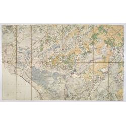
Stafkaart Steenwijk, Kwartblad 2 Schaal 1 : 50.000.
Map of the city of Steenwijk and vicinities of Blokzijl, Wolvega, Diever, Munikeburen, etc… Scale 1 : 50,000.More about folding maps. [+]
Place & Date: Steenwijk, 1904
Selling price: $60
Sold in 2013

The commercial, pictorial and tourist map of San Francisco, in colors and illustrated with litho-engraved pictures of all public buildings, parks, monuments, and recommended business houses, etc. . . .
Important and rare pre-earth-quake San Francisco town plan. Covering from the "Sunset District" and the Blue Mountain, up to the Golden Gate and the northern sh...
Place & Date: San Francisco, 1904
Selling price: $900
Sold in 2015
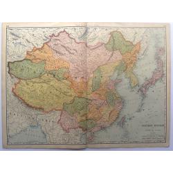
Chinese Empire with Japan and Korea.
This detailed chromolithograph map is Polar projected. It includes Tibet, Eastern Turkestan, Jingaria and Mongolia; the Chinese empire at its largest extent. It is from: ...
Place & Date: Chicago, 1904
Selling price: $25
Sold in 2015
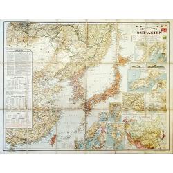
Outline Map of East Asia.
A large, uncommon map of East Asia prepared by Karl Peucker, and published by Ataria & Co.
Place & Date: Vienna, 1904
Selling price: $150
Sold in 2020
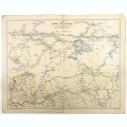
A map of part of Tibet : including Sikkim, the Chumbi Valley & Bhutan showing the routes between Darjiling and Lhasa
Beautiful and rare map of the western part of Tibet (including the town in which the Dalai Lama grew up) and Bhutan, showing geographical features, forts and major mounta...
Place & Date: London, 1904
Selling price: $350
Sold in 2018

Boston Bay approaches from the latest United States Government Charts.
A fine Hydrographic Office chart no. 1227 figuring Boston Bay approaches from the latest United States Government Charts. Engraved by Davies and Company. London : Publish...
Place & Date: London, 1904
Selling price: $80
Sold in 2020
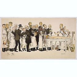
Faculte de Medicine.
Original lithograph of the ink drawing by the French Art-Nouveau artist Adrien Barrère (1877-1931), a \"pathological humoresque\" of 16 contemporary professors...
Place & Date: Paris, Ch. Wall, c.1905
Selling price: $105
Sold in 2013

Popular Astronomy (Sir Robert Stawell Ball).
Fine "SPY" colorlithograph featuring Sir Robert Stawell Ball (1840-1913), Irish astronomer at the University of Dublin and the Cambridge Observatory. His chief ...
Place & Date: New York, 1905
Selling price: $18
Sold in 2015
Johnston's Russo-Japanese War Map.
Map of the Russo-Japanese war of 1904-1905.
Place & Date: London, 1904-1905
Selling price: $110
Sold in 2016
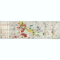
Sketch Map of the Far Eastern Rand from Johannesburg to Ermelo.
An extremely rare map showing mining concessions on the Eastern Part of the Witwatersrand Vein, the most important gold region in the world, published shortly after the S...
Place & Date: Bern, Geographischer Karten-Verlag Kümmerly & Frey, ca. 1905
Selling price: $500
Sold in 2017
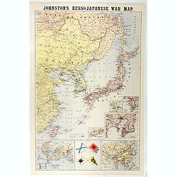
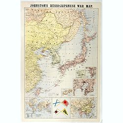
Johnston's Russo-Japanese War Map.
Shows southeastern Siberia, eastern China, Korea, Japan, and Taiwan. "The principal places concerned are underlined." Insets and ancillary maps: Chart of the wo...
Place & Date: London, 1905
Selling price: $150
Sold in 2018

Gran quadriglione Africano nel carnevale 1885 (Rana N. 28 - Cent. 20).
Imposing allegorical representation of the colonial aims of the European powers with regard to Africa. On the left the director of the large quadrociale the lady Diplomaz...
Place & Date: Bologna, 1905
Selling price: $1400
Sold in 2019
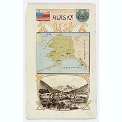
Alaska / Costume del S. Salvador.
An unusual item. It is a nice colored chromolithograph map of Alaska, with a few place names, a coat of arms and the American flag, together with a small view of Sitca be...
Place & Date: Milano, 1905
Selling price: $22
Sold in 2019
![[Pacific ocean with Australia and New Zealand]](/uploads/cache/25533-250x250.jpg)
[Pacific ocean with Australia and New Zealand]
A more than 100 year old Russian map of Pacific printed in lithography. Published by one of the most successful publishers of St. Petersburg A.Iljin. With a color key to ...
Place & Date: St. Petersburg, c.1905
Selling price: $30
Sold in 2011
![[North America]](/uploads/cache/25596-250x250.jpg)
[North America]
A more than 100 year old Russian map of North America printed in lithography. Published by one of the most successful publishers of St. Petersburg A.Iljin. With a color k...
Place & Date: St. Petersburg, c.1905
Selling price: $45
Sold in 2013
![[Palestine]](/uploads/cache/25597-250x250.jpg)
[Palestine]
A more than 100 year old Russian map of Palestine (present day Israel) printed in lithography. Published by one of the most successful publishers of St. Petersburg A.Ilji...
Place & Date: St. Petersburg, c.1905
Selling price: $20
Sold in 2009
![[Asia]](/uploads/cache/25598-250x250.jpg)
[Asia]
A more than 100 year old Russian map of the Asian continent printed in lithography. Published by one of the most successful publishers of St. Petersburg A.Iljin. With a c...
Place & Date: St. Petersburg, c.1905
Selling price: $15
Sold in 2009
![[World Map]](/uploads/cache/25599-250x250.jpg)
[World Map]
A more than 100 year old map of the world printed in lithography. Published by one of the most successful publishers of St. Petersburg A.Iljin. With a color key to evalua...
Place & Date: St. Petersburg, c.1905
Selling price: $50
Sold in 2009
![[Russia]](/uploads/cache/25601-250x250.jpg)
[Russia]
A more than 100 year old map of the world of Russia printed in lithography. Published by one of the most successful publishers of St. Petersburg A.Iljin. With a color key...
Place & Date: St. Petersburg, c.1905
Selling price: $30
Sold in 2010
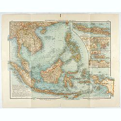
Hinterindien und Malayischer Archipel.
Map of South East Asia with 4 insets. Shows settlements, roads, railways, telegraph cables, etc. A color key to Dutch, French, British, Portuguese occupations. Includes n...
Place & Date: Leipzig, 1905
Selling price: $100
Sold in 2020
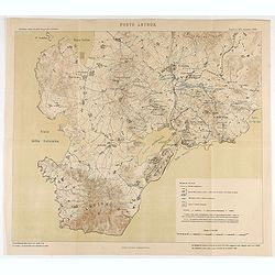
Porto Arthur.
Map of Port Arthur and its surroundings.
Place & Date: Italy, ca. 1905
Selling price: $80
Sold in 2020

Eventail cycliste. Boulogne, Paris et ses environs.
Fan, double leaf decorated with a framed map of Bois de Boulogne and two views of Paris. The verso with two plans, one of Paris, the other from the Paris region. Wooden f...
Place & Date: Paris, 1905
Selling price: $200
Sold in 2021
![[Menu fan for] Villa Tourasse.](/uploads/cache/46945-250x250.jpg)
[Menu fan for] Villa Tourasse.
A fan showing the menu of Villa Tourasse restaurant in Paris.
Place & Date: France, 1905
Selling price: $50
Sold in 2021
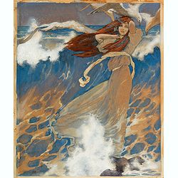
Midsummer Holiday Number
original watercolor
Place & Date: New York, 1906
Selling price: $115
Sold in 2020
Mensura de las minas.
Pen and ink drawing of mines in South America by Belisaeio Vergara and other sources of the mines "Porvenir", "Defensa" and "Amparo" in Chil...
Place & Date: Chile, 1906
Selling price: $20
Sold in 2014

Barneget Inlet to Absecon Inlet. New Yersey . Coast Chart No. 122.
A sea chart of part of the coast of New Yersey with Atlantic City and the mouth of the Mullica river with Great Bay.
Place & Date: Washington, 1906
Selling price: $50
Sold in 2018

sea chart of part of the coast of New Yersey. From Sandy hook to Barneget Inlet. New Yersey . Coast Chart No. 121.
A sea chart of part of the coast of New Yersey.
Place & Date: Washington, 1906
Selling price: $50
Sold in 2020

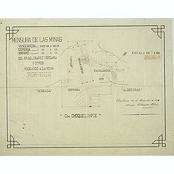
Mensura de las minas. . . Choquelimpie. (manuscript map)
Pen and ink drawing of the mines "Porvenir", "Defensa" and "Amparo" in Choquelimpe region in Chili by Belisaeio Vergara and E.Basadre Forero...
Place & Date: Chile, Choquelimpie, 19 December 1906
Selling price: $75
Sold in 2015
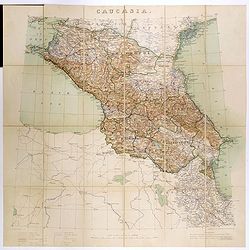
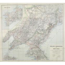
Caucasia.
Original hand-colored zincograph map of the Caucasus located at the border of Europe and Asia. The map shows part of the Black Sea and the Caspian Sea. The map is on a sc...
Place & Date: London, 1906
Selling price: $310
Sold in 2017
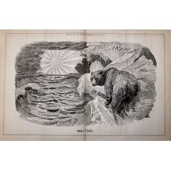
A set 15 of Punch cartoons from the periods of the Russo - Japanese War of 1904 - 5 and the crisis facing the Czar.
A set 15 of Punch cartoons from the periods of the Russo – Japanese War of 1904 – 5 and the crisis facing the Czar. The titles:Melting June 15th 1904 (double Page).Ti...
Place & Date: London, 1903-1907
Selling price: $85
Sold in 2017
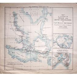
Map to Illustrate The Voyage And Artic Explorations of Capt Roald Amundsen From Surveys by Lieut. G. Hansen. 1903 to 1906.
An interesting map of the Polar region centred on King William Island, published by the Royal Geographical Society, Feb 11th 1907.
Place & Date: London, 1907
Selling price: $60
Sold in 2018
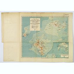
The Central Islands of the Seychelles Group. . .
A nice 'modern' map of the Seychelles, published 'to illustrate a paper by J. Stanley Gardiner, M.A.'. With a small reference table beneath the title and scales, inset of...
Place & Date: London, 1907
Selling price: $15
Sold in 2019
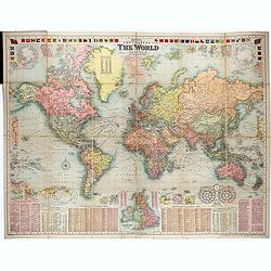
Bacon's New Chart of The World Mercator's Projection. By G.W. Bacon F.R.G.S.
Wall size format world map in Mercator projection, showing the British Empire, at its height. Around the map are inset details: with plans of towns including Hong Kong, S...
Place & Date: London, ca. 1907
Selling price: $750
Sold in 2021

Hodgon's map of the Philippines Islands.
A very rare and important map of the Philippine Islands prepared by Caspar W. Hodgson and engraved by A. Briesemeister. The map measuring unfolded more than 1,4 x 1meters...
Place & Date: New York, World Book Company, 1908
Selling price: $4100
Sold in 2020
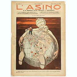
L'Asino e il popolo utile paziente e bastonato.
A satirical look at the Roman Catholic churches' ever-reaching take over of the globe. Pope Pius X is seen sitting beneath the glove, with his arms stretched as far as th...
Place & Date: Rome, 1908
Selling price: $190
Sold in 2021

Plan of Singapore.
A detailed plan of the city of Singapore in the early 1900s. Underneath the map "Drawn and Engraved for the Directory and Chronicle". Scale of 1/2 inch to a mil...
Place & Date: Edinburg, ca 1908
Selling price: $2722
Sold in 2012
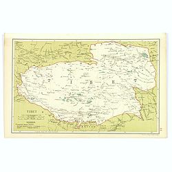
Tibet.
Although an early twentieth century map, this is the desirable region of Tibet, from Stanford's Geographical Establishment in London. A pair of mileage scales, a small re...
Place & Date: London, 1908
Selling price: $85
Sold in 2017

Plan of Singapore.
color lithographed Street Plan of Singapore. The map was drawn at the beginning of the twentieth century.Underneath the plan "Drawn and engraved for the Directory an...
Place & Date: Edinburgh, 1908
Selling price: $550
Sold in 2018
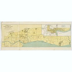
Street Plan of the Northern & Eastern Districts of the Foreign Settlement at Shanghai.
color lithographed Street Plan of the North and Eastern Districts of the Foreign Settlement at Shanghai. The map was drawn at the beginning of the twentieth century.Under...
Place & Date: Edinburgh, 1908
Selling price: $120
Sold in 2018

£100 Imperial Chinese Government 5% Tientsin-Pukow Railway Loan . . .
Text is in English and Chinese. Dated London, September 1, 1908, No. 24436, for £100. Hongkong and Shanghai Banking Corporation, printed by Waterlow & Sons, extremel...
Place & Date: London, 1 September 1908
Selling price: $150
Sold in 2020
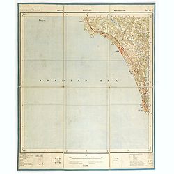
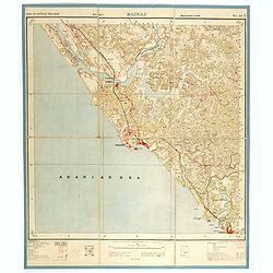
Part of district Malabar. MADRAS NO 49 M11.
Very detailed "Survey of India" map made by trigonometric surveying techniques. Season 1912-1913 and published in 1914.This "Survey of India" map was ...
Place & Date: Calcutta, Superintendent government printing, India, 1909
Selling price: $30
Sold in 2014
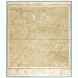
Part of district Malabar. MADRAS NO 49 M5.
Very detailed "Survey of India" map made by trigonometric surveying techniques. Season 1912-1913 and published in 1914.This "Survey of India" map was ...
Place & Date: Calcutta, Superintendent government printing, India, 1909
Selling price: $40
Sold in 2014
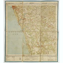
Part of district Malabar and of Mahé. MADRAS NO 49 M9.
Very detailed "Survey of India" map made by trigonometric surveying techniques. Season 1912-1913 and published in 1914.This "Survey of India" map was ...
Place & Date: Calcutta, Superintendent government printing, India, 1909
Selling price: $30
Sold in 2014
Part of district Malabar. MADRAS. NO 49 M16.
Very detailed "Survey of India" map made by trigonometric surveying techniques. This "Survey of India" map was published under the direction of Colone...
Place & Date: Calcutta, Superintendent government printing, India, 1909
Selling price: $50
Sold in 2015
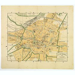
Plan von Bromberg.
An interesting town plan of Bromberg (German) / Bydgoszcz (Polish) published in the town just over a century ago. The city today is in northern Poland, and is situated on...
Place & Date: Bromberg, 1909
Selling price: $13
Sold in 2021
![[India and Indochina map with Ottoman script]](/uploads/cache/44320-250x250.jpg)
[India and Indochina map with Ottoman script]
Post card size map in Ottoman script showing India and Indochina prepared by Mehmet EŞREF in a small atlas : عموم...
Place & Date: Istanbul, 1325 or 1909
Selling price: $195
Sold in 2019
![[Solar System with Ottoman script]](/uploads/cache/44324-250x250.jpg)
[Solar System with Ottoman script]
Post card size chart of the solar system in Ottoman script prepared by Mehmet EŞREF in a small atlas : عمومو&a...
Place & Date: Istanbul, 1325 or 1909
Selling price: $130
Sold in 2019
![[Africa - General continental map with Ottoman script]](/uploads/cache/44736-250x250.jpg)
[Africa - General continental map with Ottoman script]
Post card size map in Ottoman script showing Southern Africa from Mehmet Eşref’s ‘Küçük Atlas’, a rare portfolio of loose-leaf maps with text in Ottoman Turkis...
Place & Date: Istanbul, Şirket-i Mürettibiye ve Karacoğlu Matbaası 1325 or 1909
Selling price: $150
Sold in 2022
![[Libya - map with Ottoman script]](/uploads/cache/44738-250x250.jpg)
[Libya - map with Ottoman script]
Post card size map in Ottoman script of Libya from Mehmet Eşref’s ‘Küçük Atlas’, a rare portfolio of loose-leaf maps with text in Ottoman Turkish, published in...
Place & Date: Istanbul, Şirket-i Mürettibiye ve Karacoğlu Matbaası 1325 or 1909
Selling price: $150
Sold in 2022
![[Equatorial Africa - map with Ottoman script]](/uploads/cache/44739-250x250.jpg)
[Equatorial Africa - map with Ottoman script]
Postcard size map in Ottoman script of Equatorial Africa from Mehmet Eşref’s ‘Küçük Atlas’, a rare portfolio of loose-leaf postcard-sized maps with text in Ott...
Place & Date: Istanbul, Şirket-i Mürettibiye ve Karacoğlu Matbaası 1325 or 1909
Selling price: $150
Sold in 2022
![[Equatorial Africa - map with Ottoman script]](/uploads/cache/44740-250x250.jpg)
[Equatorial Africa - map with Ottoman script]
Post card size map in Ottoman script of Sub-Saharan West Africa from Mehmet Esref’s ‘Küccük Atlas’, a rare portfolio of loose-leaf maps with text in Ottoman Turki...
Place & Date: Istanbul, Matbaasi 1325 or 1909
Selling price: $100
Sold in 2019
![[Egypt / Sudan - map with Ottoman script]](/uploads/cache/44744-250x250.jpg)
[Egypt / Sudan - map with Ottoman script]
Postcard size map in Ottoman script of Egypt and Sudan from Mehmet Eşref’s ‘Küçük Atlas’, a rare portfolio of loose-leaf maps with text in Ottoman Turkish, pu...
Place & Date: Istanbul, Şirket-i Mürettibiye ve Karacoğlu Matbaası 1325 or 1909
Selling price: $150
Sold in 2022
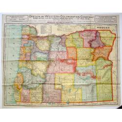
Oregon and Western Colonization Company map of Oregon.
Very detailed Oregon And Western Colonization Company real estate map in color. The Willamette Valley and Cascade Mountain Wagon Road Company sold their 800,000 land gran...
Place & Date: Chicago, ca. 1909
Selling price: $175
Sold in 2013
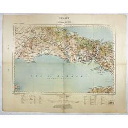
Turkey - Constantinople.
Rare and detailed map ( 1: 250.000) centered on Istanbul, with the Sea of Marmara and the Bosporus, published by the War Office.With scales in miles and kilometers, and t...
Place & Date: London , 1909
Selling price: $150
Sold in 2016
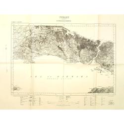
Turkey Constantinople.
War office map centered on Bosporus with Constantinople and the Sea of Marmara. Scale 1: 250.000. With key in bottom part.
Place & Date: London, 1909
Selling price: $110
Sold in 2011

Paris, Notre Dame and bridge over the Seine.
Engraving of the bridge over the Seine, the Notre Dame and stalls of booksellers on the quays.By W.A. Grondhout, signed in the plate (engraved) and with pencil by the art...
Place & Date: Amsterdam ca. 1910
Selling price: $50
Sold

University building Leiden.
Etching by G.C.Haverkamp (1872-1926) showing the building of Leiden University on the Rapenburg, seen from beyond the canal. Signed with pencil under botto-right by the a...
Place & Date: Netherlands ca. 1910
Selling price: $45
Sold

International Railways of Central America (chemins de fer internationaux de l'Amérique centrale).
Two colorful maps, a large one showing the railway systems in Central America by "International Railways of Central America" with a key to the ones unde...
Place & Date: London, ca. 1910
Selling price: $25
Sold in 2009
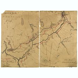
Chemin de fer du Yum-Nan. Boucle du Pei-ho ou Faux Namti entre Kilomètres 104 et 119 (7ème Lot).
Manuscript map of Boucle du Pei-Ho (Taku Forts) showing the river Pei-ho, along with the projected railway lines were to be built, including bridges, installations, villa...
Place & Date: China ?, ca.1910
Selling price: $600
Sold in 2023
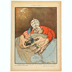
Il Papato in America.
A satirical look at the Roman Catholic church and its 'reach' and 'designs' over America. Pope Pius X is seen with his hands surrounding and enveloping 'Uncle Sam', as he...
Place & Date: Rome, ca 1910
Selling price: $160
Sold in 2021

*untitled*
Very unusual and rare Railway map of todays Zimbabwe, parts of Mozambique, and parts of South Africa, parts of Congo and Tansania. Extends from Lake Tanganyika south unt...
Place & Date: London, c1910
Selling price: $120
Sold in 2022
![[Official US Government Document.]](/uploads/cache/48154-250x250.jpg)
[Official US Government Document.]
An official US government printed document, completed in manuscript. An attractive engraved broadside, completed in manuscript and signed by President William Howard Taft...
Place & Date: Washington D.C., 1910
Selling price: $300
Sold in 2022
![[Game of the goose] Tramway spel](/uploads/cache/48341-250x250.jpg)
[Game of the goose] Tramway spel
Goose board game. Oval with boxes numbered from 1 to 63. In the central box, under the title showing a Amsterdam horse drawn tram while serving as an advertisement for t...
Place & Date: Amsterdam, ca. 1880-1910
Selling price: $75
Sold in 2023