Browse Listings
VENETIA [Venice]
Splendid and rare Lafreri School town plan of Venice, engraved by Paolo Forlani, of the Lafreri school of mapmakers, first published in "Il Primo Libro Delle Citta, ...
Place & Date: Venice, Zaltieri, (1567) 1569
Selling price: $700
Sold in 2016
Istria sotto il dominio veneto..
Fine map of the Istrian peninsula, based on a map of the Venetian patrician Pietro Coppo (1469-1556), probably the most prolific Italian cartographer before Gastaldi.The ...
Place & Date: Venice, 1569
Selling price: $6000
Sold
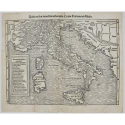
Italia mit den Dreien Furnemsten Inseln Corsica / Sardinia und Sicilia.
One of the earliest woodblock maps of Italy. It shows the area from Marseille to Albania, including the Adriatic Sea, also the islands of Sicily, Corsica and Sardinia. Th...
Place & Date: Basel, 1569
Selling price: $600
Sold in 2023
MIRANDOLA. [Mirandola]
Rare bird's-eye view of the town of Mirandola. Engraved and published by Donato Bertelli.Some examples are found, in fact, in the work Le vere imagini et descritioni del...
Place & Date: Venice, 1569
Selling price: $250
Sold in 2022
MESSINA. [Messina]
Rare bird's-eye view of the town of MessinaEngraved and published by Donato Bertelli.Underneath the town view a blank space.Some examples are found, in fact, in the work ...
Place & Date: Venice, 1569
Selling price: $400
Sold in 2022
Regni Neapolitani Verissima secundum antiquorum et recentiorum traditionem descriptio, Pyrrho Ligorio Auct.
Very fine map of Southern Italy, including the towns of Ascoli, Piceno, Napoli, Fogia, Bari, Catanzaro and the most northern tip of Sicily with Messina.Orientation: top i...
Place & Date: Antwerp, 1570
Selling price: $265
Sold in 2020
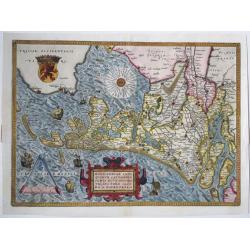
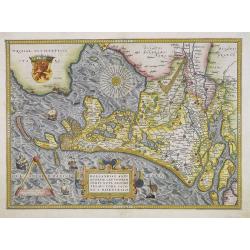
Hollandiae Antiquorum Catthorum sedis Nova Descriptio.
A fine and decorative, early map if the Duchy of Holland in the first state by Abraham Ortelius, from his "Theatrum Orbis Terrarum", Antwerp 1570, after a Jacob...
Place & Date: Antwerp, 1570
Selling price: $900
Sold in 2023
Ptolemeisch General Tafel, die Halbe Kugel der Welt Begreiffende​. . .
A spectacular example of the second ancient map of the World, based upon the writings of Ptolemy. This map by Sebastian Münster and features 12 wind heads. Many Pre-Colu...
Place & Date: Basle, ca 1570
Selling price: $1150
Sold in 2021
Isola Cuba Nova
This important Ruscelli map of Cuba from his work La Geografia di Claudio Tolomeo Alessandrino, is based on Gastaldi’s earlier map of the same region, dated 1548. Altho...
Place & Date: Venice, 1570
Selling price: $375
Sold in 2023
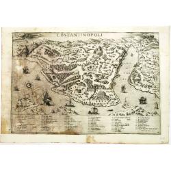
Costantinopoli.
Very rare plan of Istanbul, with in the lower part a numbered key (1-58) to the important places in town by Claudio Ducheto. Collector's item. A unique opportunity to acq...
Place & Date: Rome, 1570
Selling price: $2700
Sold in 2012
Leaf on vellum from a French manuscript Book of Hours.
A wonderful vellum leaf from a Book of Hours, written in Paris, around 1570. The scribe used dark brown ink and wrote in a fine rounded roman hand. The initials are in br...
Place & Date: Paris, 1570
Selling price: $160
Sold in 2012
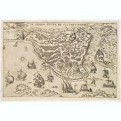
La famosa citta de Constantinopoli.
A separately published decorative and very rare panoramic of of present-day Istanbul, viewed from the village of Scutari. The City is shown with all its fortifications, ...
Place & Date: Venice, c. 1570
Selling price: $4000
Sold in 2013
Leaf on vellum from a French manuscript Book of Hours.
A wonderful vellum leaf from a Book of Hours, written in Paris, around 1570. The scriber used dark Guido ink and wrote in a fine rounded roman hand. The initials are in b...
Place & Date: Paris, 1570
Selling price: $125
Sold in 2013
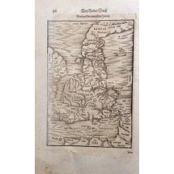
Britannischen Insula.
An unusual outline of the British Isles, influenced by Ptolemy.
Place & Date: Basle, 1570
Selling price: $300
Sold in 2016
Flandria.
Very decorative, egg-shaped map. This is the early state with the farmer's wife and three ships in the North Sea.
Place & Date: Antwerp, 1570
Selling price: $650
Sold in 2015
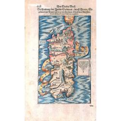
Sardinia Insula.
An early woodcut depicting the Italian island of Sardinia, by Sebastian Münster. It also shows the southern part of Corsica. From one of the German editions of the famou...
Place & Date: Basel, ca 1570
Selling price: $128
Sold in 2023
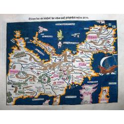
Europa, das ein Drittheil der Erden, nach gelegenheit unsern zeiten.
A very important, attractive woodcut map showing the European continent with South at the top.It comes from a German edition of the famous 'Cosmographia Universalis' by S...
Place & Date: Basel, ca 1570
Selling price: $1200
Sold in 2016
Der Statt Rom in Aller Welde Bekant Contrafehtung nach Jetziger Gelegenheit
An early plan view of Rome and the Vatican City. Many monuments of the ancient time, like the Coliseum, the Pantheon, Castello St. Angelo and the aqueducts are shown. Ger...
Place & Date: Basel, ca. 1570
Selling price: $240
Sold in 2017
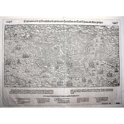
Constantinopel.
An early, fine, extremely detailed woodcut depicting a bird's-eye view of Istanbul as seen from the perspective showing it out on a spur, with Pera across the water to th...
Place & Date: Basle, ca. 1570
Selling price: $200
Sold in 2022
Africae Tabula Nova Edita Antverpiae 1570.
This beautiful map is one of the cornerstone maps of Africa. This particular map does not have text on the verso. This example is not recorded by van den Broecke in his b...
Place & Date: Antwerp, 1570
Selling price: $1850
Sold in 2017
Russiae, Moscoviae et Tartariae Descriptio. [With Latin text on verso]
From a 1570 Latin text edition, v.d. Broecke estimates that only 225 copies are printed. Engraved by Frans Hogenberg from an original of 1562 by Anthony Jenkinson of the ...
Place & Date: Antwerp, 1570
Selling price: $1000
Sold in 2021
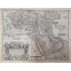
Turcici imperii descriptio.
From Ortelius' 'Theatrum Orbis Terrarum', the first regularly produced, and uniform format, modern atlas of the World. Reference literature: MARCEL P.R. van den Broecke, ...
Place & Date: Antwerp, 1570
Selling price: $900
Sold in 2020
Hamburg.
A delightful birds-eye view of the north German city from of Hamburg, as seen from the River, as set within a page of German text. This lovely view includes a key (A-O) b...
Place & Date: Basle, 1570
Selling price: $45
Sold in 2021
Europae.
The first edition Ortelius’ map of Europe. The map is based upon several important maps of Europe, including Gerard Mercator’s 1554 map of Europe. Mapping of Greenlan...
Place & Date: Antwerp, 1570
Selling price: $600
Sold in 2021
La Saincte cité de Ierusalem iadiz metropolitaine..
A particularly attractive example of this early wood cut view of Jerusalem from an French text edition. The Holy city appears well laid out, and is surrounded by a vast w...
Place & Date: Basle 1570
Selling price: $140
Sold
Hollandiae Antiquorum.
A first state of this mile stone map published by Ortelius on the basis of the map drawn by Jacob van Deventer in abt. 1550. Here from the very first 1570 edition of the ...
Place & Date: Antwerp, 1570
Selling price: $1300
Sold in 2013
Leaf on vellum from a French manuscript Book of Hours.
A wonderful vellum leaf from a Book of Hours, written in Paris, around 1570. The scribe used dark brown ink and wrote in a fine rounded roman hand. The initials are in br...
Place & Date: Paris, 1570
Selling price: $200
Sold
Leaf on vellum from a French manuscript Book of Hours.
A wonderful vellum leaf from a Book of Hours, written in Paris, around 1570. The scribe used dark brown ink and wrote in a fine rounded roman hand. The initials are in br...
Place & Date: Paris, 1570
Selling price: $150
Sold
Leaf on vellum from a French manuscript Book of Hours.
A wonderful vellum leaf from a Book of Hours, written in Paris, around 1570. The scribe used dark brown ink and wrote in a fine rounded roman hand. The initials are in br...
Place & Date: Paris, 1570
Selling price: $165
Sold
Leaf on vellum from a French manuscript Book of Hours.
A wonderful vellum leaf from a Book of Hours, written in Paris, around 1570. The scribe used dark brown ink and wrote in a fine rounded roman hand. The initials are in br...
Place & Date: Paris, 1570
Selling price: $170
Sold
Leaf on vellum from a French manuscript Book of Hours.
A wonderful vellum leaf from a Book of Hours, written in Paris, around 1570. The scribe used dark brown ink and wrote in a fine rounded roman hand. The initials are in br...
Place & Date: Paris, 1570
Selling price: $150
Sold
23 Leaves on vellum from a French manuscript Book of Hours.
Very Rare Manuscript: 23 vellum leaves, the beginning of a Book of Hours!The leaves 1, 2 and 3 are blank, but for a liquid gold panel around each page. Leaf 4 has the tex...
Place & Date: Paris, 1570
Selling price: $1300
Sold
Leaf on vellum from a French manuscript Book of Hours.
A wonderful vellum leaf from a Book of Hours, written in Paris, around 1570. The scribe used dark brown ink and wrote in a fine rounded roman hand. The initials are in br...
Place & Date: Paris, 1570
Selling price: $190
Sold
Leaf on vellum from a French manuscript Book of Hours.
A wonderful vellum leaf from a Book of Hours, written in Paris, around 1570. The scribe used dark brown ink and wrote in a fine rounded roman hand. The initials are in br...
Place & Date: Paris, 1570
Selling price: $190
Sold in 2008
Africae Tabula Nova.
The title is contained in a striking cartouche consisting of a panel flanked by caryatids and strap work. The sea is engraved in stipple-work, and features a sea-battle i...
Place & Date: Antwerp, 1570
Selling price: $1800
Sold in 2009
Africae Tabula Nova.
The title is contained in a striking cartouche consisting of a panel flanked by caryatids and strap work. The sea is engraved in stipple-work, and features a sea-battle i...
Place & Date: Antwerp, 1570
Selling price: $1350
Sold in 2010
Leodiencsis Dioecesis Typus.
Map of eastern Belgium region from Ortelius' Theatrum Orbis Terrarum. Shows the Meuse River and the cities located on the river, such as Namur, Liege and Maastricht. Beau...
Place & Date: Antwerp, 1570
Selling price: $400
Sold in 2010
Leaf on vellum from a French manuscript Book of Hours.
A wonderful vellum leaf from a Book of Hours, written in Paris, around 1570. The scribe used dark brown ink and wrote in a fine rounded roman hand. The initials are in br...
Place & Date: Paris, 1570
Selling price: $140
Sold in 2011
*untitled map of Russia & Ukraine*
Interesting sheet from Sebastian Munster and Henricii Petri from the influential "Cosmographiae Universalis".The very detailed map shows Belarus, the Ukraine, a...
Place & Date: Basle, c1570
Selling price: $226
Sold in 2011
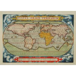
Typus Orbis Terrarum.
An early issue of this influential, and famous World map, issued in the first regularly produced world atlas. The map is a careful reduction of Mercator\'s landmark wall-...
Place & Date: Antwerp 1571
Selling price: $5200
Sold
Monasteriensis et Osnaburgensis Episcopatus descriptio.
Abraham Ortelius(1527-98), Dutch cartographer and publisher of the first modern atlas, Theatrum Orbis Terrarum in 1570. Editions till 1612. Also an atlas of ancient carto...
Place & Date: Antwerp, 1571
Selling price: $280
Sold in 2008
Regni Neapolitani.
Abraham Ortelius (1527-98), Dutch cartographer and publisher of the first modern atlas, ' Theatrum Orbis Terrarum' in 1570. Editions till 1612. Also an atlas of ancient c...
Place & Date: Antwerp, 1571
Selling price: $425
Sold
[Title page] Theatrum Orbis Terrarum.
A decorative title page of the first atlas ever made. Depicting the five continents then known as native goddesses. From a Dutch text edition.On verso a poem : M.TVLLIVS ...
Place & Date: Antwerp c. 1571
Selling price: $500
Sold
Typus Orbis Terrarum.
An early issue of this influential, and famous World map, issued in the first regularly produced world atlas. The map is a careful reduction of Mercator's landmark wall-m...
Place & Date: Antwerp 1571
Selling price: $6900
Sold
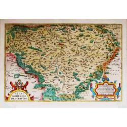
Regni Bohemiae Descriptio.
Abraham Ortelius(1527-98), Dutch cartographer and publisher of the first modern atlas, ' Theatrum Orbis Terrarum' in 1570. Editions till 1612. Also an atlas of ancient ca...
Place & Date: Antwerp, 1571
Selling price: $400
Sold
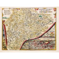
Salisburgensis Iurusdictionis. Inset: Urbis Salisburgensis genuina descriptio.
Abraham Ortelius(1527-98), Dutch cartographer and publisher of the first modern atlas, ' Theatrum Orbis Terrarum' in 1570. Editions till 1612. Also an atlas of ancient ca...
Place & Date: Antwerp, 1571
Selling price: $100
Sold in 2019
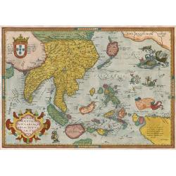
Indiae Orientalis, Insularumque Adiacientium Typus.
Finely contemporarily handcolored example of Ortelius' map of SE Asia, Japan, and the Philippines, etc. The map includes Beach and other information drawn from Marco Polo...
Place & Date: Antwerpen, 1571
Selling price: $1750
Sold in 2009
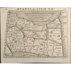
Tabula Asiae V
Woodcut map showing Persia between Persian Gulf and Caspian Sea. From the Latin 1571 edition of Strabo's Geographia with maps of Sebastian Munster which appeared in Ptole...
Place & Date: Basle, 1571
Selling price: $300
Sold in 2013
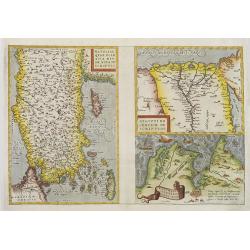
Natoliae quae olim asia minor? / Aegypti recentior? / Carthaginis celeberimisinus typus.
colored copper engraved map of Turkey by A. Ortelius. On right side a map of Egypt and one of Tunis. Three map on one sheet printed from one plate. From the 1571 Latin ed...
Place & Date: Antwerp, c. 1571
Selling price: $170
Sold in 2010
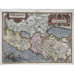
Terra Sancta.
Full title in an elaborate cartouche with scenes from the live of Christ in vignettes at top right: 'Terra Sancta, a Petro Laicstain perlustrata, et ab eius ore et schedi...
Place & Date: Antwerp, 1571
Selling price: $575
Sold in 2021
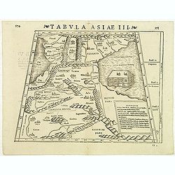
Tabula Asiae III
Attractive woodblock Ptolemaic map, depicting Armenia and in the Right part of the Caspian Sea with Noes Arch. The mountain ranges are depicted in the manner of the early...
Place & Date: Basle, Strabo, 1571
Selling price: $250
Sold in 2012
Tabula Thraciae.
Tabula Thraciae by Sebastian Münster, woodblock engraved Strabonis Ptolemeic map. Map of Greece and North Europe first published in Münster's edition of Ptolemy's 'Geog...
Place & Date: Basle, by Heinrich Petri, 1571
Selling price: $230
Sold in 2016
Descriptio Germaniae Inferioris.
Fine map of the Netherlands of Philip II King of Spain. The oval map is surrounded by a strapwork frame and the title, adorned with ribbons, is held aloft by two winged c...
Place & Date: Antwerp, 1571
Selling price: $700
Sold in 2015
Tabula Hispaniae. (Spain and Portugal)
Double-page woodcut Ptolemaic-style map by Sebastian Münster figuring Spain and Portugal, published in the edition of Strabo by Henri Petri in 1571."Strabonis rerum...
Place & Date: Basle, Henri Petri, 1571
Selling price: $80
Sold in 2018
Tabula Galliae. (France)
Double-page woodcut Ptolemaic-style map by Sebastian Münster figuring France, published in the edition of Strabo by Henri Petri in 1571."Strabonis rerum geographica...
Place & Date: Basle, Henri Petri, 1571
Selling price: $50
Sold in 2018
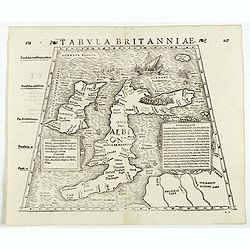
Tabula Britanniae. (British Isles)
Double-page woodcut Ptolemaic-style map by Sebastian Münster figuring the British Isles, published in the edition of Strabo by Henri Petri in 1571."Strabonis rerum ...
Place & Date: Basle, Henri Petri, 1571
Selling price: $401
Sold in 2018
Tabula Italiae. (Italy)
Double-page woodcut Ptolemaic-style map by Sebastian Münster figuring Italy and including Corsica, published in the edition of Strabo by Henri Petri in 1571."Strabo...
Place & Date: Basle, Henri Petri, 1571
Selling price: $60
Sold in 2018
Tabula Siciliae et Sardiniae. (Sicily and Sardinia)
Double-page woodcut Ptolemaic-style map by Sebastian Münster figuring Sicily and Sardinia, published in the edition of Strabo by Henri Petri in 1571."Strabonis reru...
Place & Date: Basle, Henri Petri, 1571
Selling price: $155
Sold in 2018
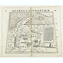
Tabula Germaniae. (Germany)
Double-page woodcut Ptolemaic-style map by Sebastian Münster figuring Germany, published in the edition of Strabo by Henri Petri in 1571."Strabonis rerum geographic...
Place & Date: Basle, Henri Petri, 1571
Selling price: $50
Sold in 2018
Tabula Sarmatiae. (Eastern Europe including Poland and Black sea region)
Double-page woodcut Ptolemaic-style map by Sebastian Münster figuring Eastern Europe including Poland, Lihuania and Black sea region, published in the edition of Strabo ...
Place & Date: Basle, Henri Petri, 1571
Selling price: $90
Sold in 2018
Tabula Thraciae. (Bulgaria, northern Greece, and the European part of Turkey)
Double-page woodcut Ptolemaic-style map by Sebastian Münster figuring Thrace, roughly corresponding to modern day Bulgaria, northern Greece, and the European part of Tur...
Place & Date: Basle, Henri Petri, 1571
Selling price: $150
Sold in 2018
Tabula Graeciae. (Greece and Greek islands)
Double-page woodcut Ptolemaic-style map by Sebastian Münster figuring Greece, published in the edition of Strabo by Henri Petri in 1571."Strabonis rerum geographica...
Place & Date: Basle, Henri Petri, 1571
Selling price: $85
Sold in 2018
Tabula Rhaetiae et Vindeliciae. (Adriatic coast and Balkan States, Dalmatia, etc.)
Double-page woodcut Ptolemaic-style map by Sebastian Münster figuring Adriatic coast and Balkan States, Dalmatia, etc., published in the edition of Strabo by Henri Petri...
Place & Date: Basle, Henri Petri, 1571
Selling price: $70
Sold in 2018
Tabula Graeciae. (Greece)
Double-page woodcut Ptolemaic-style map by Sebastian Münster figuring Greece and Greek islands, published in the edition of Strabo by Henri Petri in 1571."Strabonis...
Place & Date: Basle, Henri Petri, 1571
Selling price: $50
Sold in 2018
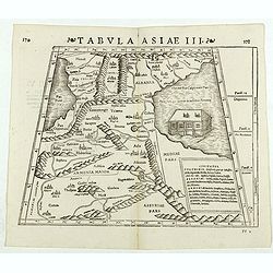
Tabula Asiae III. (Armenia)
Double-page woodcut Ptolemaic-style map by Sebastian Münster figuring Armenia, published in the edition of Strabo by Henri Petri in 1571."Strabonis rerum geographic...
Place & Date: Basle, Henri Petri, 1571
Selling price: $100
Sold in 2018
Tabula Asiae II. (Ukraine)
Double-page woodcut Ptolemaic-style map by Sebastian Münster figuring Ukraine, published in the edition of Strabo by Henri Petri in 1571."Strabonis rerum geographic...
Place & Date: Basle, Henri Petri, 1571
Selling price: $75
Sold in 2018
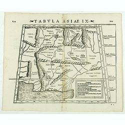
Tabula Asiae IX. (Pakistan, including part of India)
Double-page woodcut Ptolemaic-style map by Sebastian Münster figuring Pakistan, including part of India, published in the edition of Strabo by Henri Petri in 1571."...
Place & Date: Basle, Henri Petri, 1571
Selling price: $50
Sold in 2019
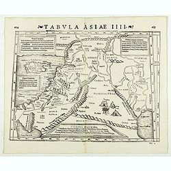
Tabula Asiae IIII. (Holy Land)
Double-page woodcut Ptolemaic-style map by Sebastian Münster figuring Holy Land, published in the edition of Strabo by Henri Petri in 1571."Strabonis rerum geograph...
Place & Date: Basle, Henri Petri, 1571
Selling price: $200
Sold in 2019
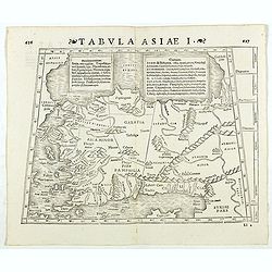
Tabula Asiae I. (Turkey)
Double-page woodcut Ptolemaic-style map by Sebastian Münster figuring Turkey, published in the edition of Strabo by Henri Petri in 1571."Strabonis rerum geographica...
Place & Date: Basle, Henri Petri, 1571
Selling price: $60
Sold in 2018
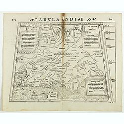
Tabula Indiae X. (part of India and the Indian Ocean)
Double-page woodcut Ptolemaic-style map by Sebastian Münster figuring part of India and the Indian Ocean, published in the edition of Strabo by Henri Petri in 1571."...
Place & Date: Basle, Henri Petri, 1571
Selling price: $25
Sold in 2022
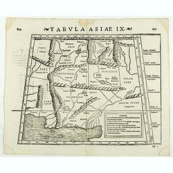
Tabula Asiae IX. (North India and Pakistan)
Double-page woodcut Ptolemaic-style map by Sebastian Münster figuring North India and Pakistan, published in the edition of Strabo by Henri Petri in 1571."Strabonis...
Place & Date: Basle, Henri Petri, 1571
Selling price: $65
Sold in 2020
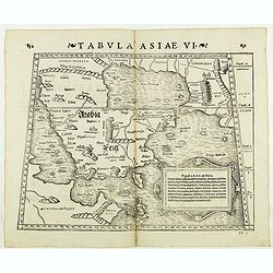
Tabula Asiae VI. ( Arabian Peninsula)
Double-page woodcut Ptolemaic-style map by Sebastian Münster figuring Arabian Peninsula, published in the edition of Strabo by Henri Petri in 1571."Strabonis rerum ...
Place & Date: Basle, Henri Petri, 1571
Selling price: $150
Sold in 2018
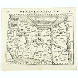
Tabula Asiae V. ( Eastern Iraq and western Iran)
Double-page woodcut Ptolemaic-style map by Sebastian Münster figuring Eastern Iraq and western Iran, published in the edition of Strabo by Henri Petri in 1571."Stra...
Place & Date: Basle, Henri Petri, 1571
Selling price: $75
Sold in 2019
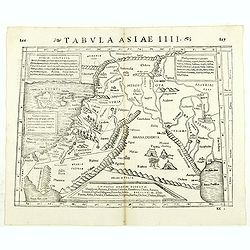
Tabula Asiae IIII. ( Holy Land, Cyprus, Syria, etc.)
Double-page woodcut Ptolemaic-style map by Sebastian Münster figuring Holy Land, Cyprus, Syria, etc., published in the edition of Strabo by Henri Petri in 1571."Str...
Place & Date: Basle, Henri Petri, 1571
Selling price: $75
Sold in 2018
Aphricae Tabula III. (North Africa and Egypt)
Double-page woodcut Ptolemaic-style map by Sebastian Münster figuring North Africa and Egypt., published in the edition of Strabo by Henri Petri in 1571."Strabonis ...
Place & Date: Basle, Henri Petri, 1571
Selling price: $60
Sold in 2018
Aphricae Tabula IIII. (North Africa and the Mediterranean)
Double-page woodcut Ptolemaic-style map by Sebastian Münster figuring North Africa and the Mediterranean, published in the edition of Strabo by Henri Petri in 1571."...
Place & Date: Basle, Henri Petri, 1571
Selling price: $200
Sold
Aphricae Tabula II. (Northern Africa and the Mediterranean showing parts of Sicily, Tunisia and Libya)
Double-page woodcut Ptolemaic-style map by Sebastian Münster figuring Northern Africa and the Mediterranean showing parts of Sicily, Tunisia and Libya, published in the ...
Place & Date: Basle, Henri Petri, 1571
Selling price: $105
Sold in 2018
[Cyprus].
Woodcut Ptolemaic-style map by Sebastian Münster figuring Cyprus, published in the edition of Strabo by Henri Petri in 1571."Strabonis rerum geographicarum" is...
Place & Date: Basle, Henri Petri, 1571
Selling price: $180
Sold in 2018
[Rhodus].
Woodcut Ptolemaic-style map by Sebastian Münster figuring Rhodes Island, published in the edition of Strabo by Henri Petri in 1571."Strabonis rerum geographicarum&q...
Place & Date: Basle, Henri Petri, 1571
Selling price: $50
Sold in 2018
[Lesbos].
Woodcut Ptolemaic-style map by Sebastian Münster figuring Lesbos Island, published in the edition of Strabo by Henri Petri in 1571."Strabonis rerum geographicarum&q...
Place & Date: Basle, Henri Petri, 1571
Selling price: $55
Sold in 2018
![VENETIA [Venice]](/uploads/cache/37625-250x250.jpg)

![MIRANDOLA. [Mirandola]](/uploads/cache/47582-250x250.jpg)
![MESSINA. [Messina]](/uploads/cache/47583-250x250.jpg)








![Russiae, Moscoviae et Tartariae Descriptio. [With Latin text on verso]](/uploads/cache/42049-250x250.jpg)






![[Title page] Theatrum Orbis Terrarum.](/uploads/cache/23108-250x250.jpg)










![[Cyprus].](/uploads/cache/41984-250x250.jpg)
![[Rhodus].](/uploads/cache/41985-250x250.jpg)
![[Lesbos].](/uploads/cache/41986-250x250.jpg)