Browse Listings
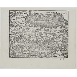
Al Ecc[ellentissi],mo Philosopho, Mathematico, Medico, et Cauallier aureato, beniemerito Guardiano grande della / Scola de .S. Marco...
The first map of Africa from the Forlani school, in a first edition. Forlani appears to have largely drawn upon the earlier work of Gastaldi. Forlani shows additional pla...
Place & Date: Venice, 1562
Selling price: $45100
Sold
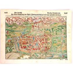
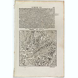
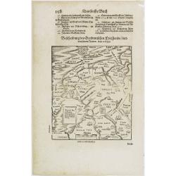
Der Statt Istien und umbligender Landschafft gelegenheit und abcontrafactur.
Text page with a map (122x155mm.) of "Istien". It is a typical woodcut illustration that makes these Münster maps fascinating and sought after by map collector...
Place & Date: Basel, 1562
Selling price: $15
Sold in 2011
Neapolis. / Tiloi.
Text page with two town views of Naples and "Tiloi". It is a typical woodcut illustration that makes these Münster maps fascinating and sought after by map col...
Place & Date: Basel, 1562
Selling price: $80
Sold in 2008
Corsica.
Nice miniature map of Corsica with monsters and ships in the sea. It is a typical woodcut illustration that makes these Münster maps fascinating and sought after by map ...
Place & Date: Basel, 1562
Selling price: $80
Sold in 2008
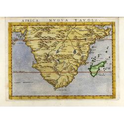
Africa nuova tavola
Decorative colored 16th century map of South Africa by G. Ruscelli. From the latin Ptolemy edition of Gastaldi-Ruscelli by V. Valgrisi, printed in Venice 1562.
Place & Date: Venice, 1562
Selling price: $425
Sold in 2009
Andere Landtaffel: In welcher der Moscauen gebuet mit sampt den welden und bergen. . .
One of the earliest obtainable, and first modern map of Russia! With curious details and many place names. Extends from Finland until the Caspian Sea. With sailing ships...
Place & Date: Basel, 1563
Selling price: $1500
Sold in 2020
[East coast of Africa]
Scarce map of the eastern part of Africa, the Arabian Peninsula, and the western part of India. In the Indian Ocean Madagascar, Noah's Ark with a dove returning with its ...
Place & Date: Venice, G.H. Camocio, ca.1563
Selling price: $4600
Sold in 2012
Il Cuscho citta principale della provincia del Peru.
A very desirable and scarce item of this decorative and early bid's-eye town-plan of the Inca city of Cuzco. Several figures shown inside the city walls and on the hillsi...
Place & Date: Lyons, 1564
Selling price: $450
Sold in 2012
Constantinoble ( Constantinople )
This chorographical view of Constantinople is from Du Pinet's rare city atlas published in Lyon by Jean d'Ogerolles. It is taken from Sebastian Munster's plan and feature...
Place & Date: Lyon, 1564
Selling price: $650
Sold in 2013
Rubeaquum Rusach (Château D'Isenbourg)
Rubeaquum Rufach is a detailed woodcut by Sebastian Münster showing the famous Château D'Isenbourg located in the heart of the vineyards on the Alsace wine route and th...
Place & Date: Basil, 1564
Selling price: $30
Sold in 2018
De Lacu Lemanno. (Lake Geneva)
One Latin text page with a woodcut map of Lake Geneva (147x157mm). From Münster's Cosmographia Universalis. The Cosmographia by Sebastian Münster from 1544 is the earli...
Place & Date: Basle, ca. 1564
Selling price: $30
Sold in 2017
Bohemici Regni . . . [Czechoslovakia]
One Latin text page with a wood cut engraved map of Czechoslovakia centered on Prague (93 x 135 mm). From Münster's Cosmographia Universalis.The Cosmographia by Sebastia...
Place & Date: Basle, ca. 1564
Selling price: $15
Sold in 2016
Ungariae & Omnium partium eius. (Hungary)
One Latin text page with a wood cut engraved map of Hungary (100 x 135 mm). From Münster's Cosmographia Universalis. The Cosmographia by Sebastian Münster from 1544 is ...
Place & Date: Basle, ca. 1564
Selling price: $10
Sold in 2016
[Elch Moose]
One Latin text page with on recto a wood cut illustration of an Elch Moose (11,5 x 16 cm). From Münster's Cosmographia Universalis.The Cosmographia by Sebastian Münster...
Place & Date: Basle, ca. 1564
Selling price: $15
Sold in 2018
Descriptio Germanicae nationis propter . . .
One text page with a small wood cut map of central Europe (10 x 13,5 cm) with south to the top. On verso, Latin text with German locals. From Münster's Cosmographia Univ...
Place & Date: Basle, ca. 1564
Selling price: $25
Sold in 2019
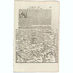
Transsylvania Ungarici Regni Provincia.
One text page with a map of Hungary, Moravia and Macedonia (150 x 190 mm). On verso Latin text page with a small wood cut of a monastery on a mountain.From Münster's Cos...
Place & Date: Basle, ca. 1564
Selling price: $25
Sold in 2016
[ Wood cut map of Russia centered on Moscovy]
One text page with a map of Russia, centered on Moscovie (175 x 160 mm). On verso, a text page in one hand , and in the other a horn from Münster's Cosmographia Universa...
Place & Date: Basle, ca. 1564
Selling price: $80
Sold in 2017
[Versalis Lib I]
One text page with Latin text with reference to Delos, Rhodes, Alone, Thera/ Sicilia and Therasia, illustrated with a fancy wood cut map (130 x 145 mm) with three dimensi...
Place & Date: Basle, ca. 1564
Selling price: $25
Sold in 2018
[De Germania - Prinum Suitenfium Foedus]
One Latin text page telling a story from the years 1316-1323. Illustrated with a wonderful wood block print of medieval knights and men shown in a highly stylized primiti...
Place & Date: Basle, ca. 1564
Selling price: $15
Sold in 2017
[ Zürich ]
One Latin text page with a wood-cut illustration of Zürich (120 x 173 mm). From Münster's Cosmographia Universalis. The Cosmographia by Sebastian Munster from 1544 is t...
Place & Date: Basle, ca. 1564
Selling price: $14
Sold in 2022
Description de la Germanie.
A wood cut printed map of Germany, The Low Countries, Poland, Austria and Switzerland (345 x 250). South to the top and a scale to the right. On verso French text.From M�...
Place & Date: Basle, ca. 1564
Selling price: $80
Sold in 2016
Sinus Persicus [Arabia]
Rare wood block printed map of the Arabian Peninsular from "De orbis situ libri tres accuratissime emendati". Underneath the map a lettered key (A-E) in letter ...
Place & Date: Basle, Henri Petri, 1564
Selling price: $425
Sold in 2017
Sinus Persicus [Arabia]
Rare wood block printed map of the Holy Land, Syria, Cyprus, northern Arabia from "De orbis situ libri tres accuratissime emendati". Underneath the map a letter...
Place & Date: Basle, Henri Petri, 1564
Selling price: $150
Sold in 2017
De Novis Insulis, Quomodo quando . . .
Text page with a map of unspecified islands in the New World (140 x 145 mm). with sea monsters on the recto. From Münster's Cosmographia Universalis.The Cosmographia by ...
Place & Date: Basle, ca. 1564
Selling price: $50
Sold in 2017
De Terra Sancta (Jerusalem)
One Latin text page with on verso three illustrations of Salomon's Temple, View of Jerusalem and stairs to Mount Calvaria. On recto the Holy Sepulchre (Sacri sepulchri te...
Place & Date: Basle, ca. 1564
Selling price: $20
Sold in 2018
De Navigatione Maris.
One Latin text page about navigation, early voyages, and illustrated with a ship (68 x 64 mm), who was lateron used to illustrate Christopher Columbus ship. On verso an i...
Place & Date: Basle, ca. 1564
Selling price: $10
Sold in 2018
[Bull from Lithuania]
One text page with a map of a bull on the recto (11 x 14 cm). On verso, a description of Poland and Russia taken from Münster's Cosmographia Universalis.The Cosmographia...
Place & Date: Basle, ca. 1564
Selling price: $10
Sold in 2018
[De Galliae et eius fitu, item de eius patitione . . . . . . ]
One text page with a map of France on the recto (7,8 x 13,5 cm). On verso, a text page in one hand , and in the other a horn from Münster's Cosmographia Universalis.The ...
Place & Date: Basle, ca. 1564
Selling price: $25
Sold in 2018
De Terris Asiae Maioris de India Ultra Gangem Fluvium Sita.
One text page with a woodcuts of a fanciful creatures along the River Ganges in India from Münster's Cosmographia Universalis.The Cosmographia by Sebastian Munster from ...
Place & Date: Basle, ca. 1564
Selling price: $10
Sold in 2018
(African flora and fauna)
One text page with a woodcut of an abandon flora and fauna in Africa from Münster's Cosmographia Universalis.The Cosmographia by Sebastian Munster from 1544 is the earli...
Place & Date: Basle, ca. 1564
Selling price: $10
Sold in 2019
[De Regionibus, Ubibus et Fluviis Galliae . . . ]
One text page with a map of Europe on the recto (12,2 x 15,5 cm). From Münster's Cosmographia Universalis.The Cosmographia by Sebastian Munster from 1544 is the earliest...
Place & Date: Basle, ca. 1564
Selling price: $25
Sold in 2022
De Batavia Quae Hodie est Holandia.
One text page with an illustration of floating in the Netherland on the recto. From Münster's Cosmographia Universalis.The Cosmographia by Sebastian Münster from 1544 i...
Place & Date: Basle, ca. 1564
Selling price: $10
Sold in 2018
De pago aventico vulgo Wifelspurgergow. . .
A lovely detailed wood cut map of South-western Switzerland it shows Geneva, Lake Geneva, Lake Neuchatel, Lake Biel, Bern, Freiburg, Lake Thuner, etc (150 x 155 mm). On v...
Place & Date: Basle, ca. 1564
Selling price: $10
Sold in 2020
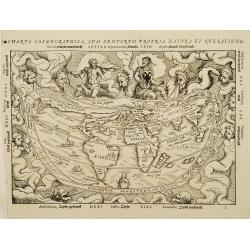
Charta cosmographica, cum ventorum propria natura et operatione..
The socond wood block cut of the cordiform world map after Gemma Frisius in Apian's Cosmographiawith explanatory text on windheads in Dutch arround, North America labeled...
Place & Date: Antwerp 1564
Selling price: $2900
Sold
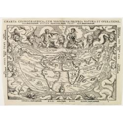
Charta cosmographica, cum ventorum propria natura et operatione..
The second wood block cut of the cordiform world map after Gemma Frisius in Apian's Cosmographiawith explanatory text on wind heads in Dutch around, North America labelle...
Place & Date: Antwerp 1564
Selling price: $2200
Sold
[Crete] EL VERO ET NVOVO DISEGNO, DI TVTTA LA ISOLA, DI CANDIA.
Fine map of Crete. No further states are recorded.Engraved by Paolo Forlani (active 1561-1577). Title in banner in top. In lower right corner a cartouche including the hu...
Place & Date: Venice 1564
Selling price: $2500
Sold in 2010
Vogliono alcuni l'isola di Corfu fosse prima ..
Fine map of the island of Kerkyra (Corfu), based on a map of the French artist Jacques Prevost. The present edition by Fernando Bertelli (ascribed by D.Woodward to Paolo ...
Place & Date: Venice, 1564
Selling price: $2100
Sold in 2010
IL PORTO DI MALTA.
Rare plan of the town of Valetta showing the counter attack of the army of Ascanio against the Turks. Thirteen departing Turkish galleys have been engraved within "P...
Place & Date: Venice, after 1564
Selling price: $4200
Sold
[No title] Daniel's Dream Map.
A somewhat curious map of Europe, Africa, and Asia is to be found in apocalyptic literature originally emanating from Wittenberg in 1530 or even 1529. One of the first im...
Place & Date: Cologne, 1564
Selling price: $2450
Sold
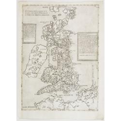
Britania Insula quae dup Regna continet Angliam et Scotiam cum Hibernia adiacente. Ferando Berteli exc. 1561. Venise: 1562
One of the earliest printed maps of England. The essential roots of mid-16th century mapping of the British Isles go back to the English catholic priest George Lily (ca 1...
Place & Date: Venice, 1564
Selling price: $16800
Sold
Totius Graeciae Descriptio.
A rare map of Greece. One of the first printed maps of Greece, decorated with many ships. A unique opportunity to acquire a fine example of a map from the early Lafreri s...
Place & Date: Venice, 1564
Selling price: $14250
Sold in 2010
[Von dem königreich Poland das in Sarmatia auch..]
Early wood block printed map of Poland. Set in a page of German text.Taken from Sebastian Münster's encyclopedic work, the "Cosmographia Universalis". The Cosm...
Place & Date: Basle, 1564
Selling price: $100
Sold in 2010
Das Pomerisch Meere.
RECTO: A double-page map of Pomeren, today's Poland. Illustrated in upper portion nine coats of arms of the duchies of the region. VERSO: a small map of the Prussian coas...
Place & Date: Basle, ca. 1564
Selling price: $150
Sold in 2009
Friesland.
RECTO: A map of Friesland. VERSO: two woodcuts of two mice, one entering a mouse trap, and the other of a pope.Taken from Sebastian Munster's encyclopedic work, the "...
Place & Date: Basle, ca. 1564
Selling price: $50
Sold in 2009
[ Two knights jousting ].
A woodcut of two knights jousting.Jousting is a sport played by two armored combatants mounted on horses. It consists of martial competition between two mounted knights u...
Place & Date: Basle, ca. 1564
Selling price: $30
Sold in 2009
Beschreibung der Statt Antorff? [Antwerp ]
RECTO: a bird's-eye-view of a Antwerp. VERSO: a woodcut portrait of Alfa. Taken from Sebastian Munster's encyclopedic work, the "Cosmographia Universalis". The ...
Place & Date: Basle, ca. 1564
Selling price: $30
Sold in 2010
Martpurg (Marburg)
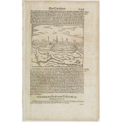
RECTO: A print of the city of Marburg in Germany illustrated in lower right portion by a woodcut of a scholar . VERSO: a small map of a provincial German village.Taken fr...
Place & Date: Basle, ca. 1564
Selling price: $10
Sold in 2014
Hessen.
RECTO: A map of the city of Hessen in Germany illustrated in lower right portion by a woodcut of a scholar.Taken from Sebastian Münster's encyclopedic work, the Cosmogra...
Place & Date: Basle, ca. 1564
Selling price: $50
Sold in 2012
Das Funffte Buch. Aldenburg.
RECTO: A map of the city of Aldenberg in Germany. Taken from Sebastian Münster's encyclopedic work, the Cosmographia Universalis. The Cosmographia by Sebastian Münster ...
Place & Date: Basle, ca. 1564
Selling price: $10
Sold in 2014
Wittenburg. / Portrait of Luther
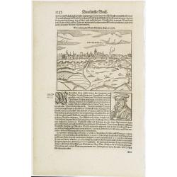
RECTO: A map of the city of Wittenburg in Germany illustrated in lower right portion by a woodcut of Luther. VERSO: a woodcut of a Pope.Taken from Sebastian Münster's en...
Place & Date: Basle, ca. 1564
Selling price: $50
Sold in 2011
Eyfalia.
RECTO: a map of the area around Cologne, including the Dutch province Limburg and part of Luxemburg. VERSO: a woodcut of a Turkish bath scene and the its outside surround...
Place & Date: Basle, ca. 1564
Selling price: $20
Sold in 2009
Munster.
A of Münster in Germany. VERSO: a woodcut of a coat of arms.Region known for its agriculture, dairy farming, livestock raising.Taken from Sebastian Münster's encyclope...
Place & Date: Basle, ca. 1564
Selling price: $30
Sold in 2012
[medieval banquet.]
RECTO: a woodcut of a medieval banquet.VERSO: a woodcut of a flood in The Netherlands in the year 1420 or 1446.Taken from Sebastian Münster's encyclopedic work, the &quo...
Place & Date: Basle, ca. 1564
Selling price: $20
Sold in 2011
Das Funffte Buch. Mitnacht.
Town-plan of Mitnacht with a key: A-Q. VERSO: a woodcut of a scholar. Taken from Sebastian Münster's encyclopedic work, the "Cosmographia Universalis". The &qu...
Place & Date: Basle, ca. 1564
Selling price: $20
Sold in 2012
Calecut Nova Tavola.
A fine early map of Indian peninsula,it being one of the earliest modern maps of the region, extending from west of the Gujarat peninsula eastward to Bengal and south as ...
Place & Date: Venice, 1564
Selling price: $120
Sold in 2020
Tabula Europae III (France)
Early map of France. Girolamo Ruscelli first published the map in his "La Geographi di Claudio Tolomeo" (Venice, 1561). In 1574 a new plate was used which laste...
Place & Date: Venice, 1564
Selling price: $60
Sold in 2020
Tabula Europae V.
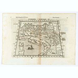
Early map of the Balkans. Girolamo Ruscelli first published the map in his "La Geographi di Claudio Tolomeo" (Venice, 1561). In 1574 a new plate was used which ...
Place & Date: Venice, 1564
Selling price: $60
Sold in 2020
Calecut Nuova Tavola.
Early map of India, extending from west of the Gujarat peninsula eastward to Bengal and south as far as northern Ceylon (“Ceilam”). Girolamo Ruscelli first published ...
Place & Date: Venice, 1564
Selling price: $60
Sold in 2020
Tabula Aphricae I.
Early map of north-west Africa. Girolamo Ruscelli first published the map in his "La Geographi di Claudio Tolomeo" (Venice, 1561). In 1574 a new plate was used ...
Place & Date: Venice, 1564
Selling price: $60
Sold in 2020
Tabula Asiae XI.
Early map of part of India. Girolamo Ruscelli first published the map in his "La Geographi di Claudio Tolomeo" (Venice, 1561). In 1574 a new plate was used whic...
Place & Date: Venice, 1564
Selling price: $70
Sold in 2020
[untitled] Judaea, Chaldaea, Syria, Mesopotamia, Asia Minor, Dioscurias, Mecha, Arabia Felix, Saba et al
Johannes Honter was a Protestant reformer from Transylvania, mentioned in 1570 by Abraham Ortelius in his ground-breaking atlas. Honter’s 'Rudimentorum Cosmographicorum...
Place & Date: Zurich, 1564
Selling price: $300
Sold in 2021
Astrologia-allegory of Astrology
After the design by Frans Floris, published by Hieronymus Cock in Antwerp. Cornelis Cort (1533-1578) was a renowned Dutch draughtsman and engraver. He was known as Cornel...
Place & Date: 1565
Selling price: $205
Sold in 2021
Der Statt Neapolis Abcontrafhetung
The rare miniature woodblock map of Italy. On verso are half-maps of the Holy Land (Israel) and Greece. The maps in Honter’s books were printed back-to-back, so the ...
Place & Date: Basel, 1565
Selling price: $500
Sold in 2023
La Nuova Francia.
Second state of the woodcut map of the Atlantic coastline from New York to Labrador. Manhattan as the peninsula "Angouleme", named after King Francis I, Duke of...
Place & Date: Venice, 1565
Selling price: $2800
Sold in 2012
La Terra de Hochelaga nella Nova Francia... (MONTREAL).
Large, very rare woodcut depicting the first printed plan of Montreal, from the famous book "Delle navigationi et viaggi", prepared Jacques Cartier, the great F...
Place & Date: Venice, ca 1565
Selling price: $1490
Sold in 2019
Ultimo disegno delli forti di Malta uenuto novamente. . . Ant. Lafrerj Romae formis 1565 de Mese Augusti.
A rare and important map showing the Great Siege of Malta which took place in 1565 when the Ottoman Empire invaded the island, then held by the Knights HospitallerThe Kni...
Place & Date: Rome, 1565
Selling price: $6400
Sold in 2010
[Gÿor] Iavarino in Ongaria et trinciere dove al presente al ritrova lo Imperatore aloggiato con lo essercito ...
Showing the siege of Iavarin (nowadays Gÿor). Title in a cartouche lower left, with compass rose, date 1566 and initials of Marios Kartaro.A unique opportunity to acquir...
Place & Date: Venice, 1566
Galliae exactissima descriptio.
A unique opportunity to acquire a fine example from a map from the early Lafreri school. It was the custom for Italian map sellers to bind together available maps into a ...
Place & Date: Venice, 1566
Selling price: $4500
Sold
Descrittione del Piamonte Mon- / ferra, et la maggior parte della / Riuiera di Genoua, con jl territorio / Astesano, Alexandrino Tortonese, / Nouarese, et la maggior parte del ..
Fine map of Piedmont, with the Mediterranean coast including Monaco till Genoa, and Milan on the top. In the center is the river PO. State 3 of 5, with the name of Camoci...
Place & Date: Venice, 1566
Selling price: $4900
Sold in 2012
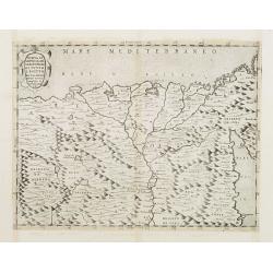
NVOVA, ET / COPIOSA, DE= / SCRITTIONE / DI TVTTO / L'EGITTO / Pur hora da Paulo / Forlani Veronese / intagliata. in / Venetia l'anno / 1566.
Rare map of the northern part of Egypt. In the right-hand part of the Red Sea. The first of only two "Lafreiri-school" maps made of Egypt!North to the top.Engra...
Place & Date: Venice 1566
Selling price: $2000
Sold
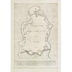
DISEGNO VERO DELLA NVOVA CITTA DI MALTA.
Rare fortification plan of the town of Valletta. Engraved by Paolo Forlani (active 1561-1577).With hatching to highlight the ditch on the landward side of Valletta. It se...
Place & Date: Venice 1566
Selling price: $1500
Sold
[untitled map of Spain and Portugal] Al Molto Mag et Ecc Alessandro Serego, Che lo studio della Geografia..
A rare map of Spain and Portugal, with an oversized Majorca. One of the first printed maps of Cyprus. A unique opportunity to acquire a fine example of a map from the ear...
Place & Date: Venice, 1566
Selling price: $9000
Sold in 2010
[Gÿor] Iavarino in Ongaria et trinciere dove al presente al ritrova lo Imperatore aloggiato con lo essercito . . .
Showing the siege of Iavarin (nowadays Gÿor). Title in a cartouche lower left, with compass rose, date 1566 and initials of Marios Kartaro. A unique opportunity to acqui...
Place & Date: Venice, 1566
Selling price: $1000
Sold in 2010
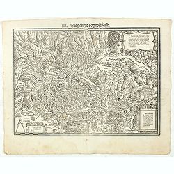
IIII. Die ganz Eydgnoschafft.
Very early wood cut printed map of Switzerland.Originally engraved in 1548. The map was prepared by Johannes Stumpf (1500-1576) and engraved by Heinrich I. Vogtherr (1490...
Place & Date: Zurich, Christoffel Froschover, 1548,1552-1566
Selling price: $900
Sold in 2021
VI. Das Zürychgow.
Very early wood cut printed regional map of Switzerland centered on Zurich.Originally engraved in 1548. The map was prepared by Johannes Stumpf (1500-1576). Included in &...
Place & Date: Zurich, Christoffel Froschover, 1548,1552-1566
Selling price: $400
Sold
X. Rhetia. Die Pündt.
Very early wood cut printed regional map of Switzerland with River Rhine.Originally engraved in 1548. The map was prepared by Johannes Stumpf (1500-1576). Included in &qu...
Place & Date: Zurich, Christoffel Froschover, 1548,1552-1566
Selling price: $400
Sold in 2018
[Title page to 'Landtaflen. Hierinn findst du lieber Läser schöner recht und wolgemachter Landtaflen XII...']
Title page with wood cut device to "Landtaflen. Hierinn findst du lieber Läser schöner recht und wolgemachter Landtaflen XII namlich ein Allgemeine Europae demnach...
Place & Date: Zurich, Christoffel Froschover, 1566
Selling price: $100
Sold in 2016
Amsterdam.
One of the oldest plans of Amsterdam, from the first edition of the book by Lodovico Guicciardini, Descrittione di tutti i Paesi Bassi, in its French translation from 156...
Place & Date: Antwerp, 1567
Selling price: $400
Sold in 2015
Anvers.
Charming and highly detailed bird’s-eye plan of Antwerpen with attractive pictorially drawn buildings, walls, churches, ships, and towers. Very early woodblock print pr...
Place & Date: Antwerp, 1567
Selling price: $250
Sold in 2018
Brusselles.
Charming bird’s-eye plan of Brussel with attractive pictorially drawn buildings, walls, churches, and towers. Very early woodblock print printed in 1567 by Silvius with...
Place & Date: Antwerp, 1567
Selling price: $250
Sold in 2014
![Al Ecc[ellentissi],mo Philosopho, Mathematico, Medico, et Cauallier aureato, beniemerito Guardiano grande della / Scola de .S. Marco...](/uploads/cache/25019-250x250.jpg)



![[East coast of Africa]](/uploads/cache/32499-250x250.jpg)



![Bohemici Regni . . . [Czechoslovakia]](/uploads/cache/38517-250x250.jpg)

![[Elch Moose]](/uploads/cache/38519-250x250.jpg)

![[ Wood cut map of Russia centered on Moscovy]](/uploads/cache/38528-250x250.jpg)
![[Versalis Lib I]](/uploads/cache/38533-250x250.jpg)
![[De Germania - Prinum Suitenfium Foedus]](/uploads/cache/38536-250x250.jpg)
![[ Zürich ]](/uploads/cache/38542-250x250.jpg)

![Sinus Persicus [Arabia]](/uploads/cache/39581-250x250.jpg)
![Sinus Persicus [Arabia]](/uploads/cache/39586-250x250.jpg)


![[Bull from Lithuania]](/uploads/cache/38520-250x250.jpg)
![[De Galliae et eius fitu, item de eius patitione . . . . . . ]](/uploads/cache/38525-250x250.jpg)


![[De Regionibus, Ubibus et Fluviis Galliae . . . ]](/uploads/cache/38524-250x250.jpg)
![[Crete] EL VERO ET NVOVO DISEGNO, DI TVTTA LA ISOLA, DI CANDIA.](/uploads/cache/23788-250x250.jpg)


![[No title] Daniel's Dream Map.](/uploads/cache/24907-250x250.jpg)

![[Von dem königreich Poland das in Sarmatia auch..]](/uploads/cache/22813-250x250.jpg)

![[ Two knights jousting ].](/uploads/cache/27198-250x250.jpg)
![Beschreibung der Statt Antorff? [Antwerp ]](/uploads/cache/27204-250x250.jpg)




![[medieval banquet.]](/uploads/cache/27203-250x250.jpg)




![[untitled] Judaea, Chaldaea, Syria, Mesopotamia, Asia Minor, Dioscurias, Mecha, Arabia Felix, Saba et al](/uploads/cache/85878-250x250.jpg)



![[Gÿor] Iavarino in Ongaria et trinciere dove al presente al ritrova lo Imperatore aloggiato con lo essercito ...](/uploads/cache/32490-250x250.jpg)


![[untitled map of Spain and Portugal] Al Molto Mag et Ecc Alessandro Serego, Che lo studio della Geografia..](/uploads/cache/25016-250x250.jpg)
![[Gÿor] Iavarino in Ongaria et trinciere dove al presente al ritrova lo Imperatore aloggiato con lo essercito . . .](/uploads/cache/25020-250x250.jpg)


![[Title page to 'Landtaflen. Hierinn findst du lieber Läser schöner recht und wolgemachter Landtaflen XII...']](/uploads/cache/37084-250x250.jpg)


