Browse Listings in Europe > Portugal > Portugal General Maps
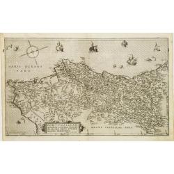
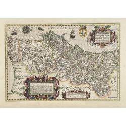
Portugalliae que olim Lusitania.
The best-known map of Portugal, after Alvares Secco (1560), map is orientated west to the top of the sheet, seen here in a fine, early impression in good color. Fernando ...
Place & Date: Antwerp, 1574
Selling price: $255
Sold in 2019
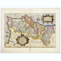
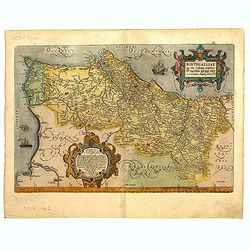
Portvgalliae qvae olim Lvsitania Vernando Alvaro Secco avtore recens descriptio.
FIRST EDITION of this fine example of De Jode's rare map of Portugal. From the first edition of De Jode's Speculum Orbis Terrarum, the second general atlas of the world, ...
Place & Date: Antwerp 1578
Selling price: $1650
Sold
Lisbona.
An attractive woodcut panoramic view of Lisbon based on Braun & Hogenberg's earlier example. The city is shown from the sea, with galleons, rowboats, and buildings. I...
Place & Date: Basle, Heinrich Petri, 1580
Selling price: $280
Sold in 2015
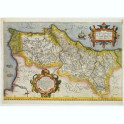
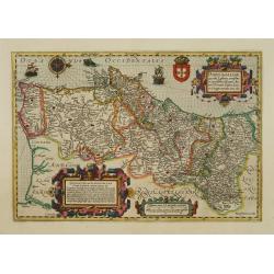
Portugalliae que olim Lusitania.
The best-known map of Portugal, after Alvares Secco (1560), map is orientated west to the top of the sheet, seen here in a fine, early impression in good color. Fernando ...
Place & Date: Antwerp, 1592
Selling price: $325
Sold in 2023
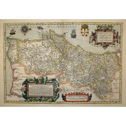
Portugalliae que olim Lusitania.
The best-known map of Portugal, after Alvares Secco (1560), orientated west to the top of the sheet, seen here in a fine, early impression in bright contemporary color. S...
Place & Date: Antwerp, ca.1592
Selling price: $400
Sold
[Departure from Lisbon for Brazil, the East Indies and America]
Departure of Hans Steden on his first voyage to Brazil from Lisbon. Steden made two voyages to Brazil, 1546 to 1548 and 1549 to 1555.Read more about "Les Grand Voyag...
Place & Date: Frankfurt, 1594
Selling price: $175
Sold in 2023
Portugalliae que olim Lusitania.
The best-known map of Portugal, after Alvares Secco (1560), orientated west to the top of the sheet. Many mapmakers and publishers copied Secco's map for upwards of a cen...
Place & Date: Antwerp, 1598
Selling price: $220
Sold in 2018
Portugalliae que olim Lusitania, novissima et exactissima descriptio Auctore Vernando Alvaro Secco. . .
A splendid map of Portugal, engraved by Baptista van Doetecum, it is richly embellished with a title, a dedication and a scale cartouches, in addition, with two sailing s...
Place & Date: Amsterdam, ca. 1606
Selling price: $370
Sold in 2020
Hispaniae nova describtio...
Hondius beautiful map of Spain and Portugal, including the Balearic islands and a small tip of northern Africa. Fully hand-coloured double-page engraving, done by Peter v...
Place & Date: Amsterdam, ca. 1606
Selling price: $304
Sold in 2023
Portugalliae que olim Lusitania..
The best-known map of Portugal, after Alvares Secco (1560), orientated west to the top of the sheet. Secco's map was copied by many mapmakers and publishers for upwards o...
Place & Date: Amsterdam, 1606
Selling price: $395
Sold in 2009
Portugallia.
A miniature map of Portugal.First published in 1598 in his Caert-Thresoor, the plates were executed by the most famous engravers in Amsterdam, including Petrus Kaerius an...
Place & Date: Amsterdam/Frankfurt 1609
Selling price: $100
Sold
Ioannes III. D.G. Portugaliae Algarbiae etc.
The engraving depicts a half length oval portrait of John III (1502 – 1557) was the King of Portugal and the Algarves from 13 December 1521 to 11 June 1557. During his ...
Place & Date: Amsterdam, Cloppenburch, 1621
Selling price: $10
Sold in 2018
Portugallia et Algarve
Superb map of Portugal by Jansson, engraved for Mercators Atlas Minor (page 155-V 2). The map is oriented with North to the right. Very detailed with a lot of topographic...
Place & Date: Amsterdam, c1628
Selling price: $50
Sold
Portugalliae que olim Lusitania..
The best-known map of Portugal, after Alvares Secco (1560), orientated west to the top of the sheet. Secco's map was copied by many mapmakers and publishers for upwards o...
Place & Date: Amsterdam, 1628
Portugalliae que olim Lusitania...
The best-known map of Portugal, after Alvares Secco (1560), orientated west to the top of the sheet. Secco's map was copied by many mapmakers and publishers for upwards o...
Place & Date: Amsterdam, 1631
Selling price: $290
Sold in 2018
Portugalliae que olim Lusitania..
The best-known map of Portugal, after Alvares Secco (1560), orientated west to the top of the sheet. Secco's map was copied by many mapmakers and publishers for upwards o...
Place & Date: Amsterdam 1633
Selling price: $275
Sold
Portugallia et Algarve.
nice small map of Portugal with north oriented to the right of the map. The map is further ornamented with strapwork title and distance scale cartouches. Latin text on ve...
Place & Date: Amsterdam 1634
Selling price: $100
Sold
Portugallia et Algarbia quae olim Lusitania.
Prepared by Fernando Alvarez Secco, a Portuguese map maker who's map was used by various publishers till the end of the 17th century.Dutch text on verso. In original outl...
Place & Date: Amsterdam 1635
Selling price: $215
Sold
Portugallia et Algarbia quae olim Lusitania.
Prepared by Fernando Alvarez Secco, a Portuguese map maker who's map was used by various publishers till the end of the 17th century.
Place & Date: Amsterdam, 1635
Selling price: $350
Sold in 2020
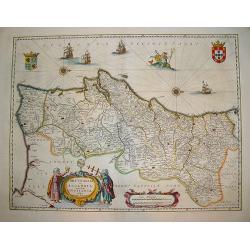
Portugallia et Algarbia quae olim Lusitania.
A striking map of Portugal with north oriented to the right. This lovely map by Jansson is adorned with numerous artistic embellishments including ships, coats-of-arms, t...
Place & Date: Amsterdam, 1638
Selling price: $160
Sold in 2018
Portugallia et Algarbia uae olim Lusitania.
A popular Blaue map of Portugal, based on the work of Fernao Alvares Seco. Verso text: German. This very detailed map depicts Portugal with numerous ships and Neptune ad...
Place & Date: Amsterdam, ca. 1642
Selling price: $355
Sold in 2008
Portugaliae et Algarbia quae olim Lusitania. Auctore Vernando Alvero Secco.
Willem Blaeu's very fine map of Portugal after Alvaro Secco's map of 1560. Embellished with two cartouches, two coats-of arms and numerous ships, compass-roses and a sea ...
Place & Date: Amsterdam, ca. 1645
Selling price: $220
Sold in 2021
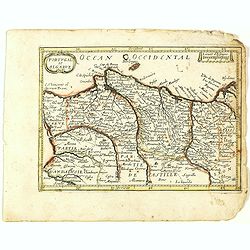
Portugallia.
Highy detailed miniature map of Portugal with parts of Spain. With Lagos, Lisbon, Porto, Vigo, and many more place names. Includes the Berlengas, shown much exaggerated i...
Place & Date: Amsterdam, c1649
Selling price: $75
Sold in 2020
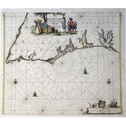
Pascaart vande Custen van Andaluzia, Portugal..
Decorative chart of the coasts of Andalusia, Portugal, Galicia, Biscayne from the first sea-atlas (in the real sense of the word) printed in the Netherlands.
Place & Date: Amsterdam 1650
Selling price: $1040
Sold
Una Carta del mare Oceano, che comincia con il capo S. Vinzensio in Portugallo, è Finisce con ll stretto de Gibilterra.
Robert Dudley (1574-1649). English geographer. Lived for the greater part in Florence in exile. His atlas 'Arcano del Mare' was the first English sea-atlas, the first sea...
Place & Date: Florence, 1661
Selling price: $1250
Sold
Portugal et Algarve. (25).
Scarce map of Portugal and Algarve published by Antoine de Fer in 1661 or 1662 in "Cartes de géographie revues et augmentées". With number 25 in lower right b...
Place & Date: Paris, Antoine de Fer, 1657 but 1661 or 1662
Selling price: $20
Sold in 2021
Portugalliae descriptio.
Charming little map of Portugal made by Gabriel Bucelin (1599-1681). Bucelin was a Swiss genealogist and an author of several books and a number of manuscript maps of Ger...
Place & Date: Ulm, Johannes Görlin, 1658-1664
Selling price: $50
Sold in 2008
Portugallia et Algarbia quæ olim Lusitania. Auctore Vernando Alvero Secco.
An attractive map of Portugal, orientated with north to the right. The cartography is based on Fernando Alvarez Secco, a Portuguese chart maker whose 1560 map was used by...
Place & Date: Amsterdam, 1666
Selling price: $175
Sold in 2016
Hispaniae, et Portugalliae, Maritimi Tractus a S. Andero ad Malagam. Pascaert van Spangie en Portugal.
Chart of the Atlantic Ocean and the region of Portugal, Gilbralter and southwestern Spain from Frederick de Wit's Zee Atlas. Coastal cities, bodies of water and islands a...
Place & Date: Amsterdam, 1675
Selling price: $1500
Sold in 2010
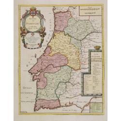
Royaume de Portugal.
From his first edition of his only folio atlas. Engraved by N.Michu.Uncommon map of Portugal, with fine title cartouche upper left and to the right a list of the Portugue...
Place & Date: Paris 1676
Selling price: $475
Sold in 2013
Novissima regnorum Portugalliae et Algarbiae descriptio.
Map of Portugal. Fine title and scale cartouche. With privilege of the State of Holland.
Place & Date: Amsterdam, 1680
Selling price: $220
Sold in 2017
Nieuwe Paskaart, van de Kuste van Reino Do Algarve.
A sea chart of the southern Iberian Peninsula, mainly Portugal, including the coastline of the Algarve and Andalucia, from Cabo San Vincente to Palos. Full title: 'Nieuwe...
Place & Date: Amsterdam, 1681
Selling price: $225
Sold in 2021
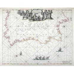
Nieuwe Pascaert van Portugaal van C.de Finisterre tot C.de S.Vincente.
Rare sea chart of Portugal.
Place & Date: Amsterdam 1683
Selling price: $1040
Sold
Le Portugal dedié au Roy.
From his first edition of his only folio atlas, the map is relied upon the map of his uncle, Nicolas Sanson. Engraved by Inselin.Nice map of Portugal with a very decorati...
Place & Date: Paris 1689
Selling price: $320
Sold in 2008
Carte des Costes de Portugal et de Partie d'Espagne depuis..
From the "Neptune Français", chart of southern part of Portugal, orientated east to the top. With insets of Lisbon and Cadiz.From Mortier's "Nep...
Place & Date: Paris (Amsterdam), 1693
Selling price: $220
Sold
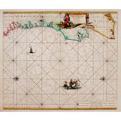
Nieuwe Paskaart Van de Kust van Portugal beginnende 3 a 4 Myl Benoorde C. Roxeur, tot aen C.d.S.Vincente.
Johannes van Keulen is the founder of the successful van Keulen firm that published charts, pilot guides and sea-atlases for over 2 centuries. In 1680 he published his im...
Place & Date: Amsterdam, c. 1695
Selling price: $500
Sold
Regno di Portogallo. . .
A beautiful and flamboyantly engraved large-scale map of Portugal. On verso a map of Lisbon "S Giovanni di Lisbona" (128x162mm.)The map is the product of the la...
Place & Date: Venice, ca. 1696
Selling price: $300
Sold in 2013
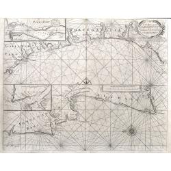
A Sea Chart of part of the Coasts of Gallisia and Portugall from Capo do Finisterre...
An unusual sea-chart of Portugal, two parts on one sheet. The top part is from Villa Nova until Peniche, the bottom part from Peniche until Lagos in the Algarve. Includes...
Place & Date: London, ca 1700
Selling price: $160
Sold in 2021
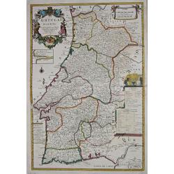
Royaume de Portugal et Partie D'Espagne Dresse sur des Memoires Envoyez de Lisbonne et de Madrid.
Very large map of Portugal (and part of Spain) by Besson, Geographer to the King of France. It was published in Paris in 1704. The map features a decorative title carto...
Place & Date: Paris , 1704
Selling price: $232
Sold in 2018
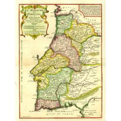
Les Royaumes de Portugal et d'Algarve..
Uncommon map of Portugal, engraved by P.Strackman.
Place & Date: Paris, 1705
Selling price: $130
Sold in 2015
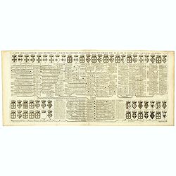
Carte Genealogique des Rois de Portugal & Partie des Differentes Branches qu'ils ont Formee avec le Blazon de leurs Armes & de leurs Alliances.
A genealogical tree of the Portuguese Kings with descriptive, from Chatelain's monumental 7 volume "Atlas Historique". Henri Abraham Chatelain (1684 – 1743) w...
Place & Date: Amsterdam, 1720
Selling price: $37
Sold in 2018
Regnum Portugalliae et Algarbiae..
Uncommon map of Portugal and Gibraltar. The originally colored title cartouche is surrounded by mythological figures. From Atlas Portatif.
Place & Date: Nuremberg 1724
Selling price: $45
Sold
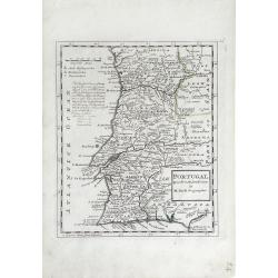
Portugal. Agreeable to Modern History. . .
Detailed, small scale map of Portugal by Herman Moll (fl.1680-1732). Little is known of Herman Moll's early life, but he emigrated from what is now northern Germany and s...
Place & Date: London, 1727
Selling price: $100
Sold in 2010
Le Portugal, suivant les nouvelles observations..
Uncommon edition of this map of Portugal. With decorative title cartouche lower left corner.This example is unusual in having the additional separately engraved decorativ...
Place & Date: Leiden, 1728
Selling price: $180
Sold in 2014
Nova Regni Portugallia et Algarbiae Descriptio.
A scarce map of Portugal with the various regions, towns, cities, rivers, and mountains depicted. The map features two large cartouches. The title cartouche has a drape h...
Place & Date: Amsterdam, ca 1730
Selling price: $416
Sold in 2018
Portugalliae et Algarbiae. [with large Regnum Brasiliae...inset]
Decorative map of Portugal, ornated with a large title cartouche, with Neptune, a queen, cherubs, coats of arms and the Portuguese fleet. In lower right inset map of Braz...
Place & Date: Augsburg, 1730
Selling price: $250
Sold in 2013
Regnum Portugalliae. . .
A detailed and uncommon map of Portugal and the Algarve, colored by provinces, showing towns, rivers, mountains, harbors, roads, etc. Embellished with a very large title ...
Place & Date: Nuremberg, 1730
Selling price: $17
Sold in 2017
Carte Genealogique des Rois de Portugal & Partie des Differentes Branches qu'ils ont Formee avec le Blazon de leurs Armes & de leurs Alliances.
A genealogical tree of the Portuguese Kings with descriptive, from Chatelain's monumental 7 volume "Atlas Historique". Henri Abraham Chatelain (1684 – 1743) w...
Place & Date: Amsterdam, 1720-1732
Selling price: $40
Sold in 2018
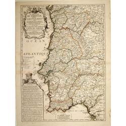
Le Royaume de Portugal divisé en cinq grandes provinces. . .
RARE map of Portugal. A visually stunning map with a large title cartouche. A second text box with a geographical description of Portugal, with the coat of arms.Nolin mus...
Place & Date: Paris, 1740
Selling price: $140
Sold in 2023
Carte des Isles du Cap Verd.
A decorative example of Bellin's map of the Cape Verde Islands, that features a decorative cartouche and compass rose.Jacques-Nicolas Bellin (1703-1772) was among the mos...
Place & Date: Paris, 1746
Selling price: $27
Sold in 2020
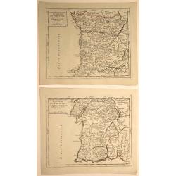
Partie Meridionale (and Septentrionale) du Royaume de Portugal. (2 Maps)
Two small detailed maps encompassing the whole of Portugal. From Atlas Portatif Universel, by Vaugondy. Numbered plate 50 and 51 in the top right corner. Gilles Robert ...
Place & Date: Paris, 1748
Selling price: $27
Sold in 2020
Partie Septentrionale du Royaume de Portugal
A finely engraved map of the northern portion of Portugal by Robert de Vaugondy. It covers northern Portugal from Tui in Spain, southward to Santarem, and inland as far a...
Place & Date: Paris, 1751
Selling price: $57
Sold in 2019
Partie Septentrionale du Royaume de Portugal.
Detailed map encompassing the whole northern half of Portugal from his "Atlas Universel".Gilles Robert de Vaugondy (1688–1766), also known as Le Sieur or Mons...
Place & Date: Paris, 1751
Selling price: $55
Sold in 2011
Partie Meridionale du Royaume de Portugal.
Detailed map encompassing the whole southern half of Portugal from his "Atlas Universel".Gilles Robert de Vaugondy (1688–1766), also known as Le Sieur or Mons...
Place & Date: Paris, 1751
Selling price: $45
Sold in 2011
Nieuwe Generale Paskaart van de Cust van PORTUGAL tusschen C: de Finisterre. . .
Decorative chart of the coast of Portugal, from Pontevedra (Spain) to the Cape Saint Vincent (Vila do Bispo). East to the top. More about Van Keulen dynasty [+]
Place & Date: Amsterdam, 1751
Selling price: $800
Sold in 2015
Belem (left) and Portugais (right)
A pair of well defined and decorative 18th century prints. One depicts Mosteiro dos Jeronimos in the Belem section of Lisbon and the other an affluent couple in typical l...
Place & Date: Paris, ca. 1760
Selling price: $50
Sold in 2011
Novissima Regnorum Portugalliae et Algarbiae descriptio.
Map of Portugal. Fine title and scale cartouche. With privilege of the State of Holland. The edition published by Covens and Mortier. Now with their address added.The Ams...
Place & Date: Amsterdam, ca. 1760
Selling price: $200
Sold in 2010
Le Royaume de Portugal divisé en cinq grandes Provinces...
Rare and large map of entire Portugal, extending from Vigo in the North to Cadiz in the South. Highly decorative map, superbly engraved, with a large title cartouche, a s...
Place & Date: Paris, 1762
Selling price: $500
Sold in 2011
Carte Des Costes De Portugal et de Partie D'Espagne depuis le Cap de Finisterre Jusques au Dêtroit De Gibraltar.
Large scale chart of Portugal engraved by H. van Loon Sculp. With inset of the Bay of Lisbon and Cadiz.With rhumb lines radiating across the chart. Published by the Depot...
Place & Date: Paris 1762
Selling price: $700
Sold
Le Portugal et ses Frontieres avec l'Espagne. . .
Impressive large-scale map of Portugal with the border areas of Spain, published by the Depot de la Marine. Highly detailed filled with information on the topography, fo...
Place & Date: Paris, 1762
Selling price: $130
Sold in 2014
Spain and Portugal.
Uncommon miniature map of Portugal, engraved by J. Gibson for "A New General and Universal Atlas Containing Forty five Maps by Andrew Dury".This miniature atlas...
Place & Date: London, 1761-1763
Selling price: $25
Sold in 2019
Il Portogallo Cioé le provincie . . . [with] L'Estremadura Di Portogallo alentejo . . .
Two maps of north and South Portugal from "Atlas Novissimo" printed in Venice between 1776 and 1785. The map was issued in Zatta's Atlas Novissimo a monumental ...
Place & Date: Venise, 1775
Selling price: $70
Sold in 2017
Regno Di Portogallo.
Map from "Atlas Novissimo" printed in Venice between 1776 and 1785. The map was issued in Zatta's Atlas Novissimo a monumental four volume work and one of the l...
Place & Date: Venise, 1775
Selling price: $62
Sold in 2018
Carte des Royaumes de Portugal et D'Algarue.
Detailed engraved map of the northern part of Portugal including cities, towns, rivers, lakes, forests and mountains. Giovanni Antonio Bartolomeo Rizzi Zannoni (1736 - 1...
Place & Date: Paris, 1783
Selling price: $15
Sold in 2015
Mapa dos Reynos de Portugal e Algarve. . .
Map of the southern part of Portugal, including part of Spain and Gibraltar. The large decorative title cartouche presents the coat of arms surmounted by a crown, a repre...
Place & Date: Paris, ca 1783
Selling price: $75
Sold in 2020
[2 maps] Partie Septentrionale... & Partie Meridionale du Royaume de Portugal...
A pair of large maps of Portugal with bordering Spanish areas. From Fisterra, Vigo and Pontevedra until Cadiz. Extends east until Salamanca and Sevilla. Very detailed, fi...
Place & Date: Venice, 1784
Selling price: $100
Sold in 2018
Karte von dem Konigreiche Portugal.
An attractive map of Portugal, including a representation of the solar system in the upper left-hand corner. With a charming title cartouche held by a cherub in the lower...
Place & Date: Vienna, 1795
Selling price: $220
Sold in 2016
Chorographical Map of the Kingdom of Portugal divided into its Grand Provinces
A very large, pleasant map of Portugal, with roads, provinces, settlements and towns published by William Faden in 1797, Filled with detail including mountains.William Fa...
Place & Date: London, 1797
Selling price: $40
Sold in 2016
A New Map of the Kingdom of Portugal.
A fine and detailed map of Portugal by John Cary, with the various provinces in pale wash color. Showing mountains, roads, rivers and numerous village and towns. Interest...
Place & Date: London, 1819
Selling price: $65
Sold in 2020
Portugal.
Large and detailed steel-engraved map of Portugal with original outline handcoloring. A fine map, nicely engraved. Extends to show the Spanish cities of Vigo, Truxillo, C...
Place & Date: London, 1829
Selling price: $46
Sold in 2014
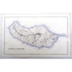
Island of Madeira.
Fine map of Madeira, one of the Portugese Islands in the Atlantic Ocean. Published by Fullerton & Company in 1862.
Place & Date: Edinburgh, 1862
Selling price: $19
Sold in 2016
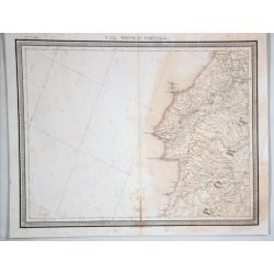
N 151. Partie de Portugal.
A lithographic atlas map, hand-colored in outline, on a conical projection. This map by Vandermaelen was published within the first atlas ever to be printed using lithogr...
Place & Date: Brussells, 1880
Selling price: $17
Sold in 2021
Le Portugal.
Le Père Placide de Sainte-Hélène was the brother-in-law of Pierre Duval. After the death of Duval his widow continued the firm.A large map of Portugal, with an inset o...
Place & Date: Paris, c. 1700.
Selling price: $275
Sold in 2013

![[Departure from Lisbon for Brazil, the East Indies and America]](/uploads/cache/48525-250x250.jpg)


















![Portugalliae et Algarbiae. [with large Regnum Brasiliae...inset]](/uploads/cache/32345-250x250.jpg)





![Il Portogallo Cioé le provincie . . . [with] L'Estremadura Di Portogallo alentejo . . .](/uploads/cache/39014-250x250.jpg)


![[2 maps] Partie Septentrionale... & Partie Meridionale du Royaume de Portugal...](/uploads/cache/81817-250x250.jpg)


