Browse Listings in Europe > Netherlands > Netherlands
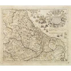
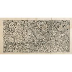
Die dritte Tafel des Rheinstroms, inhaltendt das Nider Teutschlandt. [Course of the Rhine from approx. Remagen to the North Sea]
Wood block printed map of mostly the Netherlands and Belgium - designed as third part of the course of the Rhine, by Sebastian Munster.One of the Earliest Modern Maps on ...
Place & Date: Basel, 1550
Selling price: $130
Sold in 2020
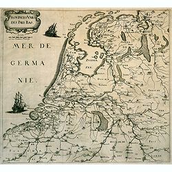
Hollàd [Holland].
A wood block printed early map of Holland. From the 1552 Latin text edition of Munster's Cosmographia, which is a short and complete summary of Renaissance knowledge.Seba...
Place & Date: Basel, 1552
Selling price: $20
Sold in 2022
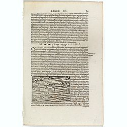
De Batavia Quae Hodie est Holandia.
One text page with an illustration of floating in the Netherland on the recto. From Münster's Cosmographia Universalis.The Cosmographia by Sebastian Münster from 1544 i...
Place & Date: Basle, ca. 1564
Selling price: $10
Sold in 2018
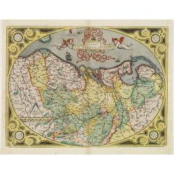
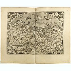
Descriptio Germaniae Inferioris.
Fine map of the Netherlands of Philip II King of Spain. The oval map is surrounded by a strapwork frame and the title, adorned with ribbons, is held aloft by two winged c...
Place & Date: Antwerp, 1571
Selling price: $700
Sold in 2015
Amsterdam
This important early map of Amsterdam is from Braun and Hogenberg’s important work Civitates Orbis Terrarum, the first atlas of cities of the world.This particular map ...
Place & Date: Cologne, 1574
Selling price: $1200
Sold in 2023
Descriptio Germaniae Inferioris.
The oval map is surrounded by a strapwork frame and the title, adorned with ribbons, is held aloft by two winged cherubs.Ortelius based this and several other maps of the...
Place & Date: Antwerp, 1580
Selling price: $750
Sold in 2018
Descriptio Germaniae Inferioris.
The oval map is surrounded by a strapwork frame and the title, adorned with ribbons, is held aloft by two winged cherubs.Ortelius based this and several other maps of the...
Place & Date: Antwerp, 1580
Selling price: $1200
Sold in 2009
Descriptio Germaniae Inferioris.
The oval map is surrounded by a strapwork frame and the title, adorned with ribbons, is held aloft by two winged cherubs.Ortelius based this and several other maps of the...
Place & Date: Antwerp, ca. 1580
Selling price: $700
Sold in 2012
Descriptio Germaniae Inferioris.
The oval map of the Low Countries is also known as the 'Egg' map, because of its oval strapwork borders. The title is adorned with ribbons, and is held aloft by two winge...
Place & Date: Antwerp, 1580
Selling price: $500
Sold in 2021
Middelburgum Selandiae Opp.[Middelburg,Zeeland]
Original colored birds's-eye view of the city of Middelburg. Coats of arms of the province of Zeeland. With ships in the city port. Churches and city walls with gates are...
Place & Date: Cologne, 1581
Selling price: $190
Sold in 2020
[DEN BRIEL/BRILLE]Brilium, Holandiae opp. ob Intestinum Batavicum Bellum . .
An old, antique map, and a bird's-eye view of Den Briel by Braun and Hogenberg, with a key to locations. TRANSLATION OF CARTOUCHE TEXT: Brielle, a town in Holland, well k...
Place & Date: Cologne, 1581
Selling price: $160
Sold in 2020
Die Stadt Enchuysen.[ENKHUIZEN]
A bird's-eye view of Enkhuizen, by Georg Braun and Frans Hogenberg, with a key to locations. TRANSLATION OF CARTOUCHE TEXT: The city of Enkhuizen, in the County of Hollan...
Place & Date: Cologne, 1581
Selling price: $210
Sold in 2020
HARLEMUM, Sive ut Ha: Barlan Herlemum, Urbs Hollandiae famosa . . .[HAARLEM]
A bird's-eye view plan of Haarlem, by Georg Braun and Frans Hogenberg. TRANSLATION OF CARTOUCHE TEXT: Harlemum, or, as Hadrianus Barlandus writes, Herlemum, a renowned Du...
Place & Date: Cologne, 1581
Selling price: $250
Sold in 2020
Bergen op Zoom - Berga, ad Somam, Brabantiae Opp: a fluvi olo sic dicto,. . .
Abird's-eye view plan of Bergen-op-Zoom b y Braun and Hogenberg. TRANSLATION OF CARTOUCHE TEXT: Bergen op Zoom, Brabantine town, named after the little River Soma (Zoom),...
Place & Date: Cologne, 1581
Selling price: $200
Sold in 2020
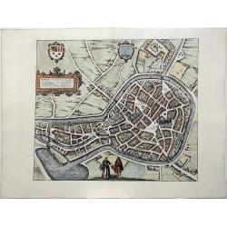
Lewardum. Occidentalis Frisiae Opp: 1580. [on sheet with:] Franicher, Nobiliu hominum, in Frisia Occidentali, ut plurimum saedes.[Leeuwarden&Franeker]
Two bird's-eye views on one sheet: Leeuwarden and Franeker, by Braun & Hogenberg. CARTOUCHE: Leeuwarden, a West Frisian town. 1580. COMMENTARY BY BRAUN: "Leeuwar...
Place & Date: Cologne, 1581
Selling price: $150
Sold in 2020
Icon civitatis Campensis, cuius situs Isulam fluvium, eleganti venustate, decorat.[Kampen, Overijssel]
A panoramic view of Kampen by Braun and Hogenberg. TRANSLATION OF CARTOUCHE TEXT: Picture of the city of Kampen, the beautiful and charming appearance of which embellishe...
Place & Date: Cologne, 1581
Selling price: $170
Sold in 2020
Charlemont [on sheet with] Landrechies [and] Avesnes [and] Beaumont.
Four bird's-eye views on one sheet: Charlemont - Beaumont - Avesnes - Landrecies. The 'Civitates Orbis Terrarum', or the "Braun & Hogenberg", is a six-volum...
Place & Date: Cologne, 1581
Selling price: $110
Sold in 2020
Roterodamum Hollandiae Opp. [on sheet with:] Goude [Rotterdam, Gouda]
An old map with two bird's-eye views: Rotterdam and Gouda, by Braun and Hogenberg. The 'Civitates Orbis Terrarum', or the "Braun & Hogenberg", is a six-volu...
Place & Date: Cologne, 1581
Selling price: $450
Sold in 2020
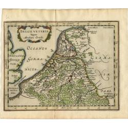
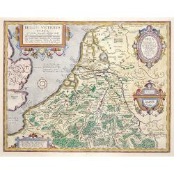
Belgii Veteris Typus..
A fine map of this historic region with many ancient place names. The map is decorated with 4 cartouches, and a compass rose in the sea. Map is dated 1594
Place & Date: Antwerp 1584
Selling price: $535
Sold
[Guerre des Pays-Bas] Geschichtsblätter (172 plates).
Illustrated with 170 plates dealing with Belgium, Dutch and German war sites (1567-1586) showing scenes of battles, sieges, executions, assassinations, parades, court sce...
Place & Date: Cologne, c.1586
Selling price: $6750
Sold
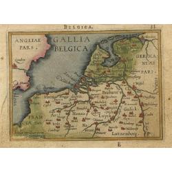
Gallia Belgica.
Miniature map covering Belgium and the Netherlands. The map is beautifully engraved with stippled seas.
Place & Date: Antwerp, 1588
Selling price: $65
Sold
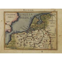
Gallia Belgica.
Miniature map covering Belgium and the Netherlands. The map is beautifully engraved with stippled seas. Hard to find now-a-days in original colors.
Place & Date: Antwerp, 1588
Selling price: $260
Sold in 2008
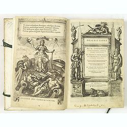
Descrittione di M. Lodovico Guicciardini, gentil- huomo fiorentino, di tutti Paesi Bassi . . .
Italian text edition of this famous description of the Low Countries. The book is illustrated with 53 double page town plans, 12 maps and 13 one page views.Ludovico Guicc...
Place & Date: Antwerp, 1588
Selling price: $5600
Sold in 2010
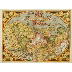
Descriptio Germaniae Inferioris.
The oval map is surrounded by a strapwork frame and the title, adorned with ribbons, is held aloft by two winged cherubs.
Place & Date: Antwerp 1590
Selling price: $600
Sold
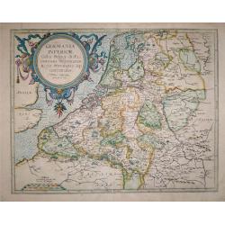
Germania Inferior Gallia, Belgica dicta, continens Hispaniarum Regis Provincias Septentrionalis.
Extremely rare map of Belgium, Luxemburg and the Netherlands from: "Speculum Orbis Terrarum" by Gerard and Cornelis de Jode.In 1578 Gerard de Jode published his...
Place & Date: Antwerp, 1578 - 1593
Selling price: $900
Sold in 2016
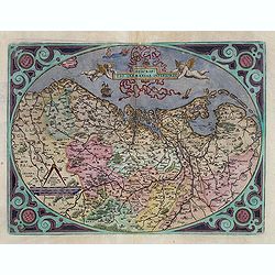
Descriptio Germaniae Inferioris.
The oval map is surrounded by a strapwork frame and the title, adorned with ribbons, is held aloft by two winged cherubs.According to P. Meurer based on de Jode's 12 shee...
Place & Date: Antwerp, 1595
Selling price: $305
Sold in 2015
Descriptio Germaniae Inferioris.
The oval map is surrounded by a strapwork frame and the title, adorned with ribbons, is held aloft by two winged cherubs. Dare to go in Black. All early maps were prin...
Place & Date: Antwerp, 1598
Selling price: $400
Sold in 2021
Tabula Geographica Provinciarum Brabantiae, Geldriae, Comitatus sutphaniae, Trajectini, Transilvaniae, Drentiae, Twentiae, Hollandiae et Frisiae.
One of the rarest maps covering a large part of the Netherlands, engraved by Benjamin Wright and published by Cornelis Claesz. Schilder mentions only one other know copy ...
Place & Date: Amsterdam, c.1600
Selling price: $4000
Sold in 2014
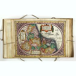
Belgii..
A beautiful map of the Low Countries, with a nice cartouche and a sail ship going the England.
Place & Date: Amsterdam 1606
Selling price: $420
Sold
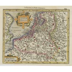
Inferior Germania.
Small map of the Netherlands, Belgium and Luxembourg with strap work title cartouche and scale of miles cartouche.From the first French-text edition of Jodocus Hondius' A...
Place & Date: Amsterdam, 1608
Selling price: $210
Sold in 2008
Belgii inferioris descriptio. . .
One of the earliest maps of the Low Countries. Including now-a-days The Netherlands in the north to Luxembourg in the South, centered on Zeeland and the Rhine River.
Place & Date: Amsterdam, 1610
Selling price: $200
Sold in 2011
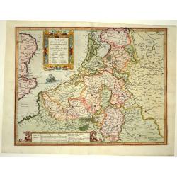
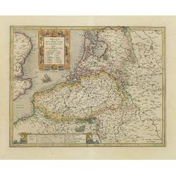
Belgii inferioris descriptio: emendata cum circumiacentium regionu[m] confinijs: Zeelant insularum loca aliquo. . .
One of the earliest maps of the Low Countries. Including now-a-days The Netherlands in the north to Luxembourg in the South, centered on Zeeland and the Rhine River.
Place & Date: Amsterdam, 1610
Selling price: $300
Sold in 2020
Inferioris Germaniae Provinciarum nova descriptio.
After 1600 Jan Baptist Vrients acquired the stock and the plates of Ortelius' Theatrum. In 1603 he published his first atlas of the Netherlands, compiled of the sheets of...
Place & Date: Antwerp 1608-1612
Selling price: $3175
Sold
Belgicarum Provinciarum Nova Descriptio.
From Ludovico Guicciardini.'s description of the Netherlands ' Beschrijvinghe van alle de Nederlanden anderssins ghenoemt Neder-Duytslandt ', published by Willem Blaeu.Th...
Place & Date: Amsterdam, W.Blaeu, 1612
Selling price: $250
Sold in 2020
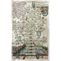
Comites Hollandiae et Seelandiae.
Copper engraved plate showing a genealogical tree of the rulers of Holland and Zeeland. Below the tree a nice view of the city of Den Haag. Published ca. 1612 by the It...
Place & Date: Augsburg, 1612
Selling price: $155
Sold in 2012
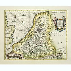
Novus XVII Inferioris Germaniae Provinciarum Typus de integro multis locis emendatus. Auct. Petro Kaerio.
Janssonius published this map when he was still working in Arnhem. One of the most decorative maps of present Netherlands, Belgium and Luxembourg.With German text on vers...
Place & Date: Arnhem, 1614
Selling price: $250
Sold in 2011
Nieuw Nederlandtsch Caertboeck. Waer in volkomentlijcker als oyt te voren vertoont werden de XVII. Nederlanden.
WITHOUT TEXT - SECOND KNOWN COPY. The rare second edition of this atlas of the provinces of the Netherlands, Belgium, and Luxemburg. Engraved title page, with : "Ged...
Place & Date: Amsterdam, 1616
Selling price: $2750
Sold in 2015
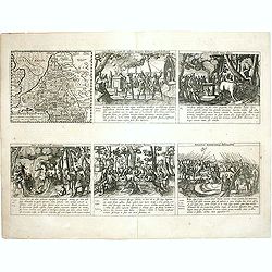
Veterum Belgarum Mores. . .
Six engravings on one sheet. In the upper left corner a map of the Ancient Low Countries, the other engravings showing the manners of the Ancient Belgics. The naked women...
Place & Date: Amsterdam, 1617
Selling price: $100
Sold in 2020
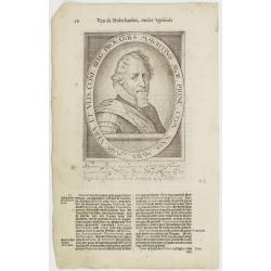
Mauritius Aur. Princ. Com. Nass. Murs. & Marc. Verae Et Ulis. Conf. Belg. Prov. Gub.
The engraving depicts a half length oval portrait of Maurice of Nassau, Prince of Orange.Nicolaes de Clerck (de Klerc) was active as engraver and publisher in Delft from ...
Place & Date: Amsterdam, Cloppenburch, 1621
Selling price: $32
Sold
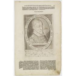
Guilelmus D. G. Princ. Aur. Com. Nass. etc. Vicec. Antu. Biz. Baro Bredae etc. Gub. Hol. Zel. Ult.
The engraving depicts a half length oval portrait of William, Prince of Orange.Nicolaes de Clerck (de Klerc) was active as engraver and publisher in Delft from 1599-1621....
Place & Date: Amsterdam, Cloppenburch, 1621
Selling price: $10
Sold in 2009
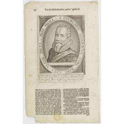
Gulielmus Ludovicus Com. Nass. Cats. Viand. Dietz. etc. Pref. Frisiae etc.
The engraving depicts a half length oval portrait of "Gulielmus Ludovicus" of Nassau, Prince of Orange.Nicolaes de Clerck (de Klerc) was active as engraver and ...
Place & Date: Amsterdam, Cloppenburch, 1621
Selling price: $30
Sold in 2011
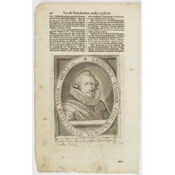
Ernestus Casimir. Com. Nassauiae. Catsenelnb. Viand. Dietz. etc.
The engraving depicts a half length oval portrait of "Ernestus Casimir" of Nassau, Prince of Orange.Nicolaes de Clerck (de Klerc) was active as engraver and pub...
Place & Date: Amsterdam, Cloppenburch, 1621
Selling price: $50
Sold in 2011
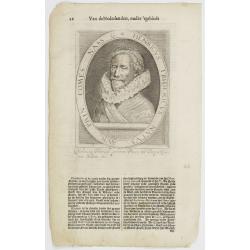
Henricus Fridericus Natus Aur. Prin. Comes Nass.
The engraving depicts a half length oval portrait of "Henricus Fridericus" of Nassau, Prince of Orange.Nicolaes de Clerck (de Klerc) was active as engraver and ...
Place & Date: Amsterdam, Cloppenburch, 1621
Selling price: $50
Sold in 2011
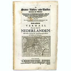
Inferior Germania.
Small map of the Benelux, centered on the Netherlands. Surrounded by text in Dutch.Nicolaes de Clerck (de Klerc) was active as engraver and publisher in Delft from 1599-1...
Place & Date: Amsterdam, Cloppenburch, 1621
Selling price: $55
Sold in 2019
Guilelmus D. G. Princ. Aur. Com. Nass. etc. Vicec. Antu. Biz. Baro Bredae etc. Gub. Hol. Zel. Ult.
The engraving depicts a half length oval portrait of William, Prince of Orange.Nicolaes de Clerck (de Klerc) was active as engraver and publisher in Delft from 1599-1621....
Place & Date: Amsterdam, Cloppenburch, 1621
Selling price: $10
Sold in 2017
Gulielmus Ludovicus Com. Nass. Cats. Viand. Dietz. Etc. Pref. Frisiae etc.
The engraving depicts a half length oval portrait of William Louis of Nassau-Dillenburg (1560 – 1620) was Count of Nassau-Dillenburg from 1606 to 1620, and stadtholder ...
Place & Date: Amsterdam, Cloppenburch, 1621
Selling price: $20
Sold in 2016
Ernestus Casimir. Com. Nassauiae. Catsenelnb. Viand. Dietz. etc.
The engraving depicts a half length oval portrait of Ernst Casimir I of Nassau-Dietz (1573 – 1632) was count of Nassau-Dietz and Stadtholder of Friesland, Groningen and...
Place & Date: Amsterdam, Cloppenburch, 1621
Selling price: $50
Sold in 2016
Mauritius Aur. Princ. Com. Nass. Murs. & Marc. Verae Et Ulis. Conf. Belg. Prov. Gub.
The engraving depicts a half length oval portrait of Maurice of Orange (1567 – 1625) was stadtholder of all the provinces of the Dutch Republic except for Friesland fro...
Place & Date: Amsterdam, Cloppenburch, 1621
Selling price: $10
Sold in 2016
Isabella Clara Eugenia, Austriaca Infans Hisp. Duciss. Burg. Brab. etc.
The engraving depicts a half length oval portrait of Isabella Clara Eugenia (1566 – 1633) was sovereign of the Spanish Netherlands in the Low Countries and the north of...
Place & Date: Amsterdam, Cloppenburch, 1621
Selling price: $10
Sold in 2016
Albertus D. G. Archidux Austriae. Dux Burgund. Brab. Com. Fland. etc.
The engraving depicts a half length oval portrait of Albert VII (1559 – 1621) was the ruling Archduke of Austria for a few months in 1619 and, jointly with his wife, Is...
Place & Date: Amsterdam, Cloppenburch, 1621
Selling price: $30
Sold in 2016
Henricus Fridericus Natus Aur. Prin. Comes Nass.
The engraving depicts a half length oval portrait of Frederick Henry, or Frederik Hendrik in Dutch (1584 – 1647), was the sovereign Prince of Orange and stadtholder of ...
Place & Date: Amsterdam, Cloppenburch, 1621
Selling price: $30
Sold in 2016
Belgii inferioris descriptio..
Gerard Mercator Junior?s decorative map of the Low Countries. A fine, early map of the area of Europe showing present-day Belgium, The Netherlands, Luxembourg and east pa...
Place & Date: Amsterdam 1630
Selling price: $500
Sold
XVII Provinciarum Inferioris Germaniae, Nec non totius tractus . . .
Rare edition of Visscher's map of the XVII Provinces. The re-edition of this map, dated 1630, 1650 and 165. The 1630 edition served as a general survey of the Seventeen P...
Place & Date: Amsterdam, 1630
Selling price: $500
Sold in 2020
Novus XVII Inferioris Germaniae Provinciarum Typus.
One of the most decorative maps of present day Netherlands, Belgium and Luxembourg.With the signature of "Willem Jansz. op't Water in de Vergulde Zonnewyzer."Su...
Place & Date: Amsterdam, ca. 1631
Selling price: $400
Sold in 2018
Belgii Sive Germaniae Inferioris accuratissima tabula.
Wonderful and detailed map with the title cartouche in the shape of a shield surrounded by the coats of arms of the XVII Provinces and the names of the Provinces in a ban...
Place & Date: Amsterdam, 1631
Selling price: $275
Sold in 2019
Belgicarum Provinciarum Descriptio. Gedruckt te Haerlem. . .
Very rare 2nd state of the map of the Low Countries, first published by Johannes and Baptist van Doetecum, in Haarlem 1588. This state of the map was only discovered in 1...
Place & Date: Amsterdam, 1588/ The Hague, Henricus Hondius, 1632
Selling price: $3100
Sold in 2019
Belgii sive Germaniae Inferioris..
An extremely rare map finely engraved. According to van der Heijden, only 5 other copies are known. The map is copied by Cornelis Danckerts II after a map by Henricus Hon...
Place & Date: Amsterdam, 1634
Selling price: $1000
Sold in 2021
Novus XVII Inferioris Germaniae Provinciarum Typus.
Willem Blaeu published this map in 1608 as a wall map with figured borders. When later, in 1630 he needed a general map of the Netherlands for his first atlas, the Append...
Place & Date: Amsterdam, 1634
Novus XVII Inferioris Germaniae Provinciarum Typus
One of the most decorative maps of the Benelux countries. Title in a cartouche with Mercury and Mars at top right, with dedication and the name of 'Guliel. Blaeu'. Bottom...
Place & Date: Amsterdam, 1630/1634
Selling price: $750
Sold in 2022
Belgii Veteris Typus ex conatibus..
Ancient map of present Netherlands, Belgium and Luxemburg. Engraved by Petrus Kaerius, after design of Abraham Ortelius. Fine title cartouche.
Place & Date: Amsterdam 1639
Selling price: $480
Sold
Belgii Veteris Typus ex conatibus..
Ancient map of present Netherlands, Belgium and Luxemburg. Engraved by Petrus Kaerius, after design of Abraham Ortelius. Fine title cartouche.
Place & Date: Amsterdam 1639
Selling price: $340
Sold
Novus XVII Inferioris Germania Provinciarum Typus.
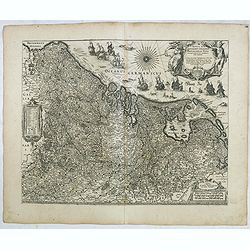
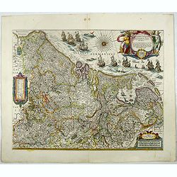
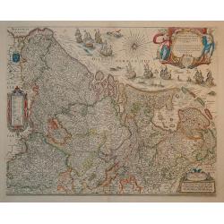
This is undoubtedly one of the most magnificent maps of the seventeen provinces of the Netherlands. It was first produced as a separately issued wall map in 1608 with fig...
Place & Date: Amsterdam, 1645
Selling price: $800
Sold in 2010
Novus XVII Inferioris Germaniae Provinciarum Typus.
One of the most decorative maps of present Netherlands, Belgium and Luxembourg.With the signature of "Willem Blaeu op't Water in de Vergulde Zonnewyzer."Superb ...
Place & Date: Amsterdam, 1645
Selling price: $750
Sold in 2017
Belgicarum Provinciarum Nova Descriptio
Beautifully handcolored copper engraving picturing the Netherlands 17 Provinces. From the 1648 edition of Guicciardini's famous work Description of the Netherlands issued...
Place & Date: Amsterdam 1648
Selling price: $650
Sold
Novus XVII Inferioris Germanie Provinciarum Typus
This is undoubtedly one of the most magnificent maps of the seventeen provinces of the Netherlands. It was first produced as a separately issued wall map in 1608 with fig...
Place & Date: Amsterdam, 1650
Selling price: $1500
Sold in 2010
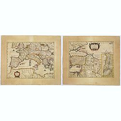
Lumen Historiarum per Occidentem. . . / Lumen Historiarum per Oreintem. . . Lumen Historiarum per Occidentem. . . / Lumen Historiarum per Orientem. . .
A pair of interesting seventeenth-century maps. The first map is an unusual 1652 map of Europe as known to the ancients by Jan Jansson. Centered on Italy, this map covers...
Place & Date: Amsterdam, 1652
Selling price: $160
Sold in 2018
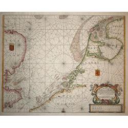
Pas Caert van Texel tot aen de Hoofden.
Very scarce and handsome sea chart of the coast of Friesland to France and at the other side of the Channel, England. It is richly embellished with rhumb lines, a half co...
Place & Date: Amsterdam, 1660
Selling price: $1200
Sold in 2008
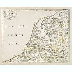
Provinces unies des Pays Bas. Par N. Sanson d'Abbeville. . .
Fine map of the present-day Netherlands. This edition carries un unfinished date "166 " and was engraved by R.Cordier Abbauil.Nicolas Sanson was to bring about ...
Place & Date: Paris, after 1660
Selling price: $225
Sold in 2014
Patriae Antiuae Inter Iuly et Caroli Magni Caesarium Romanorum Tempora Descriptio
An iInteresting map by Jan Janssonius of the “Low Countries and Northern Germany”. The compass rose orients this map with north to the right. The map describes the p...
Place & Date: Amsterdam, 1660
Selling price: $67
Sold in 2016
Belgii Veteris Typus Abrahami Ortelii.
Small map of this historic region with many ancient place names based on the map of Abraham Ortelius. The map is decorated with a delicate title cartouche.
Place & Date: Amsterdam 1661
Selling price: $100
Sold
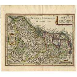
Belgii sive Germaniae Inferioris
Small map engraved by Petrus Kaerius, this map is filled with mountains, cities and villages. The map is oriented with north at right and is decorated with strapwork titl...
Place & Date: Amsterdam 1661
Selling price: $110
Sold
Hodiernae Belgicae sive Germaniae Infezrioris Tabula.
Interesting map of the Low Countries from a German edition of Philipp Clüver's famous Introductionis in Universam geographicam, first published in Leiden in 1624. Philip...
Place & Date: Wolfenbüttel, 1661
Selling price: $50
Sold in 2008
Belgii Veteris Typus ex Conatibus Geographicis Abrahami Ortelii. . . Petrus Kaerius Caelavit.
Ancient map of present Netherlands, Belgium and Luxemburg. Title cartouche on the upper right corner, giving credit to Abraham Ortelius. Engraved by Petrus Kaerius.
Place & Date: Amsterdam, 1662
Selling price: $150
Sold in 2011
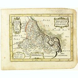
Belgium sive Inferior Germania. (27).
Scarce map of the Netherlands and Belgium published by Antoine de Fer in 1661 or 1662 in "Cartes de géographie revues et augmentées".With number 27 in lower r...
Place & Date: Paris, Antoine de Fer, 1657 but 1661 or 1662
Selling price: $40
Sold in 2020
Nova XVII Provinciarum Inferioris Germaniae Descriptio.
An early and rare map by de Wit of the 17 provinces. The map was originally engraved by P. Kaerius in 1607, and later came into the possession of de Wit, who re-engraved ...
Place & Date: Amsterdam 1662
Selling price: $900
Sold in 2022
Belgium sive inferior Germania.
Rare map of The Low Countries with present-day The Netherlands, Belgium and Luxemburg, published by Jollain in 1667. Published in "Trésor Des Cartes Geographiques D...
Place & Date: Paris, 1667
Selling price: $150
Sold in 2019
A New Mape of Ye XVII Provinces of Low Germanie.
A detailed miniature map of the Netherlands / Low Countries. From the delightful pocket edition of John Speed's atlas by Van Den Keere, who signs as P. Kaerius.
Place & Date: London, 1668
Selling price: $25
Sold in 2018
Totius Fluminis Rheni Novissima Descriptio.
Two maps on one sheet of the river Rhine. Original colored map following the river from Germany to the North Sea.
Place & Date: Amsterdam, 1670
Selling price: $200
Sold in 2013
Belgii seu XVII Provincia inferioris Germanie ex optimus quibusq. . .
Very rare map of the present-day Netherlands, Belgium and Luxembourg.François Collignon, originating from Nancy, is reckoned among the great engravers of his day. He lea...
Place & Date: Rome, dated 1672
Selling price: $1250
Sold in 2008
Provinces des Pays-Bas. (The Low Countries)
Rare map of the Low Countries, published by Gualdo Priorato (1606-1678), who entered military service at a very young age and served in Flanders under the Prince of Orang...
Place & Date: Vienna, 1672
Selling price: $350
Sold in 2018
.jpg)
![Die dritte Tafel des Rheinstroms, inhaltendt das Nider Teutschlandt. [Course of the Rhine from approx. Remagen to the North Sea]](/uploads/cache/84789-250x250.jpg)
![Hollàd [Holland].](/uploads/cache/48281-250x250.jpg)


![Middelburgum Selandiae Opp.[Middelburg,Zeeland]](/uploads/cache/84158-250x250.jpg)
![[DEN BRIEL/BRILLE]Brilium, Holandiae opp. ob Intestinum Batavicum Bellum . .](/uploads/cache/84156-250x250.jpg)
![Die Stadt Enchuysen.[ENKHUIZEN]](/uploads/cache/84159-250x250.jpg)
![HARLEMUM, Sive ut Ha: Barlan Herlemum, Urbs Hollandiae famosa . . .[HAARLEM]](/uploads/cache/84172-250x250.jpg)
![Lewardum. Occidentalis Frisiae Opp: 1580. [on sheet with:] Franicher, Nobiliu hominum, in Frisia Occidentali, ut plurimum saedes.[Leeuwarden&Franeker]](/uploads/cache/84177-250x250.jpg)
![Icon civitatis Campensis, cuius situs Isulam fluvium, eleganti venustate, decorat.[Kampen, Overijssel]](/uploads/cache/84178-250x250.jpg)
![Charlemont [on sheet with] Landrechies [and] Avesnes [and] Beaumont.](/uploads/cache/84183-250x250.jpg)
![Roterodamum Hollandiae Opp. [on sheet with:] Goude [Rotterdam, Gouda]](/uploads/cache/84188-250x250.jpg)
![[Guerre des Pays-Bas] Geschichtsblätter (172 plates).](/uploads/cache/44450-250x250.jpg)
![Belgii inferioris descriptio: emendata cum circumiacentium regionu[m] confinijs: Zeelant insularum loca aliquo. . .](/uploads/cache/33486-250x250.jpg)
