.jpg)
Browse Listings in Europe > Netherlands
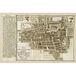
![[No title] Gravenhage.](/uploads/cache/21302-250x250.jpg)
[No title] Gravenhage.
A very decorative panoramic view of the town, with detailed keys to the principal buildings and roads of the town.With dedication to Willem Carel Henderik Friso.Engraved ...
Place & Date: The Hague 1747
Selling price: $1110
Sold
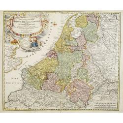
Provinciae XVII Infer Germaniae. . .
A decorative map with colored cartouche surrounded by the coats of arms of Brabant, Limburg, Luxembourg, Geldern, Holland, Zeeland, Zutphen, Flandria, Flanders, Artois, H...
Place & Date: Nurember, 1747
Selling price: $500
Sold in 2008
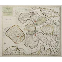
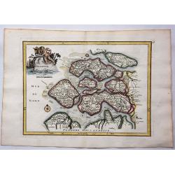
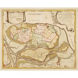
Kaart Van Zeeland.
Interesting map of the Dutch province of Zeeland depicting the individual islands in good detail. The fortified cities are highlighted in red.
Place & Date: Amsterdam, 1747
Selling price: $120
Sold in 2013
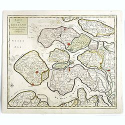
Kaart van Zeeland.
Map of the province of Zeeland, with the fortified cities are highlighted in red. Isaac Tirion was born in Utrecht ca. 1705. He came to Amsterdam ca. 1725. Tirion publish...
Place & Date: Amsterdam, 1747
Selling price: $32
Sold in 2016
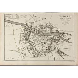
Mastricht avec les Attaques Leve sur les Lieux en Juin 1748. A Paris chez Le Sr. Le Rouge
A rare separate published plan of Maastricht by G. L. le Rouge. Showing the fortified city with important buildings named. With a key from a to x, a mileage scale and a c...
Place & Date: Paris, 1748
Selling price: $300
Sold in 2011
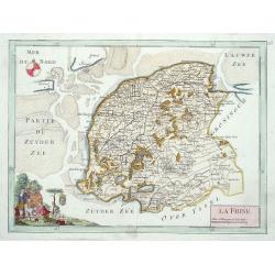
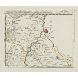
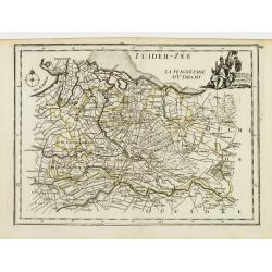
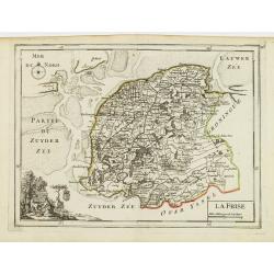
La Frise.
Map of the Dutch province Friesland, decorated with a nice title cartouche and a compass rose in the sea.
Place & Date: Paris 1748
Selling price: $80
Sold
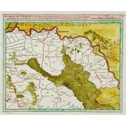
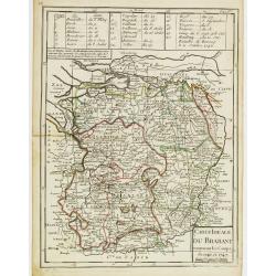
Carte du Brabant ou.. le Maesland.. de Ravenstein..
Covering north-eastern part of present day Noord-Brabant including towns of Grave, Gennep, Vlierlingsbeek, Venray, Bakel, Boxmeer, Heeswijk Dinther.
Place & Date: Paris 1748
Selling price: $120
Sold
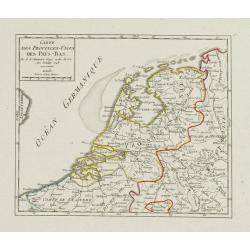
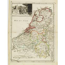
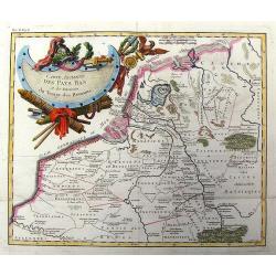
Carte des Provinces-Unies des Pays-Bas.
Attractive small map of the Low Countries. Dated 1748. From Atlas Portatif Universel, by Robert de Vaugondy.Page 17 outside border top right.
Place & Date: Paris, 1748
Selling price: $85
Sold
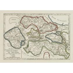
Carte du Comté de Zélande.
Attractive small map illustrating the northern part of Zeeland. From Atlas Portatif Universel, by Robert de Vaugondy.Page 18 outside border top right. Mary Sponberg Pedle...
Place & Date: Paris, later than 1748
Selling price: $180
Sold
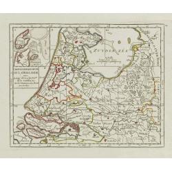
Carte Generale des Six de la Hollande, avec, la Seig? D'Utrecht, Partie de la Gueldre, &c.
Attractive small map illustrating part of the Netherlands, namely the provinces of Noord- and Zuid-Holland, Gelderland and Utrecht.With an inset map of the island of Texe...
Place & Date: Paris, later than 1748
Selling price: $75
Sold in 2021
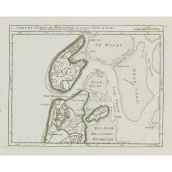
I. Carte du Comté de Hollande où se trouve l'Isle de Texel.
Attractive small map illustrating the northernmost tip of Noord-Holland and Texel. From Atlas Portatif Universel, by Robert de Vaugondy.Unrecorded state with erased date....
Place & Date: Paris, later than 1748
Selling price: $135
Sold
II. Partie du Comté de Hollande.. Edam &c.
Attractive small map illustrating the central part of Noord-Holland, between West Friesland and the IJ bay.From Atlas Portatif Universel, by Robert de Vaugondy. Unrecorde...
Place & Date: Paris, later than 1748
Selling price: $50
Sold in 2020
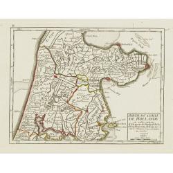
IV. Partie du Comté de Hollande.. Haarlem, Leyden, la Haye..
Attractive small map centered on Zuid Holland, including Leiden, Delft extending northwards as far as Haarlem.From Atlas Portatif Universel, by Robert de Vaugondy. Unreco...
Place & Date: Paris, later than 1748
Selling price: $60
Sold in 2017
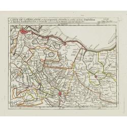
V. Carte de la Hollande et de la Seigneurie, d'Utrecht?
Detailed small map showing an area straddling the provinces of North Holland and Utrecht. Showing Amsterdam in the upper left corner.From Atlas Portatif Universel, by Rob...
Place & Date: Paris, later than 1748
Selling price: $85
Sold

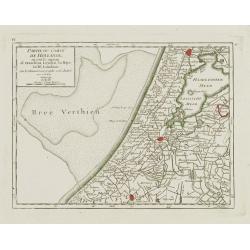
VII. Carte de la Hollande ou sont les environs de Rotterdam..
Attractive small map centered on the island of Voorne-Putten with Rotterdam and Dort[recht]. From Atlas Portatif Universel, by Robert de Vaugondy.Unrecorded state with er...
Place & Date: Paris, later than 1748
Selling price: $85
Sold
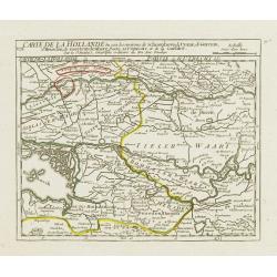
VIII. Carte de la Hollande ou sont les environs de Schoonhove..
Nice small map showing an area straddling the provinces of North Holland, Gelderland and North Brabant, crossed by the rivers Lower Rhine and Meuse.From Atlas Portatif Un...
Place & Date: Paris, later than 1748
Selling price: $50
Sold
IX. Carte de la Hollande ou sont les environs de Nimegue..
Attractive small map showing an area straddling the border between the Netherlands and Germany. Centered on Nijmegen.From Atlas Portatif Universel, by Robert de Vaugondy....
Place & Date: Paris, later than 1748
Selling price: $60
Sold
II. Carte de l'Etat de Lyege.. et partie du D.ché de Limbourg.
Attractive small map showing an area straddling the border between the Netherlands, Belgium and Germany. Centered on Roermond. Dated 1748.From Atlas Portatif Universel, b...
Place & Date: Paris, 1748
Selling price: $100
Sold
IV. Carte du Duché de Limbourg.. Aix la Chapelle &c.
Attractive small map showing an area straddling the border between the Netherlands, Belgium and Germany.Delimited by the towns of Sittard, Aachen and Dalhem. Dated 1748.F...
Place & Date: Paris, 1748
Selling price: $80
Sold in 2012
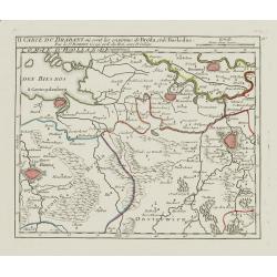
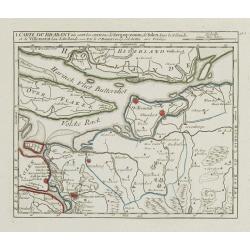
II. Carte du Brabant où sont les environs de Bréda, et de Bosleduc.
Nice small map illustrating part of North Brabant. Extending West to East from Breda to ?s-Hertogenbosch.From Atlas Portatif Universel, by Robert de Vaugondy. Unrecorded ...
Place & Date: Paris, later than 1748
Selling price: $100
Sold
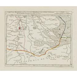
III. Carte du Brabant ou se trouvet le Maesland, la Seigneurie de Ravenstein, la Terre de Cuyck &c.
Nice small map illustrating a stretch of the river Meuse, flowing besides Alphen, Grave and Gennep.From Atlas Portatif Universel, by Robert de Vaugondy. Unrecorded state ...
Place & Date: Paris, later than 1748
Selling price: $55
Sold
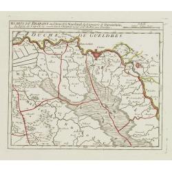
VI. Carte du Brabant ou se trouv.t les envir.s d'Eyndhoven..
Nice small map illustrating part of southeastern Noord Brabant. With Eindhoven and Helmond in center of map.From Atlas Portatif Universel, by Robert de Vaugondy. Unrecord...
Place & Date: Paris, later than 1748
Selling price: $135
Sold
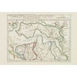
II. Carte de la Flandre où sont les environs d'Axel, d'Hulst..
Nice small map illustrating the southeastern part of Zeeland. Showing Middelburg, Goes, Tholen, Bergen op Zoom, Hulst and Axel.From Atlas Portatif Universel, by Robert de...
Place & Date: Paris, later than 1748
Selling price: $100
Sold in 2008
I. Carte du Brabant où sont les environs de Berg-op-zoom, de Tolen dans la Zélande. et de Willemstat dans la Hollande.
Nice small map centered on the western part of North Brabant. It shows Bergen op Zoom, Tholen, Willemstad, Klundert, etc.From Atlas Portatif Universel, by Robert de Vaugo...
Place & Date: Paris, later than 1748
Selling price: $90
Sold in 2012
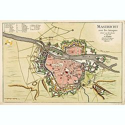
Mastricht avec les Attaques Leve sur les Lieux en Juin 1748. A Paris chez Le Sr. Le Rouge.
A rare separate published plan of Maastricht by G. L. le Rouge. Showing the fortified city with important buildings named. With a key from A to X, a mileage scale and a c...
Place & Date: Paris, 1748
Selling price: $700
Sold
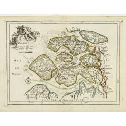
Zelande.
Hand colored copperplate map of the Dutch province of Zeeland by le Rouge from his “Atlas Nouveau Portatif “. Features cartouche of a putti holding a coat of arms and...
Place & Date: Paris, 1748
Selling price: $46
Sold in 2017

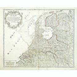
Nieuwe kaart der Provincie van Holland.
In upper left hand corner inset map of Kaartje van de Helder Texel Vlieland en Wieringen . Including the province of Utrecht and the Veluwe.
Place & Date: Amsterdam 1750
Selling price: $350
Sold
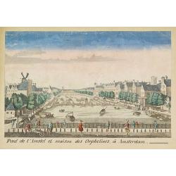
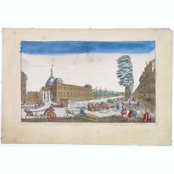
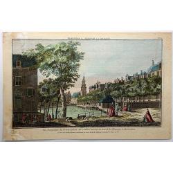
Pont de l'Amstel et maison des orphelines à Amsterdam.
Showing the Amstel bridge in Amsterdam. Likely published by Mondhard, who was a well-known publisher of optical prints, established in rue St.Martin in Paris. In the eigh...
Place & Date: Paris, ca. 1750
Selling price: $150
Sold in 2011
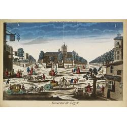
Environs de Leijde. (Vue des environs de Leyden)
Showing the market square in Leiden. J. Chereau was a publisher of optical prints, established in Paris, rue St.Jacques.In the eighteenth and nineteenth centuries there w...
Place & Date: Paris, ca. 1750
Selling price: $95
Sold in 2012
![Kaart van den loop der Rivieren de RHYN, de MAAS de MERWE, en de LEK. . . [together with] Kaart van de beneden Rivier de Maas. . . [together with] Nieuwe kaart van 't Kwartier Nijmegen . . .](/uploads/cache/33462-250x250.jpg)
Kaart van den loop der Rivieren de RHYN, de MAAS de MERWE, en de LEK. . . [together with] Kaart van de beneden Rivier de Maas. . . [together with] Nieuwe kaart van 't Kwartier Nijmegen . . .
1./ Kaart van den loop der Rivieren de RHYN, de MAAS de MERWE, en de LEK... (352x450mm.) A detailed map of the center of the Netherlands, with the rivers Rhine, Maas, de ...
Place & Date: Amsterdam, 1750
Selling price: $340
Sold in 2013

Vue du petit Voorhout une des promenades de La Haye prise du coté du pont Coucamp.
Showing the Voorhout in The Hague. Likely published by J. Chereau, who was a well-known publisher of optical prints, established in rue St.Jacques in Paris. In the eighte...
Place & Date: Paris, ca. 1750
Selling price: $75
Sold in 2013
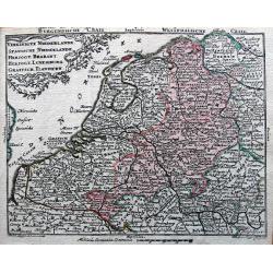
Vereinigte Niederlande, Spanische Niederlande, Herzogt. Brabant, Herzogt. Luxemburg, Graefsch. Flandern.
Detailed miniature map published by Tobias Conrad Lotter and Tobias Lobeck in their "Atlas Geographicus portatilis...".
Place & Date: Augsburg, ca. 1750
Selling price: $30
Sold in 2014
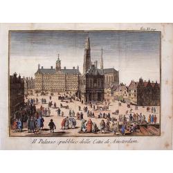
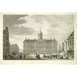
Il Palazzo Publico Della Citta di Amsterdam.
Very pleasing hand colored copper engraving of Amsterdam featuring the Palace.
Place & Date: Venice, 1750
Selling price: $54
Sold in 2019
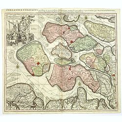
Zeelandiae Comitatus. . .
A scarce map of Zeeland, a section of south-western The Netherlands, published by Matthäus Seutter.Impressive cartouche with coat of arms of Zeeland top left, reflecting...
Place & Date: Augsburg, ca.1750
Selling price: $145
Sold in 2017
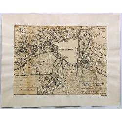
A New Plan of the Town of Bois le Duc and Its Fortifications.
Striking engraved plan showing the city of s'Hertogenbosch in Brabant, Netherlands. The map focuses on the town fortifications and also includes details of the town plan...
Place & Date: London, J. Nourse, 1750
Selling price: $26
Sold in 2018
![[Two maps] Tetrachia Ducatus Geldriae Neomagensis. / Transisalania vulgo Over-Yssel auct. N. ten Have. . .](/uploads/cache/40600-250x250.jpg)
[Two maps] Tetrachia Ducatus Geldriae Neomagensis. / Transisalania vulgo Over-Yssel auct. N. ten Have. . .
[Two maps] Frederick de Wit's very attractive map of the area of Nijmegen in The Netherlands. North is orientated to the upper right. The map is adorned with a banner sty...
Place & Date: Amsterdam, ca. 1680 - 1750
Selling price: $90
Sold in 2018
A Correct Chart Of The Sea Coasts Of England, Flanders And Holland Shewing The Sands Shoals Rocks And Dangers, The Bays Harbours Roads Buoys Beacons & Seamarks On The Said Coasts.
Mount & Page's chart of the Channel and contiguous British, Belgian and Dutch Coastlines. The imprint of "W.& J.Mount & T.Page" helps date this part...
Place & Date: London, ca. 1750
Selling price: $150
Sold in 2020

Winter pleasures on the Haarlemmer Lake with Haarlem in the distance.
Engraving By J. Aliamet, Les Amusements De L'Hiver. Rare 18th century Dutch golf engraving by J. Aliamet depicting Dutchman playing the early form of golf on the ice near...
Place & Date: Paris, 1750
Selling price: $300
Sold in 2023
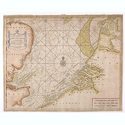
Nieuwe paskaart van het zuyderste gedeelte der Nord-Zee strekkende van Texel tot aande Hoofden...
Fine chart of the Nord Sea with the coasts of Belgium, Netherlands and South East England. Decorated with soundings, compass card, ship in a title cartouche in four langu...
Place & Date: Amsterdam, 1728-1751
Selling price: $900
Sold in 2015
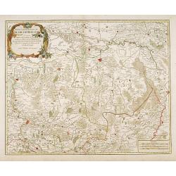
Partie septentrionale du duche de Brabant
A handsome map of the Northern half of Brabant, includes the area north of Mechelen. Includes a decorative title cartouche and a set of scales.Relief shown pictorially.
Place & Date: Paris 1752
Selling price: $200
Sold

Kaart van de belegeringe der stad Leyden..
Very detailed map of the siege of Leiden from 1573-1574. With extensive key to the important building in the town. After a design by Joost Janssen Bilhamer.
Place & Date: Amsterdam, 1752
Selling price: $140
Sold
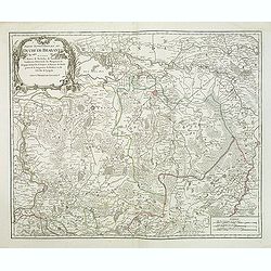
Partie septentrionale du duche de Brabant
A handsome map of Noord Brabant from his "Atlas Universel." Gilles Robert de Vaugondy (1688–1766), also known as Le Sieur or Monsieur Robert, and his son, Did...
Place & Date: Paris, 1752
Selling price: $95
Sold in 2011
A view of the Exchange the South and North Blaak taken from the Gaapers Bridge ROTTERDAM - Vue de la Bourse. . .
So-called optical print. Fine panoramic view of the exchange of Rotterdam, with many people on the foreground.Underneath : "Published according to Act of Parliament&...
Place & Date: London, after 1752
Selling price: $40
Sold in 2014
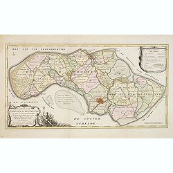
Kaarte der ..Noordbeveland, Wolphartsdyk en Oostbeveland..
Detailed map prepared by D.W.C. Hattinga in 1751. Isaac Tirion was born in Utrecht ca. 1705. He came to Amsterdam ca. 1725. Tirion published a number of important books, ...
Place & Date: Amsterdam 1753
Selling price: $320
Sold
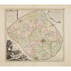
Kaart van het eiland Walcheren..
Detailed map prepared by D.W.Carel and A. Hattinga in 1751. Isaac Tirion was born in Utrecht ca. 1705. He came to Amsterdam ca. 1725. Tirion published a number of importa...
Place & Date: Amsterdam, 1753
Selling price: $210
Sold in 2013
Kaarte van Schouwen en Duiveland. . .
Map of Schouwen Duiveland, prepared by D.W. Carel and Anth. Hattinga. Title cartouche accompanied by Neptune. Isaac Tirion was born in Utrecht ca. 1705. He came to Amster...
Place & Date: Amsterdam, 1753
Selling price: $27
Sold in 2013
Provinces-Unies des Pays-Bas, . . .
Detailed map of the Netherlands, identifying the various provinces, with a large decorative cartouche. From his "Atlas Universel".Gilles Robert de Vaugondy (168...
Place & Date: Paris, 1755
Selling price: $55
Sold in 2011
Les XVII Provinces des Pays Bas.
Fine map of the Netherlands with a decorative title cartouche. George Louis Le Rouge was active from 1740- till 1780 as a publisher, and was appointed engineer for the Ki...
Place & Date: Paris 1756
Selling price: $45
Sold
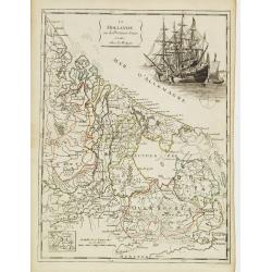
La Hollande ou les Provinces Reunies.
Fine map of Holland including Zeeland, Brabant, Utrecht, Overijssel, Friesland and Groningen. It presents a decorative cartouche on upper right corner depicting two large...
Place & Date: Paris 1756
Selling price: $85
Sold
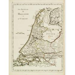
Les Provinces de Hollande et d'Utrecht.
Fine map of Holland and Utrecht. George Louis Le Rouge was active from 1740- till 1780 as a publisher, and was appointed engineer for the King of France. From his Atlas N...
Place & Date: Paris 1756
Selling price: $40
Sold
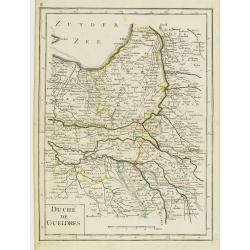
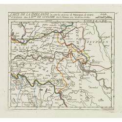
Duché de Gueldres.
Fine map of Gelderland. George Louis Le Rouge was active from 1740- till 1780 as a publisher, and was appointed engineer for the King of France. From his Atlas Nouveau Po...
Place & Date: Paris 1756
Selling price: $30
Sold
Zelande.
Fine map of Zeeland with a decorative title cartouche. George Louis Le Rouge was active from 1740- till 1780 as a publisher, and was appointed engineer for the King of Fr...
Place & Date: Paris 1756
Selling price: $70
Sold
La Seigneurie d'Utrecht.
Fine map of Utrecht presenting a decorative cartouche on upper right corner. George Louis Le Rouge was active from 1740- till 1780 as a publisher, and was appointed engin...
Place & Date: Paris 1756
Selling price: $46
Sold
La Frise.
Fine map of Friesland with a decorative cartouche on lower left corner. George Louis Le Rouge was active from 1740- till 1780 as a publisher, and was appointed engineer f...
Place & Date: Paris 1756
Selling price: $60
Sold
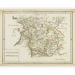
Seigneurie d'Over-Yssel.
Fine map of Overijssel. George Louis Le Rouge was active from 1740- till 1780 as a publisher, and was appointed engineer for the King of France. From his Atlas Nouveau Po...
Place & Date: Paris 1756
Selling price: $35
Sold
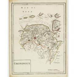
Groningue.
Fine map of Groningen. George Louis Le Rouge was active from 1740- till 1780 as a publisher, and was appointed engineer for the King of France. From his Atlas Nouveau Por...
Place & Date: Paris 1756
Selling price: $35
Sold
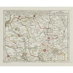
Carte Idéale du Brabant contenant les Camps de 1746 et 1747.
Fine map of Brabant. George Louis Le Rouge was active from 1740- till 1780 as a publisher, and was appointed engineer for the King of France. From his Atlas Nouveau Porta...
Place & Date: Paris 1756
Selling price: $65
Sold
Carte Ancienne des Pays Bas et des Environs du Temps des Romains.
Copper engraved map of The Netherlands in the time of the domination by the Roman Empire. The map also includes portions of Belgium and Germany. The Renaissance title car...
Place & Date: Paris, 1756
Selling price: $195
Sold in 2013
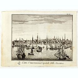
La Citta d'Amsterdam Capitale della Olanda.
Fine panoramic view of Amsterdam seen from the Y, taken from Storia moderna di tutti I popoli del mondo , edited by Thomas Salmon. A Italian edition of this famous work, ...
Place & Date: Venice, 1740-1756
Selling price: $60
Sold in 2019
Haag.
Very rare bird's-eye plan of Den Haag. To the left side a historical description.George Christophe Kilian (1709-1780) active as engraver of Augsburg published his Kleiner...
Place & Date: Augsburg 1757
Selling price: $180
Sold
Kaart van de Stad Utrecht..
Detailed map of the town of Utrecht. Including several town along the river Vecht: Maarsen, Zuylen, Amelisweert, etc.Isaac Tirion was born in Utrecht ca. 1705. He came to...
Place & Date: Amsterdam, 1757
Selling price: $100
Sold in 2013
Nieuwe en naukeurige kaart van de drie landen van Overmaaze Valkenburg, Daalhem en s'Hertogenrade.
Detailed map of southern part of Limburg, including and east of Maastricht.Isaac Tirion was born in Utrecht ca. 1705. He came to Amsterdam ca. 1725. Tirion published a nu...
Place & Date: Amsterdam, 1757
Selling price: $100
Sold in 2013
Nieuwe kaart van de Baronie van Breda. . .
Detailed map of western part of Brabant.
Place & Date: Amsterdam, 1757
Selling price: $50
Sold in 2013
Nieuwe kaart van de Baronie van Breda en 't Markgraafschap van Bergen op Zoom. . .
Detailed map of western part of Brabant, centered on Breda.Isaac Tirion was born in Utrecht ca. 1705. He came to Amsterdam ca. 1725. Tirion published a number of importan...
Place & Date: Amsterdam, 1757
Selling price: $200
Sold in 2016
Carte des XVII provinces des Pays-Bas . . .
Fine two-sheet wall-map size map of present-day The Netherlands and Belgium with a decorative armorial cartouche and small scale of miles.Alexis-Hubert Jaillot (1632-1712...
Place & Date: Paris, 1758
Selling price: $300
Sold in 2018
Nieuwe Kaart van't Kwartier de Veluwe. 1741.
Izaak Tirion (d. 1769) Amsterdam publisher. Published the Nieuwe en Beknopte handatlas', and ' Tegenwoordige staat van alle volkeren', a series of descriptions of countri...
Place & Date: Amsterdam, c. 1760
Selling price: $150
Sold
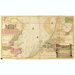
A Correct Chart of the Sea Coasts of England, Flanders and Holland showing the Sands, Shoals, Rocks and Dangers, The Bays and Harbours, Roads, Buoys, Beasons and Seamarks on the said Coasts.
A fine nautical chart of the coasts of Belgium, Holland, and Southern England by Mount and Page. The Mount and Page publishers firm of London was founded in 1701 by Richa...
Place & Date: London, c.1760
Selling price: $100
Sold in 2010
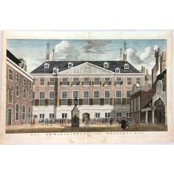
Het Admiraliteits of Prinsen - Hof
The Admiralty or courtyard of the Princes, the former Town Hall, seen at right with the main entrance from the side against the Princes Lane. Original copper engraving fr...
Place & Date: Amsterdam, 1760
Selling price: $42
Sold in 2018
Vue Perspective du Koningsplein au Reguliers Touring, ou Tour de la Monnoye, a Amsterdam.
A pleasing vue perspective featuring a river in Amsterdam. Published by Chez Maillet in Paris in 1760. After an model by Jan de Beijer (1703-1780).In the eighteenth and ...
Place & Date: Paris, 1760
Selling price: $21
Sold in 2018
![[Portrait of Jan Wagenaar with title page] Amsterdam in Zyne opkomst, aanwas, Geschiedenissen . . .](/uploads/cache/44990-250x250.jpg)
[Portrait of Jan Wagenaar with title page] Amsterdam in Zyne opkomst, aanwas, Geschiedenissen . . .
Portrait of the historian Jan Wagenaar, engraved by Jacob Houbraken, in 1766 after a painting by Jacobus Buys. Together with title page from "Amsterdam in zyne opkom...
Place & Date: Amsterdam, 1760
Selling price: $25
Sold in 2019
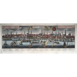
Amsterdam.
Very large size general panoramic view of the city from the water ('het IJ') with the harbour up front. With key 1-30 below the view, in Dutch (bottom left), Latin (botto...
Place & Date: Augsburg, 1740-1760
Selling price: $1100
Sold in 2020
Nova Tabula Geographica exhibens Ducatum Brabantiae Cum Pertinentiis et adjacentibus Regionibus . . .
A detailed regional map of Brabant, centered on Antwerp, Brusells, Mechlen and Louvain in Belgium, and extending north to Breda and east to Maastricht. Map is by Conrad L...
Place & Date: Augsburg, 1761
Selling price: $170
Sold in 2019
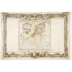
Nuova Carta del Ducato di Brabante, Limburgo e della Gheldria Superiore.
Italian rendition of this detailed copper engraved map of the Brabant region of The Netherlands. Decorated with two block type cartouches, by Giambattista Albrizzi (1698-...
Place & Date: Venice from 1740-1762
Selling price: $17
Sold in 2016
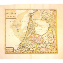
Nuova Carta della Contea de Olanda.
Fine copper engraved map of Holland. Two block cartouches. Giambattista Albrizzi (1698-1777) was a Venetian publisher and journalist. Among books published, was a monume...
Place & Date: venice, 1740-1762
Selling price: $76
Sold in 2015

Carta Nuova ed Accurata delle XVII Provincie de 'Paesi Bassi.
Fine colored copper engraved map of Belgium & The Netherlands. Two block cartouches, by Giambattista Albrizzi (1698-1777) who was a Venetian publisher and journalist....
Place & Date: Venice from 1740-1762
Selling price: $42
Sold in 2016
Voor den Weledelen Heer Mr Cornelis Pieter Pompe van Meerdervoort, Heere van Zwijndrecht. . .
Very fine and decorative map by Jan Govertsz van Linden, who was officially admitted as surveyor with by the court of Holland in 1736.According to the title the survey wa...
Place & Date: Zwijndrecht, 27 october, 1764
Selling price: $475
Sold in 2011
Amsterdam Town Hall - Royal Palace
The former Amsterdam Town Hall, now the Royal Palace. Copper engraving by Frans de Bakker after Reinier Vinkeles.From the history book of Amsterdam by Jan Wagenaar 1760 ...
Place & Date: 1760-1765
Selling price: $200
Sold
Les Pays-Bas. . .
Beautiful map of the Low Countries placed in a impressive Baroque border with putti using surveying instruments and a celestial globe.
Place & Date: Paris, 1766
Selling price: $80
Sold in 2014

Vue du Canal de Delfi a la Haye Ville de Hollande.
A hand colored optical print published in Paris by Jacques Chereau in about 1770. During the 18th century there were several manufacturers of optical viewing devices and ...
Place & Date: Paris, 1766
Selling price: $17
Sold in 2019
NoordHollands..WestFriesland..Dregterland..Koggen enz.
A very detailed map of North Holland also showing the famous cities Enkhuizen, Hoorn and Alkmaar. With an inset of the islands Texel, Vlieland and Terschelling.
Place & Date: Amsterdam 1769
Selling price: $349
Sold