Browse Listings in Europe > Mediterranean & Islands
Pas Kaert der Middelandsche.
Sea chart from Doncker?s Nieuw Groot Stuurmans Straets-Book depicting Mediterranean Sea from the Straits of Gibraltar to the Dalmatian Coast. From Old World Auctions: ?Fi...
Place & Date: Amsterdam 1670
Selling price: $755
Sold
Pas Kaert der Middelandsche.
Companion sea chart of lot 15518 from Doncker?s Nieuw Groot Stuurmans Straets-Book depicting eastern half of Mediterranean covering Italy and Cyprus and entire eastern sh...
Place & Date: Amsterdam 1670
Selling price: $755
Sold
Paskaert van 't Westelycke deel Der Middelandsche Zee . . .
Doncker's map of the Western Mediterranean, from Doncker's rare Nieuw Groot Sturmaans Straets-Book, published in Amsterdam. Doncker's sea charts are among the earliest an...
Place & Date: Amsterdam, 1670
Selling price: $590
Sold in 2021
Orientalior tractus Maris Mediterranei. / Orientalior districtus Maris Mediterranei. . .
A fine copy of this beautiful of the Mediterranean lovely color. Centered on Italy, the north coast of Africa and part of the Black Sea. The entire sheet is covered with...
Place & Date: Amsterdam, 1675
Selling price: $4200
Sold in 2017
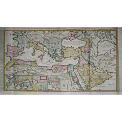
[Lot of 6 maps of the eastern Mediterranean] Estats / du Grand Seigneur / des Turcs / en Europe, en Asie et en Afrique
An attractive large-format map showing the Turkish empire in Europe, Asia and Africa, comprising the eastern Mediterranean and the Near East. Embellished with a large t...
Place & Date: Amsterdam, c. 1685
Selling price: $500
Sold in 2022
Mediterranean Sea divided into its Principall Parts of Seas
This marvelous very rare map depicts the Mediterranean Sea including its entire coastline, and much of the Ottoman Empire as it was in the late 17th century.The map is de...
Place & Date: London, 1685
Selling price: $1600
Sold in 2023
De Beschryving van de Reysen Pauli en Van de Andere Apostelen.
Dutch so-called ' Staten' bibles, published between 1637 and c. 1760, contained five maps: The World, ' Paradise', The Perigrinations, The Promised Land Canaan, The Trave...
Place & Date: Amsterdam / Dordrecht, H.,J., en M. Doornick 1682-1686
Selling price: $350
Sold
De Beschryving van de Reysen Pauli en Van de Andere Apostelen.
The Dutch so-called ' Staten' bibles published between 1637 and c. 1760, contained 5 maps: The World, ' Paradise', The Perigrinations, The Promised Land Canaan, The Trave...
Place & Date: Amsterdam, 1688
Selling price: $290
Sold in 2008
[ Sardigne and Sicily ]
Charming wood block map of Sardine and Sicily by the Italian XVIth and XVIIth century writer, humanist and cartographer Giuseppe Rosaccio. Taken from the 1688 Bologna &qu...
Place & Date: Bologna, Antonio Pisarri, 1594 - 1688
Selling price: $1449
Sold in 2011
Parte Orientale del Mediterraneo..
A beautiful map depicting the eastern part of the Mediterranean Basin, including a nice representation of Cyprus. With decorative title cartouche and scale cartouche.Hist...
Place & Date: Venice 1690
Selling price: $850
Sold
Geographische Beschryvinghe van de Wandeling der Apostelen ende De Reysen Pauli, ...
Bible map of the Eastern part of the Mediterranean Sea. A somewhat under valuated "carte à figures" map !
Place & Date: Amsterdam, ca. 1690
Selling price: $200
Sold in 2010
Aeneae Troiani navigatio.
From the Hornius edition of the Ancient Atlas by Janssonius. No text on verso
Place & Date: Amsterdam ca 1690
Selling price: $200
Sold in 2010
Argonautica.
Petrus Kaerius coelavit
Place & Date: Amsterdam, ca 1690
Selling price: $200
Sold in 2012
Ristretto del Mediterraneo...
Very large, extremely decorative map of the Western part of the Mediterranean Sea. It is embellished with coats of arms and decorative cartouches, Vincenzo Maria Coronell...
Place & Date: Venice, 1690
Selling price: $1600
Sold in 2023
SICILIA INSULA.
Scarce decorative map of Sicily by Samuel Bochart with inset of the city of Syracuse. French early linguist Bochart (1599-1667) indicates, according to his firm convictio...
Place & Date: Leiden, 1694
Selling price: $325
Sold in 2023
An attractive large-format map showing the whole of the Mediterranean. Embellished with a large title-cartouche and a large cartouche with scales.
Alexis-Hubert Jaillot (1632-1712), French cartographer. He joined the Sanson heirs and redrew Nicolas Sanson's maps on a larger scale. 'Atlas Nouveau' (1674), sea-atlas '...
Place & Date: Amsterdam, 1695
Selling price: $455
Sold in 2022
Carta Maritima della Costa Ligustica fra C. delle Melle e M. Argentato con l'Isola di Corsica et altre circonvicine. . .
A beautiful and flamboyantly engraved large-scale sea, showing Corsica and Mediterranean Sea. On verso Italian letter press and engraved plans of Antibes (130x160mm.) and...
Place & Date: Venice, 1696
Selling price: $500
Sold in 2012
Parte meridionale dell' Arcipelago . . .
A beautiful and flamboyantly engraved large-scale map of mediterranean islands and in bottom a map of Crete. On verso a map of "Sdilles Grande olim Rhenaea Insula. ....
Place & Date: Venice, ca. 1696
Selling price: $480
Sold
Parallelo Geografico dell'Antico col Moderno Arcipelago ... [in set with] Parte Meridionale dell' Arcipelago. . .
A beautiful and flamboyantly engraved large-scale map showing the Marmara Sea or Sea of Marmora (ancient Propontis), inland sea, north-western Turkey, connected to the Bl...
Place & Date: Venice, 1698
Selling price: $575
Sold in 2012
[2 charts] Accuratissima Occidentalioris Districtus Maris Mediterranei.. / Accuratissima Orientalis Districtus Maris Mediterranei..
Rare issue of Justus Danckert's attractive 2-sheet map of Mediterranean sea. Decorative title cartouche lower left hand corner.
Place & Date: Amsterdam, 1700
Selling price: $2050
Sold
Tyrus.
This hand-colored, copper plate engraving shows a view of the port and city of Tyrus or Tyre, Lebanon. This scarce topographical print by de Bruyn is from: 'Voyage au Lev...
Place & Date: Amsterdam, 1700
Selling price: $25
Sold in 2015
Paskaart van de Zee-kusten van Italie, Dalmatie, Sicilia, Grecia, Morea Malte en Candie. . .
A scarce, extensive nautical chart of the Mediterranean Sea, printed from two plates. We were not able to locate other specimens of this map. It depicts the coastlines of...
Place & Date: Amsterdam, circa 1700
Selling price: $7000
Sold in 2013
[Lot of 5 maps of the Iberian peninsula / Belearics]
Guillaume de l' Isle (1675-1724), Royal Geographer, was the most influential cartographer of the first quarter of the 18th century. ' Atlas de Géographie' (1700-12), pos...
Place & Date: 1701
Selling price: $210
Sold in 2022
De Beschryving van de Reysen Pauli en Van de Andere Apostelen.
Dutch so-called ' Staten' bibles, published between 1637 and c. 1760, contained five maps: The World, ' Paradise', The Perigrinations, The Promised Land Canaan, The Trave...
Place & Date: Amsterdam, H.,J.,P. Keur, M. Doornick en P. Rotterdam, 1702
Selling price: $300
Sold
DAS MITTELLAENDISCHE MEER...
Very decorative copper-engraved map from Bodenehr's "Atlas curieux" published in Augsburg. Shows the Mediterranean Sea with many place names. Decorated with a...
Place & Date: Augsburg, c1704
Selling price: $95
Sold
Le port et la ville de Mahon, le Bourg et le Fort St. Philippe..
Map encompassing the area between Mahon fort St. Philippe in Minorca. Wind rose in the upper left corner.Port Mahon is one of the world's finest natural harbors. During t...
Place & Date: Paris, 1705
Selling price: $300
Sold in 2008
Plan of the Works of the city of Messina . . .
Fine bird's-eye plan of the city Messina. A decorative cartouche encloses a detailed key to the map that locates the castle, bastillon, armaments and government building...
Place & Date: London, 1706
Selling price: $25
Sold in 2023
d\' Avontuurlyke Reystogt van Johan Smith uit Engeland, over zee en land, na Duitsland, Italien, en Barbarye, tot in Turkye en Tartaryen.
Pieter van der Aa was a prolific publisher. He published a.o. "Naaukeurige versameling der gedenkwaardigste zee- en land-reysen", a series of accounts of voyage...
Place & Date: Leiden, 1707
Selling price: $210
Sold in 2017
Constantinopelen en Egypten door Nicolaus Schmidt . . . Besogt.
A map of the eastern part of the Mediterranean illustrating the voyage made by Nicolaus Schmidt. Embellished with an attractive title-cartouche.Pieter van der Aa was a pr...
Place & Date: Leiden, 1707
Selling price: $200
Sold in 2017
Pas kaart Vande Zee-kusten van Cicilia, Calabria, Graetia en Morea. . .
This sea chart covers the Mediterranean coast between the coast near Syracuse, in Sicily, and the Kythera island (also known as Cerigo), in Greece.It is centred in the Io...
Place & Date: Amsterdam, 1708
Selling price: $800
Sold in 2020
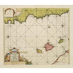
Paskaart, Voor een Gedeelte der Kust van, Barbaria.. Catalonia.. Yvica, Majorca, en Minorca..
This sea chart covers the Algerian coast in front of the Balearic Islands, South on top. Shows the 4 Balearic Islands (Majorca, Minorca, Ibiza) and part of the Catalonian...
Place & Date: Amsterdam, 1708
Selling price: $1250
Sold
Nieuwe Paskaart van de Zeekusten van 't Eylandt Sicilia..
This sea chart covers the area of the Mediterranean Sea between Italy and the Tunisian coast. Including the islands of Sicily and Malta in the center of the chart. fIt co...
Place & Date: Amsterdam, 1708
Selling price: $1050
Sold
Pascaart vande Weder zytsche Zee-kusten soo van Italia als Dalmatia..
Centred off the Gargano cape, this sea chart covers the coast surrounding the Adriatic Sea between Italy and the first Greek Islands. It contains an 3 enlarged inset plan...
Place & Date: Amsterdam, 1708
Selling price: $850
Sold
A Chart of the Mediterranean Sea According to Monsr. Berthelot &c.
An attractive map of the Mediterranean with the information taken from Monsieur Berthelot. Very accurate shows the whole of the Mediterranean centered on a Compass rose a...
Place & Date: London, 1710
Selling price: $300
Sold in 2015
Totius Danubii Nova & Accuratiss. Tabula, Universam Simul Turciam Europaeam Hungarium Magnam Germaniae Partem...
A very rare, large map depicting Italy, Sicily, Sardinia, Corsica, Greece, part of Turkey, Hungary and part of the Balkans region. Originally from France, the family de l...
Place & Date: Amsterdam, 1710
Selling price: $850
Sold in 2018
LUMEN HISTORIARUM per OCCIDENTEM.
A copperplate hand colored map showing the west Mediterranean.
Place & Date: Amsterdam, ca. 1714
Selling price: $75
Sold in 2019
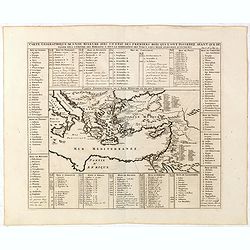
Carte de la Geographie sacrée pour l'ancien testament. . .
Beautiful map of the coast of the Mediterranean, including the south of France, Italy, the north African coast, and the near east. On the left, there is a "Table mé...
Place & Date: Paris, 1716
Selling price: $40
Sold in 2012
Carte de l\' Empire Othoman consideréedans les Etats de cette Puissance, et Etats qui l\' avoisinent ou qui luy sont tributaires. / Carte pour servir a l\' Histoire Universelle / Carte de la Grèce.
Henri Abraham Chatelain was a Amsterdam-based geographer and publisher. His main product is the 'Atlas Historique et Méthodique', in seven volumes, published between 171...
Place & Date: Amsterdam, 1710 / 1720
Selling price: $550
Sold in 2009
Carte des isles de Maiorque Minorque et d'Yvice..
Map of the Balearic Islands of Mallorca, Menorca and Ibiza with large cartouche and inset plan of the harbour of Mahon and a small overall map of the western Mediterranea...
Place & Date: Augsburg 1720
Selling price: $615
Sold
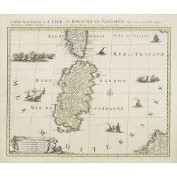
Carte nouvelle de l'Isle et royaume de Sardagne. . .
Uncommon map of Sardinia, with part of Corsica, the second-largest island in the Mediterranean Sea and an autonomous region of Italy. The Mediterranean is filled with sin...
Place & Date: Amsterdam, 1720
Selling price: $420
Sold in 2023
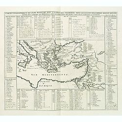
Carte geographique de l'Asie mineure avec un etat des premiers rois. . .
Map of the Mediterranean. This impressive engraving is a wonderful example of Chatelain’s elegant plates from his "Atlas Historique, Ou Nouvelle Introduction A L�...
Place & Date: Amsterdam, ca. 1720
Selling price: $60
Sold in 2012
Carte geographique de l'Asie mineure avec un etat des premiers rois. . .
Map of the Mediterranean. This impressive engraving is a wonderful example of Chatelain’s elegant plates from his "Atlas Historique, Ou Nouvelle Introduction A L�...
Place & Date: Amsterdam, ca. 1720
Selling price: $120
Sold in 2022
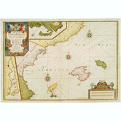
Suitte des Cotes d'Espagne.. avec les Isles de Mayorque Minorque et d'Yvice.
An attractive map centred on the eastern part of Spain. Includes two inset maps of Minorca and Sofa Bay. Decorative title cartouche on the upper left corner. With the men...
Place & Date: France 1723
Selling price: $1125
Sold
Insula et Regnum Sardiniae . . .
Kingdom of Sardinia. With arms lower right and a cartouche upper left of figures and animals in a landscape.
Place & Date: Paris, ca. 1725
Selling price: $275
Sold in 2009
Nouvelle Carte De Cotes De Catalogne, Rousiilon, Languedoc, Provence, D'Italie et Partie De L'Isle De Corce . . .
Striking two-sheet chart of the Mediterranean Coast, from Catalonia to the mouth of the Tiber River in Italy, showing most of Corsica and the island of Elba, with 6 large...
Place & Date: Marseille, 1715-1726
Selling price: $1500
Sold
Expeditiones Hannibalis per Hispaniam, Galliam, Italiam, Africam &cc..
Map covering the Eastern part of the Mediterranean Basin as far as the Adriatic Sea. It illustrates the route of Hannibal through Northern Africa and southern Europe as f...
Place & Date: Amsterdam 1730
Selling price: $200
Sold
Insula et Regnum Sardiniae,. . .
Fine map of Sardinia, showing the island in great detail. Decorated with a large title cartouche with figures and animals. Further enhanced with a large coat of arms, dis...
Place & Date: Augsburg, 1730
Selling price: $450
Sold in 2015
Nieuwe en Nette Afteekening van het Eyland Corsica en het Eyland Elba vertoonende alle desselfs Havenen, Steeden en Rivieren. Nieuwe en Nette Afteekening van het Eyland of Koninkryk Sardinia vertoonende alle desselfs Zee Havenen Anker Plaetsen Rivier ...
An extremely detailed, large sea chart of Corsica, Sardinia and Elba, with many sailing ships, compass roses, decorative cartouches, coat of arms, etc.One of the most dec...
Place & Date: Amsterdam, 1730
Selling price: $1600
Sold in 2020
Nouvelle carte de l'Isle de Corse apartenante a la Republique de Genes. . .
Map of Corsica with a splendid baroque cartouche. Carte de la Corse, sur laquelle figure le blason de l’Ile divisé en deux parties égales, la moitié droite est rése...
Place & Date: Amsterdam, 1730
Selling price: $800
Sold
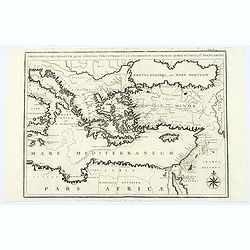
Tabula Peculiaris Regionum, quas Apostoli Perlustrarunt. . .
This map shows the entire eastern Mediterranean, with many ancient places named along the coast lines. This map depicts Paul the Apostle's journey from Jerusalem to Rome,...
Place & Date: Pars, ca. 1730
Selling price: $20
Sold in 2020
Mare Mediterraneum juxta Regna et Provincias, quas Alluit Distinctum et Cognominatum.
An old colored copperplate map of the middle west Mediterranean Sea. It shows the neighboring countries of Spain, Italy, the Balkans, Greece, as well as the north coast o...
Place & Date: Ausburg, ca. 1730
Selling price: $260
Sold in 2019
[untitled] coastal views of Corsica and Porto Venere, Italy.
Unusual sheet with 20 sections of coastal views/land profiles of Italy and Corsica. Shows Porto Venere, Bastia, Calvi, and parts along the route. Each section with inform...
Place & Date: Marseille, c1732
Selling price: $21
Sold in 2013
nsulae Corsicae Accurata Chorographia Tradita Per I. Vogt Capit. S. C. M. et excusa Studio Homannian. Heredum / Norib. MDCCXXXV
Extremely well-detailed map of Corsica, published 1735 by Homann Hires. Divided into 38 districts. At upper right with a decorative title cartouche with allegorical depic...
Place & Date: Nuremberg, 1735
Selling price: $600
Sold
Insulae Corsicae Accurata Chorographia Tradita Per I. Vogt Capit. S. C. M. et excusa Studio Homannian. Heredum / Norib. MDCCXXXV
Extremely well-detailed map of Corsica, published 1735 by Homann Hires. Divided into 38 districts. At upper right with a decorative title cartouche with allegorical depic...
Place & Date: Nuremberg, 1735
Selling price: $300
Sold in 2016
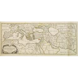
Carte Des Quatre Grandes Monarchies, des Assirieens, des Perse, des Grecs, et des Romains.. Celle Flavius Joseph .
Map covering the entire Mediterranean Basin and the Middle East as far as the borders of India. Outline coloring shows the political division.
Place & Date: Amsterdam 1740
Selling price: $200
Sold
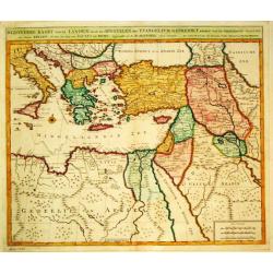
Byzondere Kaart van de Landen daar de Apostelen het Evangelium Gepredikt hebben?en van de weg van Paulus naar Rome.
A map of the eastern Mediterranean. With the track of St. Paul\'s voyage from Cesaere to Rome. From \' Hisoire du Vieux et du Nouveau Testament\', published by Johannes C...
Place & Date: Amsterdam, c. 1740
Selling price: $240
Sold
Carta Geografica del Regno di CORSICA.
Taken from In Lo stato presente di tutti i paesi, e popoli del Mondo ...Vol. XXIV, edited by Thomas Salmon. A Italian edition of this famous work, published in 26 volumes...
Place & Date: Albizzi, Venise, 1740
Selling price: $950
Sold
Carte des isles de Majorque Minorque et Yvice : Dediée A M. le Comte de Maurepas Ministre et Secret[ai]re d'Etat Commandeur des Ordres du Roi / par N. B[ellin] Ingénieur au Dépost des Cartes et Plans de la Marine. .
Fine map of the Baleares with Minorca, Majorca, Ibiza. In lower right inset maps of a Plan of the Port of Mahon, and the western Mediterranean (showing the location of th...
Place & Date: Paris, 1740
Selling price: $120
Sold in 2022
[Lot of 10 maps] In Notitiam Eclesiasticam Africae Tabula Geogrphica.
Very decorative copper engraved map of the northern coast of Africa, Spain, Italy and the western part of the Mediterranean with the islands of Sardinia, Corsica, Major...
Place & Date: Paris, c. 1740
Selling price: $220
Sold in 2022
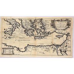
Carte des Voyages de Telemaque.
This interesting map is from “The Adventures of Telemachus” which is a didactic French novel by Fénelon, the Archbishop of Cambrai, and tutor to the seven-year-old ...
Place & Date: Paris, 1742
Selling price: $57
Sold in 2019
Sardiniae regnum et Insula..
Johann Baptist Homann's well-engraved map has a large decorative cartouche and inset plan of Porto Vecchio (Cagliari). Detailed map of Sardinia.Johann Baptist Homann (166...
Place & Date: Nuremberg, 1744
Selling price: $425
Sold in 2016
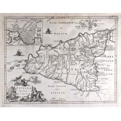
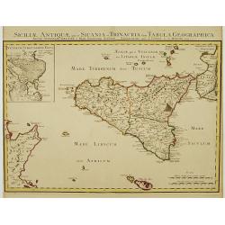
Siciliae Antiquae quae et Sicania et Trinacria dicta tabula geographica.
Detailed map of Sicily in outline color. Shows forests, a smoking Mount Etna, etc. Covers also Malta and Lipari Islands. Relief shown pictorially. Inset map: Veterum Syra...
Place & Date: Amsterdam c. 1745
Selling price: $265
Sold
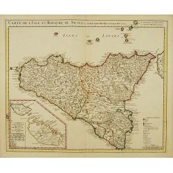
Carte de l'Isle et Royaume de Sicile.
Large, highly detailed map of Sicily. Shows illustrated topography with fortresses, churches, abbeys, ancient ruins, and aqueducts. The most prominent feature is the larg...
Place & Date: Amsterdam c. 1745
Selling price: $335
Sold
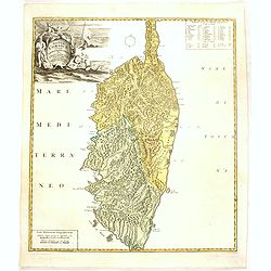
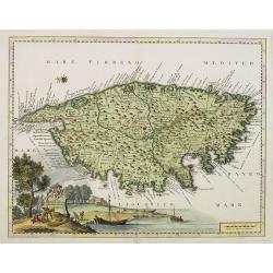
Insula Corsica, Olim Rehni Titulo Insignis . . . .
Large detailed map of Corsica. Splendid cartouche of picturesque scene of people at work engaged in their daily activities admits dogs and local fauna on the upper left c...
Place & Date: Amsterdam, ca 1745
Selling price: $950
Sold
Orientalior Districtus Maris Mediterranei / t'Ooster Gedeelte van de Middelandse Zee.
A sea chart of the Eastern Mediterranean, from Sardinia and Corsica to Syria and the Holy Land, centered on Greece. A very nice cartouche at top centre depicting a confro...
Place & Date: Amsterdam, 1745
Selling price: $555
Sold in 2020
[Untitled] Front views of the coastal relief of Sardinia.
Copper engraving presenting separate front views of the coastal relief of Sardinia and the Ponziane Islands, divided in stripes.From the rare chart book by Jacques Ayroua...
Place & Date: Marseille, 1732 - 1746
Selling price: $80
Sold in 2009
Plan de la Baye et Port de Mayorque. par Jacques Ayrouard pilote real et gravé par Louis Corne.
Large plan of the harbour Majorca. Decorated with a large compass rose.From the rare chart book by Jacques Ayrouard: "Recueil de plusieurs plans des ports et rades e...
Place & Date: Marseille 1732-1746
Selling price: $450
Sold in 2010
An accurate chart of the Mediterranean and Adriatic Sea. . .
An excellent early engraving of the Mediterranean and Adriatic Sea.
Place & Date: London, 1747
Selling price: $150
Sold in 2014
Isle et Royaume de Sardaigne.
Detailed small map of Sardinia. From Atlas Portatif Universel, by Robert de Vaugondy.Page 54 outside border top right. Mary Sponberg Pedley does not mention a state witho...
Place & Date: Paris, later than 1748
Selling price: $135
Sold
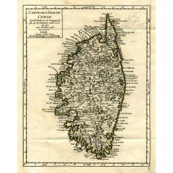
Carte de l'Isle de Corse.
Charming and very detailed map of Corsica. Shows towns, rivers, lakes, woods, mountains, bays, and islands.
Place & Date: Paris, 1748
Selling price: $120
Sold in 2010
[Lot of 3 maps] Pontus Euxinus anders Mare Maggiore
[ Lot of 3 maps ]- De Beschryvingh van de Reysen Pauli, en van de Andere Apostelen (1702). - M. Heberers Ongelukkige Voyagie gedaan in Verscheyde gedeeltens van Asia en...
Place & Date: 1748
Selling price: $140
Sold in 2023
Die Insul Corsica mit dessen Disricten und Aemtern abgetheilet.
A very detailed map of the island of Corsica. Filled with place names, rivers, and hills. Embellished with the title cartouche, a distance scale, and a compass rose. To t...
Place & Date: Leipzig, 1749
Selling price: $150
Sold in 2016
Nouvelle Carte de L'Isle de Corse..
Fine map of Corsica.
Place & Date: Paris 1750
Selling price: $185
Sold
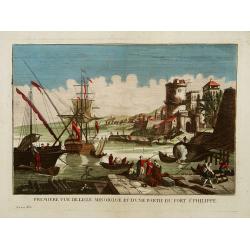
Première vue de l'Isle minorque et d'une partie du Fort St Philippe.
A so-called optical print of the harbour of Majorcal.In the eighteenth and nineteenth centuries there were many popular speciality establishments in Paris, Augsburg and L...
Place & Date: Paris 1750
Selling price: $300
Sold
Nieuwe Afteekening van het Eyland Maiorca
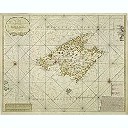
So called "Blue-back" sea- of Majorca.Latitude scale, compass rose and system of rhumb lines, soundings, anchorage's, etc. A wealth of cities and information ap...
Place & Date: Amsterdam, 1750
Selling price: $1750
Sold in 2011
A Map of the Island of Corsica.
Scarce small map of Corsica and part of Sardinia.
Place & Date: England, ca. 1750
Selling price: $100
Sold in 2019
Carte topographique DE L'ISLE MINORQUE, Dédiée et présentée au Roy ..
Very rare map depicting the island of Minorca. The bottom is decorated with a stunning title cartouche, engraved by Choffard.The French text on the left side contains a l...
Place & Date: Paris 1756
Selling price: $850
Sold
Carte welche die Inseln Maiorca, Minorca, Yvica und Formentera..
So called "Einblattdruck" of Majorca, Minorca and 2 insets of parts of the Island Majorca. Prepared after Felßecker and Bellin.
Place & Date: Frankfurt a.Main & Leipzig, dated 1756
Selling price: $560
Sold
Isle Minorque.
Nice map of the island of Majorca, title cartouche lower left. Orientated to the north.
Place & Date: Paris, 1756
Selling price: $240
Sold
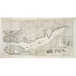
Plan de la Ville et du Port Mahon et du Fort St. Philippe.
Scarce separately issued map of the fort and town St.Philippe and port Mahon in a first state. In upper left corner the title and a key in French (A-Z, Aa-Bb) and a key i...
Place & Date: Paris, ca. 1756
Selling price: $1150
Sold in 2013


![[Lot of 6 maps of the eastern Mediterranean] Estats / du Grand Seigneur / des Turcs / en Europe, en Asie et en Afrique](/uploads/cache/18520-250x250.jpg)


![[ Sardigne and Sicily ]](/uploads/cache/30325-250x250.jpg)




![Parallelo Geografico dell'Antico col Moderno Arcipelago ... [in set with] Parte Meridionale dell' Arcipelago. . .](/uploads/cache/32827-250x250.jpg)
![[2 charts] Accuratissima Occidentalioris Districtus Maris Mediterranei.. / Accuratissima Orientalis Districtus Maris Mediterranei..](/uploads/cache/09561-250x250.jpg)


![[Lot of 5 maps of the Iberian peninsula / Belearics]](/uploads/cache/18379-(2)-250x250.jpg)








![[untitled] coastal views of Corsica and Porto Venere, Italy.](/uploads/cache/92545-250x250.jpg)

![Carte des isles de Majorque Minorque et Yvice : Dediée A M. le Comte de Maurepas Ministre et Secret[ai]re d'Etat Commandeur des Ordres du Roi / par N. B[ellin] Ingénieur au Dépost des Cartes et Plans de la Marine. .](/uploads/cache/30644-250x250.jpg)
![[Lot of 10 maps] In Notitiam Eclesiasticam Africae Tabula Geogrphica.](/uploads/cache/19552-250x250.jpg)


![[Untitled] Front views of the coastal relief of Sardinia.](/uploads/cache/24831-250x250.jpg)


![[Lot of 3 maps] Pontus Euxinus anders Mare Maggiore](/uploads/cache/IMG_3162-250x250.jpg)


