Browse Listings in Europe > Italy > General Italy
Italia / Portugalia
Decorative colored incunable leaf in folio showing imaginary views of Italy and Portugal by Hartmann Schedel. From the famous Liber chronicarum or Nuremberg Chronicle in ...
Place & Date: Nuremberg, 1493
Selling price: $280
Sold
Tabula Europ. Sexta Italiae (Italy)
Wood block printed large-format Ptolemaic map showing Italy with Corsica, Sardinia and part of Sicily, from the 1513 edition of Waldseemüller's Geographia.One of the ear...
Place & Date: Strasburg, 1513
Selling price: $4500
Sold in 2013
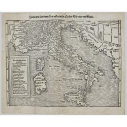
Italia mit Dreien furnemsten Inseln, Corsica, Sardinia und Sicilia.
One of the earliest woodcut maps of Italy by Sebastian Münster. Showing Italy with the Islands Sardinia, Sicily and Corsica. With Dalmatia in the East. The title on vers...
Place & Date: Basle, ca 1540
Selling price: $250
Sold in 2019
.[Italy]
Wood block printed map and one of earliest printed representation of Italy prepared by Martin Waldseemüller. Based on the slightly larger map from 1513 published in &q...
Place & Date: Vienna, Trechsel, G., 1525 -1541
Selling price: $750
Sold in 2024
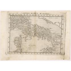
Tabula nova Italiae.
One of the earliest modern maps of Italy after Claudius Ptolemy, based on Waldseemuller. Shows Italy with ancient place names, rivers, and a prominent display of the moun...
Place & Date: Vienne or Lyon, 1541
Selling price: $215
Sold in 2016
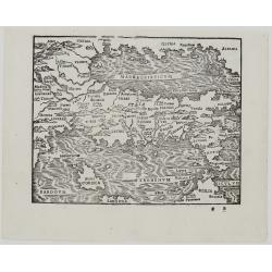
[Map of Italy]
Page with an early representation of Italy with Sicily, Sardinia and Corsica. South to the top. This text page with a fine wood block printed map is from the rare work &q...
Place & Date: Basle, Michael Isengrin, 1544
Selling price: $450
Sold in 2011
Italia Nova Tavola.
Gastaldi's modern map of Italy. From Giacomo Gastaldi's Atlas of 1548 which has been called the most comprehensive atlas, produced between Martin Waldseemüller's Geograp...
Place & Date: Venice, 1548
Selling price: $230
Sold in 2021
Beschreibung der Herzlichen und weitberhümten Statt Mirandula.
A large, early woodcut view of Mirandola by Sebastian Munster on the full double sheet. Title and a description of the city on verso. Interesting bird's-eye view of the f...
Place & Date: Basel, H.Petri, ca. 1550
Selling price: $120
Sold in 2021
Der Statt Rom boden und circkel sampt thor vnnd porten, wie sie gestanden ist vor zeiten, do sie noch in ihrer herrlichkeit was.
An early woodcut map of ancient Rome and its vicinity by Sebastian Münster. To the left of the map, a detailed explanation of the most important buildings seen on the ma...
Place & Date: Basel, H.Petri, ca. 1550
Selling price: $85
Sold in 2021
Italia mit zeijnen furnemesten Inseln Corsica Sardinia und Sicilia.
In general a fine impression of this early wood block print of Italy including Sardinia and Corsica.
Place & Date: Basle 1540-1551
Selling price: $320
Sold
[Lot of 45 leaves of Italy]
Forty-five leaves illustrated with wood block prints relating to Italy. From the 1552 Latin text edition of Münster's Cosmographia, which is a short and complete summary...
Place & Date: Basel, 1552
Selling price: $150
Sold in 2022
Italia XIX Nova Tabula
Very rare issue and the first Münster’s map of Italy, based on Ptolemy’s writings. It shows the area from Marseille to Albania, including the Adriatic Sea, also the ...
Place & Date: Basel, 1552
Selling price: $700
Sold in 2023
Der Statt Istien und umbligender Landschafft gelegenheit und abcontrafactur.
Text page with a map (122x155mm.) of "Istien". It is a typical woodcut illustration that makes these Münster maps fascinating and sought after by map collector...
Place & Date: Basel, 1562
Selling price: $15
Sold in 2012
Der Statt Neapolis Abcontrafhetung
The rare miniature woodblock map of Italy. On verso are half-maps of the Holy Land (Israel) and Greece. The maps in Honter’s books were printed back-to-back, so the ...
Place & Date: Basel, 1565
Selling price: $500
Sold in 2023
Italia mit den Dreien Furnemsten Inseln Corsica / Sardinia und Sicilia.
One of the earliest woodblock maps of Italy. It shows the area from Marseille to Albania, including the Adriatic Sea, also the islands of Sicily, Corsica and Sardinia. Th...
Place & Date: Basel, 1569
Selling price: $600
Sold in 2023
Regni Neapolitani Verissima secundum antiquorum et recentiorum traditionem descriptio, Pyrrho Ligorio Auct.
Very fine map of Southern Italy, including the towns of Ascoli, Piceno, Napoli, Fogia, Bari, Catanzaro and the most northern tip of Sicily with Messina.Orientation: top i...
Place & Date: Antwerp, 1570
Selling price: $265
Sold in 2020
Tabula Italiae. (Italy)
Double-page woodcut Ptolemaic-style map by Sebastian Münster figuring Italy and including Corsica, published in the edition of Strabo by Henri Petri in 1571."Strabo...
Place & Date: Basle, Henri Petri, 1571
Selling price: $60
Sold in 2018
Italiae Novissima Descriptio.
Original copper engraving, published 1572/74 in a French text edition of the Atlas 'Theatrum Orbis Terrarum' at Christopher Platin in Antwerp. A highly decorative and ear...
Place & Date: Antwerp, 1572/1574
Selling price: $950
Sold in 2012
Septentrionalium Partium Nova Tabula
The map of Italy, Corsica and the Gulf of Venice.Comes from atlas “La geografia di Claudio Tolomeo Alessandrino, nuouamente tradotta di Greco in Italiano, da Girolamo R...
Place & Date: Venice, 1574
Selling price: $300
Sold in 2023
[ Italy ]
On verso a small map of Italy.From a French text edition of his Cosmographia , that great compendium of Renaissance knowledge. In 1575 Sebastian Münster's Cosmographia w...
Place & Date: Basle, ca.1575
Selling price: $25
Sold in 2009
Italia totius orbis olim domatricis nova et exactiss descriptio Jacobo Castaldo auctore.
Map of Italy from the extremely rare first edition, here the state without the privilege. Engraved by Joannes and Lucas van Deutecum, who's signature is in the lower left...
Place & Date: Antwerp, 1578
Selling price: $4500
Sold
Italia mit den Dreien Furnemsten Inseln Corsica / Sardinia und Sicilia.
One of the earliest woodblock map of Italy. It shows the area from Marseille to Albania, including the Adriatic Sea, also the islands of Sicily, Corsica and Sardinia. The...
Place & Date: Basel, 1578
Selling price: $600
Sold in 2023
Italiae Novissima Descriptio, Auctore Iacopo Gastaldo Pedemontano.
A beautiful map of Italy based on an earlier work done by Gastaldi. Features a vignette of Neptune and a female mermaid companion, sea monsters ships and decorative carto...
Place & Date: Antwerp, 1579
Selling price: $800
Sold in 2020
Italiae Novissima descriptio. . .
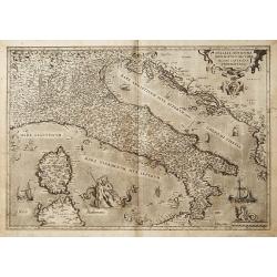
Very fine map of Italy after Giacomo Gastaldi. Embellished with a title cartouche, vessels, sea monsters and sea gods. Latin text on verso.Abraham Ortelius (1527-1598) wa...
Place & Date: Antwerp, 1579
Selling price: $1230
Sold in 2015
Italiae Novissima descriptio. . .
A very fine map of Italy by Abraham Ortelius, after Giacomo Gastaldi. Embellished with a title cartouche, vessels, sea monsters and mermaids and Neptune. The map is fille...
Place & Date: Antwerp, 1579
Selling price: $375
Sold in 2018
Italiae Veteris Specimen.
Ortelius' map of Ancient Italy which appeared in his beginning in 1584. The map is based upon Gastaldi's map of Italy, supplemented with classical sources. Signed and dat...
Place & Date: Antwerp, 1584
Selling price: $951
Sold in 2013
Caroli Sigonii von Geschichten des Königreichs Italiae Fünffsehn Bücher in sich begreiffende die herrliche Historien vom Jahr Christi 57o. anbiß ins 12.oo. Jahr.
Early description of Italy, being the German translation of Carolus Sigonius' "De Regno Italia Libri XV", (Venice, 1574).This German edition published in Strasb...
Place & Date: Bernhart, Strassburg, 1584
Selling price: $6900
Sold in 2019
Italia Mit Den Dreyen Furnempften Inseln / Corsica / Sardinia / und Sicilia
This charming wood block printed map of Italy, Corsica, Sicily and Sardinia was published in the 1588-edition of Sebastian Münster’s Cosmographia. Mountains, villages,...
Place & Date: Basle, S.H. Petrie, 1588
Selling price: $130
Sold in 2014
[ Italy ]
On recto a wood block printed map of the center part of Italy (159x129mm.), south orientated to the top. Corsica in upper right corner.From a Latin text edition of his Ge...
Place & Date: Basle, 1550-1590
Selling price: $55
Sold in 2013
Regnum Neapolit. Mare mediterraneum.
On recto a map of Southern part of Italy. />From a Latin text edition of his Geographia , that great compendium of Renaissance knowledge.
Place & Date: Basle, 1550-1590
Selling price: $60
Sold in 2013
Descriptio Italiae secundum uarios populos. . . [Italy]
On verso a wood block printed map of Italy.From a Latin text edition of his Geographia , that great compendium of Renaissance knowledge.
Place & Date: Basle, 1550-1590
Selling price: $20
Sold in 2013
Italia.
Map of Italy adorned with a title-cartouche, 6 ships, a sea monster and a scale. This is a rare copper-engraved map of Italy based on the Mercator projection. Present in ...
Place & Date: Frankfurt, 1596
Selling price: $1000
Sold in 2020
Italia.
Lovely copper engraved map of Italy featuring fancy lettering in the seas. Southern part of Sicily and Sardinia are not included. Good detail in the interior.The map come...
Place & Date: Cologne 1597
Selling price: $115
Sold
Italiae Novissima descriptio. . .
Very fine map of Italy after Giacomo Gastaldi. Embellished with a title cartouche, vessels, sea monsters and sea gods. No text on verso.Abraham Ortelius (1527-1598) was a...
Place & Date: Antwerp, 1598
Selling price: $750
Sold in 2018
Italia mit dreien fürnemsten Inseln / Corsika / Sardinia und Sicilia.
An early woodcut map from a German edition of Münster's famous 'Cosmographie.' Shows the area from Marseille to Albania, including the Adriatic Sea, the islands of Sicil...
Place & Date: Basel, ca. 1600
Selling price: $240
Sold in 2016
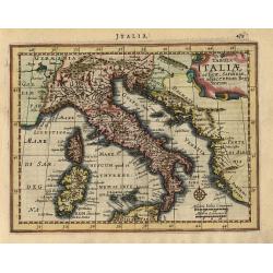
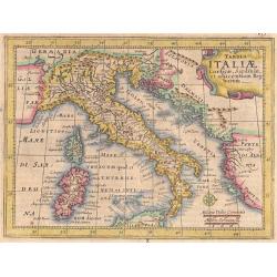
Italia. [Set of 21 maps]
A lovely miniature set of maps of Italy, published by Petrus Bertius, in Amsterdam at the beginning of the seventeenth century. The maps have strap-work titles, and inclu...
Place & Date: Amsterdam, 1606
Selling price: $1160
Sold in 2019
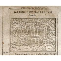
Calaris
Rare woodcut view of Cagliari (Casteddu) the capital of Sardinia. From "Parvum Theatrum Urbium sive Urbium Praecipuarum totius orbis Brevis & Methodica Descripti...
Place & Date: Frankfurt, 1608
Selling price: $120
Sold in 2009
Italia.
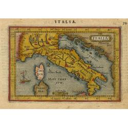
Miniature map of Italy, with major cities named. Strapwork title cartouche at the top. Sea is stipple engraved, see the little boat (there is m=no wind, they have to padd...
Place & Date: Antwerp 1609
Selling price: $150
Sold
Italia.
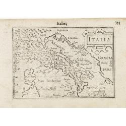
A miniature map of Italy. Title cartouche on the upper right corner.First published in 1598 in his Caert-Thresoor, the plates were executed by the most famous engravers i...
Place & Date: Amsterdam/Frankfurt 1609
Selling price: $90
Sold in 2009
Italiae Novissima descriptio..
"Very fine map of Italy after Giacomo Gastaldi. Copper engraving with Spanish text on verso. Abraham Ortelius (1527-1598) was a cartographer and publisher, who is bo...
Place & Date: Antwerp 1584-1612
Selling price: $710
Sold
Italiae Novissima descriptio. . .
Very fine map of Italy after Giacomo Gastaldi. Embellished with a title cartouche, vessels, sea monsters ans sea gods. No text on verso.Abraham Ortelius (1527-1598) was a...
Place & Date: Antwerp, 1584-1612
Selling price: $1300
Sold in 2008
Italia Nuovamente piu perfetta che mai per inanzi posta in luce..
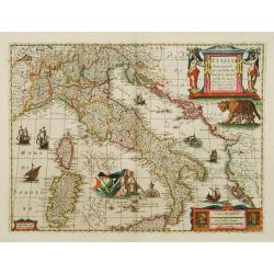
A marvellously engraved map filled with decorative features, notably Romulus and Remus being suckled by a wolf and Neptune with a mermaid, rising from the sea.
Place & Date: Amsterdam 1617
Selling price: $1200
Sold
Italia Nuovamente piu perfetta che mai per inanzi posta in luce..
A very decorative and marvelously engraved map of Italy filled with features, notably Romulus and Remus being suckled by a wolf and Neptune with a mermaid, rising from th...
Place & Date: Amsterdam, 1617
Selling price: $1190
Sold in 2016
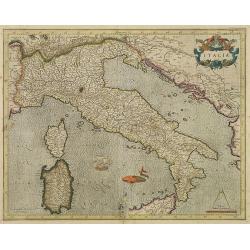
ITALIA
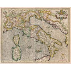
Beautiful map of Italy by G. Mercator.
Place & Date: Amsterdam, 1619
Selling price: $650
Sold in 2014
Italia . . .
A wonderful map of Italy. Incorporated into Speed's 'Prospect Of The Most Famous Parts Of The World'. English descriptive text on verso.
Place & Date: London, 1626
Selling price: $1050
Sold in 2019
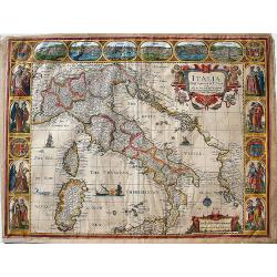
Italia Newly Augmented by J. Speede. . .
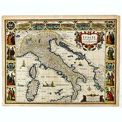
John Speed's lovely map of Italy dated 1626, decorated with 8 costumed pairs of various Italian figures, 6 town plans of early Italian cities, including (Verona, Naples, ...
Place & Date: London, 1626
Selling price: $468
Sold in 2020
Tabula Italiae Corsicae, Sardiniae,...
Beautifully engraved by Jansson Mercators Atlas Minor. Shows Italy, the Dalmatian Coast, Corsica, Sardinia and half of Sicilly with the Vulcano. Very detailed with well e...
Place & Date: Amsterdam 1628
Selling price: $120
Sold
Tabula Italiae Corsicae, Sardiniae, et adjacentium Regnorum
Fine small map of all Italy, with Sardinia and Corsica, but only the northern part of Sicily. Decorated with a strapwork title cartouche and compass rose. Latin text on v...
Place & Date: Amsterdam, 1628
Selling price: $130
Sold
Tabula Italiae Corsicae, Sardiniae, et adjacentium Regnorum.
Attractive small map of all Italy, with Sardinia and Corsica, but only the northern part of Sicily. Decorated with a strapwork title cartouche and compass rose. German te...
Place & Date: Amsterdam 1628
Selling price: $130
Sold in 2015
Tabula ITALIAE Corsicae, Sardaniae, et adjacentium Regnorum. . . Ioannem Ianssonium . . . 1628.
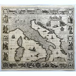
First state (of 3) of this "carte à figures"- map of Italy produced by Johannes Janssonius in 1628. The composition, decoration and geographical content follow...
Place & Date: Amsterdam, 1628
Selling price: $6000
Sold
Italia.
Very fine map showing Italy and the islands of Corsica, Sardinia and part of Sicily.Mercator was born in Rupelmonde in Flanders and studied in Louvain under Gemma Frisius...
Place & Date: Amsterdam, 1630
Selling price: $700
Sold in 2011
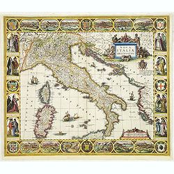
Nova Italiae delineatio.
First state of this "carte à figures"- map of Italy produced by Jodocus Hondius Jr. before 1629. The map was separately published and is sometimes found in Wil...
Place & Date: Amsterdam, ca.1630
Selling price: $3500
Sold in 2012
Italia.
Very fine map showing Italy and the islands of Corsica, Sardinia and part of Sicily.Mercator was born in Rupelmonde in Flanders and studied in Louvain under Gemma Frisius...
Place & Date: Amsterdam, 1630
Selling price: $500
Sold in 2017
Nova Italiae delineatio.
Detailed map of Italy, Sardinia and Corsica embellished with four sailing ships, a sea monster and two very decorative scale and title cartouches.
Place & Date: Amsterdam 1635
Selling price: $720
Sold
Nova Italiae Delineatio
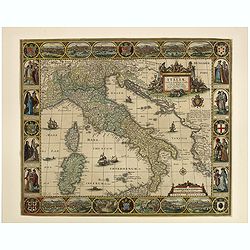
Beautiful full old colored example of Blaeu's first map of Italy. Showing whole Italy with Sardinia, Corsica and parts of Sicily. With several sailing ships and a sea mon...
Place & Date: Amsterdam, 1635
Selling price: $1000
Sold in 2008
Nova Italiae delineatio.
Originally engraved for Jodocus Hondius II, at his death in August 1629 this map was, among other copper plates,purchased by Willem Blaeu who trimmed the figured borders,...
Place & Date: Amsterdam, 1638
Selling price: $650
Sold in 2016
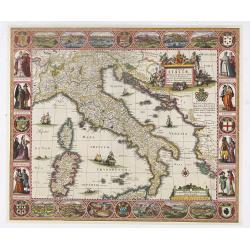
Tabulae Italiae, Corsicae, Sardiniae, et adjacentium..
A decorative map by this famous Dutch mapmaker. The border contains views of the main cities, largely inspired by the Civitates Orbis Terrarum by Braun & Hogenberg: R...
Place & Date: Amsterdam, 1628,1640
Selling price: $2500
Sold in 2023
Antiquorum Italiae & Illyrici occidentalis episcopatum geographica descriptio . . .
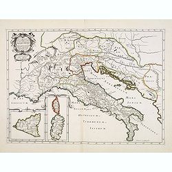
Scarce map of Ancient Italy and the Adriatic with inset maps of Corsica, Sardinia and Sicily. Engraved by Abraham de la Plaetsen. Included in "Geographia sacra, siue...
Place & Date: Paris, ca. 1641
Selling price: $150
Sold in 2014
Tabula ITALIAE Corsicae, Sardaniae, et adjacentium Regnorum. . .
An extremely rare map of Italy, including Sicily and Corsica. The map is copied by Cornelis Danckerts II after a map by Henricus Hondius. This map is found only in French...
Place & Date: Paris, 1650
Selling price: $1000
Sold in 2009
TABVLAE PEVTINGERIANAE SEGMENTVM III. à Marcomannis ad Sarmatas vsque. "Segmentvm IV. à Sarmatis vsque ad Hamaxobios
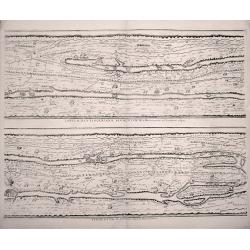
Sheet 2 of 4 from Peutinger Table, or a Roman road map of the world, "TABVLAE PEVTINGERIANAE SEGMENTVM III. à Marcomannis ad Sarmatas vsque", Segmentvm IV. a&a...
Place & Date: Amsterdam, 1652
Selling price: $325
Sold in 2014
Tabula Italiae, Corsicae, Sardiniae et adjacentium Regnorum. A°1652.
This beautiful old colored engraved map is signed on plate by Nicolas Iohannis Visscher, and by the engraver Abraham Goos on lower left. The border is decorated with 12 v...
Place & Date: Amsterdam, 1652
Selling price: $2000
Sold in 2019
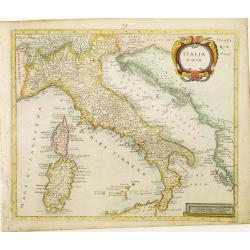
Italia Nova.
Rare map of Italy including only the north-eastern part of Sicily. Ornated with a large title cartouche.From a book by Cluver Introductionis in Universam Geograpicam publ...
Place & Date: Wolfenbüttel 1661
Selling price: $150
Sold
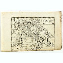
Italie Corse Sardaigne et Provinces adiacentes. (28).
Scarce map of Italy, Corsica and Sardinia published by Antoine de Fer in 1661 or 1662 in "Cartes de géographie revues et augmentées". With number 28 in lower ...
Place & Date: Paris, Antoine de Fer, 1657 but 1661 or 1662
Selling price: $70
Sold in 2023
Carte de L'Italie et des Isles adjacentes. . .
Detailed map of Italy, Sardine and Malta. With inset map of Sicily. Title at bottom with erasure in the title. Map is dated 1663 and was engraved by L'Huilier.
Place & Date: Paris, 1663
Selling price: $250
Sold
L'Italie et les Isles circomvoisines Sicile, Sardagne. . .
Map of Italy including the islands of Sicily, Sardinia and Corsica, with original or early outline hand-color. Numerous place-names of counties, cities, towns, physical f...
Place & Date: Paris, 1665
Selling price: $225
Sold in 2016
Italia Newly Augmented by J. Speede.
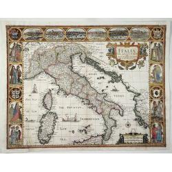
John Speed's map of Italy, from his famous atlas "Prospect of the Most Famous Parts of the World".This map is regarded as the most beautiful and decorative map ...
Place & Date: London, Basset, 1662-1665
Selling price: $1000
Sold in 2017
Italie Corse Sardaigne et Province adiacentes.
Rare map of general Italy, published by Jollain in 1667. Published in "Trésor Des Cartes Geographiques Des Principaux Estats de Lunivers".This atlas is based u...
Place & Date: Paris, 1667
Selling price: $35
Sold in 2022
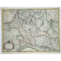
[Lot of 10 maps and prints of ITALY, the Milan States and Italy.
A detailed map of the duchy of Milan and its surrounding states. Alexis-Hubert Jaillot (1632-1712), French cartographer who joined the Sanson heirs. He redrew Nicolas San...
Place & Date: Paris, 1674
Selling price: $250
Sold in 2022
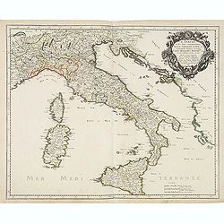
L'Italie par P. Du-Val. . . [4 sheet wall map]
One of Du Vals magnificent wall maps included in his atlas "Cartes de Geographie" and could be mounted and used as a wall map.Dated 1675. Engraved by Francois C...
Place & Date: Paris, 1675-1676
Selling price: $1800
Sold
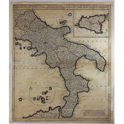
Regnum Neapolis Sisiliae et Lipariae Insulae.
A detailed map of the southern part of Italy, with a large inset of Sicily. Extends north to include Aprutium Ulterius (Aquila). Some major cities shown include; Napoli, ...
Place & Date: Amsterdam, 1680
Selling price: $55
Sold in 2018
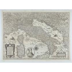
Italiae, Illirici, Sardiniae, Corsicae, et confinium regionum nova et exacta descriptio. Petro Plancio auctore. . .
Very rare map of Italy showing the area between Geneva (Switzerland), Szeged (Ottoman Hungary) and Catania (Sicily), showing patriarchates, archbishoprics and bishoprics,...
Place & Date: Paris / London, c. 1680
Selling price: $4100
Sold in 2020
[ Italy and Corsica ]
Charming wood block map of Italy and Corsica by the Italian XVIth and XVIIth century writer, humanist and cartographer Giuseppe Rosaccio. Taken from the 1688 Bologna &quo...
Place & Date: Bologna, Antonio Pisarri, 1594 - 1688
Selling price: $475
Sold in 2011
Italia Antiqua cum itineribus antiquis...
Giacomo Rossi's fine late 17th century map of Ancient Italy. Issued in Il Mercurio geografico In lower left hand corner title cartouche.
Place & Date: Rome, 1678-1688
Selling price: $150
Sold in 2015
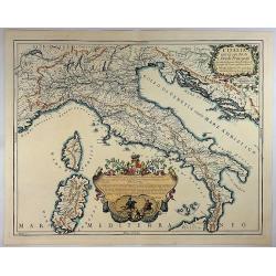
Italia divisa ne svoi regni, prini, pati, ducati...
Giacomo Rossi's fine late 17th century map of Italy. Issued in Il Mercurio geografico In upper right a tittle cartouche.The cartographer was Giacomo Cantelli da Vignola (...
Place & Date: Rome, 1681-1688
Selling price: $300
Sold in 2015
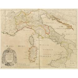
Italia Antiqua.
A fine map of Ancient Italy. This edition carries the date 1690, in manuscript.Nicolas Sanson was to bring about the rise of French cartography, although the fierce compe...
Place & Date: Paris, 1690
Selling price: $40
Sold in 2023
Ristretto del Mediterraneo...
Very large, extremely decorative map of the Western part of the Mediterranean Sea. It is embellished with coats of arms and decorative cartouches, Vincenzo Maria Coronell...
Place & Date: Venice, 1690
Selling price: $1600
Sold in 2023
L'Italia con le Sue Poste e Strade Principali.
A beautiful map of Italy featuring its Post Routes and Highways. This elegant chart of Italy extends to show the Adriatic, some of the Balkans, west to include Provence t...
Place & Date: Rome, 1695
Selling price: $725
Sold in 2018
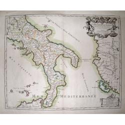
Le Royaume De Naples Divisé En Douze Provinces.
Striking large and highly detailed map of southern Italy, from Rome until Sicily. Including parts of Albania and Greece with Corfu. Also including many small islands: Tre...
Place & Date: Paris, 1696
Selling price: $65
Sold in 2014
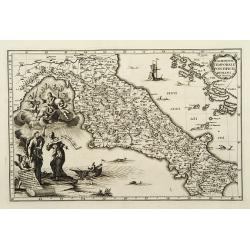
Dominium temporale pontificis Romani in Italia.
A map from the series of maps by the Jesuit mathematician. A general map of central Italy, produced by Scherer to show the spread of Catholicism in the country. Heinrich ...
Place & Date: Munich c.1702
Selling price: $150
Sold
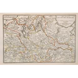
Les estats du duché de Milan.
Map of the states of the Duchy of Milan, taken from "Atlas Curieux", printed in Paris.
Place & Date: Paris, 1705
Selling price: $130
Sold in 2009


![.[Italy]](/uploads/cache/33856-250x250.jpg)

![[Map of Italy]](/uploads/cache/31509-250x250.jpg)


![[Lot of 45 leaves of Italy]](/uploads/cache/48295-250x250.jpg)




![[ Italy ]](/uploads/cache/27235-250x250.jpg)


![[ Italy ]](/uploads/cache/32528-250x250.jpg)
![Descriptio Italiae secundum uarios populos. . . [Italy]](/uploads/cache/32573-250x250.jpg)

![Italia. [Set of 21 maps]](/uploads/cache/43261-250x250.jpg)







![L'Italie par P. Du-Val. . . [4 sheet wall map]](/uploads/cache/31972-250x250.jpg)
![[ Italy and Corsica ]](/uploads/cache/30320-250x250.jpg)


