Browse Listings in Europe > Greece > Greece General
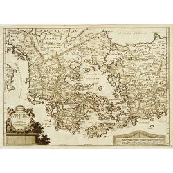
Estats de L´Empire des Turqs en Europe et Pays circomvoisins....
Map of Greece with all islands, partly showing Italy and Turkey.
Place & Date: Paris, 1655
Selling price: $300
Sold in 2014
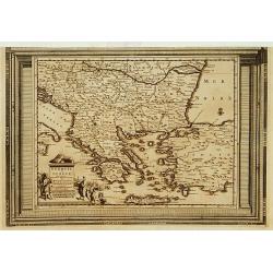
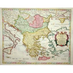
Estats de L'Empire des Turqs en Europe et pays circomvoisins.
Fine map of Greece, including lower part of Italy, western part of Turkey and the Black Sea with Crimea.This edition carries the date 1655.Nicolas Sanson was to bring abo...
Place & Date: Paris, 1655
Selling price: $300
Sold in 2013
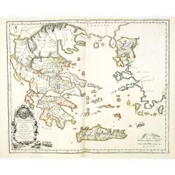
[Lot of 3 maps] Candia olim Creta.
Johannes Blaeu's attractive map of Greta. Johan Blaeu succeeded his father Willem when the latter died in 1638. Johan led the Blaeu firm to its greatest achievement the '...
Place & Date: Amsterdam, c. 1660
Selling price: $155
Sold in 2022
Graecia, Sophiani.
Charming small map of ancient Greece based on the map by Nikolaus Sophianos. Embellished with two strapwork cartouches. Engraved by Petrus Kaerius.
Place & Date: Amsterdam 1661
Selling price: $150
Sold
Hellas seu Graecia Universa.
Rare map of Greece, from a book by Cluver Introductionis in Universam Geograpicam published by Johannis Bunonis.A first state.
Place & Date: Wolfenbüttel 1661
Selling price: $50
Sold
Grece. (36).
Scarce map of Greece published by Antoine de Fer in 1661 or 1662 in "Cartes de géographie revues et augmentées". The series of maps is largely derived from th...
Place & Date: Paris, Antoine de Fer, 1657 but 1661 or 1662
Selling price: $40
Sold in 2019
Graecia olim Hellas nunc Rome=ehi, Turris Romechi.
Charming little map of Greece, made by Gabriel Bucelin (1599-1681). Bucelin was a Swiss genealogist and an author of several books and a number of manuscript maps of Germ...
Place & Date: Ulm, Johannes Görlin, 1658-1664
Selling price: $155
Sold in 2008
Partie de Turquie. . .
Map of Greece, the Aegean Sea and European part of Turkey prepared by N.Sanson and published by Pierre Mariette.Published in an early edition of the small Sanson atlas L\...
Place & Date: Paris, P. Mariette, 1667
Selling price: $45
Sold in 2009
Graecia Foederata sub Agamemnone, ob Helenae Raptum in Troiam coniurans . . .
A fine map of the ancient Greece. Engraved by Ludovicus Cordier. Nicolas Sanson was to bring about the rise of French cartography, although the fierce competition of the ...
Place & Date: Paris, 1667
Selling price: $72
Sold in 2013
Grece.
Rare map of the Greece, published by Jollain in 1667. Published in "Trésor Des Cartes Geographiques Des Principaux Estats de Lunivers".This atlas is based upon...
Place & Date: Paris, 1667
Selling price: $100
Sold in 2021
A MAPP of THE ESTATES of the TURKISH EMPIRE in ASIA, and EUROPE, 1669
A rare map of Turkey, Asia Minor, Cyprus, North Africa, Crimea, Southern part of Italy and Eastern Europe . This rare example is the earliest folio sized map of the regio...
Place & Date: London, 1669
Selling price: $350
Sold in 2020
A MAPP of THE ESTATES of the TURKISH EMPIRE in ASIA, and EUROPE, 1669.
A copperplate partly colored map showing Arabie, Asia Minor & Cyprus. This rare example is the earliest folio sized map of the region to be engraved in England by Ric...
Place & Date: London, 1669
Selling price: $435
Sold in 2019
Hellas (in Greek) seu Graecia Universa.
Nice and bright map of Greece with the biggest part of Crete (Candia).
Place & Date: Amsterdam, 1670
Selling price: $350
Sold in 2010
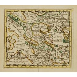
La Grece, ou partie Meridionale de l'Empire des Turcs en Europe, avec le Table Alphabetique des lieux de l'ancienne Grece célèbres en l'Histoire, les noms qu'ils ont aujourd'hui et le chiffre qui les fait trouver . . .
Uncommon map of Greece, widen to Aegean sea with title at bottom. Showing various trade routes from the Dardanelles, Gallipoli and Smyrna through the southern islands and...
Place & Date: Paris, 1674
Selling price: $400
Sold
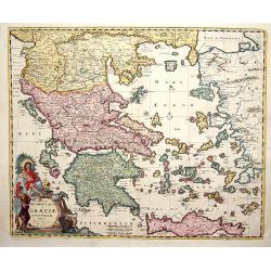
Accurata totius Archipelagi et Graeciae Universae Tabula.
Map of total Greece with all islands.
Place & Date: Amsterdam, 1680
Selling price: $360
Sold in 2014
ΕΛΛΑΣ, Seu Graecia Universa Autore J. Laurenbergio.
Highly detailed map of the whole of Greece, the Greek Islands, the Aegean, Crete and part of Asia Minor.
Place & Date: Amsterdam, 1680
Selling price: $220
Sold in 2016
Peloponnesus Hodie Moreae Regnum.
A lovely map of the southern part of Greece / Peloponnese (Pelopónnisos) by Danckerts. With a beautifully colored cartouche with a Venetian Lion fighting against the Tur...
Place & Date: Amsterdam, 1680
Selling price: $180
Sold in 2018
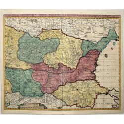
ROMANIA, THRACE, BULGARIA. -Exactissima Tabula qua tam DANUBII FLUVII PARS INFERIOR, . .
A beautifully colored map depicting the region to the lower reaches of the Danube from Belgrade to the Black Sea. Includes all of Romania, Bulgaria, most of Serbia and Th...
Place & Date: Amsterdam, 1680
Selling price: $220
Sold in 2021
Turquie in Europe.
Extremely rare map of Greece, including also lands adjacent to the Black Sea. From: Jonas Moore, A New Geography with Maps to Each Country. ¤
Place & Date: London, 1681
Selling price: $60
Sold
Turquie in Europe.
Extremely rare map of Greece, including also lands adjacent to the Black Sea. From: Jonas Moore, A New Geography with Maps to Each Country, engraved by Herman Moll.
Place & Date: London, 1681
Selling price: $90
Sold in 2009
Greece Generale.
Alain Manneson Mallet (1603-1706) published in 1683 his ' Description de l' Univers' in 5 volumes. In 1686 a German edition appeared.Map of Greece.
Place & Date: Paris, 1683
Selling price: $75
Sold
Macedoine, Thessalie, Epire.
Alain Manneson Mallet (1603-1706) published in 1683 his ' Description de l' Univers' in 5 volumes. In 1686 a German edition appeared.Map of northern Greece.
Place & Date: Paris, 1683
Selling price: $70
Sold in 2017
La Grece, ou Partie Meridionale de L'Empire De Turcs en Europe, avec La Table Alphabetique . . .
Uncommon map of the Greek Islands by Pierre Du Val, published in Paris. Shows a number of early sea routes through the islands.
Place & Date: Paris, 1686
Selling price: $280
Sold in 2023
Epirus hodie Canina cum Maris Ionii Insulis Corcyra seu Corfu Cephalenia seu Cefalogna etc.
Attractive map of the northwestern coast of Greece and part of present-day Albania. The large allegorical title cartouche features a man with a book representing Wisdom, ...
Place & Date: Wittenberg, 1686
Selling price: $60
Sold in 2010
Die Inseln Andro und Tine / I d'Andro et de Tine
Decorative engraved view of the Greek Cyclades Isles Andros and Tinos from Alain Manesson Mallet. With several ship in a sea battle.
Place & Date: Frankfurt, 1686
Selling price: $120
Sold in 2010
Regni Hungariae, Graeciae et Moreae. . .
A scarce original colored map centred on Greece, extending to all of the Balkans, Hungary, Romania, Aegean Sea and parts of Austria, Italy and Germany of the 17th century...
Place & Date: Amsterdam, before 1686
Selling price: $325
Sold in 2019
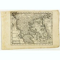
[ Greece ]
Charming wood block map of Greece by the Italian XVIth and XVIIth century writer, humanist and cartographer Giuseppe Rosaccio. Taken from the 1688 Bologna "Teatro de...
Place & Date: Bologna, Antonio Pisarri, 1594 - 1688
Selling price: $300
Sold in 2012
La Morea Ridotta dall Esemplare Antico nella moderna divisone sue Quatto Parti principali . . .
Rossi's map of Morea and neighboring regions. The engraver was Gasparo Pietra Santa.Issued in second edition of Il Mercurio geografico In lower left corner an ornate titt...
Place & Date: Rome, 1688
Selling price: $275
Sold in 2015
Peloponnesus Ad Antiquor . . .
Rossi's map of Peloponnese, based upon Sanson's map, but with revised Italian nomenclature. The engraver was F.D. Messanensis.Issued in Il Mercurio geografico In lower ri...
Place & Date: Rome, 1688
Selling price: $100
Sold in 2015
Le Royaume de Hongrie.. Turquie en Europe.. /.. Partie Meridionale de la Turquie en Europe..
Fine map of Hungary and the European part of Turkey.To the lower left a piece of paper is pasted in and the latitudes and longitudes scales are added in print. With the a...
Place & Date: Paris 1689
Selling price: $240
Sold
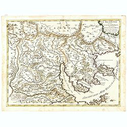
La Macedonia. . . (Northern Greece)
Rossi's map of Northern Greece with Thessaloniki, based upon Sanson's map, but with revised Italian nomenclature. The engraver was Francesco Donia Messis.Issued in a seco...
Place & Date: Rome, 1689
Selling price: $200
Sold in 2016
Graeciae Foederata.
A fine map of Ancient Greece.This edition carries the date 1690.Nicolas Sanson was to bring about the rise of French cartography, although the fierce competition of the D...
Place & Date: Paris, 1690
Selling price: $240
Sold
Graeciae Antiquae.
A fine map of Ancient Greece prepared by Sanson. A later impression of the copper plate as a large crack in the plate is shown.This edition carries the address of Pierre ...
Place & Date: Paris 1690
Selling price: $200
Sold
Exactissima totius Archipelagi nec non Graeciae tabula.
Key map of the Greek Islands, the Aegean, Crete and part of Asia Minor.
Place & Date: Amsterdam, 1690
Selling price: $600
Sold in 2009
Hellas seu Graecia universa.
From the Hornius edition of the atlas of the Ancient World by Janssonius. No text on verso.After J. Laurenbergio / Nicholas Visscher.
Place & Date: Amsterdam, ca 1690
Selling price: $350
Sold in 2012
Attica Megarica.
From the Hornius edition of the Ancient Atlas with Janssonius. No text on verso.Fine copperplate engraving of Attica and the surrounding regions with the cities of Athens...
Place & Date: Amsterdam, ca 1690
Selling price: $120
Sold in 2010
Archipelagi et Graecia Universae.
Centered on Greece. Very decorative title cartouche in the lower left-hand corner.
Place & Date: Amsterdam, 1690
Selling price: $55
Sold in 2016
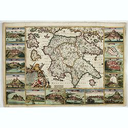
Peloponnesus Hodie Moreae Regnum Distincte Divisum in Omnes suas Provincias . . . Insulae Cefalonia, Zante, Cerigo et St. Maura Acore F. De Wit.
A rare, spectacular map in fine period color of the Peloponnese surrounded by 14 large city, port and fortress views and plans of important Greek cities including Athens,...
Place & Date: Amsterdam, 1690
Selling price: $1350
Sold in 2022
Peloponnesus Hodie Moreae regnum..
A rare, spectacular map of the Peloponnese surrounded by 14 large city, port and fortress views and plans of important Greek cities including Athens, Sparta, Lepanto, Mod...
Place & Date: Amsterdam, 1690
Selling price: $1400
Sold in 2023
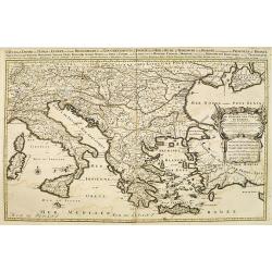
Estats de l'empire des turqs en Europe. . .
Fine map of Greece, Italy, Romania, the Balkan and western part of Turkey. With a decorative title and scale cartouche.Alexis-Hubert Jaillot (1632-1712), was a French car...
Place & Date: Amsterdam, 1692
Selling price: $800
Sold in 2009
Estats / de l' Empire de Turcs / en Europe.
Alexis-Hubert Jaillot (1632-1712), French cartographer. He joined the Sanson heirs and redrew Nicolas Sanson's maps on a larger scale. 'Atlas Nouveau' (1674), sea-atlas '...
Place & Date: Amsterdam, 1696
Selling price: $750
Sold
La Grecia descritta dal P. M. Coronelli Cosmografo della Serenissima Repubblica si Venezia dedicata all'Eccellenza del Signor Giovanni Lando.
Map of Greece and its islands in the Aegean and Adriatic Seas. The remarkable Vincenzo Coronelli (1650-1718), encyclopaedist, geographer, inventor and Doctor of Theology,...
Place & Date: Venice, 1696
Selling price: $300
Sold in 2012
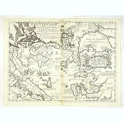
Paralello geo grafico dell'antico col moderno Arcipelago
A beautiful and rare map showing the Marmara Sea or Sea of Marmora (ancient Propontis), inland sea, north-western Turkey, connected to the Black Sea by the Bosporus Strai...
Place & Date: Venice, 1696
Selling price: $780
Sold in 2012
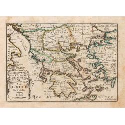
Grece ou Partie Meridionale de la Turquie en Europe..
From El atlas Abbreviado.
Place & Date: Antwerp 1697
Selling price: $45
Sold
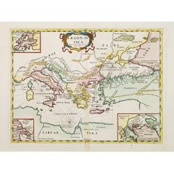
Argonautica.
A very rare map of the Mediterranean Basin, centered on Greece. Decorative title cartouche in the upper part of the map. Three inset maps in upper left-hand corner and lo...
Place & Date: Italy 1697
Selling price: $210
Sold
La Grece.
A map of Greece, from Petit et Nouveau Atlas, engraved by C. Inselin and published by Nicolas de Fer.It is to be noted that this particular atlas is scarcer than the othe...
Place & Date: Paris, 1697
Selling price: $140
Sold in 2014
Epirus Pyrrhi Patria / Novantiqua Epirus quae hodie Albania.
A Sanson map of Greece and Albania published by the Covens and Mortier firm.
Place & Date: Amsterdam, 1700
Selling price: $210
Sold in 2010
Archipelagi Graeciae Sive Maris Aegei Cum Praecipuis Suis Insulis...
A very detailed map of Greece and its islands. Includes also a portion of Turkey and South East Europe. With a table giving the ancient and modern names of all the island...
Place & Date: Munich, ca.1700
Selling price: $150
Sold in 2017
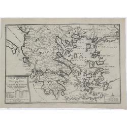
Grece Moderne ou Partie Meridionale de la Turquie en Europe. . .
Small scale, detailed map of Greece, the northern region of Crete, and the eastern coast of Asia Minor by French cartographer Nicholas de Fer.. A bordered title cartouche...
Place & Date: Paris, 1702
Selling price: $52
Sold in 2010
Grece Moderne ou Partie Meridionale de la Turquie en Europe.
A detailed map of the Southern Part of Greece and contiguous Islands. From De Fer's “Atlas Curieux”. Engraved by Van Loon. It comes with a page entitled “Descripti...
Place & Date: Paris, 1705
Selling price: $140
Sold in 2021
Pascaerte Vande Archipel en de Eylanden.. Candia.. Natolia..
This sea chart covers the Mediterranean coast between the Peloponnese, in Greece, and the Turkish coast facing Rhodes.It is centred in the Aegean Islands and shows Crete ...
Place & Date: Amsterdam, 1708
Selling price: $750
Sold
Graecia Sophiani per Abrahamum Ortelium..
A beautifully engraved and richly detailed map of Ancient Greece, after Abraham Ortelius who is given credit in the title. Engraved by J.stemmers.From Galerie Agréable d...
Place & Date: Leiden 1712
Selling price: $300
Sold
La Grece..
Nice small map of Greece, with decorative cartouches.
Place & Date: Paris, 1719
Selling price: $100
Sold
La Grece ou Partie Meridionale de la Turquie d'Europe..
Decorative map of Greece displaying precise engraving and a title cartouche flanked by 2 winged female figures, surmounted by a fan shaped shell.Another cartouche contain...
Place & Date: Paris, 1719
Selling price: $75
Sold in 2022
La Grece ou Partie Meridionale de la Turquie d'Europe. . .
Decorative map of Greece displaying precise engraving and a title cartouche flanked by 2 winged female figures, surmounted by a fan shaped shell.Another cartouche contain...
Place & Date: Paris, 1719
Selling price: $100
Sold in 2017
Fluviorum in Europa principis Danubii cum Adiacentibus..
Map showing the course of the river Danube from Ingolstadt to the Black Sea and the adjacent countries with Italy and Greece.In an inset the course of the river Danube fr...
Place & Date: Nuremberg 1720
Selling price: $220
Sold
Cronologie Historique des Rois & des différens Etats de l'Ancienne Grèce . . .
Showing in top a map of ancient Greece (130 x 115mm.) with vignette views of the City States of Athens, Thebes and Corinth. The surrounding text details the history of Gr...
Place & Date: Amsterdam, 1720
Selling price: $50
Sold in 2022
Theatrum belli sive novissima tabula maxima pars Danubii et Hungaria cum alis regnis Graecia, Morea,Archipielago Insula
Engraved map with original hand coloring showing Greece and eastern part of the Mediterranean.
Place & Date: Augsburg 1720
Selling price: $231
Sold in 2020
Graeciae Septentrionalis Pars.
A very striking map of northern Greece. From Schul-und-Reisen Atlas..
Place & Date: Nuremberg 1725
Selling price: $200
Sold
Graeciae Pars Septentrionalis.
A large and dramatic map by de L'Isle of the northern Greece, the Balkans, and Macedonia. Map extent covers from Dalmatia east to the Black Sea (Pontus Euxinus) and south...
Place & Date: London, 1725
Selling price: $46
Sold in 2018
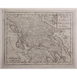
A Map of Epirus, Thessaly and Achaia.
Detailed map of Epirus, Thessaly and Achaia and Peloponnesus in Greece. Cartographer unknown.
Place & Date: ca. 1727
Selling price: $35
Sold in 2020
Turquie en Europe, suivant les nouvelles observations..
Uncommon edition of this map of Greece and eastern Turkey. With decorative title cartouche lower left corner.This example is unusual in having the additional separately e...
Place & Date: Amsterdam 1728
Selling price: $270
Sold
Carte de la Grece contenant l'Etat present de l'Eglise Grecque &..
Handsome chart with a small map of Greece (115 x 150) together with five Greek religious scenes and descriptive French text.
Place & Date: Amsterdam 1728
Selling price: $75
Sold in 2009
Carte de la Grece contenant l'Etat present de l'Eglise Grecque &..
Handsome chart with a small map of Greece (115 x 150mm.) together with five Greek religious scenes and descriptive French text.
Place & Date: Amsterdam, 1728
Selling price: $220
Sold in 2010
Carte historique et géographique de l'ancienne Grece . . .
A map of Greece during the Roman Empire, with descriptive French text, from Chatelain's monumental 7 volume Atlas Historique. In upper right margin: 'N°6.Henri Abraham C...
Place & Date: Amsterdam, 1728
Selling price: $65
Sold in 2022
Carte historique chronologique et géographique de l'empire Grec . . .
Interesting sheet with a map of the Roman Empire, with descriptive French text, from Chatelain's monumental 7 volume Atlas Historique.Henri Abraham Chatelain (1684 – 17...
Place & Date: Amsterdam, 1728
Selling price: $50
Sold in 2021
Carte de la Grece contenant l'Etat present de l'Eglise Grecque &. . .
Handsome chart with a small map of Greece (115 x 150mm.) together with five Greek religious scenes and descriptive French text.Zacharie Chatelain (d.1723) was the father ...
Place & Date: Amsterdam, 1728
Selling price: $55
Sold in 2020
Carte pour la Route de Xerxes dans la Grece et Pour l'Expedition du Jeune Cyprus et la Retraite des Dix Mille.
A striking map of Greece. The map for the Route of Xerxes in Greece and For the Expedition of the Young Cyprus, and the Retreat of the Ten Thousand. It is from “METHODE...
Place & Date: Paris, 1729
Selling price: $115
Sold in 2020
Empire et Conquetes d'Allexandre.
A striking map of Greece during the time of 'Alexander the Great,' showing his conquests. It is from “METHODE POUR ETUDIER L’HISTOIRE” by L’Abbe Lenglet du Fresno...
Place & Date: Paris, 1729
Selling price: $25
Sold in 2019
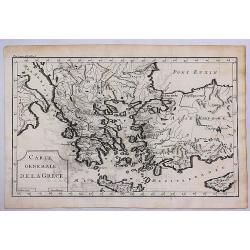
Carte Generale de la Grece.
A striking map of Greece. It is from METHODE POUR ETUDIER L’HISTOIRE by L’Abbe Lenglet du Fresnoy, published in Paris in 1729. The map is quite rare and is not now, n...
Place & Date: Paris, 1729
Selling price: $40
Sold in 2017
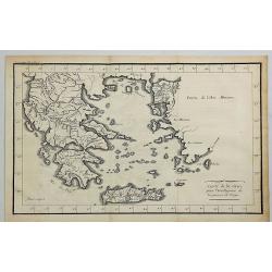
Carte de la Grece pour L'intelleigence de la Guerre de Troye.
A striking map of Greece shown at the time of the war of Troy from the “METHODE POUR ETUDIER L’HISTOIRE” by L’Abbe Lenglet du Fresnoy, published in Paris in 1729....
Place & Date: Paris, 1729
Selling price: $125
Sold in 2020
Carte de la Grece.
A striking, large map detailing Greece, the western part of Turkey and extending to show Albania, Macedonia and part of Cyprus. Latin title at top "Accurata Totius A...
Place & Date: Amsterdam, 1730
Selling price: $220
Sold in 2008
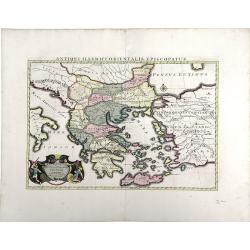
Antiquorum Illyrici Orientalis ...
Fine map of ancient Greece, Crete and Turkey by Sanson and published by the Covens and Mortier firm. Shows many ancient Greek cities and sites, such as Nicropolis, Athens...
Place & Date: Amsterdam, 1730
Selling price: $135
Sold in 2010
Hellas siue Graecia Propria.
A pleasant map of Southern Greece, portraying the ancient geography and cities, including the Pelopenesos, Athens, Corinth, Thebes, Argos, Mycenae and Sparta. With decora...
Place & Date: Leipzig, 1731
Selling price: $27
Sold in 2018
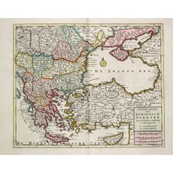
Nieuwe Kaart van Europisch Turkyen.
Izaak Tirion (d. 1769) Amsterdam publisher. His ' Nieuwe en beknopte handatlas' saw 6 editions between before 1740 and after 1784. Also ' Tegenwoordige staat van alle vol...
Place & Date: Amsterdam, 1733
Selling price: $275
Sold
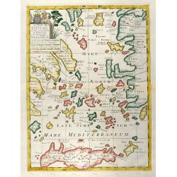
A New Map of the Islands of the Aegaean Sea, together with the Island of Crete, and the Adjoining Isles
Decorative colored map of the Aegean Sea with Crete and the western part of Turkey. From "A New Sett of Maps both of Antient and Present Geography" by Edward W...
Place & Date: London, 1738
Selling price: $650
Sold in 2009
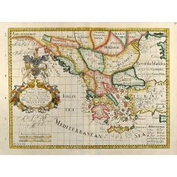
A New Map of Turky in Europe, And Parts of adjoyning
Decorative colored map of Greece, the Balkans and the Western part of Turkey. From "A New Sett of Maps both of Antient and Present Geography" by Edward Wells a...
Place & Date: London, 1738
Selling price: $300
Sold in 2009
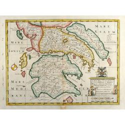
A New Map of the So. & Mid Parts of Antient Greece viz. Epirus, Hellas, or Graecia Propria, and Peloponnesus, together with Adjoyning Islands
Decorative colored map of the Peloponnese (Morea) in Greece. From "A New Sett of Maps both of Antient and Present Geography" by Edward Wells an English clergym...
Place & Date: London, 1738
Selling price: $320
Sold in 2010
Imperii Turcici Europaei Terra, in primis Graecia. . .
An unusual map showing the Turkish Empire, extending from Corsica and Sardinia in the west, to Asia Minor, Cyprus and the Black Sea in the east. Parts of North Africa als...
Place & Date: Nuremberg, 1740
Selling price: $205
Sold in 2017
Imperii Turcici Europaei Terra, in primis Graecia. . .
An unusual map showing the Turkish Empire, extending from Corsica and Sardinia in the west, to Asia Minor, Cyprus and the Black Sea in the east. Parts of North Africa als...
Place & Date: Nuremberg, 1740
Selling price: $175
Sold in 2020

![[Lot of 3 maps] Candia olim Creta.](/uploads/cache/IMG_9432-250x250.jpeg)








![[ Greece ]](/uploads/cache/30319-250x250.jpg)


