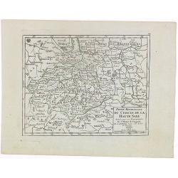
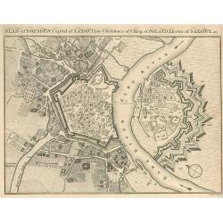
Plan of Dresden, Capital of Saxony.
Small plan of Dresden.
Place & Date: 1780
Selling price: $10
Sold in 2010
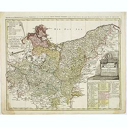
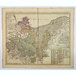
Der Nordliche Theil des Obersachsischen Kreises oder die Mark Brandenburg und das Herzogthum Pommern
Detailed map of Northern Germany, including Pomerania, Rugen, Brandenburg, etc. Centered on Berlin and the Oder River, it shows towns, roads, rivers, lakes, mountains, is...
Place & Date: Nuremberg, 1780
Selling price: $210
Sold in 2012
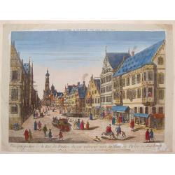
Vue Perspective de la Rue des Peintres du Cote Inferieur Vers la Tour de Perlac à Augsbourg.
A striking copper engraved print of the streets of Augsbourg, printed in Paris by Jacques Chereau. "Vue’D’Optique" optical view prints are views used in a ...
Place & Date: Paris, 1780
Selling price: $125
Sold in 2013
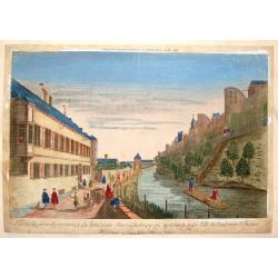
Vue de la Partie Septentrionale du Fosse et des Murs D'Ausbourg Qui Separent la Basse Ville du Faubourg St. Jacques.
A striking copper engraved print of the river separating Augsburg, Germany from Faubourg, printed in Paris by Basset."Vue’D’Optique" optical view prints are...
Place & Date: Paris, 1780
Selling price: $18
Sold in 2016
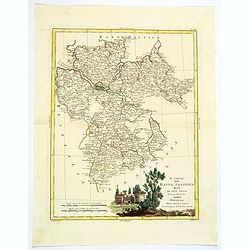
Il Circolo della Bassa Sassonia divisio ne Suoi Stati. . .
An attractive map of Lower Saxony by Antonio Zatta, from the Atlante Novissimo atlas. The map is engraved with great care and skill, and is embellished with a lovely larg...
Place & Date: Venice, 1780
Selling price: $12
Sold in 2021
Vue Perspective de L'Entrée du Parc du Prince de Manheim en Allemagne.
A perspective view of the Royal Park in Manheim by Basset, a well-known publisher of optical prints, established in rue St.Jacques in Paris. In the eighteenth and ninetee...
Place & Date: Paris, 1780
Selling price: $3
Sold in 2023
Der nordliche Theil des Obersachsischen Kreises oder die Mark Brandenburg und das Herzogthum Pommern.
A detailed map of the upper Saxon circle with Brandenbourg, Pommern, in Germany. Complete with a table of notes and explanations, and a scroll cartouche containing the me...
Place & Date: Nuremberg, ca 1780
Selling price: $15
Sold in 2021
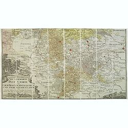
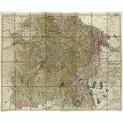
Das Herzogthum Ober und Nieder Baiern in seine Aemter oder Gerichter eingetheilt, nebst allen darinn liegenden und angrænzenden Lændern / Neu in 4 Blatt herausgegeben von Gebrüder Lotter in Augsburg
Folding map of The Duchy of Upper and Lower Bavaria. Including Regensburg, München, Salzburg in Austria. In very attractive colors.More about folding maps. [+]
Place & Date: Augsburg, 1780
Selling price: $375
Sold in 2021
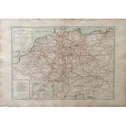
L\'Empire d\'Allemagne divise en fes principaux Etats, ou font exactement remarquees Toutes Les Routes des Postes et Chariots de Poste de L\'Empire
A fine map of the German empire of north and central Europe, showing the areas of northwestern France, Belgium, Netherlands, northern Italy, Switzerland, Luxembourg, Aust...
Place & Date: Paris, 1782
Selling price: $26
Sold in 2010
An Accurate Prospect of Vienna, the Capital of Germany.
A fine city view of Vienna, when it was the capital of Germany, not Austria. It is from "Millar's New Complete Universal System of Geography" published in Londo...
Place & Date: London, 1782
Selling price: $75
Sold in 2018
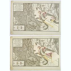
Baitaille d'Altenheim dans l'Ortnau donnee le 1st Aoust 1675. . .
A copperplate folding battle plan of Altenheim, on the east side of the river Rhine. With three pastedown overlays demonstrating the different positions of the French and...
Place & Date: Paris, 1782
Selling price: $10
Sold in 2021
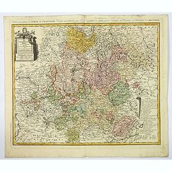
Der Fraenkische Kreis. . .
An attractive large map showing the Frankish Circle in Germany, centered on Bamberg. Each area is highlighted in a different color. With a nice title cartouche, with mile...
Place & Date: Nuremberg, 1782
Selling price: $125
Sold in 2019
Carte Topographque D'Allemagne / Contenant un reste de Pomeranie et a Partie de la Pologne Prussiene . . .
A large-scale map of Germany and northern Poland, published by the German Military cartographer Johann Wilhelm Abraham Jaeger, from his Grand Atlas d'Allemagne.This map i...
Place & Date: Frankfurt, 1782
Selling price: $22
Sold in 2021
L\' Alemagne Divisée par Cercles.
Jean Lattré, Paris-based engraver and publisher. Worked with Robert de Vaugondy, J. Janvier and R. Bonne. " Atlas Monderne', 1771, 1783 , 1793. Giovanni Antonio Riz...
Place & Date: Paris, 1783
Selling price: $150
Sold in 2009
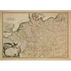
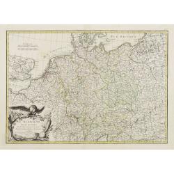
L'Allemagne Divisée par Cercles..
General map of central Europe, centered on Germany but including Poland, Belgium, the Netherlands, Switzerland, Austria and part of eastern Europe.Ornated with a decorati...
Place & Date: Paris, ca 1783
Selling price: $55
Sold in 2016
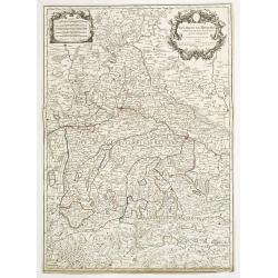
Le cercle de Baviere. . .
Fine map of Bavaria with a decorative title and scale cartouche. Including the towns of Regensburg, Passau, etc.Alexis-Hubert Jaillot (1632-1712), was a French cartograph...
Place & Date: Paris, 1783
Selling price: $50
Sold in 2012
Carte de L'Empire D'Alemagne Avec Les Etats de Boheme Dressee.
Striking map featuring south western Germany, Luxemburg and part of Austria. Lovely cartouche with double headed crowned eagle with sword, musical instruments, canon &am...
Place & Date: Paris, c1783
Selling price: $60
Sold in 2019
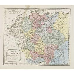
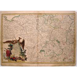
[Set of 3 maps] L'Allemagne divisée par cercles . . . / Carte de l'Empire d'Allemagne . . . / No title map.
[Set of 3 maps] L'Allemagne divisée par cercles . . . / Carte de l'Empire d'Allemagne . . . / No title map.
Place & Date: Paris, Lattré, 1783
Selling price: $28
Sold in 2019
Der Sudliche Theil des Ober-Saechsischen Kreises.
A fine antique map of the southern part of Berlin & Upper-Saxony extending from Hildesheim and Küstrin in the north to Schweinfurth, Leitmeritz and Lauban in the sou...
Place & Date: Nuremberg, 1783
Selling price: $160
Sold in 2020
Cercle de Westphalie divisé en tous ses Etats et Souverainetés.
Finely and crisply engraved map of central Germany, including the river Rhine from Deventer till Bonn, with Dusseldorf. In upper left , inset of the area of Emden until O...
Place & Date: Venice, 1776 - 1784
Selling price: $50
Sold in 2016
Le cercle De Baviere.. et la prevoté de Berchtolsgaden.
Finely and crisply engraved map centered on Regensburg, including some great skiing resort areas of Austria and part of Germany, centered on Passau, Ingollstat, Salzburg....
Place & Date: Venice, 1776 - 1784
Selling price: $25
Sold in 2021
L'Empire d'Allemagne. . .
Detailed map encompassing Germany, the Netherlands, Belgium, Austria, and part of Poland. With ornamental title cartouche and noteworthy topographical detail.The map was ...
Place & Date: Venice, 1776 - 1784
Selling price: $25
Sold in 2017
Cercle de Souabe.. les enclaves de la Maison d'Autriche.
Finely and crisply engraved map of western part of Austria.Venetian edition of Giles Didier Robert De Vaugondy's map from Atlas Universel printed in 1776-84.Ornamental ti...
Place & Date: Venice, 1776 - 1784
Selling price: $50
Sold in 2016
Partie saptentrionale du cercle de Haute Saxe.. Brandebourg.
Finely and crisply engraved map of north eastern part of Germany, including inset map of Brandenburg.Venetian edition of Giles Didier Robert De Vaugondy's map from Atlas ...
Place & Date: Venice, 1776 - 1784
Selling price: $50
Sold in 2015
Plan von der fürstlich. sæchsischen Residenz Stadt Weimar. Nürnberg, Homænnischen Erben, 1784.
Very rare town-plan of Weimar, capital of the Duchy of Saxe-Weimar, prepared in 1782 by Franz Ludwig Güssefeld, German engineer and cartographer.In the left part a key (...
Place & Date: Nuremberg, 1784
Selling price: $500
Sold in 2018
L'Allemagne dressée sur les observations..
Map of Germany, Low Countries, Poland, Switzerland, Northern Italy. Prepared by G.De L'Isle after observations by Kepler and Tycho Brahe.Engraved by Jean Batiste Liébaux...
Place & Date: Paris, 1785
Selling price: $50
Sold in 2016
Kaart van Duitschland
Willem Albert Bachiene (1712-1783), Dutch geographer in Maastricht. Most important work ' Heilige Geographie', a work on the Holy Land. Mathijs Schalenkamp published in 1...
Place & Date: Amsterdam, 1785
Selling price: $23
Sold in 2013
Kaart der Noord-westelijke deelen van Duitschland.
Willem Albert Bachiene (1712-1783), Dutch geographer in Maastricht. Most important work ' Heilige Geographie', a work on the Holy Land. Mathijs Schalenkamp published in 1...
Place & Date: Amsterdam, 1785
Selling price: $75
Sold in 2013
Neue und vollstaendige Postkarte durch ganz Deutschland. . . Carte des postes d'Allemagne partie du sud ouest. . .
The lower left part of a four sheet post road mapspost route map of Germany. Map showing the cities of Lyon, Chambery, Auxerre, Troyes, Luneville, Strasbourg, Basle, Bern...
Place & Date: Nuremberg, 1786
Selling price: $30
Sold in 2017
L'Allemagnedivissee par Cercles avec les Etats de Boheme et la Suisse.
A detailed map of the German states. Austria and Switzerland with Belgium part of Austria and Silesia as part of Prussia.
Place & Date: Paris, 1786
Selling price: $15
Sold in 2016
Der Ober Rheinische Kreis.
An antique map of The Oberrheinische Circle (Upper Rhine Germany Alsace France) the Holy Roman Empire with an inlaid map of Alsace, France, by F.L. Guessfeld (1744-1807, ...
Place & Date: Nuremberg, 1786
Selling price: $40
Sold in 2017
Nouvelle carte des postes d'Allemagne et des provinces limitrophes. . . Carte des postes d'Allemagne partie du nord est.
Upper left sheet of an important post route map of the Roman Empire with a dedication to Charles Anselme, prince de la Tour et Taxis (1733-1805). His section showing the ...
Place & Date: Nuremberg, 1786
Selling price: $45
Sold in 2017
Plan de Wurtzburg résidence du prince évêque duc de Franconie.
Decorative plan of the fortified town of Wurzburg in Bavaria, adorned with a cartouche of 34 legends, topped with the coat of arms of the Prince-Bishop of Wurzburg and Du...
Place & Date: Paris, 1786
Selling price: $250
Sold in 2019
Chorographie du Cercle de Souabe d\'apres Vischer, Homan & Hubner.
Map of south-east Germany with two fancy floral Renaissance cartouches. It was published in "Atlas Universal" in 1787. The engraver was Moithey. Étienne Andr...
Place & Date: Paris, 1787
Selling price: $100
Sold in 2013
A New Map of Germany and Its Neighbouring States.
Large, detailed map of Germany and portions of Poland, Hungary, Denmark and Italy. It was originally published by the Royal Academy of Berlin. William Faden (1750 - 1836...
Place & Date: London, c1788
Selling price: $109
Sold in 2014
Der Rhein Die Maass und Mosel mit den anliegenden Landern des Ober-Chur und Neider-Rhein. . .
A fine, detailed Johann Baptist Homann's map of the Maass and Moselle areas of the Rhine with the adjoining lands of the Upper Chur and the Neider-Rhine. This map feature...
Place & Date: Nuremberg, 1788
Selling price: $31
Sold in 2018
Charte das Erzstift u. Churfürstenthum Trier. . .
Centered on Trier. Prepared by F.L.Güssefeld. °
Place & Date: Nuremberg, 1789
Selling price: $2
Sold in 2011
Les Duches de Cleves de Juliers, de Limbourg.
Striking large copper engraved map featuring Rhineland Germany and the Netherlands. Very decorative, large, figural cartouche. Detailed presentation of cities, towns, riv...
Place & Date: Paris, 1789
Selling price: $47
Sold in 2016
Der Chur Rheinische oder Neider Rheinische Kreis.
Fine detailed 1789 Homann Heir’s map of the lower Rhine circle with the electorates of Mainz, Trier and Cologne. Features a garland style title cartouche. Johann Bapt...
Place & Date: Nuremberg, 1789
Selling price: $15
Sold in 2020
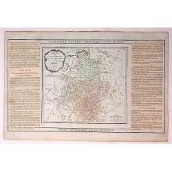
L'Alemagne Divisee en Tous ses Cercles...
An attractive and informative map of Germany by French cartographer, Louis Brion de la Tour. It notes numerous towns, cities, rivers, forests, mountains and other topogra...
Place & Date: Paris, 1790
Selling price: $11
Sold in 2018
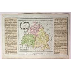
Cercles de Baviere de Franconie et de Souabe...
An attractive and informative map of France by French cartographer, Louis Brion de la Tour. It notes numerous towns, cities, rivers, forests, mountains and other topograp...
Place & Date: Paris, 1790
Selling price: $10
Sold in 2018
Cercles de Westphalie Haut et Bas Rhin Divises en Toutes Leurs Principautes et Provinces...
An attractive and informative map of Westphalia by French cartographer, Louis Brion de la Tour. It notes numerous towns, cities, rivers, forests, mountains and other topo...
Place & Date: Paris, 1790
Selling price: $18
Sold in 2019
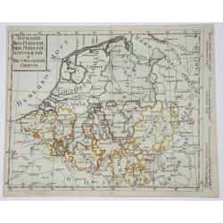
West Germany & Belgium, Luxemburg.
Copperplate russian map of West Germany & Belgium, Luxemburg. with original outline coloring.
Place & Date: St. Petersburg, 1790
Selling price: $140
Sold in 2017
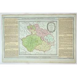
Etats de Boheme Divisee en Toutes Leurs Provinces...
An attractive and informative map of the Bohemian part of Germany by French cartographer, Louis Brion de la Tour. It notes numerous towns, cities, rivers, forests, mounta...
Place & Date: Paris, 1790
Selling price: $12
Sold in 2019
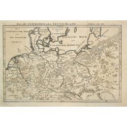
Das alte Germanien oder Teutschland.
From 'Algemeine Welthistorie (der Neuern Zeiten)', edited by S.J.Baumgarten, J.S.Semler a.o.A map of ancient Germany.
Place & Date: Halle, 1763-1792
Selling price: $80
Sold in 2010
Prussia.
Uncommon miniature map from Gibson's "Atlas Minimus, or a New Set of Pocket Maps of the several Empires, Kingdoms and States of the known World".
Place & Date: London, 1792
Selling price: $80
Sold in 2011
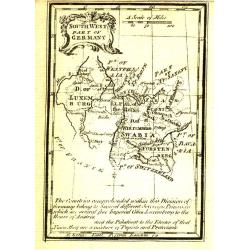
South West Part of Germany.
Uncommon miniature map from Gibson's "Atlas Minimus, or a New Set of Pocket Maps of the several Empires, Kingdoms and States of the known World".
Place & Date: London, 1792
Selling price: $35
Sold
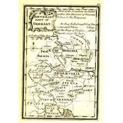
South East Part of Germany.
Uncommon miniature map from Gibson's "Atlas Minimus, or a New Set of Pocket Maps of the several Empires, Kingdoms and States of the known World".
Place & Date: London, 1792
Selling price: $35
Sold
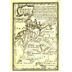
Germany divided into Circles.
Uncommon miniature map from Gibson's "Atlas Minimus, or a New Set of Pocket Maps of the several Empires, Kingdoms and States of the known World".
Place & Date: London, 1792
Selling price: $35
Sold
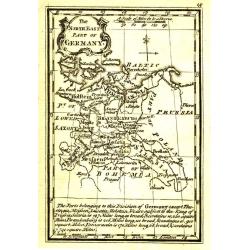
The NorthEast Part of Germany.
Uncommon miniature map from Gibson's "Atlas Minimus, or a New Set of Pocket Maps of the several Empires, Kingdoms and States of the known World".
Place & Date: London, 1792
Selling price: $35
Sold
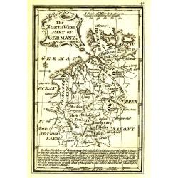
The NorthWest Part of Germany.
Uncommon miniature map from Gibson's "Atlas Minimus, or a New Set of Pocket Maps of the several Empires, Kingdoms and States of the known World".
Place & Date: London, 1792
Selling price: $35
Sold
Parte Meridionale del Circolo Dell' Alta Sassonia ....
The Southern Part of the Circle of Upper Saxony with Lusatia etc. The map comes from the rare geographical atlas that was published in Siena by Pazzini Carli between 1798...
Place & Date: Siena, 1794
Selling price: $121
Sold in 2016
Neue post karte von teutschland.
Uncommon post road maps and commercial roads of Germany, the Low Countries, Poland, Switzerland, Austria and Northern Italy, published by the well-known map makers and ma...
Place & Date: Frankfurt am Main, 1795
Selling price: $50
Sold in 2013
Neu vermehrte post charte der chur Braunschweigischen und angrenzenden lande. . . Von Friedrich Wilhelm Ohsen, ... privatim entworfen im Jahre 1774, verbessert 1777 und 1797.
post road maps map of North-Western Germany, centered on Braunsschweig, including Schaumburg, Grafsch, Lune, Brandenburg.Prepared by Friederich Wilhelm Ohsen in 1774 and ...
Place & Date: Hannover, 1797
Selling price: $100
Sold in 2011
Present Germany.
A fully colored map of (the then) Germany from An Universal Atlas Consisting of a Complete Set of Maps, peculiarly adapted to illustrate and explain ancient and modern ge...
Place & Date: London, 1797
Selling price: $20
Sold in 2021
Kriegs Theater der teutschen und franzoesischen Graenzlanden zwischen dem Rhein und der Mosel, im Jahr 1796 : drittes Blatt.
Very detailed map of Pfalz from a six-sheet map prepared by Peter Dewarat, with a dedication by Johann Ludwig Christian Rheinwald, (1763 - 1811) who was a lawyer and hist...
Place & Date: D. Artaria, Mannheim, 1795-1799
Selling price: $50
Sold in 2013
Kriegs Theater der teutschen und franzoesischen Graenzlanden swischen dem Rhein und der Mosel, im Jahr 1797 : viertes Blatt.
Very detailed map of Pfalz from a six-sheet map prepared by Peter Dewarat, with a dedication by Johann Ludwig Christian Rheinwald, (1763 - 1811) who was a lawyer and hist...
Place & Date: D. Artaria, Mannheim, 1794-1799
Selling price: $50
Sold in 2013
A New Map of the Circles of the Upper and Lower Rhine
A detailed, hand-colored antique map by the prominent English cartographer John Cary in London in 1799, covering an area from Westphalia and Lower Saxony in the north to ...
Place & Date: London, 1799
Selling price: $21
Sold in 2019
Der Schwaebische Nebst den Oesterreichischen Besizungen in Schwaben.
A fine detailed map of Swabia in southern Germany with small inset map of the Principality of Lichtenstein. Also includes parts of Austria and Switzerland. By Johann Walc...
Place & Date: Augsburg, 1799
Selling price: $15
Sold in 2016
Cercle de Franconie divisé en ses princip.ux Etats.
Small detailed map of the northern part of Bavaria. From Atlas Portatif Universel, by Robert de Vaugondy.Edited by : "Au dépôt de Géographie, Rue Geoffroy Langevi...
Place & Date: Paris, 1799
Selling price: $15
Sold in 2019
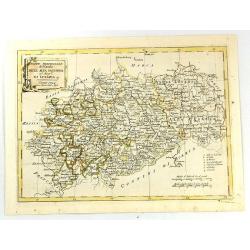
Partie Meridionale du Cercle de la Haute Saxe..
Small detailed map of part of Germany, approximatively corresponding to the today states of Thüringen, Saxony and Saxony-Anhalt.Showing Berlin in the upper part. From At...
Place & Date: Paris, 1799
Selling price: $15
Sold in 2020
Kriegs Theater der teutschen und franzoesischen Graenzlanden swischen dem Rhein und der Mosel, im Jahr 1797 : viertes Blatt.
Very detailed map of Pfalz from a six-sheet map prepared by Peter Dewarat, with a dedication by Johann Ludwig Christian Rheinwald, (1763 - 1811) who was a lawyer and hist...
Place & Date: D. Artaria, Mannheim, 1794-1799
Selling price: $50
Sold in 2020
Kriegs Theater der teutschen und franzoesischen Graenzlanden swischen dem Rhein und der Mosel, im Jahr 1796 : drittes Blatt.
Very detailed map of Pfalz from a six-sheet map prepared by Peter Dewarat, with a dedication by Johann Ludwig Christian Rheinwald, (1763 - 1811) who was a lawyer and hist...
Place & Date: D. Artaria, Mannheim, 1794-1799
Selling price: $50
Sold in 2019
Kriegs Theater der teutschen und franzoesischen Graenzlanden swischen dem Rhein und der Mosel, im Jahr 1796 : zweites Blatt.
Very detailed map of Pfalz with Mainz from a six-sheet map prepared by Peter Dewarat, with a dedication by Johann Ludwig Christian Rheinwald, (1763 - 1811) who was a lawy...
Place & Date: D. Artaria, Mannheim, 1794-1799
Selling price: $50
Sold in 2019
Kriegs Theater der teutschen und franzoesischen Graenzlanden swischen dem Rhein und der Mosel, im Jahr 1796 : erstes Blatt.
Very detailed map of Pfalz from a six-sheet map prepared by Peter Dewarat, with a dedication by Johann Ludwig Christian Rheinwald, (1763 - 1811) who was a lawyer and hist...
Place & Date: D. Artaria, Mannheim, 1794-1799
Selling price: $50
Sold in 2019
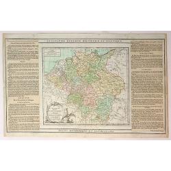
L'Allemagne.
A map of Germany of French origin, published in the late eighteenth or early nineteenth centuries, has informative and interesting text panels on either side. The map con...
Place & Date: Paris, ca 1800
Selling price: $20
Sold in 2021
Neuest Post Karte von Deutschland und dessen angrenzenden Ländern. . .
A uncommon post road mapspost route map of Germany, Poland, Austria, Switzerland and the Low countries. Highly detailed map, showing post offices with the intermediate di...
Place & Date: Berlin, 1801
Selling price: $80
Sold in 2013
Karte von Ost-Preussen Nebst Presussisch Litthauen und West-Preussen Nebst dem Netzdistrict.
Title section of this important multi sheet map of Prussia, Lithuania and Poland, showing territories of present Lithuania. With a medailon representing the King of Pruss...
Place & Date: Berlin, 1802
Selling price: $11
Sold in 2018
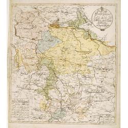
Northern part of Germany.
Very rare Ottoman printed map of northern part of Germany, including Hamburg, Bremen, Hanover, etc., from Jedid Atlas Tercümesi or New Atlas , printed 1218 H. or 1803 in...
Place & Date: Üsküdar, 1803
Selling price: $600
Sold
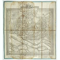
Hamburg.
Plan of the city of Hamburg, drawn up and published by C.L.B. Mirbeck in London, engraved by B. Baker.
Place & Date: London, 1803
Selling price: $36
Sold in 2022
A Map of the Dutchy of Holstein with the Territories of the Imperial Towns Hamburg and Lübek, Also the Bishoprick of Eutin...
A Map of the Dutchy of Holstein with the Territories of the Imperial Towns Hamburg and Lübek also the Bishoprick of Eutin…A pleasing map of the Duchy of Holstein, with...
Place & Date: London, 1804
Selling price: $35
Sold in 2016
Neu vermehrte post charte der chur Braunschweigischen und angrenzenden lande. . . Von Friedrich Wilhelm Ohsen, ... privatim entworfen im Jahre 1774, verbessert 1805.
Unfortunately only the lower half of a post road maps map of North-Western Germany, centered on Braunsschweig.Prepared by Friederich Wilhelm Ohsen in 1774 and updated for...
Place & Date: Hannover, 1774 - 1805
Selling price: $50
Sold in 2018
Germany Exhibiting the Present Seat of War, 1805.
A detailed map of Europe, highlighting the position of the war in and around Germany as at 1805. It covers and area from Denmark in the north Turkey in the south, from Fr...
Place & Date: Germany, 1805
Selling price: $69
Sold in 2017
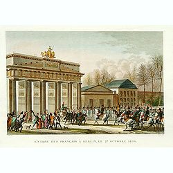
Entrée des Français à Berlin, le 27 Octobre 1806.
Engraving representing Napoleon and his troops in front of the Brandenburg Door.
Place & Date: Paris, ca. 1806
Selling price: $100
Sold in 2008
Haut et Bas Rhin Franconie Souabe.
Map of High and Low Rhine Franconie Souabe. By Robert de Vaugondy, Geographer.
Place & Date: Paris, 1794 - 1806
Selling price: $5
Sold in 2022
Karte vom Herzogthum Schleswig, nach der von der Gesellschaft der Wissenschaften in Kopenhagen bekannt gewordenen Ortsbestimmung und nach Special-Karten. Kolor. Kupferstichkarte von F. v. Golowin. Schleswig, Röhss u. Christiani, 1806.
Von Golowin was a Lieutenant in the "Schleswigschen Infanterie-Regiment" and appointed cartographer to the King. The first edition of this road map was publishe...
Place & Date: Schleswig, Röhfs und Christiani, 1806
Selling price: $175
Sold in 2010
Empire d'Allemagne. . .
Map of the German Empire. By C. F. Delamarche, successor of Robert de Vaugondy, Geographer.
Place & Date: Paris, 1794 – 1806
Selling price: $3
Sold in 2022
Der Englische Garten Bey München.
A northwest oriented plan of Der Englische Garten ( the English Garden) drawn by von Rickhauer in 1806 and engraved by J. Carl Schleich.The title in decorative lettering ...
Place & Date: Topogr. Bureau, Munich 1806
Selling price: $500
Sold in 2017
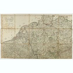
Cartes des Postes d'Allemagne et pays limitrophes. . .
Upper left part of a large detailed post road mapspost route map of Germany. Centered on Bielefeld and showing the cities of Hamburg, Coblenz. And Belgium, The Netherland...
Place & Date: Trieste, 1806
Selling price: $55
Sold in 2018
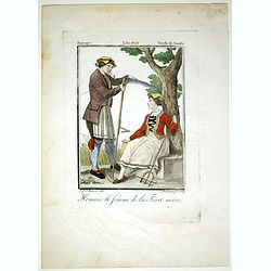
Home & Femme de la Foret noire.
Originally hand-colored mezzotint from 'Costumes civils actuels de tous les peuples connus'. Engraved by Lachaussée Jeune after Jacques Grasset de Saint-Sauveur.As an et...
Place & Date: Paris,1806
Selling price: $30
Sold in 2017



![[Set of 3 maps] L'Allemagne divisée par cercles . . . / Carte de l'Empire d'Allemagne . . . / No title map.](/uploads/cache/43025-250x250.jpg)
