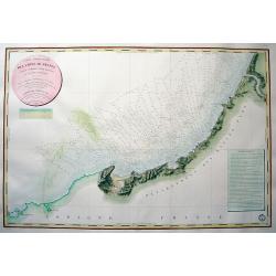
CARTE DES CÔTES DE FRANCE PARTIE COMPRISE ENTRE BAYONNE ET LA CÒTE D'ESPAGNE...
Highly decorative and scarce large-scale engraved seachart of the French and Spanish region at the Bay of Biscay / Coasts of Cantabria. Drawn by Besancon, engraved by Mic...
Place & Date: Paris, 1829
Selling price: $375
Sold in 2010
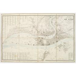
Plan de la Ville de Lyon, et ses environs, réduit d'apres les meilleurs levés, corrigé, augmenté et gravé d'après des plans particuliers et des reconoissances faites sur les lieux.
With the title at upper right, an alphabetical street index at upper left, an index of other features at lower left and right, and a scale of metres at lower right, the r...
Place & Date: Lyon, chez Midan libraire, 1830
Selling price: $200
Sold
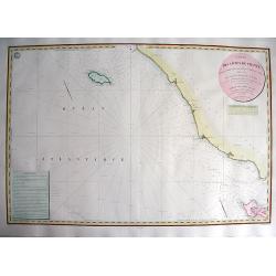
CARTE DES CÔTES DE FRANCE PARTIE COMPRISE ENTRE L'ILE D'YEU ET LA POINTE DES BALEINES
Highly decorative and very rare large-scale engraved seachart of the French coast from Ile de Ré until Ile d'Yeu, engraved by Collin. Includes Jard, Les Sables D'Olonne,...
Place & Date: Paris, 1832
Selling price: $290
Sold in 2010
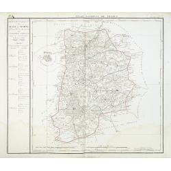
Departement de Seine et Marne. . .
Map centred of Rosoy and Fontainebleau. Borders of the district are colored. Map showing the city Nemours, Melun, Meaux, etc. In the left margin a cartouche with the list...
Place & Date: Paris, 1832
Selling price: $60
Sold
[Title page] Nouvelle géographie et statistique de la France, Alger et la Belgique.
Frontispiece with map of France with two sheets showing a mail exchanges between Henry and the rector, the prefect and the ministry of the public institution, plus a desc...
Place & Date: Paris, 1834
Selling price: $50
Sold in 2020
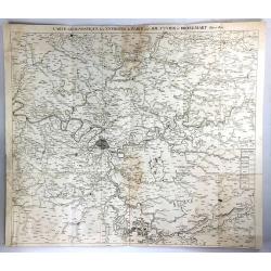
Carte Geognostique des Environs de Paris
A large detailed map from "Memoires de la Classe des Sciences Mathematiques et Physiques de l`Institut Imperial de France", by Cuvier & Brongniart, publishe...
Place & Date: Paris, 1835
Selling price: $21
Sold in 2016
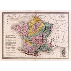
Carte physique et minéralogique de la France.
Thematical map of France with inset map of Corsica and Paris.From Malte-Brun's Atlas Géographie Universelle.."., revised by Jean Jacques Nicolas Huot.This...
Place & Date: Paris 1837
Selling price: $20
Sold
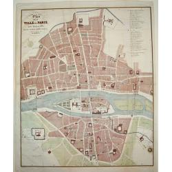
Plan de la Ville de Paris, sous Phillipe de Bel...
An uncommon, large scale, decorative early 19th century plan of Paris. The work was commissioned by architect Albert Lenoir. Important buildings are highlighted and stree...
Place & Date: Paris, 1837
Selling price: $425
Sold
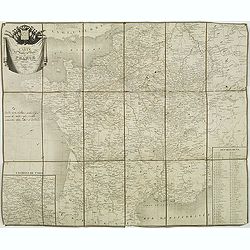
Carte des routes de poste de France dressée par Tardieu Graveur 1838.
This post road maps map of France is showing incredible detail of the postal roads, stations (or "stages"), and the distances from town to town. Lower left an i...
Place & Date: Paris, 1838
Selling price: $90
Sold
The Kingdom of France describing the New Limits according to the Treaty of Paris.
A large, beautifully detailed, and colorful map of France divided into 86 departments, with Corsica as an inset. No cartouche but very decorative calligraphy in the title...
Place & Date: London, 1838
Selling price: $16
Sold in 2016
Château de Rustephan. (Bretagne).
A view of the ruin of Rustephan Castle. Made "after nature" by Serda in 1837.
Place & Date: Paris, ca. 1840
Selling price: $20
Sold in 2009
Eglise et cimetière a St. Marc. (Bretagne).
A view of the cemetery of St. Marc in Bretagne. Made "after nature" by Serda in 1837. Lithographed by Vulleneuve.
Place & Date: Paris, ca. 1840
Selling price: $20
Sold in 2009
Vue de Monaco du côté du nord . . .
Extremely rare lithographed view of Monaco seen from the north side, lithographed by Jean Baptiste François Bosio, born June 17, 1764 in Monaco, and died July 6, 1827 in...
Place & Date: Monaco, 1841
Selling price: $1000
Sold
Western & Eastern Division Of Paris.
A detailed map of the French capital. Below it are 21 outlined perspectives of the iconic and important buildings and monuments within the city. Western and Eastern Quart...
Place & Date: London, 1842
Selling price: $65
Sold in 2018
Carte des routes de poste de France dressée par ordre de Mr Conte, Conseiler d'Etat Directeur de l'administration et Président du conseil des Postes.
This post road maps map of France is showing incredible detail of the postal roads, stations (or "stages"), and the distances from town to town. Lower right, a ...
Place & Date: Paris, 1843
Selling price: $180
Sold
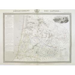
Département des Landes.
Detailed map of the Landes, with Bayonne in lower left corner. A panoramic view of Mont-de-Marsan upper right.. Text column of a detailed description of the geography, hi...
Place & Date: Paris, 1844
Selling price: $120
Sold
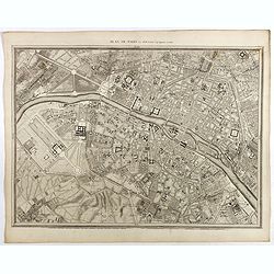
Plan de Paris Par Roussel Caqpt. Ingénieur en 1700.
Plan of the center of Paris by Claude Roussel (1655-172.?). here in a later reprint from around 1844.
Place & Date: Paris, after or ca. 1844
Selling price: $150
Sold
Carta Topografica del Principato Di Monaco.
A map of the Princedom of Monaco. Nice 19th Century map with insert at lower right: 'Topografia della Città Di Monaco', with legend 1-30. Original border-colored. From: ...
Place & Date: Florence, 1844
Selling price: $210
Sold in 2020
[Fortifications de Paris.]
A lovely quite detailed plan of Paris published towards the middle of the 19th century. The plan identifies the various fortifications that surrounded the city. They are ...
Place & Date: Paris, ca 1845
Selling price: $100
Sold in 2022
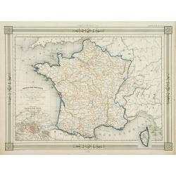
France par Provinces..
Fine map of France with inset plan of Paris at the year 1789, in lower right inset map of Corsica. Prepared by J.G.Barbié du Bocage. Published by Basset, rue de Seine 33...
Place & Date: Paris 1846
Selling price: $10
Sold
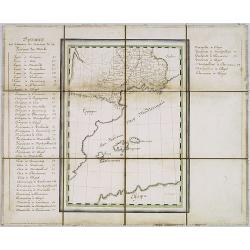
Manuscript map of the Southern Provinces of France.
Very detailed manuscript folding-map of the southern part of France. Including Lyon, Nice, Marseilles, Toulouse.Including the Balearic Islands of Majorca, Minorca, Ibiza....
Place & Date: France ca. 1850
Selling price: $475
Sold in 2020
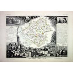
Lot of 4 French Departements
Four very decorative engraved maps of the French Departements: Haut Rhin, Loire, Lozère, Doubs. Ornately decorated borders, vignette scenes, portraits and views of the r...
Place & Date: Paris, 1850
Selling price: $50
Sold
PARIS. Vue prise au dessus du Rond-Point des Champs-Elysées.
From Voyage aerien en France, L'Italie à vol d'oiseau. Made by Jules Arnout and printed by Lemercier. Published by A.Hauser. Bd. des Italiens.The publication is extrem...
Place & Date: Paris, c.1850
Selling price: $400
Sold
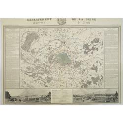
Departement de La Seine Environs de Paris.
A decorative 19th century map of the French department de La Seine with its capital Paris. The map is surrounded by two descriptive text panels to the left and right and ...
Place & Date: Paris, ca. 1850
Selling price: $300
Sold
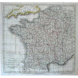
France Comparative en Provinces et en Departements . . .
Map of France
Place & Date: France, c.1850
Selling price: $1
Sold in 2010
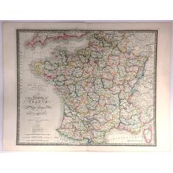
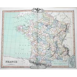
France
A fine map of France by George Frederick Cruchley. It covers all of France, seen here divided in its various departments. An inset shows the French island of Corsica. Ele...
Place & Date: London, 1850
Selling price: $12
Sold in 2016
Dépt. Des Bes. Du Rhône. N°12. [ Marseille, Arles, Aix ]
Map of the region around Marseille, Arles, Aix in the south of France.Lovely map from one of the last decorative atlases of the nineteenth century.The rather simple map i...
Place & Date: Paris, A. Combette, 1852
Selling price: $80
Sold in 2010
Dépt. De La Charente. N°13. [ Cognac ]
Map of the Charente region, centered on Angouleme and Cognac. Home of the world's best-known brandy, the map shows the countryside surrounding the Charente River one hund...
Place & Date: Paris, A. Combette, 1852
Selling price: $50
Sold in 2023
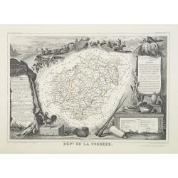
Dépt. De La Corrèze. N°18.
Map of the Corrèze region in France.Lovely map from one of the last decorative atlases of the nineteenth century.The rather simple map is framed by medallion portraits a...
Place & Date: Paris, A. Combette, 1852
Selling price: $30
Sold in 2009
Dépt. De La Côte D'Or. N°20. [ Lyon ]
Map of the Burgundy area, centered on Lyon.Lovely map from one of the last decorative atlases of the nineteenth century.The rather simple map is framed by medallion portr...
Place & Date: Paris, A. Combette, 1852
Selling price: $50
Sold in 2009
Dépt. Des Côtes Du Nord. N°21. [ St.Brieuc and St.Malo ]
Map of the northern part of Brittany, including the towns of St.Brieuc and St.Malo, Dinan, etc.Lovely map from one of the last decorative atlases of the nineteenth centur...
Place & Date: Paris, A. Combette, 1852
Selling price: $65
Sold
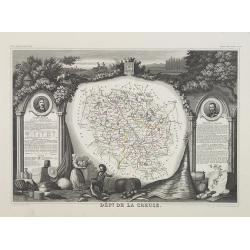
Dépt. De La Creuse. N°22.
Map of the Creuse region in France.Lovely map from one of the last decorative atlases of the nineteenth century.The rather simple map is framed by medallion portraits and...
Place & Date: Paris, A. Combette, 1852
Selling price: $35
Sold in 2009
Dépt. Du Doubs. N°24. [ Besançon ]
Map of the Doubs region, centered on the town Besançon in France.Lovely map from one of the last decorative atlases of the nineteenth century.The rather simple map is fr...
Place & Date: Paris, A. Combette, 1852
Selling price: $30
Sold in 2009
Dépt. De La Dordogne. N°25. [ Perigueux ]
Map of the Dordogne region, centered on Perigueux in France.Lovely map from one of the last decorative atlases of the nineteenth century.The rather simple map is framed b...
Place & Date: Paris, A. Combette, 1852
Selling price: $50
Sold in 2010
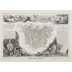
Dépt. De L'Eure. N°26.
Map of the Eure a region in France, including the area south of the River Seine from Vernon to Le Havre.Lovely map from one of the last decorative atlases of the nineteen...
Place & Date: Paris, A. Combette, 1852
Selling price: $30
Sold in 2009
Dépt. Du Gers. N°31.
Map of the Gers region in France.Lovely map from one of the last decorative atlases of the nineteenth century.The rather simple map is framed by medallion portraits and c...
Place & Date: Paris, A. Combette, 1852
Selling price: $50
Sold in 2010
Dépt. De La Gironde. N°32. [ Bordeaux ]
Map of the Gironde region, including Bordeaux in France.Lovely map from one of the last decorative atlases of the nineteenth century.The rather simple map is framed by me...
Place & Date: Paris, A. Combette, 1852
Selling price: $55
Sold in 2009
Dépt. De L'Hérault. N°33. [ Narbonne, Montpellier ]
Map of the Hérault region, including the towns of Narbonne, Montpellier, etc in Southern France.Lovely map from one of the last decorative atlases of the nineteenth cent...
Place & Date: Paris, A. Combette, 1852
Selling price: $30
Sold in 2009
Dépt. Du Loiret. N°44. [ Orleans ]
Map of the Loire region, centered on the town of Orleans and the region north of the River Loire.Lovely map from one of the last decorative atlases of the nineteenth cent...
Place & Date: Paris, A. Combette, 1852
Selling price: $40
Sold
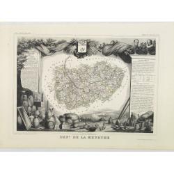
Dépt. De La Meurthe. N°53.
Map of the Meurthe region in France.Lovely map from one of the last decorative atlases of the nineteenth century.The rather simple map is framed by medallion portraits an...
Place & Date: Paris, A. Combette, 1852
Selling price: $50
Sold in 2013
Dépt. De La Sarthe. N°71. [ Le Mans ]
Map of the Sarthe region, centered on Le Mans.Lovely map from one of the last decorative atlases of the nineteenth century.The rather simple map is framed by medallion po...
Place & Date: Paris, A. Combette, 1852
Selling price: $50
Sold in 2010
Dépt. De Vaucluse. N°81. [ Avignon, Carpentras, Apt ]
Map of the Vaucluse region in France, including Avignon, Carpentras, Apt, etc.Lovely map from one of the last decorative atlases of the nineteenth century.The rather simp...
Place & Date: Paris, A. Combette, 1852
Selling price: $50
Sold in 2017
Dépt. De La Vienne. N°83. [ Poitier ]
Map of the Vienne region in France, centered on the town Poitier.Lovely map from one of the last decorative atlases of the nineteenth century.The rather simple map is fra...
Place & Date: Paris, A. Combette, 1852
Selling price: $30
Sold in 2009
Dépt. De La Hte. Vienne. N°84. [ Limoges]
Map of the Upper Vienne region, centered on the town Limoges, famous for its porcelain.Lovely map from one of the last decorative atlases of the nineteenth century.The ra...
Place & Date: Paris, A. Combette, 1852
Selling price: $30
Sold in 2009
France en 1852.
A general map of France in 1852.Lovely map from one of the last decorative atlases of the nineteenth century.The rather simple map is framed by medallions showing stages ...
Place & Date: Paris, A. Combette, 1852
Selling price: $30
Sold in 2009
Nouvelle Carte de France indiquant les Routes de Poste . . .
post road mapsPost route map of France with two inset maps, one of Paris upper left corner, and one of Corsica lower left corner. Prepared by the geographer Charle and pu...
Place & Date: Paris, A. Combette, 1852
Selling price: $100
Sold
Plan Itinéraire De Paris.
Folding plan of Paris divided into numbered and lettered squares, corresponding indices of streets and public buildings to left and right edges. Original color in block a...
Place & Date: Paris: J. Andriveau-Goujon, 1853
Selling price: $120
Sold in 2012
Plan de Paris - Paris
PRINTED ON VELLUM. Large nine panel plan of Paris, if joined height: 52 inches (1321 mm). width: 58 inches (1473 mm). This is the 1856 edition etched by E.Lebel for "...
Place & Date: Paris, Société des Bibliophiles, 1856
Selling price: $5000
Sold
Dépt. De La Seine. - Paris.
A Decorative map of Paris, including the region of Versailles.Beautiful map from one of the finest decorative atlases of the nineteenth century. This attractive map is fr...
Place & Date: Paris, 1856
Selling price: $40
Sold in 2017
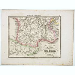
Le Vie Ferrate e le Postali della Francia Meridionale . . .
Uncommon map of South of France and part of Spain prepared by Francesco Costantino Marmocchi. Above the map "Geografia Commerciale". From "Il Globo Atlante...
Place & Date: Genova, Paolo Rivara fu Giacomo, 1858
Selling price: $10
Sold in 2020
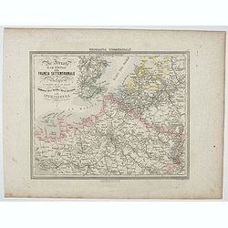
Le Vie Ferrate e le Postali della Francia Settentrionale . . .
Uncommon map of North of France and part of Belgium and England prepared by Francesco Costantino Marmocchi. Above the map "Geografia Commerciale". From "Il...
Place & Date: Genova, Paolo Rivara fu Giacomo, 1858
Selling price: $10
Sold in 2020
Frankrijk.
Uncommon map of France. Lithography by J.H. van Weijer, published in Atlas der geheele Aarde [?] in 24 kaarten.
Place & Date: Groningen, ca. 1860
Selling price: $10
Sold in 2008
Nouvelle carte Illustrée de la France . . .
A most decorative mid 19th century "carte à figures" map, in left and right part 86 vignettes giving a wealth of statistic and commercial information of each r...
Place & Date: Paris, Fatout, 1860
Selling price: $240
Sold
Toulouse. Vue du Pont de pierre prise du Quai de Brienne. N°293.
Lithographed view of St. Pierre bridge in Toulouse by C.Mercereau who made the design at the spot and afterwards the lithography.Included in "La France de nos jours&...
Place & Date: Paris, 1860
Selling price: $120
Sold
Paris sous Francois 1er. Vue générale à vol d'oiseau...
Fantastic color lithographed birds-eye view of Paris. Published by Charpentier in "Paris dans sa splendeur".
Place & Date: Paris, ca. 1860
Selling price: $65
Sold in 2016
Environs de Paris. Nouvel Atlas Topographique comprenant pour chaque Etat les villes d'industrie et de commerce, les places fortifiées, les chemins de fer, les canaux etc.
A bird's eye-view of Paris and vicinity by Guittet. Centered on Paris and the Seine River and including Versailles, St. Germain, Neuilly, Orly, etc.Paris, in pink, shown ...
Place & Date: Paris, ca. 1862
Selling price: $250
Sold in 2021
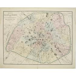
Nouveau Plan de Paris divisé en 20 arrondissements.
Detailed plan of Paris and its 20 arrondissements. Also shown are the railway system of the city with its railway stations.From Atlas des Chemins de Fer published by Napo...
Place & Date: Paris 1863
Selling price: $200
Sold in 2010
Carte Générale des Chemins de Fer et des Voies Navigables de la France.
Fine map of France, showing the early railway system of the area as well as the navigable rivers and canals.With inset map of the surrounding area of Paris in the lower l...
Place & Date: Paris, 1863
Selling price: $20
Sold in 2011
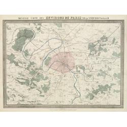
Nouvelle Carte des Environs de Paris.
Fine map of Paris and its contiguous outskirts, showing the early railway system of the area.From Atlas des Chemins de Fer published by Napoléon Chaix and printed by Imp...
Place & Date: Paris, 1863
Selling price: $10
Sold in 2011
Carte du Chemin de Fer d'Orléans..
Fine map showing the early railway system of a large area extending westwards and southwards from Paris.From Atlas des Chemins de Fer published by Napoléon Chaix and pri...
Place & Date: Paris 1863
Selling price: $4
Sold in 2011
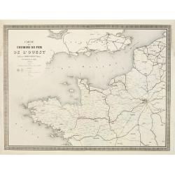
Carte des Chemins de Fer de l'Ouest..
Fine map showing the early railway system of a large area extending westwards from Paris as far as the coasts of Brittany.It includes part of the northern regions and the...
Place & Date: Paris 1863
Selling price: $90
Sold
Carte des Chemins de Fer de Paris à Lyon et à la Méditerranée.
Fine map showing the early railway system of a large area extending from Paris to South East France.From Atlas des Chemins de Fer published by Napoléon Chaix and printed...
Place & Date: Paris 1863
Selling price: $6
Sold in 2011
Cartes des Alpes Maritimes Littoral de la Méditerranée aux environs de Fréjus, Cannes, Grasse, Antibes, Nice, Monaco et Menton.
Folding-map of the Maritime Alps and the Mediterranean coastline of Fréjus, Cannes, Grasse, Antibes, Nice, Monaco, and Menton. Engraved by Erhard, geographer and engrave...
Place & Date: Paris, 1870
Selling price: $80
Sold in 2008
Instantaneous Indicator New Plan of Paris with Ribbon. . .
Instantaneous Indicator New Plan of Paris with Ribbon complete & reetify [sic], for circulating in Paris like the most acquinted [sic] with it, System Acklin, patente...
Place & Date: Paris, Logerot, ca. 1870
Selling price: $400
Sold
La Canonnière la Farcy amarrée en face des Tuileries pendante l'incendie de Paris dans la nuit du 24 Mai 1871.
Very fine lithography in decorative original hand color of the Palais des Tuileries set on fire in the last days of the Paris Commune, either by Communards or by petrol b...
Place & Date: Paris, F. Sinnett, 1871
Selling price: $300
Sold
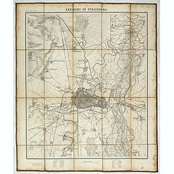
Environs de Strasbourg.
Map of Strasbourg and its direct vincinity, prepared by the Historical Section of the Major General Prussian State, map at 1 / 25,000. Published by E.S. Mittler and Sons,...
Place & Date: Berlin, 1871
Selling price: $950
Sold in 2020
France par Départements.
Decorative map of France from Géographie Universelle, Atlas Migeon. published by J. Migeon. In lower left hand corner a view of a building in Strasbourg engraved by Schr...
Place & Date: Paris 1874
Selling price: $5
Sold
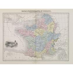
Gaule Indépendante et Romaine.
A decorative map of Ancient France from Géographie Universelle, Atlas Migeon. With an engraving of a Dolmen menhir lower left corner and an inset map of Lutecia (Paris) ...
Place & Date: Paris, 1874
Selling price: $20
Sold
France en 1789 donnant la comparaison immédiate des anciennes Provinces et des Départements actuels.
A thematic showing France in 1789 with its "departments" from Géographie Universelle, Atlas Migeon. With an engraving of the Bastille fortress in 1789 in the l...
Place & Date: Paris, 1874
Selling price: $30
Sold in 2010
France par Départements.
A decorative map of France divided in its departments from Géographie Universelle, Atlas Migeon. With an engraving of Strasbourg's Rail Road Station in the lower left co...
Place & Date: Paris, 1874
Selling price: $30
Sold in 2017
Empire Français en 1811.
A decorative map of the French Empire in 1811 from Géographie Universelle, Atlas Migeon. published by J. Migeon.From one of the last decorative atlases published in the ...
Place & Date: Paris, 1874
Selling price: $20
Sold
La France - Isere.
Nice decorated hand colored map of the Isere department of France. There are five cartouches including portraits of Vaucanson, Barnave & Bayart, the city of Grenoble ...
Place & Date: Paris, 1878
Selling price: $33
Sold in 2014
Carte particulière des cotes de France Dept. du Var...
Very large sea chart of a part of the Provence - Côte d'Azur region. From Hyères to Cap Camarat. Includes Ile de Porquerolles, Port-Cros, Ile du Levant. Dated 1843 but ...
Place & Date: Paris, 1879
Selling price: $81
Sold in 2016
Portrait de la Ville, Cité et Université de Paris avec les Faubourgs di celle dédié au Roy. [photogravure facsimile from 1880]
This very fine photogravure plate is showing Paris at medieval times after Nicolay. This late 19th century and slightly reduced facsimile of this famous and very rare pla...
Place & Date: Paris, c.1880
Selling price: $1900
Sold
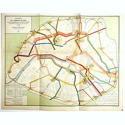
Recettes des tramways de Paris des bateaux-omnibus et du chemin de ceinture et mouvements des voyageurs dans les gares de paris en 1880.
Detailed plan of Paris showing the movements of passengers between the different stations in the year 1880. Legends in the lower right and left corners, including the num...
Place & Date: Paris, Monrocq, 1888
Selling price: $450
Sold in 2018
Exposition universelle de 1889.
Very rare broad sheet plan made for The Exposition Universelle of 1889, which was a world's fair held in Paris, from 6 May to 31 October 1889.A bird's eye view of the fai...
Place & Date: Paris, Maison Quantin, 1889
Selling price: $180
Sold
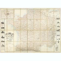
Carte routière de France de Dion Bouton spéciale pour automobiles.
Highly decorative folding wall map of France in a scale of 1 : 800 000. In the upper left hand corner an inset plan of Paris, upper right Algeria and lower right map of C...
Place & Date: Paris, J. Barreau, no date, circa 1900
Selling price: $250
Sold in 2014
[Les anciennes provinces Françaises à la ville de Saint Denis].
Nine small chromolithography's trade cards for Ville de Saint Denis, each with French regions and places, with description in French on each verso.Cards of the regions : ...
Place & Date: Paris, circa 1900
Selling price: $55
Sold in 2018
Eventail cycliste. Boulogne, Paris et ses environs.
Fan, double leaf decorated with a framed map of Bois de Boulogne and two views of Paris. The verso with two plans, one of Paris, the other from the Paris region. Wooden f...
Place & Date: Paris, 1905
Selling price: $200
Sold in 2021
Plan commode deParis rues & monuments autobus & tramways - Guide indicateur des rues de Paris avec les stations du Métropolitain le plus proches. . .
A well-preserved copy of this charming folding map of Paris, in its original hardcover gilted red wrapper. This tourist map starts with a 162pp of index to the streets an...
Place & Date: Paris, ca. 1925
Selling price: $180
Sold
![[Title page] Nouvelle géographie et statistique de la France, Alger et la Belgique.](/uploads/cache/41675-250x250.jpg)



![[Fortifications de Paris.]](/uploads/cache/48146-250x250.jpg)

![Dépt. Des Bes. Du Rhône. N°12. [ Marseille, Arles, Aix ]](/uploads/cache/27091-250x250.jpg)
![Dépt. De La Charente. N°13. [ Cognac ]](/uploads/cache/27094-250x250.jpg)
![Dépt. De La Côte D'Or. N°20. [ Lyon ]](/uploads/cache/27099-250x250.jpg)
![Dépt. Des Côtes Du Nord. N°21. [ St.Brieuc and St.Malo ]](/uploads/cache/27100-250x250.jpg)
![Dépt. Du Doubs. N°24. [ Besançon ]](/uploads/cache/27103-250x250.jpg)
![Dépt. De La Dordogne. N°25. [ Perigueux ]](/uploads/cache/27104-250x250.jpg)
![Dépt. De La Gironde. N°32. [ Bordeaux ]](/uploads/cache/27111-250x250.jpg)
![Dépt. De L'Hérault. N°33. [ Narbonne, Montpellier ]](/uploads/cache/27112-250x250.jpg)
![Dépt. Du Loiret. N°44. [ Orleans ]](/uploads/cache/27123-250x250.jpg)
![Dépt. De La Sarthe. N°71. [ Le Mans ]](/uploads/cache/27152-250x250.jpg)
![Dépt. De Vaucluse. N°81. [ Avignon, Carpentras, Apt ]](/uploads/cache/27161-250x250.jpg)
![Dépt. De La Vienne. N°83. [ Poitier ]](/uploads/cache/27164-250x250.jpg)
![Dépt. De La Hte. Vienne. N°84. [ Limoges]](/uploads/cache/27165-250x250.jpg)













![Portrait de la Ville, Cité et Université de Paris avec les Faubourgs di celle dédié au Roy. [photogravure facsimile from 1880]](/uploads/cache/32083-250x250.jpg)

![[Les anciennes provinces Françaises à la ville de Saint Denis].](/uploads/cache/41682-250x250.jpg)

