Browse Listings in Europe > Eastern Europe
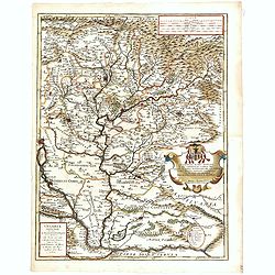
Danubius Fluvius Europae Maximus, a Fontibus ad Ostia. . .
Depicts the course of the Danube River, from its sources in the Alps to the Black Sea..Because of the dimensions the map was printed from two copper plates.With two very ...
Place & Date: Amsterdam, 1645
Selling price: $800
Sold in 2013
Hungaria Regnum.
Detailed map of Hungary centred on Budapest. Including the towns of Vienna, Zagreb as well.As Willem Blaeu died in 1638 most of his maps are actually published by his son...
Place & Date: Amsterdam, 1645
Selling price: $225
Sold
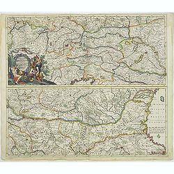
Danubius, fluvius Europae maximus, a fontibus ad Ostia, cum omnibus Fluminibus. . .
A striking large-format map of the course of the river Danube on two sheets. Nicely embellished with two large cartouches, a title cartouche with on one side the Kaiser o...
Place & Date: Amsterdam, ca 1645
Selling price: $430
Sold in 2022
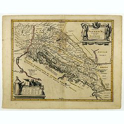
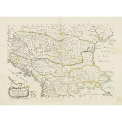
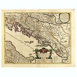
Veteris Pannoniae Utriusque Nec non Illyrici...
Uncommon map of Adriatic Sea. Decorated with two large scale cartouches, one showing two swordsman at odds with one another and the other a royal figure holding a scepter...
Place & Date: Amsterdam, 1646
Selling price: $180
Sold in 2018
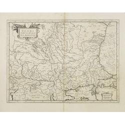
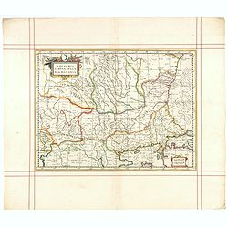
Walachia, Servia, Bulgaria, Romania.
Striking map of the region centered on the Lower Danube, Bulgaria, Romania, Serbia and Macedonia. Includes decorative cartouche, coat of arms, etc. Latin text on verso.Th...
Place & Date: Amsterdam 1647
Selling price: $174
Sold
Walachia, Servia, Bulgaria, Romania.
Striking map of the region centered on the Lower Danube, Bulgaria, Romania, Serbia and Macedonia. Includes decorative cartouche, coat of arms, etc. Latin text on verso.Th...
Place & Date: Amsterdam 1647
Selling price: $146
Sold
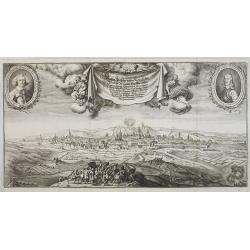
Wahrer Abriz der beijden Königlichen haubt Stadt und New Stadtt Prag . . .
Large decorative panoramic view of Prague, prepared by Carlo Sereta and engraved and published by Matthaeus Merian, in the 'Topographia Bohemiae'. Very decorative and of ...
Place & Date: Frankfurt, 1649
Selling price: $220
Sold in 2009
Karstia, Carniola, Histria ef Windorum Marchia.
Map of Slovenia, Dalmatia, Austria, Trieste.Merian was a notable Swiss engraver, born in Basle, subsequently studying in Zurich and then moving to Frankfurt where he met ...
Place & Date: Frankfurt, 1649
Selling price: $65
Sold in 2010
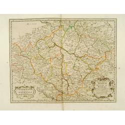
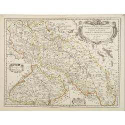
Royaume de Boheme.
Covering Czech Republic and cantered on Prague.This edition carries the date 1650. Nicolas Sanson was to bring about the rise of French cartography, although the fierce c...
Place & Date: Paris 1650
Selling price: $160
Sold
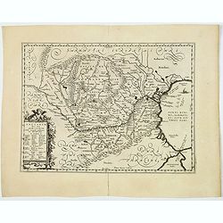
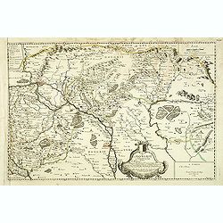
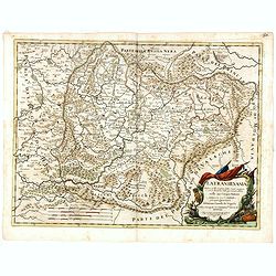
Transylvania Sibenburgen.
Crisply engraved chart of Transylvania, today parts of Hungary and Romania. Nice detail of forested areas, mountain ranges, rivers and towns.Beautifully colored cartouche...
Place & Date: Amsterdam 1650
Selling price: $160
Sold
Walachia Servia, Bulgaria, Romania.
The cartographer of this map was Gerard Mercator, but published by the Blaeu family. Map of the region centered on the Lower Danube, Bulgaria, Romania, Serbia and Macedon...
Place & Date: Amsterdam, 1650
Selling price: $550
Sold in 2014
Walachia Servia, Bulgaria, Romania.
The cartographer of this map was Gerard Mercator, but published by the Blaeu family. Map of the region centered on the Lower Danube, Bulgaria, Romania, Serbia and Macedon...
Place & Date: Amsterdam, 1650
Selling price: $200
Sold in 2014
Femme de Marcedoine. (54)
Sought-after copper engraved plate of a woman from Macedonia. Plate from Laonikos Chalcocondyle’s "L'histoire de la décadence de l'empire grec et establissement ...
Place & Date: Paris, Mathieu Guillemot, 1650
Selling price: $40
Sold in 2011
Marchant Ragusej (35) [Coatia]
Sought-after copper engraved plate from Laonikos Chalcocondyle’s "L'histoire de la décadence de l'empire grec et establissement de celuy des Turcs." by Thoma...
Place & Date: Paris, Mathieu Guillemot, 1650
Selling price: $70
Sold in 2011
Qsante de Raguse ou porteur de lettres. (36) [Coatia]
Sought-after copper engraved plate from Laonikos Chalcocondyle’s "L'histoire de la décadence de l'empire grec et establissement de celuy des Turcs." by Thoma...
Place & Date: Paris, Mathieu Guillemot, 1650
Selling price: $70
Sold in 2011
Bohemia (Map showing Rübezahl, Giants + Dragon)
Shows the Riesengebirge (Montes Gigantium - mountains of giants), and showing "Ribenzal" (Rübezahl) as figures and a dragon(?). Rare old copper engraving of B...
Place & Date: ?, c1650
Selling price: $46
Sold in 2012
Ungariae descriptio.
A scarce and charming miniature map of Hungary from the first edition of Bucelin’s “Historiae universalis cum sacrae tum prophanae nucleus” published by Praetorius ...
Place & Date: Ulm, 1650
Selling price: $60
Sold in 2020
Konigreich Boheim. Royaume de Boheme..
Covering Czech Republic and centered on Prague. Nicolas Sanson was to bring about the rise of French cartography, although the fierce competition of the Dutch would last ...
Place & Date: Paris 1654
Selling price: $220
Sold in 2010
Provinces Unies, et Incorporees a la Couronne de Boheme, qui sont les Duche de Silesie, Marq sats de Moravie, et Lusace.
Two maps on one sheet. A fine map of East Poland & Lithuania. With Breslaw in the center.Nicolas Sanson was to bring about the rise of French cartography, although th...
Place & Date: Paris 1654
Selling price: $130
Sold
Europae Tabula IX .
A fine Ptolemaic map that covers the Balkans and includes the Bosphorus one of the earliest maps of Turkey and Macedonia. The map, drawn on a trapezoidal projection, is b...
Place & Date: Venice, 1654
Selling price: $140
Sold in 2016
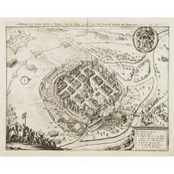
Abbildung der Statt Pilsen in Böhmen und diesselbige durch den:von Mansfeldt belägert und Eingenohmen worden. Anno 1618.
Decorative plan of the town of Pilsen.
Place & Date: Frankfurt, 1656
Selling price: $55
Sold in 2008
Totius Regni Hungarie et Adjacentium Regionum.
A beautiful, large, detailed map of southeastern Europe; featuring Hungary by Nicolas Visscher. Includes the regions of Northern Italy (showing the cities Bologna, Padua,...
Place & Date: Amsterdam, 1656
Selling price: $250
Sold in 2018
Hertzogthuber Steyer, Karnten, Krain
Covering southern part of Austria, northern part of the Gulf of Venice and part of former Yugoslavia. Nicolas Sanson was to bring about the rise of French cartography, al...
Place & Date: Paris, 1657
Selling price: $175
Sold
Buda Citerioris Hungariae Caput Regni avita sedes, vulgo Ofen.
Town-plan of the Hungarian capital of Budapest. Originally engraved for the Civitates. Compiled and written by George Braun, Canon of Cologne Cathedral. The drawings was ...
Place & Date: Amsterdam, ca. 1657
Selling price: $2000
Sold in 2013
‘Icons of Roman Emperors and Kings of Hungary'
An unusual engraving, comprised of 63 portraits of Roman Emperors and Kings of Hungary. Latin text.From ‘Icons of Roman Emperors and Kings of Hungary’ by Paul Fürst ...
Place & Date: Nuremberg, 1658
Selling price: $80
Sold in 2018
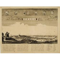
Praga.
A rare panoramic view of Prague with over the whole length of the lower part 3 columns of poems in Latin, Dutch and French and a numbered key 1-34 to the principal buildi...
Place & Date: Amsterdam, 1660
Selling price: $1800
Sold
Vetus Descriptio Daciarum Nec non Moesiarum. . .
A decorative map of ancient Dacia and Moesia, namely today's Romania, with Serbia and part of Bulgaria, With a beautiful cartouche. Signed lower part: Petrus Kaerius Cael...
Place & Date: Amsterdam, ca 1660
Selling price: $125
Sold in 2020
Daciarum Moesiarum que, Vetus Descriptio
Handsome small map of the ancient region of Romania and Bulgaria based on Ortelius' map of the same title. Filled with old place names and embellished with a fine title c...
Place & Date: Amsterdam 1661
Selling price: $80
Sold
Daciarum Moesiarum que, Vetus Descriptio.
Handsome small map of the ancient region of Romania and Bulgaria based on Ortelius' map of the same title. Filled with old place names and embellished with a fine title c...
Place & Date: Amsterdam, 1661
Selling price: $100
Sold in 2008
Principauté de Transilvanie tirée de W. Lazius, de I. Sambucus, et de G. Mercator. . .
Map of Hungary, based on map of Wolfgang Lazius. Belgrade in lower left corner. Numerous place-names of counties, cities, towns, physical features.
Place & Date: Paris, 1664
Selling price: $95
Sold in 2010
Cours du Danube, depuis Belgrade.. Transilvanie. . .
Eastern part of the River Danube, including parts of Macedonia, Bulgaria, Romania, Yugoslavia. Belgrade to the west. With original or early outline hand-color. Numerous p...
Place & Date: Paris, 1665
Selling price: $110
Sold in 2010
Haute Podolie ou Palatinat de Kamieniec tirée entièrement de la Gr. Ukranie. . .
Two maps on one sheet covering parts of Romania. Prepared by Guillaume Le Vasseur de Beauplan (1600-1685).
Place & Date: Paris, 1665
Selling price: $1250
Sold in 2011
Illyricum Occidentis. Cuj Partes IV Rhaetia, Noricum Pannonia, et Illyris. . .
Attractive historical map of the area Balkans, Hungary, Austria, the Adriatic and the northern part of Italy. Engraved by Louis Cordier. Based on the cartography of Nicol...
Place & Date: Paris, 1666
Selling price: $85
Sold in 2013
Hongrie & . . .
Map of Hungary prepared by N.Sanson and published by Pierre Mariette.Published in an early edition of the small Sanson atlas L\'Europe Dediée a Monseigneur . . . Le Tell...
Place & Date: Paris, P. Mariette, 1667
Selling price: $60
Sold in 2009
Hongrie.
Rare map of Hungary published by Jollain in 1667. Published in "Trésor Des Cartes Geographiques Des Principaux Estats de Lunivers". This atlas was based upon B...
Place & Date: Paris, 1667
Selling price: $18
Sold in 2019
Itineraire de Raguse a Bosna - Serai et de Bosna - Serai a Belgrade.
A map illustrating the route between Belgrade, Serbia and Ragusa on the Adriatic, by way of Bosna-Serai by Sieur Quiclet done during his travels to and from Constantinop...
Place & Date: Paris, 1669
Selling price: $36
Sold in 2020
Regnum Bohemia, eique Annexae provinciae uit Ducatus Silesia, Marchionatus Moravia et Lusatia.
Frederick de Wit (1610-1698) became after the closing of the Blaeu firm one of the most important Amsterdam-based publishers. He published several atlases, Atlas Minor (1...
Place & Date: Amsterdam, c. 1670
Selling price: $375
Sold in 2009
Novissima et emendata delineatio Hungariae una cum adjacentibus et finitimis regionibus.
Map Hungary with very nice insets of Buda (Buda vulgo Ofen) and Pest (Pesth)(Posoniensis vulgo Presburg) in the top with a portrait on both sides.At the bottom there are ...
Place & Date: Amsterdam, 1670
Selling price: $1500
Sold in 2009
Le Cours du Danube ou sont la Baviere, l'Austriche et la Boheme. . .
A detailed and scarce map showing the river Danube from Hungary until its source in Germany. In lower part the Gulf of Trieste with Venice.
Place & Date: Paris, 1676
Selling price: $200
Sold in 2013
Carte de la Hongarie a l'Autriche. .
A detailed and scarce map showing Hungary and Austria engraved by de François Lapointe (Lépine). Dated 1664.With a dedication to Ferdinand-Ernest Comte d'Abensperg-Trau...
Place & Date: Paris, 1676
The Mape of Hungari newly augmented by John Speede.
A wonderful map of Hungary. Incorporated into Speed's 'Prospect Of The Most Famous Parts Of The World'. Showing 2 sets of 4 costumed figures on each side of the map and v...
Place & Date: London, 1676
Selling price: $850
Sold in 2019
Slan in Bohmen. [Slany]
A very nice view of the city of Slany in Bohemia. In the foreground, a cloud symbolizing God, shining on a heart hold by a kneeling person. To the left a table with books...
Place & Date: Frankfurt 1623-1678
Selling price: $35
Sold
Non Bellum, Sed Pax. Prag.
A very nice view of Prague. With a verse in German and Latin underneath the picture.The poet and topographer from Comothau, Daniel Meisner (1585-1625), started his first ...
Place & Date: Frankfurt, 1623-1678
Selling price: $85
Sold in 2015
Hertzogthuber Steyer, Karnten, Krain, &, Duchés de Stirie, Carinthie, Carniole...
Fine map of Austria, Slovenia and north-eastern part of Italy including Venice, Udine, Trieste.This edition carries the date 1679. Nicolas Sanson was to bring about the r...
Place & Date: Paris, 1679
Selling price: $250
Sold in 2010
Il Regno d'Ungaria Transilvania, Schiavonia, Bosnia, Croatia, Dalmatia. . .
A uncommon late 17th century map of part of Balkans, based on the reports of Giacomo Cantelli da Vignola and published in Rome in Giacomo de Rossi's world atlas "Mer...
Place & Date: Rome, after 1679
Selling price: $220
Sold in 2015
TURCICUM IMPERIUM IN EUROPA.
Rare copperengraved map of the Ottoman Empire's possessions in Europe - Greece and the Balkans, published by Hoffmann, Nuremberg 1679, in his 'Atlas Universalis' ,a pirat...
Place & Date: Nuremberg, 1679
Selling price: $120
Sold in 2021
Regnum Hungaria in Omnes fuos Comitatus.
Frederick de Wit map showing Hungary and surrounding regions of Austria and Serbia. The city of Budapest is shown at the center of the map.
Place & Date: Amsterdam, 1680
Selling price: $260
Sold in 2010
Ungarn, Siebenbürgen, Wallach, Moldau. . .
Rare map of the Danube River. Surrounded by panoramic views of Vienna, Istanbul, Raab, Hermanstat, Temeswar, Gran, etc. Including Istria, and the coast of former Yugoslav...
Place & Date: Nurenberg, c. 1680
Selling price: $4400
Sold in 2010
Regnum Hungaria. . .
Centered on Budapest, with Belgrade in the bottom right.
Place & Date: Amsterdam, 1680
Selling price: $275
Sold in 2011
Exactissima Totius DANUBII FLUVII. Tabula et . . .
Two maps on one sheet, showing the course of the River Danube. With Constantinople in the lower right corner. Published by Th. Danckerts. The upper part has a nice origin...
Place & Date: Amsterdam, c.1680
Selling price: $450
Sold in 2018
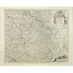
Regnum Bohemia, eique Annexae provinciae uit Ducatus Silesia, Marchionatus Moravia et Lusatia.
Detailed map of Czechoslovakia including parts of Poland, Germany with the towns of Dresden, Prague, Breslau, etc. With fine title cartouche upper left, putti carrying th...
Place & Date: Amsterdam, 1680
Selling price: $200
Sold in 2019
Regnum Hungaria in omnes suos comitatus accurate divisum et editum.
A rare map of the Kingdom of Hungary and surrounding regions of Austria and Serbia. The city of Budapest is shown at the centre of the map. Relief shown pictorially. Vers...
Place & Date: Amsterdam, 1680
Selling price: $150
Sold in 2021
Walachia, Servia, Bulgaria, Romania.
Striking map of the region centered on the Lower Danube, Bulgaria, Romania, Serbia and Macedonia. Includes decorative cartouche, coat of arms, etc. Latin text on verso.Th...
Place & Date: Oxford, 1680
Selling price: $120
Sold in 2015
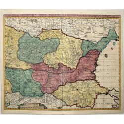
ROMANIA, THRACE, BULGARIA. -Exactissima Tabula qua tam DANUBII FLUVII PARS INFERIOR, . .
A beautifully colored map depicting the region to the lower reaches of the Danube from Belgrade to the Black Sea. Includes all of Romania, Bulgaria, most of Serbia and Th...
Place & Date: Amsterdam, 1680
Selling price: $220
Sold in 2021
Ungarn, Siebenbürgen, Wallach, Moldau. . .
Rare map of the Danube River. Surrounded by panoramic views of Vienna, Istanbul, Raab, Hermanstat, Temeswar, Gran, etc. Including Istria, and the coast of former Yugoslav...
Place & Date: Nurenberg, c. 1680
Selling price: $3500
Sold in 2020
HUNGARIA
A copperplate map of Hungary from Sir Jonas Moore's "New System of Mathematics" London, Printed by A. Godbid and J. Playford, for Robert Scott, 1681.
Place & Date: London, 1681
Selling price: $190
Sold in 2017
Prague.
Bird's-eye view of Prague from a neighbouring hillside. From the French text edition of Description d'Univers, 1683. by Allain Manneson Mallet (1630-1706), a well travell...
Place & Date: Paris 1683
Selling price: $40
Sold
Boheme et Lusace.
Alain Manneson Mallet (1603-1706) published in 1683 his ' Description de l' Univers' in 5 volumes. In 1686 a German edition appeared.A map from Alain Manesson Mallet's 'D...
Place & Date: Paris, 1683
Selling price: $70
Sold in 2010
Hongrie.
Nicolas Sanson (1600-67), 'father of the French cartography' and founder of the Sanson firm. Atlas ' Cartes générales de toutes les parties du Monde', 1658-70 and a poc...
Place & Date: Utrecht, S.de Vries / J. Ribius, 1683
Selling price: $120
Sold
Daciarum Moesiarumque Vetus Descriptio.
A map of Rumania and Bulgaria.
Place & Date: Amsterdam, 1683
Selling price: $80
Sold
Pannonie et Illyrie.
Small scale map of the ancient region of central Europe, Pannonia (bounded on the north by the Danube, located at the site of present Hungary, including part of Croatia a...
Place & Date: Paris, 1683
Selling price: $85
Sold in 2010
Illyrie.
Small scale map of the Balkan region by Allain Manesson Mallet's Description de L'Univers. Accompanying French text on verso. Allain Manesson Mallet (1630-1706) began his...
Place & Date: Paris, 1683
Selling price: $55
Sold in 2010
Carta Generale di tutta Alemagna, e Paesi circonuicini.
Rare map of central Europe with Poland, Germany, the Low Countries, Switzerland, Austria and Northern Italy. By Galeazzo Gualdo Priorato (1606-1678), known for his Schau-...
Place & Date: Vienna, 1673-1683
Selling price: $30
Sold in 2020
Prague.
A charming view of Prague.Title in curtain draped at top. French text on verso.From the original 1683 text edition of "Description d'Univers. . ." by Allain Man...
Place & Date: Paris, 1683
Selling price: $45
Sold in 2020
Vienne.
Charming view of Vienna.Title in curtain draped at top. French text on verso.From the original 1683 text edition of "Description d'Univers. . ." by Allain Manes...
Place & Date: Paris, 1683
Selling price: $25
Sold in 2020
Ofen v. Pest.
Panoramic view of Ofen v. Pest (Budapest). Published in "Der Donau-Strand Mit allen seinen Ein- und Zuflüssen. . .".Published by Jacob Sandrart.
Place & Date: Nuremberg, Jacob Sandrart, 1684
Selling price: $200
Sold in 2020
Gran.
Panoramic view of Gran (Esztergom). Published in "Der Donau-Strand Mit allen seinen Ein- und Zuflüssen. . ."Published by Jacob Sandrart.
Place & Date: Nuremberg, Jacob Sandrart, 1684
Selling price: $150
Sold
Alt Ofen. (Ó-Buda)
Panoramic view of Alt Ofen (Budapest). Published in "Der Donau-Strand Mit allen seinen Ein- und Zuflüssen. . .". Published by Jacob Sandrart.
Place & Date: Nuremberg, Jacob Sandrart, 1684
Selling price: $100
Sold in 2020
Dalmatia Istria Bosnia Servia Croatia e parte di Schiavonia...
Giacomo Rossi's fine late 17th century map of Dalmatia, with cartouches for the title and dedication. Engraved by Francesco Donia after Vignola. Issued in Il Mercurio geo...
Place & Date: Rome, 1684
Selling price: $275
Sold in 2015
Temeswar. (Timisoara)
View of TimiSoara is a city in the Banat region of western Romania. It is the capital of TimiS County.
Place & Date: Nuremberg, Jacob Sandrart, 1684
Selling price: $90
Sold in 2018
Tokay. (Tokaj)
Panoramic view of Tokaj, the center of the famous Tokaj-Hegyalja wine district where the world-famous Tokaji wine is produced Published in "Der Donau-Strand mit alle...
Place & Date: Nuremberg, Jacob Sandrart, 1684
Selling price: $100
Sold in 2015
Hatwan.
Panoramic view of Hatvan in Hungary Published in "Der Donau-Strand Mit allen seinen Ein- und Zuflüssen. . .". Published by Jacob Sandrart.
Place & Date: Nuremberg, Jacob Sandrart, 1684
Selling price: $40
Sold in 2020
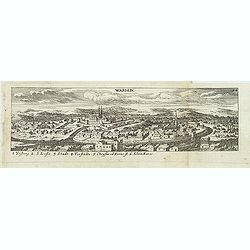
Wardein.
Panoramic view of Grosswardein or NagyváradWardein (Oradea), in northwest Romania near the Hungarian border. Published in "Der Donau-Strand Mit allen seinen Ein- un...
Place & Date: Nuremberg, Jacob Sandrart, 1684
Selling price: $50
Sold in 2022
Ungaria Orientale. . .
Rossi's map of Hungary, based upon Sanson's map, but with revised Italian nomenclature. The engraver was Francesco Donia.In lower right corner a dedicational cartouche. T...
Place & Date: Rome, 1684
Selling price: $210
Sold in 2016
RAB.
Striking and highly decorative unusual miniature copper engraved panoramic view of Raab or Gyor, the Hungarian town on the Danube.Published in "Der Donau-Strand Mit ...
Place & Date: Nuremberg, 1684
Selling price: $1
Sold in 2018
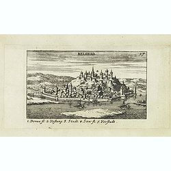
Belgrad.
Panoramic of Belgrade. Belgrade is the capital and largest city of Serbia. The city lies at the confluence of the Sava and Danube rivers, where the Pannonian Plain meets...
Place & Date: Nuremberg, Jacob Sandrart, 1684
Selling price: $100
Sold in 2019
A New Mapp of the Kingdom of Hungary and the States that have been Subject to it, which are at Present the Northern Parts of Turkey in Europe
Rare map of Hungary published by Philip Lea. In upper left corner a dedication to George Prince of Denmark and Norway by Richard Palmer. Engraved by R. Palmer, signed low...
Place & Date: London, 1686
Selling price: $2750
Sold in 2012
La Transilvania, Divisa su l'Esemplare delle Carte migliori e con la direzione delle pius recenti notizie nelle sue Cinque Nationi. . .
Rossi's map of Transylvania, based upon Sanson's map, but with revised Italian nomenclature. The engraver was Giorgio Widman.Issued in a second edition of Il Mercurio geo...
Place & Date: Rome, 1686
Selling price: $100
Sold in 2015
[Plan of a town]
City plan of Satmar in Romania, engraved by Johann Martin Lerch (1659-1684) from Vienna.
Place & Date: Vienna, ca.1686
Selling price: $32
Sold in 2019
Le grand royaume de Hongrie..
Rare. Showing the countries along the river Donau.
Place & Date: Paris 1687
Selling price: $145
Sold








![Marchant Ragusej (35) [Coatia]](/uploads/cache/31549-250x250.jpg)
![Qsante de Raguse ou porteur de lettres. (36) [Coatia]](/uploads/cache/31550-250x250.jpg)










![Slan in Bohmen. [Slany]](/uploads/cache/13763-250x250.jpg)











![[Plan of a town]](/uploads/cache/43021-250x250.jpg)
