Browse Listings in Europe > British Isles
Glocestershire By Robert Morden.
A copper engraved hand colored map of Gloucestershire, England. This map is one of the first country maps to show roads (based on Ogilby's road maps). It includes interes...
Place & Date: London, 1695
Selling price: $50
Sold in 2016
The County Palatine of Chester ...
This is the county map of Cheshire by Robert Morden. It shows an early road system with the town of Chester located on the left middle side of the map. There is a decorat...
Place & Date: London, 1695
Selling price: $11
Sold in 2016
The County of Monmouth.
A detailed British county map by Robert Morden, from Camden's famous description of Great Britain, issued the late seventeenth century. Of particular interest is Morden's...
Place & Date: London, 1695
Selling price: $25
Sold in 2016
Bedfordshire by Robt. Morden
A detailed British county map by Robert Morden from Camden's famous description of Great Britain, issued the late seventeenth century. Of particular interest is Morden's ...
Place & Date: London, 1695
Selling price: $40
Sold in 2018
The North Riding of Yorkshire
A detailed British county map by Robert Morden from Camden's famous description of Great Britain, issued the late seventeenth century. Of particular interest is Morden's ...
Place & Date: London, 1695
Selling price: $25
Sold in 2016
Comitatus Rotelandiae Tabula Nova & Aucta
An attractive, detailed map of the county of Rutland, England’s smallest county. The map was engraved by Robert Morden, and published in "Camden's Britannia"....
Place & Date: London, 1695
Selling price: $27
Sold in 2016
The County of Monmouth
A pleasing first edition map of Monmouthshire by Robert Morden from his "CAMDEN'S BRITANNIA, published by Swale, Awnshaw & Churchil in London in 1695. Features a...
Place & Date: London, 1695
Selling price: $17
Sold in 2016
Bedfordshire
A pleasing first edition map of Bedfordshire by Robert Morden from his "CAMDEN'S BRITANNIA, published by Swale, Awnshaw & Churchil in London in 1695. It features...
Place & Date: London, 1695
Selling price: $16
Sold in 2016
Dorsetshire.
A first edition county map of Dorsetshire by the English cartographer Robert Morden, published in his "Camden's Britannia" in London in 1695. An attractive titl...
Place & Date: London, 1695
Selling price: $17
Sold in 2018
A New Mapp of the Kingdome of England, Representing the Princedome of Wales, and other Provinces, Cities, Market Towns, with the Roads from Town to Town.
A very rare map of England, originally made by Nicolaes Visscher in 1695 and also sold by John Overton.The map focuses on the distances between cities and market towns (l...
Place & Date: Amsterdam, 1695
Selling price: $475
Sold in 2018
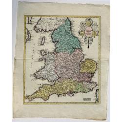
[2 sheets] Parte settentrionale del regno d'inghilterra.. [with] Parte Meridionale der regno . . .
Matching set of 2 attractive large folio maps depicting the northern and southern parts of England. Including four large cartouches and table of counties, towns, etc. Sho...
Place & Date: Venice, 1696
Selling price: $475
Sold in 2015
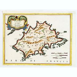
Iarsey Isola, gia detta Caesarea appartenente al Re d'Ingliterra.
An attractive small map of Jersey in the Channel Islands, with decorative cartouche from the Atlante Veneto: Isolario descrittione geografico-historia, published in Venic...
Place & Date: Venice, 1696
Selling price: $65
Sold in 2020
[2 sheets] Parte Settentrionale del' IRLANDA... [with] IRLANDA Parte Meridionale. . .
A matching set in contemporary Italian original color (contemporary colored maps of Coronelli are very rare on the market) of 2 attractive large folio maps depicting the ...
Place & Date: Venice, 1696
Selling price: $950
Sold in 2019
Pas-caert van de Zee-custen van ENGELAND van Orfordness tot aen Flamborger Hooft.
Beautifully colored sea chart of east coast of England, oriented to the West. Early state with engraved number 22. With nice decorations of the area and two compass rose...
Place & Date: Amsterdam, 1697
Selling price: $130
Sold in 2016
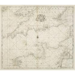
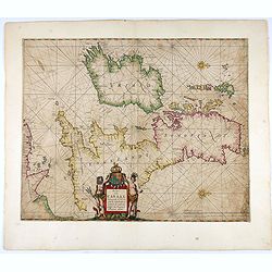
Pascaart vant Canaal Begrypende in sich Engelandt, Schotlandt, en jerlandt, als mede een gedeelt van Francryck.
Map of the English channel, oriented with east at the top and including part of France and the British isles.The beautiful title cartouche with Neptune, a river goddess a...
Place & Date: Amsterdam, 1697
Selling price: $600
Sold in 2021
Scotia parte settentrionale. . . [together with] Scotia parte meridionale . . .
A large two-sheet map of Scotland. The Northern map has a list of the provinces and their capitals at upper left, and with a title cartouche on the right side. The Southe...
Place & Date: Venice, 1698
Selling price: $210
Sold in 2020
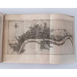
LONDEN WESTMUNSTER U SOUDWARK
A very finely engraved view of London as seen at the start of the 18th century. The work's title is presented in two ribbons at the top portion of the engraving. Two comp...
Place & Date: Germany, c. 1700
Selling price: $680
Sold
Die Brücke zu London.
Decorative view of London bridge.
Place & Date: Nuremberg 1700
Selling price: $430
Sold
L''irelande suivant les nouvelles observations
A beautifully rendered and sought after map of Ireland. The cartouche depicts a pastoral scene with horsemen, hunters and various domesticated and wild animals. A very de...
Place & Date: Leiden, ca. 1700
Selling price: $550
Sold in 2008
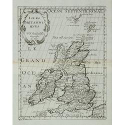
Isles Britanniques.
A map of the British Isles from Description de tous l'Univers published by François Halma.
Place & Date: Amsterdam, 1700
Selling price: $70
Sold in 2011
La Britannique dans sa Heptarchie ...
A map of the England from Description de tous l'Univers published by François Halma.
Place & Date: Amsterdam, 1700
Selling price: $40
Sold in 2011
Regnun Scotiae, feu pars Septent: Magnae Brittanniae, divifa in Scotiam Septent: et Auftralem, porro autem in Comit: Rossiam Maraviam, Praefect: Lavdoniam, Renefroviam et Arandum, una cum Infulis Ebuda Occident: et Orient: Mula, Jura et Ila.
A wonderfully detailed map of Scotland and the islands off its coast by Gerard and Leonard Valk. This map includes major cities, rivers and towns, and at the top right in...
Place & Date: Amsterdam, 1700
Selling price: $95
Sold in 2010
[No tittle] The Sea Coasts south of England and Brittany in France.
Detailed of the Channel with Cornwall and Brittany.
Place & Date: London, c.1700
Selling price: $160
Sold in 2011
Northamptoniae Comitatus Descriptio.
This rare and important map is one of a series of county maps attributed to William Smith the antiquarian, each lacking the cartographer's name and consequently often ref...
Place & Date: London, 1700
Selling price: $700
Sold in 2013
The East & West Prospect of Bushey Hall.
A very detailed plan of Bushey Hall with even the people quite detailed. It was published by Sir Henry Chauncy in "HISTORICAL ANTIQUITIES OF HERTFORDSHIRE" in 1...
Place & Date: London, 1700
Selling price: $17
Sold in 2019
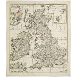
Les Isles Britanniques. . .
J.B. Nolin's map of the British Isles, based on the work of Coronelli. Map features an inset of the Orkney, Shetland and Faroe Islands. A splendid title cartouche adorns ...
Place & Date: Paris, ca 1700
Selling price: $280
Sold in 2020
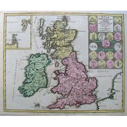
Les Isles Britanniques, ou sont les Royaumes d'Angleterre, d'Escosse et D'Ireland.
Map of the British Isles: England, Ireland and Scotland, each delineated through the use of different outline colors, from the atlas "Le Monde Dresse et Dedie Anosse...
Place & Date: Paris, 1701
Selling price: $70
Sold in 2010
Les isles Britanique, ou sont les Royaumes d'Angleterre, d'Ecosse et d'Irlande. . .
The map includes British Isles, with insets of Ferro and Shetland Islands. Engraved by Vincent de Ginville. From his "Atlas Curieux", published 1700-1705, in th...
Place & Date: Paris, 1705
Selling price: $70
Sold in 2011
Les Isles Britanniques, ou sont les Royaumes d'Angleterre, d'Ecosse et d'Irlande.
This finely engraved map of the British Isles also has some detail of the adjacent French coast. The Fero and the Shetland Islands are included in small insets. Unusually...
Place & Date: Paris, 1705
Selling price: $145
Sold in 2009
Plan des Villes de Londres et de Westminster et de leurs Faubourgs avec le Bourg de Southwark.
A rare engraving of London at the turn of the 17th/18th centuries engraved by C Inselin, stretching from Westminster Abbey in the west to Mile End in the east. A 113 poin...
Place & Date: Paris, 1705
Selling price: $285
Sold in 2011
Les Isles Britanniques qui contiennents les- Royaumes, d' Angleterre, Escosse, et Irland.
Large scale map of England, Scotland and Ireland. To the left inset map of Shetland and Orkney Islands. A first state, without with lines of latitude and longitude. Extre...
Place & Date: Amsterdam, c.1705
Selling price: $350
Sold in 2020
I. Farne.
A scarce map of the Farne Islands which are located off the coast of Northumberland! Published in Isole Britanniche. An apparently quite rare map, we can not find any oth...
Place & Date: Venice, 1706
Selling price: $90
Sold in 2018
Les Isles Britanniques ou se trouvent Les Royaumes d'Angleterre, d'Ecosse et d'Irlande. . .
A nice, scarce large scale map of the British Isles by de Fer, published in Paris at the beginning of the 18th century. Outline color highlight the old Saxon, pre Norman ...
Place & Date: Paris, 1706
Selling price: $125
Sold in 2020
Vues des villes de Londres, de Canterbury, de Colchester, et autres Lieux circonvoisins. - II. ... Vues des villes, edifices & autres choses remarquable de l'Escosse & d'Irlande. - III. and IV
Four books in one, printed Chez Pierre vander Aa, Leyden, Netherlands. Beautiful, very rare plate book of Great Britain in 6 parts with a total of 25 maps, and 216 pla...
Place & Date: Leyden, 1707
Selling price: $4000
Sold in 2023
16 plates of English castles and houses.
16 very finely engraved and detailed bird's-eye views of the great English country houses, showing the architecture, formal gardens, and the surrounding landscape.The pla...
Place & Date: London, 1708
Selling price: $1900
Sold
Nieuwe Wassende Graave Paskaart van't Canaal Tussen Engelandt en Vrankryk. . .
Chart showing the west cost of France and the south coast of England. Decorative cartouche lower right.
Place & Date: Amsterdam, c.1708
Selling price: $210
Sold in 2010
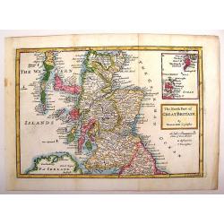
The North Part of Great Britain.
Interesting map of northern Great Britain (Scotland). It has an inlay of the Shetland and Orkney Islands. Herman Moll (1654 – 1732), was a cartographer, engraver, and ...
Place & Date: London, 1708
Selling price: $26
Sold in 2013
Swillington in the West Rideing of Yorkshire, the Seate of William Louther, Esq.
Fine hand-colored bird's-eye view of the great country house of Swillington. It shows the architecture, formal gardens, and the surrounding landscape. Drawn by Leonard Kn...
Place & Date: London, 1708
Selling price: $100
Sold in 2019
A Plan of London, Westmr. and Southwark wth ye Rivr Thames...
Hatton's famous edition of Braun & Hogenberg's view of London, first published in 1572. Shows the city in a detailed birds-eye perspective. Numerous buildings, roads,...
Place & Date: London, 1708
Selling price: $425
Sold in 2016
Novissima Regni Scotiae Septentrionalis et Meridionalis. . .
A rare and decorative double-page map of Scotland and its islands. Includes a wealth of place names, and extends until the Picts Wall near Carlisle. With bright original ...
Place & Date: Amsterdam, 1708
Selling price: $300
Sold in 2018
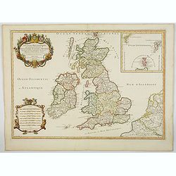
Les Isles Britanniques qui contienuent les Royaumes d'Angleterre, Escosse, et Irlande. . .
This is the 1709 Hubert Jaillot map of the British Isles. The map highlights the region from the Atlantic Ocean to the North Sea, and from the Orkney Islands to the Pas d...
Place & Date: Paris, 1709
Selling price: $200
Sold in 2023
Londres.
Nice little plan of London, with 3 cartouches with coat of arms.
Place & Date: Amsterdam 1710
Selling price: $140
Sold
Magnae Britannia Pars Septentrionalis qua Regnum Scotiae.
Large,detailed and decorative map of Scotland with two superb cartouches. They are surrounded by mythical and allegorical figures, five putti, and Royal & Scottish ar...
Place & Date: Nuremberg, 1710
Selling price: $201
Sold in 2014
Carte de la Manche.
A large detailed sea chart of the English Channel has the coast of England from Cornwall round to Suffolk and South Wales. Below is the coast of France from La Baie de Do...
Place & Date: Amsterdam, 1710
Selling price: $275
Sold in 2016
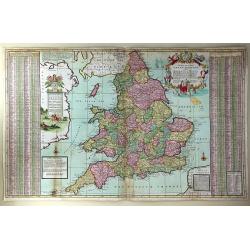
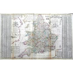
The South Part of Great Britain, Called, England and Wales. Containing All ye Cities, Market Towns, Boroughs: And whatever Places have ye Election of Members of Parliament
A large and finely detailed, copper engraved map featuring hundreds of villages, towns, mountains and much more. In the title, the "South Part" of Great Britain...
Place & Date: London, 1710
Selling price: $355
Sold in 2016
The South Part of Great Britain, called Engalnd and Wales.
Herman's Moll's magnificently detailed large scale map of England and Wales. Including a part of Ireland. Filled with cities, roads showing the distances between towns, r...
Place & Date: London, ca 1710
Selling price: $95
Sold in 2019
Londinum - London
A rare and beautifully engraved and richly detailed panoramic view of London. With in lower part description of London in German and Latin. Published by Joseph Friederich...
Place & Date: Augsburg 1711
Selling price: $450
Sold
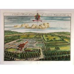
Clower-Wall the Seat of Francis Wyndham, Esq.
A large, fine, copper engraved print illustrating a birds-eye view of Clower-Wall, the Seat of Francis Wyndham, Esq.Published in 1712 for Robert Atkyns. Drawn and engrave...
Place & Date: London, 1712
Selling price: $42
Sold in 2019
Coberly the Seat of Jonathan Castelman Esq.
A fine, large, detailed birds-eye view of Coberly by Kip, who produced the engravings for the remarkable "The Ancient & Present State of Gloucestershire", p...
Place & Date: London, 1712
Selling price: $15
Sold in 2023
Stanway, the Seat of John Tracey Esq / Didmartin, the Seat of Robert Codrington Esq.
An attractive, and striking pair of early eighteenth century copperplate engravings of staely English homes, from Sir Robert Atkyn's The Ancient and Present State of Glou...
Place & Date: London, ca 1712
Selling price: $100
Sold in 2018
Denbighshire.
Highly decorative map of the county of Denbighshire, located in the northwest corner of Wales. The upper right corner inset contains a plan of the town of Denbigh, along ...
Place & Date: London 1713
Selling price: $300
Sold
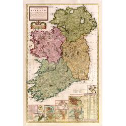
A new map of Ireland devided into its provinces..
A good copy of this very decorative and detailed large scale map. 12 inset plans of the towns of Dublin, Cork, Kinsale, Limerick, Waterford and Galway, and of the Giants'...
Place & Date: London 1714
Selling price: $1100
Sold
COLLEGII REGALIS APUD CANTABRIGIENSES SACELLUM / KINGS COLLEGE CHAPPEL IN CAMBRIDGE
A large, superb profile of the famous Kings College Chapel of Cambridge University, as seen in the very early years of the 18th century. The title of the view is shown in...
Place & Date: London, c. 1715
Selling price: $1650
Sold
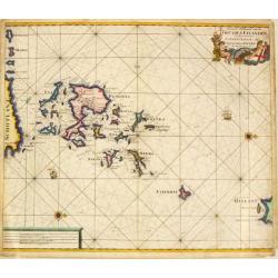
Nieuwe Paskaart van de Orcades Eylanden
The successful van Keulen firm published charts, pilot guides and sea-atlases for over 2 centuries. Founded by Johannes van Keulen, his son Gerard led the firm to its zen...
Place & Date: Amsterdam, 1715
Selling price: $400
Sold in 2010
Nieuwe Paskaert Vande oost Cust van Engeland en Schotland. Beginnende van 't Flamburger Hooft tot aan de Rivier van Eedenborg. Inset: The River Tyne.
The successful van Keulen firm published charts, pilot guides and sea-atlases for over 2 centuries. Founded by Johannes van Keulen, his son Gerard led the firm to its zen...
Place & Date: Amsterdam, 1715
Selling price: $700
Sold in 2008
Nieuwe Wassende Gradige Pas-kaart van een gedeelte der oost-kust van Engeland, Strekkende van Eckles tot Flambrouger Hooft , in zig begrypende de Rievier van Hull.
The successful van Keulen firm published charts, pilot guides and sea-atlases for over 2 centuries. Founded by Johannes van Keulen, his son Gerard led the firm to its zen...
Place & Date: Amsterdam, 1715
Selling price: $600
Sold in 2011
Oxford Shire Actually Survey'd &c. . .
Scarce extensive county map, north oriented to the right. With an elaborate title cartouche, 5 inset views of "The Prospect of Oxford," "The Theatre,"...
Place & Date: London, 1715
Selling price: $700
Sold in 2015
Hiberniae regnum. . .
A detailed and decorative map of Ireland, colored by the 4 regions and showing the towns, roads, counties, rivers, lakes, castles, etc. Includes a pair of lovely cartouch...
Place & Date: Nurnberg, 1715
Selling price: $300
Sold in 2017
The prospects of the two most remarkable towns in the north of England for the clothing trade, viz. Leeds, As it appears from Holbeck Road, and Wakefield, As it appears from London Road.
This plate was published in Ducatus Leodiensis, or the Topography of the Town and Parish of Leedesby the Yorkshire antiquary Ralph Thoresby.Thoresby continued his father�...
Place & Date: London, 1715
Selling price: $50
Sold in 2017
Plan des villes de Londres et de Westminster et de leurs Faubourgs avec le bourg de Southwark. . .
Plan of London engraved by C Inselin, stretching from Westminster Abbey in the west to Mile End in the east. A 113 point key identifies important landmarks.This is the ra...
Place & Date: Paris, 1717
Selling price: $220
Sold in 2011
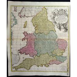
Anglia Cambdeni, excusa a Christopho Weigelio Norimbergae.
A copper engraved map, overall size 50 x 40 cm.This map shows England and Wales, with parts of Scotland. From Weigels' 'Schul und Reise atlas'. Elaborate cartouche with 5...
Place & Date: Nurnberg, ca. 1718
Selling price: $60
Sold in 2017
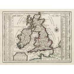
Les Royaumes D'Angleterre, D'Escosse Et D'Irlande..
Lovely small map of the British Isles with two side panels listing Scottish and English kings.From Le Nouveau et Curieux Atlas Geographique et Historique.. by Jacques Chi...
Place & Date: Paris 1719
Selling price: $100
Sold in 2008
Facies Civitalis GLASCOAE...The prospect of the Town of Glasgow from the South
A beautifully engraved view of Glasgow, Scotland from a southern approach. Glasgow is dominated in the center by its cathedral. From the THEATRUM SCOTIAE, an important re...
Place & Date: ca. 1719
Selling price: $150
Sold in 2011
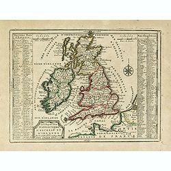
Les Royaumes D'Angleterre, D'Escosse Et D'Irlande. . .
Lovely small map of the British Isles with two side panels listing Scottish and English kings.From Le Nouveau et Curieux Atlas Geographique et Historique.. by Jacques Chi...
Place & Date: Paris, 1719
Selling price: $70
Sold
The Mote, One of the Seats of Ye Right Honorable the Lord Romney.
A fine detailed bird's eye view of 'The Mote', showing the house, gardens and the avenues of trees stretching out into the surrounding park. Title along top edge, coat of...
Place & Date: London, 1719
Selling price: $36
Sold in 2018
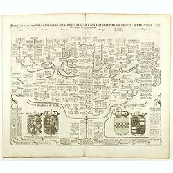
Carte Genealogique De La Maison De Stuart, Dans La Quelle L'On Fait Observer Son Origine, Ses Branches.
Fine example of Chatelain's attractive plate showing the genealogy of the House of Stuart, decorated with four coats-of-arms pertaining to military alliances. Zacharie Ch...
Place & Date: Amsterdam, 1719
Selling price: $45
Sold in 2021
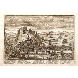
Edimbourg Ville Capitale du Royaume d'Ecosse.
"A very RARE panoramic view of the city of Edinburgh, including a numbered legend in the lower part.Published by the brothers Chéreau, active in Paris at ...
Place & Date: Paris c.1720
Selling price: $200
Sold
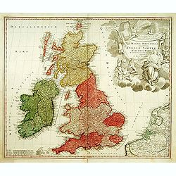
Magna Britannia?
A decorative of Britain and Ireland with great details. Includes part of France, Belgium and Holland. The large title cartouche is very decorative.
Place & Date: Nuremberg, 1720
Selling price: $200
Sold
Portsmouth.
A very fine and quite large view of Portsmouth from Joannes Kip's Britannia Illustrata or Views of Several of the Queens Palaces also of the Principal Seats of the Nobili...
Place & Date: London 1708-1720
Selling price: $750
Sold
Prospect of Cambridge from the west.
A very fine and quite large view of Cambridge seen from the west, from: Britannia Illustrata or Views of Several of the Queens Palaces also of the Principal Seats of the ...
Place & Date: London 1708-1720
Selling price: $1325
Sold
Londres capitale de l'Angleterre.
Fine and uncommon panoramic view of London. The view is printed within a large, elaborately engraved mock-frame border, which was prepared with a blank centre so that the...
Place & Date: Leiden 1720
Selling price: $350
Sold
Nieuwe pascaert, vande suyt syde van Yrlandt..
Showing the south coast of Ireland.Latitude scale, compass rose and system of rhumb lines, soundings, anchorage's, etc. In lower right corner with added number 20.
Place & Date: Amsterdam 1720
Selling price: $625
Sold
Londres Ville Capitale du Royaume d'Angleterre.
A very RARE panoramic view of the city of London, with a numbered legend in lower left corner.The plate is numbered in red pencil in upper right corner.Engraved by Jean C...
Place & Date: Paris 1690-1720
Selling price: $620
Sold
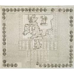
Carte Pour l'Introduction a l'Histoire d'Angleterre, ou l'on Voit son Premier Gouvernement, et l'Etat Abrege de cette Monarchie sous les Empereurs Romains, et sous les Rois Saxons.
The sheet includes a large inset map of Roman Britain including the English Channel and the western coast of France (200 x 255mm.). It also provides a wealth of informati...
Place & Date: Amsterdam, 1720
Selling price: $150
Sold in 2009
Exactissima Regni Scotiae Tabula tam in septentrionalem et meriodionalem quam in minores earundem provincias insulesq, et undique praetensas accurate . , ,
A magnificent and detailed map of Scotland, with all the counties, cities and towns, castles and churches, lochs, rivers and streams shown. This example with the imprint ...
Place & Date: Amsterdam, 1690 -1720
Selling price: $200
Sold in 2018
Novissima prae caeteris aliis accuratissima Regnorum Angliae Angliae, Scotiae, Hiberniae . . .
The title of De Wit's map is within a banner supported by winged cherubs and cavorting mermaids. Armorial shields of England, Scotland and Ireland are placed in the left-...
Place & Date: Amsterdam, c.1720
Selling price: $350
Sold in 2009
Insulae Britannicae Antiquae ex collatione.
Nice high decorative map with an inset of thule and seems to the Ornkney Isles. There are old coins displayed on the map. On the map are small spots and it has narrrow ma...
Place & Date: Nurnberg, 1720
Selling price: $70
Sold in 2013
Hartfordshire.
This is an attractive and rare map of Hertfordshire.Copper engraving. Very attractive, uncommon map in good condition . Robert Morden's miniature maps are among the earli...
Place & Date: London, 1720
Selling price: $120
Sold
Plan of London in the reign of Queen Elizabeth.
Plan of London in the reign of Queen Elizabeth 1st 1546. This delicately hand colored early map of London is highly detailed. This map dated 1720 by James Stratford of Ho...
Place & Date: London, 1720
Selling price: $280
Sold in 2014
Southwick in the County of Southampton Seat of Richard Norton Esq.
Engraved by Joannes Kip after the drawing by Leonard Knyff. Plate 74 from "Britannia Illustrata or Views of Several of the Queens Palaces and also of the Principal S...
Place & Date: London, 1720
Selling price: $60
Sold in 2017


![[2 sheets] Parte settentrionale del regno d'inghilterra.. [with] Parte Meridionale der regno . . .](/uploads/cache/23871-250x250.jpg)
![[2 sheets] Parte Settentrionale del' IRLANDA... [with] IRLANDA Parte Meridionale. . .](/uploads/cache/83234-250x250.jpg)

![Scotia parte settentrionale. . . [together with] Scotia parte meridionale . . .](/uploads/cache/45627-250x250.jpg)




![[No tittle] The Sea Coasts south of England and Brittany in France.](/uploads/cache/29447-250x250.jpg)


