Browse Listings in Europe > Belgium > Belgium Provinces
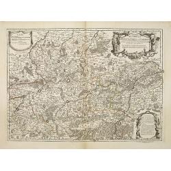
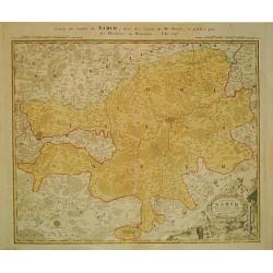
Comitatus Namurci TABULA IN Lucem.
A detailed map of Namur, Belgium centered on the Meuse River, published by the family of Frederick De Wit in about 1720.It includes a decorative cartouche featuring two b...
Place & Date: Amsterdam, ca. 1720
Selling price: $32
Sold in 2018
Comitatus Hannoniae in quas quasque Castellanias Balliviatus. . .
This beautiful and detailed map, is centered on the Belgian city of Mons, and includes the towns of Doornick, Halle, Charleroy, Camerijk and Dounay. The larger towns are ...
Place & Date: Nuremberg, ca 1720
Selling price: $19
Sold in 2021
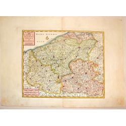
Flandria et Zeelandia Comitatus. / A Map of the County of Flanders. [Two maps]
[Two maps] First map is a decorative, large map including Flanders and Zeeland. The map, originally engraved in 1641 for Sanderus Flandria Illustrata, and was used at dif...
Place & Date: Amsterdam, ca. 1645 - London, 1721
Selling price: $63
Sold in 2018
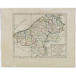
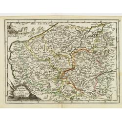
Carte du Comté de Flandre, suivant les nouvelles observations. . .
Including Flanders and part of Brabant. With decorative title cartouche lower right corner with coat of arms, a farmer and a person weaving textiles.
Place & Date: Amsterdam, 1728
Selling price: $25
Sold in 2022
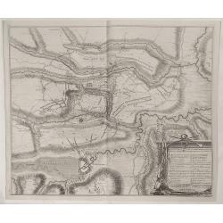
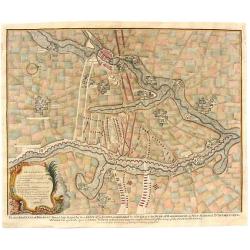
Plan der Veldslag van Oudernaerde den 11 July, 1708 ...
Fine detailed plan of the fortifications of Oudenaarde in Belgium by Dumont in 1729. Engraved by James Basire. Features a striking title cartouche with weapons. James...
Place & Date: Paris, 1729
Selling price: $1
Sold in 2023
L'Eveche et L'Etat de Liege Avec les appartenances designées dans les pais voisins Delineation nouvelle et exacte Aux depens de Matthieu Seutter
Beautiful cooper engraved map of the central part of Belgium and parts of the Netherlands by M. Seutter. Showing the area around Liège and Maastricht. The nice...
Place & Date: Augsburg, 1730
Selling price: $115
Sold in 2009
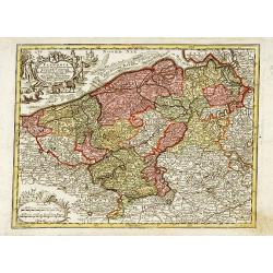
Flandria Maximus Et Pulcherrimus Europae Comitatus in suas Ditiones accurate distinctus. . .
A fine impression of this decorative map with its uncolored title cartouche, showing Flanders including the towns of Gent, Sluis, Bruges, Ostend, Brussels, Lille, Dunkerq...
Place & Date: Augsbourg, 1730
Selling price: $50
Sold in 2018
L'Eveche et l'Etat de Liege . . .
Detailed map centered on Liege. No text on verso. Very good impression done on thick paper.Matthaus Seutter the elder first published his "Atlas Geographicus" i...
Place & Date: Ausburg, 1730
Selling price: $45
Sold in 2018
Carte Particulière des Environs de Dunkerque, Bergues, Furnes, Gravelines, Calais et autres.
A fine example of Covens & Mortier's regional map of the Belgian - French coastline showing; Dunkerque, Bergtues, Furnes, Gravelines, Calais and other cities. This at...
Place & Date: Amsterdam, 1730
Selling price: $200
Sold in 2019
Kaart van 't graafschap Henegouwen.
Attractive map centred on the province of Cambrai and Mons, including two views of Mons and Valenciennes. Prepared by Daniel de La Feuille (1702) published in the rare fi...
Place & Date: Amsterdam 1735
Selling price: $10
Sold
Nova et exacta tabula geographica Salae et Castellaniae Iprensis Anno MDCXXXXI
A "carte à figures"-map the Dioceses of Ypres, with the towns of Ypres and Roeselare. With a panoramic view of the town in top and 20 vignettes of buildings at...
Place & Date: The Hague, Chr. Van Lom, 1732/1735
Selling price: $210
Sold in 2011
Plan of the Towm & Castle of Lerida.
Striking copperplate engraving featuring the approaches made by the French and Spanish armies during the Spanish War of Succession. Lovely Rococco cartouche. Paul de Rap...
Place & Date: London, 1740
Selling price: $90
Sold in 2016
Plan of the Battle of Wynendale.
Copper engraved battle plan between Major General Webb and Count de la Motte with actual miniature pictures of the troupes. Very fancy Rococco cartouche with canons, flag...
Place & Date: London, 1740
Selling price: $53
Sold in 2016
Plan of the City of Dendermonde.
Copper engraved city plan of Dendermonde showing how allied troops blocked it. Nice Rococo cartouche. Paul de Rapin (1661-1725) was a Frenchman responsible for publishing...
Place & Date: London - 1743
Selling price: $15
Sold in 2015
Doway, A Strong City in the Earldom of Flanders. - Plan of the City of Doway.
Interesting copper engraved plan of the Fortification of Doway. Fancy Rococco cartouche. Nicholas Tindal (1687-1774)/ Paul de Rapin (1661-1725) was a Frenchman responsi...
Place & Date: London, 1743
Selling price: $90
Sold in 2016
Plan of the Lines of Brabant forced July 18, 1705
This map of Brabant, Belgium is from Paul de Rapin's “The History of England” written in French by Mr. Rapin de Thoyras. The map represents a battle that took place d...
Place & Date: London, 1744
Selling price: $7
Sold in 2023
Carte Particuliere Des Environs D'Ostende Neuport Furnes et Autres
This is a seldom seen map of the coast of Belgium by one of the most prolific Belgian publishers of the 18th century, Eugène-Henri Fricx (1644-1740 c.). The map feature...
Place & Date: Brussels, 1744
Selling price: $150
Sold in 2023
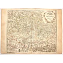
Carte des Comtéz de HAINAUT de NAMUR et de CAMBRESIS.
Map of the region of Mons, Maubeuge, Valencienes in the North of France and Namen and Huy in Belgium.Philippe Buache de la Neuville was born in Neuville-en-Pont (France) ...
Place & Date: Paris, 1745
Selling price: $30
Sold in 2020
I. Carte de l'Etat de Lyege ou se trouvent la Terre de Leon, et la Campine Lyegeoise.
Attractive small map encompassing the eastern part of the Flemish Limburg. It shows the town of Diest in the lower left corner. Dated 1748.From Atlas Portatif Universel, ...
Place & Date: Paris, 1748
Selling price: $12
Sold in 2022
V. Carte de l\'Etat de Lyege.. ou se trouvent Lyege, Hannuye, Huy..
Attractive small map showing part of the Wallon region, south west of Liège. Dated 1748. From Atlas Portatif Universel, by Robert de Vaugondy.Page 15e outside border top...
Place & Date: Paris, 1748
Selling price: $30
Sold in 2008
Carte Générale des Comtés de Haynaut, de Namur, et de Cambresis.
Attractive small map encompassing an area straddling the border between Belgium and France.Showing Cambrai, Tournai, Mons and Namur. Divided into 10 sections. From Atlas ...
Place & Date: Paris, after 1748
Selling price: $20
Sold in 2008
Carte Generale du Duché de Brabant.
Nice small map illustrating the Duchy of Brabant in the Low Countries. Divided into 10 sections. Centered on Herentals.The historical region consisted not only of the thr...
Place & Date: Paris, later than 1748
Selling price: $45
Sold
[IV.] Carte du Brabant où se trouvét la Mairie de Santhoven.. Ryen.
Nice small map encompassing an area which straddles the border between Belgium and the Netherlands.Showing Antwerp in the central lower part. From Atlas Portatif Universe...
Place & Date: Paris, later than 1748
Selling price: $70
Sold in 2008
VII. Carte du Brabant ou sont les environs de Bruxelles, de Malines et Liere.
Nice small map illustrating part of the Flemish region and the Brussels-Capital Region. It shows Brussels, Aalst, Dendermonde, Mechelen and Lier.From Atlas Portatif Unive...
Place & Date: Paris, later than 1748
Selling price: $30
Sold
[VIII.] Carte du Brabant ou sont les env.s de Louvain, d'Ascot, de Diest de Leeuwe &c.
Nice small map illustrating part of the Flemish region. It shows Leuven, Aarschot, Diest and Sint-Truiden.From Atlas Portatif Universel, by Robert de Vaugondy. Unrecorded...
Place & Date: Paris, later than 1748
Selling price: $1
Sold in 2022
I. Carte du Comté de Flandre où sont les env.s de l'Ecluse, d'Ardenburg.. &c.
Nice small map illustrating the southwestern most part of Zeeland. Centered on Sluis. Showing Aardenburg and Vlissingen. Dated 1768.From Atlas Portatif Universel, by Robe...
Place & Date: Paris, later than 1748
Selling price: $100
Sold in 2008
IV. Carte du Comté de Flandre où sont les environs de Bruges, d'Ostende, de Dixmunde.
Nice small map covering part of the West Flanders, delimited by Oostende, Bruges, Tielt, Roeselare and Diksmuide.From Atlas Portatif Universel, by Robert de Vaugondy. Unr...
Place & Date: Paris, later than 1748
Selling price: $95
Sold in 2008
V. Carte de la Flandre où sont les environs de Gand.. et d'Anvers.
Charming small map covering part of the East Flanders, delimited by Ghent, Sas van Gent, Aalst, and Antwerp.From Atlas Portatif Universel, by Robert de Vaugondy. Unrecord...
Place & Date: Paris, later than 1748
Selling price: $70
Sold in 2008
II. Carte du C.té de Haynaut où sont les environs de Halle, d'Enghien, de Braine le Comte.
Attractive small map encompassing part of Hainaut. It shows the towns of Enghien, Halle and Braine-le-Comte.From Atlas Portatif Universel, by Robert de Vaugondy.Unrecorde...
Place & Date: Paris, after 1748
Selling price: $50
Sold in 2015
Tabula Castelli ad Sanflitam, qua fimul inundati agri, alluvio nes, fossae, alvei, quae Bergas ad Zomam et Anverpiam interjacent, annotantur. . .
Fine, beautifully colored map of the Antwerp region of Belgium. Fleets of ships are depicted sailing in and out of the city of Antwerp. The city of Bergen op Zoom is also...
Place & Date: Amsterdam, c. 1750
Selling price: $250
Sold in 2010
Flandria maximus et pulcherrimus. . .
Flanders: the liberty of Bruges with the island of Cadzand. A decorative map including the towns of Gent, Sluis, Bruges, Ostend, Brussels, Lille, Dunkerque and many other...
Place & Date: Augsburg 1750
Selling price: $75
Sold in 2023
Partie Meridion. du Duche de Brabant. . .
Detailled map of a part of Belgique from his "Atlas Universel".Gilles Robert de Vaugondy (1688–1766), also known as Le Sieur or Monsieur Robert, and his son, ...
Place & Date: Paris, 1752
Selling price: $20
Sold in 2013
Comté de Flandre. . .
Detailled map of Flanders from his "Atlas Universel", with the privilege.Gilles Robert de Vaugondy (1688–1766), also known as Le Sieur or Monsieur Robert, and...
Place & Date: Paris, 1752
Selling price: $46
Sold in 2011
Partie Meridion. du Duche de Brabant.
Detailed map of a part of Belgium from his "Atlas Universel".Gilles Robert de Vaugondy (1688–1766), also known as Le Sieur or Monsieur Robert, and his son, Di...
Place & Date: Paris, 1752
Selling price: $75
Sold in 2014
La principaute de Liege et le duche de Limbourg.
Detailled map of Belgium around Liege from his "Atlas Universel".Gilles Robert de Vaugondy (1688–1766), also known as Le Sieur or Monsieur Robert, and his son...
Place & Date: Paris, 1754
Selling price: $50
Sold in 2013
Comtes de Hainaut et de Cambresis.
Large copperplate map of parts of Belgium and France including the counties of Hainaut, Cambrai, Flanders, Brabant and Namur. It was published by Robert de Vaugondy.
Place & Date: Paris, 1754
Selling price: $15
Sold in 2016
La Flandre Le Haynaut.
Fine map of the Flanders and the province of Hainaut. It presents a decorative title cartouche and a decorative cartouche on upper left corner. George Louis Le Rouge was ...
Place & Date: Paris 1756
Selling price: $30
Sold
Nuova Carta delle Contee di Fiandra, Artois ed Hannonia.
Detailed copper engraved map featuring the Flanders region of Belgium. Two block type cartouches. Published by Giambattista Albrizzi (1698-1777) who was a Venetian publis...
Place & Date: Venice from 1740-1762
Selling price: $16
Sold in 2016
Carte de Namur.
Johann Baptist Homann (1663-1724). Outstanding German cartographer. Founder of the Homann publishing house. After the death of the son Johann Christoph, the firm continue...
Place & Date: Nürnberg, c. 1770
Selling price: $40
Sold in 2013
Commitatus Hannoniae.
Johan Baptist Homann (1663-1724). Outstanding German cartographer. Founder of the Homann publishing house. After the death of the son Johann Christoph, the firm continued...
Place & Date: Nürnberg, c. 1770
Selling price: $40
Sold in 2013
LIEGE,
Map of the princedom of Liege and part of the Dutch province Limburg, with the cities of Maastricht and Liege in the centerpart of the map. An inset map represents the e...
Place & Date: Paris 1785
Selling price: $70
Sold
Les environs de Louvain..., Les environs de Limbourg, Rolduc,. . .
Showing the cities of Louvain, Liege, Aix la Chapelle, Cologne. . . The map was prepared by Jean Baptiste de Bouge (1757-1833), who prepared one of the first very detaile...
Place & Date: Bruxelles, 1789
Selling price: $25
Sold in 2017
Die Markgrafschaft des heiligen römischen Reichs Antwerpen mit der Herrschaft Mecheln.
A detailed large scale map of the area with Antwerp, Lier, Herentals, Geel, Mol, Turnhouta, Hoogstraten, etc. Shows many small towns.
Place & Date: Vienna, ca. 1790
Selling price: $30
Sold in 2018
IX. Carte du C.té de Haynaut où sont les environs de Philippeville, Marienbourg, Rocroix &c.
Attractive small map showing an area straddling the border between France and Belgium. It shows Philippeville, Marienbourg, Rocroi, Couvin and Chimay.From Atlas Portatif ...
Place & Date: Paris, 1799
Selling price: $15
Sold in 2020
Département des 2 Nethes.
Map representing the area around Antwerp, with a short key list in the upper right corner.From Atlas de la Géographie de toutes les parties du monde .. Ouvrage destiné ...
Place & Date: Paris, Prudhomme, Levrault, Debray, 1806
Selling price: $20
Sold in 2017
Département de l'Escaut.
Map centered on Gand, with a short key list in the lower left corner. From Atlas de la Géographie de toutes les parties du monde .. Ouvrage destiné pour l'education, et...
Place & Date: Paris, Prudhomme, Levrault, Debray, 1806
Selling price: $60
Sold
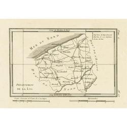
Département de la Lys.
Map representing the area between Furnes, Ypres, Courtray and Bruges, with a short key list in the upper right corner.From Atlas de la Géographie de toutes les parties d...
Place & Date: Paris, Prudhomme, Levrault, Debray, 1806
Selling price: $5
Sold in 2023
Sketch of the River Scheldt, from Flushing to Antwerp with the Soundings Fortifications, &c. 1810
A chart of a portion of the Scheldt River in Belgium. It is after the earlier work by the French hydrographer Beautemps Beaupre. Named places include: Antwerp, Fort Lillo...
Place & Date: London, 1810
Selling price: $65
Sold in 2019
Carte réduite des côtes des Pays-Bas.
repaired by Beautemps-Beaupreé. Covering the coast from Oostende till Hellevoetssluis. Giving exquisite detail with soundings. Upper left large advertisement, upper rig...
Place & Date: Paris, 1817
Selling price: $350
Sold in 2013
Les Comtez de Hainaut, de Cambresis, et Partie du Comté de Namur..
Uncommon map showing southern Belgium provinces south of Brussels and published by Crepy.Including the towns of Lille, Brussels, Namen, Dinant, Cambray, Mons, etc.
Place & Date: Paris, 1735
Selling price: $300
Sold in 2015
[Bottom of Very Large Map] The Duchy of Brabant.
This the bottom of a very large English map showing the following regions: Duchy of Brabant, Luxemburg, Duchy of Limburg, Bishoprick, French Flanders, County of Artois, C...
Place & Date: Unknown
Selling price: $32
Sold in 2017


![Flandria et Zeelandia Comitatus. / A Map of the County of Flanders. [Two maps]](/uploads/cache/40598-250x250.jpg)






![[IV.] Carte du Brabant où se trouvét la Mairie de Santhoven.. Ryen.](/uploads/cache/24684-250x250.jpg)

![[VIII.] Carte du Brabant ou sont les env.s de Louvain, d'Ascot, de Diest de Leeuwe &c.](/uploads/cache/24688-250x250.jpg)










![[Bottom of Very Large Map] The Duchy of Brabant.](/uploads/cache/98717-250x250.jpg)