Browse Listings in Europe
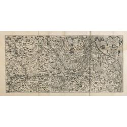
Brandeburgensis Marchiae Descriptio.
A very fine map centered on the towns of Brandenburg and Berlin. Nice title cartouche on the lower left corner.Prepared by Elias Camerius. Abraham Ortelius (1527-1598) wa...
Place & Date: Antwerp, 1598
Selling price: $70
Sold in 2018
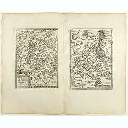
Turingiae Noviss../ Mansfeldiae Comitatus.
Two maps on one sheet. Left hand presents the province of Thüringen and is centered on the city of Erfurt. Nice cartouche on the lower left corner with a credit to the a...
Place & Date: Antwerp, 1598
Selling price: $50
Sold in 2020
Franciae Orientalis (Vulgo Franckenlant) Descriptio, Avctore, Sebast.A. Rotenhan. (with) Monasteriensis Et Osnaburgensis Episcopatvs Descriptio Auctore Godefrido Mascop Embricense. Cum privilegio.
The map of Frankenland is prepared by Sebastian Rotenhan (1478-1532) and showing the area between Frankfurt and Bamberg. To the right a map Monasteriensis which is after ...
Place & Date: Antwerp, 1598
Selling price: $50
Sold in 2018
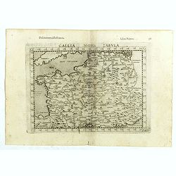
Gallia Nova Tabula.
The third state of Ruscelli's map of France, based upon Claudius Ptolemy. Girolamo Ruscelli first published the map in his "La Geographi di Claudio Tolomeo" (Ve...
Place & Date: Venice, 1598
Selling price: $50
Sold in 2018
Tavola nuova di Schiavonia.
The third state of Ruscelli's map of the Balkans, with a coat of arms in lower left corner, based upon Claudius Ptolemy. Girolamo Ruscelli first published the map in his ...
Place & Date: Venice, 1598
Selling price: $55
Sold in 2018
Europae tabula IX.
The third state of Ruscelli's map of The Balkans region, based upon Claudius Ptolemy. Showing the Balkans and Turkey. Girolamo Ruscelli first published the map in his &qu...
Place & Date: Venice, 1598
Selling price: $50
Sold in 2018
Tabula Asiae II.
The third state of Ruscelli's map of part of the Ukraine and the region between the Black Sea and Caspian Sea extending south to include all of Armenia Maior and part of ...
Place & Date: Venice, 1598
Selling price: $100
Sold in 2018
Wiismaria [Wismar].
Wismar is here shown in a cavalier perspective. The former Hanseatic city on the Baltic rises on the far side of Wismar Bay beyond a broad reach of land. The impressive s...
Place & Date: Cologne, 1598
Selling price: $425
Sold in 2020
Europa.
Fascinating, scarce early map of the Europe from Quad's Europae totius orbis terrarum, published by Johann Bussemacher. Quad's map is a fantastic amalgam of many cartogr...
Place & Date: Cologne, 1598
Selling price: $365
Sold in 2019
Heide / Meldorf.
Twin perspective bird's-eye views of Heide and Meldorf. HEIDE: The town of Heide is presented in a bird's-eye view from the south. The houses are arranged around the larg...
Place & Date: Cologne, 1598
Selling price: $300
Sold in 2019
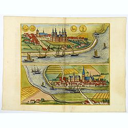
Tonning / Husum.
A pair of bird's-eye perspective views. TONNING: The illustration of Tönning shows a view across the Eider. The castle with five towers at the center of the town was bui...
Place & Date: Cologne, 1598
Selling price: $200
Sold in 2019
Odense.
The Danish city of Odense is presented in a sweeping panorama seen in a bird's-eye view from the south. The River Odense winding its way across the landscape flows into t...
Place & Date: Cologne, 1598
Selling price: $290
Sold in 2020
Halle / Hildesheim.
A pair of bird's eye perspective Views of Halle & Hildesheim. Halle is presented in a view across the Saale from the west. Particularly prominent on the skyline - hal...
Place & Date: Cologne, 1598
Selling price: $180
Sold in 2020
Plon.
Plön is shown in a sweeping bird's-eye view of the countryside surrounding the Greater and Lesser Lake Plön, on which a number of fishermen are seen at work. The palace...
Place & Date: Cologne, 1598
Selling price: $335
Sold in 2020
Calatia vulgo Caiazo.
The well-fortified town of Caiazzo (also called the Città dell'Olio, "City of Oil"), which lies northeast of Capua in the immediate vicinity of the Vilturno, i...
Place & Date: Cologne, ca 1598
Selling price: $175
Sold in 2020
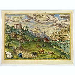
Elegantissimus a parte Orientali Oenipontis prospectus.
This engraving offers a view of the Inn Valley from the east. In its animation and dynamism, conveyed by the rural staffage, high mountains and dramatic, cloudy sky, the ...
Place & Date: Cologne, 1598
Selling price: $400
Sold in 2020
Senensis ditionis, Accurata descript.
Map by Ortelius of Tuscan Sea, with Siena in upper left corner. The map was based on a map of Caesar Orlandi.In attractive original colors. From 'Theatrum Orbis Terrarum ...
Place & Date: Antwerp, 1598
Selling price: $50
Sold in 2019
Rovigno [View of Rovinj]
Very rare view of Rovinj in Croatia situated on the north Adriatic Sea. Located on the western coast of the Istrian peninsula, it is a popular tourist resort and an activ...
Place & Date: Venice, Giacomo Franco, 1598
Selling price: $150
Sold in 2023
[The disposition of the Holy League fleet and that of the Ottoman Army during the Battle of Lepanto.]
Very rare print of the disposition of the Holy League fleet and that of the Ottoman Army (semicircle) during the Battle of Lepanto (1571), published in the first edition ...
Place & Date: Venice, Giacomo Franco, 1598
Selling price: $90
Sold in 2023
Golfo di Lepanto. [Map of the Gulf of Nafpaktos]
Very rare map of Gulf of Nafpaktos, known as Lepanto. It is named for Naupaktos, an important Athenian naval station in the Peloponnesian war. As a strategically crucial ...
Place & Date: Venice, Giacomo Franco, 1598
Selling price: $250
Sold in 2023
Scharpanto [Map of Scharpantos]
Very rare map of Karpathos Island published in the first edition of "Viaggio da Venetia, a Costantinopoli. Per Mare, e per Terra, & infieme quello di Terra Santa...
Place & Date: Venice, Giacomo Franco, 1598
Selling price: $450
Sold
Famagosta [Plan of Famagusta]
Very rare plan of Famagusta, situated east of Nicosia and possesses the deepest harbour of the island. During the medieval period (especially under the maritime republics...
Place & Date: Venice, Giacomo Franco, 1598
Selling price: $375
Sold in 2020
Hispalensis Conventus Delineatio, Auctore Hieronijmo Chiave...
The part of Andalusia centered on Seville, with Cadiz and Cordoba also shown. The second plate with overall stippling in the sea area (after 1595). The map is ornated wit...
Place & Date: Antwerp, 1598
Selling price: $160
Sold in 2020
Carpetaniae Partis Desc.1584. - Guipus Coae Regionis Typus.
An ornate and highly decorative set of three maps on one sheet, Calretinin, (upper left), Guipuzcoa, (upper right) and Cadiz (lower center). The maps are highly decorativ...
Place & Date: Antwerp, 1598
Selling price: $200
Sold in 2020
Polla/Viaggio Da Venetia [Pola in Istria] Rare 1st edition
Very rare view of the City of Pola in Istria. From the rare first edition of "Viaggio da Venetia, a Costantinopoli. Per Mare, e per Terra, & infieme quello di Te...
Place & Date: Venice, Giacomo Franco, 1598
Selling price: $130
Sold in 2021
[View of Navarino]
Very rare view of Navarino published in the first edition of "Viaggio da Venetia, a Costantinopoli. Per Mare, e per Terra, & infieme quello di Terra Santa. Da Gi...
Place & Date: Venice, Giacomo Franco, 1598
Selling price: $135
Sold in 2022
[View of Napoli Romania]
Very rare view of Nafplion published in the first edition of "Viaggio da Venetia, a Costantinopoli. Per Mare, e per Terra, & infieme quello di Terra Santa. Da Gi...
Place & Date: Venice, Giacomo Franco, 1598
Selling price: $200
Sold in 2022
Iaverinum vulgo Rab Anno 1594. [Gyor].
A plan of Györ after a sketch by Nicolao Aginelli of 1566, redrawn by Joris Hoefnagel for the fifth volume of the 'Civitates Orbis Terrarum', the first systematic atlas ...
Place & Date: Cologne, 1598
Selling price: $250
Sold in 2021
Poitiers & Montargis. - Pictavia Vulgo Poictiers [on sheet with:] La pierre levee demie lieue de Poictiers [and] Prospectus Montis Henrici vulgo Montherri.
Fine antique copper engraved sheet with one panoramic view, and two others by Braun and Hogenberg: Poitiers and Montargis from the uncommon fifth volume of Braun & Ho...
Place & Date: Cologne, 1598
Selling price: $270
Sold in 2021
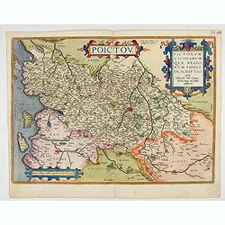
Poictou. Pictonum Vicinarum que Regionum Fidiss Descriptio.
Beautiful antique map of the former French province of Poitou, centered on the city of Poitiers.Reaching from the Atlantic to La Haye and Limoges and from Nantes to Cogna...
Place & Date: Antwerp, 1598
Selling price: $150
Sold in 2022
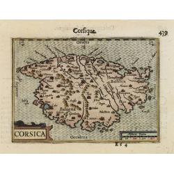
CORSICA.
A miniature map of Corsica.First published in 1598 in his Caert-Thresoor, the plates were executed by the most famous engravers in Amsterdam, including Petrus Kaerius and...
Place & Date: Amsterdam/Frankfurt 1599
Selling price: $170
Sold
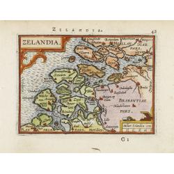
Zelandia.
Map of the Province of Zeeland, with its many islands and peninsulas. Major cities, small villages.
Place & Date: Amsterdam 1599
Selling price: $130
Sold
Tabula Asiae II
An interesting Ptolemaic map with trapezoidal projection. Shows the Caucasus region from the modern-day Crimea and Sea of Azov, to the mouth of the Volga River and the Ca...
Place & Date: Venice, 1599
Selling price: $160
Sold in 2016
Cantuarbury.
A beautifully rendered and decorative bird's-eye view of the famous English town of Canterbury. The plan identifies important sites and contains four coats-of-arms along ...
Place & Date: Cologne, 1599
Selling price: $350
Sold in 2017
Yorke - Shrowesbury - Lancaster - Richmont.
Four city plans by Braun & Hogenberg on one sheet : Plans of York, Shrewsbury and Lancashire and a view of the castle of Richmond.On each side of the four views are ...
Place & Date: Cologne, 1599
Selling price: $350
Sold in 2017
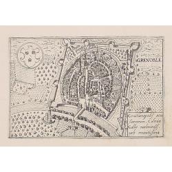
Grenoble.
Uncommon plan of Grenoble from Francesco Valegio's townbook: Raccolta di le piv illustri et farmose citta di tutto il mondo.
Place & Date: Venice 1600
Selling price: $45
Sold
[Zurichgow et Basiliensis Provincia].
Including the towns of Basle, Lucerne, Zürich, etc.Mercator was born in Rupelmonde in Flanders and studied in Louvain under Gemma Frisius, Dutch writer, astronom...
Place & Date: Amsterdam c.1600
Selling price: $42
Sold
Leodiensis Dioecesis Typus.
Engraved by Baptist Doetecum. East to the top. Showing the River Maas up to Roermond.
Place & Date: Amsterdam, 1600
Selling price: $210
Sold in 2015
Leodiensis Dioecesis Typus.
Engraved by Baptist Doetecum. East to the top. Showing the River Maas up to Roermond.
Place & Date: Amsterdam, 1600
Selling price: $150
Sold in 2018
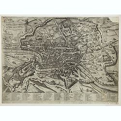
Novissima Urbis Romae Descriptio.
A rare view of Rome from the Lafreri-School.
Place & Date: Sienne, 1600
Selling price: $2325
Sold
Illyricum
Detailed early map of Istria, Slovenia and parts of Croatia. Skillfully engraved towns, mountains, woods and rivers! First issued 1572 by Johannes Sambucus, this is the 2...
Place & Date: Antwerp. c1600
Selling price: $200
Sold
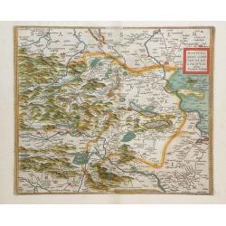
Schlavoniae, Croatiae, Carniae, Istriae, Bosniae...
Detailed early map after Hirschvogel of Southern Austria, Slovenia, Croatia, Bosnia and a small part of Italy. Artfully engraved map with many place names, showing towns,...
Place & Date: Antwerp, c1600
Selling price: $200
Sold
Thietmarsiae Holsaticaereg.
Petrus Bertius (1565- Paris,1629), Dutch cartographer and engraver. Pocket atlas ' Tabularum geographicarum contractarum', 1600-16, ' Totius orbis Terrarum', 1626. Worked...
Place & Date: Amsterdam, c. 1600
Selling price: $55
Sold
DESCRITTIONE DELL\'ISOLA DELL\'ELBA
Rare early map of Elba of the Tuscany coast. Beautifully engraved with pictoral symbols for the towns and decorated with seamonsters, ships, a mermaid, a compassrose and ...
Place & Date: Padua c.1600
Selling price: $180
Sold in 2010
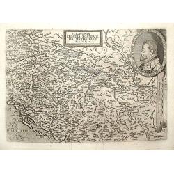
Sclavonia Croatia, Bosnia & Dalmatiae Pars Maior.
Matthias Quadt (1557-1613), Dutch geographer, worked in Cologne. ' Europae', 1592, 'Geographisch handtbuch, 1600 and Fasciculus Geographicus'. Johan Bussemacher published...
Place & Date: Cologne, 1600
Selling price: $120
Sold in 2018
Wratislavia silesie metropolis ad Odra et olaue Fluuiorum con fluentern sita est
Beautiful and detailed birdeye view of Wroclaw in Silesia, Poland. Signed in the plate by Francesco Valegio. Printed in Venice around 1600.
Place & Date: Venice, 1600
Selling price: $240
Sold in 2008
Citta dell\' Aqulia.
Rare and early plan of L\'Aquila in central Italy.Published by Jacobus Laurus.Rare, separately published, "Lafreri" map.
Place & Date: Rome, 1600
Selling price: $2150
Sold in 2008
Tab. II. Europae, Hispaniam ac Lusitaniam Complectens
An attractive Ptolemaic map of the Iberian Peninsula. Mercator originally published this map in his 1578 edition of Ptolemy's great Geography.
Place & Date: c.1600
Selling price: $290
Sold in 2009
Regni Hispaniae post omium editiones locupletissima descriptio.
Spain by Quad. Rare.
Place & Date: Coln, 1600
Selling price: $170
Sold in 2009
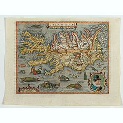
Islandia.
Quad's : reduced in size Ortelius´ map, of Iceland. With German text on verso, from Geographisch Handtbuch. Signed by the engraver Johan Bussemacher.Rare in original col...
Place & Date: Cologne, 1600
Selling price: $2070
Sold in 2016
Lutzenburgensis Ducatus Veriss Descript.
Map of the Luxembourg published by Ortelius, manuscript map prepared by Jacob Surhon. Surhon was paid 500 Livres for the manuscript map by Charles V in 1551. The map was ...
Place & Date: Antwerp, c. 1600
Selling price: $200
Sold in 2010
Mansfeldiae Comitatus Descriptioauctore Tilemanno Stella Sig.
Map of the region surrounding the town of Mansfeld (Mansfelt) in central Germany. The manuscript map drawn by Tilemann Stella. Mansfeld is the town that Martin Luther gre...
Place & Date: Antwerp, c. 1600
Selling price: $55
Sold in 2010
ANVERS
Uncommon copper engraved plan of Antwerp, with the harbor, the fortifications, and the surrounding area. Latin text on verso. Shows the streets and city walls, plus fiel...
Place & Date: Amsterdam, 1600
Selling price: $80
Sold in 2012
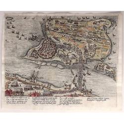
Der Candinal vor Hulst Komt An...
A very fine copper engraving of the attack of Hulst, showing the military strengths of opposing forces. Attack by Archduke Albert Von Austria, governor of the Netherlands...
Place & Date: Cologne, ca. 1600
Selling price: $37
Sold in 2018
Londen oder Lunden (Londinum Feracis: Ang. Met.).
Superb bird's-eye view of London based on the Braun & Hogenberg view. Shows the area between Clerkenwell, Wapping, Southwark and Westminster Abbey. Elizabethan costum...
Place & Date: Basle, c1600
Selling price: $650
Sold in 2013
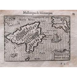
Majorcae et Minorcae descrip.
Superb miniature map of the Balearics. Including a sailing ship, sea monsters, and the title cartouche. With French text on verso.Published in his "Caert-Thresoor&qu...
Place & Date: Amsterdam, c. 1600
Selling price: $210
Sold in 2017
Moscoviae Imperium.
Early map of Imperial Russia and Ukraine by Mathias Quad, published by Johann Bussemacher and Wilhelm Lützenkirchen. It shows the Russian Empire in Europe from the Mare...
Place & Date: Cologne, 1600
Selling price: $550
Sold in 2014
Tabula Geographica Provinciarum Brabantiae, Geldriae, Comitatus sutphaniae, Trajectini, Transilvaniae, Drentiae, Twentiae, Hollandiae et Frisiae.
One of the rarest maps covering a large part of the Netherlands, engraved by Benjamin Wright and published by Cornelis Claesz. Schilder mentions only one other know copy ...
Place & Date: Amsterdam, c.1600
Selling price: $4000
Sold in 2014
Vera Designatio Urbis in Littavia Grodnae.
Shows a view of the city of Hrodna (Grodno. Different groups of people are crossing the wooden bridge and entering the city.After an engraving by Matthias Zündt, dated 1...
Place & Date: Cologne, c. 1600
Selling price: $650
Sold in 2014
Italia mit dreien fürnemsten Inseln / Corsika / Sardinia und Sicilia.
An early woodcut map from a German edition of Münster's famous 'Cosmographie.' Shows the area from Marseille to Albania, including the Adriatic Sea, the islands of Sicil...
Place & Date: Basel, ca. 1600
Selling price: $240
Sold in 2016
RynBerk (Seige of Rynberk).
This is a very detailed copper engraving with hundreds of identifiable soldiers, horses, fortresses and topographical places. It includes ships in the rivers.The Siege of...
Place & Date: Amsterdam, 1600
Selling price: $64
Sold in 2021
Britannia & Normandia cum confinibs regionibus.
An important early map of Bretagne (Brittany) and Normandie, extending to show Paris, the Channel Islands, and parts of Cornwall. Decorated with sailing ships, a sea mons...
Place & Date: Duisburg or Amsterdam, ca. 1600
Selling price: $121
Sold in 2017
Oropitum.
A lovely, detailed miniature map of the region around the Lago di Bolsena, including the cities of Montefiascone, Viterbo, Orvieto, and many more.
Place & Date: Antwerp, ca. 1600
Selling price: $17
Sold in 2017
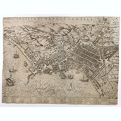
La Citta di Napoli Gentile.
Florimi's plan of the city of Naples derives from Mario Cartaro's plan (1579). Probably engraved by Arnoldo di Arnoldi (Arnold van Scherpenseel) who worked for a short ti...
Place & Date: Siena, c. 1600
Selling price: $1800
Sold
France Picardie Champaigne cum regionibus adiacentibus.
An early map of Bretagne (Brittany), Normandie, and Champagne. Extends from Arras to Auxerre and Orleans. Including Dieppe, Rouen, Paris, Verdun, towns are shown as small...
Place & Date: Amsterdam, ca 1600
Selling price: $14
Sold in 2018
Europa primi pars terrae in forma Virginis septentrio.
Desirable, famous and relatively scarce-to-rare item usually deemed a curiosity or oddity map. All of Europe is depicted in the form of a Queen wearing her crown and in f...
Place & Date: Magdeburg, ca 1581-1600
Selling price: $2750
Sold
Riga.
An early view of Riga from the seaside with many buildings shown. Set on a page with latin text printed on both sides. Published in Münsters famous "Cosmographie&qu...
Place & Date: Basel, ca 1600
Selling price: $35
Sold in 2018
Stocholmia [Stockholm].
The top engraving, showing the timber houses so typical of Scandinavia, is a view from the northeast across what was then the suburb of Norrmalm and is now the city centr...
Place & Date: Cologne, 1588-1600
Selling price: $650
Sold in 2020
Antverpia.
A spectacular bird's-eye view plan of Antwerp by Braun and Hogenberg after Georg Hoefnagel, with key to locations. From the famous Civitates Orbis Terrarum.COMMENTARY BY ...
Place & Date: Cologne, ca 1600
Selling price: $1080
Sold in 2020
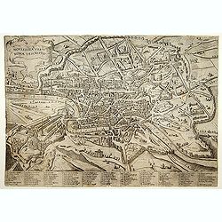
Novissima Urbis Romae Descriptio.
First state. A rare bird's-eye-view of Rome from the Lafreri-School. Numbered key below the view with 86 references. It is inspired by the plan created by Ambrogio Brambi...
Place & Date: Sienne, 1600
Selling price: $2200
Sold
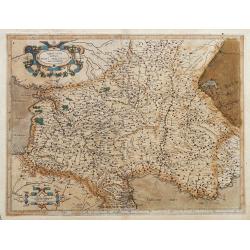
Aquitania australis regnu Arelatense cum confinijs
Early map of southern France, extending until Monaco, parts of Spain and Switzerland. Published in Mercators famous Atlas Sive Cosmographia. Latin text on verso.
Place & Date: Amsterdam, ca. 1600
Selling price: $75
Sold in 2022
Islandia.
Quad's : reduced in size Ortelius´ map, of Iceland. With German text on verso, from Geographisch Handtbuch. Signed by the engraver Johan Bussemacher.Matthias Quad was o...
Place & Date: Cologne, 1600
Selling price: $1900
Sold in 2023
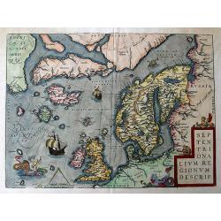
Septentrionalium Regionum Descrip.
A fantastic map of the northern Atlantic. Shows a part of America, Greenland, Iceland, the British Islands, Scandinavia, and parts of Europe and Russia. With several phan...
Place & Date: Antwerp, 1601
Selling price: $1500
Sold in 2016
Ducatus mediolanensis, ?
Miniature map of a part of Italy, with major cities named. Strapwork title cartouche. Latin text on verso.
Place & Date: Antwerp, 1601
Selling price: $110
Sold in 2010
Ceremonensis Ager.
Miniature map of a part of Italy, with major cities named. Strapwork title cartouche. Latin text on verso
Place & Date: Antwerp, 1601
Selling price: $85
Sold in 2010
Typus regni Neapolitani.
Miniature map of a part of Italy, with major cities named. Strapwork title cartouche. Latin text on verso.
Place & Date: Antwerp, 1601
Selling price: $110
Sold in 2010
Perusia.
Miniature map of a part of Italy, with major cities named. Strapwork title cartouche. Latin text on verso.
Place & Date: Antwerp, 1601
Selling price: $105
Sold in 2010
Apulia.
Miniature map of a part of Italy, with major cities named. Strapwork title cartouche. Latin text on verso.
Place & Date: Antwerp, 1601
Selling price: $85
Sold in 2010
Fori Iuly vulgo Friuli typus.
Miniature map of a part of Italy, with major cities named. Strapwork title cartouche. Latin text on verso.
Place & Date: Antwerp, 1601
Selling price: $155
Sold in 2010
Hispania.
Miniature map of a part of Spain and Portugal, with major cities named. Strapwork title cartouche. Latin text on verso.
Place & Date: Antwerp, 1601
Selling price: $100
Sold in 2010




![Wiismaria [Wismar].](/uploads/cache/42766-250x250.jpg)





![Rovigno [View of Rovinj]](/uploads/cache/45192-250x250.jpg)
![[The disposition of the Holy League fleet and that of the Ottoman Army during the Battle of Lepanto.]](/uploads/cache/45225-250x250.jpg)
![Golfo di Lepanto. [Map of the Gulf of Nafpaktos]](/uploads/cache/45227-250x250.jpg)
![Scharpanto [Map of Scharpantos]](/uploads/cache/45234-250x250.jpg)
![Famagosta [Plan of Famagusta]](/uploads/cache/45239-250x250.jpg)


![Polla/Viaggio Da Venetia [Pola in Istria] Rare 1st edition](/uploads/cache/84452-250x250.jpg)
![[View of Navarino]](/uploads/cache/45229-250x250.jpg)
![[View of Napoli Romania]](/uploads/cache/45231-250x250.jpg)
![Iaverinum vulgo Rab Anno 1594. [Gyor].](/uploads/cache/85304-250x250.jpg)
![Poitiers & Montargis. - Pictavia Vulgo Poictiers [on sheet with:] La pierre levee demie lieue de Poictiers [and] Prospectus Montis Henrici vulgo Montherri.](/uploads/cache/85896-250x250.jpg)


![[Zurichgow et Basiliensis Provincia].](/uploads/cache/14324-250x250.jpg)













![Stocholmia [Stockholm].](/uploads/cache/44040-250x250.jpg)

