Browse Listings in Europe
Calis Malis
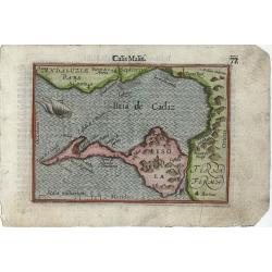
Very fine early miniature map of a part of the Bay of Cadiz, this map is from the first edition of the Langenes atlas, (later well known under the name of Bertius). Dutch...
Place & Date: Middelburg, 1598
Selling price: $70
Sold in 2012
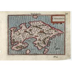
Cefalonia
Very fine early miniature map of the Greek island of Cefalonia (Cephalonia), this map is from the first edition of the Langenes atlas, (later well known under the name of...
Place & Date: Middelburg, 1598
Selling price: $60
Sold in 2010
PROVENZA. GALLI NARBONESIS ORA MARITIMA RECETI
Rare copper-engraved miniature map by Giovanni Botero. Shows the Provence with North orientated to the bottom. Charming map with many place names. Decorated with a smal...
Place & Date: Venice, 1598
Selling price: $131
Sold in 2011
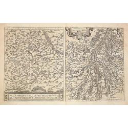
1) Palatinatvs Bavariae .. 2) Argentoratensis agri ..
From 'Theatrum Orbis Terrarum [Atlas of the Whole World]. The left hand map of Bavaria is after Erhart Reych's 4-sheet map of 1540. Including the towns of Regensburg, Nur...
Place & Date: Antwerp, 1598
Selling price: $50
Sold in 2016
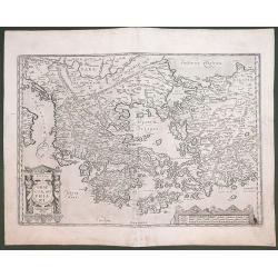
GRAECIA SOPHIANI.
An original copper engraving was published in 1598 in the famous historical Atlas 'Parergon' Latin text-edition by Abraham Ortelius. The map is ornate; with two cartouche...
Place & Date: Antwerp, 1598
Selling price: $650
Sold in 2012
Andegavensium Ditionis Vera et Integra Descriptio.
A superbly engraved map of the area around Angers on the Loire exhibiting all the qualities for which Ortelius maps are renowened more that four hundred years after their...
Place & Date: Antwerp, 1598
Selling price: $280
Sold in 2013
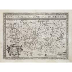
Brandeburgensis Marchiae Descriptio.
A very fine map centered on the towns of Brandenburg and Berlin. Nice title cartouche on the lower left corner.Prepared by Elias Camerius. Abraham Ortelius (1527-1598) wa...
Place & Date: Antwerp, 1598
Selling price: $250
Sold in 2011
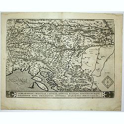
Schlavoniae, Croatiae, Carniale.. Bosniae. . .
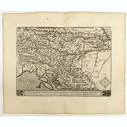
First state. Fine and early map of former Yugoslavia after a map of Hirschvogel (1552-1565) and used by A.Ortelius in his atlas 'Theatrum Orbis Terrarum [Atlas of the Who...
Place & Date: Antwerp, 1598
Selling price: $215
Sold in 2014
Daniae Regni Typus . . . / Cimbricae Chersonesi. .. [2 maps].
Two maps on one sheet. The left hand is centered on Denmark, with a credit to the cartographer, Cornelis Anthoniszoon (1499-1557) Cornelius Antoniades Descripsit .The rig...
Place & Date: Antwerp, 1598
Selling price: $375
Sold in 2012
Poictou / Pictonum Vicinarum Que Regionum Fidiss Descriptio...
Beautiful old colored map of the Poitou in Western France by Abraham Ortelius. Showing the Atlantic coast with La Rochelle up to Limoges in the East. Includes the Loire r...
Place & Date: Antwerp, 1598
Selling price: $120
Sold in 2015
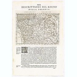
Poloniae Regnum.
A detailed map of Poland, Lithuania and the Ukraine stretching from the Baltic Sea in the north to the Black Sea in the south.Italian text on recto and verso.The map come...
Place & Date: Venice, Galignani, 1597-1598
Selling price: $220
Sold in 2018
Islandia.
From the rare Dutch text edition of the Theatrum of which according to van den Broecke only 100 copies are printed.Perhaps the most famous map of Iceland. On the south si...
Place & Date: Antwerp, 1598
Selling price: $6000
Sold in 2016
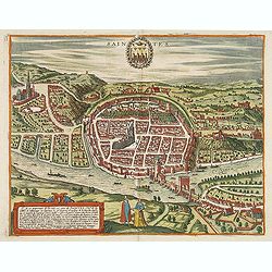
Saintes.
Bid's-eye view of Saintes with the river la Charente in the front. French text on verso.
Place & Date: Cologne, 1598
Selling price: $400
Sold in 2014
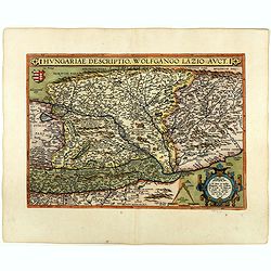
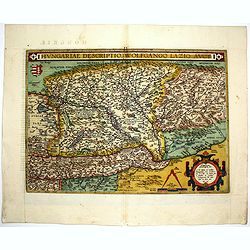
Hungariae Descriptio ..
A very fine map of Hungary, centered on Budapest. The map was prepared by Wolfgang Lazius in 1556. Very decorative cartouche on the lower right corner.Abraham Ortelius (1...
Place & Date: Antwerp, 1598
Selling price: $205
Sold in 2014
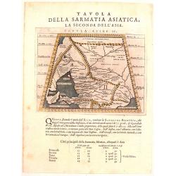
Tavola Della Sarmatia Asiatica, La Seconda Del L'Asia.
This is the second Prolemy map of Asia. It features the Crimea region of Russia showing the Caucasus region north of the Black Sea and east of the Sea of Asov with a smal...
Place & Date: Venice, 1598
Selling price: $180
Sold in 2018
Islandia.
Perhaps the most famous map of Iceland. On the south side of the island a collection of all possible sea monsters is depicted. Polar bears on ice flows and volcanoes in t...
Place & Date: Antwerp, 1598
Selling price: $5800
Sold in 2015
Florentini Dominii Fidelissima et nova descriptio.
Very fine map bu Ortlius including the towns of Pisa, Florence, Siena, etc. The map is based on Stefano Buonsignori's map.Copper engraving with French text on verso. Abra...
Place & Date: Antwerp, 1598
Selling price: $590
Sold in 2015
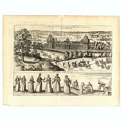
Palatium Regium in Angliæ Regno Appelatum Nonciutz. . .
This engraving is a view of Nonsuch Palace, with carriages and deer hunting, a panel of female costume figures below. Latin text verso, dated in the plate 1582. The scene...
Place & Date: Cologne, 1598
Selling price: $400
Sold in 2016
Austriae Descrip. per Wolfgangum Lazium.
An early map of eastern Austria, Salzburg to Bratislava. In the south until Carinthia and the Drau river. An excellent and detailed map with many cities and towns, rivers...
Place & Date: Amsterdam, 1598
Selling price: $55
Sold in 2017
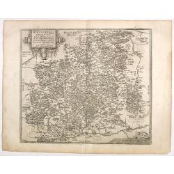
Wirtenberg Ducatus.
Ortelius copied the map after Georg Gadner's map of 1572.Very decorative and a masterpiece in the sense of engraving and composition.
Place & Date: Antwerp, 1598
Selling price: $50
Sold in 2016
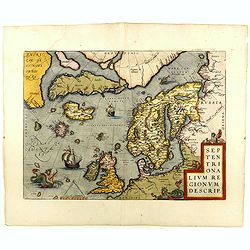
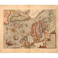
SEPTENTRIONALIUM REGIONUM DESCRIP, 1598
A copperplate full colored decorative map of North Europe.This influential map of the Arctic, including Scandinavia, Iceland, Greenland and part of the North American con...
Place & Date: Antwerp, 1598
Selling price: $950
Sold in 2019
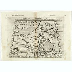
Europae Tabula VIII.
The third state of Ruscelli's map of Eastern Europe and Scandinavia, based upon Claudius Ptolemy. Showing "Daniae et Norvegiae" as an island, with a separate is...
Place & Date: Venice, 1598
Selling price: $175
Sold in 2018
Iaverinum vulgo Rab.
View of Gyor, engraved by G. Hoefnagel, from Braun & Hogenberg's "Civitatus Orbis Theatrum", the most famous atlas of city views published in the 16th Centu...
Place & Date: Cologne, 1598
Selling price: $300
Sold in 2017
Hiberniae Britannicae insulae nova descriptio.
Copied from Mercator's influential wall map of the British Isles of 1564, this is certainly the best map of Ireland of the 16th century.Dare to go in Black. All early map...
Place & Date: Antwerp, 1598
Selling price: $500
Sold in 2018
Cambriae Typus.
Ancient map of Wales, prepared by Humphrey Lhuyd. With fine cartouche, part of a compass-rose and a sea monster.Dare to go in Black. All early maps are printed in black a...
Place & Date: Antwerp, 1598
Selling price: $280
Sold in 2018
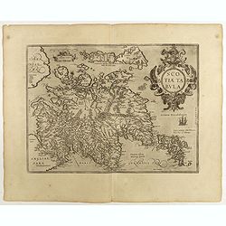
Scotiae tabula.
Fine general map of Scotland with north to right of page. Derived from Mercator's 1564 map of the British Isles in 8 sheets.Dare to go in Black. All early maps are printe...
Place & Date: Anwerp, 1598
Selling price: $375
Sold in 2018
Valentiae Regni ...
An attractive map of the province of Valence. Title cartouche centered on the lower part.Dare to go in Black. All early maps were printed in black and white, and many wer...
Place & Date: Antwerp, 1598
Selling price: $250
Sold in 2019
Portugalliae que olim Lusitania.
The best-known map of Portugal, after Alvares Secco (1560), orientated west to the top of the sheet. Many mapmakers and publishers copied Secco's map for upwards of a cen...
Place & Date: Antwerp, 1598
Selling price: $220
Sold in 2018
Regni Hispaniae Post Omnium Editio..
Very decorative map of Spain and Portugal including Majorca and Minorca.Dare to go in Black. All early maps were printed in black and white, and many were kept that way f...
Place & Date: Antwerp, 1598
Selling price: $275
Sold in 2018
Nobilis Hanoniae Comitatus descrip.
Including part of Belgium and the northern part of France.Dare to go in Black. All early maps were printed in black and white, and many were kept that way for a long time...
Place & Date: Antwerp, 1598
Selling price: $85
Sold in 2018
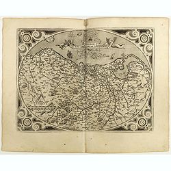
Descriptio Germaniae Inferioris.
The oval map is surrounded by a strapwork frame and the title, adorned with ribbons, is held aloft by two winged cherubs. Dare to go in Black. All early maps were prin...
Place & Date: Antwerp, 1598
Selling price: $400
Sold in 2021
Germania.
General map of Germany, including Switzerland, Austria, The Netherlands and Belgium. Dare to go in Black. All early maps were printed in black and white, and many were...
Place & Date: Antwerp, 1598
Selling price: $250
Sold in 2021
Burgundiae Comitatus Recentiss. Descriptio.
From 'Theatrum Orbis Terrarum [Atlas of the Whole World]'. Dare to go in Black. All early maps were printed in black and white, and many were kept that way for a long ...
Place & Date: Antwerp, 1598
Selling price: $75
Sold in 2022
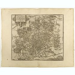
Westphaliae . . .
A very fine map of Westphalia prepared by Christian sGroten. A very decorative cartouche on the upper right corner.Abraham Ortelius (1527-1598) was a cartographer and pub...
Place & Date: Antwerp, 1598
Selling price: $50
Sold in 2022
Thietmarsiae Holsaticae . . . (together with) Rugiae . . .
Two maps on one sheet: Left a fine map of Holstein: The island of Rugia and part of Pomerania on the right hand sheet. Abraham Ortelius (1527-1598) was a cartographer and...
Place & Date: Antwerp, 1598
Selling price: $50
Sold in 2022
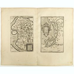
Daniae Regni .. / Oldenburg Com. [2 maps].
Two maps on one sheet. The left hand is centered on Denmark, with a credit to the cartographer, Cornelis Anthoniszoon (1499-1557) Cornelius Antoniades Descripsit .The rig...
Place & Date: Antwerp, 1598
Selling price: $120
Sold in 2018
Frisia Orientalis.
Includes the provinces of Friesland. The map was prepared by Jan Bloemmaerts. Dare to go in Black. All early maps were printed in black and white, and many were kept t...
Place & Date: Antwerp, 1598
Selling price: $200
Sold in 2023
Frisia Occidentalis.
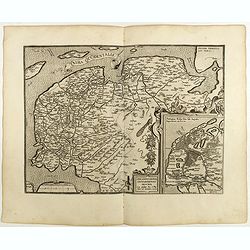
Includes the provinces of Friesland and Groningen. The map was prepared by Sibrandus Leonis (Leo Sybrands) from Leeuwarden in 1579. In a large inset a map of the Netherla...
Place & Date: Antwerp, 1598
Selling price: $250
Sold in 2022
Flandriae Comitatus Descriptio.
Very fine map of Flanders, after Gerard Mercator's map of 1540. Dare to go in Black. All early maps were printed in black and white, and many were kept that way for a ...
Place & Date: Anvers, 1598
Selling price: $240
Sold in 2018
Austriae Descrip. Par Wolfganum Lazium.
Early map of the Duchy of Austria, engraved after the cartographic source by Wolfgang Lazius.Dare to go in Black. All early maps were printed in black and white, and many...
Place & Date: Antwerp, 1598
Selling price: $100
Sold in 2021
Regni Bohemiae descriptio.
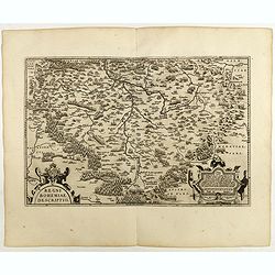
Fine and early map of Czechoslovakia after Johann Criginger. and used by A.Ortelius in his atlas 'Theatrum Orbis Terrarum [Atlas of the Whole World].Only included in the ...
Place & Date: Antwerp, 1598
Selling price: $200
Sold in 2019
Ducatus Mediolanensis.
A very nice map of Italy, centered on Milan, prepared by Johannes Septala. Very decorative title cartouche on the left side. A sea monster and a ship are depicted on the ...
Place & Date: Antwerp, 1598
Selling price: $250
Sold in 2022
Veronae Urbis Territorium.
Very fine map of part of Italy centered on Verona, Vizenza and Lake Garda. Prepared by Bernardino Brugnoli, which first was published in 1574 by Forlani. Ortelius' map is...
Place & Date: Antwerp, 1598
Selling price: $200
Sold in 2018
Fori Ivlii accvrata descriptio
Map from 'Theatrum Orbis Terrarum [Atlas of the Whole World]': published in Antwerp.Dare to go in Black. All early maps are printed in black and white and many were kept ...
Place & Date: Antwerp, 1598
Selling price: $375
Sold in 2018
Rhetiae alpestris descriptio, . . . Goritiae, Karstii, . . .
Two maps from 'Theatrum Orbis Terrarum [Atlas of the Whole World]':published in Antwerp.Dare to go in Black. All early maps are printed in black and white and many were k...
Place & Date: Antwerp, 1598
Selling price: $250
Sold in 2020
Schlavoniae, Croatiae, Carniale.. Bosniae. . .
Fine and early map of former Yugoslavia after a map of Hirschvogel (1552-1565) and used by A.Ortelius in his atlas 'Theatrum Orbis Terrarum [Atlas of the Whole World]. Wi...
Place & Date: Antwerp, 1598
Selling price: $305
Sold in 2022
Graeciae Universae Secundum Hodiernum Situm Neoterica descriptio.
Ortelius' fine map of Greece, based on Jacobo Gastaldi's map of 1560. The early imprint with the uncorrected scale bar numeral.Dare to go in Black. All early maps are pri...
Place & Date: Antwerp, 1598
Selling price: $275
Sold in 2018
Archipelagi Insularum Aliquot Descrip.
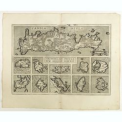
Very decorative map showing map of Crete and 10 insets of Greek islands: Candia, Metellino, Santorini, Milo, Rodus, Scio, etc.Dare to go in Black. All early maps are prin...
Place & Date: Antwerp, 1598
Selling price: $300
Sold in 2021
Ischia, quae olim Aenaria.
Prepared by Giulio Iasolino (1537-1622), who wrote a book about Ischia in 1568 and its beneficial baths which included a map of the island, which Ortelius faithfully foll...
Place & Date: Antwerp, 1598
Selling price: $300
Sold in 2018
Perusini Agri.
A very nice map of northern province of Italy, centered on Perugia. Very nice title cartouche on the lower right corner, with a credit to the cartographer who prepared th...
Place & Date: Antwerp, 1598
Selling price: $200
Sold in 2019
Transilvania.
Detailed map of Hungary prepared by Sambucas in 1566, who itself based his map on Honter's map of 1532.Dare to go in Black. All early maps are printed in black and white ...
Place & Date: Antwerp, 1598
Selling price: $350
Sold
Ungariae Loca Praecipva..
Map of Hungary.Dare to go in Black. All early maps are printed in black and white and many were kept that way for a long time. A black and white map in an early and stron...
Place & Date: Antwerp, 1598
Selling price: $250
Sold in 2022
Illyricum.
Early map of Istria and Slovenia. Prepared by Johann Sambucus 1572. Abraham Ortelius (1527-1598) was a cartographer and publisher, who is born and died in Antwerp. Publis...
Place & Date: Antwerp, 1598
Selling price: $150
Sold in 2018
Graeciae Sophiani.
This is a beautiful depiction of ancient Greece. The map has a beautiful title cartouche in the shape of a Grecian temple in the bottom left-hand corner and a large scale...
Place & Date: Antwerp, 1598
Selling price: $275
Sold in 2018
Palatium Regium in Angliæ Regno Appelatum Nonciutz. . .
This fine engraving is a view of Nonsuch Palace, with carriages and deer hunting, a panel of female costume figures below. Latin text verso, dated in the plate 1582. The ...
Place & Date: Cologne, 1598
Selling price: $450
Sold in 2019
Carpetaniae Partis Desc.1584. - Guipus Coae Regionis Typus.
An ornate and highly decorative set of three maps on one sheet, Carpetanin, (upper left), Guipuzcoa, (upper right) and Cadiz (lower center). The maps are highly decorativ...
Place & Date: Antwerp, 1598
Selling price: $200
Sold in 2018
Hispalensis Conventus Delineatio, Auctore Hieronijmo Chiave...
The part of Andalusia centered on Seville, with Cadiz and Cordoba also shown. The second plate with overall stippling in the sea area (after 1595). The map is ornated wit...
Place & Date: Antwerp, 1598
Selling price: $200
Sold in 2018
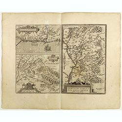
Venuxini Comitatus Nova Descr. / Gallia Narbonensis. / Sabaudiae Ducat.
Three maps on one sheet. Upper left the coast of the Mediterranean Sea (with places like Narbonne, Aigues Mortes, Avignon, Arles etc. In the bottom left corner a map of t...
Place & Date: Antwerp, 1598
Selling price: $180
Sold in 2019
Hassiae Descriptio / Holsatiae Descriptio.
Two maps on one sheet. Left hand presents the province of Hessen, centered on the city of Munich : the right part shows the province of Holstein. Very nice cartouche on t...
Place & Date: Antwerp, 1598
Selling price: $50
Sold in 2020
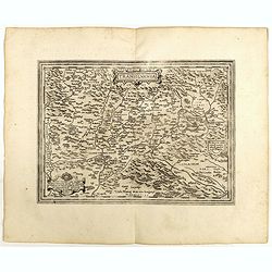
Saxoniae Misniae Thuringiae.
A very fine map of Saxen, Misnie and Thüringen . A very decorative title cartouche on the lower left corner, and a symbolized legend cartouche on the upper right corner....
Place & Date: Antwerp, 1598
Selling price: $60
Sold in 2020
Wirtenberg Ducatus . . .
Ortelius copied the map after Georg Gadner's map of 1572.Very decorative and a masterpiece in the sense of engraving and composition.Abraham Ortelius (1527-1598) was a ca...
Place & Date: Antwerp, 1598
Selling price: $50
Sold in 2023
Salisburgensis Iuridictionis.
Prepared by the Salzburg-born cartographer Marcus Secsnagel (1520-1580). Title cartouche on the lower right corner. Abraham Ortelius (1527-1598) was a cartographer and pu...
Place & Date: Antwerp, 1598
Selling price: $200
Sold in 2021
Bavariae, olim vindeliciae delineationis..
Fine and early map of Bavaria, prepared by Philipp Apian in 1561 and used by Ortelius in his atlas 'Theatrum Orbis Terrarum [Atlas of the Whole World]. The Theatrum was r...
Place & Date: Antwerp, 1598
Selling price: $50
Sold in 2018
Thusciae descriptio . . .
Very fine map of Tuscany after Girolamo Bellarmati (1493-1555). In lower right hand corner Rome, includes Chianti wine region, Pisa, Florence, etc.Abraham Ortelius (1527-...
Place & Date: Antwerp, 1598
Selling price: $275
Sold in 2021
Pedemontanae vicinorumque...
Very fine map of Piemonte after Giacomo Gastaldi (1500-1566). Including towns of Turin, Milan, Genoa, S.Remo, Monaco, etc.Abraham Ortelius (1527-1598) was a cartographer ...
Place & Date: Antwerp, 1598
Selling price: $400
Sold in 2018
Brixiani Agri Typus [Brescia].
A very nice map of northern province of Italy, Brecia. Copied after a map prepared in 1560 by Christoforo Sorte. Very large title cartouche on the lower left corner. Abra...
Place & Date: Antwerp, 1598
Selling price: $185
Sold in 2018
Agricremonensis Typus
Very decorative map of northern Italy with the city of Cremona near the center. The map is based on the 1571 map of Antonio Campi. Large inset of essentially the same reg...
Place & Date: Antwerp, 1598
Selling price: $195
Sold in 2018
Regni Neapolitani verissi..
Very fine map of Southern Italy, including the towns of Ascoli Piceno, Napels, Fogia, Bari, Catanzaro, most northern tip of Sicily with Messina. The map is based on Pirro...
Place & Date: Antwerp, 1598
Selling price: $250
Sold in 2022
Aprutii Ulterioris Descriptio.
Very fine map covering Abruzzi area, including the towns of Ascoli Piceno, Teramo, Pescara, etc. Prepared by Natale Bonifacio (1538-1592). Three fine title cartouches. A ...
Place & Date: Antwerp, 1598
Selling price: $200
Sold in 2018
Septentrionalium Regionum Descrip.
This influential map of the Arctic, including Scandinavia, Iceland, Greenland and part of the North American continent, includes also the legendary islands of i.a. Drogeo...
Place & Date: Antwerp, 1598
Selling price: $1750
Sold in 2018
Insularum Aliquot Maris Mediterranei Descriptio.
Six maps on one sheet. In the center a map of Sicily, surrounded by maps of Sardinia, Djerba, The island of Elbe, Corfu and Malta.
Place & Date: Antwerp, 1598
Selling price: $700
Sold in 2018
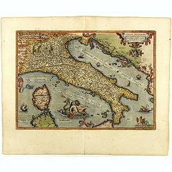
Italiae Novissima descriptio. . .
Very fine map of Italy after Giacomo Gastaldi. Embellished with a title cartouche, vessels, sea monsters and sea gods. No text on verso.Abraham Ortelius (1527-1598) was a...
Place & Date: Antwerp, 1598
Selling price: $750
Sold in 2018
Islandia.
Perhaps the most famous map of Iceland. On the south side of the island a collection of all possible sea monsters is depicted. Polar bears on ice flows and volcanoes in t...
Place & Date: Antwerp, 1598
Selling price: $6300
Sold in 2018
Romani Imperii Imago.
An attractive map of the second plate prepared (after 1592) of the Roman Empire, drawn by Ortelius and published in the 'Paregon' section. The medallion portraits are of ...
Place & Date: Antwerp, 1598
Selling price: $700
Sold in 2018
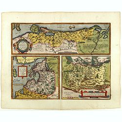
Pomeraniae, Wandalicae Regionis, Typ. - Livoniae Nova Descriptio, Ioanne Portantio auctore. - Ducatus Oswieczensis, et Zatoriensis, Descriptio.
Three maps on one sheet. The first map covers northern part of Pomerania. The map of Livonia is prepared by Johannes Portanius, who was a contemporary of Ortelius who als...
Place & Date: Antwerp, 1598
Selling price: $450
Sold in 2018
Hungariae Descriptio ..
A very fine map of Hungary, centered on Budapest. The map was prepared by Wolfgang Lazius in 1556. Very decorative cartouche on the lower right corner.Abraham Ortelius (1...
Place & Date: Antwerp, 1598
Selling price: $325
Sold in 2018
Prussiae descriptio. . .
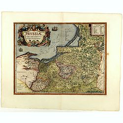
Fine map of Ortelius' first map of Prussia, with a striking cartouche and two sailing ships, showing part of present day Poland.The map was prepared by Caspar Henneberger...
Place & Date: Antwerp, 1598
Selling price: $450
Sold in 2018
Poloniae, Lituaniaeq descriptio.
Fine general map of Poland. Rare, the second plate appearing in post-1595 edition of the Theatrum. Only used until 1612. Based on the now lost map of Waclaw Grodecki. Sho...
Place & Date: Antwerp, 1598
Selling price: $900
Sold in 2018
Bornnes / Zahara.
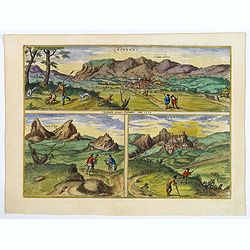
Three fine engravings after G> Hoefnagel, dated 1564 of two towns in the province of Cadiz. The two engravings of the hill-top town of Zahara are taken from the west, ...
Place & Date: Cologne, ca 1598
Selling price: $210
Sold in 2020
Gemeine Beschreibung aller Mitnachtigen Lander / alss Schweden / Gothen / Norwegien / Denmarck / &c.
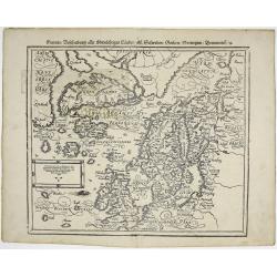
Sebastian Münster’s third and final map of Scandinavia including England, Denmark, Norway, Sweden, Iceland, The Baltics, Greenland and America by Sebastian Munster 159...
Place & Date: Basle, 1598
Selling price: $700
Sold in 2019


![Daniae Regni Typus . . . / Cimbricae Chersonesi. .. [2 maps].](/uploads/cache/32297-250x250.jpg)











![Daniae Regni .. / Oldenburg Com. [2 maps].](/uploads/cache/40978-250x250.jpg)














![Brixiani Agri Typus [Brescia].](/uploads/cache/41011-250x250.jpg)


