Browse Listings in Europe
Salisburgensis Jurisdictio.
Minature copperplate map of the region around Salzburg in Austria by Abraham Ortelius. It was published by Plantin for Ortelius's "epotome" in 1593. It was engr...
Place & Date: Antwerp, 1593
Selling price: $35
Sold in 2019
Typus Vindeliciae Sive Utriusque Bavariae.
Charming miniature map of Danube River as it passes through Bavaria. It is from Philip Galle's 1593 Italian edition of the Epitome. Simple title cartouche.
Place & Date: Rome, 1593
Selling price: $40
Sold in 2017
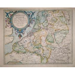
Germania Inferior Gallia, Belgica dicta, continens Hispaniarum Regis Provincias Septentrionalis.
Extremely rare map of Belgium, Luxemburg and the Netherlands from: "Speculum Orbis Terrarum" by Gerard and Cornelis de Jode.In 1578 Gerard de Jode published his...
Place & Date: Antwerp, 1578 - 1593
Selling price: $900
Sold in 2016
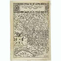
Saltzburgensis episcopatus.
Scarce map of the diocese Salzburg embraces the area between Braunau and Klagenfurt in Austria. The coat of arms belongs to Wolf Dietrich von Raitenau, the bischof of Sal...
Place & Date: Antwerp, 1593
Selling price: $220
Sold in 2020
Topographia Insulae Huenae in Celebri Porthmo Regni Daniae, quem vulgo Oersunt Vocant.
Shows the Island of Hven, where Tycho Brahe had his observatory, Uraniborg. Latin text on verso. More about Braun and Hogenberg, Civitatus [+]
Place & Date: Cologne, 1593
Selling price: $350
Sold in 2016
Helsheborch - Lunden - Elbogen - Landeskron.
Decorative bird's eye views of the cities Helsingburg, Lunden, Elbogen and Landeskron. Four city views on one sheet. More about Braun and Hogenberg, Civitatus [+]
Place & Date: Cologne, 1593
Selling price: $300
Sold in 2016
Freti Danici or Sundt Accuratiss Delineatio.
Bird's-eye view of The Sound with Helsingborg, Landskrona and Elbogen. Inset with a view of Kronenborg Castle. More about Braun and Hogenberg, Civitatus [+]
Place & Date: Cologne, 1593
Selling price: $650
Sold in 2016
Wie wir zu Honfleur zu Schiff giengen... (Honfleur, Normandy)
The view depicts numerous ships at harbour in Honfleur for loading proviant for their journey to the Americas. From the 3rd book, part 1 of Le Moyne's highly important ac...
Place & Date: Frankfurt, 1593
Selling price: $105
Sold in 2016
Oxonium nobile Anglie oppidum...
A decorative view of Oxford, from Braun & Hogenberg's "Civitatus Orbis Theatrum", the most famous atlas of city views published in the 16th Century. A fine ...
Place & Date: Cologne, 1593
Selling price: $170
Sold in 2017
Lugdunum (Lyon).
A nice, old-colored view of the French city of Lyon, from the first volume of the famous Civitates Orbis Terrarum. A very decorative, large early map of Lyon, that descri...
Place & Date: Antwerp, 1593
Selling price: $260
Sold in 2018
Prussiae Regionis Sarmatiae Europae Nobilissimae Novaet vera descriptio . . .
Nice example of the first edition of De Jode's map of Prussia, from the 1593 edition of De Jode's atlas.The present map is an entirely new addition to the second De Jode ...
Place & Date: Antwerp, 1593
Selling price: $1600
Sold in 2018
[Title page] Germania geographicis tabulis illustrata. .
Very rare and beautiful title page from the second edition of Cornelis de Jode rare atlas. In lower part a map of Germany, Poland and the Low Countries.
Place & Date: Antwerp, 1593
Selling price: $600
Sold
[Untitled.] A Rarity of the Balkans with Fine Original color. Balkans/ Greece/ Istanbul.
A rare and attractive work with rich, full, original color; one of the earliest atlas maps to focus on Serbia and the lands around the mouth of the Danube. The map also p...
Place & Date: Antwerp, 1593
Selling price: $425
Sold in 2019
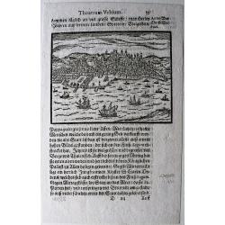
Lissabon.
Rare, small view of Lisbon, from the 'Theatrum Urbium' by Abraham Saur, first published in 1581.
Place & Date: Frankfurt, 1593
Selling price: $90
Sold in 2020
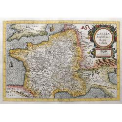
Galliae Amplissimi Regni tabula.
Very rare map which was only published once in the 1593 edition of the Speculum orbis terrae. A highly decorative and beautifully engraved map. Centered on France, also ...
Place & Date: Antwerp, 1593
Selling price: $700
Sold in 2021
[Departure from Lisbon for Brazil, the East Indies and America]
Departure of Hans Steden on his first voyage to Brazil from Lisbon. Steden made two voyages to Brazil, 1546 to 1548 and 1549 to 1555.Read more about "Les Grand Voyag...
Place & Date: Frankfurt, 1594
Selling price: $175
Sold in 2023
[Hans Staden Arrives in Lisbon] De Ijs quae acciderunt circa primam navigationem
The arrival of Hans Staden in Lisbon. Hans Staden (c. 1525 – c. 1576) was a German soldier and explorer who voyaged to South America in the middle of the sixteenth cent...
Place & Date: Frankfurt, 1594
Selling price: $200
Sold in 2023
Tusciae Antiquae Typus.
Based on Bellarmati's map of Tuscany, supplemented by classical sources, viz. Livius, Plinius, Cato, Virgil, Halicarnassaeus and Plutarchus.This map belongs to a series o...
Place & Date: Antwerp 1595
Selling price: $400
Sold
Europam, Sive Celticam Veterem.
Possibly derived to some extent from Ortelius' own two sheet map of the Roman Empire, which appeared in 1571. Further, this map is based on classical sources, such as Sal...
Place & Date: Antwerp 1595
Selling price: $390
Sold
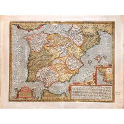
Hispaniae Veteris descriptio.
Made on the basis of modern information from Clusius' six-sheet map of Spain which appeared in 1571 and ancient knowledge from Strabo, Appianus, Bongarius, Livius, Valeri...
Place & Date: Antwerp 1595
Selling price: $255
Sold
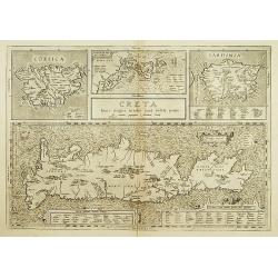
Creta Iouis magni../Corsica../ Sardinia..
Islands are shown with place names and important locales as they existed in the Classical Period. Ortelius mentions as his classical sources Strabo, Palenses, Athenaeus, ...
Place & Date: Antwerp 1595
Selling price: $270
Sold
Daciarum, Moesiarumque, Vetus descriptio.
Decorative ancient map of Hungary. From his historical atlas including a series of maps prepared by Ortelius himself.Signed lower left hand corner Ex conatibus Abrahami O...
Place & Date: Antwerp 1595
Selling price: $110
Sold
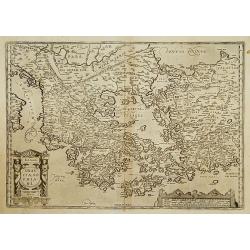
Graeciae Sophiani.
This is a beautiful depiction of ancient Greece. The map has a beautiful title cartouche in the shape of a Grecian temple in the bottom left-hand corner and a large scale...
Place & Date: Antwerp 1595
Selling price: $360
Sold
Siciliae Veteris Typus.
A very beautiful early map of ancient Sicily. Title cartouche centred on the upper part: includes also an inset map of Syracuse in the upper left, and a list of the towns...
Place & Date: Antwerp 1595
Selling price: $400
Sold
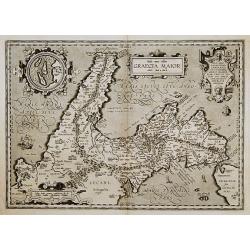
Graecia Maior.
Based on classical authors sources. With inset map: I. di Tremite (actually located just outside the lower left corner of the map), belonged to the Kingdom of Naples, and...
Place & Date: Antwerp 1595
Selling price: $165
Sold
Latium.
Based on classical authors sources, specifically Virgilius, Plinius, Varro, Halicarnasseus, Festus and Ausonius.Philip Wingius in his letter to Ortelius from 1592 mention...
Place & Date: Antwerp 1595
Selling price: $180
Sold
ROMANI IMPERII IMAGO.
The medallion portraits are of Romulus and Remus -the genealogical 'tree' describes the lineage of the Roman emperors while the strapwork bordered panels explain the hist...
Place & Date: Antwerp 1595
Selling price: $435
Sold
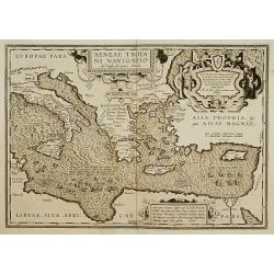
Aeneae Troiani navigatio..
After the destruction of Troy, Aenaeas is reported to have roamed the seas for seven years, as described in the writings of Xenophon, Ovidius, Lycrophonous, but most exte...
Place & Date: Antwerp 1595
Selling price: $320
Sold
Pannoniae, et Illyrici Veteris Tabula.
Made on the basis of Gastaldi's 1560 map of South East Europe and on information from ancient sources, specifically Plinius, Livius, Bonfinius, Dionus and Aurelius Victor...
Place & Date: Antwerp 1595
Selling price: $130
Sold
Hispaniae Veteris descriptio.
Made on the basis of modern information from Clusius' six-sheet map of Spain which appeared in 1571 and ancient knowledge from Strabo, Appianus, Bongarius, Livius, Valeri...
Place & Date: Antwerp 1595
Selling price: $435
Sold
Islandia.
Miniature map Island. From the second series of miniature atlas of Ortelius' Epitome. A new series of pocket-size atlases was begun by Philip Galle in 1588. It seems that...
Place & Date: Antwerp 1595
Selling price: $210
Sold
Tuscia.
Miniature map of Tuscany. From the second series of miniature atlas of Ortelius' Epitome. A new series of pocket-size atlases was begun by Philip Galle in 1588. It seems ...
Place & Date: Antwerp 1595
Selling price: $120
Sold
Malta olim Melita Insula.
Miniature map of Malta. From the second series of miniature atlas of Ortelius' Epitome. A new series of pocket-size atlases was begun by Philip Galle in 1588. It seems th...
Place & Date: Antwerp 1595
Selling price: $210
Sold
Hispaniae Veteris descriptio.
Based on Clusius' six-sheet map of Spain appeared in 1571 and knowledge from Strabo, Appianus, Bongarius, Livius, Valerius Maximus, and Suetonius.This map belongs to the ...
Place & Date: Antwerp, 1595
Selling price: $400
Sold in 2013
ISLANDIA.
Superb miniature map of Iceland. From the second series of the miniature atlas of Ortelius' Epitome. Shows the island with the main towns, mountains, rivers, and islands....
Place & Date: Antwerp, 1595
Selling price: $140
Sold in 2009
Daciarum, Moesiarumaue Vetus Descriptio.
Decorative map of ancient Hungary. From his historical atlas including a series of maps prepared by Ortelius himself. Signed lower left hand corner Ex conatibus Abrahami ...
Place & Date: Antwerp, 1595
Selling price: $300
Sold in 2009
Morea olim Peloponnesus.
Peloponnisos by Mercator. Latin text on verso.
Place & Date: Amsterdam, 1595
Selling price: $300
Sold in 2009
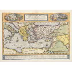
Peregrinationis Divi Pauli Typus Corographicus . . .
A splendid map depicting the travels of Paulus. With two fine scenes in top. Showing the countries along the Mediterranean, including Cyprus and Italy. Based on Mercator'...
Place & Date: Antwerp, 1595
Selling price: $1300
Sold
Flandriae Comitatus Descripto.
Colorful map of Belgium focuses on Flanders, the Dutch speaking region in northern Belgium, after Gerard Mercator. Many major cities and religious centers, including Ghen...
Place & Date: Amsterdam, 1595
Selling price: $800
Sold in 2010
Daciarum, Moesiarumaue Vetus Descriptio.
Decorative map of ancient Hungary. From his historical atlas including a series of maps prepared by Ortelius himself. Signed lower left hand corner Ex conatibus Abrahami ...
Place & Date: Antwerp, 1595
Selling price: $200
Sold in 2010
Artois. Atrebatum Regionis Vera Descriptio.
Map of Artois, a former province at the northwest tip of France, by Abraham Ortelius. Accompanying Latin text with hand-colored rubric letters on verso. Vibrant, original...
Place & Date: Antwerp, c.1595
Selling price: $120
Sold in 2010
Hispaniae Veteris descriptio.
Made on the basis of modern information from Clusius' six-sheet map of Spain which appeared in 1571 and ancient knowledge from Strabo, Appianus, Bongarius, Livius, Valeri...
Place & Date: Antwerp, 1595
Selling price: $485
Sold in 2011
Daniae Regnu.
An uncolored example of Mercator's first map of Denmark, from the first edition of his Atlas.A decorative map of Denmark by Gerard Mercator himself., with an ornate strap...
Place & Date: Amsterdam, 1595
Selling price: $500
Sold in 2012
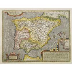
Hispaniae nova describtio. . .
Map of Spain and Portugal. Engraved by Petrus Kaerius.
Place & Date: Amsterdam, 1595
Selling price: $500
Sold in 2011
Daciarum, Moesiarumaue Vetus Descriptio.
Decorative map of ancient Hungary. From his historical atlas including a series of maps prepared by Ortelius himself. Signed lower left hand corner Ex conatibus Abrahami ...
Place & Date: Antwerp, 1595
Selling price: $300
Sold in 2011
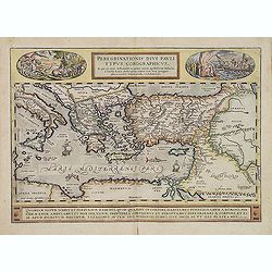
Peregrinationis Divi Pauli Typus...
A splendid map depicting the travels of Paulus. With two fine scenes in top. Showing the countries along the Mediterranean, including Cyprus and Italy. Based on Mercator'...
Place & Date: Antwerp, 1595
Selling price: $600
Sold in 2014
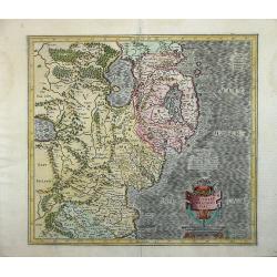
Ultoniae Orientalis Par.
Decorative map of the Ulster Region.From the first edition of Mercator's Atlas, published in 1595. The map features an ornate title cartouche with a scale below. The map...
Place & Date: Duisberg, 1595
Selling price: $600
Sold
Poloniae descriptio.
Early miniature map of Poland from Ortelius' Epitome Theatri Ortelianai. Engraved and published by Philip Galle in Antwerp. Based on Ortelius folio map of Poland. The Epi...
Place & Date: Antwerp, 1577-1595
Selling price: $200
Sold in 2014
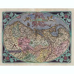
Descriptio Germaniae Inferioris.
The oval map is surrounded by a strapwork frame and the title, adorned with ribbons, is held aloft by two winged cherubs.According to P. Meurer based on de Jode's 12 shee...
Place & Date: Antwerp, 1595
Selling price: $305
Sold in 2015
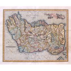
Irlandia Regnum.
Striking map of Ireland, with north oriented to the right and featuring a splendid ribbon style title banner cartouche. Fully engraved with topographical features and a s...
Place & Date: Amsterdam, 1595
Selling price: $265
Sold in 2017
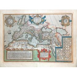
ROMANI IMPERII IMAGO.
Very decorative map of the ancient Roman empire. The medallion portraits Romulus and Remus.This map belongs to a series of historical maps known as the "Parergon The...
Place & Date: Antwerp 1595
Selling price: $650
Sold in 2013
Holsatia Ducatus.
A detailed map of the Schleswig-Holstein area of Germany extending south to include Hamburg and Lubeck. From the first edition of Mercator's Atlas. Latin text verso
Place & Date: Duisberg, 1595
Selling price: $95
Sold in 2014
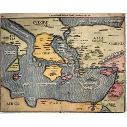
Tafel der Lender / darin der Apostel Paulus geprediget hat.
Woodcut showing the Eastern Mediterranean from the "Itinerarium Sacrae Scripturae", showing Italy, Sicily, Greece, Cyprus, Asia Minor, the Holy Land and North A...
Place & Date: Magdeburg, 1595
Selling price: $340
Sold in 2017
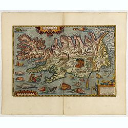
Islandia.
Perhaps the most famous map of Iceland. On the south side of the island a collection of all possible sea monsters is depicted. Polar bears on ice flows and volcanoes in t...
Place & Date: Antwerp, 1595
Selling price: $6100
Sold in 2014
Islandia.
Perhaps the most famous map of Iceland. On the south side of the island a collection of all possible sea monsters is depicted. Polar bears on ice flows and volcanoes in t...
Place & Date: Antwerp, 1595
Selling price: $6300
Sold in 2015
Hispaniae Veteris descriptio.
Made on the basis of modern information from Clusius' six-sheet map of Spain which appeared in 1571 and ancient knowledge from Strabo, Appianus, Bongarius, Livius, Valeri...
Place & Date: Antwerp, 1595
Selling price: $373
Sold in 2015
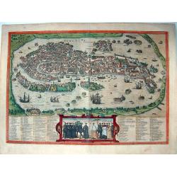
Venetia.
Superb bird's-eye view of Venice, which precisely illustrates most of the architectural features of the city. The lagoon is also depicted, animated with many vessels. The...
Place & Date: Cologne, circa 1595
Selling price: $2000
Sold in 2015
Gallia.
Rather crude but quite charming little woodcut map of Gallia with Celtica, Aquitania, Angliar Pars, Narbonensis, Hispaniae Pars etc., based on Ortelius. Published in 1595...
Place & Date: Venice, 1595
Selling price: $169
Sold in 2016
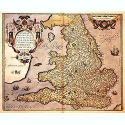
Angliae Regni flo: rentissimi nova descriptio, auctore Humfredo Lhuyd Cum Privilego.
Map by Humphrey Lloyd, Denbigh with coast shaded sea borders, rivers, hillocks, forests and towns. Published by Abraham Ortelius. The map presents an interesting picture ...
Place & Date: Antwerp, 1595
Selling price: $800
Sold in 2016
Provinciae, Regionis Galliae, vera exactissimaq. Descriptio..
Early imprint of this decorative map of the Province prepared by Pierre-Jean de Bompar who published a single sheet map of the Province in 1591.Title cartouche on the upp...
Place & Date: Antwerp, 1595
Selling price: $110
Sold in 2016
Galliae Regni Potentiss: Nova Descriptio Ioanne Ioliveto Auctore.
A decorative view of 16th Century France that is derived from Jean Jolivet's woodcut map of 1560. Decorated with one large cartouche and one smaller royal crest. The map ...
Place & Date: Antwerp, 1595
Selling price: $70
Sold in 2016
Malta olim Melita Insula.
Miniature map of Malta. From the second series of miniature atlas of Ortelius' Epitome. A new series of pocket-size atlases was begun by Philip Galle in 1588. It seems th...
Place & Date: Antwerp, 1595
Selling price: $200
Sold in 2017
Berghe Ducatus Marck comitatus et Coloniensis Dioecisis.
A rare first edition of Mercator's detailed map of Germany, from the first addition (1595) of Mercator's atla, “Atlas Sive Cosmographia”. The map covers a large secti...
Place & Date: Amsterdam, 1595
Selling price: $70
Sold in 2018
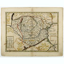
Vetus Descriptio Daciarum Nec non Moesiarum.
Decorative map of Romania, Signed lower part : Petrus Kaerius Caelavit. No text on verso. Extremely rare early or proof state of Jan Jansson's map of Romania, pre-dating ...
Place & Date: Antwerp, 1595
Selling price: $350
Sold in 2018
Cambriae Typus Auctore Humfredo Lhuydo Denbigiense Cambrobritano.
A beautiful hand colored copper-engraved map of Wales. It is the first separately printed map of Wales, by Humphrey Lhuyd. This is the second variant of the Ortelius publ...
Place & Date: Antwerp, ca 1595
Selling price: $120
Sold in 2019
Turingiae Noviss. Descript. / Misniae et Lusatiae Tabula.
A delightful pair of central German maps of Thuringia & Meissen, by Ortelius, published in Antwerp towards the end of the sixteenth century. The left hand map is that...
Place & Date: Antwerp, ca 1595
Selling price: $50
Sold in 2020
Anglia regnum.
A finely engraved map of England published during the last years of the reign of Elizabeth I, filled with names taken from the earlier Christopher Saxton map of 1579. Wit...
Place & Date: Duisburg, ca 1595
Selling price: $200
Sold in 2023
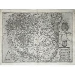
Brabantiae Belgarum Provinciae Exactaque Descriptio.
A very rare Brabant map, Netherlands, Belgium, Brabant; by Gerard de Jode - Brabantiae Belgarum Provinciae recens exactaque descriptio - 1595.Orientation: is West upwards...
Place & Date: Antwerp, 1595
Selling price: $1550
Sold in 2021
[Map of Switzerland canton of Argow.]
Map of Argow. With his engraved signature lower left.
Place & Date: Amsterdam, ca. 1595
Selling price: $50
Sold in 2021
[Lot of 9 maps/ prints of Egypt ] Aegypti Recentior Descriptio / Carthaginis Celeberrimi Sinus Typus.
Abraham Ortelius' maps of Egypt and Carthago on one sheet.Abraham Ortelius(1527-98), Dutch cartographer and publisher of the first modern atlas, ' Theatrum Orbis Terrarum...
Place & Date: Antwerp, 1595
Selling price: $160
Sold in 2023
Germania.
Giovanni Antonio Magini (1555-1617), Italian mathematician and cartographer. Edited edition of Ptolemy's ' Geographia', 1596.The 'modern' map of Germany. An elegantly eng...
Place & Date: Venice, 1596
Selling price: $40
Sold in 2018
Hydrographica Septentrionalis Norvegiae partis descriptio. . . / Beschrijvinghe der Zeecusten vant Nordelicxste deel van Norweghen. . .
A detailed chart of the coast of Norway and Lapland. Decorated by a colorful title cartouche and scale cartouche, two compass roses, several vessels and sea monsters, and...
Place & Date: Amsterdam, C.Claesz, 1596
Selling price: $15750
Sold in 2008
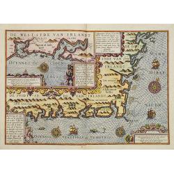
Beschrivinge der zeecusten van de Züijtsijde ende de Oos t-sijde van Irlandt. . . .
A detailed chart of the coast of the western side of Ireland. Decorated by a title cartouche and scale cartouche, four compass roses, several vessels and sea monsters, an...
Place & Date: Amsterdam, C.Claes, 1596
Selling price: $10000
Sold in 2008
Verthoninghe van de Zee Custen van Bretaignen.
A very decorative chart covering the coast along the coast of Britany. South to the top. A first edition, without the privilege. Engraved by the master engraver, Johannes...
Place & Date: Amsterdam, 1596
Selling price: $1000
Sold in 2018
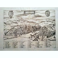
FLORENZA (Florence)
Rare Lafreri School town-plan of Florence, engraved by Paolo Forlani, of the Lafreri school of mapmakers, first published in "Il Primo Libro Delle Citta, Et Fortezze...
Place & Date: Venice, 1596
Selling price: $560
Sold in 2016
WITTENBERG.
Rare Lafreri School town-plan of Wittenberg, and church marked by Luther, engraved by Paolo Forlani, of the Lafreri school of mapmakers, first published in "Il Primo...
Place & Date: Venice, 1596
Selling price: $250
Sold in 2019
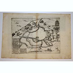
METZ.
Rare Lafreri School of the siege of Metz by imperial troops of Charles V in 1552-1553, engraved by Paolo Forlani, of the Lafreri school of mapmakers, first published in &...
Place & Date: Venice, 1596
Selling price: $35
Sold in 2018
Als Konig Heinrich Von Naverr . . .
Early print showing Henry of Navarra (1553–1610) baptized in Rome on 23 September 1595.Plate from the series about the "Eighty Years' War" or the Independence...
Place & Date: Cologne, ca. 1596
Selling price: $75
Sold in 2019
Islandia.
A fine, strong impression example of the famous Quad's map of Iceland. It can be considered a reduced version of Ortelius' "Islandia", the first realistic map o...
Place & Date: Cologne, 1596
Selling price: $1540
Sold in 2019
Artesia cuius incolae Atrebates. . .
A scarce copper engraved map of the Arras region of France by Matthias Quad, a German cartographer based in Cologne. Engraved by Johannes Bussemacher. The map shows the a...
Place & Date: Cologne, ca 1596
Selling price: $27
Sold in 2018




![[Title page] Germania geographicis tabulis illustrata. .](/uploads/cache/42262-250x250.jpg)
![[Untitled.] A Rarity of the Balkans with Fine Original color. Balkans/ Greece/ Istanbul.](/uploads/cache/82204-250x250.jpg)
![[Departure from Lisbon for Brazil, the East Indies and America]](/uploads/cache/48525-250x250.jpg)
![[Hans Staden Arrives in Lisbon] De Ijs quae acciderunt circa primam navigationem](/uploads/cache/48528-250x250.jpg)























![[Map of Switzerland canton of Argow.]](/uploads/cache/47450-250x250.jpg)
![[Lot of 9 maps/ prints of Egypt ] Aegypti Recentior Descriptio / Carthaginis Celeberrimi Sinus Typus.](/uploads/cache/18309-(8)-250x250.jpg)


