Browse Listings in Europe
Salisbvrgensis Ivrisdictionis, locorumgue vicinorum vera..
From Theatrum Orbis Terrarum [Atlas of the Whole World], published in Antwerp.The map is drawn in trompe l'oeil fashion, as though on a parchment of irregular shape, curl...
Place & Date: Antwerp 1590
Selling price: $220
Sold
Abcontrafehtung der schönen und weitberümpten Statt Leon.
Map shows the city of Lyon wit a beautiful border.From a German text edition of his Cosmographia , that great compendium of Renaissance knowledge.
Place & Date: Basle 1550-1590
Selling price: $90
Sold
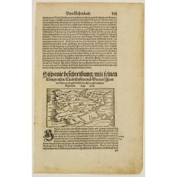
Hispanie beschreibung mit seinen Künigreichen/landschafften und stätten/item von sitten/gebzeüchen der alten vn neüven Spaniern.
Map shows Spain with Portugal and the Island of Mallorca.From a German text edition of his Cosmographia , that great compendium of Renaissance knowledge.
Place & Date: Basle 1550-1590
Selling price: $40
Sold
Anglia.
Map of Great Britain.From a German text edition of his Cosmographia , that great compendium of Renaissance knowledge.
Place & Date: Basle 1550-1590
Selling price: $40
Sold
[Map showing region of Basle and Strassbourg].
An early map of Colmar, Strasbourg, Basle, etc. (85x135 cm). VERSO: showing the cultivation of vinesFrom a German text edition of his Geographia , that great compendium o...
Place & Date: Basle 1550-1590
Selling price: $20
Sold
Cantuarbury.
A spectacular and early view of Canterbury.From the greatest publication in this genre! The Civitates was compiled and written by George Braun, Canon of Cologne Cathedral...
Place & Date: Cologne 1590
Selling price: $550
Sold
Descriptio Lineae Occiduae Rheni .. / Alsatia.
On recto an early map of the province of Alsace, with Strasbourg, Heidelberg and Metz. (Map : 88x135 mm).From a Latin text edition of his Geographia , that great compendi...
Place & Date: Basle, 1550-1590
Selling price: $15
Sold in 2014
Lipsia..
On recto an early map of Germany, centered on Leipzig (117x155 mm).From a Latin text edition of his Geographia , that great compendium of Renaissance knowledge.
Place & Date: Basle, 1550-1590
Selling price: $19
Sold in 2014
De Suevia et eius Praecipuis Civitatibus..
On recto an early map of south eastern part of Germany, including the towns of Fribourg, Zürich, Basel, Strasbourg, Heidelberg, Spire, etc. (Map : 117x155 mm).From a Lat...
Place & Date: Basle, 1550-1590
Selling price: $15
Sold in 2014
De Istria Peninsula.
On recto an early map of the province of Istria, including the Gulf of Triest (143x156 mm).From a Latin text edition of his Geographia , that great compendium of Renaissa...
Place & Date: Basle 1550-1590
Selling price: $40
Sold
Lutzenburgen sis Ducatus Veriss. Descript
A attractive map of Luxembourg : title cartouche on the lower left corner. From 'Theatrum Orbis Terrarum [Atlas of the Whole World]'.Iacobo Surhonio Montano auctore.
Place & Date: Antwerp, 1590
Selling price: $550
Sold
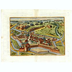
EYNDHOVEN - Nach dem Eindhoven mitt kriegs macht. . . .
Earliest printed bird's-eye view of Eindhoven. Showing the siege of April 13-23 1583. On April 22nd the young Count Carel van Mansfeld was taking the town after a 9 days ...
Place & Date: Cologne, 1590
Selling price: $1100
Sold in 2015
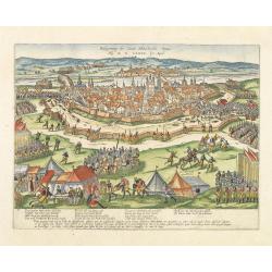
Als nun Truxes Reutter und knecht.. (Delft)
Early of Delft with a Spanish army entering the town.The plates by Hogenberg are dealing with the independence war of Holland against Spain.Recently a very interesting r...
Place & Date: Cologne, 1590
Selling price: $150
Sold in 2017
New Griechenlandt / mit andern anstoffenden Landern / wie es zu unsern zeiten bescreiben ist.
Double page woodcut map of mainland Greece and the islands from a German text edition of Münster's Cosmographia, that great compendium of Renaissance knowledge!. Headpie...
Place & Date: Basle, ca. 1590
Selling price: $150
Sold in 2008
EYNDHOVEN - Nach dem Eindhoven mitt kriegs macht. . . .
Earliest printed bird's-eye view of Eindhoven. Showing the siege of April 13-23 1583. On April 22nd the young Count Carel van Mansfeld was taking the town after a 9 days ...
Place & Date: Cologne, 1590
Selling price: $1900
Sold in 2009
Holandt. [Holland].
On verso an early map of Holland (215x140 mm). From a German text edition of his Geographia , that great compendium of Renaissance knowledge.
Place & Date: Basle, 1550-1590
Selling price: $60
Sold in 2010
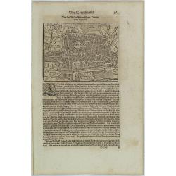
Von der Bischofflichen Statt Utrecht..
An early representation of the city of Utrecht (125x155 cm). From a German text edition of his Geographia , that great compendium of Renaissance knowledge.
Place & Date: Basle, 1550-1590
Selling price: $10
Sold in 2021
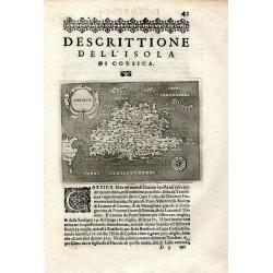
Descrittione Dell' Isola Di Corsica
Rare early map of the French island Corsica and a small part of Sardinia. Published around 1590 in "L'isole piu famose del mondo." Very detailed naming many s...
Place & Date: Padova, ca. 1590
Selling price: $160
Sold in 2009
Descrittione Dell' Isola Di Corsica.
Rare early map of the French island Corsica and a small part of Sardinia. Published around 1590 in "L'isole piu famose del mondo." Very detailed map, naming man...
Place & Date: Padova, ca. 1590
Selling price: $180
Sold in 2011
Pontus Euxinus Aequor Iafonio pulfatum remige premum.
Prepared by Ortelius after Mercator, and additional ancient sources as Plinius, Ovidius, Strabo, Apollonius, Procopius, and Apppianus.This map belongs to a series of hist...
Place & Date: Antwerp, 1590
Selling price: $435
Sold in 2011
Andegavensium Ditionis Vera et Intregra Descriptio.
Decorative map centered on the Loire River and Angiers. Includes several bridges across the Loire and its tributaries.Prepared by Licimo Guyeto Andegauense.
Place & Date: Antwerp, 1590
Selling price: $220
Sold in 2013
Schlavoniae, Croatiae, Carniae, Istriae, Bosniae, Finitimarumque Regionum Nova Descriptio, Auctore Augustino Hirsvogellio
Fine map of the Balkan region by Ortelius. Map is centered on the Sava River, and shows the current countries of Croatia, Bosnia and Herzegovina, Serbia and Slovenia.
Place & Date: Antwerp, c. 1590
Selling price: $240
Sold in 2010
Andegavensium Ditionis Vera et Intregra Descriptio.
Early map of the Loire Valley, with Angiers in the center. Prepared by Lézin Guyet in 1579.
Place & Date: Antwerp, 1590
Selling price: $55
Sold in 2010
Engellandt mit dem anstossenden Reich Schottlandt so vor zeiten Albion und Britannia haben geheissen.
A decorative map of Great Britain and eastern part of Ireland. Oriented to the west. Tablet in lower right corner with a brief commentary in German. Two ships and a sea-c...
Place & Date: Basle, 1590
Selling price: $220
Sold in 2010
Thietmarsiae, Holsaticae Regionis Partis Typvs. Auctore Petro Boeckel. / Oldenbvrg Comit.
Two engraved maps on a folio sheet by Petro Boeckel of Germany. Published by Abraham Ortelius (1527-98) in his "Theatrum Orbis Terrarum".
Place & Date: Antwerp, c.1590
Selling price: $105
Sold in 2010
Pontus Euxinus Aequor Iafonio pulfatum remige premum.
Prepared by Ortelius after Mercator, and additional ancient sources as Plinius, Ovidius, Strabo, Apollonius, Procopius and Apppianus.This map belongs to a series of histo...
Place & Date: Antwerp, 1590
Selling price: $300
Sold in 2010
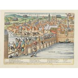
Belegerung der statt Maestricht Anno Drij MDLXXIX Im April.
Early print showing the siege of Maastricht under command of the sick Count Parma, June 29th 1579.The plates by Hogenberg are dealing with the independence war of Holland...
Place & Date: Cologne, 1590
Selling price: $345
Sold in 2012
Wie Maestricht ingenomen und erobert wirdt. . .
Early print showing the siege of Maastricht under command of the sick Count Parma, June 29th 1579.The plates by Hogenberg are dealing with the independence war of Holland...
Place & Date: Cologne, 1590
Selling price: $200
Sold in 2017
Von dem Hertogthumb Braband. . . [Brabant]
On recto an early birds-eye view of Luik in Belgium.From a German text edition of his Geographia , that great compendium of Renaissance knowledge.
Place & Date: Basle, 1550-1590
Selling price: $20
Sold in 2012
Contrastung der Statt Löven. . . [Leuven]
On verso an early birds-eye view of Leuven and on recto a plan of Tongeren in Belgium, with a lettered key underneath.From a German text edition of his Geographia , that ...
Place & Date: Basle, 1550-1590
Selling price: $25
Sold in 2012
Smolensk.
View of the siege of Smolensk. "Schmolenska" by the Polish army in1609-1611. The Dnieper River in the background. From Hogenberg's "Geschichtsblättern&quo...
Place & Date: Cologne,1590
Selling price: $2050
Sold in 2012
Messina.
A of the city of Messina on Sicily by Matteo Florimi (1540-1613). Below the view is a numbered key (1-167) with a key to locations.Florimi was a print-and-book dealer an...
Place & Date: Sienna, c. 1590
Selling price: $1200
Sold in 2014
Neapolis.
On recto an early birds-eye view of Naples. On verso a city view of Tivoli. From a Latin text edition of his Geographia , that great compendium of Renaissance knowledge.S...
Place & Date: Basle, 1550-1590
Selling price: $67
Sold in 2012
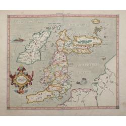
Tab. I. Europae Continens Albion, Britanniam, et Hiberniam.
Mercator’s map of Great Britain, based on Ptolemy’s Geographia. This map is from the 1584 edition of his Tabulae Geographicae. The ancient map of the British Isles ha...
Place & Date: Cologne, Amsterdam, 1590
Selling price: $500
Sold in 2012
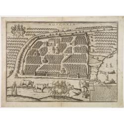
Moscovia. Questa Citta è la principale de la provincia di Russia. . .
Very rare Lafreri school-type plan of Moscow from a slightly elevated viewpoint across the frozen Moskva River. The print is based on a view by the Austrian Sebastian Her...
Place & Date: Siena, 1590
Selling price: $4150
Sold in 2012
Prussiae vera descriptio.
Map of Poland, oriented to the North. Prepared by the cartographer Caspar Henneberger. From "Theatrum Orbis Terrarum Abrahami Ortelii Antverp".
Place & Date: Antwerpen, 1590
Selling price: $360
Sold in 2015
[Europe]
On verso an early wood block printed map of Europe.From a Latin text edition of his Geographia , that great compendium of Renaissance knowledge.
Place & Date: Basle, 1550-1590
Selling price: $115
Sold in 2013
[British Isles ]
On recto an early birds-eye view of Great Britain. Cornwall is depicted as an entity on an equal footing as Wales and Scotland.From a Latin text edition of his Geographia...
Place & Date: Basle, 1550-1590
Selling price: $30
Sold in 2013
[ Spain and Portugal ]
On recto an early wood block printed map of Spain and Portugal.From a Latin text edition of his Geographia , that great compendium of Renaissance knowledge.
Place & Date: Basle, 1550-1590
Selling price: $20
Sold in 2013
[ Italy ]
On recto a wood block printed map of the center part of Italy (159x129mm.), south orientated to the top. Corsica in upper right corner.From a Latin text edition of his Ge...
Place & Date: Basle, 1550-1590
Selling price: $55
Sold in 2013
[Flandria - Belgium]
On recto an early wood block printed map (115x153mm.) of Flanders in present-day Belgium. On verso a tiny view of Gent.From a Latin text edition of his Geographia, that g...
Place & Date: Basle, 1550-1590
Selling price: $50
Sold in 2013
[De istria Peninsula.]
On verso a wood block printed map of the triangular peninsula of Istria pointing down into the northern Adriatic. From a Latin text edition of his Geographia, that great ...
Place & Date: Basle, 1550-1590
Selling price: $20
Sold in 2013
[De Graecia.- Euböa or Evia ]
On verso an early wood block printed map of the island of Euböa (Evia) in Greece. Below a portrait of Aristote. From a Latin text edition of his Geographia , that great ...
Place & Date: Basle, 1550-1590
Selling price: $20
Sold in 2017
Candia seu Creta insula.
On recto an early map of the Island of Crete (77x156mm.). From a Latin text edition of his Geographia , that great compendium of Renaissance knowledge.Read more [+]
Place & Date: Basle, 1550-1590
Selling price: $20
Sold in 2020
Regni polonici contracta descriptio. sequens uero. . .
On verso a map of Poland (77x156mm.) From a Latin text edition of his Geographia , that great compendium of Renaissance knowledge.
Place & Date: Basle, 1550-1590
Selling price: $20
Sold in 2013
De regno & tota regione Poloniae. . .
On recto an early map of Poland (120x153mm.), extending from the Baltic (Danzig and Riga) to Moscow, Cremania, and Moldau in the east and the Oder and Klein Poland in the...
Place & Date: Basle, 1550-1590
Selling price: $165
Sold in 2013
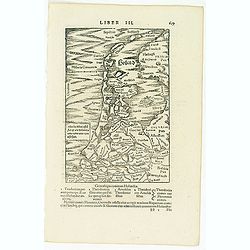
Holland. . .
On recto a map of the provinces of North and South Holland in the Netherlands. />From a Latin text edition of his Geographia , that great compendium of Renaissance kno...
Place & Date: Basle, 1550-1590
Selling price: $100
Sold in 2013
Siciliae insulae atque totius regni eius descriptio, secundum uarium eius habitudinem.
On verso an early map of Sicily. From a Latin text edition of his Geographia , that great compendium of Renaissance knowledge.
Place & Date: Basle, 1550-1590
Selling price: $40
Sold in 2013
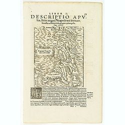
Regnum Neapolit. Mare mediterraneum.
On recto a map of Southern part of Italy. />From a Latin text edition of his Geographia , that great compendium of Renaissance knowledge.
Place & Date: Basle, 1550-1590
Selling price: $60
Sold in 2013
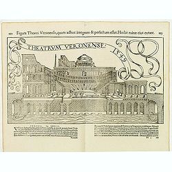
Theatrum Veronense. . .
A double page illustration of the Roman Theatre of Verona, constructed in the 1st century B.C., at the foot of the Hill of St. Peter on the banks of the Adige River. />...
Place & Date: Basle, 1550-1590
Selling price: $33
Sold in 2013
De terris asiae minoris.
On verso a wood block printed map of the region between the Black Sea and the Caspian Sea with parts of Tartary and Kazakhstan, also the neighboring Armenia in the south....
Place & Date: Basle, 1550-1590
Selling price: $50
Sold in 2013
Descriptio Italiae secundum uarios populos. . . [Italy]
On verso a wood block printed map of Italy.From a Latin text edition of his Geographia , that great compendium of Renaissance knowledge.
Place & Date: Basle, 1550-1590
Selling price: $20
Sold in 2013
[Amsterdam]
On verso an early birds-eye town-plan of Amsterdam. The wood block print is showing hundreds of individual buildings and houses. Ships in the harbor and the Amstel River....
Place & Date: Basle, 1550-1590
Selling price: $75
Sold in 2013
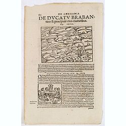
De Germania de Ducatu Brabantino. . . (Brabant)
On recto a map of the province of Brabant covering present-day the Netherlands and Belgium. From a Latin text edition of his Geographia , that great compendium of Renaiss...
Place & Date: Basle, 1550-1590
Selling price: $17
Sold in 2013
Brittanicarum Insularum Vetus Descriptio.
Southern part of Ortelius important two-sheet map of the British Isles. Includes Ireland, Wales, the Isle of Man, and England. Shows the Hadrian's Wall. Richly decorated ...
Place & Date: Antwerp, c1590
Selling price: $550
Sold in 2013
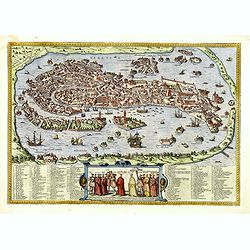
Venetia. (Venice)
Precise, beautiful bird's-eye town-plan of Venice, clearly depicting the city's architectural landmark. The surrounding lagoon is animated with a great variety of sailing...
Place & Date: Cologne, 1590
Selling price: $2100
Sold in 2013
Brugae, Flandricarum Urbium Ornamenta. (Brugge)
Very desirable and early town-plan of Brugge. "from a northwesterly direction, ringed by numerous windmills. At the center can be seen the market square with the clo...
Place & Date: Cologne, 1590
Selling price: $500
Sold in 2014
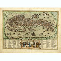
Venetia. (Venice)
Precise, beautiful bird's-eye town plan of Venice, clearly depicting the city's architectural landmark. The surrounding lagoon is animated with a great variety of sailing...
Place & Date: Cologne, 1590
Selling price: $2500
Sold in 2014
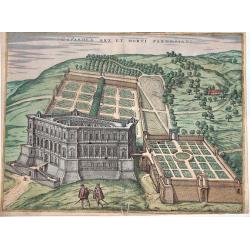
Caprarola Arx et Horti Farnesiani.
A nice view of the castle and gardens of the Farnese family, in Lazio. From the famous "Civitates orbis terrarum". Attractive original colors. French text on ve...
Place & Date: Cologne, circa 1590
Selling price: $190
Sold in 2016
Descrittione dell' Isola dell'Elba.
The map depicts the Italian Mediterranean island of Elba. The map is orientated towards the north-west. From "L'Isole Piu Famose del Mondo", printed in Venice. ...
Place & Date: Venice, 1590
Selling price: $150
Sold in 2019
Antverpia.
Prepared for Volume V of Braun & Hogenberg "Civitates Orbis Terrarum", which was first published in 1598. Two sheets joined, for a total dimension of 450mm ...
Place & Date: Antwerp, circa 1590
Selling price: $495
Sold in 2017
Pontus Euxinus Aequor Iafonio pulfatum remige premum.
Prepared by Ortelius after Mercator, and additional ancient sources as Plinius, Ovidius, Strabo, Apollonius, Procopius and Apianus.This map belongs to a series of histori...
Place & Date: Antwerp, 1590
Selling price: $200
Sold in 2021
Naues a Gandauo submissae obuias Antwerpiensium naues fugant.
Striking and highly detailed rare copper engraved panoramic view of the siege of Antwerp, Belgium. In the middle we see the pontoon bridge by the Duke of Parma, Alessandr...
Place & Date: Antwerp, 1590
Selling price: $130
Sold in 2016
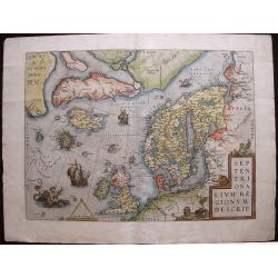
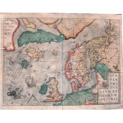
Septentrionalium Regionum Descrip.
Influential map of the Arctic. It includes Scandinavia, Iceland, Greenland and part of the North American continent, together with the legendary islands of the north: Dro...
Place & Date: Antwerp, ca. 1590
Selling price: $1200
Sold in 2015
Islandia.
Probably the most famous (and among the most beautiful!) map of Iceland. On the south side an impressive collection of sea monsters. Polar bears on ice flows and volcanoe...
Place & Date: Anwerp, ca 1590
Selling price: $4200
Sold in 2016
EYNDHOVEN - Nach dem Eindhoven mitt kriegs macht. . . .
Earliest printed bird's-eye view of Eindhoven. Showing the siege of April 13-23 1583. On April 22nd the young Count Carel van Mansfeld was taking the town after a 9 days ...
Place & Date: Cologne, 1590
Selling price: $1300
Sold in 2023
[Koblentz]
Attractive birds eye view of the region around Coblenz. The Rhine and Mosel Rivers, fortified castles on the hillside and the fortified city below.With a decorative title...
Place & Date: Basle 1550-1590
Selling price: $20
Sold in 2016
Septentrionalium Regionum Descrip.
A fascinating and important map of the North Atlantic by A. Ortelius in beautiful original colors.
Place & Date: Antwerp, 1590
Selling price: $1400
Sold in 2016
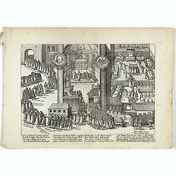
Wer lustig ist zu Wissen gar. . .
Plate from the series about the " Eighty Years' War" or the independence war of Holland against Spain, we know approximately four hundred engravings by Frans Ho...
Place & Date: Cologne, ca. 1590
Selling price: $45
Sold in 2020
Hertzog Friedrich von Wirtenbergh. . .
Early print showing count Friedrich von Wirtenbergh receiving the English equestrian order on 16 November 1603 in Stuttgart.Plate from the series about the " Eighty ...
Place & Date: Cologne, ca. 1590
Selling price: $25
Sold in 2019
Beim Colnschen Sant Jeronim Machtelis. . .
Early print showing a beheading in Cologne.Plate from the series about the " Eighty Years' War" or the independence war of Holland against Spain, we know of app...
Place & Date: Cologne, ca. 1590
Selling price: $25
Sold in 2018
Hie siechstu wie gelegen seint . . Plate 261.
Early print showing an army position near the town of Dreux in France on 14 March 1590 during the French Wars of Religion.Plate from the series about the " Eighty Ye...
Place & Date: Cologne, ca. 1590
Selling price: $25
Sold in 2020
Des Konigs undder Fursten regiment . . . Plate 32.
Plate from the series about the " Eighty Years' War" or the independence war of Holland against Spain, we know of approximately four hundred engravings by Frans...
Place & Date: Cologne, ca. 1590
Selling price: $25
Sold in 2020
PARIS
Early print showing the capture of Barnabé Brisson in Paris, who was hanged on 15 November by the Spanish.Plate from the series about the " Eighty-Years War" o...
Place & Date: Cologne, ca. 1590
Selling price: $75
Sold in 2020
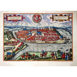
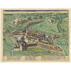
Chilonium, vulgo Kyell.
A rare, large, spectacular view of the German city of Kiel. From the famous 'Civitates Orbis Terrarum' of Braun & Hogenberg, with spectacular old colors, partly enhan...
Place & Date: Cologne, 1590
Selling price: $590
Sold in 2017
Bergen.
A spectacular, large, rare view of Bergen, from the famous 'Civitates Orbis Terrarum' of Braun & Hogenberg. Bergen was founded in 1070, during the warm medieval perio...
Place & Date: Cologne, 1590
Selling price: $1050
Sold in 2018
Monachium Utriusque Bavariae Civitas Primar.
A panoramic view of the city of Munich and its environs, as seen from the east from the famous civitates orbis terrarum of Braun & Hogenberg. Note, left in the backgr...
Place & Date: Cologne, ca 1590
Selling price: $450
Sold in 2017
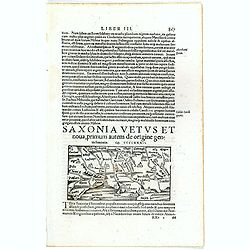
Saxonia Vetus et Nova . . .
Text sheet with on recto an early map of Saxony, centered on Berlin and including Hamburg and Danzig as well (map : 69x134 mm). South to the top.From a Latin text edition...
Place & Date: Basle 1550-1590
Selling price: $20
Sold in 2017
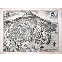
Catana urbs Siciliae clarissima patria sc.te Agathae virgin. . .
A large, beautiful print of the Italian city of Catania, in Sicily, with Mount Etna in the background, one of the most impressive volcanos in Europe. It comes from the gr...
Place & Date: Cologne, 1590
Selling price: $350
Sold in 2018
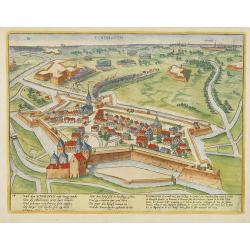
Chilonium, vulgo Kyell.
A rare, large, spectacular view of the German city of Kiel. From the famous 'Civitates Orbis Terrarum' of Braun & Hogenberg, with spectacular old color. With French t...
Place & Date: Cologne, 1590
Selling price: $590
Sold in 2019



![[Map showing region of Basle and Strassbourg].](/uploads/cache/14377-250x250.jpg)




![Holandt. [Holland].](/uploads/cache/26999-250x250.jpg)


![Von dem Hertogthumb Braband. . . [Brabant]](/uploads/cache/32239-250x250.jpg)
![Contrastung der Statt Löven. . . [Leuven]](/uploads/cache/32240-250x250.jpg)



![[Europe]](/uploads/cache/32516-250x250.jpg)
![[British Isles ]](/uploads/cache/32517-250x250.jpg)
![[ Spain and Portugal ]](/uploads/cache/32527-250x250.jpg)
![[ Italy ]](/uploads/cache/32528-250x250.jpg)
![[Flandria - Belgium]](/uploads/cache/32530-250x250.jpg)
![[De istria Peninsula.]](/uploads/cache/32532-250x250.jpg)
![[De Graecia.- Euböa or Evia ]](/uploads/cache/32552-250x250.jpg)




![Descriptio Italiae secundum uarios populos. . . [Italy]](/uploads/cache/32573-250x250.jpg)
![[Amsterdam]](/uploads/cache/32574-250x250.jpg)





![[Koblentz]](/uploads/cache/37202-250x250.jpg)
