Browse Listings in Catch All
East India Arichpelago (Miyako + Oki Daito Islands)
Very large sea-chart showing the Japanese Islands Miyako-jima (here still called Typinsan) and Okidaitō (Rasa Island). The huge sheet mainly covers water, only ...
Place & Date: London, 1887
Selling price: $30
Sold in 2012
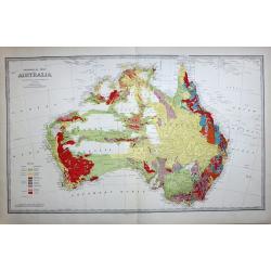
GEOLOGICAL MAP OF AUSTRALIA
The best colonial period geological map of Australia. The map has a color index to the lower left quadrant. This rare map is from the 'Picturesque Atlas of Australasia', ...
Place & Date: Melbourne, 1888
Selling price: $350
Sold in 2017
Mission du Japon méridional. (Kyushu)
Important missionary map showing Kyushu in southern Japan, prepared by Adrien Launay, who was a French Missionary and later chronicler of the history of the French Missio...
Place & Date: Lille, 1890
Selling price: $80
Sold in 2016
Mission du Japon central.
Important missionary map showing the northern part of Honshu, including Tokyo and Hokkaido. In upper left inset of Kuriles Islands. Prepared by Adrien Launay, who was a F...
Place & Date: Lille, 1890
Selling price: $90
Sold in 2016
Australland.
Detailed map of Australia. With index to the different, colonies, with number of inhabitants and size. Border lines are drawn in by hand.A interesting map by the famous G...
Place & Date: Glogau, 1892
Selling price: $150
Sold in 2020
Study of two Horses.
Unfinished study plate by Pieter Dupont(1870-1911).Printed by E.J. van Wisselingh in Amsterdam, with a total of 50 copies. cat. Nr. 341. with atelierstamp "Atelier P...
Place & Date: Paris, 1897
Selling price: $100
Sold in 2008
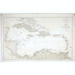
Título: Carta General del Mar de las Antillas : segun los trabajos mas fidedignos nacionales y extrangeros / publicada de Órden del Almirantazgo por la Seccion de Hidrografía. . .
Rare Spanish sea chart of the Caribbean and the coasts of Mexico, Honduras, Nicaragua, Panama, Costa Rica, Colombia and Venezuela. Graduated margins. Meridian of origin: ...
Place & Date: Madrid , 1897
Selling price: $300
Sold in 2020
Terrestrial Globe constructed by Th. Mettke.
Height with stand 62cm. Two sets of twelve colored lithographed paper gores, on an ebonized stand. Some very minor brown spotting and place on globe touched up.Terrestria...
Place & Date: Berlin, ca.1890~1900
Selling price: $3750
Sold
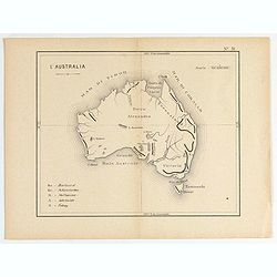
L'Australia. (N°51)
Small map of general Australia.
Place & Date: France, ca. 1900
Selling price: $60
Sold in 2020
[Pacific ocean with Australia and New Zealand]
A more than 100 year old Russian map of Pacific printed in lithography. Published by one of the most successful publishers of St. Petersburg A.Iljin. With a color key to ...
Place & Date: St. Petersburg, c.1905
Selling price: $30
Sold in 2011
[Menu fan for] Villa Tourasse.
A fan showing the menu of Villa Tourasse restaurant in Paris.
Place & Date: France, 1905
Selling price: $50
Sold in 2021
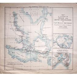
Map to Illustrate The Voyage And Artic Explorations of Capt Roald Amundsen From Surveys by Lieut. G. Hansen. 1903 to 1906.
An interesting map of the Polar region centred on King William Island, published by the Royal Geographical Society, Feb 11th 1907.
Place & Date: London, 1907
Selling price: $60
Sold in 2018
Paris, Notre Dame and bridge over the Seine.
Engraving of the bridge over the Seine, the Notre Dame and stalls of booksellers on the quays.By W.A. Grondhout, signed in the plate (engraved) and with pencil by the art...
Place & Date: Amsterdam ca. 1910
Selling price: $50
Sold
University building Leiden.
Etching by G.C.Haverkamp (1872-1926) showing the building of Leiden University on the Rapenburg, seen from beyond the canal. Signed with pencil under botto-right by the a...
Place & Date: Netherlands ca. 1910
Selling price: $45
Sold
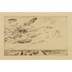
Les insects malfaisants.
The artist Walter Vaes made this etching after the invasion of the German army into Antwerp in 1914.In the air an army of Grasshoppers and other insects on the ground, An...
Place & Date: Belgium ,ca. 1915
Selling price: $50
Sold in 2008
Sydney Harbour Trust, Birds eye view of Pyrmont - 1919.
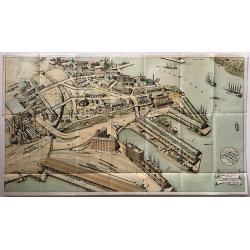
A rare WW1 birds eye view of Pyrmont, Sydney Harbour.A wonderful, large lithographed view of the wharves at Pyrmont, Sydney Harbour by W. Withers, who was commissioned by...
Place & Date: Sydney, 1919
Selling price: $180
Sold in 2017
Aquellos Polvos.
Number 23. "That dust..", taken from "Los Caprichos" - "The Sleep of Reason produces monsters." Original etching and aquatint made by Manuel...
Place & Date: Barcelona 1928
Selling price: $80
Sold
Ocean Pacifique. Partie Est de l'Australie... N.elle Zélande...
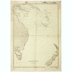
Large French sea chart featuring the eastern coast of Australia (Queensland, New South Wales and Tasmania ), New Zealand, New Guinea, New Caledonia, New Hebrides, New Bri...
Place & Date: France, 1897-1929
Selling price: $500
Sold in 2021
Island of Maui.
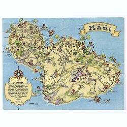
A fun, humorous, whimsical map of the Hawaiian island of Maui by Ruth Taylor White. With vibrant colors, the map was issued by the Hawaiian Tourist Bureau of Honolulu.On ...
Place & Date: Boston, ca 1931
Selling price: $45
Sold in 2018
Island of Maui.
A fun, humorous, whimsical map of the Hawaiian island of Maui by Ruth Taylor White. With vibrant colors, the map was issued by the Hawaiian Tourist Bureau of Honolulu.On ...
Place & Date: Boston, ca 1931
Selling price: $75
Sold in 2020
Tasmania formerly Van Diemen Land.
Admiralty chart of Tasmania based on surveys of M.Flinders, P.P.King, J.L.Stokes, Burnett, and James Sprent, published in 1860 and corrected till 1932.
Place & Date: London, 1860 updated for 1932
Selling price: $110
Sold in 2009
Authorized Map of the Second Byrd Antarctic Expedition.
Offset lithograph color pictorial map of Antarctica and the South Pole by George Annand, printed by General Foods in 1934. The cartouche explains the "notable feat i...
Place & Date: U.S.A., 1934
Selling price: $150
Sold in 2020
Chateau Gaillard Normandy.
Etching of a landscape on the banks of the Seine-river, with Chateau Gaillard at les Andelys.Signed with pencil by the artist at bottom right.
Place & Date: England c. 1937
Selling price: $50
Sold
Partie ouest de l'Australie. . .
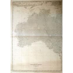
A large French sea-chart of Western Australia, extending Bali until King Island and a part of Tasmania. With excellent detail of the islands, coasts, and also Australia's...
Place & Date: Paris, 1938
Selling price: $46
Sold in 2018
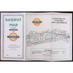
1939 map of the Sydney underground system and it's suburban railway system.
An extremely interesting and rare map of the Sydney underground system and it’s suburban railway system published in 1939. The map clearly takes inspiration from Harry ...
Place & Date: Sydney, 1939
Selling price: $260
Sold in 2020
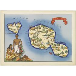
Tahiti.
Very decorative, informative map of Tahiti. The map is filled with buildings, animals, figures and two locals. With a large compass rose in upper right corner.In lower le...
Place & Date: France, 1943
Selling price: $90
Sold in 2015
Sheet V East coast of Australia. New South Wales Port Stephens to Tacking Point surveyed by Comr. Fredk. W. Sidney R.N. . . 1862-5. . . with additions and corrections to 1938. . .
Large
Place & Date: London, 1865-1943
Selling price: $100
Sold in 2016
Sheet IX East coast of Australia Queensland Danger Pt. to Cape Monton. . .
Large chart representing east coast of Australia's Queensland showing Danger Pt. to Cape Monton with relief shown by hachures, spot heights and bathymetric soundings. Sur...
Place & Date: London, 1869-1943
Selling price: $110
Sold in 2015
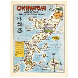
Okinawa mem-o-map part of the Ryukyu Islands.
A Mem-o-Maps published at the end of World War II, marking various memorable spots eg. "10th Army HQ", "77th Division Memorial", airfields and some lo...
Place & Date: 1945
Selling price: $110
Sold in 2019
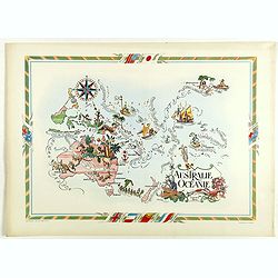
Australie et Océanie.
color printed pictorial map of Australia and Oceania, with decorative title cartouche and borders, depict countries, regions, major cities, industries, agriculture and wi...
Place & Date: Paris, 1951
Selling price: $130
Sold in 2018
Island of Maui..Map.
A map of the Hawaiian island of Maui, used to promote Paschoal's Gray Line Motor Tours & Car Rentalin the 1960's. A large map of the island is littered with numbered ...
Place & Date: Maui, ca. 1960
Selling price: $12
Sold in 2017
Australia, The Awakening Giant.
A large, fully colored map of Australia.
Place & Date: Victoria, 1967
Selling price: $50
Sold in 2018
[Russian map of southern USA, Mexico, West Indies & Central America].
An unusual Russian map of the south of the United States, western Mexico, the Caribbean, Central America, and the northern tip of South America. Fully colored, with three...
Place & Date: Moscow, 1967
Selling price: $120
Sold in 2019
Mit Singapore Airlines Autralien Entdecken.
Map of Australia for Karawane travel agency in Ludwigsburg, Germany from Singapore. Map with animals, leisure facilities, places of interest and locations of Singapore Ai...
Place & Date: Ludwigsburg, ca. 1970
Selling price: $150
Sold in 2020
[Rare tectonic globe]
This rare tectonic earth globe was one of the first globes beautifully illustrating the novel theory of plate tectonics at the time. The science of plate tectonics descri...
Place & Date: Leipzig, 1972
Selling price: $1100
Sold in 2019
Oceanica Polinesia.
A pictorial map showing Australia, New Zealand and islands around.
Place & Date: Italy, 1986
Selling price: $100
Sold in 2020
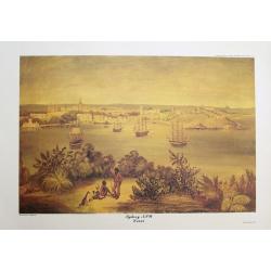
Sydney NSW 1825.
Fantastic limited edition print after a painting of M. F. Fitzgerald, published by Clive A. Burden. Fantastic view of the city and harbour, with sailing ships. Three men ...
Place & Date: London, 1989
Selling price: $100
Sold in 2014
Sydney NSW 1825.
Fantastic limited edition print after a painting of M. F. Fitzgerald, published by Clive A. Burden. Fantastic view of the city and harbour, with sailing ships. Three men ...
Place & Date: London, 1989
Selling price: $30
Sold in 2014
Sydney NSW 1825.
Fantastic limited edition print after a painting of M. F. Fitzgerald, published by Clive A. Burden. Fantastic view of the city and harbour, with sailing ships. Three men ...
Place & Date: London, 1989
Selling price: $6
Sold in 2014
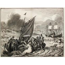
Tocht naer Nova Zemla in den Jaere MDXCVI.
A whaling scene from the voyage undertaken by the Dutch to Novoy Zemlya in the year 1596 under command of Willem Barentsz.
Place & Date: Amsterdam, c. 1700.
Selling price: $257
Sold
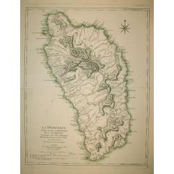
La Dominique située entre La Martinique et La Guadeloupe
A map of Dominica by Le Rouge.
Place & Date: Paris, s.d. (1778)
Selling price: $350
Sold in 2009
Carte des Isles Sandwich.
Handsome copper-engraved chart of the archipelago of Hawaii with a large inset "Plan de la Baye de Karakakooa." Cook's tracks through the island chain in both 1...
Place & Date: Paris 1779.
Selling price: $400
Sold
POLUS ANTARCTICUS.
With vignettes of natives within corners. This is the first printed map as far as I know to show the discovery of Peter Nuyts land, or part of the south coast of Australi...
Place & Date: Amsterdam 1639-44
Selling price: $1025
Sold
Terre de Iesso.
"A charming small map of Hokkaido and the northern part of Honshu. With four western ships in the sea, by Allain Manneson Mallet (1630-1706), a well travelled milita...
Place & Date: MALLET,A.M.
Selling price: $300
Sold
Les Isles De L'Amerique.
"Les Isles De L'Amerique Connues Sous le Nom D'Antilles, ou Sont les Isles de Cuba, St. Domingue et Jamaique les Lucayes, les Caribes."An elegant map of the Car...
Place & Date: 1705, Paris
Selling price: $325
Sold in 2019




![[Pacific ocean with Australia and New Zealand]](/uploads/cache/25533-250x250.jpg)
![[Menu fan for] Villa Tourasse.](/uploads/cache/46945-250x250.jpg)









![[Russian map of southern USA, Mexico, West Indies & Central America].](/uploads/cache/44785-250x250.jpg)

![[Rare tectonic globe]](/uploads/cache/82786-250x250.jpg)

