Browse Listings
Sumatra ein grosse Insel, so von den alten Geographen Taprobana, ist genent worden (Sri Lanka).
One of the earliest and highly decorative woodcut maps of Ceylon (Sri Lanka) by Sebastian Münster. To the left of the map a cartouche with explanatory text in 10 lines a...
Place & Date: Basel, ca 1540
Selling price: $225
Sold in 2019
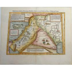
Cyria / Cypern / Palestina / Mesopotamia / Babylonia / Chaldea und zwey Arabia mit Bergen Wassern und Stetten.
An early, attractive woodcut map of the eastern Mediterranean and the Middle East. Covering the area between northern Syria and the Red Sea, with Cyprus, the Holy Land, J...
Place & Date: Basel, ca 1540
Selling price: $190
Sold in 2021
Neuw Griechenlandt, mit andern anstossenden Landern, wie es zu unsern zeiten beschriben ist.
An early woodcut map of Greece by Sebastian Münster. Showing Greece with western Turkey. The title on verso is surrounded by a beautiful woodcut border. From the German ...
Place & Date: Basel, ca 1540
Selling price: $175
Sold in 2019
Ptolemaïsch General Tafel Begreiffend die halbe Kugel der Weldt.
An attractively colored first state of Sebastian Münster’s first world map. The world map is surrounded by clouds and eleven wind gods (with their names shown in banne...
Place & Date: Basel, ca 1540
Selling price: $540
Sold in 2019
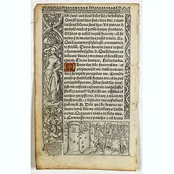
Leaf on vellum from a printed Book of Hours.
24 lines of printed text, surrounded by renaissance borders decorated with flowers, vases and religious scenes.From the press of the leading Parisian publisher and illumi...
Place & Date: Paris, Germain Hardouyn, c.1520-1540
Selling price: $100
Sold in 2019
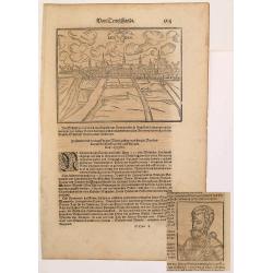
Der Statt Parma abcontrafactur nach Ihrer gelgenheit.
A large, early woodcut view of Parma by Sebastian Munster on the full double sheet. Title and a description of the city on verso. This interesting view of Parma depicts t...
Place & Date: Basel, ca 1540
Selling price: $150
Sold in 2019
[Greece]
Wood block printed map and one of earliest printed representation of Greece prepared Martin Waldseemüller.Based on the slightly larger map from 1513 published in "P...
Place & Date: Vienna, Trechsel, G., 1525 -1541
Selling price: $1050
Sold in 2013
[Spain and Portugal]
Wood block printed map and one of earliest printed representation of Spain and Portugal prepared Martin Waldseemüller.Based on the slightly larger map from 1513 publishe...
Place & Date: Vienna, Trechsel, G., 1525 -1541
Selling price: $500
Sold in 2013
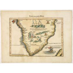
Tabula nova partis Africae.
Wood block printed map of southern part of Africa, the second earliest map to focus on the southern part of the Continent. The map is prepared by Lorenz Fries after Marti...
Place & Date: Vienna, Trechsel, G., 1525 -1541
Selling price: $2200
Sold
.[Italy]
Wood block printed map and one of earliest printed representation of Italy prepared by Martin Waldseemüller. Based on the slightly larger map from 1513 published in &q...
Place & Date: Vienna, Trechsel, G., 1525 -1541
Selling price: $750
Sold in 2024
[Great Britain, Ireland]
Wood block printed map and one of earliest printed representation of the Great Britain and Ireland prepared Martin Waldseemüller. Based on the slightly larger map from 1...
Place & Date: Vienna, Trechsel, G., 1525 -1541
Selling price: $750
Sold in 2013
[Czech Republic, Germania, Germany, Poland]
Wood block printed map and one of earliest printed representation of Czech Republic, Germania, Germany, Poland prepared Martin Waldseemüller. River Rhine to the left. Ba...
Place & Date: Vienna, Trechsel, G., 1525 -1541
Selling price: $750
Sold in 2014
[No title - Daniel's Dream map - Rare Swedish edition]
A rare Swedish edition of this somewhat curious map of Europe, Africa, and Asia is to be found in apocalyptic literature originally emanating from Wittenberg in 1530 or e...
Place & Date: Uppsala, Georg Richolff, 1541
Selling price: $1800
Sold in 2017
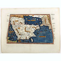
[Tabula Sexta Asiae Complectitur Arabam felicem & Carmaniam].
A classic Ptolemaic map of Arabia after Waldseemüller. Arabia and the Persian Gulf are both oversized and distorted. With numerous place names, islands, rivers and mount...
Place & Date: Strasbourg, 1522-1541
Selling price: $500
Sold in 2016
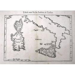
Tabula nova Siciliae, Sardiniae, & Corsicae
An early woodcut Ptolemaic map of Corsica, Sardinia, Sicily, and southern Italy. With several towns and islands named. The active volcano Etna is shown with flames.
Place & Date: Vienne, 1541
Selling price: $120
Sold in 2016
Tabula nova Italiae.
One of the earliest modern maps of Italy after Claudius Ptolemy, based on Waldseemuller. Shows Italy with ancient place names, rivers, and a prominent display of the moun...
Place & Date: Vienne or Lyon, 1541
Selling price: $215
Sold in 2016
[World map] Typus Universalis.
The first of Münster's world map blocks, which can be distinguished from the editions of 1550 and after, the later editions being significantly revised and including the...
Place & Date: Basle, ca. 1541
Selling price: $4000
Sold in 2017
Tabula sexta Asiae de Moribus Arabum, & prodigÿs arabiae.
Wood block printed map and one of earliest printed representation of the Arabian Peninsula prepared by Martin Waldseemüller. Based on the slightly larger map from 1513 p...
Place & Date: Vienna, Trechsel, G., 1525 -1541
Selling price: $5000
Sold
Typus orbis descriptione Ptolemaei.
A finely colored example of this early16th Century map of the World according to the ancients, surrounded by 12 wind heads representing the various wind directions. The W...
Place & Date: Vienne, (1522) 1541
Selling price: $3000
Sold in 2019
Europae Tabula Decima continent (Title on verso)
Attractive woodblock Ptolemaic map showing south east Europe from the Adria to the black sea with Albania, Mazedonia, North-Greece to the Bosporus. Some detail of Turkey ...
Place & Date: Strasbourg 1541
Selling price: $350
Sold in 2019
[Armillary Sphere with Windheads]
Attractive woodblock print showing an armillary sphere with a large globe at center and surrounded by twelve classical winds. Each wind direction is depicted with a wind ...
Place & Date: Strasbourg, 1522 - 1541
Selling price: $400
Sold in 2019
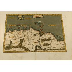
Aphricae tabula secunda continet.
Map representing northern Africa.The fourth edition of Ptolemy's Geographia utilising Lorenz Fries's woodcut maps was published in Vienne, Dauphine, in 1541 by Gaspar Tre...
Place & Date: Vienna, 1541
Selling price: $300
Sold
No title. [China and Japan.]
The earliest printed representation of the China and Japan region in a European Atlas. The first issue of this engraving with minor titular amendments appeared in the 152...
Place & Date: Vienne 1541
Selling price: $1800
Sold
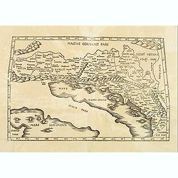
EUROPAE Tabula Quinta continet Rhetiam et Vindeliciam?
A Ptolemaic map of the Dalmatian coast but also showing parts of Italy, and the northern tip of Corsica. ¤
Place & Date: Vienne, 1541
Selling price: $400
Sold in 2009
ASIAE TABULA quinta continentur Assyria...
This map covers the territory delimited by the Tigris and the Euphrates rives, the so called Mesopotamia.It extends as far as the borders with Iran, the eastern part of T...
Place & Date: Vienne, 1541
Selling price: $300
Sold
ASIAE TABULA secunda continet.
This is a Ptolemaic version of the Black Sea, Ukraine and Southern Russia areas extending to the Caspian Sea. The Crimean Penninsula is shown, lower left, and the Russian...
Place & Date: Vienne, 1541
Selling price: $800
Sold in 2019
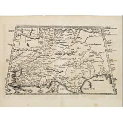
Tabula X. Asiae hae sunt e cognitis totius orbis.
The earliest printed representation of India west of the Ganges River in Ptolemy's time. Considerable detail of river systems and mountain ranges.The first issue of this ...
Place & Date: Vienne 1541
Selling price: $550
Sold
Tabula octava Asiae continet.
Woodblock map illustrating the Ptolemaic concept of the region of ancient Schytia Extra in a trapezoidal projection. Title is on verso.Central Asia and China with the cou...
Place & Date: Vienne, 1541
Selling price: $180
Sold in 2009
Tabula IX Asia (title on verso).
Martin Waldseemüller (1470-1521) drew the maps for the 1513 and 1520 editions of Ptolemy's ' Geographia'. They were revised and reduced by Laurent Fries and used for the...
Place & Date: c. 1541
Selling price: $450
Sold in 2008
Europae Tabula quarta continet. [Central Europe]
The earliest printed representation of Germany, Poland and central Europe.
Place & Date: Vienne 1541
Selling price: $400
Sold in 2008
Aphricae tabula secunda continet
Untitled trapezoidal Ptolemaic woodcut map of North Africa. From the 1541 Vienne (Dauphiné) edition of Ptolemy\'s Geographia published by Gaspar Trechsel and sold by H...
Place & Date: Vienne, 1541
Selling price: $500
Sold in 2009
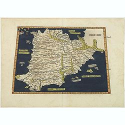
Europae Tabula secunda : Continet Hispaniam Baeticam, Hispaniam Lusitaniam& Hispaniam Tarraconensem .
Map of Spain and Portugal prepared by C. Ptolemy (0100?-0170?) and edited by Michel Servet (1511-1553).Included in "Claudii Ptolemaei Alexandrini geographicae enarra...
Place & Date: Lyon, M. Servetus, 1541
Selling price: $950
Sold in 2011
Tabula nova utriusque Indiae
This is the fourth and last edition of this map based on Waldseemüller's first "modern" map of Asia. It follows that cartography without change but adds an int...
Place & Date: Vienne, L.Fries, Servetus, 1541
Selling price: $1550
Sold in 2011
Tabula Asiae XI.
Attractive early woodblock map of South East Asia, with inset panel of tiger, cockerels and parrot. Woodcut map with full hand-coloring as known to Ptolemy. From his Geog...
Place & Date: Basle, H. Petri, c. 1542
Selling price: $650
Sold in 2011
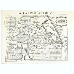
Tabula Asiae VII.
Attractive woodblock map, depicting to the left Persian Gulf and Caspian Sea according to Ptolemy. The mountain ranges are depicted in the manner of the early Ptolemaic f...
Place & Date: Basle, 1542
Selling price: $160
Sold in 2019
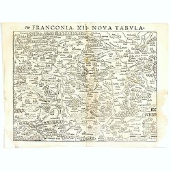
Franconia XII Nova Tabula.
Detailed regional map of Germany, centered on Bamberg and the Mein River. One of the earliest obtainable modern maps of the region. From the 1542 edition of Münster's Ge...
Place & Date: Basle, ca. 1542
Selling price: $50
Sold in 2017
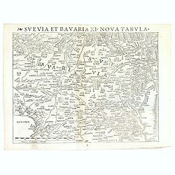
Svevia et Bavaria XII, Nova Tabula.
A highly decorative woodcut map by famous mapmaker Sebastian Münster published in his Ptolemy edition 1552 in Basel at Heinrich Petri. The decorative woodcut bordures ve...
Place & Date: Basle, ca. 1542
Selling price: $50
Sold in 2016
Alsatia et Brisgoia II Rheni Et VII Nova Tabula.
Detailed map of the Rhine River Valley, from Strasburg and Argentina to Basel and Laufenberg, centered on Brisach and Kappel and showing Colmar. West is at the top of the...
Place & Date: Basle, ca. 1542
Selling price: $60
Sold in 2019
Quarta Rheni et IX Nova Tab.
Highly detailed regional map of the course of the Rhine, from Mainz to Bonn, one of the first obtainable modern maps of the region. Extremely detailed for the period. The...
Place & Date: Basle, ca. 1542
Selling price: $135
Sold in 2017
Novae Insulae XXVI Nova Tabula (America)
Rare first state of Münster's map of America which is the earliest map to show both continents of America and the first to use Magellan’s name, Mare Pacificum (Pacific...
Place & Date: Basel, (1540) 1542
Selling price: $6250
Sold in 2022
Woodcut of King Charles le Grant etc.
A 1543 woodcut print from “THE SEA OF HISTORY” that is called “The one of the most beautiful of the history of French printing”. La Mer des Hystoires contains Ae...
Place & Date: Paris, 1543
Selling price: $22
Sold in 2018
Woodcut of Aesop's Fables etc.
A 1543 woodcut print from “THE SEA OF HISTORY” that is called “The one of the most beautiful of the history of French printing”. La Mer des Hystoires contains Ae...
Place & Date: Paris, 1543
Selling price: $60
Sold in 2019
Woodcut of Abraham & Isaac etc.
A 1543 woodcut print from “THE SEA OF HISTORY” that is called “The one of the most beautiful of the history of French printing”. La Mer des Hystoires contains Ae...
Place & Date: Paris, 1543
Selling price: $35
Sold in 2019
's-Hertogenbosch and Mechelen
Very early panoramic view of 's-Hertogenbosch and Mechelen. Size of the sheet is 364x235mm. From his Geographia, that great compendium of Renaissance knowledge.
Place & Date: Basle, ca. 1544
Selling price: $25
Sold in 2012
[Map of Europe]
Page with an early representation of Europe. This text page with a fine wood block printed map is from the rare work "C. Iulii Solini Polyhistor, Rerum Toto Orbe Mem...
Place & Date: Basle, Michael Isengrin, 1544
Selling price: $225
Sold in 2013
Cairo, Warhaffte abcontrafehtung der machtigen und vesten Statt Alkair.
A highly detailed birds-eye view of the city of Cairo, illustrated with drilling soldiers, crocodiles, camels, horse riding, fishermen at work, mosques, and more. The vie...
Place & Date: Basel, 1544
Selling price: $210
Sold in 2019
Description of the World.
Set before the text on the first page of his book Cosmographiae , Sebastian Münster presents his view of the Cosmos. We find the Divinity presiding over his creation, w...
Place & Date: Basel, 1544
Selling price: $150
Sold in 2019
Discovery of America.
The discovery of America by Christopher Columbus from the Cosmographia by Sebastian Münster (ca 1544), on a full leaf. A second full leaf is added with the description o...
Place & Date: Basel, 1544
Selling price: $120
Sold in 2020
Terrae Sanctae Tabula
"Attractive woodblock map of the Holy Land drawn with west to the top of the sheet, the map shows the division of the country between the tribes of Israel according ...
Place & Date: Basle 1544
Selling price: $630
Sold
Leyden / Alva.
Very early panoramic view of Leiden. Size of the sheet is 360x232mm. From his Geographia , that great compendium of Renaissance knowledge. An exciting print.
Place & Date: Basle 1544
Selling price: $90
Sold
[Sea monsters] Les monstres marins & terrestres..
Münster's plate of monsters of both land and sea, taken from Olaus Magnus' 'Carta Marina' of 1539, with abundant tusks, horns and twin-spouts. One vignette shows a galle...
Place & Date: Basle 1544
Selling price: $925
Sold
's-Hertogenbosch / Antwerp / Alva.
Very early panoramic view of 's-Hertogenbosch and Antwerp. Size of the sheet is 334x222mm. From his Geographia , that great compendium of Renaissance knowledge. An exciti...
Place & Date: Basle 1544
Selling price: $50
Sold
Leyden/ Alva
Very early panoramic view of Leiden. Size of the sheet is 360x232mm. From a German text edition of his Geographia , that great compendium of Renaissance knowledge.The Cos...
Place & Date: Basle, 1544
Selling price: $40
Sold in 2010
's-Hertogenbosch and Mechelen.
Very early panoramic views of 's-Hertogenbosch and Mechelen. Size of the sheet is 364x235mm.From his Geographia , that great compendium of Renaissance knowledge.
Place & Date: Basle, 1544
Selling price: $80
Sold in 2010
[Map of Caspian Sea and Europe]
Page with an early representation of the Caspian Sea and on verso a map of Europe. This text page with a fine wood block printed map is from the rare work "C. Iulii ...
Place & Date: Basle, Michael Isengrin, 1544
Selling price: $210
Sold in 2011
[Map of Caspian Sea and Europe]
Page with an early representation of Germany. This text page with a fine wood block printed map is from the rare work "C. Iulii Solini Polyhistor, Rerum Toto Orbe Me...
Place & Date: Basle, Michael Isengrin, 1544
Selling price: $50
Sold in 2011
[Map of Northern half of Africa]
An early representation of North Africa with a prominent "Mountains of the Moon" (Montes Lunae), a mountain range in central Africa that is the source of the Wh...
Place & Date: Basle, Michael Isengrin, 1544
Selling price: $400
Sold in 2012
[Map of Italy]
Page with an early representation of Italy with Sicily, Sardinia and Corsica. South to the top. This text page with a fine wood block printed map is from the rare work &q...
Place & Date: Basle, Michael Isengrin, 1544
Selling price: $450
Sold in 2011
[Plan of Rome]
Page with an early representation of Rome. This text page with a fine wood block printed map is from the rare work "C. Iulii Solini Polyhistor, Rerum Toto Orbe Memor...
Place & Date: Basle, Michael Isengrin, 1544
Selling price: $142
Sold in 2011
[Map of Morea]
Page with an early representation of the Greek Island of Morea. This text page with a fine wood block printed map is from the rare work "C. Iulii Solini Polyhistor, ...
Place & Date: Basle, Michael Isengrin, 1544
Selling price: $150
Sold in 2013
[Map of Rhodes]
Page with an early representation of the Greek Island of Rhodes. This text page with a fine wood block printed map is from the rare work "C. Iulii Solini Polyhistor,...
Place & Date: Basle, Michael Isengrin, 1544
Selling price: $60
Sold in 2018
[Map of the central Europe with Switzerland]
Page with an early representation of Central Europe with Switzerland, Austria. South to the top. This text page with a fine wood block printed map is from the rare work &...
Place & Date: Basle, Michael Isengrin, 1544
Selling price: $100
Sold in 2014
[Map of Russia]
Page with an early representation of Russia. This text page with a fine wood block printed map is from the rare work "C. Iulii Solini Polyhistor, Rerum Toto Orbe Mem...
Place & Date: Basle, Michael Isengrin, 1544
Selling price: $260
Sold in 2011
[Map of the England]
Page with an early representation of the British Isles. This text page with a fine wood block printed map is from the rare work "C. Iulii Solini Polyhistor, Rerum To...
Place & Date: Basle, Michael Isengrin, 1544
Selling price: $475
Sold in 2011
[Map of the Palestine]
Page with an early representation of the Palestine. This text page with a fine wood block printed map is from the rare work "C. Iulii Solini Polyhistor, Rerum Toto O...
Place & Date: Basle, Michael Isengrin, 1544
Selling price: $350
Sold in 2011
[Map of Ukrania]
Page with an early representation of Ukrania with the Black Sea. This text page with a fine wood block printed map is from the rare work "C. Iulii Solini Polyhistor,...
Place & Date: Basle, Michael Isengrin, 1544
Selling price: $275
Sold in 2011
[Map of Sicily]
Page with an early representation of Sicilia and the south of Italia. This text page with a fine wood block printed map is from the rare work "C. Iulii Solini Polyhi...
Place & Date: Basle, Michael Isengrin, 1544
Selling price: $600
Sold in 2011
[Map of Greece]
Page with an early representation of Greece. This text page with a fine wood block printed map is from the rare work "C. Iulii Solini Polyhistor, Rerum Toto Orbe Mem...
Place & Date: Basle, Michael Isengrin, 1544
Selling price: $100
Sold in 2016
[Map of Europe]
Page with an early representation of Europe. The continent is filled with the Alps mountains and the rivers Rhine and Danube.This text page with a fine wood block printed...
Place & Date: Basle, Michael Isengrin, 1544
Selling price: $500
Sold in 2011
Heidelberg.
One of the two largest woodcuts from the 'Cosmographia' by Sebastian Münster. This is the attractively colored bird-eye view of Heidelberg. It is highly detailed, with a...
Place & Date: Basel, 1544
Selling price: $190
Sold in 2019
(Fragment from the Cosmographia)
This fragment of the Cosmographia by Sebastian Münster covers the entire mathematical and geographical introductions given in Book I. In these twenty-two pages Münster...
Place & Date: Basel, 1544
Selling price: $425
Sold in 2020
Von dem Europa, das zu unsern zeiten die Christenheit under im begreifft und etwas von der Türkey.
An attractive map of Europe from the famous 'Cosmographia' by Sebastian Münster, in very nice colors. Europe has almost already taken the shape of Regina Europa. On ve...
Place & Date: Basel, 1544
Selling price: $100
Sold in 2022
Tabula Europae I (Great Brittain)
The first edition of Munster's Ptolemaic map of Great Britain appeared in his "Geographia Universalis", first published in 1540. This was a new and important ed...
Place & Date: Basel, Heinrich Petri, 1545
Selling price: $540
Sold in 2014
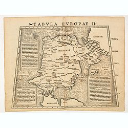
Tabula Europae II (Spain and Portugal)
The first edition of Munster's Ptolemaic map of Spain and Portugal appeared in his "Geographia Universalis", first published in 1540. This was a new and importa...
Place & Date: Basel, Heinrich Petri, 1545
Selling price: $350
Sold
Tabula Europae III (France)
The first edition of Munster's Ptolemaic map of France appeared in his "Geographia Universalis", first published in 1540. This was a new and important edition o...
Place & Date: Basel, Heinrich Petri, 1545
Selling price: $150
Sold in 2016
Tabula Europae V ( Adriatic Sea and the Balkans)
The first edition of Munster's Ptolemaic map of the Adriatic Sea and the Balkans appeared in his "Geographia Universalis", first published in 1540. This was a n...
Place & Date: Basel, Heinrich Petri, 1545
Selling price: $275
Sold in 2014
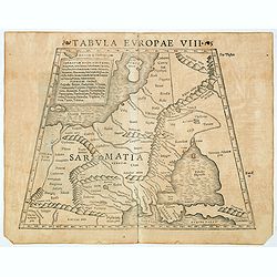
Tabula Europae VIII ( Russia, Ukraine, Baltic, Scandinavia)
The first edition of Munster's map of the Russia, Ukraine, Baltic, Scandinavia, based upon Claudius Ptolemy which appeared in his "Geographia Universalis", firs...
Place & Date: Basel, Heinrich Petri, 1545
Selling price: $350
Sold in 2018
Tabula Europae IX ( Greece & Turkey)
The first edition of Munster's map of Greece & Turkey, based upon Claudius Ptolemy which appeared in his "Geographia Universalis", first published in 1540. ...
Place & Date: Basel, Heinrich Petri, 1545
Selling price: $300
Sold in 2014
Aphricae Tabula I (Mauritania - present-day Morocco, Algeria, and Tunisia.)
The first edition of Munster's map of Mauritania - present-day Morocco, Algeria, and Tunisia, based upon Claudius Ptolemy which appeared in his "Geographia Universal...
Place & Date: Basel, Heinrich Petri, 1545
Selling price: $200
Sold in 2019
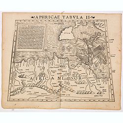
Aphricae Tabula II (Northern Africa and the Mediterranean showing parts of Sicily, Tunisia and Libya.)
The first edition of Munster's map of Northern Africa and the Mediterranean showing parts of Sicily, Tunisia and Libya, based upon Claudius Ptolemy which appeared in his ...
Place & Date: Basel, Heinrich Petri, 1545
Selling price: $300
Sold in 2014




![[Greece]](/uploads/cache/33846-250x250.jpg)
![[Spain and Portugal]](/uploads/cache/33848-250x250.jpg)
![.[Italy]](/uploads/cache/33856-250x250.jpg)
![[Great Britain, Ireland]](/uploads/cache/33865-250x250.jpg)
![[Czech Republic, Germania, Germany, Poland]](/uploads/cache/33866-250x250.jpg)
![[No title - Daniel's Dream map - Rare Swedish edition]](/uploads/cache/34783-250x250.jpg)
![[Tabula Sexta Asiae Complectitur Arabam felicem & Carmaniam].](/uploads/cache/97404-250x250.jpg)

![[World map] Typus Universalis.](/uploads/cache/39237-250x250.jpg)


![[Armillary Sphere with Windheads]](/uploads/cache/26265-250x250.jpg)

![No title. [China and Japan.]](/uploads/cache/01626-250x250.jpg)




![Europae Tabula quarta continet. [Central Europe]](/uploads/cache/15350-250x250.jpg)





![[Map of Europe]](/uploads/cache/31501-250x250.jpg)


![[Sea monsters] Les monstres marins & terrestres..](/uploads/cache/21687-250x250.jpg)


![[Map of Caspian Sea and Europe]](/uploads/cache/31512-250x250.jpg)
![[Map of Caspian Sea and Europe]](/uploads/cache/31513-250x250.jpg)
![[Map of Northern half of Africa]](/uploads/cache/31511-250x250.jpg)
![[Map of Italy]](/uploads/cache/31509-250x250.jpg)
![[Plan of Rome]](/uploads/cache/31510-250x250.jpg)
![[Map of Morea]](/uploads/cache/31508-250x250.jpg)
![[Map of Rhodes]](/uploads/cache/31507-250x250.jpg)
![[Map of the central Europe with Switzerland]](/uploads/cache/31505-250x250.jpg)
![[Map of Russia]](/uploads/cache/31506-250x250.jpg)
![[Map of the England]](/uploads/cache/31504-250x250.jpg)
![[Map of the Palestine]](/uploads/cache/31503-250x250.jpg)
![[Map of Ukrania]](/uploads/cache/31494-250x250.jpg)
![[Map of Sicily]](/uploads/cache/31492-250x250.jpg)
![[Map of Greece]](/uploads/cache/31493-250x250.jpg)
![[Map of Europe]](/uploads/cache/31463-250x250.jpg)


