Browse Listings in Asia > Philippines
Insulae Philippinae [Philippines].
A miniature map of Philippines, centered on Mindanao and Luzon. Title cartouche on the upper left corner. First published in 1598 in his Caert-Thresoor, the plates were e...
Place & Date: Middelburg, 1598
Selling price: $1500
Sold in 2018
Descriptio Philippinarum / Insulae Philippinae.
A rare miniature map of Philippines. East is at the top. Title cartouche on the upper left corner.First published in 1598 in his Caert-Thresoor, the plates were executed ...
Place & Date: Amsterdam, Cornelis Claes, 1606
Selling price: $1075
Sold in 2016
Insulae Philippinae.
This lovely miniature map shows the Philippine Islands. Published by Petrus Bertius, in Amsterdam at the beginning of the seventeenth century, this map is embellished wit...
Place & Date: Amsterdam, 1606
Selling price: $1550
Sold in 2019
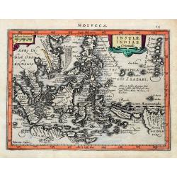
Insulae Indiae Orientalis.
An early and decorative map of South East Asia or Indochina. Shows Indonesia, the Philippines, Malaya, and a part of New Guinea. Filled with islands and names. Latin text...
Place & Date: Amsterdam, ca 1630
Selling price: $150
Sold in 2020
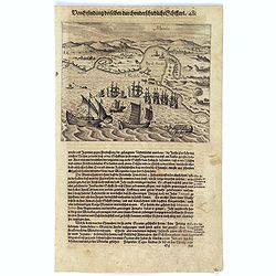
Schlacht for Manille.
Scarce print with German text sheet showing the Dutch anchored near Manila, the Spanish, with 7 soldiers to each Dutchman, tried to conquer the Dutch with their great bat...
Place & Date: Frankfurt, M.Merian, 1633
Selling price: $500
Sold in 2017
Manila.
Scarce print with German text sheet showing the harbour of Manila, carefully depicted here, is a good place for ships. The letter ‘A’ is the harbour itself. B: Shows ...
Place & Date: Frankfurt, M.Merian, 1633
Selling price: $800
Sold in 2017
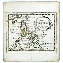
Isles Philippines dites autrement de Manilhe.
Uncommon miniature map of the Philippines, from Pierre Duval's La Geographie Universeille dated 1676.The fictitious island of San Juan (I. S. Iuan) appears in one of its ...
Place & Date: Paris, 1663
Selling price: $325
Sold in 2016
Les Iles Philippines. . .
Map of the Philippine Islands prepared by N.Sanson and published by Pierre Mariette.Published in an early edition of the small Sanson atlas L'Europe Dediée a M...
Place & Date: Paris, P. Mariette, 1667
Selling price: $250
Sold in 2009
Insulae Philippinae (with inset of the Ladrones).
Fine example of this detailed map the Philippines, including a large inset map of the Ladrones. This is one of the earliest obtainable maps to focus on the Philippine isl...
Place & Date: Utrecht/Amsterdam, J.Halma, 1683
Selling price: $500
Sold in 2019
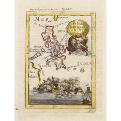
Les Isles Philippines 1684.
A charming late 17th century French map of the Philippines with a large pictorial cartouche depicting a mermaid with sea horses, a nautical sailing ship scene across the ...
Place & Date: Franckfurt 1684
Selling price: $125
Sold
Manille.
A charming late 17th century French bird's-eye view of Manila and its harbour. With a ribbon style title cartouche and a nautical sailing ship scene on the bottom.By Alla...
Place & Date: Franckfurt 1684
Selling price: $385
Sold
Baye la Baye.
Early map of Albay Bay on the Southeast Coast of Luzon, with the northern tip of Samar in the lower right. The mountains rising in the upper left lead to Mayon Volcano.Fr...
Place & Date: Amsterdam, E. Rogers, 1703
Selling price: $200
Sold in 2015
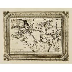
Insulae Indicae Cum Terris Circumvicinis.
Highly sought-after map of Southeast Asia. Includes today's Malaysia, Thailand, Vietnam, Singapore, Indonesia, Ceylon,< etc. Nova Hollandia (Australia) is depicted at ...
Place & Date: Munich, c1710
Selling price: $850
Sold in 2016
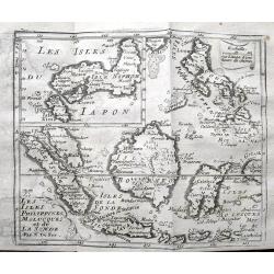
Les Isles Philippines, Molucques et de la Sonde.
Detailed map of the Philippines, Borneo and Indonesia. With an inset map of Japan. Names Singapore (Sincapura) and extends until Timor. The equator line is shown.
Place & Date: Paris, ca. 1710
Selling price: $135
Sold in 2019
[Manilhas Bay]
Fine chart depicting Manilla Bay. Little interior detail is given but the coastlines, settlements and principal coastal features are identified. An attractive early chart...
Place & Date: Amsterdam 1724
Selling price: $200
Sold
[Lucon of Luconia]
Fine chart depicting the Islands of the Philippines. Little interior detail is given but the coastlines, settlements and principal coastal features are identified. An att...
Place & Date: Amsterdam 1724
Selling price: $650
Sold
Lucon of Luconia. [ Map of the Philippines]
Fine chart depicting the Islands of the Philippines. Little interior detail is given but the coastlines, settlements and principal coastal features are identified. An att...
Place & Date: Amsterdam, 1724
Selling price: $2400
Sold in 2017
Baye la Baye.
Early map of Albay Bay on the Southeast Coast of Luzon, with the northern tip of Samar in the lower right. The mountains rising in the upper left lead to Mayon Volcano.Fr...
Place & Date: Amsterdam, F. Bernard, 1725
Selling price: $200
Sold in 2016
Typus freti Manilensis. Détroit de Manilles.
This is a scarce map of Southern Luzon and the Manila Strait. Includes the Islands of Kalusunan, Mindoro, Burias, Ticao, and Isla han Samar. Includes fleets of ships and ...
Place & Date: Rouen, Jean-Baptiste Machuel jr. 1725
Selling price: $700
Sold in 2017
Baye la Baye.
Early map of Albay Bay on the Southeast Coast of Luzon, with the northern tip of Samar in the lower right. The mountains rising in the upper left lead to Mayon Volcano.Fr...
Place & Date: Amsterdam, F. Bernard, 1725
Selling price: $180
Sold in 2018
Manila.
A rare and important early engraving of the Bay and city of Manila as visited by the Dutch fleet of Joris van Spilbergen in March 1616. The Dutch fleet are seen to be app...
Place & Date: Amsterdam, 1725
Selling price: $360
Sold in 2019
Het Eyland Sangir. / De Talautse Eylanden.
To the left map of the island of Sangir. To the right map of Talautse Islands.François Valentijn (1666-1727), a missionary, worked at Amboina from 1684 to 1694 and 1705 ...
Place & Date: Amsterdam 1726
Selling price: $100
Sold
(Philippine Islands)
Oriented to the east. The northern Philippines, showing all of Luzon.François Valentijn (1666-1727), a missionary, worked at Amboina from 1684 to 1694 and 1705 to 1713 a...
Place & Date: Amsterdam, 1726
Selling price: $1600
Sold in 2015
(Manilhas)
Untitled chart of Manila Bay [MANILHAS BAY] ... One of three maps and views of the Philippines published by François Valentijn (1666-1727), a missionary, who worked at A...
Place & Date: Amsterdam, 1726
Selling price: $1000
Sold in 2016
De Stad Manilhia.
A view of the city of Manila taken from the Bay. The view shows Intramuros, Cavite and churches then existing in the countryside around Manila at the beginning of the eig...
Place & Date: Amsterdam, 1726
Selling price: $950
Sold in 2016
De Manilles of Philippines Eylanden benevens de Moluccos, Macassar, Tymor en andere door P.W.Verhoeve aangedaan.
A beautifully engraved map of the area around the Philippines. Showing the track of the voyage by Pieter Willem Verhoeve.From Galerie Agréable du Monde, a sixty-six volu...
Place & Date: Leiden 1729
Selling price: $600
Sold
Perspective de la côte de Lucon pres de Manille a 6 lieues de la cote la plus haute montagne etant à l'est.
The print shows most likely Albay Bay on the Southeast Coast of Luzon with mountains risng in the back. Showing Dutch vessels in the foreground, likely those of Olivier v...
Place & Date: Paris / Amsterdam, ca 1730
Selling price: $375
Sold in 2017
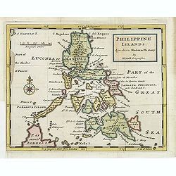
Philippine islands Agreable to Modern History. . .
Map of the Philippines, with insets of Manila, Manila vicinity, Borneo. . .
Place & Date: London, c. 1732
Selling price: $975
Sold in 2011
Les Isles Philippines Moluques et de la Sonde.
A very nice map of Southeast Asia with the Philippines including Borneo, Java, Sumatra and the Moluccas, with an inset map of Japan. From Francisco Giustiniani for El Atl...
Place & Date: Leon de Francia (Lyon), Jaime Certa, 1739
Selling price: $450
Sold in 2021
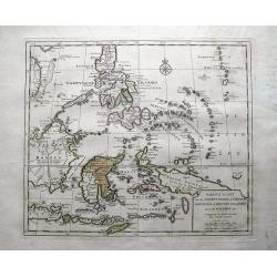
Nieuwe kaart van de Filippynsche, Ladrones, Moluccos of Specery Eilanden als mede Celebes etc.
Shows the western islands of the archipelago, Borneo, Java and Sumatra, up to and including New Guinea. With very good detail to Philippines.Read more Early maps of South...
Place & Date: Amsterdam, 1740
Selling price: $350
Sold in 2018
Plan de la baye de Manille capitale des isles Philippines située en l'isle Luçon [with] Plan de Pulo Condor ou Isle Condor située à l'extrémité orientale du golfe de Siam [and] Veue de l'Isle Condor. . .
A first edition of the important and large French Sea chart including a chart of Manila Bay, Philippines, accompanied by a chart and view of Côn Son Island, Vietnam by J...
Place & Date: Paris, 1745
Selling price: $6200
Sold in 2017
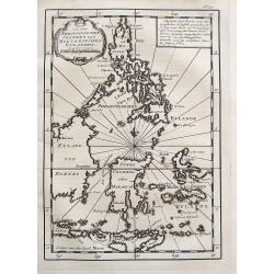
Isles Philippines.
Nice map of the Archipel des Philippines.
Place & Date: Paris 1748
Selling price: $100
Sold
Carte du Canal des Iles Philippines par lequel Passe le Galion de Manille...
This large and detailed copper-engraved sea-chart, is one of the best obtainable maps of the Islands of the Philippines from the 18th century. It provides excellent detai...
Place & Date: Paris, ca. 1748
Selling price: $600
Sold in 2016
Karte von den Philippinischen Celebes und Molukkischen Eylanden.
Uncommon map of the Philippines, including a large part of Borneo, Sulawesi, the Moluccas, Bali, Timor, etc. With a small title cartouche and a box with German text.More ...
Place & Date: Paris, 1748
Selling price: $110
Sold in 2017
Carte des Isles Philippines Celebes et Moluques.
Uncommon issue of this map of the Philippines Islands, Borneo, Moluccas and Sulawesi.FromAtlas Portatif pour servir a l'intelligence de l'Histoire Philosophique et Politi...
Place & Date: Amsterdam, 1749
Selling price: $300
Sold in 2009
A Chart of the Channel in the Phillippine Islands through which the Manila Galeon passes together with the adjacent Islands.
Chart of the northern Philippine islands. Double page chart, engraved by R. W. Seale, from the English edition of George Anson's Voyages, London 1749.
Place & Date: London, 1749
Selling price: $500
Sold in 2013
Isles Philippines et Moluques. . .
Fine miniature map of Philippines, Moluccas and New Guinea. Found in his Atlas Portatif, universel et militaire, 1749-1799.
Place & Date: Paris, 1749
Selling price: $200
Sold in 2015
Isles Philippines et Moluques Par le Sr. Robert de Vaugondy fils de Mr. Robert Geog. Ord du Roi avec Privilege 1749.
Small detailed map of Philippines, including New Guinee and Moluccas. From Atlas Portatif Universel, by Robert de Vaugondy.Page 169 outside border top right. First state ...
Place & Date: Paris, 1749
Selling price: $180
Sold in 2016
A Chart of the Channel in the Phillippine Islands...
A very attractive copper-engraved sea-chart, one of the best obtainable maps of Philippines from the 18th century. Covers the area from Luzon south until Negros, Cebu, an...
Place & Date: London, 1748-1749
Selling price: $475
Sold in 2016
Carte de la Baye de Manille / Plan van de Baay van Manilla.
This attractive chart of Manila Bay comes from a more rare Dutch/French edition of Anson's Voyage Around the World (´Voyage autour du Monde´), published in 1749 in Amst...
Place & Date: Amsterdam, 1749
Selling price: $160
Sold in 2019
Carte du Canal des Iles Philippines. . . / Kaart van het kanaal in de Filippynsche eilanden waar door het galjoen van Manilla passeert te gelyk met de naastgelegen eilanden.
Splendid chart of the Philippines illustrating the track of the Manila galleon route. The coasts of the islands are fairly accurately charted but there are no details inl...
Place & Date: Amsterdam, ca. 1750
Selling price: $900
Sold in 2015
Vue de Deux des Iles des Larrons & Vue de la Cote du N.O. Saypan, une des Iles des Larons.
Views of several of the Mariana Islands in the Philippines Sea in the South Pacific. From George Anson's "Voyage Aurout du Monde". George Anson, 1st Baron Anson...
Place & Date: Paris, 1750
Selling price: $18
Sold in 2015
Carte du Canal des Philippines. . .
Large detailed chart of the Islands of the Philippines from the French edition of Anson's Voyages. Anson's voyages were one of the last great buccaneering voyages, and it...
Place & Date: Paris, ca 1750
Selling price: $370
Sold in 2018
Carte du Canal des Iles Philippines par lequel Passe le Galion de Manille. . .
A detailed copper-engraved sea-chart, the first obtainable large format map, and one of the best maps of the Philippines from the 18th century.It provides excellent detai...
Place & Date: Paris, 1750
Selling price: $380
Sold in 2019
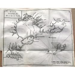
Plan de la Baye de Manille.
One of the earliest obtainable plans of Manila published in 1750. The detailed chart of the Manila Bay includes anchorages, soundings, rocks, and several places are named...
Place & Date: Paris, 1750
Selling price: $165
Sold in 2019
Neue Charte von dem Philippinischen und Moluckischen Insuln..
Very rare map of South East Asia including the Philippines, Moluccas, New Guinea, parts of Borneo, and Java. The map is a faithful copy of Isaac Tirion's map of a few yea...
Place & Date: Altona, 1751
Selling price: $300
Sold
Carte du Canal des Iles Philippines. . . Page 88.
Important large-scale map of the northern Philippines, from Luzon to Negros, featuring the track of the Manila Galleon on its yearly treasure voyage from Manila to Mexico...
Place & Date: Amsterdam, 1751
Selling price: $185
Sold in 2008
Plan de la Baye de Manille.
Detailed plan of Manila Bay after George Anson's key plan of the Bay of Manila. Several places are named along the coast, including Bataan, Metro Manila, and Cavite. With...
Place & Date: Paris, 1751
Selling price: $300
Sold in 2018
Carte des isles Philippines, dressée sur la carte espagnole du R.P. Murillo de Velarde. Ire feuille. . . 1752.
Fine map of the northern islands of the Philippines.Jacques Nicolas Bellin (1703-1772) was one of the most important and proficient French cartographers of the mid-eighte...
Place & Date: Paris, 1752
Selling price: $120
Sold in 2021
Carte des isles Philippines, dressée sur la carte espagnole du R.P. Murillo de Velarde. Ire feuille. . .
Fine map of the northern islands of the Philippines.Jacques Nicolas Bellin (1703-1772) was one of the most important and proficient French cartographers of the mid-eighte...
Place & Date: Paris, 1752
Selling price: $200
Sold in 2016
Carte Des Isles Philippines.. 2e. Feuille. . . / Kaart der Philippines Eilanden. . .
Detailed edition of this fine map of the southern portion of the Philippines, extending from Masbate and Oetablas Islands to Jolo Island and centered on Mindanao and Leyt...
Place & Date: Paris, 1752
Selling price: $300
Sold in 2016
Cartes des Isles Philippines...
A striking map of southern part of the Philippines, based upon Pedro Murillo Velarde’s map, by the mapmaker, Nicolas Bellin in 1752 and published in Prevost’s “D' E...
Place & Date: Paris, 1752
Selling price: $145
Sold in 2017
Carte des Isles Philippines. . .
Detailed map of the northern part of the Philippines, including Manilla.Jacques Nicolas Bellin (1703-1772) was one of the most important and proficient French cartographe...
Place & Date: Paris, 1752
Selling price: $250
Sold in 2016
Carte des Isles Philippines . . . (1ere feuille)
The northern part of the Philippines, including the town of Manila.Jacques Nicolas Bellin (1703-1772) was one of the most important and proficient French cartographers of...
Place & Date: Paris, 1752
Selling price: $220
Sold in 2018
Nieuwe Afteekening van de PHILIPPYNSE EYLANDEN geleegen in de Oost-Indische Zee tusschen Formosa en Borneo.
A finely engraved and detailed chart of the Philippines.Very rare: only included in 6th volume (so-called secret atlas) of Van Keulen's. Latitude scale, compass rose and ...
Place & Date: Amsterdam, 1753
Selling price: $6000
Sold in 2008
[2 charts] Nieuwe aftekening van de Baay MANILLA in de Oostindische Zee.. / Kaart van de baay van Bongo onder 't Eilandt MINDANO..
Two finely engraved and detailed charts of the Bay of Manila and the coast of Mindanao with the island Bongo.Very rare: only included in 6th volume (so-called secret atla...
Place & Date: Amsterdam 1753
Selling price: $2000
Sold in 2009
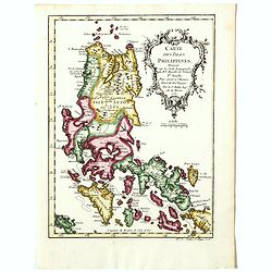
Isles Philippines.
Fine map of the Philippines. George Louis Le Rouge was active from 1740- till 1780 as a publisher, and was appointed engineer for the King of France. From his Atlas Nouve...
Place & Date: Paris, 1756
Selling price: $600
Sold in 2015
Isles Philippines.
Fine map of the Philippines. George Louis Le Rouge was active from 1740- till 1780 as a publisher, and was appointed engineer for the King of France. From his Atlas Nouve...
Place & Date: Paris, 1756
Selling price: $400
Sold in 2016
Isles Philippines.
Fine map of the Philippines. George Louis Le Rouge was active from 1740- till 1780 as a publisher, and was appointed engineer for the King of France. From his Atlas Nouve...
Place & Date: Paris, 1756
Selling price: $425
Sold in 2018
Carte du Canal des Isles Philippines par lequel passe le Galion de Manille et les Iles voisines
Large and detailed chart tracking the route of the Galleons from Manila. With the title in French and Dutch. Very detailed showing many bays, islands, sand banks, and de...
Place & Date: Amsterdam, ca. 1760
Selling price: $200
Sold in 2009
Nieuwe Kaart van de Filippynsche, Ladrones, Moluccos of Specery Filanden, als Mede Celebes etc.
Very detailed map of the Philippine islands and eastern Indonesia. With hundreds of tiny islands, including the famous Spice Islands here called Specery Eilenden. Further...
Place & Date: Amsterdam, c1760
Selling price: $100
Sold in 2013
Carte des Nouvelles Philipines.
Jaques Nicolas Bellin (1702-720) was the most important French hydrographer of the 18th century. Sea-atlas 'Hydrographique Français' , 1756-65, atlas to accompany Prévo...
Place & Date: Amsterdam, c. 1760
Selling price: $70
Sold in 2014
Carte du Canal des Isles Philippines Par lequel passe le Galion de Manille...
This large and detailed copper-engraved sea-chart, is one of the best obtainable maps of the Islands of the Philippines from the 18th century. It shows Islands, bays, ree...
Place & Date: Paris, ca. 1760
Selling price: $575
Sold in 2016
A Chart of the Channel in the Phillippine Islands . . .
Large detailed chart of the Islands of the Philippines from the English edition of Anson's Voyages. One of the most detailed charts of the Philippines of the era. Shows I...
Place & Date: Augsburg 1760
Selling price: $700
Sold in 2018
Carte du Canal des Iles Philippines Par lequel passe le Galion de Manille, et les Iles voisines de ce Canal.
A map of the Philippines from a Dutch edition of Anson's Voyage around the World.
Place & Date: Amsterdam, 1765
Selling price: $450
Sold in 2016
Carte du Canal des Iles Philippines Par lequel passe le Galion de Manille, et les Iles voisines de ce Canal / Kaart van het Kanaal in de Filippynsche Eilanden . . .
Important chart of the Islands of the Philippines. Shows islands, bays, reefs, soundings tracks of the Manila Galleon route, etc. Includes a large compass rose and rhumb ...
Place & Date: Paris, 1765
Selling price: $750
Sold in 2016
Isles Philippines et Moluques.
Small detailed map showing the Philippines and part of Indonesia. From Atlas Portatif Universel, by Robert de Vaugondy.Page 73 outside border top right. Mary Sponberg Ped...
Place & Date: Paris, later than 1769
Selling price: $400
Sold in 2015
Banc de Sable dangereux / Isles de Jofeph Freewill / L'Extrémité Méridionale de Mindanao. [Tome I. Pl. 15.]
Three charts on one page showing the southern tip of Mindanao. This map is taken from the first French edition of James Cook's first voyage entitled Relation des voyages ...
Place & Date: Paris, 1774
Selling price: $80
Sold in 2015
Plan des Principaux Ports de la Côte d'Illocos en l'Isle de Lucon.
French sea chart of a small part of the northwest coast of the Philippines main island of Luzon. Latitude and longitude scales, compass rose and system of rhumb lines, so...
Place & Date: Paris, ca 1775
Selling price: $400
Sold in 2008
Plan du Port de Subec en l'Isle de Luçon.
French sea chart of Subic Bay and the town of "Subec". Latitude and longitude scales, compass rose and system of rhumb lines, soundings near coast and in bay ar...
Place & Date: Paris, ca 1775
Selling price: $300
Sold
Plan de la baye et Ville de Manille, Capitale des Isles de Philippines.
French sea chart of the inlet and city of Manille. Prepared by Jacques-François L'Abbé Dicquemare (1733-1789). Latitude and longitude scales, compass rose and system of...
Place & Date: Paris, ca 1775
Selling price: $1300
Sold in 2009
Plan des Principaux Ports de la Côte d'Illocos en l'Isle de Lucon.
French sea of a small part of the northwest coast of the Philippines main island of Luzon. Latitude and longitude scales, compass rose and system of rhumb lines, soundin...
Place & Date: Paris, Brest, Demonville, 1775
Selling price: $450
Sold in 2014
Plan de la baye et Ville de Manille, Capitale des Isles de Philippines . . .
French sea chart of the inlet and city of Manila with latitude and longitude scales, compass rose and system of rhumb lines, soundings near coast and in bay areas.Publish...
Place & Date: Paris, Brest, Demonville, 1775
Selling price: $1150
Sold in 2012
Plan du port de Subec, en l'Isle de Luçon.
French sea chart of Subic Bay and the town of "Subec", prepared in 1766. Subic is a 1st class municipality in the province of Zambales, Philippines. It is found...
Place & Date: Paris, Brest, Demonville, 1775
Selling price: $475
Sold in 2012
Carte de l'Archipel de St Lazare ou les Isles Marianes.
An interesting map the archipelago of St Lazare or Marianne's islands, on Alsonso P. Lopez maps and the Spanish Jesuits memory .Prepared by Jacques Nicolas Bellin after D...
Place & Date: Paris, 1738-1775
Selling price: $20
Sold in 2017
Plan of Solsogon Harbour / Chart on the Eastern Coast of Bongo Bay (Mindanao).
A nice copper engraving, with 2 Philippine sea charts on one sheet, published by Laurie & Whittle in London; pl. 125. With the usual sand banks, depth soundings, rhum...
Place & Date: London, 1794-1778
Selling price: $500
Sold in 2020
Carte des Indes en deçà et au delà du Gange...
Detailed 18th century map of the Philippines, Borneo, and parts of Indonesia from the Strait of Singapore to New Guinea. Includes also Formosa (Taiwan) and Hainan. A deta...
Place & Date: Paris, ca. 1780
Selling price: $80
Sold in 2015
Les Isles Philippines, celle de Formose, le sud de la Chine,...
A very interesting map of the South China Sea and the Philippines. Highly detailed with numerous places and islands named.Extends from Pegu and Thailand to Taiwan, and so...
Place & Date: Paris, c1780
Selling price: $56
Sold in 2016
Plan de la Baye de Manille.
Detailed plan of Manila Bay engraved by Jean Lattré after Anson's key plan of the Bay of Manila. With a compass rose and soundings in the Bay.
Place & Date: Paris, c.1780
Selling price: $300
Sold in 2016
Carte des Isles Philippines.
Detailed map of Philippines, published by Louis Brion de la Tour. From the 'Histoire Universel'.More about maps of the Philippines. [+]
Place & Date: Paris, c.1780
Selling price: $300
Sold in 2019

![Insulae Philippinae [Philippines].](/uploads/cache/42048-250x250.jpg)







![[Manilhas Bay]](/uploads/cache/15798-250x250.jpg)
![[Lucon of Luconia]](/uploads/cache/15797-250x250.jpg)
![Lucon of Luconia. [ Map of the Philippines]](/uploads/cache/39345-250x250.jpg)




![Plan de la baye de Manille capitale des isles Philippines située en l'isle Luçon [with] Plan de Pulo Condor ou Isle Condor située à l'extrémité orientale du golfe de Siam [and] Veue de l'Isle Condor. . .](/uploads/cache/39244-250x250.jpg)







![[2 charts] Nieuwe aftekening van de Baay MANILLA in de Oostindische Zee.. / Kaart van de baay van Bongo onder 't Eilandt MINDANO..](/uploads/cache/23817-250x250.jpg)




![Banc de Sable dangereux / Isles de Jofeph Freewill / L'Extrémité Méridionale de Mindanao. [Tome I. Pl. 15.]](/uploads/cache/25899-250x250.jpg)


