Gli Stati del Mogol e la Penisola delle Indie di qua dal Gange.
Cassini's large and lovely map of the Mogul States of India, published in: Nuovo atlante geografico universale in Rome. As well as a strong, decorative title cartouche, t...
Place & Date: Rome, 1797
Selling price: $195
Sold in 2019
Inde Ancienne.
Map of ancient India in attractive out-line color. Shows from modern day Pakistan eastwards and southwards down to Thailand, the Nicobar and the Andaman Islands, includes...
Place & Date: Paris, 1799
Selling price: $50
Sold in 2017
Charte von Indostan.
Rare map of India, with imposing title cartouche lower right. Engraved by Gustav Georg Endner (1754-1824).
Place & Date: Leipzig 1800
Selling price: $240
Sold
PLAN DE LA VILLE DE PONDICHERI DEDIÉ A LA MÉMOIRE DE Mr. DUPLEIX...
Very large and unusual plan of the city of Pondichéry in India. The map depicts the famous hold-off of the British Navy by Dupleix during the siege in 1748. Large scale...
Place & Date: Paris, ca.1800
Selling price: $250
Sold in 2009
Charte von Indostan.
Rare map of India, with imposing title cartouche lower right. Engraved by Gustav Georg Endner (1754-1824).
Place & Date: Leipzig, 1800
Selling price: $150
Sold in 2018
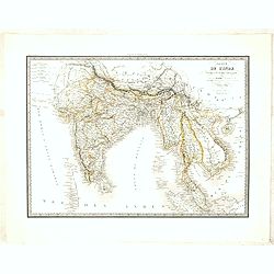
Carte de L'Inde.
A scarce engraved map of the Indian subcontinent covering India and including parts of Iran (Perse), Afghanistan (Royaume de Candahar), Tibet, China, and Indochina (Empir...
Place & Date: Paris, 1803
Selling price: $120
Sold in 2021
Charte von OstIndien nach I.Rennel von Gebr. Lotter.
Decorative map in very good condition with a title cartouche at bottom right, scale bars at the top right, bottom left color key legend.A rare map published by After a ma...
Place & Date: Augsburg, 1777/1810
Selling price: $900
Sold
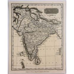
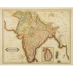
Hindoostan.
A fine copper engraved map of Hindoostan (now India) drawn and engraved by Alexander Findlay and published by Thomas Kelly, London in 1814
Place & Date: London, 1814
Selling price: $35
Sold in 2017
Group From India (111 ter Stamm).
A group of three men from India. From a natural history or ethnographic folio by renowned Swiss artist and lithographer Carl (Karl) Joseph Brodtmann (1787-1862).Carl Jose...
Place & Date: Zurich, 1816
Selling price: $20
Sold in 2019
Southern Hindostan.
A fine Thomson regional map of India, extending from Arungabad, Mahoor and Cicacole in the North, to the southern tip of India, including most of Celyon. Highly detailed,...
Place & Date: Edinbourgh, 1817
Selling price: $43
Sold in 2021
Hindoostan or India.
A fascinating 'Geographical, Historical and Statistical Map of India'. The map indicates 'British Possessions or Dependencies', and identifies 'A Place remarkable for a B...
Place & Date: Philadelphia, 1821
Selling price: $45
Sold in 2019
Madras, Entrée Occidentale du Fort St. George.
An attractive copperplate engraving of the east entrance to the St. George Fort in Madras (Chennai) in southern India. You can see an impressive wall surrounding the fort...
Place & Date: Anon, ca 1821
Selling price: $21
Sold in 2020
Vue du Fort St. George a Madras prise a l'est.
A nice copperplate view of Madras from the south east, engraved after the Daniell aquatint from his book Oriental Scenery, or Views of the Architecture, Antiquities and L...
Place & Date: Paris ca 1821
Selling price: $40
Sold in 2019
Hindoostan.
Somewhat later but very finely engraved and detailed map of India. Tibet is left blank. Published by Longman, Hurst, Rees, Orne & Brown, a London publishing company b...
Place & Date: London, 1823
Selling price: $20
Sold in 2015
Hindoostan.
Somewhat later but very finely engraved and detailed map of India. Tibet is left blank. Published for the proprietors by Mr.Bull Holles St.Cavendish Square. Printed by Pe...
Place & Date: London, 1823
Selling price: $30
Sold in 2017
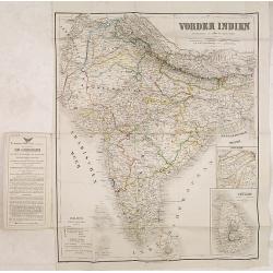
Vonder Indien.
Map of India with two inset maps, one of Upper Asam, and the other of Ceyland.
Place & Date: Weimar, 1822-1825
Selling price: $220
Sold in 2016
[ LXIII. Varj guiochi].
Aquatint depicting performing arts at a square engraved by G. Bigatti. Plate N°63.From Giulio Ferrario's work Le Costume Ancien et Moderne ou Histoire du gouvernement, d...
Place & Date: Milan, 1827
Selling price: $25
Sold in 2018
[ I. Stromenti musicali].
Aquatint depicting a group of musicians engraved by G. Zancon. Plate N°50.From Giulio Ferrario's work Le Costume Ancien et Moderne ou Histoire du gouvernement, de la mil...
Place & Date: Milan, 1827
Selling price: $25
Sold in 2018
[ XXV. Festa di Mariatal].
Aquatint depicting a wedding party engraved by G. Zancon. Plate N°25.From Giulio Ferrario's work Le Costume Ancien et Moderne ou Histoire du gouvernement, de la milice, ...
Place & Date: Milan, 1827
Selling price: $25
Sold in 2018
[ LI. Danza delle Ram-genye ossiano ballerine].
Aquatint depicting a scene of music and Indian dancers, engraved by G. Zancon. Plate N°51.From Giulio Ferrario's work Le Costume Ancien et Moderne ou Histoire du gouvern...
Place & Date: Milan, 1827
Selling price: $25
Sold in 2014
Inde en-deça et au-dela du Gange. . .
Detailed map of India and the Malayan Peninsula, prepared by A. H. Basset, rue Saint-Jacques, no. 64, Paris and published in Atlas classique et Universel de Géographie ....
Place & Date: Paris, A.H. Basset, 1828
Selling price: $100
Sold in 2015
Carte de l'Inde en deça et au-delà du Gange . . .
Very detailed map of India and Sri Lanka, Thailand, Cambodia, Malaysian Peninsular, including Singapore.From his "Atlas Universel".
Place & Date: Paris, Emery Fruger & Co., 1829
Selling price: $125
Sold in 2018
[British soldiers in India].
A decorative print showing a group of English soldiers being attacked by Indian locals. After design of A. van Eschen. From a series Englischer Dienst. 10 Service d'Angle...
Place & Date: Germany, c.1830
Selling price: $4
Sold in 2011
[Set of 9 maps of India]
A set of 9 steel engraved maps of India published under the superintendence of the Society for the Diffusion of Useful Knowledge (SDUK), most sheets are early editions da...
Place & Date: London, ca. 1831
Selling price: $60
Sold in 2023
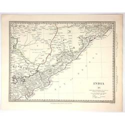
India IV.
Original map engraved by J&C Walker in London and Published by Chapman & Hall in 1832. Published under the Superintendence of the Society for the Diffusion of Use...
Place & Date: London, 1832
Selling price: $15
Sold in 2018
Das Himálaja Gebirg in Bissahir, Gherwal..
Very detailed map of Himalaya, plateaus of Tibet and the lowlands of Hindostan, prepared by J.L.Grim and Carl Ritter. In upper high land corner key to travels by Raper 18...
Place & Date: Berlin 1833
Selling price: $40
Sold
Hindostan.
Uncommon detailed steel engraved map of India, with inset map of Shri Lanka. Published in Edinburgh by D. Lizars.
Place & Date: Edinburgh, 1833
Selling price: $100
Sold in 2012
Hindostan.
A striking map of India, showing the region in remarkable detail. Lizars’ maps are scarcer than his contemporaries, John Cary and John Thomson, but contain more topogra...
Place & Date: Edinburgh, 1833
Selling price: $120
Sold in 2018
The Bernar Pagoda. Benares.
A fine and detailed view with decorative coloring. Varanasi, also known as Benares, Banaras or Kashi, is a city on the banks of the Ganges in the Uttar Pradesh state of N...
Place & Date: London, 1834
Selling price: $15
Sold in 2017
Shuwallah Gaut, Benares.
A fine and detailed view of Shivala Ghat at Benares (Varanasi), a city on the banks of the Ganges in the Uttar Pradesh state of North India. Drawn by William Daniell, and...
Place & Date: London, ca. 1834
Selling price: $21
Sold in 2017
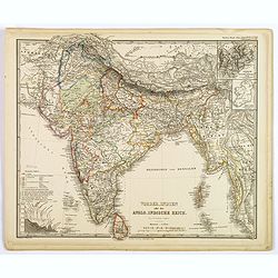
Vorder-Indien oder dasIndo-Britische Reich.
This is a nice example of Stieler's 1834 map of the Indian subcontinent. It covers from the Tibet and the Himalayas in the north as far south as Ceylon (Sri Lanka), and f...
Place & Date: Gotha, 1834
Selling price: $50
Sold in 2020
Tombeau d'une Bramine brulée sur le bucher de son mari.
Depiction of an Indian temple after Barthelemy Lauvergne (1805-1875) and engraved in aquatint technique by Sigismond Himely (1801-1872). Published as plate 13 in Voyage a...
Place & Date: Paris, Finot, 1835
Selling price: $100
Sold in 2014
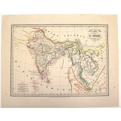
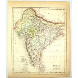
Ostindien [and] Carte de L'Inde. [2 maps]
First map is 'Ostindien' by Radefeld, from Meyer's Atlas, countries and regional boundaries shown in differing colors, with plenty of map detail, relief shown in hachures...
Place & Date: Hildeburghausen, Paris ca. 1835
Selling price: $60
Sold in 2017
Map of India..
Very detailed map of India. In the Indian Ocean and the Bay of Bengalen numerous information: Native states not under British protection, Native states under British prot...
Place & Date: London 1836
Selling price: $50
Sold
Carte de L'Inde.
An interesting lithographed map of India and Indo China from the Brussels edition of Malte-Brun's "Atlas Complet". The different provinces are nicely differenti...
Place & Date: Brusselles, 1836
Selling price: $50
Sold in 2015
India.
colorful map of India engraved by J. Dower in 1836. Published by Orr & company in London.
Place & Date: London, 1836
Selling price: $55
Sold in 2014
India (Northern Part).
Detailed colored map of Northern India by J. Archer. Published in London by H.G. Collins in 1836.
Place & Date: London, 1836
Selling price: $30
Sold in 2014
NINGTHEE RIVER, FROM MULPHOO TO SUNAYACHIL.
Finely executed pen drawing in brown ink with river in blue color of The Eastern Frontier Of India. Scale is in English miles. Underneath the title an explanation.From th...
Place & Date: ca, 1836
Selling price: $100
Sold in 2017
Asie Meridionale Comprenant L'Inde en deca et au Dela du Gange.
Detailed map of Asia including India. Published by Aubree Armand in Paris in 1837. Engraved by I. Grenier and printed by Mangeon.
Place & Date: Paris, 1837
Selling price: $25
Sold in 2015
Vue d'un grand étang Indien, au moment des ablutions Carnate. (Inde)
After a drawing by Charles Bélanger. Charles Bélanger (1805-1881), French naturalist and explorer in Asia and the East Indies. Lithography taken most probably from 7 vo...
Place & Date: Paris, ca 1834-1838
Selling price: $45
Sold in 2013
India.
Detailed map of India and Ceylon. This map by the nephew of Aaron Arrowsmith first appeared in 1832 and was reissued several times. The present issue appeared in Arrowsmi...
Place & Date: London, 1838
Selling price: $300
Sold
Map of the Peninsula of India, from the 19th Degree of North Latitude to Cape Comorin.
Large and detailed map of Southern India from Bomba/Mumbai and Aurangabad, until a part of of Sri Lanka/Ceylon. Original outline color indicated the British Possessions, ...
Place & Date: London, 1838
Selling price: $55
Sold in 2017
Carte du Golfe du bengale dressée par Mr daussy, ingénieur hydrographe en chef, d'après les travaux les plus récents. . .
Large sea chart showing the Gulf of Bengal with India, Ceylon and Thailand with the Gulf of Siam to the right. The chart was engraved by E. Collin and Chassant for the D�...
Place & Date: Paris, 1839
Selling price: $200
Sold in 2020
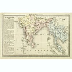
Inde.
Finely engraved map of India, Thailand, Malaysia, including Singapore prepared by A.H.Dufour and engraved by Giraldon-Bovinet. Published by Jules Renouard in his uncommon...
Place & Date: Paris, Jules Renouard, ca.1840
Selling price: $50
Sold in 2015
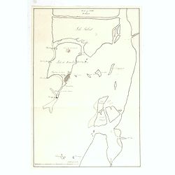
(Manuscript) Plan du port de Bombay.
French manuscript map of Bombay harbor complete with anchorage point at Bombay. The map is likely based on Jean B.N.D. D'Apres de Mannevillette: "Plan du Port de Bom...
Place & Date: France or India, c. 1840
Selling price: $305
Sold in 2015
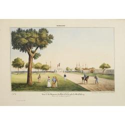
Pondichery - Vue de la Maison du Port et de la rade de Pondichery. . .
Lithography representing a view of Pondicherry. Plate 9. From Souvenirs d'un voyage dans l'Inde, execute de 1834 à 1839, after a design by A. Delessert. Adolphe Delesser...
Place & Date: Paris, 1843
Selling price: $360
Sold
Madras. - Scottch - Church.
Lithography representing a view of a Scottish church in Madras. Plate N 13. From Souvenirs d'un voyage dans l'Inde, execute de 1834 a 1839, by A. Delessert.Adolphe Deless...
Place & Date: Paris, 1843
Selling price: $240
Sold
A Chart Of The Indian Ocean Drawn From The Best Authorities.
This detailed sea chart by John William Norie features the Western Indian Ocean and east coast of Africa, from Cape Delgado in the south to Persian Gulf in the north. T...
Place & Date: London, 1844
Selling price: $189
Sold in 2015
Indes.
Detailed map of India, Malaysia, Cambodia, Tibet and Thailand, prepared by Charles V. Monin (fl.1830-1880) a French cartographer of Caen and Paris. Published in Atlas Uni...
Place & Date: Paris, 1845
Selling price: $45
Sold in 2024
Overland Route to India.
Steel engraved map of the Overland Route to India. The illustrations are by H Warren and engraved by J H Kernot, the map engraved by J Rapkin. Published by John Tallis. T...
Place & Date: London, 1850
Selling price: $80
Sold in 2014
Northern India
A very decorative steel-engraved map of a portion of India including Nepal, Bhutan, and modern day Bangladesh. Very detailed with place names, rivers, hills, bays, lakes,...
Place & Date: London, ca.1850
Selling price: $75
Sold in 2017
Northern India.
Decorative steel engraved map of Northern India, surrounded 6 decorative vignettes.Taken from "The illustrated atlas and modern history of the world by John Tallis&q...
Place & Date: London, 1851
Selling price: $50
Sold in 2018
Northern India.
Decorative steel engraved map of Northern India, surrounded 6 decorative vignettes.Taken from "The illustrated atlas and modern history of the world by John Tallis&q...
Place & Date: London, 1851
Selling price: $45
Sold in 2020
Southern India.
Original steel engraved map of Southern India. Several vignette scenes, including Shuhur, Jeypoor, Calcutta and Bejapoor. Decorative scrolling and title cartouche around ...
Place & Date: London, Edinburgh & Dublin: J & F Tallis, 1851
Selling price: $100
Sold in 2020
India.
Large detailed map of India by Sidney Hall published by A. &. C. Black in Edinburgh Steel engraving with original color Relief shown by hachures. States shown by tint...
Place & Date: Edinburgh, 1854
Selling price: $50
Sold in 2014
Persia and Arabia. / India and Malaysia.
Map of India and Malaysia. On the verso a map of Persia and Arabia (110x140mm.) . From Sidney E. Morse''s: System of Geography for the use of schools , published by Harpe...
Place & Date: New York, 1855
Selling price: $10
Sold in 2011
Map of the Countries lying between Turkey & Birmah, comprising Asia Minor, Persia, India, Egypt & Arabia, and including the Black, Caspian & Red seas by James Wyld, Geographer to the Queen, Charing Cross East. Model of the Earth, Leicester Square, London.
Map of the Countries lying between Turkey & Birmah, comprising Asia Minor, Persia, India, Egypt & Arabia, and including the Black, Caspian & Red seas by James...
Place & Date: London, 1855
Selling price: $375
Sold in 2013
Dachinabadae ora Maritima secundum anonymi periplum maris erythrei. (India)
Two ancient maps on one sheet showing India, prepared by Karl Wilhelm Ludwig Muller (1813-1894) and published in "Geographi Graeci Minores". Muller wrote in Lat...
Place & Date: Paris, Ambrosio Firmin Didot, 1855
Selling price: $20
Sold in 2017
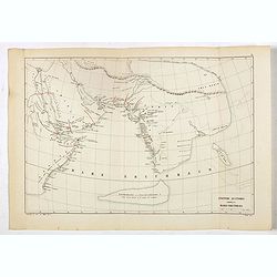
Anonymi auctoris periplus Maris Erythraei.
Delicate map showing the Indian Ocean during ancient times according to the "Stadiasmus Maris Magni", and prepared by Karl Wilhelm Ludwig Muller (1813-1894) and...
Place & Date: Paris, Ambrosio Firmin Didot, 1855
Selling price: $25
Sold in 2017
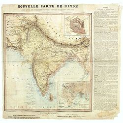
Nouvelle carte de l'Inde pour suivre les opérations militaires dans les possessions anglaises .
Very detailed map of India, printed on very thin paper. With inset plan of Delhi. In dedicate original hand colors. In lower right inset map of the Western Hemisphere, &q...
Place & Date: Paris, ca. 1857
Selling price: $100
Sold in 2021
India shewing the post roads and dawk stationsby James Wyld, geographer to the Queen and H.R.H. Prince Albert.
Decorative post road map also showing railways. A color key is showing British possessions, subsidiary states, and protected and independent areas. Scale [ca. 1:4,400,000...
Place & Date: London, ca. 1858
Selling price: $525
Sold in 2016
Vorder Indien.
An excellent map of India with nice coloring indicating colonial occupations. With two insets of upper Assam, and Ceylon.
Place & Date: Weimar, 1858
Selling price: $14
Sold in 2017
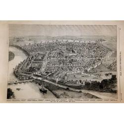
The City of Delhi Before the Siege.
The City of Delhi Before the Siege. An interesting woodblock print of Delhi, published January 16th 1858, in the Illustrated London News.This large bird's eye view of Del...
Place & Date: London, 1858
Selling price: $85
Sold in 2017
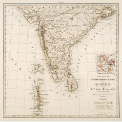
Carte des établissements .. L'Inde..
Detailed map of India. On verso 5 manuscript maps in pen and ink showing "Territoire de Pondichèry", "Territoire de Karikat, scale 1:300.000", "...
Place & Date: Paris 1860
Selling price: $80
Sold
The British Possessions In The East Indies, With The Dependent States And Countries Adjacent.
Fantastic map of India, Pakistan, Afganistan, Tibet, Bhutan, and the Himalayas. Extending east to show Siam. With a small inset of the southern India and Ceylon. Large...
Place & Date: Edinburgh, c1860
Selling price: $40
Sold in 2013
British India.
A late edition map of British India, published by the London Printing and Publishing Company. Replacing the decorative vignettes of earlier editions are tables of signifi...
Place & Date: London, 1860
Selling price: $40
Sold in 2020
Asie Meridionale. Inde Anglaise et Indo-Chine.
Very detailed map from Atlas Spherodidal & Universel de geographie , Prepared by F.A.Garnier and edited by Jules Renouard, rue de Tournon, Paris. Uncommon map with de...
Place & Date: Paris, 1861
Selling price: $45
Sold in 2020
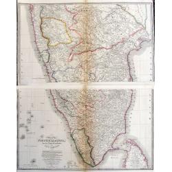
India (Southern Sheet).
A large and detailed steel engraved map sheet (1 of 2 only) of Southern India. Map extent is from Nagpur in the north to Ceylon (Sri Lanka) in the south. Regions are in d...
Place & Date: London, 1861
Selling price: $20
Sold in 2021
Vorder-Indien oder das Anglo-Indische Reich.
This is a nice example of Stieler's 1863 map of the Indian subcontinent. It covers from the Himalayas in the north as far south as Ceylon (Sri Lanka), and from Sindh in t...
Place & Date: Gotha, 1863
Selling price: $33
Sold in 2020
Map of India. . .
Very detailed road, railway and telegraphic map of India showing the post roads. With color key to British possessions, independent-, protected- and subsidiary states. Se...
Place & Date: London, 1855/1864
Selling price: $135
Sold
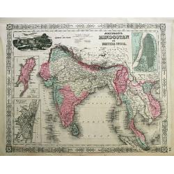
Johnson's Hindostan or British India.
Attractive steel engraved map, extending from the Indus River eastwards with India, Burma, Siam (Thailand), Laos, Cambodia, Malaysia (Malacca), Singapore, and Vietnam (To...
Place & Date: New York, 1864
Selling price: $70
Sold in 2012
Physical Chart of the Indian Ocean Showing the Temperature of the Water.
This interesting map shows the currents of the air and oacean , direction of the wind , distracts of hurricanes, regions of the monsoons & tyfoons and the temperature...
Place & Date: Edinburgh, 1865
Selling price: $23
Sold in 2015
India ( on two sheets)
An extremely highly detailed map of India printed over two sheets North & South, color-coded for the different provinces. The South sheet has Ceylon (present day Sri ...
Place & Date: Edinburgh 1870
Selling price: $80
Sold in 2015
Map of India to Illustrate the History of the Mutiny .
An unusual subject for this folding map of India by James Wyld the junior, the map covers the area from Afghanistan and Cashmere in the North to Ceylon(Sri Lanka) in the ...
Place & Date: London, 1872
Selling price: $60
Sold in 2016
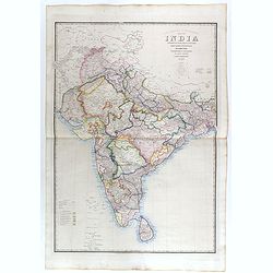
Road, Railway & Telegraphic map of India shewing the post roads and dawk stations. . .
A large, decorative post road map also showing Indian railways. A color key is showing British possessions, subsidiary states, and protected and independent areas. Scale ...
Place & Date: London, ca. 1872/1873
Selling price: $400
Sold in 2019
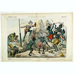
Un Reclutatore in India. Papagallo No. 42. Anno VI.
British in India. Design by Augusto Grossi. Taken from the Italian satirical newspaper Il Papagallo, a satirical magazine founded in January 1873 by Augusto Grossi (1835-...
Place & Date: Bologne, 1878
Selling price: $195
Sold in 2019
Plan de Calcutta.
Detailed plan of Calcutta, engraved by F. Dien and published in "Voyage aux Indes Orientales" de Charles Belanger.
Place & Date: Paris, c.1880
Selling price: $200
Sold in 2015
India shewing the post roads and dawk stations by James Wyld, geographer to the Queen and H.R.H. Prince Albert.
A large, decorative post road map also showing Indian railways. A color key is showing British possessions, subsidiary states, and protected and independent areas. Scale ...
Place & Date: London, ca. 1880
Selling price: $245
Sold in 2017
[142 Indian Mica paintings.]
One hundred and forty-two Mica Paintings of castes, people of India, trades-people, musicians, snake charmers.The majority of these paintings were produced in standard se...
Place & Date: India, 1850 to ca.1880
Selling price: $1600
Sold in 2019
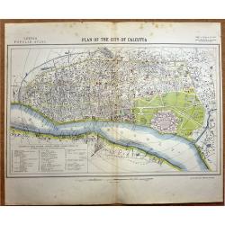
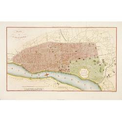
Plan of the City of Calcutta.
A highly detailed late -19th century plan of the city of Calcutta. It depicts the entire city in remarkable detail, noting individual streets, important public buildings,...
Place & Date: London, 1881
Selling price: $120
Sold in 2020




![[ LXIII. Varj guiochi].](/uploads/cache/34994-250x250.jpg)
![[ I. Stromenti musicali].](/uploads/cache/34995-250x250.jpg)
![[ XXV. Festa di Mariatal].](/uploads/cache/34996-250x250.jpg)
![[ LI. Danza delle Ram-genye ossiano ballerine].](/uploads/cache/34998-250x250.jpg)

![[British soldiers in India].](/uploads/cache/14500-250x250.jpg)
![[Set of 9 maps of India]](/uploads/cache/20230514_144931-250x250.jpg)



![Ostindien [and] Carte de L'Inde. [2 maps]](/uploads/cache/40043-250x250.jpg)


















![[142 Indian Mica paintings.]](/uploads/cache/42949-250x250.jpg)
