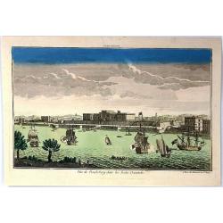
Ville de Cochin de Stad Coestsijen.
Striking copper engraving of Kochi, a major port city on the west coast of India. It has been considered as the center of the Indian spice trade for centuries. It was fir...
Place & Date: Amsterdam, 1755
Selling price: $95
Sold in 2018
Carte des cotes de l'Hindoustan depuis Bombay jusqu'à Godavery . . .
A well engraved and highly detailed chart that was prepared by M. Daussy. Engraved by Chassant, engraver for the Depot Générale de la marine is noted as such on the map...
Place & Date: Paris, 1755
Selling price: $110
Sold in 2016
Plan de la Forteresse de Coylan / Plan de la Forteresse de Cranganor. . .
The first of a pair of Indian prints is a rare map of the fort of Kollam, Kerala, on India's (east) Malabar Coast by the French cartographer N. Bellin. Kollam, or as it i...
Place & Date: Paris, ca 1756
Selling price: $45
Sold in 2019
A Plan of the Town & Fortress of Garlah belonging to Angria the Admiral to the Jahou Rajah on the Coast of Mallabar.
A very interesting bird's eye view of the fort and surrounds. Text at left explains the numbers on the chart providing fascinating detail. With rhumb lines, soundings, a ...
Place & Date: London, 1756
Selling price: $9
Sold in 2021
Plan de Madraz et du Fort St. Georges. Pris par les Francois le 21 Septembre 1746 / Grondtekening van Madras en't Fort St. Georges, door de Fransen ingenoomen den 21 September 1746.
A plan of the city of Chennai (then Madras) the capital of Tamil Nadu, in southern India, and the old British Fort of St George (captured during the brief French occupati...
Place & Date: Amsterdam, ca 1756
Selling price: $5
Sold in 2021
Toneel des Oorlogs op de Kust van Choromandel . . .
The detailed map refers to the Carnatic (or Karnatic) Wars (1746-1763), a series of military conflicts in the middle of the 18th century in India. These conflicts involve...
Place & Date: Amsterdam, 1756
Selling price: $6
Sold in 2021
Les Indes Orientales, ou sount distingues les Empires et Royaumes..
Interesting regional map extending from India, the Ganges and the Maldives Islands to Hai-nan, Cochin china, Malacca and Sumatra. Includes islands, towns, mountains, rive...
Place & Date: Paris, 1757
Selling price: $170
Sold in 2011
Carte Réduite de l'Océan Oriental ou Mer des Indes.
A of the Indian Ocean, with its islands and adjacent coasts in detail. The chart stretches from the Congo coast, around Africa, Arabia, India and South East Asia, includ...
Place & Date: Paris, 1757
Selling price: $850
Sold in 2011
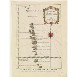
Carte des Isles Maldives.
A small detailed map of the Maldives, with rhumb lines and a large compass rose. Includes a decorative title cartouche. One of the maps produced by Nichlas Bellin for Pre...
Place & Date: Paris, 1757
Selling price: $13
Sold in 2021
Karte von dem Morgenlaendischen Ocean oder dem Indischen Meere. Zur allgemeinen Historie der Reisebeschreibungen entworfen. . . .
Copper engraving, decorative handcolored in wash and outline. A fine and detailed larger map of the Indian Ocean from Africa towards Southeast Asia and New Holland (Austr...
Place & Date: Leipzig, Merkur, 1758
Selling price: $100
Sold in 2013
Mogol.
This fine little map shows Northern India and Pakistan including Kabul, Delhi & Gulf of Bengal.
Place & Date: Paris, 1758
Selling price: $109
Sold in 2017
Kaart van den Oostersen Oceaan, of Indiese Zee......
Intriguing map of the Indian Ocean, with partial outlines of Australia, South East Asia, India, Arabia and Eastern Africa and Madagascar. With title in French (and Dutch ...
Place & Date: Amsterdam, ca 1758
Selling price: $500
Sold in 2016
Carte des Costes de Perse Gusarat et Malabar. . .
Detailed copper engraved map of the Persian Gulf and western India, from Perse (Persia), and Grand Mogol in the north, down to the southern tip of India, including the Ma...
Place & Date: Paris, ca. 1758
Selling price: $40
Sold in 2018
Carte des Costes de Perse, Gusarat et Malabar.
A detailed copper engraved map of the Persian Gulf and western India, from Perse (Persia), and Grand Mogol in the north, down to the southern tip of India, including the ...
Place & Date: Paris, 1758
Selling price: $17
Sold in 2017
Vue de Goa.
Fine plan of Goa. Goa was made as capital of the Portuguese Vice-Kingdom in Asia, and the other Portuguese possessions in India.
Place & Date: Paris, 1758
Selling price: $50
Sold in 2022
Carte de la Cote Orientale du Golfe de Bengale
A French sea chart from 'Le Depot de la marine", depicting the most-northern part of the Gulf of Bengalen.
Place & Date: Paris, c. 1760
Selling price: $150
Sold
Nouvelle Carte du Royaume de Bengale.
Jaques Nicolas Bellin (1702-720) was the most important French hydrographer of the 18th century. Sea-atlas 'Hydrographique Français' (1756-65) atlas to accompany Prévos...
Place & Date: Amsterdam, c. 1760
Selling price: $100
Sold
Carte du District de Tranquebar.
A map of Tranqebar and vincinity on the Coromandel coast.Jacques Nicolas Bellin (1702-720) was the most important French hydrographer of the 18th century. Sea-atlas "...
Place & Date: Amsterdam, c. 1760
Selling price: $75
Sold in 2018
Carte du Golphe de Bengale.
Jaques Nicolas Bellin (1702-720) was the most important French hydrographer of the 18th century. Sea-atlas 'Hydrographique Français' , 1756-65, atlas to accompany Prévo...
Place & Date: Amsterdam, c. 1760
Selling price: $80
Sold
Carte de la Partie Meridionale de la Presqu'ile de l'inde en deca du Gange.
A quaint map of southern India and Ceylon by Brion de la Tour. From Brunet's Histoire Universelle, depuis le commencement du monde jusqu'a present by Brion de la Tour.Lo...
Place & Date: Paris, 1760
Selling price: $47
Sold in 2018
Carte du District de Tranquebar.
A lovely detailed map of the area around Tranquebar (now Tharangambadi), on the Coromandel coast. It was an early Danish Trading Colony in the modern Indian state of Tami...
Place & Date: Paris ca 1760
Selling price: $30
Sold in 2020
Fort St. George on the Coromandel Coast, Belonging to the East India Company of England.
A fine copperplate engraving of Fort St. George, Madras (Chennai )on the south east coast of India. The fort flies the Union Jack flag, and many sailing vessels are seen ...
Place & Date: London, ca 1760
Selling price: $50
Sold in 2019
Plan der Stadt und Festung Madrass in Ost-Indien.
Scarce plan of Madras, taken from a collection of battle and siege plans that relate to the 'Seven Years War'. This detailed plan shows off the British Fortress of Madras...
Place & Date: Nuremberg, ca 1762
Selling price: $50
Sold in 2018
Plan de la Ville de Pondicheri.
A pretty small plan of the south eastern Indian city of Pondicherry. Over the centuries it has been ruled by the French (mostly), the Dutch and the English (occasionally)...
Place & Date: Paris, 1764
Selling price: $60
Sold in 2018
Ad antiquam Indiae geographiam tabula.
A map showing India with an inset in the lower part entitled Ptolemaicae Tabulae showing the island of Sri Lanka.
Place & Date: Paris, 1765
Selling price: $30
Sold in 2011
Neue Karte Von De, Konigreiche Bengala.
A fine Jacques Bellin map of the Nyanmar region of India, featuring the Bay of Bengal.
Place & Date: Paris, 1767
Selling price: $100
Sold in 2017
Theatre de la Guerre dans l'Inde sur la Cote de Coromandel Par M.B.C.T.
VERY RARE MAP of southern part of India, running from Madras to Cape Comorin, interestingly a part is marked in red manuscript Etats de Ayder Aly Kan and colored in pink ...
Place & Date: France, 1770
Selling price: $800
Sold
Carte de la Partie Superieure de l' Inde en deça du Gange.
Rigobert Bonne (1727-1795), French cartographer. His maps are found in a.o. Atlas Moderne (1762), Raynal's Histoire Philos. du Commerce des Indes (1774) and Atlas Encyclo...
Place & Date: Paris, c. 1770
Selling price: $60
Sold
Prospect der Stadt Masulipatam in Ost=Indien.
A rare view of the town of Masulipatam in India. Many locals and elephants in the foreground.
Place & Date: Nurnberg 1770
Selling price: $100
Sold
Carte du District de Tranquebar.
A detailed map of Tharangambadi,(Tranquebar & vicinity) an early trading colony controlled by Denmark. It is in the current Indian state of Tamil Nadu on the Coromand...
Place & Date: Amsterdam, 1770
Selling price: $45
Sold in 2015
Carte du Golphe de Bengale...
Nice chart of the Bay of Bengal. The map extends from Malabar to Sumatra and today Phuket area in Thailand. Including Pegu, Ceylon, and the Andaman and Nicobar Islands. N...
Place & Date: Paris, ca. 1770
Selling price: $30
Sold in 2017
Carte des isles Maldives.
Jaques Nicolas Bellin (1702-720) was the most important French hydrographer of the 18th century. Sea-atlas 'Hydrographique Français' , 1756-65, atlas to accompany Prévo...
Place & Date: Amsterdam, 1773
Selling price: $50
Sold
Carte des Costes de Perse, Guzarat et Malabar.
Jaques Nicolas Bellin (1702-720) was the most important French hydrographer of the 18th century. Sea-atlas 'Hydrographique Français' , 1756-65, atlas to accompany Prévo...
Place & Date: Amsterdam, 1773
Selling price: $60
Sold in 2018
Carte de L'Indoustan. . .
Uncommon edition of this fine map of the northern part of India. In lower right engraved "4a"From Atlas Portatif pour servir a l'intelligence de l'Histoire Phil...
Place & Date: Amsterdam, 1773
Selling price: $125
Sold in 2013
Carte des isles Maldives.
A map of the Maldive Islands. Jacques Nicolas Bellin (1702-720) was the most important French hydrographer of the 18th century. He published a sea-atlas "Hydrographi...
Place & Date: Amsterdam, 1773
Selling price: $70
Sold in 2017
The East Indies including more particularly the British Dominions on the Continent of India...
Very detailed map of India with Ceylon. Extends to include the Maledives, Andaman Islands, Tibet, Pegu, and a tiny part of Sumatra. Engraved by Thomas Kitchin.
Place & Date: London, 1773
Selling price: $50
Sold in 2013
The East Indies . . .
Highly detailed map of India and Sri Lanka, drawn by Thomas Kitchin and published in the London Magazine. Cities, towns and geographical features are all shown.
Place & Date: London, 1773
Selling price: $150
Sold in 2018
Carte réduite de l'Océan Oriental Septentrional qui contient une partie des Côtes d'Afrique, de l'Arabie, de la Perse et celles de l'Indostan.
French of the coast of Indian ocean with a part of Africa, of Arabia of Persia, of India. Latitude and longitude scales, compass rose and system of rhumb lines, sounding...
Place & Date: Paris, ca 1775
Selling price: $160
Sold
Carte de l'inde en deça du gange comprenant l'Indoustan.
An interesting map of Hindustan and the River Ganges .Prepared by Jacques Nicolas Bellin after Dutch sources and included in Prévost d' Exile's "Histoire des Voyage...
Place & Date: Paris, 1738-1775
Selling price: $20
Sold in 2020
Carte de l'Inde en deça du Gange comprenant l'Indoustan.
An interesting map of Hindustan and the River Ganges.Prepared by Jacques Nicolas Bellin after Dutch sources and included in Prévost d' Exile's "Histoire des Voyages...
Place & Date: Paris, 1738-1775
Selling price: $20
Sold in 2020
Carte des Isles Maldives, pour servir à l'Histoire Générale des Voyages.
An interesting map of all the islands of the Maldives.Prepared by Jacques Nicolas Bellin after Dutch sources and included in Prévost d' Exile's "Histoire des Voyage...
Place & Date: Paris, 1738-1775
Selling price: $20
Sold in 2014
Carte des Costes de Perse, Gusarat, et Malabar.
An interesting map of the coasts of the Persian Gulf, Iran, Pakistan and Western India including the Maldives Islands .Prepared by Jacques Nicolas Bellin after Dutch sour...
Place & Date: Paris, 1738-1775
Selling price: $20
Sold in 2022
Carte de l'inde en deça du gange comprenant la presqu'iIle de l'Inde.
An interesting map of the peninsula of India with Ceylon.Prepared by Jacques Nicolas Bellin after Dutch sources and included in Prévost d' Exile's "Histoire des Voy...
Place & Date: Paris, 1738-1775
Selling price: $45
Sold in 2017
A new & Correct Chart shewing.. Bay of Bengalen..
Important chart of the Bay of Bengal. In upper part inset map of river Ganges. From East India Pilot . Detailed map with compass roses and system of rhumb lines, sounding...
Place & Date: London 1778
Selling price: $490
Sold
The country Coromandel from the Coleroon to Cape Comorin. . . [with] The carnatic from the Pennar to the Coleroon. .
Coromandel from the Coleroon to Cape Comorin. Elegant map in two sheets compiled for the East-India Company. In lower right margin : Writing by W. Harrison.
Place & Date: London, 1778
Selling price: $105
Sold in 2020
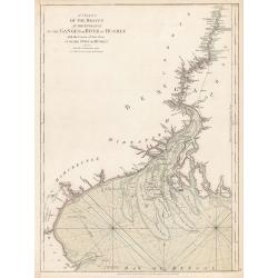
A Chart of the Braces at the Entrance of the Ganges or River...
A Chart of the Braces at the Entrance of the Ganges or River of Hughly with the Course of that River up to the Town of Hughly. Improved from Mr. d’Anville’s Chart of ...
Place & Date: London, 1778
Selling price: $200
Sold in 2023
Vue D'Une Partie des Ruines de Pondichery en 1769.
Fine city view of Pondicherry India by Guillaume le Gentil. It was engraved by Gardette in 1769. It has a key at the bottom identifying important buildings in the city.
Place & Date: Paris , 1779
Selling price: $23
Sold in 2018
Vue de la Pondichery dans les Indes Orientales
Pondicherry is the capital city of Indian union territory of Puducherry. Pondicherry is situated in Puducherry district of the union territory in India. The vue was produ...
Place & Date: Paris, 1780
Selling price: $52
Sold in 2016
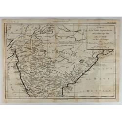
Carte de la Partie Septentrionale de la Presqu'ile de L'Inde...
Striking map of central and northern India showing rivers, mountains, towns and cities, including Bombay. Beneath the title cartouche, the Bouches du Gange ("Mouth...
Place & Date: Paris, 1780
Selling price: $20
Sold in 2018
[Untitled] English Sea Chart.
A large, English Sea Chart of southern India, the Maldives (and other) Islands, and the island of 'Zeloan' (Sri Lanka). The interiors are almost bare of any information w...
Place & Date: Anon, ca 1780
Selling price: $100
Sold in 2018
Carte de la Partie Inferieure de l'Inde en Deca du Gange. . .
A late eighteenth century map of southern India by the French cartographer Rigobert Bonne. Shows the southern coasts of Malabar and Coromandel. Map extent is from the Dec...
Place & Date: Paris, 1780
Selling price: $30
Sold in 2020
Madirass. Ville Indienne don't les Maisons sont basses & plates.
A small plan of Fort St. George, Madras/Chennai in India. It highlights both inner and outer fortifications, fences, town entrances and the sea, together with the church,...
Place & Date: Unknown, ca 1780
Selling price: $65
Sold in 2020
Carta Dell' Indostan che comprende il Malabar, Coromandel, e tutta la penisola Dell' India.
This is from a scarce Italian edition of French cartographer Jacques-Nicholas Bellin’s map of southern India and the island of Ceylon (Sri Lanka). The map extent is fro...
Place & Date: Paris, ca 1780
Selling price: $16
Sold in 2021
Carte de la Partie Superieure de L'Indie en de ca du Gange. . .
Rigobert Bonne (1727-1795), French cartographer. His maps are found in the 'Atlas Moderne' (1762), Raynal's 'Histoire Philos. du Commerce des Indes' (1774) and 'Atlas Enc...
Place & Date: Paris, 1780
Selling price: $45
Sold in 2020
Carta Della Costa di Persia, Guzarat, E Malabar.
A copper engraving by Bellin on the order of Conte Di Maurepas, dated 1781. Published in the Italian edition of the atlas. This interesting map shows a tip of the Arabian...
Place & Date: Paris, 1781
Selling price: $23
Sold in 2018
A Prospect of the Castle of Surat, a Great City of Indostan, Commonly called the Mogul Empire in India.
Striking Engraving of the Castle of Surat by John Goldar (1729-1795) for Millar's New Complete and Universal System of Geography dated 1782. The print has a very fancy bo...
Place & Date: London, 1782
Selling price: $95
Sold in 2017
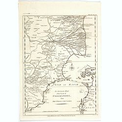
An Accurate Map of the Coast of Coromandel, from Fort St. David to Cape Comorin.
This is a finely engraved map of the south eastern Indian Coromandel coastal regions & the north west Sri Lankan coast through the Gulf of Manar. It was engraved by J...
Place & Date: London, 1782
Selling price: $17
Sold in 2021
Indes. Iere. Feuille.
Attractive map of the northern part of India, extending northwards to Pakistan and Afghanistan. Including Bangladesh in the East. Boundaries outlined in hand color.From t...
Place & Date: Paris, ca 1783
Selling price: $150
Sold in 2010
The Doo=AB, from Allahabad to Kalpy. .
Detailed map of part of the rivers Ganges and Jumnah.From the English original edition published in London in 1783 by Brown under the title "Memoir of a Map of Hindu...
Place & Date: Londen, 1783
Selling price: $100
Sold in 2015
The river Ganges from Patna to Surdah . . .
Detailed map of part of the rivers Ganges and Jumnah.From the English original edition published in London in 1783 by Brown under the title "Memoir of a Map of Hindu...
Place & Date: Londen, 1783
Selling price: $180
Sold in 2016
Indes. Iere. Feuille.
An attractive map of the northern part of India, extending northwards to Pakistan and Afghanistan, and it includes Bangladesh in the East. Boundaries outlined in hand col...
Place & Date: Paris, ca 1783
Selling price: $55
Sold in 2020
Carte Generale du Cours du Gange et du Gagra. . .
A large chart with six inset maps printed on one sheet by the Jesuit Joseph Tiefentaller in the latter half of the eighteenth century. The map is in French and in Persian...
Place & Date: Paris ca 1784
Selling price: $2000
Sold in 2023
Stato del Mogol con l' Isole di Ceilan e Maldive.
A handsome map of India including Sri Lanka and the Maldives islands.
Place & Date: Venice, 1785
Selling price: $75
Sold in 2018
Stato del Mogol con l' Isole di Ceilan e Maldive.
A handsome map of India including Sri Lanka and the Maldives islands. With a nice decorative title cartouche in lower right corner. This lovely map incorporates plenty of...
Place & Date: Venice, 1785
Selling price: $120
Sold in 2019
A Map of Bengal, Bahar, Oude and Allahabad with Part of Agra and Delhi Exhibiting the Course of the Ganges from Hurdwar to the Sea..
Very large wall map extending from the Bay of Bengal in the South East as far as Tibet to the North and Gohud to the West.Engraved from the original drawing in the posses...
Place & Date: London, 1786
Selling price: $275
Sold in 2022
Presqu'Isle Des Indes Orientales, Comprenant l'Indostan ou l'Empire du Mogol. . .
Detailed map of India with inset map (220x155mm) of the mouth of the river Ganges. Identifies Delhi (or Jehan Abad), Agra (or Ekbar Abad), Bombay, Goa, Calcutta, Pondiche...
Place & Date: Paris, Boudet, 1786
Selling price: $280
Sold in 2016
Neueste Karte von Hindostan, Bengalen etc. . .
Wall map of the Indian sub-continent after James Rennell, with large title cartouche of Britannia, native figures, a soldier and a merchant. Published by F. A. Schraembl ...
Place & Date: Vienna, 1788
Selling price: $960
Sold
Neueste Karte von Hindostan, Bengalen etc. . .
Wall map of the Indian sub-continent after James Rennell, with large title cartouche of Britannia, native figures, a soldier and a merchant. Published by F. A. Schraembl...
Place & Date: Vienna, 1788
Selling price: $700
Sold in 2019
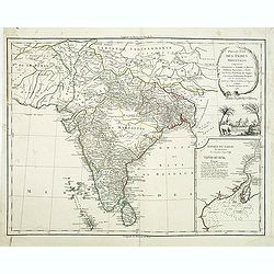
Presqu 'Isle Des Indes Orientales,..
Detailed map of India with inset map (220x155mm) of the entree of the river Ganges. With decorative scene with an elephant underneath the title cartouche.
Place & Date: Paris, 1790
Selling price: $55
Sold in 2012
Carte du Bengale avec la Partie Septentrionale des Etats du Roi D'Aua.
A detailed eighteenth century map of Bengal, India with Calcutta prominently marked, and the Ganges up to Patna, and that part which is modern Bangladesh. From Brunet's '...
Place & Date: Paris, 1790
Selling price: $17
Sold in 2019
Ad Antiquam Indiae Geographiam Tabula.
A map of the ancient map of the Indian subcontinent, with an inset of Taprobana (Ceylon / Sri Lanka), next to a set of mileage scales, in the shape of a slab of rock. Pla...
Place & Date: Anon, ca 1790
Selling price: $35
Sold in 2020
Presqu 'Isle Des Indes Orientales. . .
A nice large and detailed map of India by de Vaugondy with inset map of the entree of the river Ganges.
Place & Date: Paris, 1790
Selling price: $150
Sold in 2018
Presqu 'Isle Des Indes Orientales. . .
A nice large and detailed map of India by de Vaugondy with inset map of the entree of the river Ganges. With a decorative scene with an elephant underneath the title cart...
Place & Date: Paris, 1790
Selling price: $240
Sold in 2019
Stato del Mogol con le Coste del Malabar..
Fine map of India including Ceylon.
Place & Date: Venice 1791
Selling price: $120
Sold
India on both Sides the Ganges.
Uncommon miniature map from Gibson's "Atlas Minimus, or a New Set of Pocket Maps of the several Empires, Kingdoms and States of the known World".
Place & Date: London, 1792
Selling price: $45
Sold in 2011
Island of Seringapatam.
A scarce map of Srirangapatna, (also Shrirangapattana) in Mandya district of the Indian state of Karnataka. Located near the city of Mysore. The entire town is enclosed b...
Place & Date: London, ca. 1792
Selling price: $80
Sold in 2022
A Sketch of Coringa Bay...
RARE nautical from "The country East-India Pilot" published in 1799 by Laurie & Whittle. Engraved by Neele, after Capt. Lesley 1774. Great copper engraved...
Place & Date: London, 1794
Selling price: $98
Sold in 2011
The coast of India, from Point Gordeware to the Ganges comprehending part of the coast of Golconda the coasts of Orissa and Bengal, with the mouth of the Hoogly river
SCARCE sea from "The country East-India Pilot" published in 1799 by Laurie & Whittle. The copper engraved map extends from the Coringa Bay to the Ganges r...
Place & Date: London, 1794
Selling price: $55
Sold in 2011
India Antiqua, auctore D'Anville...
Large scale map of India and Siam, extending to the Strait of Malacca and the area of today's Singapore. With several place names, rivers, islands, and mountain ranges sh...
Place & Date: London, c1795
Selling price: $80
Sold in 2016
Gli Stati del Mogol e la Penisola delle Indie di qua dal Gange.
Cassini's lovely map of the Mogol States in India, published in: Nuovo atlante geografico universale delineato sulle ultime osservazioni in Rome. As well as a strong, dec...
Place & Date: Rome, 1797
Selling price: $100
Sold in 2018




![The country Coromandel from the Coleroon to Cape Comorin. . . [with] The carnatic from the Pennar to the Coleroon. .](/uploads/cache/40457-250x250.jpg)

![[Untitled] English Sea Chart.](/uploads/cache/42898-250x250.jpg)


