Search Listings matching "cyprus" in Asia > Holy Land & Jerusalem
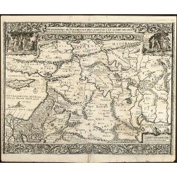
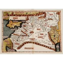
Tabula Quarta Asia (Holy Land and Cyprus)
One of the earliest maps available to a collector of Cyprus, Syria, Mesopotamia,. Babylonia, Arabia Petraea, Armenia Minor and the Holy Land, based upon the Georgraphy of...
Place & Date: Strasburg, 1525
Selling price: $2000
Sold in 2015
Tabula IIII Asiae. [Holy Land, Syria, Cyprus, Arabia.]
One of the earliest maps available to a collector of Cyprus, Syria, Mesopotamia,. Babylonia, Arabia Petraea, Armenia Minor and the Holy Land, based upon the Georgraphy of...
Place & Date: Strassburg, 1535
Selling price: $1550
Sold in 2011
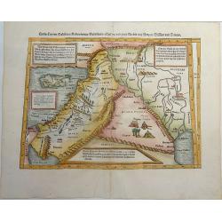
Cyria / Cypern / Palestina / Mesopotamia / Babylonia / Chaldea und zwey Arabia mit Bergen Wassern und Stetten.
An early, attractive woodcut map of the eastern Mediterranean and the Middle East. Covering the area between northern Syria and the Red Sea, with Cyprus, the Holy Land, J...
Place & Date: Basel, ca 1540
Selling price: $190
Sold in 2021
[Lot of 2 plates] Ierusalem civitas../ [map of Palestine + Cyprus].
Early woodcut view of the city of Jerusalem surrounded by its ancient walls, featuring the temples and mosques. From the 1552 Latin text edition of Munster's Cosmographia...
Place & Date: Basel, 1552
Selling price: $100
Sold in 2023
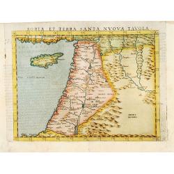
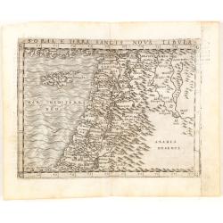
Soria et Terra Santa nova tavola.
Uncommon first edition of this classical map of the Holy Land, including Cyprus. The map is an enlarged version of Giacomo Gastaldi's published in 1548Girolamo Ruscelli's...
Place & Date: Venice, 1561
Selling price: $400
Sold in 2016
Sinus Persicus [Arabia]
Rare wood block printed map of the Holy Land, Syria, Cyprus, northern Arabia from "De orbis situ libri tres accuratissime emendati". Underneath the map a letter...
Place & Date: Basle, Henri Petri, 1564
Selling price: $150
Sold in 2017
[Tevarya] Lago di Tiberia.
Extremely rare map centered on the town and Lake Tevarya, including Jerusalem, Bethlehem, Sichem, Damascus and the island of Cyprus.Engraved by Paolo Furlani (active 1561...
Place & Date: Venice 1568
Selling price: $1925
Sold
[Tevarya] Lago di Tiberia.
Extremely rare map centered on the town and Lake Tevarya, including Jerusalem, Bethlehem, Sichem, Damascus and the island of Cyprus.Engraved by Paolo Furlani (active 1561...
Place & Date: Venice 1568
Selling price: $1750
Sold
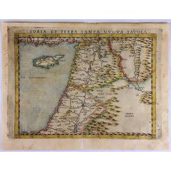
Soria et Terra Santa Nuova Tavola.
Ruscelli's map of the Holy Land, Syria and Cyprus. One of the earliest obtainable separately published maps of the region. The map first appeared in the 1561 edition of R...
Place & Date: Venice, 1574
Selling price: $290
Sold in 2017
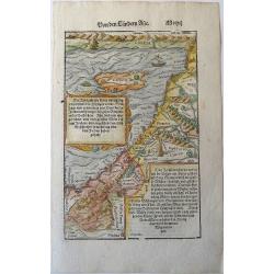
Holy Land. Die Tafel gibt ein klein anzeigung...
Early, attractive woodcut map of the Holy Land with Cyprus. On the full page. From the German edition of Sebastian Münster's Cosmography, titled Cosmographey oder beschr...
Place & Date: Basel, 1578
Selling price: $150
Sold in 2020
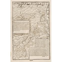
No title (Holy Land)
Attractive full page longitudinal map of Palestine, Syria and Cyprus, cut by Hans Rudolf Manuel Deutsch. The shore line running from Southern Anatolia to the Nile Delta. ...
Place & Date: Basle 1550-1580
Selling price: $220
Sold
[Map of the Holy Land, including Cyprus]
Attractive full page longitudinal map of Palestine, Syria and Cyprus, cut by Hans Rudolf Manuel Deutsch. The shore line running from Southern Anatolia to the Nile Delta. ...
Place & Date: Basle 1550-1580
Selling price: $70
Sold in 2008
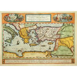
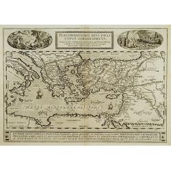
Peregrinatio Divi Pauli Typus Corographicus.
"A splendid map depicting the travels of Paulus. With two fine scenes in top. Showing the countries along the Mediterranean, including Cyprus and Italy. A first edit...
Place & Date: Antwerp 1584
Selling price: $850
Sold
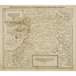
Syria, Cypern, Palestina, Mesopotamia..
A famous wood block map of the Near East, including Cyprus, Palestine, Iran and Iraq, etc. From his Cosmographia , that great compendium of Renaissance knowledge. In 1588...
Place & Date: Basle c.1588
Selling price: $210
Sold
Syria / Cypern / Palestina Mesopotamia / Babylonia / zwen Arabia / mit Bergen / Wasseren und Stetten.
A famous wood block map of the Near East, including Cyprus, Palestine, Iran and Iraq, etc. From his "Cosmographia", that great compendium of Renaissance knowled...
Place & Date: Basle, c.1588
Selling price: $200
Sold in 2012
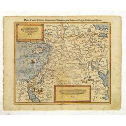
In monte casio iuxta ostracinam. . . [Israel with Cyprus]
On recto a woodcut engraved map of Israel and Cyprus. Engraved by Hans Rudolf Manuel Deutsch, with his monogram. From a Latin text edition of his Geographia , that great ...
Place & Date: Basle, 1550-1590
Selling price: $20
Sold in 2015
[Set of 5 maps of the Holy Land: Paradise, Canaan, Israel & Egypt, the Eastern Mediterranean. . .]
A lovely set of biblical maps of the Holy Land and its surrounds and, the Eastern Mediterranean by Cloppenburg, and engraved by Baptista Deuticum. The first map is an ear...
Place & Date: Amsterdam, ca 1590
Selling price: $1700
Sold in 2022
Peregrinationis Divi Pauli Typus?
A splendid map depicting the travels of Paulus. With two fine scenes in top. Showing the countries along the Mediterranean, including Cyprus and Italy. Based on Mercator'...
Place & Date: Antwerp 1595
Selling price: $650
Sold in 2008
Soria et Terra Santa nuova tavola.
Early map of this classical map of the Holy Land, including Cyprus, prepared by Giovanni Botero. The copper plate was however later used by Giuseppe Rosaccio's expended e...
Place & Date: Venice, 1598
Selling price: $200
Sold in 2014
Peregrinationis Divi Pauli Typus..
A splendid map depicting the travels of Paulus. With two fine scenes in top. Showing the countries along the Mediterranean, including Cyprus and Italy. A first edition wi...
Place & Date: Antwerp, 1598
Selling price: $400
Sold in 2022
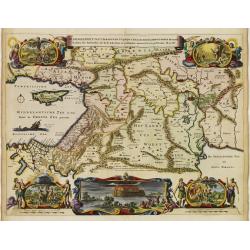
Tabula Geographica, in Qua Paradisus, nec Non Regiones, Urbes oppida, et loca describuntur; quorum in Genesi mentio fit.
A wonderful work of art, consisting of a map of the Holy Land and contiguous regions, including Cyprus and Armenia, surrounded by beautiful etchings. In the center of the...
Place & Date: Amsterdam, 1604
Selling price: $1350
Sold in 2021
Varia antiquitates in itinere Bethleëmitico confpecta. . .
Text page with copper engraved illustration of region north of Jerusalem taken from Itinerarium Hierosolymitanum et Syriacum, in quo variarum Gentium Mores et Institua in...
Place & Date: Antwerp, Verdussen, 1619
Selling price: $30
Sold in 2009
Hiervsalem.
Text page with copper engraved illustration of Jerusalem, with in background Mount Olive, taken from Itinerarium Hierosolymitanum et Syriacum, in quo variarum Gentium Mor...
Place & Date: Antwerp, Verdussen, 1619
Selling price: $30
Sold in 2009
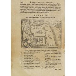
Hiervsalem. [Jerusalem]
Text page with copper engraved illustration of Jerusalem, taken from Itinerarium Hierosolymitanum et Syriacum, in quo variarum Gentium Mores et Institua insularum, region...
Place & Date: Antwerp, Verdussen, 1619
Selling price: $50
Sold in 2008
Hiervsalem.
Text page with copper engraved plan of Jerusalem, taken from Itinerarium Hierosolymitanum et Syriacum, in quo variarum Gentium Mores et Institua insularum, regionum, vrbi...
Place & Date: Antwerp, Verdussen, 1619
Selling price: $50
Sold in 2008
Ramma. [Ramla] / Domus Boni Latronis [Latrum]
Text page with copper engraved view of Ramla, taken from Itinerarium Hierosolymitanum et Syriacum, in quo variarum Gentium Mores et Institua insularum, regionum, vrbium s...
Place & Date: Antwerp, Verdussen, 1619
Selling price: $30
Sold in 2009
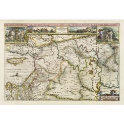
De Gelegentheyt van 't Paradys Ende 't Landt Canaan..
Uncommon issue of this very attractive map, showing the location of Paradise. Two vignettes depict the Temptation of Adam and Eve, and their Expulsion from the Garden of ...
Place & Date: Amsterdam, 1648
Selling price: $500
Sold in 2008
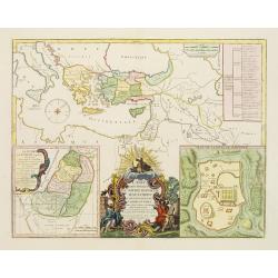
Jesu Christi Salvatoris Nostri et Apostolorum Petri et Pauli Mansiones, Itinera Pergrinationes. . .
Showing eastern part of the Mediterranean, including Cyprus, Italy. Lower right hand corner inset plan of Jerusalem. Lower left map of Palestine.
Place & Date: Paris, 1665
Selling price: $65
Sold in 2015
Paradise or the Garden of Eden with the Countries Circumjacent Inhabited by the Patriarchs.
An attractive, detailed map of the middle East region around the Paradise and Garden of Eden, extending from Cyprus to the Persian Sea. The Garden of Eden is located in t...
Place & Date: Amsterdam, ca. 1670
Selling price: $113
Sold in 2020
De gelegentheyt van 't Paradys en de 't Landt Canaan..
A finely engraved map of the Middle East from the Mediterranean, including Cyprus, eastwards to Syria and Iraq.At the four corners are insets showing the temptation of Ev...
Place & Date: Amsterdam 1682
Selling price: $200
Sold
A mapp of the travels and voyages of the apostles..
The engraver of this map was Richard Palmer.Finely engraved detailed map covering the whole of the eastern Mediterranean. Showing the travels of the apostles after the de...
Place & Date: London 1687
Selling price: $445
Sold
A Mapp of the Travels and Voyages of the Apostales in Their Mission and in Particular of Saint Paul.
Beautiful Holy Land figural map of the travels of St. Paul and the Apostles by Richard Blome and engraved by Jan Kip. A series of thirteen border vignettes featuring the ...
Place & Date: London, 1689
Selling price: $220
Sold in 2017
Ierusalem.
Panoramic view of Jerusalem as viewed from Mount of Olives with several figures in the foreground. Cornelis de Bruyn (1652-1726) was a painter who traveled through the Ho...
Place & Date: Delft, Henrik van Krooneveld, 1698
Selling price: $650
Sold in 2011
Ierusalem.
Panoramic view of Jerusalem as viewed from Mount of Olives with several figures in the foreground. Cornelis de Bruyn (1652-1726) was a painter who traveled through the Ho...
Place & Date: Delft, Henrik van Krooneveld, 1698
Selling price: $1080
Sold in 2018
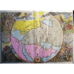
ORBIS PER CREATIONEM INSTITUTUS; ORBIS PER DILUVIUM DESTITIUTUS
Attractive and rare map centered on the Garden Eden. Shows the Near East with Holy Land Israel, Syria, Jordania, Palestine, Arabia, Yemen, the Emirates, Egypt, Turkey, C...
Place & Date: Amsterdam, c 1700
Selling price: $500
Sold in 2008
Land Tafel darinnen die gegendt des Paradijs das land Canaan. . .
Beautiful and rare map showing the Holy Land, Syria, Cyprus, Iran, Iraq, etc. With inset portraits showing Adam and Eve. Scale in lower part, with little cartouche giving...
Place & Date: Germany, ca. 1700
Selling price: $1550
Sold in 2010
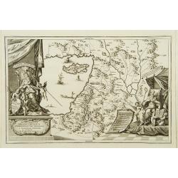
Terra Sancta Christi et Deiparae patria ..
A map from the series of maps by the Jesuit mathematician. A general map of eastern part of Medeteranean with Holy Land and Cyprus, produced by Scherer to show the spread...
Place & Date: Munich c.1702
Selling price: $410
Sold
Patriarchatus Ierosolymitanus comprehendebat tres provincias..
A map from the series of maps by the Jesuit mathematician. A general map of the Holy Land and Cyprus (only listing town of Constantia, produced by Scherer to show the spr...
Place & Date: Munich c.1702
Selling price: $360
Sold
Die Gelegenheit des Paradeis und des Landes Canaan, sambt den erst Bewohnten Lõnderen der Patriarchen aus H. Schrift u anderen Auctoren zusamen getragen
Very rare anonymous map of the Middle East. Based on the "Paradise Map" of Visscher. Showing the Eastern Mediterranean with Cyprus up to today Iraq / Iran in th...
Place & Date: Minden, 1716
Selling price: $475
Sold in 2009
Regni Davidici et Salomonaei descriptio Geographica cum vicinis regionibus Syriae et Aegypti. . .
A rare map of the Near East region, extending from Turkey to Egypt. It includes Cyprus, Holy Land, and Mesopotamia, and illustrates the Kingdoms of David and Solomon. Myt...
Place & Date: Nuremberg, ca 1739
Selling price: $90
Sold in 2020
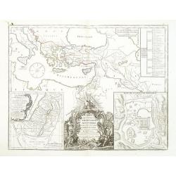
Carte des voyages de Notre seigneur Jesus Christ..
Showing eastern part of the Mediterranean, including Cyprus, Italy. Lower right hand corner inset plan of Jerusalem. Lower left map of Palestine. Published by Vaugondy, a...
Place & Date: Paris, 1747
Selling price: $450
Sold in 2009
Carte des voyages de Notre seigneur Jesus Christ. . .
Showing eastern part of the Mediterranean, including Cyprus, Italy. Lower right hand corner inset plan of Jerusalem. Lower left map of Palestine. Published by Vaugondy, a...
Place & Date: Paris, 1747
Selling price: $150
Sold in 2011
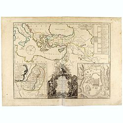
Carte des voyages de Notre seigneur Jesus Christ. . .
Showing eastern part of the Mediterranean, including Cyprus, Italy. Lower right hand corner inset plan of Jerusalem. Lower left map of Palestine. Published by Vaugondy, a...
Place & Date: Paris, 1747
Selling price: $16
Sold in 2022
Afbeelding van all de Landen gelegen tusschen de Middellandsche, Zwarte, Caspische, Persische en Rode Zeën.
A map of the Near East, with an oversized Cyprus.Decorative, scrolled title cartouche to upper left corner. From a Dutch bible published by Nicolaas Goetzee. Willem Alber...
Place & Date: Gorichem, Nicolaas Goetzee, 1748
Selling price: $65
Sold in 2020
Terre Sainte et Partie des Provinces Voisines.
Uncommon map of Palestine, Turkey and an over-sized Cyprus. Engraved by Leparmantier.
Place & Date: Paris 1760
Selling price: $150
Sold
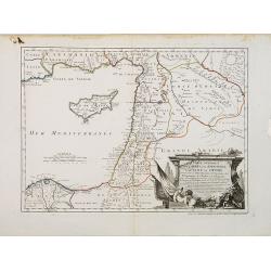
Carte Générale de la Syrie / Palestine / Isle de Chypre. . .
A very fine map of Syria, Palestine, and the island of Cyprus with part of the surrounding countries, prepared for the understanding of the history of the Crusades by Gui...
Place & Date: Paris, ca. 1764
Selling price: $450
Sold
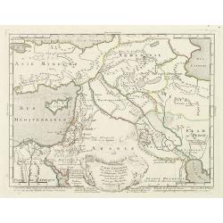
Carte générale pour servir à l'Intelligence de l'Histoire Sainte..
Fine map of the Middle East, including the Holy Land, Cyprus, Iran and Irak, etc.Philippe Buache was one of the most active proponents of the so-called school of theoreti...
Place & Date: Paris 1783
Selling price: $60
Sold
Carte des Regions et des Lieux dont il est parlé dans le Nouveau Testament..
A map of the near East at the time of Christ. Ornated with a decorative title cartouche. Boundaries outlined in hand color.Inset plan of Jerusalem in the bottom left corn...
Place & Date: Paris ca 1783
Selling price: $70
Sold
Carte générale pour servir à l'Intelligence de l'Histoire Sainte..
Fine map of the Middle East, including the Holy Land, Cyprus, Iran and Iraq, etc.Philippe Buache was one of the most active proponents of the so-called school of theoreti...
Place & Date: Paris, 1783
Selling price: $200
Sold in 2010
Syriae Mappa Generalis .. Paleaestina..
Detailed map of Syria, the Holy Land and the eastern tip of Cyprus. Prepared by Lud.Vivien and engraved in steel by Giraldon-Bovinet. Published by Menard and Desenne, rue...
Place & Date: Paris 1824
Selling price: $70
Sold
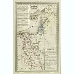
Egypte ancienne et Palestine.
Finely engraved map of Egypt and Palestine with Cyprus, prepared by A.H.Dufour and engraved by Giraldon-Bovinet. Published by Jules Renouard in his uncommon atlas "L...
Place & Date: Paris, Jules Renouard, ca.1840
Selling price: $50
Sold in 2013
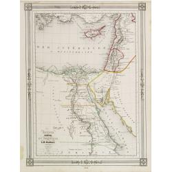
Égypte Palestine et Phénicie.
Detailed map of Egypt, Cyprus and the Holy Land, prepared by Auguste Henri Dufour (1798-1865). Published by Basset, rue de Seine 33, Paris. The engraver of the map was Ch...
Place & Date: Paris 1846
Selling price: $20
Sold
![Tabula IIII Asiae. [Holy Land, Syria, Cyprus, Arabia.]](/uploads/cache/26877-250x250.jpg)
![[Lot of 2 plates] Ierusalem civitas../ [map of Palestine + Cyprus].](/uploads/cache/48240-250x250.jpg)
![Sinus Persicus [Arabia]](/uploads/cache/39586-250x250.jpg)
![[Tevarya] Lago di Tiberia.](/uploads/cache/16894-250x250.jpg)
![[Tevarya] Lago di Tiberia.](/uploads/cache/22050-250x250.jpg)
![[Map of the Holy Land, including Cyprus]](/uploads/cache/26213-250x250.jpg)
![In monte casio iuxta ostracinam. . . [Israel with Cyprus]](/uploads/cache/32575-250x250.jpg)
![[Set of 5 maps of the Holy Land: Paradise, Canaan, Israel & Egypt, the Eastern Mediterranean. . .]](/uploads/cache/48407-250x250.jpg)


![Hiervsalem. [Jerusalem]](/uploads/cache/25500-250x250.jpg)
![Ramma. [Ramla] / Domus Boni Latronis [Latrum]](/uploads/cache/25502-250x250.jpg)
