Browse Listings in Asia
Quinzai. [Hangzhou]
Uncommon and one of the earliest western prints, showing a bird's eye view of Hangzhou. From Francesco Valegio's townbook: Raccolta di le piv illustri et farmose citta di...
Place & Date: Venice, 1600
Selling price: $150
Sold in 2008
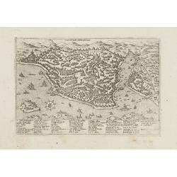
Constantinopoli.
Uncommon plan of Istanbul from Francesco Valegio's townbook: "Raccolta di le piv illustri et farmose citta di tutto il mondo".
Place & Date: Venice, 1600
Selling price: $350
Sold in 2009
SUMATRA INSULA.
Superb miniature map of Sumatra and southern Malaysia (including Singapore). One of the earliest obtainable maps of the Strait of Malacca naming Singapore. With French te...
Place & Date: Amsterdam, c. 1600
Selling price: $210
Sold in 2014
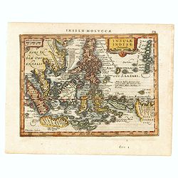
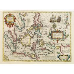
Insulae Indiae Orientalis.
One of the most decorative maps of the Indonesian Archipelago, including the Philippines, Malaya and further India. Signed in the plate bottom left, P. Kaerius Calavit.
Place & Date: Amsterdam, c.1600
Selling price: $300
Sold in 2016
Natolia Olim Sive Asia Minor. [shows Cyprus]
A nice example of Mathias Quad's map of Asia Minor and Cyprus. Latin text beneath and to verso of map. A good early map of the region in good condition. Engraved by Johan...
Place & Date: Cologne, 1600
Selling price: $230
Sold in 2015
Insulae Indiae Orientalis.
One of the most decorative maps of the Indonesian Archipelago, including the Philippines, Malaya and further India. Signed in the plate bottom left, P. Kaerius Calavit.Re...
Place & Date: Amsterdam, c.1600
Selling price: $300
Sold in 2016
Jerusalem.
A beautiful double page woodcut bird's eye view of Jerusalem from Sebastian Münster's famous "Cosmographia", from the rare 1600 German edition. The view shows ...
Place & Date: Basle, 1600
Selling price: $300
Sold in 2017
Asia..
Very rare map of Asia executed by the Flemish artist and cartographer Fiamengo Arnoldo di Arnoldi, who was working in Bologna and Siena, at the end of the 16th century.Be...
Place & Date: Siena, 1600
Selling price: $5500
Sold
Asia.
A lovely miniature version of the Ortelius map of Asia, complete with a strap-work title and a stippled sea. Map extent is from East Africa to Japan (no Korea), and down ...
Place & Date: Antwerp, ca 1600
Selling price: $100
Sold in 2020
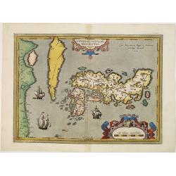
IAPONIAE INSULAE DESCRIPTIO. Ludoico Teisera auctore.
RARE in this perfect condition. The map was based upon the manuscript draft supplied to Ortelius in about 1592 by the famous official Portuguese chart maker, Luis Teixeir...
Place & Date: Antwerp, 1601
Selling price: $3500
Sold in 2017
Chinae, olim Sinarum Regionis, nova descriptio. Auctore Ludovico Georgio.
The first map of China ever to appear in a Western atlas, west to the top. When this map appeared, it was by far the most accurate one of China.Japan is shown on a curiou...
Place & Date: Antwerp, 1601
Selling price: $5400
Sold in 2010
Indiae Orientalis, Insularumque Adiacientium Typus.
Finely originally hand colored example of Ortelius' map of SE Asia, Japan, and the Philippines, etc. The map includes Beach and other information drawn from Marco Polo.Th...
Place & Date: Antwerp, 1601
Selling price: $3200
Sold in 2010
Descripcion De Las Indias Del Poniente 14.
Plate 14 from Herrera’s Descripción de las Indias Occidentales.The work is based on the manuscript charts of Juan Lopez de Velasco dating from approximately 1...
Place & Date: Madrid, 1601
Selling price: $1200
Sold in 2012
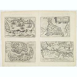
Amboinum Insula / Insulae Baly / Banda Insula / Java mayor.
Four maps on one sheet, extremely rare maps of Ambon, Banda, Bali and Java, included in Johannes Metelellus, Insularium Orbis Aliquot insularum tabulis Aeneis delineation...
Place & Date: Cologne, 1601
Selling price: $1000
Sold in 2019
Indiae Orientalis Insularemque.
Covering all of South East, China, Japan (Kyushu and Honshu shown as one peculiar circular-shaped Island) and the West Coast of North America. The Northern coasts of New ...
Place & Date: Antwerp 1602
Selling price: $3000
Sold
China, Regio Asiae.
This is the miniature version of Ortelius' important map focusing on China. The map is oriented with north to the right and extends to include parts of Indo-China. The Gr...
Place & Date: Antwerp, ca.1602
Selling price: $250
Sold in 2008
No title: South East Asia.
Very rare map of South East Asia, also including India, China, Japan and the northern tip of Australia , published by Hulsius.The German writer Levinus Hulsius compiled a...
Place & Date: Nuremberg 1602
Selling price: $1100
Sold
Insulae Indiae Orientalis et Molucae.
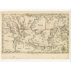
Very rare map of South East Asia, depicting Sumatra, Java, Borneo, Sulawesi, Moluccas, Bali, southern tip of Malaysia, mentioning Siucapura, published by Hulsius.The Germ...
Place & Date: Nuremberg 1602
Selling price: $1338
Sold
No title: South East Asia.
Very rare map of South East Asia, also including India, China, Japan and the northern tip of Australia , published by Hulsius.The German writer Levinus Hulsius compiled a...
Place & Date: Nuremberg, 1602
Selling price: $3100
Sold in 2011
No title: South East Asia.
Very rare map of South East Asia, also including India, China, Japan and the northern tip of Australia , published by Hulsius.The German writer Levinus Hulsius compiled a...
Place & Date: Nuremberg, 1602
Selling price: $1150
Sold in 2012
Insulae Indiae Orientalis et Molucae.
Very rare map of South East Asia, depicting Sumatra, Java, Borneo, Sulawesi, Moluccas, Bali, southern tip of Malaysia, mentioning "Siucapura" (Singapore), publi...
Place & Date: Nuremberg, 1602
Selling price: $1050
Sold in 2014
[ South East Asia. ]
Very rare map of South East Asia, also including India, China, Japan and the northern tip of Australia , published by Hulsius.The German writer Levinus Hulsius compiled a...
Place & Date: Nuremberg, 1602
Selling price: $2175
Sold in 2014
Contrafactur des Scharmutz els der Holander (Singapore)
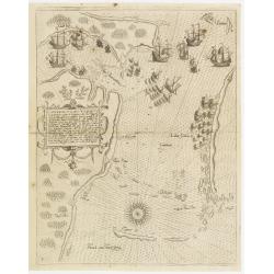
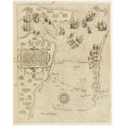
An especially rare and beautiful map of Strait Singapore, with exquisite calligraphy and superb detail of Dutch and Portuguese ships in Strait Singapore. It shows only th...
Place & Date: Frankfurt 1603
Selling price: $2500
Sold
Alexandri Magni Marcedonis Expeditio.
Handsomely engraved map of Alexander the Great's Empire at full flower, with a large inset depicting the Temple of the Oracle of Jupiter Amman, supposedly situated in pre...
Place & Date: Antwerp 1603
Selling price: $850
Sold
Terra sancta a Petro Laicstain perlustrata?
The Holy Land described by Petrus Laicstain and designed by Christian Schrot. Oriented to the east. Shows the shore line from Birut to Gaza. The shore line is distorted b...
Place & Date: Antwerp 1603
Selling price: $450
Sold
Turcici Imperii Descriptio.
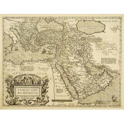
Map of the Middle East, extending from Greece to Arabia and covering the Cradle of Civilisation region. This is a new plate copied from another Ortelius map of 1570 with ...
Place & Date: Antwerp, 1603
Selling price: $725
Sold
Contrafactur des Scharmutz els der Holander (Singapore)
An especially rare and beautiful map of Strait Singapore, with exquisite calligraphy and superb detail of Dutch and Portuguese ships in Strait Singapore. It shows only th...
Place & Date: Frankfurt, 1603
Selling price: $2360
Sold
Contrafactur des Scharmutz els der Holander (Singapore)
An especially rare and beautiful map of Strait Singapore, with exquisite calligraphy and superb detail of Dutch and Portuguese ships in Strait Singapore. It shows only th...
Place & Date: Frankfurt 1603
Selling price: $4100
Sold in 2011
Chinae, olim Sinarum Regionis, nova descriptio. Auctore Ludovico Georgio.
The first map of China ever to appear in a Western atlas, west to the top. When this map appeared, it was by far the most accurate one of China.Japan is shown on a curiou...
Place & Date: Antwerp, 1603
Selling price: $4500
Sold in 2016
Abrahami Patriarchae Peregrinatio et Vita.
The Holy Land map itself occupies the center and is surrounded by vignettes of the life of the Patriarch Abraham. Extremely decorative map made by Ortelius, based on Ptol...
Place & Date: Antwerp, 1601-1603
Selling price: $1800
Sold in 2024
Alexandri Magni Macedonis Expeditio
Detailed map of Alexander the Great's expedition to the Middle East and Persia. The map extends from Greece until east of the Indus river.With a large inset: Iovis Ammoni...
Place & Date: Antwerp, 1603
Selling price: $475
Sold in 2019
Asia.
Beautiful colored copper engraved map of Asia. With an unusual shape of Japan and a small part of the American continent east of Japan. From the 1604 Cologne edition of &...
Place & Date: Cologne, 1604
Selling price: $300
Sold in 2009
Waerachtige beschryvinge vande wydvermaerde Conincklicke Hooft Stadt Jerusalem.
Engraved by Baptista van Doetechum for a bible printed by Jan Everts Cloppenburg. The bible maps of 1590 are the earliest of Plancius compilations to survive.Very rare pl...
Place & Date: Amsterdam, 1604
Selling price: $1000
Sold in 2021
Waerachtige beschryvinge van de.. Stadt Jerusalem; . . .
A highly decorative map of Jerusalem, oriented to the West. Before Plancius, it was common to include a number of Bible maps, however, Plancius was the first to include a...
Place & Date: Amsterdam, 1604
Selling price: $1550
Sold in 2021
Tabula Geographica in qua Regiones Cananaeae, et Locorum Situs Prout ea Tempore Christi. . .
A superb and highly decorative map from a Dutch Bible depicting the land of Canaan with political divisions during the time of Christ. Fifteen wonderfully etched vignette...
Place & Date: Amsterdam, 1604
Selling price: $600
Sold in 2021
Tabula Geographica, in Qua Paradisus, nec Non Regiones, Urbes oppida, et loca describuntur; quorum in Genesi mentio fit.
A wonderful work of art, consisting of a map of the Holy Land and contiguous regions, including Cyprus and Armenia, surrounded by beautiful etchings. In the center of the...
Place & Date: Amsterdam, 1604
Selling price: $1350
Sold in 2021
Tabula Geographica, in Qua Iisraelitarum, ab Aegypto ad Kenahanaeam usque profectiones omnes, et stationes describuntur...
A highly decorative map illustrating the region surrounding the Dead Sea through the Nile Delta and depicting, the wanderings of the Children of Israel. Top right : indic...
Place & Date: Amsterdam, 1604
Selling price: $1550
Sold in 2021
Tabula Geographica, in qua Omnes Regiones, Urbes, Oppida, Loca et Fluvii Israeliae Describuntur. . .
A very rare map of Israel oriented to the East, originating from a Dutch Bible. Where most Bible publishers included five or six maps into their Bible, Plancius included ...
Place & Date: Amsterdam, 1604
Selling price: $1350
Sold in 2021
Tabula geographica in qua omnes regiones, urbes, oppida, et loca describuntur, ....
A work of art this map, depicting the Southern and Eastern Mediterranean countries visited by the Apostles. It is the final map of the standard set of five Holy Land maps...
Place & Date: Amsterdam, 1604
Selling price: $800
Sold in 2021
Insulae Indiae Orientalis Praecipuae, In quibus Moluccae celeberrimae sunt.
Two beautiful new maps of Southeast Asia were created by the Dutch mapmaker Jodocus Hondius for an enlarged issue of the Mercator Atlas of 1606. One covered the Indian Oc...
Place & Date: Amsterdam 1606
Selling price: $900
Sold
CYPRUS INS:
A decorative map of Cyprus, with insets for the other six islands.
Place & Date: Amsterdam 1606
Selling price: $800
Sold
CYPRUS INS:
A decorative map of Cyprus, with insets for the other six islands.
Place & Date: Amsterdam 1606
Selling price: $1000
Sold
Insulae Indiae Orientalis Praecipuae, In quibus Moluccae celeberrimae sunt.
Two beautiful new maps of Southeast Asia were created by the Dutch mapmaker Jodocus Hondius for an enlarged issue of the Mercator Atlas of 1606. One covered the Indian Oc...
Place & Date: Amsterdam 1606
Selling price: $2500
Sold
Natoliae Sive Asia Minor. [with Cyprus]
Mercator's map of Turkey, Asia Minor and Cyprus., published by Jodocus Hondius. Fine dark impression, including decorative cartouches, sailing ship, sea monster and finel...
Place & Date: Amsterdam, 1606
Selling price: $750
Sold in 2011
Insulae indiae orientalis..
This impressive map reflects the increasing Dutch interest in South East Asia in the wake of the establishment of the Dutch East India Company. It is one of two Asian map...
Place & Date: Amsterdam, 1606
Selling price: $2200
Sold in 2009
India Orientalis.
Published in Hondius' editions of the Mercator Atlas from 1606 onwards, showing the Indian subcontinent, the Malay Peninsula, Siam and Cambodia, China and the Philippines...
Place & Date: Amsterdam, 1606
Selling price: $1250
Sold in 2010
India Orientalis.
Published in Hondius' editions of the Mercator Atlas from 1606 onwards, showing the Indian subcontinent, the Malay Peninsula, Siam and Cambodia, China and the Philippines...
Place & Date: Amsterdam, 1606
Selling price: $3000
Sold in 2015
Tartaria.
This splendid map covers all of northern Asia from Moscow to the Anian Fretum and Americae Pars. Korea is shown as an island. Illustrations include the Great Wall in Chin...
Place & Date: Amsterdam, 1606
Selling price: $1000
Sold in 2011
The Description of the Holy Land.
Two woodcut biblical maps from the famous "Breeches Bible", one titled "The Description of the Holy Land, containing the places mentioned by the four evang...
Place & Date: London, 1606
Selling price: $195
Sold in 2013
Malacca.
A rare miniature map of the area which is now the modern countries of Malaysia and Singapore. Singapore is 'Sincapura', and the Malaysian province of Solongor(Solongor), ...
Place & Date: Amsterdam, Cornelis Claes, 1606
Selling price: $200
Sold in 2016
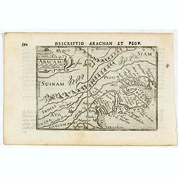
Descriptio Arachan et Pegu / Aracam.
A rare miniature map of Thailand. Title cartouche on the upper left corner.First published in 1598 in his Caert-Thresoor, the plates were executed by the most famous engr...
Place & Date: Amsterdam, Cornelis Claes, 1606
Selling price: $200
Sold in 2016
Descriptio Philippinarum / Insulae Philippinae.
A rare miniature map of Philippines. East is at the top. Title cartouche on the upper left corner.First published in 1598 in his Caert-Thresoor, the plates were executed ...
Place & Date: Amsterdam, Cornelis Claes, 1606
Selling price: $1075
Sold in 2016
Seconda Tavola.
Splendid map with south to the top.From Arabia over India towards Golf of Bengala, shows the way to the Spice islands. (Vado alla Moluche). And Mount Adam (paradise lost ...
Place & Date: Venice, Giunti, 1606
Selling price: $3100
Sold in 2016
Tartaria.
Published in Hondius' editions of the Mercator Atlas from 1606 onwards, showing China, Korea and the northern Pacific coast of America showing the two continents separate...
Place & Date: Amsterdam, 1606
Selling price: $560
Sold in 2017
China.
An important and decorative map of China, Korea and Japan, decorated with three cartouches, ships, China’s great wall, and sea monsters. It shows also a sail-cart and a...
Place & Date: Amsterdam, 1606
Selling price: $1650
Sold in 2019
Insulae Philippinae.
This lovely miniature map shows the Philippine Islands. Published by Petrus Bertius, in Amsterdam at the beginning of the seventeenth century, this map is embellished wit...
Place & Date: Amsterdam, 1606
Selling price: $1550
Sold in 2019
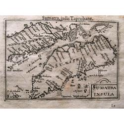
Sumatra Insula.
This lovely miniature map shows the S.E. Asian Islands of Sumatra and (part) Malaysia, published by Petrus Bertius, in Amsterdam at the beginning of the seventeenth centu...
Place & Date: Amsterdam, 1606
Selling price: $160
Sold in 2020
Malabar.
Attractive little map of the southern part of the Indian subcontinent, focusing on the Malabar coast from Goa to Cape Comorin and its important trading posts. Also depict...
Place & Date: Amsterdam, 1606
Selling price: $40
Sold in 2023
Cyprus.
A decorative miniature map of the eastern Mediterranean island of Cyprus, published by Petrus Bertius in Amsterdam, at the beginning of the seventeenth century. This attr...
Place & Date: Amsterdam, 1606
Selling price: $150
Sold in 2019
Palaestina.
A decorative miniature map of the Holy Land, stretching from Egypt to Damascus in Syria, published by Petrus Bertius in Amsterdam, at the beginning of the seventeenth cen...
Place & Date: Amsterdam, 1606
Selling price: $150
Sold in 2019
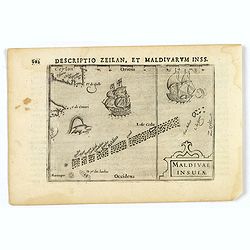
Maldivae Insulae.
A miniature map of The Maldives islands, situated southwest of Ceylon situated in the Arabian Sea, located in the Indian Ocean. North is orientated to the left. The south...
Place & Date: Amsterdam, 1606
Selling price: $50
Sold in 2019
China.
A miniature map of China. It also shows a portion of western America, Indo-China, the Philippines, Borneo, Japan and Korea. Published by Petrus Bertius in Amsterdam, at t...
Place & Date: Amsterdam, 1606
Selling price: $200
Sold in 2019
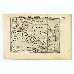
Descriptio Borneo Insula.
A miniature map of the Indonesian island of Borneo. Title is in bold capitals above the map. North is orientated to the left. The Equator runs through the southern part o...
Place & Date: Amsterdam, 1606
Selling price: $65
Sold in 2019
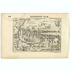
Iava Maior.
This map is one of the earliest obtainable maps of Java, pre-dating the establishment of Batavia. Interestingly, nothing is shown (or apparently known) along the southern...
Place & Date: Amsterdam, 1606
Selling price: $130
Sold in 2021
Moluccae Insulae.
An attractive miniature map of the Molucca Islands, formerly known as the 'Spice Islands', in Indonesia, published by Petrus Bertius, in Amsterdam at the beginning of the...
Place & Date: Amsterdam, 1606
Selling price: $50
Sold in 2019
Descriptio Narsingae.
A rare miniature map of the southern part of India with Sri Lanka (Ceylon). Strap-work title cartouche in the upper right corner. Expertly engraved by Petrus Kaerius, the...
Place & Date: Amsterdam, 1606
Selling price: $80
Sold in 2020
CYPRUS INS:
A decorative map of Cyprus, with insets for the other six islands.
Place & Date: Amsterdam, 1606
Selling price: $435
Sold in 2020
AMACAO.
One of the splendid engravings from the Voyages of de Bry, this full double-page view shows the artist's conception of Macao. Macao had quickly became a strategic strongh...
Place & Date: Frankfurt 1607
Selling price: $650
Sold
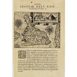
I.Baly.
Map of Bali, oriented to the south. Decorated with ships and three compass roses. With two insets representing buildings.From Theodor & Johann Theodor de Bry's eighth...
Place & Date: Frankfurt 1607
Selling price: $200
Sold
De foro Goae frequentato..
An attractive panorama view of the market square at Goa, with Indians and Portuguese traders, buying and selling various merchandise, with a row of colonial buildings in ...
Place & Date: Frankfurt 1607
Selling price: $150
Sold
Contrafactur des Scharmutz els der Holander (Singapore)
An especially rare and beautiful map of Strait Singapore, with exquisite calligraphy and superb detail of Dutch and Portuguese ships in Strait Singapore. It shows only th...
Place & Date: Frankfurt, 1607
Selling price: $1275
Sold
China.
Rare first issue, first state of Hondius' reduced map of China, from Atlas Minor Gerardi Mercatoris. Most notable differences from the second state include the spelling o...
Place & Date: Amsterdam, 1607
Selling price: $450
Sold in 2013
TIDORE.
View of Dutch vessels stationed in bay of Tidore. From Theodor & Johann Theodor de Bry's eighth volume compilation of voyages to the east, the so-called "Little ...
Place & Date: Frankfurt 1607
Selling price: $380
Sold in 2008
De foro Goae frequentato..
An attractive panorama view of the market square at Goa, with Indians and Portuguese traders, buying and selling various merchandise, with a row of colonial buildings in ...
Place & Date: Frankfurt, 1607
Selling price: $350
Sold in 2016
TIDORE.
View of Dutch vessels stationed in bay of Tidore. From Theodor and Johann Theodor de Bry's eighth volume compilation of voyages to the east, the so-called "Little Vo...
Place & Date: Frankfurt, 1607
Selling price: $350
Sold in 2013
Delineatio Regiae Civitatis Candy. (Plan of the city in Ceylon.)
View of Dutch vessels stationed in bay of Tidore. From Theodor and Johann Theodor de Bry's eighth volume compilation of voyages to the east, the so-called "Little Vo...
Place & Date: Frankfurt, 1607
Selling price: $350
Sold in 2013
Iapan I.
Map of Japan from the first French-text edition of Jodocus Hondius' Atlas Minor.Shortly after the publication of the big folio-atlases the need was apparently felt for a ...
Place & Date: Amsterdam, 1608
Selling price: $300
Sold in 2008
Paradisus.
Early map showing the Syrian desert, Lebanon, and the mouth of the Tigris in the Persian Gulf. Including Babylon, Tripoli, etc.Showing the site of Paradise between the fo...
Place & Date: Amsterdam, 1608
Selling price: $250
Sold in 2008
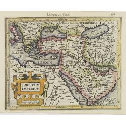
Turcicum Imperium.
Early map of Turkey, the Arabian peninsula and eastern part of the Mediterranean.From the first French-text edition of Jodocus Hondius'' Atlas Minor.Shortly after the pub...
Place & Date: Amsterdam, 1608
Selling price: $300
Sold in 2008
Ceilan insula.
Charming small map of the island of Sri Lanka with great detail of the villages, kingdoms, mines and spice plantations.Decorated with a strap work title and distance scal...
Place & Date: Amsterdam, 1608
Selling price: $200
Sold in 2017
![Quinzai. [Hangzhou]](/uploads/cache/25263-250x250.jpg)

![Natolia Olim Sive Asia Minor. [shows Cyprus]](/uploads/cache/35957-250x250.jpg)








![[ South East Asia. ]](/uploads/cache/35256-250x250.jpg)




![Natoliae Sive Asia Minor. [with Cyprus]](/uploads/cache/10497-250x250.jpg)


