Browse Listings in Asia
[Middle East Map]
Very large map of the region north and east of the Mediterranean Sea. It covers the are from Eastern Italy to Western Persia, and from The Crimea to Egypt. It includes co...
Place & Date: England, ca. 1800
Selling price: $115
Sold in 2017
Charte von Indostan.
Rare map of India, with imposing title cartouche lower right. Engraved by Gustav Georg Endner (1754-1824).
Place & Date: Leipzig, 1800
Selling price: $150
Sold in 2018
A new and Accurate map of China. . .
Map of China, including Taiwan and Korea. Engraved and published by Thomas Brown, who was active as map seller in Edinburg. Engraved by Gavin and son.From Brown's seldom ...
Place & Date: Edinburgh, 1801
Selling price: $1035
Sold in 2010
Asia and its Islands, from the most recent Authorities.
A fine, small but detailed map, showing Asia, a tip of Australia named New Holland, and a small part of Alaska. With numerous areas, rivers, and islands named. Includes m...
Place & Date: London, 1801
Selling price: $160
Sold in 2015
A New Map of China, From the Latest by John Cary
A beautiful example of John Cary's important 1801 map of China and Korea. Offers extraordinary detail including the great Wall of China. Also identifies the Island of Tai...
Place & Date: London, 1801
Selling price: $250
Sold in 2015
Asie divisee en ses principeaux Etats Empires & Royaumes.
Charles François Delamarche (1740-1817), Paris-based geographer and publisher, successor to Didier Robert de Vaugondy after his death in 1786.An attractive map of Asia.
Place & Date: Paris, 1802
Selling price: $220
Sold in 2014
Gezigt van de stad en haven van St. Petrus en St. Paul aan Kamtschatka.
Captain James Cook (1728-79), explorer, circumnavigator and hydrographer. Three voyages, 1768-71, 1772-75 and 1776-79. From 1778 on printed editions of ' Captain Cook's T...
Place & Date: Leiden, 1795-1803
Selling price: $70
Sold
Schets van Typa of van Macao.
Captain James Cook (1728-79), explorer, circumnavigator and hydrographer. Three voyages, 1768-71, 1772-75 and 1776-79. From 1778 on printed editions of ' Captain Cook's T...
Place & Date: Leiden, 1795-1803
Selling price: $130
Sold
Schets van Typa of van Macao.
Captain James Cook (1728-79), explorer, circumnavigator and hydrographer. Three voyages, 1768-71, 1772-75 and 1776-79. From 1778 on printed editions of "Captain Coo...
Place & Date: Leiden, 1795-1803
Selling price: $125
Sold in 2008
Asia.
Very rare Ottoman printed map of the world in a Mercator projection, centered on Australia.From Jedid Atlas Tercümesi or New Atlas , printed 1218 H. or 1803 in Üsküdar...
Place & Date: Üsküdar 1803
Selling price: $3100
Sold
Kaart van de noord-west kust van Amerika en de noord-oost kust van Asia. Opgenoomen in de Jaaren 1778 en 1779.
Captain James Cook (1728-79), explorer, circumnavigator and Hydrographer. Three voyages, 1768-71, 1772-75 and 1776-79. From 1778 on printed editions of ' Captain Cook's T...
Place & Date: Leiden, 1795-1803
Selling price: $60
Sold in 2010
Schets van Typa of van Macao.
A map of Macao and the islands in its vicinity. From a Dutch edition of "Cook's voyages ".Captain James Cook (1728-79), explorer, circumnavigator and hydrograph...
Place & Date: Leiden, 1795-1803
Selling price: $130
Sold in 2011
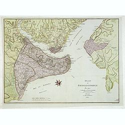
Plan de Constantinople leve par - F. Kaufer et I. B. Lechevalier. A Weimar au Burau d'Industrie 1803.
Large plan of Constantinople, the Golden Horn, the Bosporus and Scutari on the Asian side. With many engraved details, streets, villages, mosques, etc. The area outside t...
Place & Date: Weimar, Industrie Comptoire, 1803
Selling price: $500
Sold in 2015
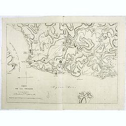
Carte de la Troade levée par les C. C. le Chevalier et L.F.Cassas en 1786.
Interesting map of Troad in Turkey and the Simois River. At the top is Mount Ida and the Egee Sea is at the bottom.Troy was a city situated in what is known from Classica...
Place & Date: Paris, 1803
Selling price: $50
Sold in 2022
China, Contains 15 Subject Provinces Including the 2 Islands of Hainan, Formosa and the Tributary Kingdoms of Corea, Tonkin
An antique hand colored map from Wilkinson's "A General Atlas, being a Collection of Maps of the World and Quarters the Principal Empires, Kingdoms &c. with thei...
Place & Date: London, 1803
Selling price: $60
Sold in 2016
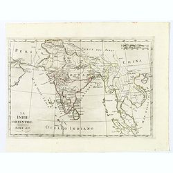
Le Indie Orientali.
A nice map of the East Indies, published in Rome at the beginning of the nineteenth century. Shows from the Persian Gulf across Pakistan, India, and Bangladesh, then sout...
Place & Date: Rome, ca 1803
Selling price: $7
Sold in 2021
Carte de L'Inde.
A scarce engraved map of the Indian subcontinent covering India and including parts of Iran (Perse), Afghanistan (Royaume de Candahar), Tibet, China, and Indochina (Empir...
Place & Date: Paris, 1803
Selling price: $120
Sold in 2021
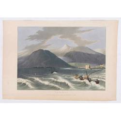
Tripoli.
Showing a few boats and harbour of Tripoli in Libanon, sketched on the spot by F.B. Spilsbury and drawn by D. Orme for "Picturesque Scenery in the Holy Land and Syri...
Place & Date: London, 1803
Selling price: $30
Sold in 2022
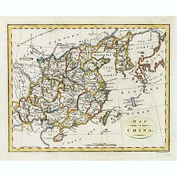
Map of China.
Showing China, Taiwan and Korea, divided into provinces with the main cities marked. The map is of interest for the use of Sea of Corea, the sea between Korea and Japan, ...
Place & Date: London, 1804
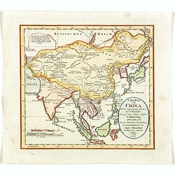
Charte von China..
Uncommon map of China prepared by H.F.A.Stieler, giving good detail of the region and extending as far as Taiwan and the Korean peninsula.With inset map of the Ryukyu Isl...
Place & Date: Weimar 1804
Selling price: $450
Sold
L'Asie.
Map of Asia. By C. F. Delamarche, successor of Robert de Vaugondy, Geographer.
Place & Date: Paris, 1804
Selling price: $85
Sold in 2016
Map of China.
Showing China, Taiwan and Korea, divided into provinces with the main cities marked. The map is of interest for the use of East Sea, the sea between Korea and Japan, here...
Place & Date: London, 1804
Selling price: $300
Sold
Map of China.
Showing China, Taiwan and Korea, divided into provinces with the main cities marked. The map is of interest for the naming of the sea between Korea and Japan, here called...
Place & Date: London, 1804
Selling price: $300
Sold in 2014
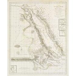
Golphe D'Arabie,.. Bab-el-Mandeb, ..
Detailed map of the Red Sea, here called Golfe d'Arabie, showing tracks of Poncet and James Bruce. Giving good detail along the coast of Saudi Arabia. From Voyages de Bru...
Place & Date: Paris 1805
Selling price: $100
Sold in 2014
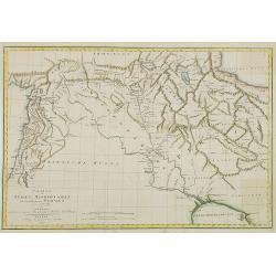
Charte von Syrien, Mesopotamien und einem Theile von Persien. . .
Map of Persia , Syria and Mesopotamia. German edition taken from the French edition Atlas pour servir au voyage dans l'Empire Othoman. . . that was published in Paris f...
Place & Date: Weimar, 1805
Selling price: $50
Sold in 2009
Östlicher Theil des Russischen Reiches oder Sibirien mit den Kurilischen, Aleutischen und Fuchs-Inseln. . .
Scarce map of Eastern part of Russia, prepared by F.L. Güssefeld and published by Homann Heirs.Engraved by I.B.Slbrig.
Place & Date: Nuremberg, ca. 1805
Selling price: $50
Sold in 2014
Asia Florente Persarum Imperio.
An early nineteenth century map of Asia covering the regions of Asia Minor and the Black Sea, the Balkans, the Middle East, Ethiopia, Persia, Tartary, Siberia, India and ...
Place & Date: Göttingen, 1805
Selling price: $20
Sold in 2021
Les Indes Orientales et leur Archipel..
Map of South Eastern Asia, encompassing the area between India and Indonesia.From Atlas de la Géographie de toutes les parties du monde .. Ouvrage destiné pour l\'educa...
Place & Date: Paris, Prudhomme, Levrault, Debray, 1806
Selling price: $100
Sold in 2008
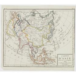
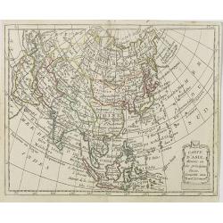
Carte d\'Asie Divisée en ses principaux Etats..
Map of Asia, from Atlas de la Géographie de toutes les parties du monde .. Ouvrage destiné pour l\'education, et nécessaire aux négocians, aux voyageurs, aux fonction...
Place & Date: Paris, Prudhomme, Levrault, Debray, 1806
Selling price: $40
Sold in 2009
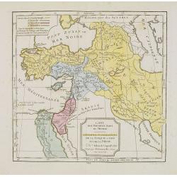
Cartes des premiers ages du monde. Géographie Ecclédiastique de la Turquie, d''Asie et de la Perse.
Map of ancient Turkey, Cyprus, Persia and Near and Middle East.By C. F. Delamarche, successor of Robert de Vaugondy, Geographer.
Place & Date: Paris, ca.1806
Selling price: $50
Sold
Les Isles de la Sonde, Moluques, Philippines, Carolines et Marianes.
Map of South East Asia. By C. F. Delamarche, successor of Robert de Vaugondy, Geographer.
Place & Date: Paris, 1794 - 1806
Selling price: $100
Sold in 2014
Siberie ou Russie Asiatique, Tartarie Chinoise, Pays des Eluts et Isles du Japon.
Map of the Kamchatka peninsula, Russian Far East., Korea, Japan, with Hokaido labeled "Terre del Jeso".By C. F. Delamarche, successor of Robert de Vaugo...
Place & Date: Paris, 1794 - 1806
Selling price: $90
Sold in 2009
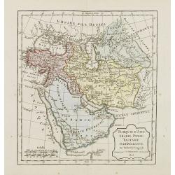
Turquie d'Asie, Arabie, Perse, Tartarie Indépendante.
Map of the Turkey and the Arabian peninsula. By C. F. Delamarche, successor of Robert de Vaugondy, Geographer.
Place & Date: Paris, 1794 - 1806
Selling price: $110
Sold in 2009
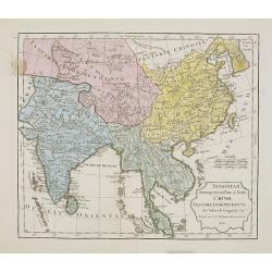
Indostan, presqu'isles de l'Inde, Chine, Tartarie Indépendendante.
Map of Hindustan, the Indian peninsula , China, and Tartary. By C. F. Delamarche, successor of Robert de Vaugondy, Geographer.Uncommon later edition with the date 1806. ...
Place & Date: Paris, 1806
Selling price: $80
Sold in 2009
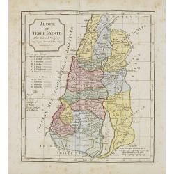
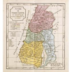
Judée ou Terre Sainte.
Map of the Holy Land, Judea. By C. F. Delamarche, successor of Robert de Vaugondy, Geographer.
Place & Date: Paris, 1794 -1806
Selling price: $40
Sold in 2011
Carte des Premiers Ages du Monde. Géographie Ecclésiastique de la Turquie, d'Asie et de la Perse.
Map of the Arabian peninsula and Turkey. By C. F. Delamarche, successor of Robert de Vaugondy, Geographer.
Place & Date: Paris, 1794 -1806
Selling price: $5
Sold in 2023
L'Empire de la Chine avec les Isles du Japon et la Corée . . .
Map of the Chinese Empire with Japan, Taiwan (Formose I.) and Korea, from Atlas moderne portatif composé de vingt-huit cartes sur toutes les parties du globe terrestre ....
Place & Date: Paris, Prudhomme, Levrault, Debray, 1806
Selling price: $500
Sold
Carte des Régions et Lieux dont il est parlé dans le Nouveau Testament . . .
Map of the regions and sites mentioned in the New Testament with inset maps of the Holy Land and a plan of Jerusalem, from Atlas moderne portatif composé de vingt-huit c...
Place & Date: Paris, Prudhomme, Levrault, Debray, 1806
Selling price: $220
Sold in 2019
Carte d'Asie . . .
Map of the Asian continent. The map is of interest for the use of East Sea, the sea between Korea and Japan, here called "Mer de Corée".from Atlas moderne port...
Place & Date: Paris, Prudhomme, Levrault, Debray, 1806
Selling price: $180
Sold
Morokoshi Meisho Zue [Illustrated Description of Famous Sites of China].
Very rare first edition, of the famous places of Qing dynasty in China, edited and illustrated by the Japanese artists Okada Gyokuzan (1737–1812), Oka Yugaku (1762–18...
Place & Date: Osaka, Kawachiya Kichibei, Bunka, year of the tiger, 1806
Selling price: $13000
Sold in 2011
Morokoshi Meisho Zue [Illustrated Description of Famous Sites of China].
Published : Osaka, Kawachiya Genhichiro, et al.[8 book sellers], slightly later issue but apparently in Edo period, using all the same woodblocks of original first editi...
Place & Date: Osaka, Bunka 3 or1806
Selling price: $3600
Sold in 2013
Judée ou Terre Sainte.
Map of the Holy Land, Judea. By C. F. Delamarche, successor of Robert de Vaugondy, Geographer.
Place & Date: Paris, 1794 -1806
Selling price: $40
Sold in 2021
Persen.
Originally hand-colored mezzotint of a Persian man dressed in native garb, engraved by Félix Mixelle and Lachaussée Jeune after Jacques Grasset de Saint-Sauveur.As an e...
Place & Date: Paris,1801-1806
Selling price: $30
Sold in 2016
Homme et femme Calmouck.
Originally hand-colored mezzotint of two men from the autonomous Republic of Kalmykia dressed in native garb, engraved by Félix Mixelle and Lachaussée Jeune after Jacqu...
Place & Date: Paris,1801-1806
Selling price: $30
Sold in 2016
A New Map of Chinese Independent Tartary, from the Latest Authorities.
Map that displays Independent and Chinese Tartary, with present-day China, Tibet, Mongolia, Japan, South Korea, Taiwan, Kazakhstan, Uzbekistan, Turkmenistan, Iran,... Hig...
Place & Date: London, 1806
Selling price: $71
Sold in 2015
Les Isles de la Sonde, Moluques, Philippines, Carolines et Marianes Par Robert de Vaugondy.
Map of South East Asia. from the atlas Nouvel Atlas Portatif destiné principalement à la jeunesse d'après la Géographie Moderne de l'Abbé Delacroix, published by Fel...
Place & Date: Paris, 1794 - 1806
Selling price: $100
Sold in 2018
[Map of Asia]
Map of the continent of Asia with in the lower right corner the continent of Australia, labeled "Nouvelle Hollande", with only "Botany Bay" mentioned....
Place & Date: Paris, 1807
Selling price: $360
Sold
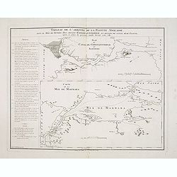
Tableau de l'arrivée de la Flotte Anglaise, dans le Mois de Février 1807, devant Constantinople, et retour de cette même flotte, après 10 jours de présence inutile devant cette ville.
Two maps on one sheet, with an extensive daily description of the mission of Sidney Smith who was sent to join Admiral Sir John Thomas Duckworth's expedition to Constanti...
Place & Date: Paris, ca. 1807
Selling price: $220
Sold in 2018
Empire of Japan. (with Korea)
Detailed map of Japan and including Korea. Japan with good detail, gold mines and more. An island in the Pacific is called "Fatsisio, or Unhappy I. The Place of Exil...
Place & Date: London, 1807
Selling price: $400
Sold in 2020
Empire of Japan. (With Sea of Corea)
Detailed map of Japan and including Korea. Japan with good detail, gold mines and more. An island in the Pacific is called "Fatsisio, or Unhappy I. The Place of Exil...
Place & Date: London, 1807
Selling price: $500
Sold in 2023
China.
Map of China with Formosa and Strait of Corea. Topographical detail is limited to rivers, lakes, mountains and place names. Sea area shaded. Aaron Arrowsmith, (born July ...
Place & Date: London, 1807
Selling price: $40
Sold in 2017
The plantain tree, in the island of Cracatoa.
The plantain tree, in the island of Cracatoa, taken from "Views in the South Seas" being a very important and early views depicting scenes encountered while emp...
Place & Date: London, Boydell and Co., 1808
Selling price: $1500
Sold in 2010
Balagans or summer habitations, with the method of drying fish at St. Peter and Paul, Kamtschatka.
Balagans or summer habitations, with the method of drying fish at St. Peter and Paul, Kamtschatka, taken from "Views in the South Seas" being a very important a...
Place & Date: London, Boydell and Co., 1808
Selling price: $1200
Sold in 2017
View in Macao, including the residence of camoens, when he wrote his Lusiad.
One of two views of Macao, taken from "Views in the South Seas" being a very important and early views depicting scenes encountered while employed as draughtsma...
Place & Date: London, Boydell and Co., 1808
Selling price: $4200
Sold in 2010
View in Macao.
Early view of Macao, taken from "Views in the South Seas" being a very important and early views depicting scenes encountered while employed as draughtsman on C...
Place & Date: London, Boydell and Co., 1808
Selling price: $2900
Sold in 2012
A New and Accurate Map of the Islands and Channels between China and New Holland.
Very rare copper-engraved map from Thomas Brown's General Atlas (1801 or 1808). The map extends from Burma to Taiwan with parts of China, and south to Australia, includin...
Place & Date: Edinburgh, 1801-1808
Selling price: $450
Sold in 2015
Asia, drawn from the latest Astronomical Observations.
This finely engraved, and detailed, map of Asia shows the extent of knowledge from astronomical observations at the time. It is also of interest for showing Australia her...
Place & Date: London ca. 1808
Selling price: $27
Sold in 2017
Carte des Isles Formose, Madjicosemah et Lieu-Kieu..
Rare map of Taiwan, the Lieu-Kieu Islands and the coast of China, including Hong Kong and Nanking.Engraved by Tardieu.
Place & Date: Paris 1809
Selling price: $500
Sold
Charte von OstIndien nach I.Rennel von Gebr. Lotter.
Decorative map in very good condition with a title cartouche at bottom right, scale bars at the top right, bottom left color key legend.A rare map published by After a ma...
Place & Date: Augsburg, 1777/1810
Selling price: $900
Sold
Carte d'Asie.
An informative map of the continent of Asia by the French engineer and geographer, Jean-Baptist Poirson. Map covers from the northern tip of Australia, up to the Behring ...
Place & Date: Paris, 1810
Selling price: $125
Sold in 2018
Haizhou Prefecture, Jiangsu Province.
A very rare Qing era manuscript map of Haizhou Prefecture in Jiangsu province, China showing coastal area, islands and ocean. Dated as made in 1810 by Yu Dengda from Haiz...
Place & Date: Haizhou, 1810
Selling price: $675
Sold in 2019
[Lot of 2 manuscript maps] Schetskaart van het westelijk vaarwater naar de reede van Ternate. [together with ] Sketch of the island of Ternate, Tidore and to the Southward.
Two rare manuscript maps being one general map of the spice islands and a detailed map of the South Western Channel in front of the town Ternate with the island "Noo...
Place & Date: Ternate ?, ca. 1800-1810
Selling price: $850
Sold in 2022
A new map of the East India Islands from the latest authorities. . .
Detailed map of the Indonesia , including the Malay Peninsula, engraved and published by John Cary. With excellent and geographically depicted detail. The original hand c...
Place & Date: London, 1811
Selling price: $380
Sold in 2011
The Empire of China Divided into Separate Provinces from the Latest and Best Authorities.
Uncommon map of China and Korea.
Place & Date: Edinburgh, 1811
Selling price: $82
Sold in 2012
Charte von Japan mit seinen VII Provinzen nach Robert's Entw.
A detailed and scarce map of Japan after Gilles Robert. The map is of interest for the double naming of "Meer von Corea" and Meer von Japan.", the sea betw...
Place & Date: Weimar, 1811
Selling price: $450
Sold in 2015
Judee ou Terre Sainte.
A pleasant map of present day Israel and Jordan. Below the title cartouche are keys to three divisions of the land: the twelve tribes, the six provinces under Herod the ...
Place & Date: Paris, ca. 1811
Selling price: $3
Sold in 2016
Entwurf des Birmanschen Reichs nach einer Leichnung. . .
A pleasant, simple map of the Burmese Empire, based on a drawing by Alexander Dalrymple. The map is drawn on a slightly trapezoidal projection, with the base being wider ...
Place & Date: Weimar, 1811
Selling price: $50
Sold in 2021
Charte von China und den angränzenden Ländern und Völkerschaften so wie den letzten Kaiser Tschien-Long. . .
Uncommon map of China on a scale of ca. 1:6,000,000. The map's complete title is “Charte von China und den angränzenden Ländern, und Völkerschaften so wie sie dem le...
Place & Date: Parague, 1812
Selling price: $400
Sold in 2023
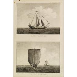
Bateau Japonais. Two prints on one sheet.
Engraving of 18th century Japanese boat drawn by Lt. Blondela. Done during the expedition of comte de Jean-Francois de Galaup La Perouse in the Pacific Ocean in 1785-1788...
Place & Date: Paris, 1812
Selling price: $100
Sold in 2023
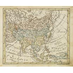
Asien.
Nice small map of Asia published by Johannes Walch in his rare Allgemeiner Atlas Nach den bewährsten Hülfsmitteln und astronomischen Ortsbestimungen…, edition of 1812...
Place & Date: Augsburg, 1812
Selling price: $80
Sold in 2018
Türkey.
Nice small map of Turkey, including Greece, Holy Land, Cyprus, Armenia, etc. by Johannes Walch in his rare Allgemeiner Atlas Nach den bewährsten Hülfsmitteln und astron...
Place & Date: Augsburg, 1812
Selling price: $120
Sold in 2012
Places Mentioned in the Old & New Testament with those remote from the Holy Land.
Map of the Mediterranean with places of the Old and New testament underlined. From "The Scripture atlas or a series of maps…"
Place & Date: London, 1812
Selling price: $12
Sold in 2018
Charte von China...
Unusual map of east Asia, from India to Japan, including parts of Russia, and Indonesia. With several notes in German. A very interesting and rare map!
Place & Date: Prague, 1812
Selling price: $70
Sold in 2014
Charte von China und den angränzenden Ländern und Völkerschaften so wie den letzten Kaiser Tschien-Long. . .
Uncommon map of China on a scale of ca. 1:6,000,000. The map's complete title is “Charte von China und den angränzenden Ländern, und Völkerschaften so wie sie dem le...
Place & Date: Prague, 1812
Selling price: $225
Sold in 2015
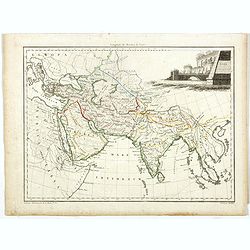
Asie Ancienne.
Map of ancient Asia with interesting detail on Arabia and India. From the "Atlas Complet du precis de la Geographie Universelle…". Maps from this atlas were a...
Place & Date: Paris, 1812
Selling price: $130
Sold in 2017
Océanique Occidentale.
Showing Indonesia, with good detail on the Philippines. Engraved by Chamouin and prepared by Giraldon. Nice title, cartouche with octopus sea creatures.From Conrad Malte-...
Place & Date: Paris, 1809/1812
Selling price: $100
Sold in 2018
Ostindien.
A scarce map of China, India, Japan, Indonesia, Borneo, Taiwan and many other countries. Published in "Allgemeiner Atlas" by Johann Walch (1757-1824). He was a ...
Place & Date: Augsburg, 1812
Selling price: $40
Sold in 2018
Asie Ancienne.
A striking map of ancient Asia, with interesting detail on Arabia and India. From the "Atlas Complet du precis de la Geographie Universelle…". Maps from this ...
Place & Date: Paris, 1812
Selling price: $15
Sold in 2020
Kaiserthum China.
A fascinating and unusual copper-engraved map of the Aral lake to Hainan Island shows parts of today's China, Russia, Mongolia, India, Nepal, Bhutan, Bangladesh, and Myan...
Place & Date: Vienna, 1813
Selling price: $100
Sold in 2010
Views of the coast of Kamchatka.
An original view in imperial folio size, originating from the original first edition (Russian & German) of Krusenstern's atlas to his voyage around the world: Atlas k...
Place & Date: St. Petersburg, 1813-1814
Selling price: $900
Sold in 2011
![[Middle East Map]](/uploads/cache/98780-250x250.jpg)














![Morokoshi Meisho Zue [Illustrated Description of Famous Sites of China].](/uploads/cache/00003-250x250.jpg)
![Morokoshi Meisho Zue [Illustrated Description of Famous Sites of China].](/uploads/cache/93014-250x250.jpg)


![[Map of Asia]](/uploads/cache/29686-250x250.jpg)


![[Lot of 2 manuscript maps] Schetskaart van het westelijk vaarwater naar de reede van Ternate. [together with ] Sketch of the island of Ternate, Tidore and to the Southward.](/uploads/cache/47989-250x250.jpg)


