Browse Listings in Asia
Carte de la Partie Superieure de L'Indie en de ca du Gange. . .
Rigobert Bonne (1727-1795), French cartographer. His maps are found in the 'Atlas Moderne' (1762), Raynal's 'Histoire Philos. du Commerce des Indes' (1774) and 'Atlas Enc...
Place & Date: Paris, 1780
Selling price: $45
Sold in 2020
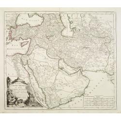
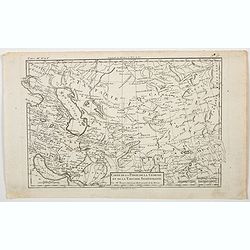
Carte de la Perse, de la Géorgie, et de la Tartarie. . .
A nice detailed map that shows Persia, Caspian Sea, Persian Gulf, etc. by the prolific French cartographer Rigobert Bonne (1727-1795), who, flourished between about 1760 ...
Place & Date: Paris, 1780
Selling price: $17
Sold in 2023
[2 maps] Carte de la partie Orientale des Philippines. / .. Occidentale ..
Two maps together forming a map of the Philippines, within upper left corner inset: Trombe Marine.Engraved by A.J. Gaitte and included in volume II of Le Gentil de la Gal...
Place & Date: Paris 1781
Selling price: $350
Sold
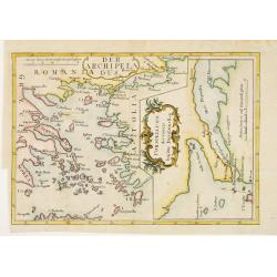
Der Archipelaagus. / Vorstellung des Canals bey den Dardanellen.
Very unusual map south eastern part of Greece and the west coast of Turkey. In right hand part a map of Strait Dardanelles.
Place & Date: Germany c.1781
Selling price: $120
Sold
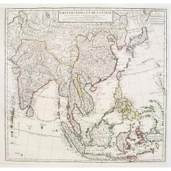
Carte des Indes et de la Chine..
A large and elegant map of the East Indes, India and China.
Place & Date: Paris 1781
Selling price: $300
Sold
Carte de ce qui appartient a L'Empereur de la Chine dans L'Isle de Formose faite par ordre de L'Empereur Kamhi
Important map of Taiwan extracted from Vol XVIII the 1781 edition of the Jesuit Lettres Edifiantes, illustrating the account of Formosa by the Jesuit Father de Mailla, fi...
Place & Date: Paris, 1781
Selling price: $680
Sold
Carte des Isles de PONGHOU suivant le point sur lequel on ete faites les Cartes de la China et de l Tartarie par l'Ordre et aux frais de L'Empereur.
Important map of the Ponghou or Pescadore Islands lying in the Straits of Taiwan and includes details of the environs of Fort Zeelandia on the south-western coast of Taiw...
Place & Date: Paris, 1781
Selling price: $200
Sold
L'Empiro dela China. . .
Attractive map of China with Korea and Taiwan (I.Tay-wan, ou Formosa). Decorative title cartouches in three corners. Uncommon Italian issue. The major towns and cities sh...
Place & Date: Venice, 1781
Selling price: $5900
Sold in 2008
L'Impero Della China.
Uncommon map of China from the Italian version of Bellin's Petit Atlas Maritime.
Place & Date: Venice, 1781
Selling price: $400
Sold in 2012
Orbis Romani Pars Orientalis. . .
Unusual map of Ancient Turkey, including a curiously shaped Cyprus, prepared by Nolin and published by L.J. Mondhare for his Atlas Général a l'usage des colleges et mai...
Place & Date: Paris, 1781
Selling price: $80
Sold in 2023
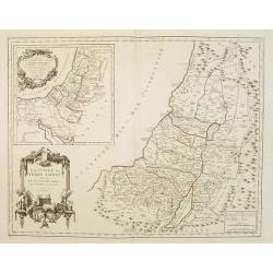
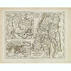
Camp des Israelites dans le désert. . . / La Judée ou Terre Sainte divisée en douze tribus. . . Carte des Voyages de St. Paul.
This antique map shows detailed the Holy Land, prepared by Nolin and published by L.J. Mondhare for his Atlas Général a l'usage des colleges et maisons d'education.. Lo...
Place & Date: Paris, 1781
Selling price: $80
Sold in 2013
L'Impero Della China.
The map is of interest for the use of Mare di Corea, the sea between Korea and Japan.Attractive and scarce map of China with Korea, Taiwan and Hainan from "Teatro De...
Place & Date: Venice, 1781
Selling price: $400
Sold in 2020
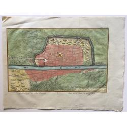
Grontekening der Stad Bagdad.
A rare town plan of Baghdad, Iraq, drawn and engraved by Caspar Jacobsz Philips (1732 – 1789.
Place & Date: Amsterdam, 1781
Selling price: $35
Sold in 2016
Carta Della Costa di Persia, Guzarat, E Malabar.
A copper engraving by Bellin on the order of Conte Di Maurepas, dated 1781. Published in the Italian edition of the atlas. This interesting map shows a tip of the Arabian...
Place & Date: Paris, 1781
Selling price: $23
Sold in 2018
L'Impero della China.
A rare map of China, from 'Teatro della Guerra', the Italian version of Bellin's French 'Petit Atlas Maritime.'
Place & Date: Venice, 1781
Selling price: $175
Sold in 2020
Carta dell' Isole Filippine . . .
Map of Philippines from the Italian edition of Abbè Presvost’s “Histoire Générale des Voyages”. The Histoire Géneral des Voyages was a monumental eighteenth cen...
Place & Date: Venice, ca. 1781
Selling price: $70
Sold in 2020
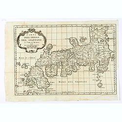
Carta dell' Impero Giappone . . .
Map of Japan from the Italian edition of Abbè Presvost’s “Histoire Générale des Voyages”. The Histoire Géneral des Voyages was a monumental eighteenth century g...
Place & Date: Venice, ca. 1781
Selling price: $70
Sold in 2020
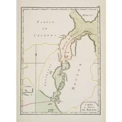
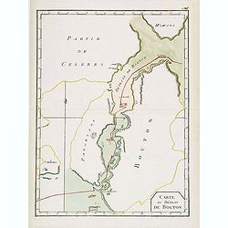
Carte du Détroit de Bouton.
Uncommon map of Celebes centered on the Island of Butung. It shows part of Wowoni Island as well as South East Sulawesi.Indicating a V.OC. Settlement on the island Bouton...
Place & Date: France 1782
Selling price: $50
Sold in 2009
A Map of the Empire of China.
Map showing China, Formosa, and Korea. The map is of interest for the use of East Sea, the sea between Korea and Japan, here called "Sea of Korea". Uncommon map...
Place & Date: London, 1782
Selling price: $152
Sold in 2011
A map of the Empire of China.
Map showing China, Formosa and Corea.The map is of interest for the use of East Sea, the sea between Korea and Japan, here called "Sea of Korea".Uncommon map en...
Place & Date: London, 1782
Selling price: $475
Sold in 2010
Carte du Détroit de Bouton.
Scarce map of Celebes centered on the Island of Butung. It shows part of Wowoni Island as well as South East Sulawesi.Indicating a V.OC. Settlement on the island Bouton.P...
Place & Date: France, 1782
Selling price: $100
Sold in 2021
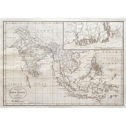
A new map of the East Indies,...
An unusual copper-engraved map of South-East Asia. Extends from Afghanistan to New Guinea and the Philippines, with India, the Gulf of Siam, Sri Lanka or Ceylon, Indonesi...
Place & Date: London, 1782
Selling price: $65
Sold in 2016
A View of the celebrated Great Wall of China which divides that Empire from Tartary...
A decorative copperplate print of festivities being held at the Great wall in China. The scene is framed within an ornately decorative border. Engraved for Millar's 'New ...
Place & Date: London, ca. 1782
Selling price: $25
Sold in 2021
Various Charts of Islands & c in the Atlantic & Pacific Oceans
A fine collage of maps featuring five groups of islands including the New Northern Archipelago (Aleutian Islands), Azores, Canary Islands, Madeira and Cape Verde.The char...
Place & Date: London, 1782
Selling price: $60
Sold in 2017
A Prospect of the Castle of Surat, a Great City of Indostan, Commonly called the Mogul Empire in India.
Striking Engraving of the Castle of Surat by John Goldar (1729-1795) for Millar's New Complete and Universal System of Geography dated 1782. The print has a very fancy bo...
Place & Date: London, 1782
Selling price: $95
Sold in 2017
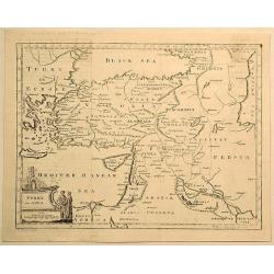
Turkey in Asia.
Original copperplate map by Thomas Jefferys in 1782, engraved by H. Gavin, and published in Thomas Salmon's “The New Universal Geographical Grammar”. Features figura...
Place & Date: London, 1782
Selling price: $6
Sold in 2019
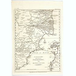
An Accurate Map of the Coast of Coromandel, from Fort St. David to Cape Comorin.
This is a finely engraved map of the south eastern Indian Coromandel coastal regions & the north west Sri Lankan coast through the Gulf of Manar. It was engraved by J...
Place & Date: London, 1782
Selling price: $17
Sold in 2021
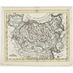
Carte Générale de l'Empire des Russes et de la Tartarie Universelle.
Rare map of Tartary and Russia, including Korea and Japan prepared after J.B.Nolin and published by Monhare for his Atlas Général a l'usage des colleges et maisons d'ed...
Place & Date: Paris, 1783
Selling price: $400
Sold in 2023
TERRAE SANCTAE TABULA e scripturae sacrae?
Map of the Holy Land on both sides of the Jordan, divided among the Tribes and according to the division into provinces at the Roman time. The shore line runs from Sidon ...
Place & Date: Paris 1771-1783
Selling price: $200
Sold
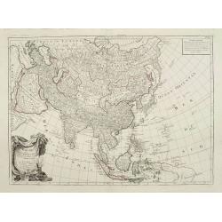
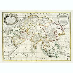
L'Asie divisée en ses principales régions..
Detailed map of Asia. After Sanson and Jaillot but updated by Brion de la Tour, in 1783. Louis Brion de la Tour was a military engineer and Geographer to the King.
Place & Date: Paris, 1783
Selling price: $450
Sold
Carte générale pour servir à l'Intelligence de l'Histoire Sainte..
Fine map of the Middle East, including the Holy Land, Cyprus, Iran and Irak, etc.Philippe Buache was one of the most active proponents of the so-called school of theoreti...
Place & Date: Paris 1783
Selling price: $60
Sold
Carte de l'Asie Divisée entre Ses principaux Etats ..
Rare map of Asia, dated 1780 prepared by de la Fosse and J.B.Nolin, published by Monhare for his Atlas Général a l'usage des colleges et maisons d'education.. Louis Jos...
Place & Date: Paris, 1783
Selling price: $200
Sold in 2009
L'Empire de la Chine Avec les Isles Du Japon et la Coree ..
Rare map of China, including Korea, Taiwan and southern part of Japan, prepared after J.B.Nolin and published by Monhare for his Atlas Général a l'usage des colleges et...
Place & Date: Paris, 1783
Selling price: $400
Sold
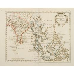
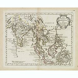
Les Indes Oriental et Leur Archipels Assujetties..
Rare map of India and South East Asia prepared after J.B.Nolin and published by Monhare for his Atlas Général a l'usage des colleges et maisons d'education.. Louis Jose...
Place & Date: Paris, 1783
Selling price: $330
Sold
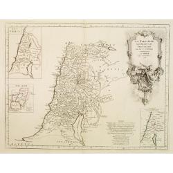
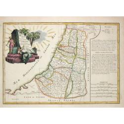
Carte des douzes Tribus d' Israel.
Jean Lattré, Paris-based engraver and publisher. Worked with Robert de Vaugondy, J. Janvier and R. Bonne. " Atlas Monderne', 1771, 1783 , 1793. Rigobert Bonne (1727...
Place & Date: Paris, 1783
Selling price: $260
Sold
Carte de la Turquie d'Asie..
Attractive map of the Near East centered on Turkey, ornated with a rococo title cartouche. A curious shape for Cyprus. Boundaries outlined in hand color.From theAtlas mod...
Place & Date: Paris ca 1783
Selling price: $135
Sold
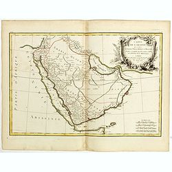
Carte de l'Arabie qui se divise en Arabie Petrée, Deserte et Heureuse..
Attractive map of the Arabian peninsula, ornated with a rococo title cartouche. Boundaries outlined in hand color.From theAtlas moderne ou collection de cartes sur toutes...
Place & Date: Paris, ca 1783
Selling price: $160
Sold in 2009
Indes. Iere. Feuille.
Attractive map of the northern part of India, extending northwards to Pakistan and Afghanistan. Including Bangladesh in the East. Boundaries outlined in hand color.From t...
Place & Date: Paris, ca 1783
Selling price: $150
Sold in 2010
Indes IVe. Feuille.
Attractive map of the East Indies, centered on Borneo. Boundaries outlined in hand color.From theAtlas moderne ou collection de cartes sur toutes les parties du globe ter...
Place & Date: Paris, ca 1783
Selling price: $220
Sold in 2012
L'Asie divisée en ses principaux Etats..
Attractive map of Asia, ornated with a sumptuous title cartouche. Boundaries outlined in hand color.Prepared by Le Sieur Janvier, Jean denis [Robert], French geographer a...
Place & Date: Paris, ca 1783
Selling price: $150
Sold
Carte des Regions et des Lieux dont il est parlé dans le Nouveau Testament..
A map of the near East at the time of Christ. Ornated with a decorative title cartouche. Boundaries outlined in hand color.Inset plan of Jerusalem in the bottom left corn...
Place & Date: Paris ca 1783
Selling price: $70
Sold
Camp des Israelites dans le désert à la sortie de l'Egipte . . . / La Judée ou Terre Sainte. . . / Carte des voyages de St. Paul.
Three maps on one sheet. The largest map showing Palestine north of the Death Sea, dived in 12 Tribes. The left a map of the travels of St. Paul and a detailed map of the...
Place & Date: Paris, 1783
Selling price: $400
Sold in 2008
Orbi Romani Pars Orientalis. . .
Unusual map of Ancient Turkey, including a curiously shaped Cyprus, prepared by J.B.Nolin and published by Monhare for his Atlas Général a l'usage des colleges et maiso...
Place & Date: Paris, 1783
Selling price: $180
Sold in 2009
L'Asie divisée en ses principaux Etats ...
Attractive map of Asia, ornated with a sumptuous title cartouche. Boundaries outlined in hand color.Prepared by Le Sieur Janvier, Jean Denis [Robert], French geographer a...
Place & Date: Paris, c.1783
Selling price: $50
Sold in 2011
Carte générale pour servir à l'Intelligence de l'Histoire Sainte..
Fine map of the Middle East, including the Holy Land, Cyprus, Iran and Iraq, etc.Philippe Buache was one of the most active proponents of the so-called school of theoreti...
Place & Date: Paris, 1783
Selling price: $200
Sold in 2010
L'Empire de la Chine.
Attractive map of China, Korea, and Japan by Lattre.
Place & Date: Paris, 1783
Selling price: $20
Sold in 2012
Carte générale de l'Empire des Russes et de la Tartarie universelle. . .
Scarce map of Russia prepared by Nolin and published by L.J. Mondhare for his Atlas Général a l'usage des colleges et maisons d'education.. Louis Joseph Mondhare was ac...
Place & Date: Paris, 1783
Selling price: $200
Sold in 2013
L'empire de la Chine avec les Isles du Japon. . .
Scarce map of China, including Korea, Taiwan and southern part of Japan, prepared by Nolin and published by L.J. Mondhare for his Atlas Général a l'usage des colleges e...
Place & Date: Paris, 1783
Selling price: $200
Sold in 2017
Les Indes oriental et leur archipel. . .
Scarce map of India and South East Asia, nice detail in the Philippines, prepared by Nolin and published by L.J. Mondhare for his Atlas Général a l'usage des colleges e...
Place & Date: Paris, 1783
Selling price: $360
Sold in 2015
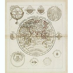
Hémisphère Oriental ou Ancien Monde.
Scarce map of the western hemisphere with Africa, Europe, Asia and Australia. The hemisphere is surrounded by the moon, sun, a sphere and celestial systems after Cassini....
Place & Date: Paris, 1783
Selling price: $150
Sold in 2013
The Doo=AB, from Allahabad to Kalpy. .
Detailed map of part of the rivers Ganges and Jumnah.From the English original edition published in London in 1783 by Brown under the title "Memoir of a Map of Hindu...
Place & Date: Londen, 1783
Selling price: $100
Sold in 2015
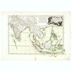
Les Indes Orientales et leur Archipel. . .
General map of Indonesia, extending from India to the Philippines and New Guinea.Ornated with a decorative title cartouche. Boundaries outlined in hand color.From theAtla...
Place & Date: Paris, ca 1783
Selling price: $135
Sold in 2016
The river Ganges from Patna to Surdah . . .
Detailed map of part of the rivers Ganges and Jumnah.From the English original edition published in London in 1783 by Brown under the title "Memoir of a Map of Hindu...
Place & Date: Londen, 1783
Selling price: $180
Sold in 2016
Les Indes Orientales et leur Archipel. . .
General map of Indonesia, extending from India to the Philippines and New Guinea.Ornated with a decorative title cartouche. Boundaries outlined in hand color.From theAtla...
Place & Date: Paris, ca 1783
Selling price: $220
Sold in 2017
[4 maps] Carte Hydro-Geo-Graphique des Indes Orientales en deça et au dela du Gange avec leur Archipel.. .
A 4 sheet map south and east Asia, from Afghanistan in the west, across to China in the east, from the southern tip of the Indian peninsular and Ceylon (Sri Lanka) across...
Place & Date: Paris, ca. 1783
Selling price: $225
Sold in 2016
Les Indes Orientales et leur Archipel. . .
General map of Indonesia, extending from India to the Philippines and New Guinea.Ornated with a decorative title cartouche. Boundaries outlined in hand color.From theAtla...
Place & Date: Paris, ca 1783
Selling price: $100
Sold in 2018
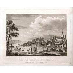
View of the Seraglio at Constantinople.
A rare engraved view after Metz, with people in the foreground and the city in the background. A ship and several small boats are on the river. This is the earliest state...
Place & Date: London, 1783
Selling price: $52
Sold in 2018
Present Asia.
Map of sea of Korea.
Place & Date: United States, 1783
Selling price: $110
Sold in 2018
Carte de l'Arabie qui se divise en Arabie Pétrée, Deserte et Heureuse . . .
Attractive map of Arabia, ornated with a decorative title cartouche. Boundaries outlined in hand color.Prepared by Le Sieur Janvier, Jean Denis [Robert], French geographe...
Place & Date: Paris, ca 1783
Selling price: $100
Sold in 2018
L'Empire de la chine . . .
Attractive map of China, ornated with a decorative title cartouche. Boundaries outlined in hand colorPrepared by Le Sieur Janvier, Jean Denis [Robert], French geographer ...
Place & Date: Paris, ca 1783
Selling price: $50
Sold in 2020
[Two maps] Carte de la Turquie d'Asie . . . Turquie d'Europe . . .
Attractive map of Turkey, ornated with a decorative title cartouche. Boundaries outlined in hand color.Prepared by Le Sieur Janvier, Jean Denis [Robert], French geographe...
Place & Date: Paris, ca 1783
Selling price: $25
Sold in 2019
[Two maps] Carte de la Tartarie Chinoise . . . Carte de la Tartarie indépendante. . .
Attractive map of Tartary, ornated with a decorative title cartouche. Boundaries outlined in hand color.Prepared by Le Sieur Janvier, Jean Denis [Robert], French geograph...
Place & Date: Paris, ca 1783
Selling price: $20
Sold in 2019
[Two maps] Terrae Sanctae Tabula. . .
Attractive map of the Holy Land, orated with a decorative title cartouche. Boundaries outlined in hand color.Prepared by Le Sieur Janvier, Jean Denis [Robert], French geo...
Place & Date: Paris, ca 1783
Selling price: $38
Sold in 2019
[4 maps] Carte Hydro-Geo-Graphique des Indes Orientales en deça et au dela du Gange avec leur Archipel.. .
A 4 sheet map south and east Asia, from Afghanistan in the west, across to China in the east, from the southern tip of the Indian peninsular and Ceylon (Sri Lanka) across...
Place & Date: Paris, ca. 1783
Selling price: $160
Sold in 2019
Les Indes Orientales et leur Archipel. . .
A good general map of Indonesia, extending from India to the Philippines and New Guinea.Decorated with a delightful title cartouche. Countries in hand color.From theAtlas...
Place & Date: Paris, ca 1783
Selling price: $95
Sold in 2020
Indes. Iere. Feuille.
An attractive map of the northern part of India, extending northwards to Pakistan and Afghanistan, and it includes Bangladesh in the East. Boundaries outlined in hand col...
Place & Date: Paris, ca 1783
Selling price: $55
Sold in 2020
L'EMPIRE DE LA CHINE d'apres l'Atlas Chinois avec les isles du Japon.
An attractive map of eastern part of China, including Taiwan, Korea and Japan. With ornamental title cartouche. Boundaries outlined in hand color. From the 'Atlas moderne...
Place & Date: Paris, 1783
Selling price: $60
Sold in 2021
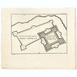
Plan du fort de Zelande à l'île Formose, les chinois appellent ce fort Nganping-tching, tiré par ordre de l'empereur de la Chine.
Plan of the Dutch fort Zeeland on Taiwan and it direct environs. From "Lettres Édifiantes et Curieuses. . Missionaires de la Compagnie de Jesus [Jesuit Letters]&quo...
Place & Date: Paris, 1780-1783
Selling price: $55
Sold in 2022
La Tartaria Chinese.
With decorative title cartouche. Covering north eastern part of China, Korea and Hokkaido (here called Jeso-Gasima ).
Place & Date: Venice, 1784
Selling price: $400
Sold in 2010
Impero della China colle Isole del Giappone
Large copper-engraved map by Zatta, published in the monumental "Atlante Novissimo" in Venice. Shows Japan, Korea and China with Formosa in much detail. Handsom...
Place & Date: Venice 1784
Selling price: $280
Sold
Asia Minor in suas partes seu provincias divisa.
Detailed map of Asia Minor and contiguous Islands and the Black Sea region, including Cyprus.With fine rococo title cartouche in the upper left corner.The map was prepare...
Place & Date: Venice, 1776 - 1784
Selling price: $250
Sold
L\'Asie divisée en ses principaux Etats..
Finely and crisply engraved map of Asia, decorated with an ornamental title cartouche in the lower left corner. Noteworthy topographical detail is shown. Shows New Guinea...
Place & Date: Venice, 1776 - 1784
Selling price: $550
Sold in 2009
Archipel des Indes Orientales, qui comprend les Isles de la Sonde, Moluques et Philippines, tirées des cartes du Neptune Oriental..
Finely and crisply engraved map of the Malay Archipelago, including the Philippines south to the northern coast of Australia. Decorated with an ornamental title cartouche...
Place & Date: Venice, 1776 - 1784
Selling price: $650
Sold
L'Empire Du Japon Divise En Sept Principales Parties..
Santini's Italian published edition of Giles Didier Robert De Vaugondy's map of Japan first appeared in 1778 in the "Atlas Universel".In 1784 Santini sold the p...
Place & Date: Venice, 1776 - 1784
Selling price: $600
Sold in 2008
La Palestine, les Tribus, et Jerusalem par le Sr. d'Anville.
Map of Palestine on both sides of the Jordan, the shore line running from Sidon to Rhinocorura (El-Harish).The Jordan river between teh Lake of Tiberias and the Dead Sea ...
Place & Date: Venice, 1776 - 1784
Selling price: $130
Sold in 2023
Etats du Grand-Seigneur en Asie, Empire de Perse, Pays des Usbecs, Arabie et Egypte.
Detailed map of the region bounded by the Black Sea, Georgia, the Caspian, Uzbekistan, The Indian Ocean, Saudi Arabia (here called "Arabie Heureuse"), Egypt and...
Place & Date: Venice, 1776 - 1784
Selling price: $400
Sold in 2008
La Judée ou Terre Sainte divisée en ses douze Tribus..
A finely engraved and uncommon map depicting the division of the Holy Land into twelve tribes. In upper left hand corner inset map of land of Canaan.Venetian edition of G...
Place & Date: Venice, 1776 - 1784
Selling price: $350
Sold in 2008
La Tartaria Chinese.
With decorative title cartouche. Covering north eastern part of China, Korea and Hokkaido (here called Jeso-Gasima ).
Place & Date: Venice, 1784
Selling price: $150
Sold in 2008
La Tartaria Chinese.
With decorative title cartouche. Covering north eastern part of China, Korea and Hokkaido (here called Jeso-Gasima, Tartary including the Gobi Desert, also Peking and the...
Place & Date: Venice, 1784
Selling price: $300
Sold in 2010
Impero delle china colle isole del Giappone. . .
Large copper-engraved map by Zatta, published in the monumental "Atlante Novissimo" in Venice. Shows Japan, Korea and China with Formosa in much detail. Handsom...
Place & Date: Venise, 1784
Selling price: $200
Sold in 2011

![[2 maps] Carte de la partie Orientale des Philippines. / .. Occidentale ..](/uploads/cache/17587-250x250.jpg)




















![[4 maps] Carte Hydro-Geo-Graphique des Indes Orientales en deça et au dela du Gange avec leur Archipel.. .](/uploads/cache/38416-250x250.jpg)



![[Two maps] Carte de la Turquie d'Asie . . . Turquie d'Europe . . .](/uploads/cache/42838-250x250.jpg)
![[Two maps] Carte de la Tartarie Chinoise . . . Carte de la Tartarie indépendante. . .](/uploads/cache/42839-250x250.jpg)
![[Two maps] Terrae Sanctae Tabula. . .](/uploads/cache/42840-250x250.jpg)
![[4 maps] Carte Hydro-Geo-Graphique des Indes Orientales en deça et au dela du Gange avec leur Archipel.. .](/uploads/cache/42474-250x250.jpg)


