Browse Listings in Asia
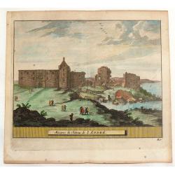
Mazures du Chateau de S. Andre.
Hand-colored copper engraved view of the ruins of the Castle of Saint Andrew, a former royal burgh on the east coast of Fife in Scotland, named after St. Andrew, the Apos...
Place & Date: Amsterdam, 1761
Selling price: $60
Sold in 2014
Vue de la superbe Entrée de l'Embassadeur de Siam a la Cour de Pekin.
So-called optical print illustrating a pompous parade to celebrate the arrival of the ambassador of Siam in Beijing.Mondhare was a well-known publisher of optical prints,...
Place & Date: Paris, 1761
Selling price: $600
Sold
Asie.
Map of Asia. With a curiously shaped Australia, and marked Partie du Continent inconnu.Left and right a box with geographical information for Asia.Prepared by Buy de Morn...
Place & Date: Paris 1762
Selling price: $60
Sold
L' Empire de Russie en Europe et en Asie.
Rigobert Bonne (1727-1795), French cartographer. His maps are found in a.o. Atlas Moderne (1762), Raynal's Histoire Philos. du Commerce des Indes (1774) and Atlas Encyclo...
Place & Date: Paris, 1762
Selling price: $90
Sold
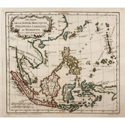
Les Isles de la Sonde, Moluques, Philippines, Carolines, et Mariannes.
Small detailed map of southeast Asia, showing the Malay Peninsula, Sumatra, Java and the island of Borneo.
Place & Date: Paris, 1762
Selling price: $110
Sold in 2010
Ueberstetzung der Algemeinen Welthistorie die in England durch eine geselschaft von Gelehrten ausgefertigt worden vol. 24
Part of an extensive work on general world history, this volume focusing on Siam, CochinChina, Tartary, and China including a large fold-out map of China based on D'Anvil...
Place & Date: Halle, 1762
Selling price: $250
Sold in 2011
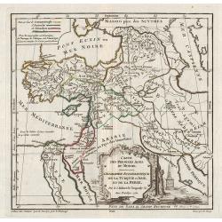
Carte des Premiers Ages du Monde. Géographie Ecclésiastique de la Turquie d'Asie, et de la Perse.
Historical map of Middle east. From Gilles Robert de Vaugondy's Nouvel Atlas Portatif.
Place & Date: Paris, 1762
Selling price: $40
Sold in 2011
L'Asie, divisee en ses principaux etats par le Sr. Janvier, Geographe.
Detailed map of Asia from Janvier's Atlas Moderne. Includes a decorative cartouche that incorporates an incense pot with a pile of treasure. Engraved map. Boundaries ou...
Place & Date: Paris, 1762
Selling price: $300
Sold in 2012
Nuova Carta del Europa Turchesca.
Nice Italian version of Tirion's detailed map of the Black Sea, Balkans, Cyprus and Asia Minor including Turkey. Includes a block cartouche. Published by Albrizzi. Giamb...
Place & Date: venice, 1740-1762
Selling price: $101
Sold in 2015
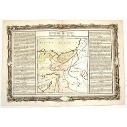
Royaume de Pont - Depuis L'An 3689 Jusqu'a L'an 3855.
Fine copper engraved map of a portion of the ancient Holy Land. It is decorated with a floral frame that interestingly, was printed separately from the map. It is from &q...
Place & Date: Paris, 1762
Selling price: $20
Sold in 2015
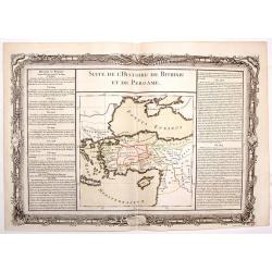
Suite de L'Histoire de Bithinie et de Pergame.
Striking map of the ancient Holy Land featuring the territory between Macedonia and Armenia north of the Mediterranean Sea. The text in the sides of the map describe the ...
Place & Date: Paris, 1762
Selling price: $17
Sold in 2015
Carte d'Asie..
Detailed map of Asia with inset map of Siberia and the east coast of America. The map is of interest for the use of East Sea, the sea between Korea and Japan, here called...
Place & Date: Paris, 1762
Selling price: $750
Sold in 2014
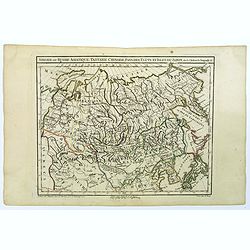
Siberie ou Russie Asiatique, Tartarie Chinoise, pays des Eluts et Isles du Japon.
A detailed map of Siberia and Chinese Tartary. Map includes Corea and Japan to the east. Gilles Robert de Vaugondy (1688–1766), also known as Le Sieur or Monsieur Rober...
Place & Date: Paris, c 1762
Selling price: $65
Sold in 2021
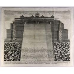
The Prospect of Ye East Side of the Temple.
A fine copper engraved religious print from a Bible in 1762. It features the east side view of the Temple of Solomon. “And the word of the Lord came to Solomon saying ...
Place & Date: London, 1762
Selling price: $11
Sold in 2019
The Prospect of the North Side of the Temple.
A fine copper engraved religious print from a Bible in 1762. It features the north side view of the temple of Solomon. Each of the different levels of the temple are lab...
Place & Date: London, 1762
Selling price: $32
Sold in 2019
These are the Things Wherin Solomon Was Instructed for the Building of the House of God, II Chronicles, Chapter III, Verse 3.
A fine copper-engraved religious print from a Bible in 1762. It features pictures of all sides of the temple with labels and explanations in the key at the center.
Place & Date: London, 1762
Selling price: $23
Sold in 2018
Plan der Stadt und Festung Madrass in Ost-Indien.
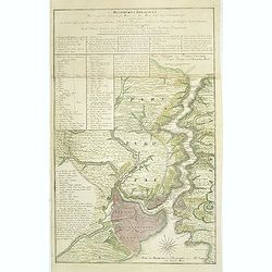
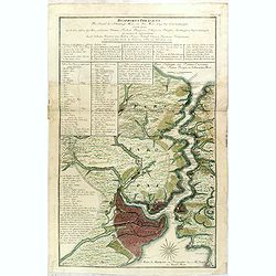
Scarce plan of Madras, taken from a collection of battle and siege plans that relate to the 'Seven Years War'. This detailed plan shows off the British Fortress of Madras...
Place & Date: Nuremberg, ca 1762
Selling price: $50
Sold in 2018
L'EMPIRE DE LA CHINE d'après l'Atlas Chinois avec les Isles du Japon.
A detailed map of China, Korea and the Islands of Japan, showing the Provinces, towns, mountains, rivers, lakes, islands, published in Paris by Jean Lattre. The map is dr...
Place & Date: Paris, 1762
Selling price: $135
Sold in 2019
Les Indies Orientales au-dela Gange. . .
A nice map of Indo-China, taking in Burma, Thailand, Laos, Vietnam, Malaysia, Sumatra and Singapore. With good map detail, covering rivers, mountains, small islands, and ...
Place & Date: Paris, 1762
Selling price: $85
Sold in 2020
L'Empire de La Chine pour servir a L'Histoire Generale des Voyages..
Detailed colored map of China and Korea in the Northeast with the Chinese Sea.The map is high accurate and naming many cities, lakes, rivers and mountains. Major towns ar...
Place & Date: Amsterdam 1763
Selling price: $90
Sold
L' Isle Formose et parties des Costes de la Chine. . .
This well-known map of Taiwan is prepared by Jacques Nicolas Bellin and was based on Jesuit information. The text along the island's east-coast claims: Of this coast litt...
Place & Date: Paris, 1763
Selling price: $1100
Sold in 2014
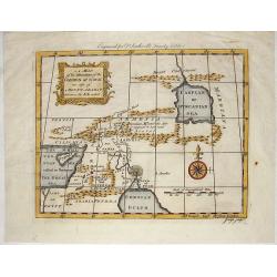
A Map of the Situation of the Garden of Eden as Also of Mouth Ararat.
This interesting map shows Gordion Mountains where the ark is supposed to have rested. It was engraved by J. Flyn for Dr. Southwell's Family Bible.
Place & Date: London, 1763
Selling price: $125
Sold in 2014
A Map of the Land of Canaan and Parts Adjacent.
"At the time of Abraham's coming to sojourn the rein, showing the several people & places mentioned in the history of the Patriarchs".Engraved by G. Rollos ...
Place & Date: London, 1763
Selling price: $125
Sold in 2014
Histoire universelle depuis le commmencement du monde jusqu'a present. . . Tome Vingtieme. Contenant [...] l'histoire [...] la Chine [...] la Corée [...] du Japon [...] & des [...] Indes Orientales
Volume 20 of this informative publication with a description of China and Korea and the discoveries, conquests, and settlements by the Portuguese, Spaniards, English, and...
Place & Date: Amsterdam, Leipzig, 1763
Selling price: $1500
Sold in 2014
Carte de L'Isle Formose aux Costes de la Chine.
This well-known map of Taiwan is based on Jesuit information. One of the first maps to give the name Taiwan to island of Formosa. The mountains in the center have the lar...
Place & Date: Paris, 1763
Selling price: $700
Sold in 2021
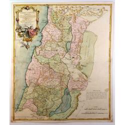
Terrae Sanctae Tabula e Scripturae Sacrae, Flavii Josephi ....
A large, striking example of De L'Isle's 1762 decorative map of the Holy Land, including Israel and Palestine. Printed in two sheets, it covers the region from Gaza and t...
Place & Date: Paris, 1763
Selling price: $170
Sold in 2015
Russia in Asia.
Uncommon miniature map of Siberia, Kamchatka and Hokkaido. The map is of interest for the use of "Little East Sea" for the sea between Japan and Korea.Engraved ...
Place & Date: London, 1761-1763
Selling price: $60
Sold
Kaart van't Eiland Cheu-chan of Chusan. . .
A detailed map of Zhoushan Island & Zhajiang China (The coastal area east of Ningbo in the Chinese province of Chekiang, located across the bay from Shanghai). The or...
Place & Date: Paris, 1763
Selling price: $37
Sold in 2021
[63] Alexandrette.
"Charming chart of the harbour of the town of Alexandretta in Syria. Showing town and harbour plan, with soundings, anchorages, rocks, shoals, fortifications and lig...
Place & Date: Marseille 1764
Selling price: $40
Sold
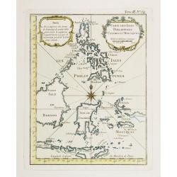
Carte Des Isles Philippines Celebes et Moluques.
Attractive map of the region showing the islands of the Philippines, Suluwesi, the Moloccus, Timor, Flores, Bali, and parts of Borneo and Java. There is no interior detai...
Place & Date: Paris 1764
Selling price: $80
Sold
Carte Générale de la Syrie / Palestine / Isle de Chypre..
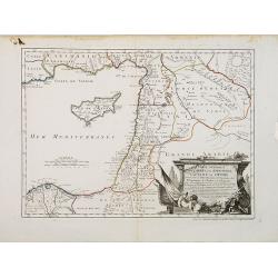
A very fine map of Syria, Palestine, and the island of Cyprus with part of the surrounding countries, prepared for the understanding of the history of the Crusades by Gui...
Place & Date: Paris/ Bordeaux 1764
Selling price: $900
Sold
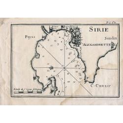
Sirie
Sea chart of Iskenderun in southern Turkey, close to the border to Syria. Published in Roux's influental work "Recueil des principaux plans des ports et rades de la ...
Place & Date: Paris, 1764
Selling price: $35
Sold in 2010
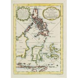
Carte Des Isles Philippines Celebes et Moluques.
Attractive map of the region showing the islands of the Philippines, Sulawesi, the Moluccas, Timor, Flores, Bali, and parts of Borneo and Java. There is no interior detai...
Place & Date: Paris, 1764
Selling price: $80
Sold in 2009
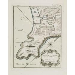
Plan de la ville et château de Gallipoli.
Nice detailed map of the Gallipoli peninsula located in Turkish Thrace (or East Thrace), in the European part of Turkey.The only issue of this version of Bellin's map, sl...
Place & Date: Paris, 1764
Selling price: $40
Sold in 2014
Carte Générale de la Syrie / Palestine / Isle de Chypre. . .
A very fine map of Syria, Palestine, and the island of Cyprus with part of the surrounding countries, prepared for the understanding of the history of the Crusades by Gui...
Place & Date: Paris, ca. 1764
Selling price: $450
Sold
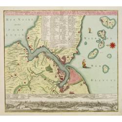
Bosphorvs Thracicvs : der Kanal des Schwartzen Meers oder die Meer-Enge bey Constantinopel sambt denen an beiden ufern desselben gelegenen Stätten, Flecken, Dörffern, Schlössern, Palaesten, Lusthäusern, Wasserleitungen. . .
Rare and detailed map of the Bosporus, shows names of villages, towns, drainage, vegetation, and other points of interest. In top text columns.
Place & Date: Nuremberg, 1764
Selling price: $1550
Sold in 2011
A New and Accurate Map of China, Drawn From Surveys Made by the Jesuit Missionaries. . .
Uncommon map by Kitchin, which appeared in "A Complete Collection of Voyages and Travels" by John Harris, printed for T. Osborne. The map closely resembles Thom...
Place & Date: London, 1764
Selling price: $115
Sold in 2012
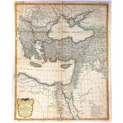
Asiae, quae vulgo Minor Dicitur, et Syriae...
Fantastic large copper engraved map, shows (parts of): Turkey, Black Sea, Mediterranean Sea, Aegean Sea and Greek islands, Crete, Cyprus, part of Armenia, Lebanon, and Sy...
Place & Date: Paris, 1764
Selling price: $60
Sold in 2012
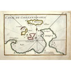
Canal de Constantinople.
A quaint little map featuring the Canal of Constantinople in Turkey. It was engraved by J. Roux in France in 1764.
Place & Date: Paris, 1764
Selling price: $33
Sold in 2014
Bosphorvs Thracicvs : der Kanal des Schwartzen Meers oder die Meer-Enge bey Constantinopel sambt denen an beiden ufern desselben gelegenen Stätten, Flecken, Dörffern, Schlössern, Palaesten, Lusthäusern, Wasserleitungen. . .
Rare and detailed map of the Bosporus, shows names of villages, towns, drainage, vegetation, and other points of interest. In top text columns.
Place & Date: Nuremberg, 1764
Selling price: $1500
Sold in 2015
Orbis Romani Pars Orientalis Auspiciis Serenissimi Principis....
Large format map of the Eastern part of the Roman Empire, published by D'Anville. The map extends from Greece and the Balkans in the west to Iran in the east, and is cent...
Place & Date: Paris, 1764
Selling price: $60
Sold in 2016
Carte de la Baye d'Hocsieu et des Entrees de la Riviere de Chang Situes dans la Province de Fokyen...
A striking antique map of the mouth of the Yangtze River China by the French cartographer, Nicolas Bellin. Published in Antoine-François Prevost's “ L`Histoire General...
Place & Date: Paris, 1764
Selling price: $40
Sold in 2019
Plan de la Ville de Pondicheri.
A pretty small plan of the south eastern Indian city of Pondicherry. Over the centuries it has been ruled by the French (mostly), the Dutch and the English (occasionally)...
Place & Date: Paris, 1764
Selling price: $60
Sold in 2018
Carte du Golphe de Bengale.
An uncolored example of the Gulf on Bengal from Bellin's "Le Petit Atlas Maritime". Showing the island of Ceylon (Sri Lanka), the east coast of India, across in...
Place & Date: Paris, 1764
Selling price: $50
Sold in 2017
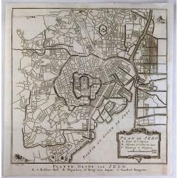
Plan de Jedo.
An antique city plan of the city and port of Tokyo, Japan built for the Dutch (VOC - Dutch East India Company) concession, on the Japanese island of Kyushu. Published by ...
Place & Date: Paris, 1764
Selling price: $165
Sold in 2020
Vue de Peking tiree de Nieuhof.
This handsome view shows Beijing from the countryside, showing the city rising above its massive ancient walls. When Nieuhof visited Peking in the 1650s, the city was the...
Place & Date: Paris, 1764
Selling price: $50
Sold in 2019
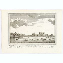
Vue du Chateau de Batavia.
A nice view of Batavia (now Jakarta in Indonesia) then under the control of the Dutch VOC. Many vessels are seen off the harbor, beneath the print is a lettered legend (A...
Place & Date: Paris, ca 1764
Selling price: $65
Sold in 2020
[Lot of 12 maps] INDIA maps+gravures - Carte De La Baye De Trinquemale Dans L’Isle De Ceylon
[Lot of 12] INDIA maps + gravure - Carte De La Baye De Trinquemale Dans L’Isle De Ceylon.- Platte Grond van t'Fort Tricoen male met de daar aangelegen Pagoods-Berg...
Place & Date: 1764
Selling price: $180
Sold in 2023
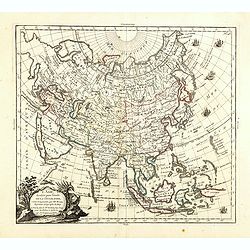
L'Asie, dressée pour l'étude de la Géographie . . .
Highly decorative map of Asia embellished with a landscape style title cartouche and several sailing ships.The map is of interest for the use of Mer de Corée, the sea be...
Place & Date: Paris, 1765
Selling price: $600
Sold in 2023
Carte du Canal des Iles Philippines Par lequel passe le Galion de Manille, et les Iles voisines de ce Canal.
A map of the Philippines from a Dutch edition of Anson's Voyage around the World.
Place & Date: Amsterdam, 1765
Selling price: $450
Sold in 2016
Asiae Quae Vulgo Minor Dicatur et Siriae.
Fine map of ancient Turkey featuring the Black Sea, Mediterannean Sea,and Aegean Sea and the islands of Cyprus and Crete. Also includes inserts of Troy & Bosphorus. ...
Place & Date: Paris, 1765
Selling price: $61
Sold in 2016
Ad antiquam Indiae geographiam tabula.
A map showing India with an inset in the lower part entitled Ptolemaicae Tabulae showing the island of Sri Lanka.
Place & Date: Paris, 1765
Selling price: $30
Sold in 2011
PLAN DE LA VILLE ET DU PORT DE MACAO
Bellin\'s important and interesting map of the bay and city of Macau. Macau was the first and the last European colony in China. It was under Portuguese control from the ...
Place & Date: Paris, ca. 1765
Selling price: $110
Sold in 2008
Plan de la ville et du port de Macao.
Bellin's important and interesting map of the bay and city of Macau. Macau was the first and the last European colony in China. It was under Portuguese control from the 1...
Place & Date: Paris, ca. 1765
Selling price: $160
Sold in 2010
Carte du Canal des Iles Philippines Par lequel passe le Galion de Manille, et les Iles voisines de ce Canal / Kaart van het Kanaal in de Filippynsche Eilanden . . .
Important chart of the Islands of the Philippines. Shows islands, bays, reefs, soundings tracks of the Manila Galleon route, etc. Includes a large compass rose and rhumb ...
Place & Date: Paris, 1765
Selling price: $750
Sold in 2016
Les Indies Orientales pour la Concorde de la Geographie. . .
A nice small map of India and South East Asia, from the "Concorde de la Geographie des Differens Ages" by Freres Estienne.
Place & Date: Paris, 1765
Selling price: $55
Sold in 2020
L' Asie.
Louis Brion de la Tour (1756-1823), "Atlas Géneral, Civil et Ecclésiastique", 1766, " Atlas Général", 1790-98. Louis Charles Desnos (fl.1750-70), ...
Place & Date: Paris, 1766
Selling price: $175
Sold in 2010
Grande Tartarie et Isles du Japon.
Louis Brion de la Tour (1756-1823), 'Atlas Géneral, Civil et Ecclésiastique', 1766, 'Atlas Général', 1790-98. Louis Charles Desnos (fl.1750-70), Le Rouge's 'Atlas Nou...
Place & Date: Paris, 1766
Selling price: $200
Sold
Grande Tartarie et Isles du Japon.
Text on both sides. Curious shape for Japan, but Ieso as an island and on the position of Hokaido.Curious shape for Korea.
Place & Date: Paris 1766
Selling price: $90
Sold in 2009
A particular plan of Acheen road with the islands adjacent. . .
Uncommon English of part of the most northern part of Sumatra, with the ancient Sultanate of Acheen.William Herbert (1718-1795), was born 29 Nov. 1718, and was educated ...
Place & Date: London, 1767
Selling price: $150
Sold in 2011
The straits of Banca. . .
Uncommon English with the Straits of Banca in northern part of Sumatra, with inset map in top right corner.William Herbert (1718-1795), was born 29 Nov. 1718, and was ed...
Place & Date: London, 1767
Selling price: $150
Sold in 2011
L' Empire Des Turcs.
A highly detailed map of the Arabian Peninsula and the Eastern Mediterranean Sea.
Place & Date: Paris, 1767
Selling price: $80
Sold in 2020
Villes de la Province de Chensi. Steden van't Landschap Shensi of Shansi.
Interesting set of two local town plans of "Si-Ngan-Fu: Capitale, Hoofdstad." and "Tchang Lan, Ou Tchouang Lan.", both cities in the province of Shanx...
Place & Date: The Hague, Pieter de Hondt, 1747-1767
Selling price: $3
Sold in 2022
Tchin-Ywen-Fou (...). Chin-Ywen-Fu, (...), in't Landschap Quey-Chew, of Koei-Tcheou.
Interesting set of three local town plans each with extensive titles : "Lan-Tcheou ou Lan-Chew Dans la Province Chensi (…). Lan-Chew, of Lan-Tcheou, in't Landschap...
Place & Date: The Hague, Pieter de Hondt, 1747-1767
Selling price: $25
Sold in 2022
La Palestine.
This is an authentic Antique Map of Palestine by Jean Baptiste d’Anville. The map was published out of Paris in 1767.This informative map shows the area of Palestine an...
Place & Date: Paris, 1767
Selling price: $85
Sold in 2015
Neue Karte Von De, Konigreiche Bengala.
A fine Jacques Bellin map of the Nyanmar region of India, featuring the Bay of Bengal.
Place & Date: Paris, 1767
Selling price: $100
Sold in 2017
Mappa Geogr. JMP: Chinensis Eller Geogr:Charta ofwer China.
Uncommon Swedish map of China by Andrew Akerman (1721-1778), taken from his successful "Atlas Juvenilis eller Geographiska Chartor till ungdomens tienst i methodisk ...
Place & Date: Uppsala, 1768
Selling price: $60
Sold in 2011
Empire de la Chine.
Small detailed map showing the eastern part of China as well as Korea. Including Taiwan and Hainan. Dated 1769.From Atlas Portatif Universel, by Robert de Vaugondy.Page 7...
Place & Date: Paris, later than 1769
Selling price: $200
Sold in 2008
Isles Philippines et Moluques.
Small detailed map showing the Philippines and part of Indonesia. From Atlas Portatif Universel, by Robert de Vaugondy.Page 73 outside border top right. Mary Sponberg Ped...
Place & Date: Paris, later than 1769
Selling price: $400
Sold in 2015
Empire de la Chine.
An attractive small detailed map showing the eastern part of China as well as Korea. Including Taiwan and Hainan. Dated 1769 in the cartouche.From ‘Atlas Portatif Unive...
Place & Date: Paris, 1769
Selling price: $200
Sold in 2016
Theatre de la Guerre dans l'Inde sur la Cote de Coromandel Par M.B.C.T.
VERY RARE MAP of southern part of India, running from Madras to Cape Comorin, interestingly a part is marked in red manuscript Etats de Ayder Aly Kan and colored in pink ...
Place & Date: France, 1770
Selling price: $800
Sold
Carte de la Partie Superieure de l' Inde en deça du Gange.
Rigobert Bonne (1727-1795), French cartographer. His maps are found in a.o. Atlas Moderne (1762), Raynal's Histoire Philos. du Commerce des Indes (1774) and Atlas Encyclo...
Place & Date: Paris, c. 1770
Selling price: $60
Sold
Nieuwe Kaart van 'T Rijk van Persien.
Isaac Tirion's map of the Persian Empire. Isaac Tirion (d. 1769) Amsterdam publisher. His ' Nieuwe en beknopte handatlas' saw 6 editions between before 1740 and after 178...
Place & Date: Amsterdam, c. 1770
Selling price: $60
Sold in 2019
Opulentissimum Sinarum Imperium.
Detailed map of China. Korea, Taiwan and southern tip of Japan.T.C.Lotter married M.Seutter's daughter in 1740 and succeeded him in 1756. Lotter used the copperplate of S...
Place & Date: Augsburg, 1770
Selling price: $1800
Sold
Ceylon olim Taprobana?Maris Indici Insula?
T.C. Lotter married M. Seutter's daughter in 1740 and succeeded him in 1756. Lotter used the copperplate of Seutter, he only changed the name.
Place & Date: Augsbourg, 1770
Selling price: $525
Sold
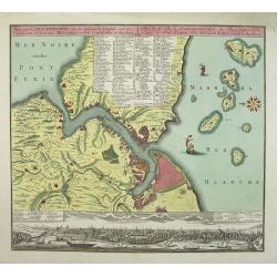
Plan von Constantinopel..
Constantinople and environs with panorama of the city beneath (uncolored), engraved plan of the town with a extensive key of 75 to the most important buildings of the tow...
Place & Date: Augsburg 1770
Selling price: $1700
Sold
Prospect der Stadt Masulipatam in Ost=Indien.
A rare view of the town of Masulipatam in India. Many locals and elephants in the foreground.
Place & Date: Nurnberg 1770
Selling price: $100
Sold
[2 maps] Carte des Nouvelles découvertes.. / Extrait d'une Carte Japonaise de l'Univers..
Two maps on one sheet. In both maps there are texts a.o. by Kaempfer who refers to voyages made by Japanese seafarers in that region. The map is from Diderot's Encycloped...
Place & Date: Paris, 1770
Selling price: $80
Sold
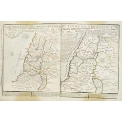
Descriptio Acurata Terrae Promissae Per Sortes XII.. & Terre Sainte Moderne.
2 maps on 1 sheet. To the left a very attractive map of Palestine divided among the 12 Tribes on both sides of the Jordan, after Philippe de La Rue. At the right hand sid...
Place & Date: Paris, 1770
Selling price: $150
Sold in 2013
Plan von Constantinopel, mit der umliegenden Gegend, und des Canals vom Schwarzen Meer.
Engraved plan of Constantinople and environs with a extensive key to 75 of the most important buildings in town.A decorative handcolored map of Constantinople, Bosporus, ...
Place & Date: Augsburg, 1770
Selling price: $1100
Sold in 2009









![Histoire universelle depuis le commmencement du monde jusqu'a present. . . Tome Vingtieme. Contenant [...] l'histoire [...] la Chine [...] la Corée [...] du Japon [...] & des [...] Indes Orientales](/uploads/cache/35153-250x250.jpg)



![[63] Alexandrette.](/uploads/cache/12835-250x250.jpg)






![[Lot of 12 maps] INDIA maps+gravures - Carte De La Baye De Trinquemale Dans L’Isle De Ceylon](/uploads/cache/4100003-250x250.jpg)










![[2 maps] Carte des Nouvelles découvertes.. / Extrait d'une Carte Japonaise de l'Univers..](/uploads/cache/23658-250x250.jpg)
