Browse Listings in Asia
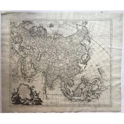
Carte d'Asie. . .
This is an updated re-issue of de L'Isle's map of 1723. An inset shows the northeastern tip of the continent which has been altered significantly from the earlier version...
Place & Date: Amsterdam, 1757
Selling price: $180
Sold in 2011
Les Indes Orientales, ou sount distingues les Empires et Royaumes..
Interesting regional map extending from India, the Ganges and the Maldives Islands to Hai-nan, Cochin china, Malacca and Sumatra. Includes islands, towns, mountains, rive...
Place & Date: Paris, 1757
Selling price: $170
Sold in 2011
Carte Réduite de l'Océan Oriental ou Mer des Indes.
A of the Indian Ocean, with its islands and adjacent coasts in detail. The chart stretches from the Congo coast, around Africa, Arabia, India and South East Asia, includ...
Place & Date: Paris, 1757
Selling price: $850
Sold in 2011
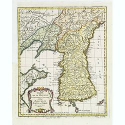
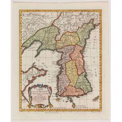
Carte de la province de Quan-tong, ou Lyau-tong et du Royaume de Kau-li. . .
Map of Korea. The map is of interest for the use of East Sea, the sea between Korea and Japan, here called "Mer de Corée.Decorative title cartouche in lower left co...
Place & Date: Paris, 1757
Selling price: $750
Sold in 2013
Carte d\'Asie. . .
This is an updated re-issue of de L'Isle's map of 1723. An inset shows the northeastern tip of the continent which has been altered significantly from the earlier version...
Place & Date: Amsterdam, 1757
Selling price: $230
Sold in 2014
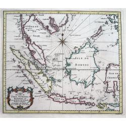
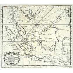
Carte Des Isles De Java, Sumatra, Borneo &c Les Detroits de la Sonde Malaca et Banca Golphe De Siam...
Detailed map of Southeast Asia, with the Gulf of Siam, Cambodia, Brunei, Mindoro in the Philippines, Lombok, Bali, Java and Sumatra, Borneo and the Malay Peninsula.A deco...
Place & Date: Paris, 1757
Selling price: $180
Sold in 2016
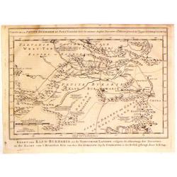
Kaart van Klyn-Bukharia, en de Nabuurige Landen.
Interesting map of Klyn-Bukharia and Nabuurige Countries, which includes Central Asia and the current countries of Kazakstan, Turkmenistan, Uzbekistan, Tajikistan, and Ky...
Place & Date: The Hague, 1757
Selling price: $25
Sold in 2017
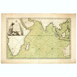
Jacques Nicolas Bellin: Carte Reduite De L'Ocean Oriental ou Mer Des Indes Seconde Edition Pour Servir aux Vaisseau du Roy . . . Par order de M. De. Machault . . . MDCC LVII
This map is a second state of Bellin's map of the Indian Ocean and is significantly revised from the first edition of 1740. Significant revisions are shown in Australia a...
Place & Date: Paris, 1757
Selling price: $1300
Sold in 2018
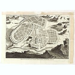
Novus conspectus veteris Ierusalem ex autoris mentes.
Copper engraving with bird’s eye view of ancient Jerusalem. Royal palace, gardens and Solomon’s grave are well-highlighted. Verso is blank.
Place & Date: Amsterdam, 1757
Selling price: $20
Sold in 2019
Eauweck Capitale de Camboye.
A highly detailed 1757 Bellin copper engraved panoramic view of the city of Lawec, Cambodia situated halfway along the Mekong River on the way to Phnom Penh. A new Lawec ...
Place & Date: Paris, 1757
Selling price: $99
Sold in 2019
Carte du Chemin Entre Samarang et Cartasoera.
A highly detailed 1757 Bellin map depicting the Road between Semarang and Kartasuro in Java, Indonesia. Semarang is the capital and largest city of Central Java province ...
Place & Date: Paris, 1757
Selling price: $24
Sold in 2019
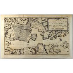
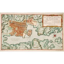
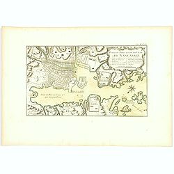
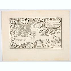
Plan de la Ville et du Port de Nangasaki.
A fine copper engraved map featuring a 'birds-eye' view of Nagasaki, Japan. The map is oriented to the southwest with a bold compass rose. The map locates the principal p...
Place & Date: Paris, 1757
Selling price: $45
Sold in 2019
Carte de la province de Quan-tong, ou Lyau-tong et du Royaume de Kau-li. . .
Map of Korea. The map is of interest for the use of East Sea, the sea between Korea and Japan, here called "Mer de Corée".Decorative title cartouche in lower l...
Place & Date: Paris, 1757
Selling price: $350
Sold in 2021
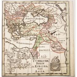
TURKISCHE REICH in EUROPA und ASIA.
A rare copper engraved map of the Ottoman Empire in Europe and Asia. Contains in a lower quadrant the coats of arms of the Empire, and a genealogical tree of the rulers ,...
Place & Date: Berlin, ca 1757
Selling price: $43
Sold in 2021
Carte des Isles Maldives.
A small detailed map of the Maldives, with rhumb lines and a large compass rose. Includes a decorative title cartouche. One of the maps produced by Nichlas Bellin for Pre...
Place & Date: Paris, 1757
Selling price: $13
Sold in 2021
Carte de l'Isle de Sumatra Dréssée sur les Journaux des Navigateurs...
Map of Sumatra, also showing the tip of the Malay Peninsula and the Straits of Singapore. An unusually detailed map of the area, showing many coastal features, shoals, ba...
Place & Date: Paris, 1758
Selling price: $140
Sold in 2008
Karte von dem Morgenlaendischen Ocean oder dem Indischen Meere. Zur allgemeinen Historie der Reisebeschreibungen entworfen. . . .
Copper engraving, decorative handcolored in wash and outline. A fine and detailed larger map of the Indian Ocean from Africa towards Southeast Asia and New Holland (Austr...
Place & Date: Leipzig, Merkur, 1758
Selling price: $100
Sold in 2013
Mogol.
This fine little map shows Northern India and Pakistan including Kabul, Delhi & Gulf of Bengal.
Place & Date: Paris, 1758
Selling price: $109
Sold in 2017
Kaart van den Oostersen Oceaan, of Indiese Zee......
Intriguing map of the Indian Ocean, with partial outlines of Australia, South East Asia, India, Arabia and Eastern Africa and Madagascar. With title in French (and Dutch ...
Place & Date: Amsterdam, ca 1758
Selling price: $500
Sold in 2016
El Asia con toda la Extension de susReinos y Provincias Segun las ultimas y nuevas Observationes
A rare Spanish map of Asia. Translation of the title is - "Asia to the full extent of their Kingdoms and Provinces According to the latest and new Observations."...
Place & Date: Madrid, ca. 1758
Selling price: $1200
Sold in 2016
Carte des Costes de Perse Gusarat et Malabar. . .
Detailed copper engraved map of the Persian Gulf and western India, from Perse (Persia), and Grand Mogol in the north, down to the southern tip of India, including the Ma...
Place & Date: Paris, ca. 1758
Selling price: $40
Sold in 2018
Carte des Costes de Perse, Gusarat et Malabar.
A detailed copper engraved map of the Persian Gulf and western India, from Perse (Persia), and Grand Mogol in the north, down to the southern tip of India, including the ...
Place & Date: Paris, 1758
Selling price: $17
Sold in 2017
Carte de la Tartarie Occidentale Pour Servir a L'Histoire Generale des Voyages Tiree des Auteurs Anglois.
A map of Western Tartary, covering present-day Northern China and Mongolia. The site of Genghis Khan's ancient Mongol capital of Karakum (Karakorum) is centrally marked o...
Place & Date: Paris, 1758
Selling price: $37
Sold in 2019
Vue de Goa.
Fine plan of Goa. Goa was made as capital of the Portuguese Vice-Kingdom in Asia, and the other Portuguese possessions in India.
Place & Date: Paris, 1758
Selling price: $50
Sold in 2022
Vue de la Maison de Ville á Batavia / Vue de la Batterie Anjol / Vue du Fort Noortwyck en venant de Ryswyck / Vue du Fort noortwyck en venant de Jacatra / Vue de Poste Ryswyck / Vue du Fort Tangeran.
Jan van Schley is the engraver of the maps (by J.N. Bellin) and views in the Dutch edition of A.F. Prévost d\' Exile\'s \'Histoire Géneral des Voyages.A set of 6 engrav...
Place & Date: Amsterdam, 1759
Selling price: $350
Sold
Carte de la Baye de Chin-Chew. Avec les Isles de Emowi et de Quemowi.
Jaques Nicolas Bellin (1702-720) was the most important French hydrographer of the 18th century. Sea-atlas 'Hydrographique Français' , 1756-65, atlas to accompany Prévo...
Place & Date: Amsterdam, 1759
Selling price: $125
Sold
Carte de la Baye d?Hocsieu.
Jaques Nicolas Bellin (1702-720) was the most important French hydrographer of the 18th century. Sea-atlas 'Hydrographique Français' , 1756-65, atlas to accompany Prévo...
Place & Date: Amsterdam, 1759
Selling price: $245
Sold
Carte des Isles... de la Rivière de Canton.
Jaques Nicolas Bellin (1702-720) was the most important French hydrographer of the 18th century. Sea-atlas 'Hydrographique Français' , 1756-65, atlas to accompany Prévo...
Place & Date: Amsterdam, 1759
Selling price: $195
Sold
Carte del? Entrée de la Rivière de Canton.
Jaques Nicolas Bellin (1702-720) was the most important French hydrographer of the 18th century. Sea-atlas 'Hydrographique Français' , 1756-65, atlas to accompany Prévo...
Place & Date: Amsterdam, 1759
Selling price: $150
Sold
Partie de l'Empire de Russie comprise en Asie par le Sr. D'Anville. . .
Map of Russia.
Place & Date: Paris, 1759
Selling price: $30
Sold in 2009
Kaart der Baai van Chin-Chew, of Chang-Chew.
This map features the Bay of Changchow in the Fukien province. The map features a floral title cartouche. The Dutch title is at the bottom.
Place & Date: Paris, 1759
Selling price: $25
Sold in 2018
La Tour de Porcellaine à Nanking.
A well-known publisher of optical prints, established in Augsburg. After a design by P.van Blankaert.In the eighteenth and nineteenth centuries there were many popular sp...
Place & Date: Augsburg 1760
Selling price: $260
Sold
Carte de la Cote Orientale du Golfe de Bengale
A French sea chart from 'Le Depot de la marine", depicting the most-northern part of the Gulf of Bengalen.
Place & Date: Paris, c. 1760
Selling price: $150
Sold
Vue de Peking, tirée de Nieuhof.
A view of Peking.
Place & Date: Amsterdam, c. 1760
Selling price: $70
Sold
Kaart van 't Eiland Celebes of Makassar.
Jaques Nicolas Bellin (1702-720) was the most important French hydrographer of the 18th century. Sea-atlas 'Hydrographique Français' , 1756-65, atlas to accompany Prévo...
Place & Date: Amsterdam, c. 1760
Selling price: $60
Sold
Carte des Isles Kouriles.
An attractive and unusual map of the Kuriles Islands and the northern coast of Hokkaido. The map includes numerous inaccuracies and fanciful names for a number of the isl...
Place & Date: Paris, c. 1760
Selling price: $90
Sold in 2020
Baye de Trinquemale.
Jan van Schley is the engraver of the maps (by J.N. Bellin) and views in the Dutch edition of A.F. Prévost d' Exile's 'Histoire Géneral des Voyages.A map of Koddiyar Ba...
Place & Date: Amsterdam, c. 1760
Selling price: $120
Sold
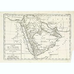
Carte de l'arabie, rédigée en grande partie..
Map of South Arabia based on the journey of the famous Danish explorer Carsten Niebuhr in this area. Showing the ruins of Babylon in actual Iraq and the ruins of Persepol...
Place & Date: Paris, 1760
Selling price: $40
Sold
Nouvelle Carte du Royaume de Bengale.
Jaques Nicolas Bellin (1702-720) was the most important French hydrographer of the 18th century. Sea-atlas 'Hydrographique Français' (1756-65) atlas to accompany Prévos...
Place & Date: Amsterdam, c. 1760
Selling price: $100
Sold
Carte du District de Tranquebar.
A map of Tranqebar and vincinity on the Coromandel coast.Jacques Nicolas Bellin (1702-720) was the most important French hydrographer of the 18th century. Sea-atlas "...
Place & Date: Amsterdam, c. 1760
Selling price: $75
Sold in 2018
Carte du Golphe de Bengale.
Jaques Nicolas Bellin (1702-720) was the most important French hydrographer of the 18th century. Sea-atlas 'Hydrographique Français' , 1756-65, atlas to accompany Prévo...
Place & Date: Amsterdam, c. 1760
Selling price: $80
Sold
Carte de l?Isle de Ceylan, 1750.
Jaques Nicolas Bellin (1702-720) was the most important French hydrographer of the 18th century. Sea-atlas 'Hydrographique Français' (1756-65) atlas to accompany Prévos...
Place & Date: Paris, c. 1760
Selling price: $180
Sold
Terre Sainte et Partie des Provinces Voisines.
Uncommon map of Palestine, Turkey and an over-sized Cyprus. Engraved by Leparmantier.
Place & Date: Paris 1760
Selling price: $150
Sold
Carte de l?Isle de Ceylan, 1750.
Jaques Nicolas Bellin (1702-720) was the most important French hydrographer of the 18th century. Sea-atlas 'Hydrographique Français' , 1756-65, atlas to accompany Prévo...
Place & Date: Amsterdam, c. 1760
Selling price: $100
Sold
Carte du Cours de la Riviere de Tunquin.
Jaques Nicolas Bellin (1702-720) was the most important French hydrographer of the 18th century. Sea-atlas 'Hydrographique Français' , 1756-65, atlas to accompany Prévo...
Place & Date: Paris, c. 1760
Selling price: $75
Sold in 2009
CARTE DES ISLES DE JAVA, SUMATRA, BORNEO & LES DETROITS DE LA SONDE MALACA ET BANCA GOLPHE DE SIAM ETC
Very detailed map of Indonesia by celebrated French mapmaker Nicolas Bellin. Decorated with a compass rose and an attractive title cartouche. Many Islands and harbors are...
Place & Date: Paris, c1760
Selling price: $80
Sold
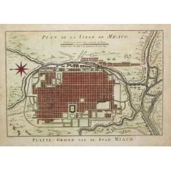
Plan de la Ville de Meaco.
Jaques Nicolas Bellin (1702-720) was the most important French hydrographer of the 18th century. Sea-atlas 'Hydrographique Français' , 1756-65, atlas to accompany Prévo...
Place & Date: Amsterdam, c. 1760
Selling price: $150
Sold in 2016
Regni Sinae vel Sinae propriae..
General map of China, including the islands of Taiwan and Hainan. The map is based on the work of du Halde. An appealing title cartouche bottom right with allegorical ima...
Place & Date: Nuremberg, 1760
Selling price: $200
Sold in 2011
Vue de Peking Capitale de la Chine, et de la Superbe Muraille qui la Separe de la Tartarie.
So-called optical print showing panoramic view of Beijing with the Great Wall in the background.In the eighteenth and nineteenth centuries there were many popular special...
Place & Date: Paris, 1760
Selling price: $850
Sold
Carte du Canal des Isles Philippines par lequel passe le Galion de Manille et les Iles voisines
Large and detailed chart tracking the route of the Galleons from Manila. With the title in French and Dutch. Very detailed showing many bays, islands, sand banks, and de...
Place & Date: Amsterdam, ca. 1760
Selling price: $200
Sold in 2009
Regni Sinae vel Sinae propriae..
General map of China, including the islands of Taiwan and Hainan. The map is based on the work of du Halde. An appealing title cartouche bottom right with allegorical ima...
Place & Date: Nuremberg, 1760
Selling price: $250
Sold in 2011
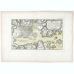
Plan du port et de la ville de Nangasaki.
This plan originates from Charlevoix's work Histoire et description Générele du Japon . His first in 1715 published work was the Histoire de l'etablissement du christia...
Place & Date: Paris, 1760
Selling price: $120
Sold in 2023
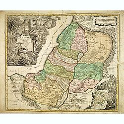
Palaestina accurata descriptio geographica. . .
Map of the Holy Land, with two very large cartouches. Lower left with inset of travels of the Israelites.
Place & Date: Nuremberg, 1760
Selling price: $115
Sold in 2012
Tartaria.
Attractive, simple map of Tartary and China.
Place & Date: c. 1760
Selling price: $90
Sold in 2013
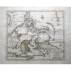
Nieuwe Kaart van de Filippynsche, Ladrones, Moluccos of Specery Filanden, als Mede Celebes etc.
Very detailed map of the Philippine islands and eastern Indonesia. With hundreds of tiny islands, including the famous Spice Islands here called Specery Eilenden. Further...
Place & Date: Amsterdam, c1760
Selling price: $100
Sold in 2013
China as surveyed by the Jesuit Misionaries between the years 1708 & 1717 with Korea & the adjoining parts of Tartary.
The map is of interest for the use of Eastern Sea or Sea of China, the sea south of Korea. In the sea along the coast line of Korea : "Kau-Li-Qua or King:m of Korea&...
Place & Date: London, c. 1760
Selling price: $500
Sold in 2014
Vue de Siam avec diverses Sortes des Ballons, ou Vaisseaux Chinoise a rame.
So-called optical print illustrating a parade of vessels. Engraved by F.X. Habermann (1721-1796). The Academie Imperiale was a well-known publisher of optical prints, est...
Place & Date: Augsburg, 1760
Selling price: $600
Sold in 2014
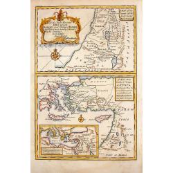
A Map of the Travels of Our Lord & Saviour, Jesus Christ.
This lovely, 3 part, religious map includes the Travels of Jesus, St. Paul and Holy Land places referred to in the New Testament. It is by Stackhouse and comes from his B...
Place & Date: London, 1760
Selling price: $99
Sold in 2015
Carte des Nouvelles Philipines.
Jaques Nicolas Bellin (1702-720) was the most important French hydrographer of the 18th century. Sea-atlas 'Hydrographique Français' , 1756-65, atlas to accompany Prévo...
Place & Date: Amsterdam, c. 1760
Selling price: $70
Sold in 2014
A New & Accurate Map of the Empire of China, from the Sieur Robert's Atlas, with Improvements.
Nice example of Bowen's map of China with neighboring Korea and Formosa published for the 'Geographical Dictionary' in London around 1760. Excellent detail, decorative ca...
Place & Date: London, 1760
Selling price: $400
Sold in 2015
Regni Sinae vel Sinae propriae..
General map of China, including the islands of Taiwan and Hainan. The map is based on the work of du Halde. An appealing title cartouche bottom right with allegorical ima...
Place & Date: Nuremberg, 1760
Selling price: $700
Sold in 2015
Plan de la Ville de Su-Tcheou-Fou / Plan de L'Enceinte de la Ville de Nan-King.
Two plans on one page. One is a plan of Nanking while the other is of the town of Su-Chew-Fu. Published in Paris by Jacques Nicolas Bellin in 1760.
Place & Date: Paris, 1760
Selling price: $12
Sold in 2016
Carte du Canal des Isles Philippines Par lequel passe le Galion de Manille...
This large and detailed copper-engraved sea-chart, is one of the best obtainable maps of the Islands of the Philippines from the 18th century. It shows Islands, bays, ree...
Place & Date: Paris, ca. 1760
Selling price: $575
Sold in 2016
Plan du port et de la ville de Nangasaki.
Attractive and well detailed plan of Nagasaki, large title cartouche with reference key to principal points of interest. Deshima is central to the map.Jacques Nicolaas Be...
Place & Date: Paris, 1760
Selling price: $80
Sold in 2018
A Chart of the Channel in the Phillippine Islands . . .
Large detailed chart of the Islands of the Philippines from the English edition of Anson's Voyages. One of the most detailed charts of the Philippines of the era. Shows I...
Place & Date: Augsburg 1760
Selling price: $700
Sold in 2018
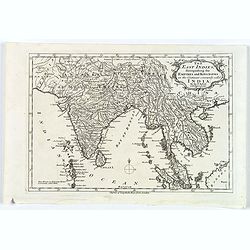
The East Indies, distinguishing the Empires and Kingdoms on the Continent commonly call'd India.
A typical mid eighteenth century mid-sized French map of the East Indies showing India, Tibet, Burma, Siam, Cambodia, Laos and down to Malaysia.Semi-decorative title cart...
Place & Date: Paris, ca. 1760
Selling price: $90
Sold in 2017
Karte von den Küsten von Cochin China, Tunquin und einem Theile der chinesischen Küste
Manuscript map of the coast of Northern Vietnam up to coast of the south Chinese coast below there the island of Hainan. In upper right corner the region of Canton, Macao...
Place & Date: Germany, ca. 1760
Selling price: $750
Sold in 2020
Plan de l'Enceinte de la Ville de Nan-King ou Kyang-Ning-Fou (and) Plan de la Ville de Su-Tcheou-Fou.
Two maps on a single sheet, depicting major Chinese Cities. The plan of the left shows Nanking and its fortifications. The plan on the right shows Su-Tcheou-Fou or Su-Che...
Place & Date: Paris, 1760
Selling price: $15
Sold in 2018
Carte de la Partie Meridionale de la Presqu'ile de l'inde en deca du Gange.
A quaint map of southern India and Ceylon by Brion de la Tour. From Brunet's Histoire Universelle, depuis le commencement du monde jusqu'a present by Brion de la Tour.Lo...
Place & Date: Paris, 1760
Selling price: $47
Sold in 2018
Carte de l'entrée de la Riviere de Canton. . .
Bellin's map of the mouth of the Canton River, from the island of Macao, to Canton itself. Shows the future site of Hong Kong (Sinn-gan-hein).The city of Canton is divide...
Place & Date: Paris, 1760
Selling price: $58
Sold in 2020
Carte de la Baye d'Hocsieu. . .
An interesting map showing the mouth and estuary of the Chiang River in southwest China, opposite Taiwan (Formosa) by Prevost, after Bellin. It shows the modern day Chine...
Place & Date: Paris, ca 1760
Selling price: $22
Sold in 2020
Carte du District de Tranquebar.
A lovely detailed map of the area around Tranquebar (now Tharangambadi), on the Coromandel coast. It was an early Danish Trading Colony in the modern Indian state of Tami...
Place & Date: Paris ca 1760
Selling price: $30
Sold in 2020
Fort St. George on the Coromandel Coast, Belonging to the East India Company of England.
A fine copperplate engraving of Fort St. George, Madras (Chennai )on the south east coast of India. The fort flies the Union Jack flag, and many sailing vessels are seen ...
Place & Date: London, ca 1760
Selling price: $50
Sold in 2019
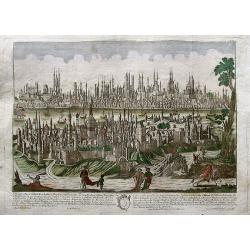
Constantinopolis.
Beautiful optical print (vues d'optique) of Constantinople, in the forefront with Galata and Pera. A very detailed image of the city, filled with buildings, towers, ships...
Place & Date: Augsburg, ca. 1760
Selling price: $265
Sold in 2019
Plan du port et de la ville de Nangasaki.
Attractive and well detailed plan of Nagasaki, large title cartouche with reference key to principal points of interest. Deshima is central to the map.Jacques Nicolaas Be...
Place & Date: Paris, 1760
Selling price: $120
Sold in 2020
Gezicht van Punto de Galle. Plus 2 other views of the area.
[Antique view of Galle] Gezicht van Punto de Galle. Jan van Schley is the engraver of the maps (by J.N. Bellin) and views in the Dutch edition of A.F. Prévost d' Exile's...
Place & Date: Amsterdam, ca 1760
Selling price: $85
Sold in 2020
Plan du port et de la ville de Nangasaki.
An attractive and detailed plan of Nagasaki, with a large title cartouche with a reference key to principal points of interest. Deshima is central to the map.Jacques Nico...
Place & Date: Paris, 1760
Selling price: $85
Sold in 2023
Vue de la superbe Entrée de l'Embassadeur de Siam a la Cour de Pekin.
So-called optical print illustrating a pompous parade to celebrate the arrival of the ambassador of Siam in Beijing.Mondhare was a well-known publisher of optical prints,...
Place & Date: Paris, 1761
Selling price: $600
Sold in 2010
Vue perspective de la grande Ceremonie du Couronnement de l'Empereur de la Chine.
So-called optical print illustrating the crowning of the Chinese emperor. It shows the throne at the center.Mondhare was a well-known publisher of optical prints, establi...
Place & Date: Paris, 1761
Selling price: $600
Sold
Ceremonie de la grande Feste que les Chinois celebre le 24 de la Lune d'Aoust..
So-called optical print illustrating great festivities on the 24th of August in Beijing.Mondhare was a well-known publisher of optical prints, established in Paris, at ru...
Place & Date: Paris, 1761
Selling price: $600
Sold


