Browse Listings in Asia
A Chart of ye EAST-INDIES, With the Coast of Persia, China also the Philipina, Moluca and Sunda Islands &c.
A very decorative chart of the Indian Ocean. The map extends until Saudi Arabia and Madagascar in the West, and Australia, New Guinea, and Japan in the East. Shows a part...
Place & Date: London, c.1740
Selling price: $350
Sold in 2009
Afbeldinge van het casteel en de stadt Batavia. . .
Copied after Clement de Jonghe's map of 1650. Map of Jakarta, head quarters of the V.O.C.Joachim Ottens (1663 - 1719) and his sons Renier and Joshua were prominent Dutch ...
Place & Date: Amsterdam, 1740
Selling price: $2800
Sold in 2011
Peninsula Indiae Malabar Coromandel Ceylon.
Homann's family well-engraved map of southern India and Ceylon.
Place & Date: Nuremberg, 1740
Selling price: $280
Sold in 2014
Regni Japoniae nova mappa geographica.
One of the most decorative and elegant maps of Japan. The map is based on Englebert Kaempfer's map of 1727. It shows a much distorted outline for the Island of Japan and ...
Place & Date: Augsburg, 1740
Selling price: $1200
Sold in 2010
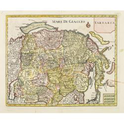
Tartaria.
A fine map of Siberia, including Korea and Japan. From "Atlante Novissimo Che Contiene Tutte Le Parti Del Mondo...." This atlas was published in Venice and was ...
Place & Date: Venice, 1740
Selling price: $200
Sold in 2012
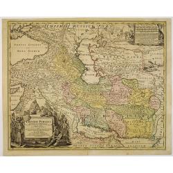
Imperii Persici in omnes suas Provincias . . . Exacte Divisi Nova Tabula Geographica. . .
Showing the eastern part of Turkey and Cyprus, Palestine, Persian Gulf, including Gulf of Oman, Caspian Sea, Iran and the north-west territories of India.Embellished with...
Place & Date: Nurenberg, 1740
Selling price: $85
Sold in 2010
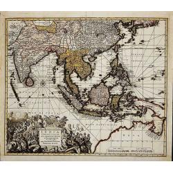
India Orientalis
First state (before the privilege, which was granted not before 1740). Map of South-East Asia showing the area between India in the West and Japan and Australia in the Ea...
Place & Date: Augsburg, c. 1730-1740
Selling price: $900
Sold in 2014
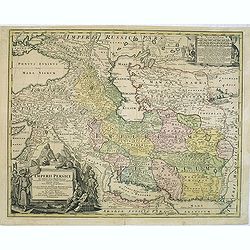
Imperii Persici in omnes suas Provincias . . . Exacte Divisi Nova Tabula Geographica. . .
Showing the eastern part of Turkey and Cyprus, Palestine, Persian Gulf, including Gulf of Oman, Caspian Sea, Iran and the north-west territories of India.Embellished with...
Place & Date: Nurenberg, 1740
Selling price: $200
Sold in 2014
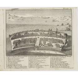
Isoletta Desima abittata Dagli Olandesi nel Giappone..
Bird's-eye view of Deshima copied from a manuscript by Voogt, who was second-in-command on Deshima in 1713. The island is viewed from the landside, depicting the developm...
Place & Date: Venice, 1740
Selling price: $250
Sold in 2020
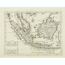
Isole di Sunda Borneo Sumatra Iava Grande. . .
The Malay Peninsula and Singapore, Sumatra, Java and Borneo.From "Atlante Novissimo Che Contiene Tutte Le Parti Del Mondo...." This atlas was published in Venic...
Place & Date: Venice, 1740
Selling price: $250
Sold in 2012
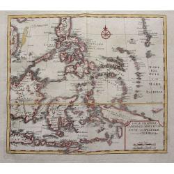
Isole Filippine Ladrones e Moluccos o Isole delle speziarie come anco Celebes. . .
The East Indies from Philippines south to New Guinea and Timor.From "Atlante Novissimo Che Contiene Tutte Le Parti Del Mondo…." This atlas was published in Ve...
Place & Date: Venice, 1740
Selling price: $300
Sold in 2014
Afbeelding van dat gedeelte van BATAVIA, alwaar eigentlyk de Schrikkelyke Slagting der CHINEZEN, na de Ontdekking van hun Verraad, geshied is, den 9. Octob: 1740.
Very rare bird's-eye view of part of the city of Batavia, houses burning in foreground, canals filled with dead and drowning bodies and massacre of Chinese in progress on...
Place & Date: B. Mourik, after 1740
Selling price: $1000
Sold in 2013
Carte du Golphe de Bengale Tire de la Carte de L'Ocean Oriental.
Striking copper engraved map of the Indian Ocean, South Eastern India and Sri Lanka, Burma & Thailand. Lovely floral, title cartouche. Jacques Nicolas Bellin (1703 �...
Place & Date: Paris, 1740
Selling price: $91
Sold in 2016
Asiae in tabula geographica..opera A.F.Zürner. . .
A rare map prepared by Adam Friedrich Zürner (1680-1742) with a much oversized Hokkaido. Lower left a decorative title cartouche with eastern merchants a lion and a pair...
Place & Date: Amsterdam, 1740
Selling price: $550
Sold in 2014
Imperio del Giappone.
Attractive early decorative copper plate map of the Kingdom of Japan with title a nice compass rose.The sea north of Japan is called Mare del Noort o Mare di tramontana d...
Place & Date: Venice, 1740
Selling price: $400
Sold in 2017
Isola Ceilon.
Attractive copper engraved map of Sri Lanka showing mountains, Towns and the Rama's Bridge (Ponte di Adamo). Included in "Atlante Novissimo che Contiene Tutte le Par...
Place & Date: Venice, 1740
Selling price: $300
Sold in 2017
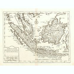
Isole di Sunda Borneo Sumatra Iava Grande. . .
The Malay Peninsula and Singapore, Sumatra, Java and Borneo. From "Atlante Novissimo Che Contiene Tutte Le Parti Del Mondo…." This atlas was published in Veni...
Place & Date: Venice, 1740
Selling price: $400
Sold in 2015
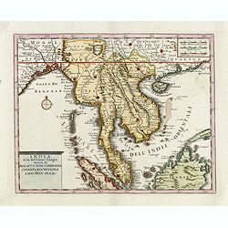
India di la del Fiume Ganges overo di Malacca Siam Cambodia Chiampa KoChinkina Laos Pegu ava&c..
Fine map of Malay Peninsular, with present-day Thailand, the Straits of Singapore and Borneo in the South to China in the east and the Bay of Bengal in the south, edited ...
Place & Date: Venice, 1740
Selling price: $400
Sold in 2017
Isole Filippine, Ladrones, e Moluccos o Isole della Speziarie come anco Celebes &c.
Scare map of Southeast Asia with Borneo, Bali, the Philippines, New Guinea, Timor, etc. Very detailed naming even smallest islands. From an Italian edition of Thomas Salm...
Place & Date: Venice, c1740
Selling price: $180
Sold in 2015
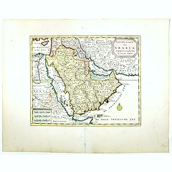
Nieuwe kaart van Arabia.
An attractive map of the Arabian Peninsula here called Gelukkig Arabia or Happy Arabia . The map has a great advance on other maps of the time by showing the true extent ...
Place & Date: Amsterdam, 1740
Selling price: $550
Sold in 2016
Nuova Carta del Europa Turchesca.
Isaak Tiron's uncommon map of Asia Minor, Cyprus, Crete, the Black Sea, The Crimea, Greece and the Balkans. Although attributed to Tirion, the map was actually published ...
Place & Date: Venice, 1740
Selling price: $80
Sold in 2021
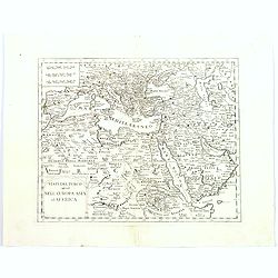
Stati del Turco situati Nell' Europa Asia ed Affrica.
Detailed map of southern Europe, northern eastern Africa, the Arabian peninsular, Turkey and the Balkans, and the Caucasus. Although attributed to Tirion, the map was act...
Place & Date: Venice, 1740
Selling price: $110
Sold in 2016
Asia verfertiget von Joh.Schreibern in Leipzig.
Rare map of Asia, from "Atlas Selectus", by Johann Georg Schreiber, a German cartographer and geographer, who was born 1676 and lived in Leipzig. Atlas Selectus...
Place & Date: Leipzig, 1740
Selling price: $120
Sold in 2017
Nieuwe kaart van Asia.
Attractive and detailed map of Asia showing good detail in China, Mongolia, Tibet, Kamchatka, Japan, Kuriles, Korea, Manchuria, Formosa, Philippines, Indonesia Borneo, Ne...
Place & Date: Amsterdam, 1740
Selling price: $200
Sold in 2017
Impero del Gran Mogol.
A very fine map showing India divided into its regions with major towns and cities marked and also parts of its neighbouring kingdoms.
Place & Date: Venice, 1740
Selling price: $95
Sold in 2017
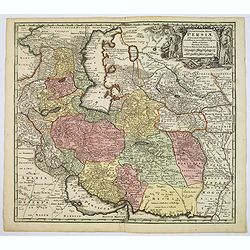
Opulentissimi Regni Persiae.
A very detailed map of the Persian Empire, with a large, decorative title cartouche in upper right corner. Differing colors denote different regions within the map.Seutte...
Place & Date: Augsburg, ca. 1740
Selling price: $300
Sold in 2017
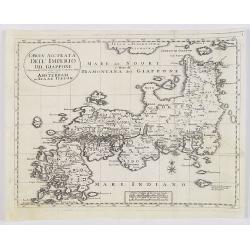
Carta Accurata dell' Imperio del Giappone. . .
Albrizzi published this Italian version of Tirion's map of Japan. In the upper part of the map Jesso of Jesogasima Kamtzchatka is shown north of the Noto Peninsula. At th...
Place & Date: Venice, 1740
Selling price: $130
Sold in 2018
Asiae in tabula geographica..opera A.F.Zürner..
A rare map prepared by Adam Friedrich Zürner (1680-1742) with a much oversized Hokkaido and the Philippines. Lower left a decorative title cartouche with eastern merchan...
Place & Date: Amsterdam, 1740
Selling price: $1600
Sold in 2017
Nieuwe kaart van de Filippynsche, Ladrones, Moluccos of Specery Eilanden als mede Celebes etc.
Shows the western islands of the archipelago, Borneo, Java and Sumatra, up to and including New Guinea. With very good detail to Philippines.Read more Early maps of South...
Place & Date: Amsterdam, 1740
Selling price: $350
Sold in 2018
Grund-Riss und Prospect. . . Stadt Dansburg und Trankenbar. . .
The Danish East India Company was founded in 1616. A first expedition was sent out in November 1618, which led to the purchase of a parcel of land on the Coromandel coast...
Place & Date: Augsburg ca 1740
Selling price: $475
Sold in 2019
A Plan of Fort St. George and the City of Madras.
A detailed plan of the famous Fort St. George and the city of Madras (now Chennai). The fort was the first British fortification in India, built in 1639 and it still stan...
Place & Date: London, ca 1740
Selling price: $60
Sold in 2020
Carte Des Costes de Perse, Gusarat, et Malabar.
An interesting map of the Persian Gulf, Iran and Western India including the Maldives Islands. Featuring a decorative cartouche. Jacques Nicolas Bellin (1703-1772) was on...
Place & Date: Paris, 1740
Selling price: $16
Sold in 2019
Carte du Golphe de Bengale Tire de l'Ocean Oriental.
Bellin's detailed regional map of the Gulf of Bengal and the lower Ganges River. t features a decorative cartouche and a large compass rose in the centre.Jacques-Nicolas...
Place & Date: Paris, 1740
Selling price: $11
Sold in 2020
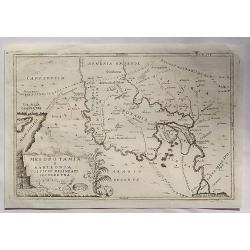
Mesopotamia E Babilonia Coifmi Delineati Secondovna.
A fine copperplate map of current-day Armenia, Syria, Cyprus & Iraq. An Italian edition by Cellarius in 1740. It features a decorative cartouches including building...
Place & Date: Amsterdam, 1740
Selling price: $17
Sold in 2023
Isola Ceilon.
Attractive copper engraved map of Sri Lanka showing mountains, Towns and the Rama's Bridge (Ponte di Adamo). Included in "Atlante Novissimo che Contiene Tutte le Par...
Place & Date: Venice, 1740
Selling price: $65
Sold in 2020
Isola Ceilon.
Attractive copper engraved map of Sri Lanka showing mountains, towns and the Rama's Bridge (Ponte di Adamo). Published by Giovanni Battista Albrizzi (1698 - 1777) and cop...
Place & Date: Venice, 1740
Selling price: $70
Sold in 2020
[Lot of 4 maps] Magni Mogolis Imperium. de novo Correctum et Divisum.
An attractive map depicting the northern part of India, Afghanistan, Pakistan, Bangladesj, Nepal and Tibet. Embellished with a title-cartouche and a cartouche with scales...
Place & Date: Amsterdam, ca 1740
Selling price: $230
Sold in 2022
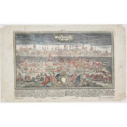
Constantinopolis. Konstantinopel.
Rare and decorative city view of Constantinople, Istanbul, Turkey. Engraved by Alexander Glaser after F.B. Werner by J.G. Ringlin drawing, published in “Europäische St...
Place & Date: Augsburg, ca. 1740
Selling price: $900
Sold in 2023
A General Map of Eastern and Western Tatary, commonly call'd Tartray, drawn from the Particular Maps of the Jesuit Missionaries. . .
Important map covering the region from the Gobi Desert to the coast, and including Korea. Including the Great Wall. The Korean peninsula is a bit distorted, and covered w...
Place & Date: London, T.Gardner, 1738-1741
Selling price: $500
Sold in 2010
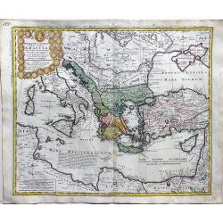
Imperii Turcici Europaei Terra in primis Graeciae.
A fine, large map delineating the Eastern Mediterranean with the possession of the Turkish empire. Homann Heirs (of Johann Baptist and Johann Christof) published differen...
Place & Date: Nurnberg, 1741
Selling price: $210
Sold in 2018
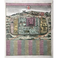
Statt Ierusalem.
Jerusalem at the time of Christ. An imaginary plan, drawn after Adrichomius. Extensive title at top in Latin (L) and German (R): ‘Ierusalem, cum suburbiis, prout tempor...
Place & Date: Augsburg, 1741
Selling price: $1050
Sold in 2020
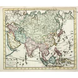
Asia.
An attractive pocket-size map of the Asian continent.
Place & Date: Amsterdam, 1742
Selling price: $90
Sold
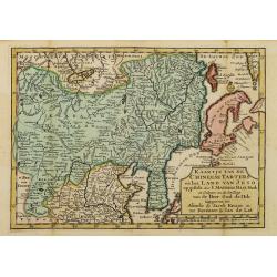
Kaartje van de Chineese Tarters en het land van Jeso..
Attractive and uncommon map of North China with Korea and Jedso. Dutch issue, of this map prepared by de L'Isle. From Atlas Portatif . With a curious and oversized Hokkai...
Place & Date: Deventer, 1742
Selling price: $600
Sold in 2011
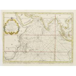
Carte De L'Ocean Oriental ou Mer Des Indes Pour Servir a l'Histoire Generale des Voyages..
Fine chart of Asia from south Africa till the western tip of Australia, including Arabia, India and Indonesia, including Philippines and Taiwan.With Dutch title in lower ...
Place & Date: Amsterdam 1742
Selling price: $100
Sold
Het oosterdeel van de Moscoviesche Tarters. . .
Uncommon map of Russia and representing Siberia and including Kamchatka. This map is credited to Johann Matthias Haas (1684-1742) and Guillaume De l'Isle.
Place & Date: Deventer, Almelo, 1742
Selling price: $300
Sold in 2012
Kaartje van Asia. . .
Attractive and rare map of Asia. From Atlas Portatif . With a curious and oversized Hokkaido. The map is of interest for the use of Coreanse Zee for the sea between Korea...
Place & Date: Deventer 1742
Selling price: $400
Sold in 2014
Novissima totius Terrae Sanctae sive promissionis. . .
Engraved by J.B.Homann and published by David Funck. One of the very few maps engraved by Johan Baptist Homann, signed lower right.A scarce map of the Holy Land, orientat...
Place & Date: Nuremberg, 1742
Selling price: $450
Sold in 2021
The Island of Manaer.
The island of Manaer (Mannar) is connected to northern Srl Lanka by a small causeway. This map appeared in Churchill's work 'A Collection of Voyages and Travels', and is ...
Place & Date: London, ca. 1742
Selling price: $75
Sold in 2016
Carta dell India, Foglio II.
A fine map of the northern part of India by Bellin. A copper engraved map from the “Storia Generale de'Viaggi” di Prevost, an Italian edition of the French original �...
Place & Date: Paris, 1742
Selling price: $16
Sold in 2019
Overblyfselen der tuinen, en groote waterbakken van Salomon.
Fine copper engraving showing the contemporary remains of the Gardens and water reservoirs of Salomon. Engraved by A.D.Putter and taken from Bernard Picart's famous Cér�...
Place & Date: Amsterdam 1743
Selling price: $40
Sold
Kaert van Het geheele Russische Keizerryk..
Map of the whole Russian empire. Together with Major and Minor Tartary now enlarged with new discoveries in the year 1739 by captain Span(g)berg.Map extends from Scandina...
Place & Date: Utrecht 1743
Selling price: $176
Sold
China.
Charming uncommon Italian map of China, Japan, Korea and Taiwan listed as Tayoun and I.di Formosa. The Great Wall is depicted prominently.
Place & Date: Italy c.1743
Selling price: $150
Sold
Pagode de la Chine. - Grande Pagode de la Chine.
Two scenes on one page showing scenes on the square of a Pagoda, probably in Changzhou. Fine copper engraving by Bernard Picart and taken from Bernard Picart's famous Cé...
Place & Date: Amsterdam, 1743
Selling price: $75
Sold in 2012
La China.
Smaller format map of China based on the work of De L'Isle.The map is of interest for the use of Sea of Japan / East Sea, the sea between Korea and Japan, here called &qu...
Place & Date: ca. 1743
Selling price: $65
Sold in 2012
Toranga divinité du Japon/ La Pagode de Toranga/ Prédicateur Japonais.
Three scenes on one page showing scenes on the square of a Pagoda, in Japan. Fine copper engraving by Bernard Picart and taken from Bernard Picart's famous Céréonies et...
Place & Date: Amsterdam, 1743
Selling price: $20
Sold in 2021
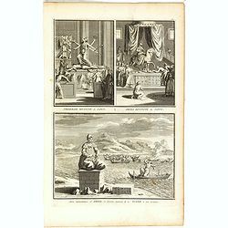
Pagode de Canon/ Canon divinité du Japon/ Autre représentation de Canon/ Xantai divinité du Japon.
Four scenes on one page showing religious scenes, in Japan. Fine copper engraving by Bernard Picart and taken from Bernard Picart's famous Céréonies et costumes religie...
Place & Date: Amsterdam, 1743
Selling price: $20
Sold in 2021
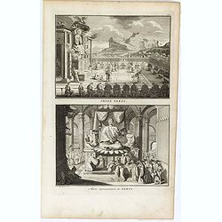
Tiedebaik divinité du Japon. / Amida divinité du Japon. / Autre représentation d'Amida, et diverses manieres de noyer dans son honneur.
Three scenes on one page showing religious scenes, in Japan. Fine copper engraving by Bernard Picart and taken from Bernard Picart's famous Céréonies et costumes religi...
Place & Date: Amsterdam, 1743
Selling price: $20
Sold in 2021
Idole Xekia. / Autre représentation de Xekia.
Two scenes on one page showing religious scenes in Japan. Fine copper engraving by Bernard Picart and taken from Bernard Picart's famous Céréonies et costumes religieus...
Place & Date: Amsterdam, 1743
Selling price: $20
Sold in 2021
Asia secundum legitimas projectionis..
"A decorative map prepared by Prof. Johann Matthias Haas (1684-1742), who produced a number of continental and regional maps for the atlases issued by the firm of Ho...
Place & Date: Nuremberg 1744
Selling price: $300
Sold
Asia Secundum Legitimas Projectionis..
Attractive 18th century map of the continent and the East Indies drawn by Matthias Haas. The extent of European knowledge of the region is vividly depicted with good deta...
Place & Date: Nurnberg 1744
Selling price: $220
Sold
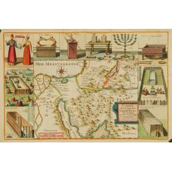
Carte du Voïage des Israëlites dans de desert..
Lièbaux's map of the Wandering of the Children Israel. With the route taken by the Israelites from Egypt to Canaan.
Place & Date: Paris 1744
Selling price: $300
Sold
Carte Marine de la Mer Caspiene levée Suivant les Ordres.. (2 maps)
Accurate map of the Caspian. Dutch edition based upon earlier maps by De L'Isle who re-drew Verden's original map. Embellished with 2 cartouches and 8 insets.The map is f...
Place & Date: Amsterdam c. 1744
Selling price: $265
Sold
Carte de L'Isle de Ceylan Dressée sur les Observations de..
Large, detailed map of Ceylon. Embellished with 2 decorative cartouches. Latin title Insula Ceilon olim Taprobana on top.The map is from a Dutch edition of De L'Isle's wo...
Place & Date: Amsterdam, c. 1744
Selling price: $500
Sold in 2009
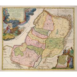
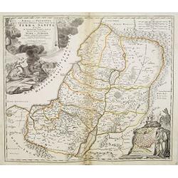
Judaea seu Palaestina .. Terra Sancta. . .
Johann Baptist Homann's well-engraved map has two large decorative cartouches. Upper left Moses receiving the Tables. Lower right Moses and Aaron pointing at a map showin...
Place & Date: Nuremberg, 1744
Selling price: $400
Sold in 2021
Palestina seu Terra olim Sancta.
Homann Heirs (of Johann Baptist and Johann Christof) published: Grosser Atlas, 1731, 1737. Geogr. Maior, 1759, Atlas Homannianus, 1762.A map of Palestine and the Libanon ...
Place & Date: Nürnberg, 1744
Selling price: $500
Sold
Asia.
Homann Heirs (of Johann Baptist and Johann Christof) published: Grosser Atlas, 1731, 1737. Geogr. Maior, 1759, Atlas Homannianus, 1762.August Gottlieb Boehme?s map of Asi...
Place & Date: Nürnberg, 1744
Selling price: $475
Sold in 2013
Asia Secundum..
The map is of interest for the use of East Sea, the sea between Korea and Japan, here called "Mere Orientale Minus Corea".The cartouches are painted in strong a...
Place & Date: Nuremberg, ca. 1744
Selling price: $1650
Sold in 2015
Carte des Indes orientales dressee sur les observations de l'Academie Royale des Sciences, et sur les memoires de la Compagnie des Indes.
Uncommon map of South East Asia, with in upper right corner inset "Plan de Pondicherry en 1741", with a key A-S, 1-21. Engraved by F.Desbruslins. Scale ca. 1:25...
Place & Date: Paris, Jean Desaint & Charles Saillant, 1744
Selling price: $150
Sold in 2008
Iudaea seu Palaestina .. Terra Sancta. . .
Johann Baptist Homann's well-engraved map has two large decorative cartouches. Upper left Moses receiving the Tables. Lower right Moses and Aaron pointing at a map showin...
Place & Date: Nuremberg, 1744
Selling price: $250
Sold in 2011
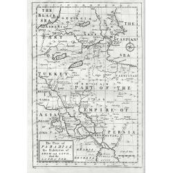
The Place Of Paradise The Habitation Of Adam And Seth And The Land Of Nod.
Mainly covers much of Georgia, Armenia, Turkey, Iran and Iraq and furthermore pointing out sites associated with Adams sons and charting the course that Noah's Ark took. ...
Place & Date: London, 1744
Selling price: $50
Sold in 2017
An exact chart of the countries through which Capt. Behring travelled from Tobolsky capital of Siberia ti the country of Kamtschatka.
The earliest English language map to show Vitus Behring's Route.After retiring from a tour as Captain in the Czar's Navy, Behring, originally from Denmark, settled in Vyb...
Place & Date: London, 1744
Selling price: $230
Sold in 2013
Asia secundum legitimas projectionis stereographicae.
Highlighted area covers part of Spain, eastern coast of Ireland to western part of Papua New Guinea and the Asian continent from the Northern Polar Sea to the Indian Ocea...
Place & Date: Nurenberg, 1744
Selling price: $211
Sold in 2014
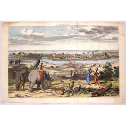
Masulipatnam.
Fine hand-colored copper engraving of a view of the city of Masulipatnam on the Malibar Coast in India. It was published in "THE TRUE & EXACT DESCRIPTION OF THE ...
Place & Date: London, 1744
Selling price: $111
Sold in 2015
Accurater Plan u See-Charte von der Insul Ceylon..
Decorative map of Ceylon and southern tip of India. Rare, from Allerneuster geographisch- und topographischer Schau-Platz von Africa und Ost-Indien.
Place & Date: Germany, 1744
Selling price: $275
Sold in 2015
No title. [South East Asia]
Including Indonesia, India, Java, Sumatra, Japan, Taiwan and North coast of Australia. Rare, from Allerneuster geographisch- und topographischer Schau-Platz von Africa un...
Place & Date: Germany, 1744
Selling price: $1350
Sold in 2015
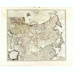
Etats de Moscovie. . .
Fine and rare map of Russia, Siberia, China, Korea and Japan. George Louis Le Rouge was active between 1740 and 1780, in Paris at, rue des Augustins as a publisher, and w...
Place & Date: Paris, 1744
Selling price: $450
Sold in 2023
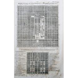
Plans of the Old & New City of Peking ye Metropolis of China.
Two plans of the city, on top new Peking, and below ancient Peking. An extensive legend key identifies around 49 important places such as the Emperor’s residence, remar...
Place & Date: London, 1744
Selling price: $100
Sold in 2017
A New & Accurate Map of China.
Emanuel Bowen's map of China based on D'Anville's earlier work.Includes the Korean peninsula, Formosa (Taiwan), and Hainan. With an explanation legend, and text informati...
Place & Date: London, 1744
Selling price: $220
Sold in 2017
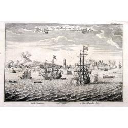
A View of the Town and Castle of Macao.
Nice view of the town seen from the sea. Numerous buildings and ships shown. With the British ship Centurion in the foreground firing cannons, and the return fire is seen...
Place & Date: London, 1744
Selling price: $120
Sold in 2018
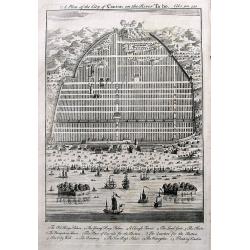
A Plan of the City of Canton on the River Ta ho.
An early plan of Guangzhou, with many buildings and ships shown. A key names 13 places, including the King's Palace, Young Kings's Palace, The City Wall, and two Floating...
Place & Date: London, 1744
Selling price: $66
Sold in 2017











![[Lot of 4 maps] Magni Mogolis Imperium. de novo Correctum et Divisum.](/uploads/cache/85476-250x250.jpg)















![No title. [South East Asia]](/uploads/cache/36593-250x250.jpg)
