Browse Listings in Asia
Pas-kaart van t Westerdeel van Oost Indien..
East to the top. A very representative example of a Dutch chart of the East Coast of Africa, the Arabian pen-insular and India. Prepared and signed by Gerard van Keulen a...
Place & Date: Amsterdam, c.1728
Selling price: $2900
Sold in 2010
Baay van Tricoen Male.
From Francois Valentyn's "Oud en Nieuw Oost Indien', part V : Beschryving van Coromandel, Pegu, Arrakan, Bengale, Mocha,? Persien... Malakka.. Sumatra... Ceylon.&quo...
Place & Date: Amsterdam, 1728
Selling price: $120
Sold
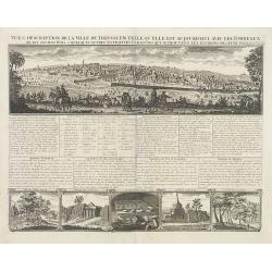
Vue & discription de la Ville de Jerusalem..avec Tombeaux..
This copper-engraving shows a panoramic view of Jerusalem, two insets of mount "Liban" and three insets of the tombs De Zacharie, Des Rois and D'Absalom.Zachari...
Place & Date: Amsterdam, 1728
Selling price: $340
Sold
L'Asie. suivant les nouvelles observations?
Detailed map of the continent of Asia. Decorative cartouche upper left.Although not renowned for the originality of his work, Pieter van der Aa is highly thought of for t...
Place & Date: Amsterdam, 1728
Selling price: $200
Sold in 2008
Wahrer und Grundlicher Abriss der Welt-beruhmten und Hochheiligen Stadt Jerusalem aller angrenzenden Oertern und Heiligt³mern wie auch anderer Merckwurdigkeiten welche durch das Leben, Wunderzeichen, Leiden, Todt, und Auferstehung Jesu Christi seynd gehei
An important and absolutely rare chronogram-dated view of Jerusalem.Only a handful copies are known : one in the Eran Laor Collection at the Jewish National and Universit...
Place & Date: Vienna, 1728
Selling price: $3700
Sold in 2009
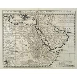
Carte Particuliere De L'Egypte, De La Nubie et de L'Abyssinie, Dressee sur les Memoires les plus Nouveaux & les Observation les plus exactes.
Including the Arabian Peninsular, Egypt, north eastern part of Africa, Cyprus and part of the Mediterranean.Based on the work of Guillaume Delisle. It is a very detailed ...
Place & Date: Amsterdam, 1728
Selling price: $250
Sold in 2016
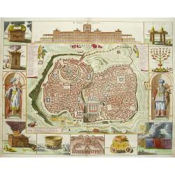
De Stadt Ierusalem.
A great bird's eye plan of the holy city flanked by engravings of religious icons. At the bottom are an elevation of the Temple of Solomon and a panoramic view of Jerusal...
Place & Date: Amsterdam, 1728
Selling price: $230
Sold in 2009
Vue & discription de la Ville de Jerusalem.. Avec Tombeaux..
This copper-engraving shows a panoramic view of Jerusalem, two insets of mount "Liban" and three insets of the tombs De Zacharie, Des Rois, and D'Absalom.Zachar...
Place & Date: Amsterdam, 1728
Selling price: $500
Sold in 2010
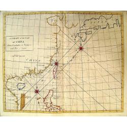
A Chart of the Coast of China.
Rare English chart of the China coast and seas by famed astronomer and comet tracker Edmond Halley. This chart comes from Halley's rare Atlas Maritimus et Commercialis. D...
Place & Date: London, 1728
Selling price: $4300
Sold in 2009
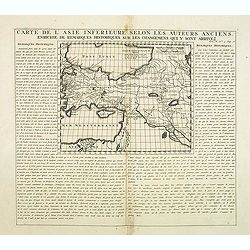
Carte De L'Asie Inferieure Selon Les Auteurs Anciens, Enrichie de Remarques Historiques sur les Changemens qui y sont arrivez (shows Cyprus)
Text page with inset map (220x269.mm.) of Turkey, including Cyprus. From Chatelain's Atlas Historique, 1732-1739. In upper right margin: 'Tom. V. No 3. Pag: 16.'
Place & Date: Amsterdam, 1728
Selling price: $20
Sold in 2012
Carte de l'Asie selon les auteurs anciens enrichie de remarques historiques. . .
The map (290x365mm.) is centered on the India and the Indian Ocean, with explanatory text on either side of the map. From Chatelain's Atlas Historique, 1732-1739. In uppe...
Place & Date: Amsterdam, 1728
Selling price: $95
Sold in 2012
Suite de la généalogie ou chronologie des rois patriarches. . .
Page with two historical maps. One showing Israel and Judæa with a part of Syria, "Arabie Heureuse", and Egypt; the other one showing the region occupied by Is...
Place & Date: Amsterdam, 1728
Selling price: $35
Sold in 2013
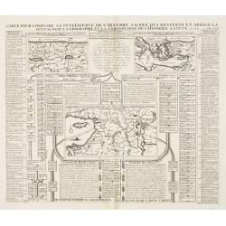
Carte pour conduire à l'intelligence de l'histoire sacrée qui renferme en abrégé la généalogie, la géographie et la chronologie de l'Histoire Sainte. Seconde période du Monde depuis Moyse jusqu'au règne des Rois d'Israël et de Juda.
A Map Showing the understanding of Sacred History, containing an abbreviated genealogy, geography and chronological history of the Bible.Henri Abraham Chatelain (1684 –...
Place & Date: Amsterdam, 1728
Selling price: $27
Sold in 2013
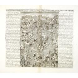
Representation Et Description Du Soulevement Des IV. Princes Du Mogol Contre L'Empereur Leur Père du Combat dans lequel Aureng-Zeb demeura vainqueur dese trois Freres & c. sit ensuite proclamer Empereur.
Fascinating engraving depicting a grand battle between the princes of the Mughal Empire. Aurangzeb was the last of the great Mughal emperors and the empire reached its la...
Place & Date: Amsterdam, 1728
Selling price: $125
Sold in 2013
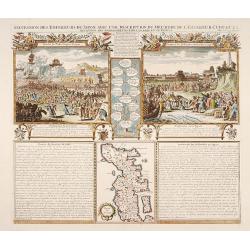
Succession des Empéreurs du Japon. . .
A fine folio sheet of engravings depicting the death of the Emperor Cubo and the arrival of one of the early Dutch embassies to Japan and a small map of the main island H...
Place & Date: Amsterdam, 1728
Selling price: $250
Sold in 2014
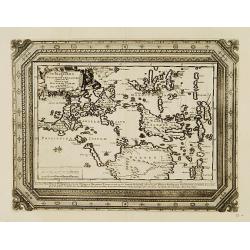
Van Keulen Map of the Pisang Islands on the West Coast of Sumatra.
Very rare chart of Pisang Island, a small island near Padang, on the west coast of Sumatra, Indonesia. Oriented to the west, this map covers the coast of Padang, and the ...
Place & Date: Amsterdam, 1728
Selling price: $100
Sold in 2015
Atsjien.
From Francois Valentyn's "Oud en Nieuw Oost Indien, part V : Beschryving van Coromandel, Pegu, Arrakan, Bengale, Mocha, Persien, Malakka, Sumatra, Ceylon."A bir...
Place & Date: Amsterdam, 1728
Selling price: $95
Sold in 2015
laffenapatnam.
From Francois Valentyn's "Oud en Nieuw Oost Indien, part V : Beschryving van Coromandel, Pegu, Arrakan, Bengale, Mocha, Persien, Malakka, Sumatra, Ceylon."A bir...
Place & Date: Amsterdam, 1728
Selling price: $100
Sold in 2015
Punto de Galle.
From Francois Valentyn's "Oud en Nieuw Oost Indien', part V : Beschryving van Coromandel, Pegu, Arrakan, Bengale, Mocha, Persien, Malakka.. Sumatra, Ceylon."An ...
Place & Date: Amsterdam, 1728
Selling price: $65
Sold in 2017
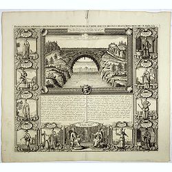
Habillemens d'hommes et de femmes de diverses provinces de la Chine avec un des plus beaux monumens de ce païs là.
In top a view of a bridge in Xensi Province bordered by eleven examples of Chinese dress from different provinces. Showing various people in their typical dress including...
Place & Date: Amsterdam, 1728
Selling price: $100
Sold in 2023
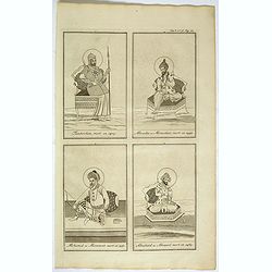
(Ichan / Cha Ichan / Oranzeb / Badour Siah)
From Chatelain's monumental 7 volume Atlas Historique. Henri Abraham Chatelain (1684 – 1743) was a Huguenot pastor of Parisian origins. He lived consecutively in Paris,...
Place & Date: Amsterdam, 1728
Selling price: $30
Sold in 2017
(Tamberlan / Miracha / Mohamed / Abuchaid)
From Chatelain's monumental 7- volume Atlas Historique. Henri Abraham Chatelain (1684 – 1743) was a Huguenot pastor of Parisian origins. He lived consecutively in Paris...
Place & Date: Amsterdam, 1728
Selling price: $20
Sold in 2018
Jaffenapatnam.
A bird's eye-view of the fort and town of Jaffna. From Francois Valentyn's "Oud en Nieuw Oost Indien". The view depicts Jaffnapatnam, the fort on the coast of S...
Place & Date: Amsterdam, 1728
Selling price: $60
Sold in 2019
Carte de la Turquie, de la L'Arabie et de la Perse..
Including the Arabian Peninsular, Egypt, Persia, Caspian Sea, north eastern part of Africa, Cyprus and Mediterranean. From Chatelain's monumental 7 volume "Atlas His...
Place & Date: Amsterdam, 1728
Selling price: $300
Sold in 2017
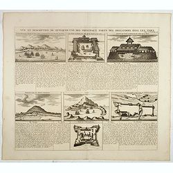
Vue et description de quelques-uns des principaux forts des Hallandois dans les Indes.
Interesting sheet with seven detailed views illustrating the most important Dutch trading outposts and fortified colonial possessions in South East Asia, including 4 harb...
Place & Date: Amsterdam, 1728
Selling price: $100
Sold in 2018
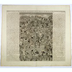
Representation Et Description Du Soulevement Des IV. Princes Du Mogol Contre L'Empereur Leur Père du Combat dans lequel Aureng-Zeb demeura vainqueur dese trois Freres & c. sit ensuite proclamer Empereur.
Fascinating engraving depicting a grand battle between the princes of the Mughal Empire. Aurangzeb was the last of the great Mughal emperors and the empire reached its la...
Place & Date: Amsterdam, 1728
Selling price: $54
Sold in 2017
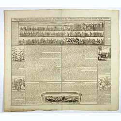
Description du pelerinage des turcs a la Mecque et a Medine . . .
Fascinating engraving depicting Turkish peoples en route from the gates of Cairo to visit their holy sites in Mecca and Medina is in a beautifully detailed vignette which...
Place & Date: Amsterdam, 1728
Selling price: $55
Sold in 2017
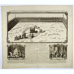
Le temple de la Mecque avec une description de tout ce qu'on y voit . . .
Fascinating engraving depicting the Muslim Kaaba at Mecca. Below the main image are two smaller vignette images of people praying. In between the two vignettes is a key (...
Place & Date: Amsterdam, 1728
Selling price: $56
Sold in 2017
Kaarte van de Eylanden Pysang, by Padang. Gelegen aan de West kust van Sumatra.
Very rare chart of Pisang Island, a small island near Padang, on the west coast of Sumatra, Indonesia. Oriented to the west, this map covers the coast of Padang, and the ...
Place & Date: Amsterdam, 1728
Selling price: $100
Sold in 2017
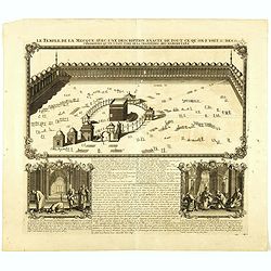
Le temple de la Mecque avec une description de tout ce qu'on y voit . . .
Fascinating engraving depicting the Muslim Kaaba at Mecca, Arabia. Below the main image are two smaller vignette images of people praying. In between the two vignettes is...
Place & Date: Amsterdam, 1728
Selling price: $200
Sold in 2018
L'Inde de ça le Gange, suivant les nouvelles observations...
Uncommon edition of this map of South of India, with part of Ceylon. From Le Nouveau Theatre du Monde, ou la Geographie Royale.
Place & Date: Amsterdam, 1728
Selling price: $210
Sold in 2021
[4 sheets] Portraits du Grand Seigneur G des principaux Officiers de l'Empire Ottoman, tirez .... / Portraits du grand seigneur é des principaux officiers de l'empire Ottoman . / Viandes & breuvages des Turcs / La maniere dont les Turcs mangent
Four engraved, decorative sheets showing images of Turcs officials and cultural images. Each sheet measures 37 x 43 cm. except the smaller which measures 38 x 23cm.From C...
Place & Date: Amsterdam, ca. 1728
Selling price: $55
Sold in 2019
Carte de la route par terre depuis Jokaitz jusqu'à Fammamatz.
Detailed and attractive map from his important and comprehensive work. The land route from Yokkaichi to Hammamatsu. Kaempfer's greatest cartographic achievement was his r...
Place & Date: The Hague, 1729
Selling price: $300
Sold in 2011
Paradigma XV Provinciarum et CLV Urbium Capitalium Sinensis Imperij Cum Templis...
Rare map of China from Stocklein's "Neuer Welt Bolt", a German translation of the Jesuit Lettres Edifiantes. Based on Philippe Couplet's map of 1686, the map sh...
Place & Date: Augsburg, 1729
Selling price: $750
Sold in 2010
Ierusalem
Great bird's eye plan of the holy city flanked by engravings of religious icons, and two priests. At the top is a large elevation of the Temple of Solomon and at bottom i...
Place & Date: Amsterdam 1729
Selling price: $250
Sold
De Manilles of Philippines Eylanden benevens de Moluccos, Macassar, Tymor en andere door P.W.Verhoeve aangedaan.
A beautifully engraved map of the area around the Philippines. Showing the track of the voyage by Pieter Willem Verhoeve.From Galerie Agréable du Monde, a sixty-six volu...
Place & Date: Leiden 1729
Selling price: $600
Sold
Nouvelle Carte de L'Asie.
An uncommon and beautifully engraved map of Asia, including Australia. In the upper right corner, north of Japan Companies Land.From Galerie Agréable du Monde, a sixty-s...
Place & Date: Leiden 1729
Selling price: $250
Sold
William Adams Reystogt na Oost-Indien.. JAPAN..
Map of Japan and Korea. In lower right a fine title cartouche showing William Adams during an audience with the shogun, who sits under a baldachin on a fancifully portray...
Place & Date: Leiden 1729
Selling price: $450
Sold
Imperii Sinarum
Map with a fair number of provinces & cities in the interior. The Great Wall is depicted along the northern border. A large fictitious interior lake labeled Kia Lacus...
Place & Date: Amsterdam 1729
Selling price: $300
Sold
Carte de la route depuis Nagasaki jusqu' à Kokura.
Detailed and attractive map from his important and comprehensive work. The east-oriented route map from Nagasaki to Kokura.Kaempfer's greatest cartographic achievement wa...
Place & Date: The Hague 1729
Selling price: $150
Sold
Carte de la route depuis Kokura jusqu' à Khurissima.
Detailed and attractive map from his important and comprehensive work. The route from Kokura to Kurishima.Kaempfer's greatest cartographic achievement was his route maps ...
Place & Date: The Hague 1729
Selling price: $150
Sold
De Gelegentheyt van t' Paradys en t' Landt Canaan, mitsgaders d' eerst bewoonde Landen der Patriarchen.
Dutch so-called ' Staten' bibles, published between 1637 and c. 1760, contained 5 maps: The World, ' Paradise', The Perigrinations, The Promised Land Canaan, The Travels ...
Place & Date: Amsterdam, Pieter en Jacob Keur, 1729
Selling price: $250
Sold
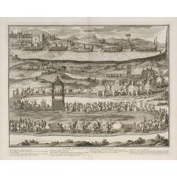
Pompe funèbre des rois de Tunquin.
Place & Date: London, 1729
Selling price: $160
Sold in 2010
Constantinople Ville de la Turquie en Europe.
Beautiful view of Constantinople, from "La Galerie agreable du monde. . . divisée en LXVI tomes...Cette partie comprend le tome premiere d'Hongrie, Turquie en Europ...
Place & Date: Leiden, 1729
Selling price: $300
Sold in 2011
Constantinople Ville de la Turquie en Europe.
Beautiful view of Constantinople, from "La Galerie agreable du monde. . . divisée en LXVI tomes...Cette partie comprend le tome premiere d'Hongrie, Turquie en Europ...
Place & Date: Leiden, 1729
Selling price: $450
Sold in 2014
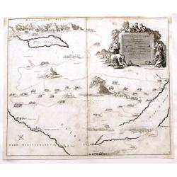
Voyage des Enfans F'Israel Dans le Desert depuis Sortie D'Egypte par la Mer Rouge Insquest au Pays de Canaan.
Decorative map of the HOly Land with a bird's eye view of the Sinai Desert, showing the wanderings of Moses and the Children of Israel through Egypt to Canaan. It feature...
Place & Date: Amsterdam, 1729
Selling price: $20
Sold in 2016
Imperii Sinarum.
Map of China. Along the northern border the Great Wall is visible. Note a large, fancyful lake named Kia Lacus which is the source of five large rivers. The map shows als...
Place & Date: Amsterdam, 1729
Selling price: $200
Sold in 2016
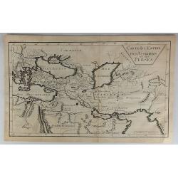
Carte de L'Empire des Assiriens et des Perses.
Striking map of Persia and Arabia. It is from “METHODE POUR ETUDIER L’HISTOIRE” by L’Abbe Lenglet du Fresnoy, pulished in Paris in 1729. The map is quite rare and...
Place & Date: Paris, 1729
Selling price: $17
Sold in 2023
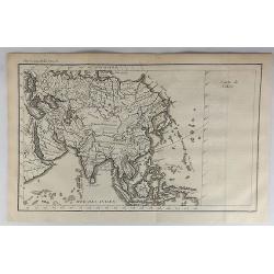
Carte de l'Asie.
A striking map of Asia. It is from “METHODE POUR ETUDIER L’HISTOIRE” by L’Abbe Lenglet du Fresnoy, published in Paris in 1729. The map is quite rare, and is not n...
Place & Date: Paris, 1729
Selling price: $11
Sold in 2021
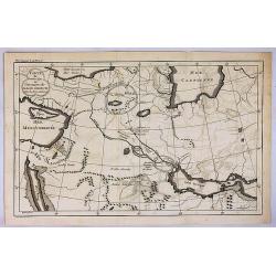
Carte du Premier Age, ou Situation du Paradis Terrestre.
A striking map of the ancient Middle East. It is from METHODE POUR ETUDIER L’HISTOIRE by L’Abbe Lenglet du Fresnoy, published in Paris in 1729. The map is quite rare ...
Place & Date: Paris, 1729
Selling price: $31
Sold in 2017
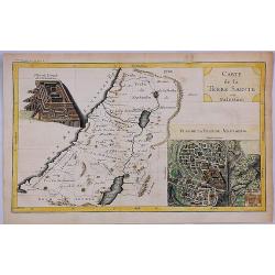
Carte de la Terre Sainte ou Palestine.
A striking map of the Holy Land (Palestine). It is from "METHODE POUR ETUDIER L’HISTOIRE" by L’Abbe Lenglet du Fresnoy, published in Paris in 1729. The map ...
Place & Date: Paris, 1729
Selling price: $120
Sold in 2020
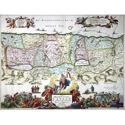
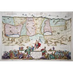
Het Beloofde Landt Canaan door wandelt van onsen Salichmaecker Iesu Christo, neffens syne Apostelen.
A beautifully engraved map of the ancient land of Canaan which roughly corresponds to present-day Israel. Cherubs hold up a draped cloth of key symbols, also a scale pane...
Place & Date: Amsterdam, Pieter and Jacob Keur, 1729
Selling price: $96
Sold in 2020
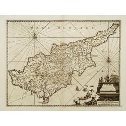
Cypre, île de la Méditerrannée.
This map by van der Aa copies the Cyprus map of Willem Blaeu . It is smaller in size and Blaeu's exquisite decorative treatment has been replaced by a cartouche and new p...
Place & Date: Leiden 1730
Selling price: $1150
Sold
Recentissima Asiae Delineatio..
A fine example of this detailed map of Asia showing the outlines of New Holland, Terre des Papons, Nova Britannia and Capentaria. The cartouche shows a Sultan on his thro...
Place & Date: Nuremberg 1730
Selling price: $400
Sold
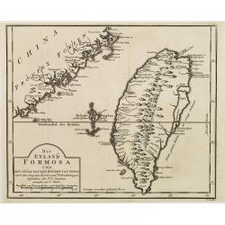
Das Eyland Formosa und ein stück von den Küsten von China..
A rare German edition of this well-known map of Taiwan, based on Jesuit information. The text along the island's east-coast claims: Of this coast little is known .
Place & Date: Paris 1730
Selling price: $550
Sold
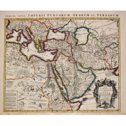
Carte de la Turquie de l'Arabie et da le Perse.
Superb map of the Ottoman Empire stretching from the Balkans through present-day Turkmenistan in the north and including Northeastern Africa and the Arabian Peninsula. Th...
Place & Date: Amsterdam, c. 1730
Selling price: $425
Sold in 2016
Asiae Recentissima Delineatio, Qua Status Imperia totius Orientalis. . .
This state appears to be an update of his father's Asia map of c.1712 (Sweet 109). An important innovation is the appearance of Kamchatka, which is represented as a huge ...
Place & Date: Nuremberg 1730
Selling price: $250
Sold in 2008
Recentissima Asiae Delineatio. . .
A fine example of this detailed map of Asia showing the outlines of New Holland, Terre des Papons, Nova Britannia and Capentaria. The cartouche shows a Sultan on his thro...
Place & Date: Nuremberg, 1730
Selling price: $300
Sold in 2008
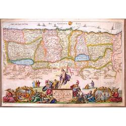
Het Beloofde Landt Canaan..
Het Beloofde Landt Canaan door wandelt van onsen Salichmaecker Iesu Christo, neffens syne Apostelen. Fine map of Israel with north oriented to right. Large decorative tit...
Place & Date: Amsterdam, 1730
Selling price: $120
Sold in 2009
Tab. XII Asiae Taprobanam repraesentans Medius meridianus 125 ad quem reloqui inclinantur ratione aequin octalis et 9 septentrionalis
Ptolemaic map of Taprobana. The map itself depicts the island with the typical misconceptions of Ptolemy with the island straddling the Equator and showing a small part o...
Place & Date: Amsterdam, 1578-1730
Selling price: $125
Sold in 2010
Tab.X Asiae Complectens Indiam intra gangem. . .
A Ptolemaic view of India. The Himalayan Mountains stretch across the top of the map and the Indus and Ganges river systems are well delineated. The subcontinent is consi...
Place & Date: Amsterdam, 1730
Selling price: $80
Sold in 2010
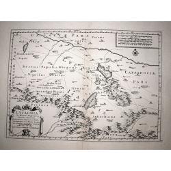
Lycaonia.
Very scarce map of the Lycaonia region of central modern day Turkey, a region rarely mapped in any detail. Published by Covens & Mortier in 1730, a reworked copy of t...
Place & Date: Amsterdam, 1730
Selling price: $100
Sold in 2017
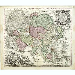
Asia cum omnibus Imperiis, Provinciis, Statibus et ..
A finely engraved and decorative mid-18th century map published in Augsburg, Germany and incorporating two large decorative title cartouches upper right and bottom left. ...
Place & Date: Augsburg, 1730
Selling price: $500
Sold in 2012
Het Beloofde Landt Canaan Door Wandelt van Onsen Salichmaecker Iesu Christo Neffens Syne Apostelen.
Oriented to the West, this map covers the Holy Land to just beyond the Jordan River. This map was published by the Keur family in the "KEUR BIBLE".Daniel Stoope...
Place & Date: Amsterdam, 1730
Selling price: $120
Sold in 2018
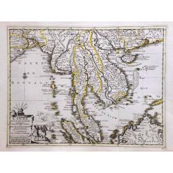
L'Inde de la le Gange, suivant les nouvelles observations.
A decorative map of Malaysia, Thailand, Indo China and the Northern parts of the islands of Sumatra and Borneo. Singapore marked as Sincapour. Pieter van der Aa is highl...
Place & Date: Amsterdam, c. 1730
Selling price: $660
Sold in 2014
Scheuzcher's Iter ad Ophir.
A striking map of Africa and Arabia featuring Sumatra, The Maldive Islands and the Persian Gulf. The map is from Scheuzcher's "PHYSICA SACRA" from 1730 and was ...
Place & Date: Augsburg, 1730
Selling price: $96
Sold in 2017
Tab. I. Asiae, in qua Galatia, Cappadocia, Pontus, Bithynia, Asia Minor, Pamphylia, Lycia, ac Cilicia... (With Cyprus)
A fine Ptolemaic map of Turkey and Cyprus showing its ancient political divisions. Two fierce sea monsters fill the Mediterranean Sea. Decorated with a strapwork title ca...
Place & Date: Amsterdam, 1730
Selling price: $125
Sold in 2015
L'Inde de la le Gange, Suivant les Nouvelles Observations.
An attractive detailed map of Malaysia, Thailand, Indo-China, Sumatra, Borneo and Singapore, spelt as "Sincapour" on the map from the Covens and Mortier edition...
Place & Date: Amsterdam, 1730
Selling price: $425
Sold in 2017
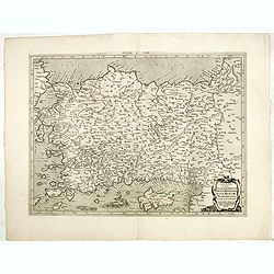
Chersonesi quae hodie Natolia Descriptio.
Lovely map of Asia Minor, with some parts of the eastern Greek Archipelago, plus Cyprus and northern Syria. Cherub holding banner title in top right corner.
Place & Date: Amsterdam, ca. 1730
Selling price: $55
Sold in 2018
Asia Cum Omnibus Imperiis Provinciis Statibus et Insulis Iuxta Observationes Recentissimas et Accuratissimas Correcte et Adornata...
A gorgeous colored example of Seutter's map of Asia, with two spectacular embellishments. It depicts an incomplete northern coastline of Australia, and speculative region...
Place & Date: Augsburg, ca 1730
Selling price: $315
Sold in 2017
[Antique map of China] Opulentissimum Sinarum Imperium
A highly decorative and strongly engraved map of China that includes the islands of Hainan and Formosa (Taiwan), the Korean peninsula and western Japan.The cartography is...
Place & Date: Augsburg, ca 1730
Selling price: $1550
Sold in 2017
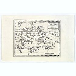
The Island of Celebes, or Macassar with the Islands of Banda, Amboyna. . .
A detailed map of the islands from Eastern Brunei to Timor and part of New Guinea, centered on the Moluccas, including the famous Spice Islands that were once the heart o...
Place & Date: London, ca. 1730
Selling price: $55
Sold in 2019
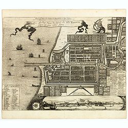
Plan de la Ville et du Chateau de Batavia en l'Isle de Iava / Ware affbeeldinge wegens het Casteel ende Stadt Batavia gelegen opt groot Eylant Java.
Detailed East-oriented plan of Jakarta former Batavia on Java / Indonesia. With bird's-eye view from sea side, various ships and a lion. Two inset keys with detailed desc...
Place & Date: Leiden, 1730
Selling price: $300
Sold in 2019
Perspective de la côte de Lucon pres de Manille a 6 lieues de la cote la plus haute montagne etant à l'est.
The print shows most likely Albay Bay on the Southeast Coast of Luzon with mountains risng in the back. Showing Dutch vessels in the foreground, likely those of Olivier v...
Place & Date: Paris / Amsterdam, ca 1730
Selling price: $375
Sold in 2017
Tab.X Asiae Complectens Indiam intra gangem. . .
A Ptolemaic view of India. The Himalayan Mountains stretch across the top of the map and the Indus and Ganges river systems are well delineated. The subcontinent is consi...
Place & Date: Amsterdam, 1730
Selling price: $24
Sold in 2018
Imperii Russici et Tatariae Universae tam majoris et Asiaticae quam minoris et Europae Tabula.
Detailed map of the Asian part of the Russian Empire, from the Caspian Sea and Bergen Island to Japan and the Pacific.
Place & Date: Augsburg, 1730
Selling price: $120
Sold in 2018
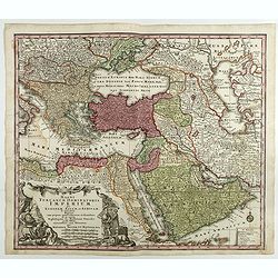
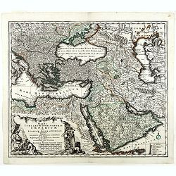
Magni Turcarum Dominatoris Imperium per Europam ..
Alluring map of the Near and Middle East centered on Turkey, giving good detail in the Arabian Peninsula.With large cartouche in lower left depicting figures with turbans...
Place & Date: Augsburg, 1730
Selling price: $150
Sold in 2018
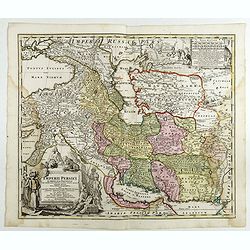
Imperii Persici in omnes suas Provincias . . . Exacte Divisi Nova Tabula Geographica. . .
Showing the eastern part of Turkey and Cyprus, Palestine, Persian Gulf, including Gulf of Oman, Caspian Sea, Iran and the north-west territories of India.Embellished with...
Place & Date: Ausburg, 1730
Selling price: $100
Sold in 2017
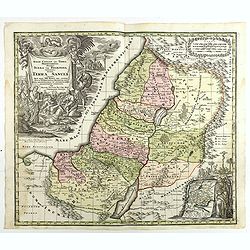
Terra Sancta vocata quae olim XII tribus . . .
Map of the Holy Land, among the 12 Tribes and divided into 6 provinces. In the upper left near the title cartouche Pharaoh's daughter discovers Moses in the River Nile. O...
Place & Date: Augsburg, 1730
Selling price: $185
Sold in 2018
Magni Turcarum Dominatoris Imperium per Europam . . .
Alluring map of the Near and Middle East centered on Turkey, giving good detail in the Arabian Peninsula.With large cartouche in lower left depicting figures with turbans...
Place & Date: Augsburg, 1730
Selling price: $250
Sold in 2019












![[4 sheets] Portraits du Grand Seigneur G des principaux Officiers de l'Empire Ottoman, tirez .... / Portraits du grand seigneur é des principaux officiers de l'empire Ottoman . / Viandes & breuvages des Turcs / La maniere dont les Turcs mangent](/uploads/cache/83054-250x250.jpg)













![[Antique map of China] Opulentissimum Sinarum Imperium](/uploads/cache/97974-250x250.jpg)
