Browse Listings in Asia
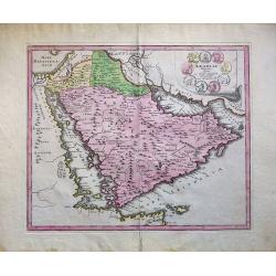
Arabiae Veteris Typus.
An attractive map of the ancient Arabian Peninsular, with a colored pictorial title cartouche.
Place & Date: Nuremberg, 1720
Selling price: $220
Sold in 2018
Asia antiqua et nova.
Interesting map of Asia from a German edition of Philipp Clüver's famous Introductionis in Universam geographicam, first published in Leiden in 1624. Philipp Clüver (15...
Place & Date: Wolfenbüttel, ca 1720
Selling price: $95
Sold in 2019
Vue et description de la Ville de Meaco Capitale du Japon. . .
Top part of the print shows the town of Meaco (Kyoto) at that time the capital of Japan, with a coach and horses in the foreground. Other parts show among other things th...
Place & Date: Amsterdam, 1720
Selling price: $140
Sold in 2020
[Four engravings showing People from India]
Interesting sheet with four illustrations of different activities of people from India, from Chatelain's monumental 7 volume Atlas Historique. In upper right margin: 'Tom...
Place & Date: Amsterdam, ca. 1720
Selling price: $50
Sold in 2017
Portraits du Grand Seigneur et des Principaux Officiers de l'Empire Ottoman. . .
These four impressive engravings are a wonderful example of Chatelain’s elegant plates.Divided in 4 panels accompanied by detailed descriptions, are examples of costume...
Place & Date: Amsterdam, ca. 1720
Selling price: $50
Sold in 2018
Sek ou Seich Omar, mort en 1493. Babar ou Baber ou Babour, mort en 1530. Amayum ou Houmayon, mort en 1552. Akebar ou Xa Aguebar, mort en 1605.
Striking and highly detailed copper engraved plate including 4 Indian Princes or Kings. From Chatelain's "Atlas Historique", 1732-1739. In upper right margin: '...
Place & Date: Amsterdam, 1720
Selling price: $35
Sold in 2018
Description des Tombeaux & autres Monumens Anciens..
This impressive engraving is a wonderful example of Chatelain’s elegant plates.Ornamented with views representing burial monuments and mausoleums hewed out in the rock ...
Place & Date: Amsterdam, ca. 1720
Selling price: $25
Sold in 2018
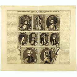
Habillemens des Dames.. Constantinople.. Serrail..
This beautiful copper-engraving containing 7 engravings of native female and 3 males of Istanbul.From Chatelain's Atlas Historique et Méthodique .
Place & Date: Amsterdam, 1720
Selling price: $50
Sold in 2018
Table contenant les divisions de l'Asie dans toutes ses parties.
This folio sheet gives a breakdown of Asia into 6 principal regions.Henri Abraham Chatelain (1684 – 1743) was a Huguenot pastor of Parisian origins. He lived consecutiv...
Place & Date: Amsterdam, 1720
Selling price: $20
Sold in 2021
Habillemens des Dames.. Constantinople.. Serrail..
This beautiful copper-engraving containing 7 engravings of native female and 3 males of Istanbul. From Chatelain's monumental 7 volume "Atlas Historique". Henri...
Place & Date: Amsterdam, 1720
Selling price: $50
Sold in 2018
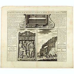
Antiquez curieuses qui se trouvent aux environs de Smyrne, et sur le chemin d'Ephese.
Folio sheet describing and depicting ancient Greek monuments and ruins in Smyrna (Izmir). From Chatelain's monumental 7 volume "Atlas Historique". Henri Abraham...
Place & Date: Amsterdam, 1720
Selling price: $25
Sold in 2020
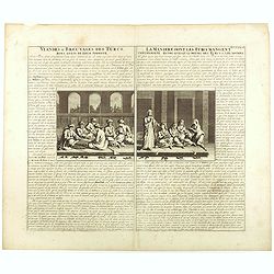
Viandes & breuvages des Turcs . . . / La manière dont les Turcs mangent . . .
Interesting sheet with a detailed views illustrating the lunch time in turkey, with descriptive French text, from Chatelain's monumental 7 volume Atlas Historique. In upp...
Place & Date: Amsterdam, ca. 1720
Selling price: $50
Sold in 2018
Carte de l'Asie selon les auteurs anciens enrichie de remarques historiques sur les changements qui y sont arrivez.
Map of Asia, extending from the Mediterranean, the Red Sea and the Saudi Arabian Peninsula to Japan, the Philippines and Southeast Asia. With explanatory text on either s...
Place & Date: Amsterdam, 1720
Selling price: $150
Sold in 2018
Nouvelle Carte de l'Asie avec des Tables Alphabetiques. . .
Full title: Nouvelle Carte de l' Asie avec des Tables Alphabetiques pour Trouver sans Peine les Etats des Principaux Princes de Cette partie du Monde. A fine map of Asia ...
Place & Date: Paris, ca 1720
Selling price: $90
Sold in 2019
Vue & description de la ville de Siam, des pagodes, des Talapoins ou religieux de ce pais. . .
Page with a profile view on the capital Ayutthaya, the throne of the King, the King who rides an elephant, ships on a lake, the typical plants such as ginseng, the monks ...
Place & Date: Amsterdam, ca. 1720
Selling price: $150
Sold in 2020
CARTE DE L'ASIE, Selon les auteurs anciens enriche de Remarques Historiques sur le Changements qui y sont arrivez.
A map of Asia, extending from the Mediterranean, the Red Sea and the Saudi Arabian Peninsula to Japan, the Philippines and Southeast Asia. With explanatory text on either...
Place & Date: Amsterdam, 1720
Selling price: $67
Sold in 2019
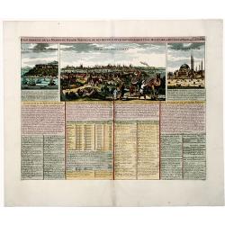
État abrégé de la MAISON du GRAND SEIGNEUR, de ses revenus et le gouvernement civil, militaire et ecclesiastique de cet Empire Grand document gravé.
View of the city of Constantinople, the seraglio of the sultan and of Hagia Sophia. Many insets with information and descriptions.More about "Chatelain Atlas." ...
Place & Date: Amsterdam, 1720
Selling price: $60
Sold in 2019
Vue & description de la ville de Siam, des Pagodes, des Talapoins oureligeux ce ce pais, des balons du roi & de ses elephans, de la maniere de dompter ces ..
Page with a profile view on the capital Ayutthaya, the throne of the King, the King who rides an elephant, ships on a lake, the typical plants such as ginseng, the monks ...
Place & Date: Amsterdam, ca. 1720
Selling price: $120
Sold in 2019
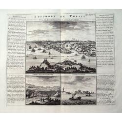
Bosphore de Thrace.
A large sheet with three views and extensive text in French. The main view is a bird's-eye view of Istanbul after De Bruyn. The two smaller views show an aqueduct near Is...
Place & Date: Amsterdam, 1720
Selling price: $78
Sold in 2019
Le Royaume de Siam avec Les Royaumes Qui Luy sont Tributaries & c.
Part of Mortier's large Format multiple sheet Map of the Kingdom of Siam, Malaysian Peninsula, Singapore, Indonesia, etc. A gorgeous full color example of Pierre Mortier'...
Place & Date: Amsterdam, ca 1720
Selling price: $160
Sold in 2021
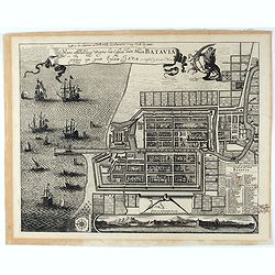
Waere Affbeeldinge Wegens het Casteel ende Stadt BATAVIA Gelegen opt Groot Eylant Java.
A good impression of this finely engraved and detailed plan of Batavia, present-day Jakarta, the Dutch center of trading activities in the East Indies. Copied after Cleme...
Place & Date: Amsterdam, 1721
Temple de Jerusalem
This fine copper engraved view of the temple and surrounding city is full of activity, with hundreds of people, animals, and carriages. It is based on the plan of Villalp...
Place & Date: Amsterdam, 1721
Selling price: $150
Sold in 2009
Les Indes Orientales sous le Nom de queles est compris L'Empire du Grand Mogol, Les Deux Presqu'Isles Deca et de la Le Gange, Les Maldives, et L'Isle de Ceylan...
Rare map of Southeast Asia, showing India, Tibet, parts of China with Canton, Malaysia, Singapore (Sincapur), Thailand, Sumatra, the Maledives, parts of Borneo and Java. ...
Place & Date: Paris, 1721
Selling price: $850
Sold in 2015
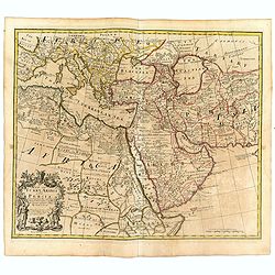
A map of Turkey Arabia and Persia . .
Fine map of Arabia, Egypt, Turkey, Greece, Persia and Mediterranean with decorative title cartouche flanked by a Greek and a Turk, based on the work of Guillaume De L'Isl...
Place & Date: London, 1721
Selling price: $700
Sold in 2016
A New Map of India & China From the latest Observations. . .
Fine map of Indonesia, India, China, Philippines, Japan, Korea and Taiwan, with decorative title cartouche. With dedication to the directors of the English East India Com...
Place & Date: London, 1721
Selling price: $750
Sold in 2016
Waere Affbeeldinge Wegens het Casteel ende Stadt BATAVIA Gelegen opt Groot Eylant Java.
Excellent impression of Batavia's finely engraved and detailed plan, present-day Jakarta, the Dutch center of trading activities in the East Indies. Copied after Clement ...
Place & Date: Amsterdam, 1721
Selling price: $1750
Sold in 2016
Mustapha I. Türckischer käyser.
Portrait engraving of Mustapha I. or Mustafa I (1591-1639), Ottoman sultan (1617-1618, 1622-1623), brother and successor of Ahmed I to the throne of the Ottoman Empire (T...
Place & Date: Leipzig, 1721/1722
Selling price: $60
Sold in 2017
Plan et distribution de la terre de Chanaan.
Map of the tribes of Israel, with French text.
Place & Date: Paris 1722
Selling price: $100
Sold
Imperii Orientalis Circumjacenttium..Constantiono..
Including Greece, Cyprus, Ukraine, Moldavia and the Black Sea.
Place & Date: Paris, 1722
Selling price: $450
Sold in 2008
L'Asie dressée selon les dernières relations et suivant les nouvelles découvertes dont les points principaux. . .
Showing the land masses from Arabia to Japon ou I.de Niphon and Nouvelle Zeelande (but what is part of New Guinea). Decorative dedication panel and title cartouche.
Place & Date: Paris, 1722
Selling price: $200
Sold in 2011
La Chine.
The map is of interest for the use of Sea of Japan / East Sea, the sea between Korea and Japan, here called "Mer Orientale".This small Italian map of China, Kor...
Place & Date: Venice, c.1722
Selling price: $450
Sold in 2023
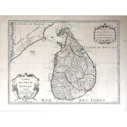
Carte de l'Isle de Ceylan.
A detailed map of Sri Lanka with soundings and two large title cartouches. Engraved by Charles Amadeus de Berey, an engraver active in Paris. Dated 1722 at the bottom of ...
Place & Date: Paris, 1722
Selling price: $200
Sold in 2018
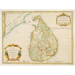
Carte de l'Isle de Ceylan..
Detailed map of Sri Lanka with soundings and two large title cartouches. Engraved by Charles Amadeus de Berey, an engraver active in Paris. Dated 1700.
Place & Date: Paris 1723
Selling price: $150
Sold
Carte de l'Isle de Ceylan..
Engraved by Charles Amadeus de Berey, an engraver active in Paris. Detailed map of Shri Lanka with soundings and two large title cartouches.
Place & Date: Paris 1723
Selling price: $270
Sold
Carte des Cotes de Malabar et de Coromandel..
Detailed and attractive map of India and the northern tip of Sri Lanka. With decorative title cartouche and two compass-roses.
Place & Date: Paris, 1723
Selling price: $600
Sold in 2011
Carte des Cotes de Malabar et de Coromandel..
An early issue of this detailed and attractive map of India and the northern tip of Sri Lanka. With decorative title cartouche and two compass-roses.Engraved by Marin.
Place & Date: Paris 1723
Selling price: $450
Sold
Carte des Cotes de Malabar et de Coromandel. . .
Detailed and attractive map of India and the northern tip of Sri Lanka. With decorative title cartouche and two compass-roses. Engraved by Martin.Interestingly; during th...
Place & Date: Paris, 1723
Selling price: $550
Sold in 2015
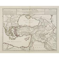
Retraite des Dix Mille Tabula conspectum exhibens Regionum omnium quas Cyrus Junior, Artaxerxi fratibellum illaturus ac Cyro in acie caeso. . .
Depicting ancient Turkey and Greece, including Cyprus, Black Sea, Iraq and Persia.
Place & Date: Paris, 1723
Selling price: $100
Sold in 2008
Carte d'Asie, dressée sur les Memoires envoyéz par le Czar. . .
The important 1723 map of Asia by G.de L'Isle. The map is of interest for the use of East Sea, the sea between Korea and Japan, here called "Mer de Corée". Wit...
Place & Date: Paris, 1723
Selling price: $900
Sold in 2010
Carte des Cotes de Malabar et de Coromandel.
A striking map of southern India and Northern Ceylon, that extends to the Maldive Islands, and the northern tip of Sri Lanka. Cities, trade routes and topography are deta...
Place & Date: Paris, 1723
Selling price: $92
Sold in 2018
Carte des Cotes de Malabar et de Coromandel..
Detailed and attractive map of India and the northern tip of Sri Lanka. Prepared by G. de l'Isle and published in Amsterdam. With decorative title cartouche and two compa...
Place & Date: Amsterdam, 1723
Selling price: $95
Sold in 2020
Great Tartary, The Isle of Japan.
A nice copper engraved map of Northern Asia and Japan. It extends from the Caspian Sea and "Part of Moscovy or Russia" in the west to China in the east, northwa...
Place & Date: London, ca 1723
Selling price: $17
Sold in 2021
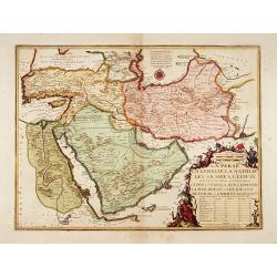
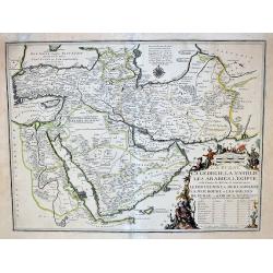
La Perse La Georgie, La Natolie Les Arabies..
Rare map of the Arabian Peninsular, Turkey, Persia. Prepared by Nicolas de Fer, issued by G.Danet.
Place & Date: Paris 1724
Selling price: $850
Sold
Nieuwe Kaart van het Eyland Sumatra..
Fine chart depicting the Island of Sumatra and the southern coasts of Malaysia from Quedo to Johore. North is orientated to the left of the page. Singapore is probably id...
Place & Date: Amsterdam 1724
Selling price: $361
Sold
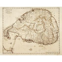
Nieuwe Kaart van het Eyland Ceylon opgestelt door..
Fine chart depicting the Island of Ceylon/Sri Lanka.Good interior detail is given with settlements, roads, etc. An attractive early map, one of the few early very detaile...
Place & Date: Amsterdam 1724
Selling price: $250
Sold
[Manilhas Bay]
Fine chart depicting Manilla Bay. Little interior detail is given but the coastlines, settlements and principal coastal features are identified. An attractive early chart...
Place & Date: Amsterdam 1724
Selling price: $200
Sold
No title [Persia]
Fine map centered on Persia, including Caspian Sea, northern part of the Arabian Peninsular, etc.
Place & Date: Amsterdam 1724
Selling price: $350
Sold
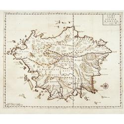
Kaart van het eyland Borneo.
Fine chart depicting the Island of Borneo. North is orientated to the left of the page.Little interior detail is given but the coastlines, settlements and principal coast...
Place & Date: Amsterdam 1724
Selling price: $400
Sold
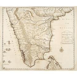
Nieuwe Kaart van Choromandel ende Malabar..
"Fine chart depicting the southern part of India and the northern tip of Ceylon. Much detail is given along the coastlines, settlements and principal coastal feature...
Place & Date: Amsterdam 1724
Selling price: $150
Sold
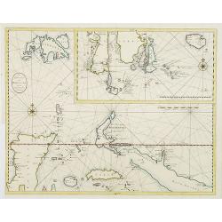
[Lucon of Luconia]
Fine chart depicting the Islands of the Philippines. Little interior detail is given but the coastlines, settlements and principal coastal features are identified. An att...
Place & Date: Amsterdam 1724
Selling price: $650
Sold
De Landvoogdy der Moluccos..
"Fine chart depicting the Moluccas islands. Little interior detail is given but the coastlines, settlements and principal coastal features are identified. To the low...
Place & Date: Amsterdam 1724
Selling price: $1000
Sold
Tabula Indiae Orientalis et regnorum adjacentium.
The map originally appeared in Valentijn's book Oud en Nieuw Oost-Indien (Dordrecht/Amsterdam 1724/26). With in the right bottom corner the imprint J.van Braam en G. onde...
Place & Date: Amsterdam 1724
Selling price: $800
Sold
Nieuwe kaart van het eyland Japan.
The map originally appeared in Valentijn's book Oud en Nieuw Oost-Indien (Dordrecht/Amsterdam 1724/26). With in the right bottom corner the imprint J.van Braam en G. onde...
Place & Date: Amsterdam 1724
Selling price: $1100
Sold
Nieuwe Kaart van het Eyland Sumatra..
Fine chart depicting the Island of Sumatra and the southern coasts of Malaysia from Quedo to Johore. North is orientated to the left of the page. Singapore is probably id...
Place & Date: Amsterdam 1724
Selling price: $1050
Sold
Nova Asiae tabula e majori in minorem..
On this map Hokkaido is even bigger depicted than Honshu and connected to Japan's main island.
Place & Date: Nurnberg, 1724
Selling price: $500
Sold in 2015
Nieuwe Kaart van Choromandel ende Malabar..
Fine map depicting the southern part of India and the northern tip of Ceylon. Much detail is given along the coastlines, settlements and principal coastal features are id...
Place & Date: Amsterdam 1724
Selling price: $220
Sold
De Landvoogdy der Moluccos..
Fine chart depicting the Moluccas islands. Little interior detail is given but the coastlines, settlements and principal coastal features are identified. To the lower rig...
Place & Date: Amsterdam, 1724
Selling price: $400
Sold in 2008
Nieuwe kaart van het eyland Japan.
The map originally appeared in Valentijn's book Oud en Nieuw Oost-Indien (Dordrecht/Amsterdam 1724/26). With in the right bottom corner the imprint J.van Braam en G. onde...
Place & Date: Amsterdam, 1724
Selling price: $650
Sold in 2008
Nieuwe Kaart van Choromandel ende Malabar..
Fine map depicting the southern part of India and the northern tip of Ceylon. Much detail is given along the coastlines, settlements and principal coastal features are id...
Place & Date: Amsterdam, 1724
Selling price: $275
Sold in 2015
Tabula Indiae Orientalis et regnorum adjacentium.
Highly detailed map of Australia, Southeast Asia and the Indian Ocean depicting the working area of the V.O.C. The map originally appeared in Valentijn's book Oud en Nieu...
Place & Date: Amsterdam, 1724
Selling price: $2250
Sold in 2015
La Perse La Georgie, La Natolie Les Arabies...
A very rare map of the Arabian Peninsular, Turkey, Persia. Prepared by Nicolas de Fer, issued by G.Danet. The title is enhanced with gold.
Place & Date: Paris, 1724
Selling price: $540
Sold in 2017
Lucon of Luconia. [ Map of the Philippines]
Fine chart depicting the Islands of the Philippines. Little interior detail is given but the coastlines, settlements and principal coastal features are identified. An att...
Place & Date: Amsterdam, 1724
Selling price: $2400
Sold in 2017
Nieuwe en zeer naaukeurige kaart van t eyland Java Major of Groot Java : verdeeld in seven byzondere bestekken. . .
This large-scale map of Java is richly engraved with details of agricultural fields, roads, temples, and topography. The coastline is filled with soundings, anchorages, s...
Place & Date: Amsterdam, 1724
Selling price: $1750
Sold in 2020
Asia cum omnibus Imperiis, Provinciis, Statibus et ..
A finely engraved and decorative mid-18th century map published in Augsburg, Germany and incorporating two large decorative title cartouches upper right and bottom left. ...
Place & Date: Augsburg 1725
Selling price: $500
Sold
Asia cum omnibus Imperiis, Provinciis, Statibus et ..
A finely engraved and decorative mid-18th century map published in Augsburg, Germany and incorporating two large decorative title cartouches upper right and bottom left. ...
Place & Date: Augsburg 1725
Selling price: $250
Sold
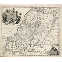
Carte de la Terre Sainte divisée selon les Douze Tribus d'Israel.
After the death of the widow of Pieter Mortier in 1719, the firm continued till 1778 as Covens & Mortier. They published numerous atlases and pocket atlases, using ma...
Place & Date: Amsterdam, 1725
Selling price: $220
Sold
Arabiae Veteris.
Striking map of the ancient Arabian Peninsular. Title cartouche embellished with colored ancient coins.
Place & Date: Nuremberg, 1725
Selling price: $125
Sold in 2008
Asia Vetus per Christoph Weigelium. . .
A very striking map of the ancient Arabian Peninsular, embellished with an colored pictorial title cartouche.
Place & Date: Nuremberg 1725
Selling price: $65
Sold in 2008
La Chine.
Scarce map based on a map published by Nicholas DeFer in Paris.
Place & Date: Antwerp, 1725
Selling price: $25
Sold in 2012
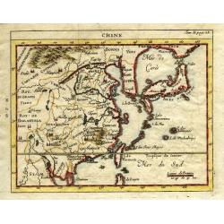
Chine.
Very uncommon state of Chevigni's map of China based on De L'Isle from "La Science des Personnes de la Cour..." published by Lottin, Genneau, and Morin. The map...
Place & Date: Paris, 1725
Selling price: $110
Sold in 2011
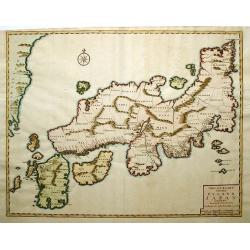
Nieuwe Kaart van het Eyland Japan...
This copper engraved map of Japan divides the country by provinces, and extends to show the eastern border of Korea. Only the mountain ranges are depicted in the interior...
Place & Date: Amsterdam, 1725
Selling price: $1000
Sold in 2014
A Map of the Holy Land Divided Into the XII Tribes of Israel.
A copper engraved featuring the Holy Land with the travels of Jesus marked. The map is enhanced by a large figural cartouche with Jesus healing Lazarus. A detailed map di...
Place & Date: London, c1725
Selling price: $27
Sold in 2018
Baye de Matecalo Dans l'Isle de Ceylon / Partie du Golfe de Bengale. ( Tome 2 Page 417)
Uncommon map of the Bay of Matecalo on Ceylon in the Gulf of Bengal. From the French reissue of the account of early Dutch voyages first published in 1608 by Commelin. Th...
Place & Date: Amsterdam, F. Bernard, 1725
Selling price: $25
Sold in 2022
Forteresse des Goramois.
Showing a view of the fortress of Goram. From the French reissue of the account of early Dutch voyages first published in 1608 by Commelin. The French translation was car...
Place & Date: Amsterdam, F. Bernard, 1725
Selling price: $50
Sold in 2016
Cranganor.
This view of Cranganor in the state of Kerala in southwestern India. From the French reissue of the account of early Dutch voyages first published in 1608 by Commelin. Th...
Place & Date: Amsterdam, F. Bernard, 1725
Selling price: $50
Sold in 2019
Amboyna. / I.Neri.
Fine engraving of the Dutch and English enclaves at Amboyna (top) and Banda-Neira (bottom). From the French reissue of the account of early Dutch voyages first published ...
Place & Date: Amsterdam, F. Bernard, 1725
Selling price: $65
Sold in 2016
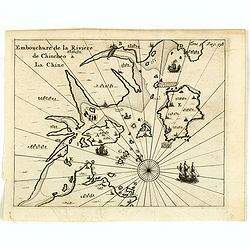
Embouchure de la rivière de Chincheo à la Chine.
This map is a view of Quanzhou Bay. Quanzhou was established in 718 during the Tang Dynasty (618–907). In those days, Guangzhou was China's greatest seaport, but this s...
Place & Date: Amsterdam, F. Bernard, 1725
Selling price: $110
Sold in 2014
Fort de Zeelande ou de Taiovang.
Rare view of Fort Zeelandia, which was a fortress built over ten years from 1624–1634 by the Dutch East India Company, in the town of Anping (Tainan) on the island of F...
Place & Date: Amsterdam, F. Bernard, 1725
Selling price: $300
Sold in 2015
Persia cum adjaccentibus regionibus.
A very striking map of the ancient Persia and present-day Iran, Pakistan and Afghanistan, embellished with an colored pictorial title cartouche, putti and Roman coins.
Place & Date: Nuremberg, 1725
Selling price: $90
Sold in 2016
Generalis Totius Imperii Russorum Novissima Tabula.
Highly detailed map of the Russian Empire and northern China covering the region from Finland and the Black Sea to Kamchatka. It is from the beginning of the period when ...
Place & Date: Nuremberg, 1725
Selling price: $130
Sold in 2016


![[Four engravings showing People from India]](/uploads/cache/39592-250x250.jpg)
















![[Manilhas Bay]](/uploads/cache/15798-250x250.jpg)
![No title [Persia]](/uploads/cache/15799-250x250.jpg)
![[Lucon of Luconia]](/uploads/cache/15797-250x250.jpg)




![Lucon of Luconia. [ Map of the Philippines]](/uploads/cache/39345-250x250.jpg)


