Browse Listings in Asia
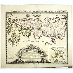
L'EMPIRE DU JAPON, TIRE DES CARTES DES JAPONNOIS (JAPAN).
A beautiful old colored map, which was published by Henri Chatelain in 1719 for his 'Atlas Historique'. Published from 1705 to 1720, the 'Atlas Historique' was intended f...
Place & Date: Amsterdam, 1719
Selling price: $400
Sold in 2019
LE ROYAUME DE SIAM avec les ROYAUMES QUI LUY sont TRIBUTAIRES et les Isles de SUMATRA ANDEMAON.
A beautiful, old colored map of South East Asia shows the Kingdom of Siam (Thailand), the Malaysian Peninsula and the islands of Borneo, Sumatra and Java. This was the do...
Place & Date: Amsterdam, 1719
Selling price: $375
Sold in 2019
Carte Nouvelle des Terres de CUCAN, de CANARA, de MALABAR, de MADURA,m et de COROMANDL.
India south of Goa, from Chatelain's monumental 'Atlas Historique', published in Amsterdam. The map includes three text boxes giving particulars of the region and its div...
Place & Date: Amsterdam, 1719
Selling price: $75
Sold in 2019
Goa Indiae orientalis metropolis.
A decorative and detailed birds-eye view of the city and harbour of Goa. The map is based upon an earlier map by Jan Huygen van Linschoten. Linschoten served 6 years as t...
Place & Date: Leiden, 1719
Selling price: $450
Sold in 2020
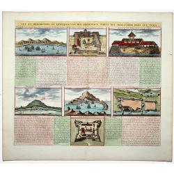
Vue et description de quelques-uns des principaux forts des Hollandois dans les Indes. (Dutch Forts).
A clean plate with seven detailed views illustrating the most important Dutch trading outposts and fortified colonial possessions in the East Indies. This plate includes ...
Place & Date: Amsterdam, 1719
Selling price: $130
Sold in 2019
La Ville de SURATTE, dans l'Empire du Mogol.
A copper engraving of Suratte, an important former trade post of the VOC, seen here with some VOC ships and local vessels in the foreground. From Pieter van der Aa's in &...
Place & Date: Leiden, 1719
Selling price: $120
Sold in 2020
Habillement De L'Empereur De La Chine & Des Dames De Son Palais Avec Quel-ques Usages & Coutumes Observees en ce Pais.
A decorative and interesting folio sheet of engravings showing the costumes of the Chinese king and his wives in the Royal Palace. A finely engraved print from Chatelain'...
Place & Date: Amsterdam, 1719
Selling price: $57
Sold in 2020
Description d' un des plus Fameux Temples des Chinois, avec leurs Principales Idoles telles que la Figure. . .
An interesting folio sheet with three engravings illustrating Chinese religion. The central engraving is of a pagoda in the Province of Fokien, which is flanked by two dr...
Place & Date: Amsterdam 1719
Selling price: $26
Sold in 2020
[Holy Land] Carte De La Terre Saint Divisee Dans Toutes Ses Parties Selon Le Nombre Des Tribus D'Israel . . .
Detailed map of the Holy Land, from Chatelain's Monumental Atlas Historique et Methodique. Edited anno 1719. The map extends from Gaza to Sidon and identifies the 12 Tri...
Place & Date: Amsterdam, 1719
Selling price: $150
Sold in 2021
[Lot of 5 maps] PERSIA - Carte la plus nouvelle et plus-exacte du Royaume de Perse
[Lot of 5 maps of Persia] - Carte la plus nouvelle et plus-exacte du Royaume de Perse, avec ses Côtes, Villes Maritimes, tous les Pays qui en dependent, et ses Lieux...
Place & Date: Leiden, 1719
Selling price: $210
Sold in 2023
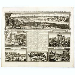
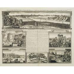
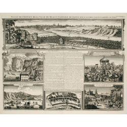
Vue et description de la Ville de Meaco Capitale du Japon..
"Top part of the print shows the town of Meaco (Kyoto) at that time the capital of Japan, with a coach and horses in the foreground. Other parts show among other thi...
Place & Date: Amsterdam, 1720
Selling price: $1000
Sold in 2010
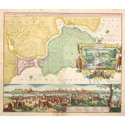
Accurate Vorstellung der .. Constantinopel..
The upper part shows Constantinople with adjoining regions. The bottom part shows a prospect of the town.
Place & Date: Nuremberg 1720
Selling price: $950
Sold
The Travels of st. Paul ..
Around 1655 Moxon (1627-1700 ) visited Amsterdam, probably to learn from the Dutch if there was a northern passage to the Indies. In Amsterdam he met father Claes and son...
Place & Date: London 1720
Selling price: $410
Sold
Descriptio Acurata Terrae Promissae.. Terre Sainte Moderne.
To the left a very attractive map of Palestine on both sides of the Jordan, after Philippe de La Rue. To the right hand side a map of Terre Sainte Moderne , under Turkish...
Place & Date: Paris 1720
Selling price: $825
Sold
l'Isle de Formosa..
A decorative map of the west coast of Taiwan and the Pescadores Islands (Penghu), showing little detail of the Taiwanese inland, apart from the immense mountain range. Fo...
Place & Date: Leiden 1720
Selling price: $1250
Sold
Magni Mogolis Imperium de novo correctum et Divisum..
A rare issue of this attractive map of northern India and Central Asia. The map was originally published by F.de Wit. P.Mortier acquired de Wit's stock of copperplates in...
Place & Date: Amsterdam 1720
Selling price: $300
Sold
Habillemens d'Hommes & Femmes de diverses provinces de la Chine avec.....la Pont volant de la Provence de Xensi.
Henri Abraham Chatelain was a Amsterdam-based geographer and publisher. His main product is the 'Atlas Historique et Méthodique', in seven volumes, published between 171...
Place & Date: Amsterdam, c. 1720
Selling price: $170
Sold
Habillement de l'Empereur de la Chine & des Dames de son Palais
Henri Abraham Chatelain was a Amsterdam-based geographer and publisher. His main product is the 'Atlas Historique et Méthodique', in seven volumes, published between 171...
Place & Date: Amsterdam, c. 1720
Selling price: $170
Sold
Insulae Iavae Borneo Sumatrae..
No text on verso. A finely engraved map in the classic Dutch baroque style of Java and parts of Bali, Sumatra, and Borneo.
Place & Date: Amsterdam 1720
Selling price: $686
Sold
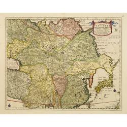
Magnae Tartariae Magni Mogolis Imperii Japoniae et Chinae
The map stretches from the Caspian Sea in the West to Formosa and Japan in the East. Korea rightly correctly depicted as a peninsula.With decorative title cartouche held ...
Place & Date: London 1720
Selling price: $500
Sold
Vue et description de la Ville de Meaco Capitale du Japon.
Top part of the print shows a panoramic view of Meaco (Kyoto) at that time the capital of Japan, with a coach and horses in the foreground. Other parts show among other t...
Place & Date: Amsterdam, 1720
Selling price: $600
Sold in 2014
De Beschryving van de Rysen Pauli..
Highly decorative map of the eastern part of the Mediterranean. At the bottom are a cartouche and four vignettes with episodes from the travels of the Apostle Paul.
Place & Date: Amsterdam, 1720
Selling price: $200
Sold
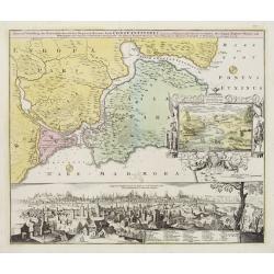
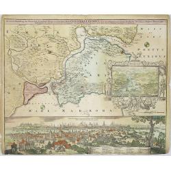
Accurate Vorstellung der Orientalisch Kayserlichen Haupt- und Residenz-Stadt Constantinopel samt ihrer Gegend und zweven berühmten Meer-Engen Bosphoro Thracio und Hellsponto.
Fine and sought-after plan of Istanbul. The allegorical title cartouche is clearly inspired by the oriental world using symbols like the half-moon and the oil lamp. Wisdo...
Place & Date: Nuremberg 1720
Selling price: $1360
Sold
Carte des Indes, de la Chine & des Isles de Sumatra, Java &c..
This fine and quite detailed general map extends from northern Japan to Timor and from India to New Guinea.Here, the Terre de Yeco in northern Japan is still joined to th...
Place & Date: Amsterdam 1720
Selling price: $200
Sold
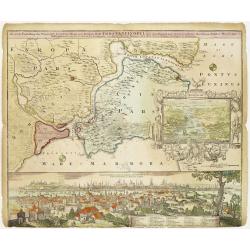
Accurate Vorstellung der Orientalisch Kayserlichen Haupt- und Residenz-Stadt Constantinopel samt ihrer Gegend und zweven berühmten Meer-Engen Bosphoro Thracio und Hellesponto..
A lovely and well engraved plan of Istanbul. A large inset features a bird's-eye view of the Bosphorus with several ships in the foreground framed with an allegorical car...
Place & Date: Nuremberg 1720
Selling price: $925
Sold
Carte des costes de l'Asie sur l'Ocean..
Pristine nautical chart with an inset of southern coast of southern Australia and Tasmania in the wake of Tasman and other 17th century Dutch explorations of these region...
Place & Date: Amsterdam 1720
Selling price: $3700
Sold
Terre Sainte Moderne que les Turcs..
Rare map of the Promised Land by De Fer after Phil de la Rue.Presents some explicatory text at the bottom and under the title cartouche.
Place & Date: Paris, 1720
Selling price: $150
Sold
Iunnan, Queicheu, Quangsi, et Quantung..
A beautifully engraved map of Southern China covering Hainan and the Pearl River Delta with Macao and the islands around present-day Hong Kong.
Place & Date: Amsterdam, 1720
Selling price: $1800
Sold
Nouvelle Carte de Moscovie où sont representés les differents etats de sa Maiesté Czarienne..
Map of Russia Tartary and part of China with key tables to the towns. Depicting the different states belonging to the Czar in Asia and Europe, showing the path of one of ...
Place & Date: Amsterdam, ca. 1720
Selling price: $190
Sold
Description des Tombeaux & autres Monumens Anciens..
This impressive engraving is a wonderful example of Chatelain\'s elegant plates.Ornamented with views representing burial monuments and mausoleums hewed out in the rock a...
Place & Date: Amsterdam, ca. 1720
Selling price: $90
Sold in 2009
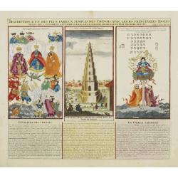
Description d'un des plus fameux temples des Chinois..
This impressive engraving is a wonderful example of Chatelain?s elegant plates.Divided in 3 panels, respectively showing the most important gods in the Chinese deities sy...
Place & Date: Amsterdam, ca. 1720
Selling price: $100
Sold
Description des habits des Persans..
This impressive engraving is a wonderful example of Chatelain\'s elegant plates.Ornamented with numerous vignettes showing the costumes of the ancient Persians.General in...
Place & Date: Amsterdam, ca. 1720
Selling price: $110
Sold in 2009
Vue et Description de quelques-uns des principaux forts des Hollandois..
This impressive engraving is a wonderful example of Chatelain's elegant plates.Ornamented with numerous vignettes representing some of the Dutch settlements in the East I...
Place & Date: Amsterdam, ca. 1720
Selling price: $160
Sold in 2008
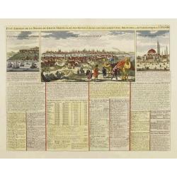
Etat abregé de la Maison du Grand Seigneur..
This impressive engraving is a wonderful example of Chatelain?s elegant plates. Ornamented with 3 vignettes: Vuë du Serrail de Constantinople, Vuë de Constantinople, Vu...
Place & Date: Amsterdam, ca. 1720
Selling price: $300
Sold
Habillement de l'Empereur de la Chine & des Dames de son Palais..
This impressive engraving is a wonderful example of Chatelain?s elegant plates.Divided in 3 panels, showing examples of costumes of Chinese ladies and those of the king o...
Place & Date: Amsterdam, ca. 1720
Selling price: $150
Sold
Habillemens d'Hommes et Femmes de diverses provinces de Chine..
This impressive engraving is a wonderful example of Chatelain?s elegant plates.Very nice view representing a bridge in the upper central part. Surrounded with panels show...
Place & Date: Amsterdam, ca. 1720
Selling price: $150
Sold
Carte generale des Etats du Czar. Empereur de Moscovie, ou L'on voit ce que ce prince possede en Europe ..
Impressive map of Russia Tartary and part of China with key tables to the towns. Depicting the different states belonging to the Czar in Asia and Europe, showing the path...
Place & Date: Amsterdam, ca. 1720
Selling price: $550
Sold
Vue et description de quelques-uns des principaux forts des Hollandois dans les Indes.
Henri Abraham Chatelain was a Amsterdam-based geographer and publisher. His main product is the 'Atlas Historique et Méthodique', in seven volumes, published between 171...
Place & Date: Amsterdam, 1710-1720
Selling price: $180
Sold in 2010
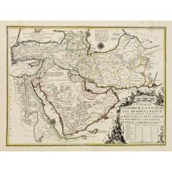
La Perse, La Georgie, LA Natolie, Les Arabies, L'Egipte et le Cours du Nile..
A regional map showing the Asian territories of Ottoman Empire with emphasis on the course of river Nile.The map has an elaborate cartouche showing the ethnic population ...
Place & Date: Paris, 1720
Selling price: $650
Sold in 2008
l'Isle de Formosa ou sont exactement marquez les bancs de Sables . . .
A decorative map of the west coast of Taiwan and the Pescadores Islands (Penghu), showing little detail of the Taiwanese inland, apart from the immense mountain range. Fo...
Place & Date: Leiden, 1720
Selling price: $2500
Sold in 2008
Vue & description de la ville de Siam, des pagodes, des Talapoins ou religieux de ce pais. . .
This impressive engraving is a wonderful example of Chatelain?s elegant plates.Exhaustive information about each scene is given in lengthy tables.Zacharie Chatelain (d.17...
Place & Date: Amsterdam, ca. 1720
Selling price: $250
Sold in 2008
Portraits du Grand Seigneur et des Principaux Officiers de l'Empire Ottoman. . .
These four impressive engravings are a wonderful example of Chatelain's elegant plates.Divided in 4 panels accompanied by detailed descriptions, are examples of costumes ...
Place & Date: Amsterdam, ca. 1720
Selling price: $80
Sold in 2008
Imperii Persici In Omnes Suas Provincias
Hand colored copper engraving by J.B. Homann, showing Persia between Astrakhan, Kabul, Arabic Sea and Cyprus.
Place & Date: Nuremberg, 1720
Selling price: $250
Sold in 2008
Carte des pays voisins de la mer Caspiene. . .
Detailed and attractive map focusing on Georgia, Azerbaijan and Armenia. It depicts roads, forts, cities, villages, topography and is filled with notations.The map is emb...
Place & Date: Amsterdam, 1720
Selling price: $850
Sold
Vue et description de la Ville de Meaco Capitale du Japon..
Top part of the print shows the town of Meaco (Kyoto) at that time the capital of Japan, with a coach and horses in the foreground. Other parts show among other things th...
Place & Date: Amsterdam, 1720
Selling price: $680
Sold in 2009
Accurate Vorstellung der Orientalisch Kayserlichen Haupt- und Residenz-Stadt Constantinopel samt ihrer Gegend und zweven berühmten Meer-Engen Bosphoro Thracio und Hellesponto..
A lovely and well engraved plan of Istanbul. A large inset features a bird's-eye view of the Bosporus with several ships in the foreground framed with an allegorical cart...
Place & Date: Nuremberg, 1720
Selling price: $1050
Sold in 2009
Carte d'une partie de la Chine, les Isles Philippines, de la Sonde, Moluques, ... Carte des Indes, de la Chine & des Iles de Sumatra, Java / Indes Orientalis. . . [two maps]
A fine detailed double-sheet map of the South East Asia. The map draws information from the late 17th century French Jesuit accounts of Thailand and Siam and has good det...
Place & Date: Amsterdam, 1720
Selling price: $1500
Sold in 2014
Regnum Persicum Imperium Turcicum in In Asia Russorum Provinciae ad Mare Caspium. . .
Striking and rare map of the region bounded by Cyprus and the Eastern Mediterranean, the Nile, Medina, the Persian Gulf and the Indus River in the south and the Black Sea...
Place & Date: Amsterdam, 1720
Selling price: $850
Sold in 2010
Carte des Indes, de la Chine & des Isles de Sumatra, Java &c..
This fine and quite detailed general map extends from northern Japan to Timor and from India to New Guinea.Here, the Terre de Yeco in northern Japan is still joined to th...
Place & Date: Amsterdam, 1720
Selling price: $500
Sold in 2010
De Agste Oostindize Reys voor d'Engelse Maatschappie. . .
Fine map of the Far East including China, Japan, and the East Indies highlighting the voyage of John Saris, captain of “The Clove”. Saris commanded the first English ...
Place & Date: Leiden, 1720
Selling price: $90
Sold in 2010
Asia Peninsula sive Asia Intra Taurum
Nice Handcolored map of Turkey and Cyprus. There is an inset with coins from that time.
Place & Date: Nurnberg, 1720
Selling price: $150
Sold in 2010
Imperium Japonicum.
The map is based on Englebert Kaempfer's map of 1727. It shows a much distorted outline for the Island of Japan and a wonderful decorative cartouche top left.The map was ...
Place & Date: Augsburg 1720
Selling price: $1350
Sold in 2011
India Orientalis cum adjacentibus. . .
The finely engraved detail shows the whole of the region from India to the Dutch discoveries in the Gulf of Carpentaria in northern Australia. The map is embellished by a...
Place & Date: Augsburg, 1720
Selling price: $850
Sold in 2010
Description exacte de l'arabie heureuse, Petrée et Déserte.
Very rare map of Arabian peninsular, here called "L'Arabie heureuse", "Arabia Felix" or "Happy Arabia", prepared by Pierre van der AA (1659-...
Place & Date: Amsterdam, ca 1720
Selling price: $750
Sold in 2010
Carte des Costes de L'Asie sur L'Ocean Contenant les Bancs Isles et Costes &c . . . Partie Orientale de L'Asie sur L'Ocean .
Pristine nautical with an inset of southern coast of southern Australia and Tasmania in the wake of Tasman and other 17th century Dutch explorations of these regions: di...
Place & Date: Amsterdam, 1720
Selling price: $4000
Sold in 2015
Regnum Persicum Imperium Turcicum in In Asia Russorum Provinciae ad Mare Caspium. . .
Striking and rare map of the region bounded by Cyprus and the Eastern Mediterranean, the Nile, Medina, the Persian Gulf and the Indus River in the south and the Black Sea...
Place & Date: Amsterdam, 1720
Selling price: $510
Sold in 2011
Etat abregé de la Maison du Grand Seigneur. . . Vue de Constantinople. . .
This impressive engraving is a wonderful example of Chatelain’s elegant plates. Ornamented with 3 vignettes: Vuë du Serrail de Constantinople, Vuë de Constantinople, ...
Place & Date: Amsterdam, ca. 1720
Selling price: $160
Sold in 2011
Carte des Indes, de la Chine & des Isles de Sumatra, Java &c..
This fine and quite detailed general map extends from northern Japan to Timor and from India to New Guinea.From the important Atlas Historique et Méthodique.Here, the Te...
Place & Date: Amsterdam, 1720
Selling price: $500
Sold in 2011
Jehan ou Jehon Gure, mort en 1627. / Gha Jehan ou Kourum, mort en 1665. / Oranzeb, mort en 1707. / Badour Siah, On ignore le tems de sa mort.
A striking and highly detailed copper engraved plate including 4 Indian Raja's Portraits. From Chatelain's 'Atlas Historique', 1732-1739. In upper right margin: 'Tom. V. ...
Place & Date: Amsterdam, 1720
Selling price: $36
Sold in 2011
Jehan Darsiac. / Ferrog Sier. / Pompe & Ceremonie de la Marche du Grand Mogol.
From Chatelain's Atlas Historique, 1732-1739. In upper right margin: 'Tom. V. No 39. Pag: 110. Striking and highly detailed copper engraved plate including 2 Indian Raja'...
Place & Date: Amsterdam, 1720
Selling price: $30
Sold in 2016
Terra Sancta.
Prepared by M.Seutter. With decorative title cartouches. Engraved by Andreas Silbereisen.
Place & Date: Augsburg 1720
Selling price: $240
Sold
L'Île de Formosa, ou sont exactement marquez les bancs de sables, rochers et brasses d'eau, le tout fait . . .
A decorative map of the west coast of Taiwan and the Pescadores Islands (Penghu), showing little detail of the Taiwanese inland, apart from the immense mountain range.For...
Place & Date: Leiden, 1720
Selling price: $2500
Sold in 2014
Habillemens d'hommes & de femmes de diverses provinces de la Chine. . .
An attractive view of the flying bridge in the province of Xensi, surrounded by 11 costume prints.The ethnographic studies show various types of people including physicia...
Place & Date: Amsterdam, 1720
Selling price: $100
Sold in 2012
Le Royaume de Siam avec Les Royaumes Qui Luy sont Tributaries & c.
Influential map of Southeast Asia, including modern day Thailand, southern Vietnam, Cambodia, Malaysia, Singapore, Borneo, Sumatra and Java. Chatelain incorporated inform...
Place & Date: Amsterdam, c.1720
Selling price: $1100
Sold in 2014
Regnum Persicum Imperium Turcicum in In Asia Russorum Provinciae ad Mare Caspium . . .
Striking map of the region bounded by Cyprus and the Eastern Mediterranean, the Nile, Medina, the Persian Gulf and the Indus River in the south and the Black Sea, Circass...
Place & Date: Amsterdam, 1720
Selling price: $400
Sold in 2012
Vue et Description de quelques-uns des principaux forts des Hollandois dans les Indes.
This impressive engraving is a wonderful example of Chatelain’s elegant plates.Ornamented with numerous vignettes representing some of the Dutch settlements in the East...
Place & Date: Amsterdam, c.1720
Selling price: $80
Sold in 2013
La Perse, La Georgie, La Natolie, Les Arabies, L'Egipte et le Cours du Nile. .
A scarce regional map showing the Asian territories of Ottoman Empire with emphasis on the course of river Nile. The map has an elaborate cartouche showing the ethnic pop...
Place & Date: Paris, c 1720
Selling price: $900
Sold in 2013
Tamberlan, mort en 1405. - Miracha ou Miraschae, mort en 1451. - Mohamed ou Miramont mort en 1451. - Abuchaid ou Abuzaid mort en 1469.
Striking and highly detailed copper engraved plate including 4 Indian princes or kings. From Chatelain's Atlas Historique, 1732-1739. In upper right margin: 'Tom. V. Nro ...
Place & Date: Amsterdam, 1720
Selling price: $47
Sold in 2014
Sek ou Seich Omar, mort en 1493. Babar ou Baber ou Babour, mort en 1530. Amayum ou Houmayon, mort en 1552. Akebar ou Xa Aguebar, mort en 1605.
Striking and highly detailed copper engraved plate including 4 Indian princes or kings. From Chatelain's Atlas Historique, 1732-1739. In upper right margin: 'Tom. V. No 3...
Place & Date: Amsterdam, 1720
Selling price: $42
Sold in 2014
Antiquités curieuses de qui se trouvent aux environs de Smyrne, et sur le chemin d´Ephese.
Striking and highly detailed copper engraved plate showing monuments in Ephesus which was an ancient Greek city on the coast of Ionia, three kilometers southwest of prese...
Place & Date: Amsterdam, 1720
Selling price: $30
Sold in 2014
Carte pour conduire a l'inteligence de l'Histoire Sacree qui renferme en abree la genealogie, la geographie, et la chronologie de l'Histoire Sainte.
Four maps of the Holy Land on the same sheet. The main map in the middle of the sheet: "Carte de l’introduction du peuple d’Israel dans le Pais de Canaan..."...
Place & Date: Amsterdam, 1720
Selling price: $35
Sold in 2014
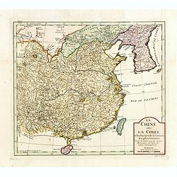
La Chine avec La Corée et les parties de la Tartarie les plus voisines..
Fine map of China, Korea and Taiwan (named as Tayouan ou Formose I.). Prepared after Jesuit sources from 1708-1717.The map is of interest for the use of Kao-Liqoue ou Roy...
Place & Date: Paris, 1720
Selling price: $270
Sold in 2023
A chart of the Western Part of the East-Indies with all the Adjacent Islands from Cape Bona Esperanca to the Island od Zelone.
This scarce sea of the Indian Ocean from the Cape of Good Hope to the west coast of India (Malabar). First issued by John Seller, the present example published by Mount ...
Place & Date: London, Mount & Page, ca. 1720
Selling price: $1200
Sold in 2015
Vue et description de la Ville de Meaco Capitale du Japon. . .
Top part of the print shows the town of Meaco (Kyoto) at that time the capital of Japan, with a coach and horses in the foreground. Other parts show among other things th...
Place & Date: Amsterdam, 1720
Selling price: $120
Sold in 2016
Carte historique et géographique pour servir à l'Histoire Sainte et à la Vocation de Saint Paul, avec quelques remarques curieuses pour servir à l'Histoire des Antiquités judaïques.
Interesting sheet with a map of the travels of Saint Paul, including eastern part of Europe, Asian continent and part of north Africa, with descriptive French text, from ...
Place & Date: Amsterdam, 1720
Selling price: $50
Sold in 2016
Carte des Indes, de la Chine & des Isles de Sumatra, Java &c..
This fine and quite detailed general map extends from northern Japan to Timor and from India to New Guinea.Here, the Terre de Yeco in northern Japan is still joined to th...
Place & Date: Amsterdam, 1720
Selling price: $500
Sold in 2017
Portraits du Moufti & autres Gens de Loi de l'Empire Ottoman . . .
Four full-length portraits of Turkish costumes, each with a descriptive engraved text: a Mufti, an scholar of Islamic law. An Emir, a commander, here described as a desce...
Place & Date: Amsterdam, 1720
Selling price: $50
Sold in 2018
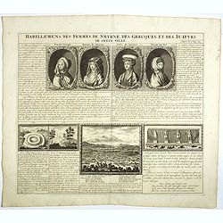
Habillement des femmes de Smyrnes, des Grecques et des Juifs de cette ville.
Four portraits of Smirne women in typical dress, each with a descriptive engraved text. From Chatelain's monumental 7 volume "Atlas Historique".Henri Abraham Ch...
Place & Date: Amsterdam, 1720
Selling price: $50
Sold in 2018
Vue et description de Surate et de Batavia.
In top a panoramic view of Surat, a port city in India previously known as Suryapur, with Dutch ships in the foreground. In bottom a plan of Jakarta (Batavia, 100 x 125mm...
Place & Date: Amsterdam, 1720
Selling price: $100
Sold in 2022
L'Empire du Japon, tiré des cartes des Japonnois.
A good impression of this decorative map of Japan based on Reland's map of 1715, one of the earliest to use both Latin names and Japanese characters. With inset of the ba...
Place & Date: Amsterdam, 1720
Selling price: $500
Sold in 2017




![[Holy Land] Carte De La Terre Saint Divisee Dans Toutes Ses Parties Selon Le Nombre Des Tribus D'Israel . . .](/uploads/cache/85930-250x250.jpg)
![[Lot of 5 maps] PERSIA - Carte la plus nouvelle et plus-exacte du Royaume de Perse](/uploads/cache/IMG_4837-250x250.jpg)


-250x250.jpg)










![Carte d'une partie de la Chine, les Isles Philippines, de la Sonde, Moluques, ... Carte des Indes, de la Chine & des Iles de Sumatra, Java / Indes Orientalis. . . [two maps]](/uploads/cache/02448-250x250.jpg)
