Browse Listings in Asia
Amoenitatum exoticarum politico-physico-medicarum fasciculi V.
> FIRST EDITION OF KAEMPFER'S FIRST WORK ON ASIAN NATURAL HISTORY AND MEDICINE, the only book Kaempfer published during his lifetime. The book includes on page 764 &qu...
Place & Date: Lemgo: Heinrich Wilhelm Meyer, 1712
Selling price: $3750
Sold
Wakan Sansai Zue (和漢三才図会 [Illustrated Sino-Japanese Encyclopedia - one volume].
The Wakan Sansai Zue (和漢三才図会, lit. "Illustrated Sino-Japanese Encyclopedia") is an illustrated...
Place & Date: Edo, 1712
Selling price: $130
Sold in 2017
A New Map of The Eastern Parts of Asia Minor. . .
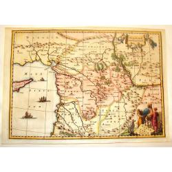
A very pleasant map showing eastern Turkey, Cyprus, the Holy Land, Armenia, Lebanon, Syria, and Iraq. Map features a decorative title cartouche, and the heraldic arms of ...
Place & Date: Oxford, ca. 1712
Selling price: $55
Sold in 2018
Le détroit de Malacca.
A map of the Strait of Malacca between the Malay Peninsula and the Indonesian island of Sumatra. The north is towards the top right corner. The map details the Strait of ...
Place & Date: Leiden, 1712
Selling price: $210
Sold in 2019
Le Detroit de Malacca. . .
Map of Malacca. The map details the Strait of Malacca from P. Pera and Tanjong Goeree to Lingen and Pulu Panjang. Malacca and Ihor (Johore), along with numerous other coa...
Place & Date: Leiden, 1712
Selling price: $240
Sold in 2020
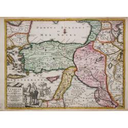
Turquie en Asie.
Pieter van der Aa was a prolific publisher. He published a.o. ' Naauwkeurge versameling der gedenkwaardigste zee- en land-reysen', a series of accounts of voyages (1706-0...
Place & Date: Leiden, 1713
Selling price: $170
Sold
Scheeps-Togt van Malacca na de Golf van Bengale en de kusten van Siam tot in China.
Rare map of the Indian Ocean and Malacca with Singapore (Cingapura) Although not renowned for the originality of his work, Pieter van der Aa is highly thought of for the ...
Place & Date: Leiden, 1713
Selling price: $400
Sold in 2011
Mingrelie, autrefois Colchis, Pays baigné au Couchant par la Mer Noire.
A rare map of the ancient kingdom of Colchis, in the region of Mingrelia, on the coast of the Black Sea, in Western Georgia. It is oriented to the northeast. Shows place ...
Place & Date: Leiden, 1713
Selling price: $200
Sold in 2019
Asia in Praecipuas Ipsius partes distributa ad observationes
Van der Aa is considered the most accomplished Dutch engraver of his period. He raised the art of map ornamentation to its highest level of sophistication through the use...
Place & Date: Amsterdam, 1714
Selling price: $3000
Sold in 2010
De Beschryvingh van de Reysen Pauli.
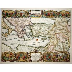
Title: De Beschryvingh van de Reysen Pauli en van de andere apostelen.This is an original map from a Dutch Keur bible of 1714. colorful map of the eastern Mediterranean f...
Place & Date: Amsterdam 1714
Selling price: $180
Sold
Terre Sainte suivant les nouvelles observations de Mess. De l'Academie Royale des Sciences. Etc.
Uncommon and detailed map of Holy Land, from Nouvelle atlas, trés-exact et fort commode pour toutes sortes de personnes, contenant les principales cartes géographiques....
Place & Date: Leiden 1714
Selling price: $140
Sold
De Gelegentheyt van 't Paradys en 't Landt Canaan..
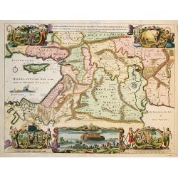
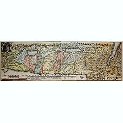
This Dutch Bible "carte à figures" map was published by Pieter & Jacob Keur. It covers the region between the Mediterranean and the Persian Gulf, depicting...
Place & Date: Amsterdam, 1714
Selling price: $220
Sold in 2009
Jerusalem
Plan of ancient Jerusalem from a Dutch bible. At the top the Temple as a Renaissance palace, at left and right Biblical figures and Temple vessels.
Place & Date: Amsterdam 1714
Selling price: $450
Sold in 2010
De Agste Oostinische Reys voor d' Engelze Maatschappie onder Kapitein Joan Saris, gedaan na Java, de Moluccas en Japan.
Map of the route of the English captain Joan Saris to Japan.Although not renowned for the originality of his work, Pieter van der Aa is highly thought of for the design a...
Place & Date: Leiden, 1714
Selling price: $220
Sold in 2011
[No tittle] Dardannelles
Engraving presenting 4 views of Dardanelles from the standard work "Cornelis de Bruins Reizen over Moskovie, door Persie en Indie ".
Place & Date: Amsterdam, R. en G. Wetstein, 1714
Selling price: $75
Sold in 2012
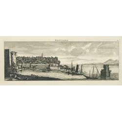
Sattalia.
Beautiful panoramic view of Sattalia. Sattalia was one of the most important cities of the Ottoman Empire and contains many old buildings as can be easily inferred from i...
Place & Date: Paris, 1714
Selling price: $200
Sold in 2013
Asia in Praecipuas Ipsius partes distributa ad observationes.
Van der Aa is considered the most accomplished Dutch engraver of his period. He raised the art of map ornamentation to its highest level of sophistication through the use...
Place & Date: Amsterdam, 1714
Selling price: $2000
Sold in 2016
Het Beloofde Landt Canaan Door Wandelt van Onsen Salichmaaker Jesu Christo Nessens Syne Apostelen.
A splendid map of "the beloved land of Canaan," oriented with west at the top of the page, and featuring a multitude of place names as well as St. Paul's sea ro...
Place & Date: Amsterdam, 1714
Selling price: $88
Sold in 2016
L'Inde De La Le Gange Suivant les Nouvelles Observations...
Fantastic map of South East Asia with today's Malaysia, Thailand, Vietnam Bay of Bengal, Hainan, Straits of Malaca, and the Northern parts of Sumatra and Borneo. Singapor...
Place & Date: Amsterdam, 1714
Selling price: $500
Sold in 2016
L'Empire du Mongol sur les Memoires de Mr. Manchouri.
Map of Empire of the Mogol from Memoirs of Mr. Manouchi (Manucci) . Published in Histoire Generale de l´Emppire du Mogol depuis sa Fondation jusqu´a Present, sur les Me...
Place & Date: Paris 1715
Selling price: $100
Sold
Plan du Saint Sepulchre..
Bird\'s-eye view of ancient Jerusalem. With 3 inset maps: \"Carte de la Terre Sainte...\", showing Holy Land with the route which Jesus took through Galilea, Sa...
Place & Date: France, 1715
Selling price: $300
Sold in 2009
The Turkish Empire in Europe, Asia and Africa..
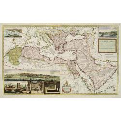
A fascinating, very decorative map of Turkey, the Arabian peninsular, the Mediterranean and countries bordering. The map is covered with detailed annotations, and has lar...
Place & Date: London 1715
Selling price: $1500
Sold
Facies Palaestinae Ex Monumentis Veteribus descripta ab Hadriano Relando.
Map of Iudaea, Samaria and Galilaea, with decorative inset of three figures overlooking a bay with a city in the background.Prepared by H.Reland (1676-1718) a professor a...
Place & Date: Amsterdam 1715
Selling price: $150
Sold
Orbis Per Creationem Institutus. . .
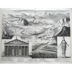
An uncommon Dutch Bible map of the Middle East and Holy Land, including a map of Paradise, a map of the Exodus, a map of Israel divided among the Tribes, a map of Canaan,...
Place & Date: 1715
Selling price: $180
Sold in 2010
Plan du Saint Sepulchre..
Bird's-eye view of ancient Jerusalem. With 3 inset maps: "Carte de la Terre Sainte...", showing Holy Land with the route which Jesus took through Galilea, Samar...
Place & Date: France 1715
Selling price: $310
Sold in 2009
Orientaliora Indiarum Orientalium..C.Comorin ad Iapan.
The uncommon Louis Renard edition. - A superb late 17th century Dutch sea-chart of Australia and the East Indies, closely modelled on Pieter Goos' chart of 1666. The char...
Place & Date: Amsterdam, 1680-1715
Selling price: $3300
Sold in 2016
GENEALOGIE DE MAHOMET Depuis Ismael fils du Patriarche Abraham. (Muhammad).
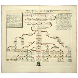
An old colored folio sheet that shows a detailed genealogical chart of Ishmael and his descendants to the prophet Mahomet (Muhammad), founder of Islam. It was published i...
Place & Date: Amsterdam, ca 1715
Selling price: $42
Sold in 2020
SUCCESSION DES EMPEREURS DU JAPON AVEC UNE DESCRIPTION du MEURTRE DE L'EMPEREUR CUBO ET LA.
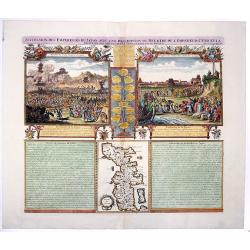
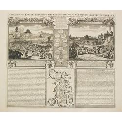
The plate is showing the murder of the Emperor Cubo at Kyoto, and the arrival of one of the early Dutch Ambassadors to Japan. A small map of Honshu in a central panel. Fr...
Place & Date: Amsterdam, 1715
Selling price: $65
Sold in 2020
VUE & DESCRIPTION DE LA VILLE DE SIAM . . .
A copper engraved sheet with set of 9 decorative views of Thailand, including the king of Siam riding on his elephant. A very decorative item ! - It features the capital ...
Place & Date: Amsterdam, ca 1715
Selling price: $220
Sold in 2021
Habillemens Des Dames de Constantinople, des Dames du Serrail & Ianissaires.
A large copper engraved sheet with decorative set of images on the costumes of the women and Janissaries of Turkey, from Chatelain's monumental 7 volume 'Atlas Historique...
Place & Date: Amsterdam, ca 1715
Selling price: $160
Sold in 2021
Viertzig Iõhrige Reysen der Kinder Israel aus Egypten durch das Rothe Meer und W³sten bis ins Gelobte Land Canaan
Rare anonymous map of the Holy Land after the N. Visscher map from 1657. Showing the Exodus of the Israel tribes from Egypt to Canaan. With beautiful figural cartouche an...
Place & Date: Minden, 1716
Selling price: $400
Sold in 2008
Die Gelegenheit des Paradeis und des Landes Canaan, sambt den erst Bewohnten Lõnderen der Patriarchen aus H. Schrift u anderen Auctoren zusamen getragen
Very rare anonymous map of the Middle East. Based on the "Paradise Map" of Visscher. Showing the Eastern Mediterranean with Cyprus up to today Iraq / Iran in th...
Place & Date: Minden, 1716
Selling price: $475
Sold in 2009
Asia according ti ye Newest Obervations.
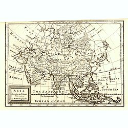
Detailed map of Asia, from Herman Moll's "Forty-two new maps of Asia, Africa, and America ... : all engrav’d, according to the latest observations. . ."The ma...
Place & Date: London, J. Nicholson, 1716
Selling price: $250
Sold in 2015
Orbis Bibliis Sacris Cognitus Seu Geographia Sacra: Carte de la Geographie Sacree pour l'Ancien Testament.
Interesting copperplate map of the ancient world, showing the biblical lands divided amongst the Sons of Noah: Shem, Ham and Japeth. Informative genealogical table to the...
Place & Date: Paris, 1716
Selling price: $111
Sold in 2016
Facies Palaestinae ex Monumentis veteribus descripto ab Hadriano Relando
A striking and historic map showing what is now called Israel, Palestine, Lebanon, Gaza, The West Bank, Jordan, and parts of Syria. The large title cartouche features an ...
Place & Date: Nuremberg, 1716
Selling price: $121
Sold in 2016
L\'Asie Suivant les Nouvelles Decouvertes. . .
Showing the land masses from Arabia to Japon ou I.de Niphon and Nouvelle Zeelande (but what is part of New Guinea). Decorative dedication panel and title cartouche.
Place & Date: Paris, 1717
Selling price: $200
Sold in 2009
La Gran Tartaria descritta secondo le relationi ..
Prepared by De Fer. Including Korea and Japan. A peninsula protrudes out of Tartary and is called Yupi and is separated from Honshu by the Strait of Zungar (Tsugaru). Rar...
Place & Date: Napels, 1717
Selling price: $2200
Sold
Syriae Sive Soriae Nova et Accurata Desctiptio.
Striking copper engraved map of Syria and Lebanon with a slice of Turkey, including Cyprus. Embellished with decorative, figured title and scale cartouches including four...
Place & Date: 1717
Selling price: $101
Sold in 2014
Tabula Geographica Terrae Sanctae, Auctore J. Bonfrerio Societat Jesu.
Uncommon map of Holy Land showing the wandering of the Children Israel's with the 42 encampments, published by Francois Halma. Oriented with north at top left and divided...
Place & Date: Amsterdam, F.Halma, 1717
Selling price: $145
Sold in 2018
L'Asie Suivant les Nouvelles Decouvertes. . .
Showing the land masses from Arabia to Japon ou I.de Niphon and Nouvelle Zeelande (but what is part of New Guinea). Decorative dedication panel and title cartouche.
Place & Date: Paris, 1717
Selling price: $180
Sold in 2016
Rama van d'Arabieren Ramla, en de Turken Remele, en Remle genaamt; volgens d'aftekening gedaan 1668.
Interesting view of the city of Ramallah in Israel. Shows a water place in the foreground, with numerous animals drinking. The city in the background is very detailed wit...
Place & Date: Leeuwarden, 1717
Selling price: $19
Sold in 2016
De Olyf-Berg en 't Dal Josaphats.
Shows the Mount of Olives and the Valley of Josaphat with Jesus ascending to heaven.
Place & Date: Leeuwarden, 1717
Selling price: $20
Sold in 2016
Syria and Assyria According to the Description of Ptolomy and Other Authors.
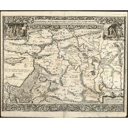
A map of Syria and Assyria according to Claudius Ptolemy and other authors, by Herman Moll from the “Geographica Classica” published in London in 1717. It features na...
Place & Date: London, 1717
Selling price: $23
Sold in 2019
De gelegentheyt van 't Paradys en ' t Landt Canaan
Bottom right:' t Amsterdam uytgegeven door Cornelis Dankerts voor aen op de Nieuwendijck in den Atlas met Previlegie. This Cornelis Danckerts ( the spelling of his name d...
Place & Date: Amsterdam, 1718
Selling price: $600
Sold in 2013
Het Beloofde Landt Canaan
First state. Map of the Holy Land as travelled by Christ and the Apostles. Oriented to the west. The shore line runs from Biblium to Rinocorura. This Cornelis Danckerts (...
Place & Date: Amsterdam, 1718
Selling price: $400
Sold in 2008
Nouvelle Carte de L'Isle de Ceylon, avec des remarques Historiques.
Handsome and very detailed map of the island. The mountainous topography is graphically presented, along with roads, locations of Dutch forts, gem and salt mines. Numerou...
Place & Date: Amsterdam 1718
Selling price: $40
Sold
Afbeeldinge van de Veertich-Iaarige Reyse der Kinderen Israels..
Attractive and decorative map of the Holy Land divided into the twelve Tribes of Israel, depicting the Exodus from Egypt and the wanderings of the Children of Israel. The...
Place & Date: Amsterdam, 1718
Selling price: $200
Sold in 2008
Het Beloofde Landt Canaan.
Finely engraved and very detailed map of the Holy Land embellished with sailing ships and compass rose. Dutch text on verso, engraved by Albert Schut. First state.
Place & Date: Amsterdam, 1718
Selling price: $180
Sold in 2008
Imperii Persici delineatio...
An attractive map of Persia/Iran, with vignettes of ancient monuments.
Place & Date: Nuremberg, 1718
Selling price: $85
Sold in 2014
A plan of the city of Ephesus according to Pitton de Tournefort.
Large and important map in a birds-eye view of the ancient Greek city Ephesus near today's Izmir. Shows the city from the seaside with numerous buildings. A 1-20 number k...
Place & Date: London, 1718
Selling price: $65
Sold in 2016
Asia peninsula sive Asia intra Taurum. . . (with Cyprus)
Striking map the Black Sea, Cyprus and Asia Minor, featuring the geographical features known to the ancients and decorated with a vignette and 27 medallions.From "De...
Place & Date: Nuremberg, 1718
Selling price: $242
Sold in 2015
CARTE DE L'ILE DE JAVA: PARTIE OCCIDENTALE, PARTIE ORIENTALE DRESSEE...
A decorative large format map of Java, with an inset of the bay of Batavia in the lower left corner.Two title banners include a short sketch of the history of the Dutch o...
Place & Date: Amsterdam, 1718
Selling price: $950
Sold in 2017
La ville de Batavie / Cheaçteau de Batavia.
From La Galerie agréable du monde.
Place & Date: Leiden c.1719
Selling price: $150
Sold
La ville de Derbendt, en Perse.
Originally engraved for Dapper's important compilations of travels in Asia and Persia. Pieter van der AA acquired several plates who he later used in his own publications...
Place & Date: Leiden, c. 1719
Selling price: $95
Sold in 2013
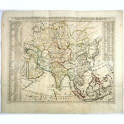
Nouvelle carte de l'Asie avec des tables..
Chatelain's map of Asia. The title is in two lines across the map. On each side border appears an index to the map's contents.From Chatelain's Atlas Historique et Méthod...
Place & Date: Amsterdam 1719
Selling price: $300
Sold
Succession de Empereurs du Japan avec une description du meutre de l' Emperuer Cubo et la Reception des Ambassadeurs Hollandoois en ce pays la. / Carte du Japon.
Henri Abraham Chatelain was a Amsterdam-based geographer and publisher. His main product is the 'Atlas Historique et Méthodique', in seven volumes, published between 171...
Place & Date: Amsterdam, 1719
Selling price: $250
Sold
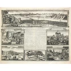
Vue et Desription de la Ville de Meaco Captitale du Japon avec d' autre particularitez du Pays. / Ville de Saccai. / Loge des Hollandois a Nanguesague / Grand Temple de Saccay.
Henri Abraham Chatelain was a Amsterdam-based geographer and publisher. His main product is the 'Atlas Historique et Méthodique', in seven volumes, published between 171...
Place & Date: Amsterdam, 1719
Selling price: $375
Sold
Nouvelle Carte de la province de Kilian en Perse.
Pieter van der Aa was a prolific publisher. He published a.o. ' Naauwkeurge versameling der gedenkwaardigste zee- en land-reysen', a series of accounts of voyages (1706-0...
Place & Date: Leiden, 1719
Selling price: $175
Sold in 2009
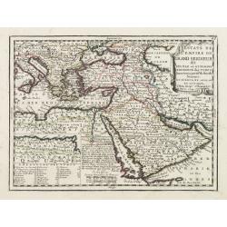
Estats de L'empire du Grand Seigneur dit Sultan et Ottomans Empereur des Turcs..
The map shows the extent of the Ottoman Empire from the Balkans to Persia, including all of Arabia and North Africa (an inset map at lower left shows the continuation of ...
Place & Date: Paris, 1719
Selling price: $250
Sold
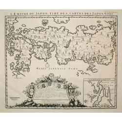
L'Empire Du Japon, Tiré Des Cartes Des Japonnois.
A good impression of this decorative map of Japan based on Reland's map of 1715, one of the earliest to use both Latin names and Japanese characters.With inset of the bay...
Place & Date: Amsterdam 1719
Selling price: $980
Sold
Nouvelle carte de l'Asie avec des tables..
Chatelain's map of Asia. The title is in two lines across the map. On each side border appears an index to the map's contents.From Chatelain's Atlas Historique et Méthod...
Place & Date: Amsterdam, 1719
Selling price: $350
Sold
Carte de l'' Isle de Java..
This important large-scale chart of the island of Java is one of the finest 18th century maps of the island. The map is filled with details of rice fields, mountains, for...
Place & Date: Amsterdam, 1719
Selling price: $1400
Sold in 2008
Nouvelle carte de l'Asie avec des tables..
Chatelain's map of Asia. The title is in two lines across the map. On each side border appears an index to the map's contents.From Chatelain's Atlas Historique et Méthod...
Place & Date: Amsterdam, 1719
Selling price: $200
Sold in 2008
L'Empire du Japon, tire des cartes des Japonnois.
A good impression of this decorative map of Japan based on Reland's map of `1715, one of the earliest to use both Latin names and Japanese characters. With inset of the b...
Place & Date: Amsterdam, 1719
Selling price: $1000
Sold in 2009
Bosphore de Thrace
This handsome folio sheet present three views of the strategically important Bosporus. At top is a large decorative bird's-eye view of Istanbul as viewed from across the ...
Place & Date: Amsterdam, 1719
Selling price: $350
Sold in 2009
Genealogie des anciens empereurs Tartares,. . .
In lower part a map Russia including Tartary (158 x 290mm.) flanked by text in French. In top a family tree of the descendants of Genghis Khan.From Chatelain's "Atla...
Place & Date: Amsterdam, 1719
Selling price: $110
Sold in 2012
Goa Indiae orientalis metropolis.
A fine example of a rare plan of this important Indian city and port, the focal point for Portuguese trading activity in southern Asia. Pictorial map by Pieter Boudewyn v...
Place & Date: Leiden, 1719
Selling price: $600
Sold in 2015
Carte pour Conduire a l'Inteligence de L'Histgoire Sacree...
This sheet includes three maps that illustrate Holy Land biblical history. The main map at centre (Carte de l'introduction du peuple d'Israel dans les Pais de Canaan) sho...
Place & Date: Paris, 1719
Selling price: $70
Sold in 2016
Succession des Empereurs du Japon avec une Description du Meutre de L'Empereur Cubo...
A composite sheet with a small map of Japan and two detailed views, one depicting the murder of the Emperor Cubo, the other, the reception of the Dutch ambassadors, each ...
Place & Date: Amsterdam, 1719
Selling price: $300
Sold in 2019
La Chine.
A charming small map of China, Taiwan, Philippines, Korea and Kyushu (Japan).From the "Des berühmten Königlichen geographi" the German Edition of "Descri...
Place & Date: Frankfurt, 1719
Selling price: $131
Sold in 2017
Carte nouvelle des Terres de Cucan. . . [India]
All the trading posts of the V.O.C. are marked with a flag. Prepared by H.Reland (1676-1718) a professor active in Utrecht and specialised in Asian languages, geography a...
Place & Date: Amsterdam, 1719
Selling price: $200
Sold in 2017
Nouvelle Carte De L'Asie Avec Des Tables Alphabetiques Pour Trouver Sans Peine Les Etats Des Principaux Princes De Cette Partie Du Monde . . .
Chatelain's map of Asia. The title is in two lines across the map. On each side, the border appears an index to the map's contents. The map is based upon Guillaume De L'I...
Place & Date: Amsterdam, 1719
Selling price: $450
Sold in 2023
La ville de Bagdad, dans la Turquie.
Decorative view of Bagdad. This well executed engraving was published in 1729 and 1727 by Pieter van der AA, in Leiden in "Les Voyages tres-curieux et tres-renommez ...
Place & Date: Leiden, 1719
Selling price: $200
Sold in 2021
Kom, ville de la Province d'Yerack, en Perse. (Qom).
Decorative view of Kom (Qom). This well executed engraving was published in 1729 and 1727 by Pieter van der AA, in Leiden in "Les Voyages tres-curieux et tres-renomm...
Place & Date: Leiden, 1719
Selling price: $150
Sold in 2021
Ispahan, capitale du Royaume de Perse. (Isfahan)
Decorative view of Ispahan (Isfahan), then the Capital of the Kingdom of Persia. This well executed engraving was published in 1729 and 1727 by Pieter van der AA, in Leid...
Place & Date: Leiden, 1719
Selling price: $220
Sold in 2021
Carte de la Terre Promise. . .
An attractive copper engraved map of the Holy Land as divided into the 12 tribes of Israel. It has a large drapery title cartouche and a prominent compass rose. Nicolas d...
Place & Date: Paris, 1719
Selling price: $95
Sold in 2017
Carte de l'Ile de Java: partie Occidentale, partie Orientale, Dressée tout nouvellement sur les Mémoirs les plus exacts, Avec une Table des principales villes de cette Ile. . .
An inset plan of Batavia and clearly indicated rice fields, mountains, forests, towns in profile and even elephants suggest the wealth of detail found on this map. Modell...
Place & Date: Amsterdam, François L'Honoré & Châtelain, 1719
Selling price: $1500
Sold in 2020
Carte de l'Asie selon les auteurs anciens enrichie de remarques historiques. . .
The pleasant map is centered on the India and the Indian Ocean, with explanatory text on either side of the map. It shows the ancient kingdoms and empires of the continen...
Place & Date: Amsterdam, 1719
Selling price: $250
Sold in 2018
Succession des Rois de Perse Anciens & Modernes, Depuis Cyrus Jusqu'a a Present.
A striking and highly detailed fine and unusual copper engraved plate including, on one sheet, a genealogical tree, showing the Kings of Persia Iran), from Cyrus in 3468 ...
Place & Date: Amsterdam, 1719
Selling price: $30
Sold in 2019
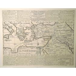
Carte Historique et Geographique pour Servir a L'Histoire Ste et a la Vocation de St. Paul. . .
An historical map of the Mediterranean region and Middle East. It details the major trade routes (both on land and over sea). This detailed map marks the travels of St. P...
Place & Date: Amsterdam, 1719
Selling price: $46
Sold in 2023
![Wakan Sansai Zue (和漢三才図会 [Illustrated Sino-Japanese Encyclopedia - one volume].](/uploads/cache/40338-250x250.jpg)







![[No tittle] Dardannelles](/uploads/cache/29095-250x250.jpg)
















![Carte nouvelle des Terres de Cucan. . . [India]](/uploads/cache/38871-250x250.jpg)
