Browse Listings in Asia
Cyprus Ex deliniatione Ubonis Emmii
A very scarce small map of Cyprus drawn by Ubonis Emmii and based on the Parergon map of Ortelius. Its shape is rather deformed and it has fewer ancient place names than ...
Place & Date: Amsterdam, 1661
Selling price: $600
Sold in 2008
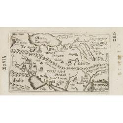
Armenia Syria, Mesopotamia etc.
This little map covers the region between the Black and Caspian Seas in the north, and from Egypt to the Persian Gulf in the south. It is finely engraved to show mountain...
Place & Date: Amsterdam, 1661
Selling price: $150
Sold in 2008
Natolia, Quae olim Asia Minor.
A small decorative map of Turkey and Cyprus with detail of mountains, rivers, lakes, cities and villages. Embellished with a banner style title cartouche and architectura...
Place & Date: Amsterdam 1661
Selling price: $80
Sold
Totius Terrae Sanctae Delineatio.
Rare map of Palestine with large decorative title cartouche, from a book by Cluver Introductionis in Universam Geograpicam published by Johannis Bunonis.
Place & Date: Wolfenbüttel 1661
Selling price: $100
Sold
Asia Antiqua et Nova.
Rare map of Asia, from a book by Cluver Introductionis in Universam Geograpicam published by Johannis Bunonis.A first state.
Place & Date: Wolfenbüttel 1661
Selling price: $300
Sold in 2014
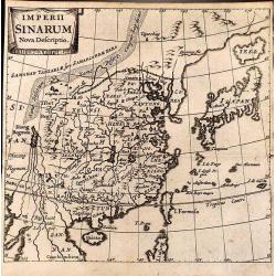
Imperii Sinarum Nova Descriptio.
Rare map of the easternmost part of China, from a book by Cluver Introductionis in Universam Geograpicam published by Johannis Bunonis.A first state.
Place & Date: Wolfenbüttel 1661
Selling price: $95
Sold
Chersonesi quae hodie Natolia Descriptio.
Rare map of Turkey, including Cyprus. From a book by Cluver Introductionis in Universam Geograpicam published by Johannis Bunonis.A first state.
Place & Date: Wolfenbüttel 1661
Selling price: $245
Sold
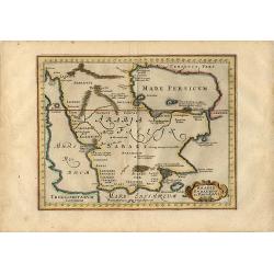
Arabia Eudaemon ex Plinio Lib VI Cap. 28. Orbis terrarum
Charming small map of the Arabian Peninsula is decorated with a strapwork title cartouche. Sparse detailing reflects the lack of knowledge of the geography other than the...
Place & Date: Amsterdam, 1661
Selling price: $120
Sold in 2008
Scythia et Tartaria Asiatica.
Interesting map of Tartary and Scythia from a German edition of Philipp Clüver's famous Introductionis in Universam geographicam, first published in Leiden in 1624. Phil...
Place & Date: Wolfenbüttel, 1661
Selling price: $30
Sold in 2009
Indiae Orientalis et Insularum Antiqua et nova Descriptio.
Interesting map of South East Asia, including Indonesia, India, Taiwan from a German edition of Philipp Clüver's famous Introductionis in Universam geographicam, first p...
Place & Date: Wolfenbüttel, 1661
Selling price: $70
Sold in 2009
Asia Antiqua et Nova.
Interesting map of Asia from a German edition of Philipp Clüver\'s famous Introductionis in Universam geographicam, first published in Leiden in 1624. Philipp Clüver (1...
Place & Date: Wolfenbüttel, 1661
Selling price: $50
Sold in 2008
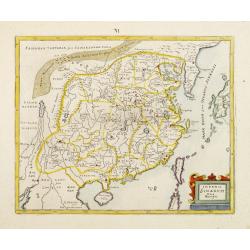
Imperii Sinarum Nova Descriptio.
Detailed small map of China engraved by Bertius.
Place & Date: Amsterdam, 1661
Selling price: $45
Sold in 2012
Indiae Orientalis et Insularum Antiqua et nova Descriptio.
Interesting map of South East Asia, including Indonesia, India, Taiwan, Philippines from Philipp Clüver's famous Introductionis in Universam geographicam, first publishe...
Place & Date: Wolfenbüttel, 1661
Selling price: $200
Sold in 2020
Kiangsi Imperii Sinarum provincia octava. (Kiangsi)
Prepared 1655 by Martino Martini and published by Joan Blaeu in his Atlas Maior. A fine map of Jiangxi (Kiangsi) Province in China. The map depicts the region from the Ya...
Place & Date: Amsterdam, 1661
Selling price: $126
Sold in 2020
Carta prima Generale dell' Asia.
A rare sea chart of India and Indonesia, in a first state. The chart appeared in Dudley's Arcano del Mare, one of the rarest and most highly sought after sea atlases of t...
Place & Date: Florence, 1641/1661
Selling price: $4200
Sold in 2019
Tabula Indiae Orientalis.
An attractive and decorative map covering all South East Asia engraved by Johannes Lhuilier. The map encompasses the region from India to Southern China, Taiwan and the P...
Place & Date: Amsterdam, 1662
Selling price: $1600
Sold in 2011
Asia noviter delineata..
From 1633 the members of the Blaeu family were official cartographers to the United East India Company and, as such, had access to the most up-to-date cartographic inform...
Place & Date: Amsterdam 1662
Selling price: $4225
Sold
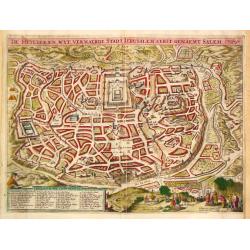
De Heylige en wyt vermaerde stadt Jerusalem eerst genaemt Salem.
Joshua Offerman's plan of Jerusalem is a close copy of the second state of the plan by Claes Jansz Visscher. The fisherman above the legende bottom left has been substitu...
Place & Date: Gorkum, 1662
Selling price: $400
Sold
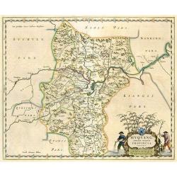
Huquang Imperii Sinarum Provincia Septima.
Decorative map of the seventh Chinese province 'Huquang', ornated with the typical high decorative ornated title cartouche together with an ornated mileage scale. The map...
Place & Date: Amsterdam, 1662
Selling price: $375
Sold in 2010
Suchuen Imperii Sinarum Provincia Sexta.
Province map of China from the Atlas Sinensis. Decorative map of the sixth Chinese province 'Suchuen', ornated with the typical high decorative ornated title cartouche to...
Place & Date: Amsterdam, 1662
Selling price: $230
Sold in 2010
Dimidia Tribus Manasse Ultra Iordanem, Tribus Neptalim et partes orientales tribuum Zabulon et Isachar.
One sheet of the six sheet map by Georgius Hornius map of the Holy Land. Each of the maps is embellished with countless vignettes and other images drawn from Biblical tra...
Place & Date: Amsterdam, Janssonius, 1662
Selling price: $375
Sold in 2013
Tribus Aser, et partes occidentales tribuum Zabulon et Isachar.
One sheet of the six sheet map by Georgius Hornius map of the Holy Land. Each of the maps is embellished with countless vignettes and other images drawn from Biblical tra...
Place & Date: Amsterdam, Janssonius, 1662
Selling price: $91
Sold in 2014
Tribuum Ephraim, Beniamin, et Dimidiae Manasse intra Iordanem partes occidentales, et partes septentrionales Dan et Iuda.
One sheet of the six sheet map by Georgius Hornius map of the Holy Land. Each of the maps is embellished with countless vignettes and other images drawn from Biblical tra...
Place & Date: Amsterdam, Janssonius, 1662
Selling price: $220
Sold in 2013
Tribus Simeon et pars meridionalis Tribus Dan, et orientalis Tribus Idua.
One sheet of the six sheet map by Georgius Hornius map of the Holy Land. Each of the maps is embellished with countless vignettes and other images drawn from Biblical tra...
Place & Date: Amsterdam, Janssonius, 1662
Selling price: $61
Sold in 2014
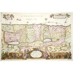
Hornius Map of the Holy Land, Israel, and Palestine.
A fine example of the six sheet map by Georgius Hornius map of the Holy Land. Each of the maps is embellished with countless vignettes and other images drawn from Biblica...
Place & Date: Amsterdam, Janssonius, 1662
Selling price: $1750
Sold in 2018
Tabula Indiae Orientalis.
An attractive and decorative map covering all South East Asia engraved by Johannes Lhuilier. The map encompasses the region from India to Southern China, Taiwan and the P...
Place & Date: Amsterdam, 1662
Selling price: $2200
Sold in 2015
Geographiae sacrae, ex veteri et novo Testamento desumptae, tabula secunda, in qua Terra promissa, sive Iudaea, in suas tribus partesque distincta . . .
A first edition (dated 1662) of this fine map of the lands described in the Old and New Testament. It provides good detail throughout. Attractive map with decorative cart...
Place & Date: Paris, c. 1662
Selling price: $30
Sold in 2017
Tabula Indiae Orientalis
An attractive and decorative map covering all South East Asia engraved by Johannes Lhuilier. The map encompasses the region from India to Southern China, Taiwan, and the ...
Place & Date: Amsterdam, 1662
Selling price: $850
Sold in 2016
Moluccae Insulae Celeberrimae.
A striking map of the famous Spice Islands, originally described by Van Linschoten. This map was the first large-scale map of the region and depicts the islands that prov...
Place & Date: Amsterdam, 1662
Selling price: $230
Sold in 2017
Natolie ou Asie Mineure. (16).
Scarce map of Turkey and Cyprus published by Antoine de Fer in 1661 or 1662 in "Cartes de géographie revues et augmentées". With number 16 in lower right bott...
Place & Date: Paris, Antoine de Fer, 1657 but 1661 or 1662
Selling price: $50
Sold in 2020
Terre Sainte jadis Terre Promise ou Palestine. (18).
Scarce map of Palestine published by Antoine de Fer in 1661 or 1662 in "Cartes de géographie revues et augmentées". With number 18 in lower right bottom of th...
Place & Date: Paris, Antoine de Fer, 1657 but 1661 or 1662
Selling price: $20
Sold in 2021
Le grand Royaume du Sophi de Perse. (19).
Scarce map of Persia, Afghanistan and part of Arabia published by Antoine de Fer in 1661 or 1662 in "Cartes de géographie revues et augmentées". With number 1...
Place & Date: Paris, Antoine de Fer, 1657 but 1661 or 1662
Selling price: $50
Sold in 2018
La Chine. (21).
Scarce map of China published by Antoine de Fer in 1661 or 1662 in "Cartes de géographie revues et augmentées". Korea shown as an island.With number 21 in low...
Place & Date: Paris, Antoine de Fer, 1657 but 1661 or 1662
Selling price: $250
Sold in 2020
Les Isles des Indes Orientales. (23).
Scarce map of Indonesia and the Philippines published by Antoine de Fer in 1661 or 1662 in "Cartes de géographie revues et augmentées". With number 23 in lowe...
Place & Date: Paris, Antoine de Fer, 1657 but 1661 or 1662
Selling price: $150
Sold in 2018
Tabula Indiae Orientalis.
An attractive and decorative map covering all South East Asia engraved by Johannes Lhuilier. The map encompasses the region from India to Southern China, Taiwan and the P...
Place & Date: Amsterdam, 1662
Selling price: $500
Sold in 2020
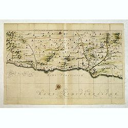
[Hornius Map of the Holy Land, Israel, and Palestine]
A fine example of a single sheet from the original six sheet map by Georgius Hornius map of the Holy Land. The map is embellished with countless vignettes and other image...
Place & Date: Amsterdam, Janssonius, 1662
Selling price: $60
Sold in 2020
Deze Caerte van den Uittocht der kinderen Israels..
Rare wood block map, depicting the exodus from Egypt, from the final Dutch edition of Heinrich B¨nting's famous Itinerarium Sacrae Scripturae, a book mainly about...
Place & Date: Amsterdam 1663
Selling price: $440
Sold
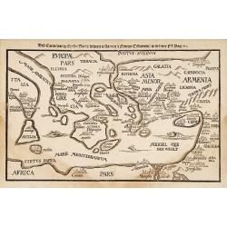
Deze Caerte van de henzen pauli..
Rare wood block map, depicting the Mediterranean, from the final Dutch edition of Heinrich Bünting's famous Itinerarium Sacrae Scripturae, a book mainly about th...
Place & Date: Amsterdam 1663
Selling price: $250
Sold
Dese Conterfentinge hoe den Tempel te Jerusalem
Rare wood block print, depicting the Solomon's Temple, from the final Dutch edition of Heinrich Bünting's famous Itinerarium Sacrae Scripturae, a book mainly about the H...
Place & Date: Amsterdam 1663
Selling price: $25
Sold
Imperii Sinarum Nova Descriptio.
A most uncommon and scarce map of China, including Korea, Formosa (Taiwan) and Japan, published in the collection of Voyages "Relation de Divers Voyages Curieux"...
Place & Date: Paris 1663
Selling price: $1375
Sold
Geographifche Beschryvinghe van de Wandeling..
Title: "Geographifche Beschryvinghe van de Wandeling der Apostelen ende De Reysen Pauli"This is an original map from a Dutch bible of 1663 made by Visscher. col...
Place & Date: Amsterdam 1663
Selling price: $200
Sold
Het Beloofde Landt Canaan..
Title of the map: "Het Beloofde Landt Canaan door wandelt van onsen Salichmaecker Iesu Christo, neffens syne Apostelen"Fine map of Israel with north oriented to...
Place & Date: Amsterdam 1663
Selling price: $150
Sold
Die rechte See farte von der Gelegenheit dess Landes IAPAN.
Rare map of Japan, Hokkaido (Iezzo), Korea and part of China's coast.From the account of Japan by Francis Caron, who was Director of the Dutch Trade there and spent more ...
Place & Date: Nuremberg 1663
Selling price: $3500
Sold
Imperii Sinarum Nova Descriptio
A scarce and extremely uncommon map of China. The work also includes Korea, Formosa (Taiwan) and Japan. It was published in the collection of Voyages, RELATION DE DIVER...
Place & Date: Paris, 1663
Selling price: $2500
Sold
Asia noviter delineata.
A wide paper copy, probably from his famous Atlas Major. From 1633 the members of the Blaeu family were official cartographers to the United East India Company and, as su...
Place & Date: Amsterdam 1663
Selling price: $4600
Sold
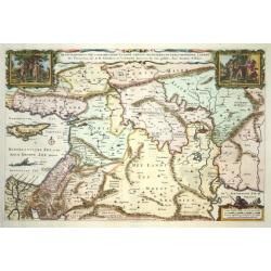
De gelegentheyt van 't paradys..
Dutch Bible map covering the region between the Mediterranean and the Persian Gulf, featuring the Garden of Eden. Strapwork title cartouche flanked by scenes of Eve offer...
Place & Date: Amsterdam 1663
Selling price: $180
Sold
Asia noviter delineata.
With columns of figures on either side depicting the native manners of dress, and nine city plans and views at the top.Japan is shown accurately unusually with Korea as a...
Place & Date: Amsterdam, 1663
Selling price: $2700
Sold
Asia noviter delineata.
With columns of figures on either side depicting the native manners of dress, and nine city plans and views at the top.Japan is shown accurately unusually with Korea as a...
Place & Date: Amsterdam, 1663
Selling price: $3150
Sold
Sourie ou Terre Saincte moderne..
Decorative and detailed map of modern Palestine. Shows the political division under Turkish rule. Prepared by Philippe de La Rue. In lower right hand corner inset sketch ...
Place & Date: Paris, 1663
Selling price: $240
Sold in 2013
(6 coastal profiles)
A page with 6 coastal profiles of favorite anchor places and bays used by the Dutch and French vessels on their way to Asia : "Figure de la Terre de Saldagne",...
Place & Date: Paris, 1663
Selling price: $110
Sold in 2011
Geographische Beschryvinghe van de Wandeling der Apostelen ende De Reysen Pauli. . .
A decorative map of the eastern Mediterranean from Rome through Asia Minor and the Holy Land, depicting the route of Apostle Paul, including Italy, Sicily, Cyprus, Turkey...
Place & Date: Amsterdam, 1663
Selling price: $300
Sold in 2012
[Map covering the area from India till Australia.]
Probably of Portuguese origin, this appeared in Thevenot's Relations de divers Voyages , the greatest collection of travel accounts of the seventeenth century. Of partic...
Place & Date: Paris, Langlois, 1663
Selling price: $3400
Sold in 2015
Moluccae Insulae Celeberrimae.
Showing the geographical features of the spice islands, and decorated with ships, sea monsters and a handsome cartouche. In addition to a sumptuous title cartouche, the m...
Place & Date: Amsterdam, 1663
Selling price: $650
Sold in 2016
Asia noviter delineata.
An elegant map with columns of figures on either side depicting the native manners of dress, and nine city plans and views at the top.Japan is shown accurately unusually ...
Place & Date: Amsterdam, 1663
Selling price: $2500
Sold in 2016
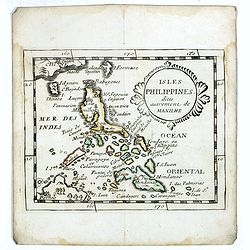
Isles Philippines dites autrement de Manilhe.
Uncommon miniature map of the Philippines, from Pierre Duval's La Geographie Universeille dated 1676.The fictitious island of San Juan (I. S. Iuan) appears in one of its ...
Place & Date: Paris, 1663
Selling price: $325
Sold in 2016
t Koonincklyck BANKET.
A decorative copperplate print of a diplomatic Dutch delegation, led by Van Hoorn, dining with a Chinese viceroy. A sumptuous feast is in progress, with many tables of fo...
Place & Date: Amsterdam, J. van Meurs, 1663
Selling price: $30
Sold in 2016
The Mughal Empire. India/ Afghanistan. Description de la partie des Indes orientales qu est sous la domination du grand Mogol.
A very scarce, attractive map of the Mughal or Mogul Empire that at its height controlled much of India and Afghanistan from early in the 16th century; it gradually dwind...
Place & Date: Paris, 1663
Selling price: $260
Sold in 2019
De Gelegenheyt van 't Paradys en 't Landt Canaan, mitsgaders de eerste bewoonde landen der Patriarchen? door Nicolaes Visscher.met Privilege vande Groot Mog: Heeren van Hollandt en West-Frieslandt voor 15 Jaaren. Broeck sculpsit.
Dutch so-called ' Staten' bibles, published between 1637 and c. 1760, contained 5 maps: The World, ' Paradise', The Perigrinations, The Promised Land Canaan, The Travels ...
Place & Date: Amsterdam, 1664
Selling price: $375
Sold
Tartaria Sive Magni Chami Imperium.
Charming little map of Tartary made by Gabriel Bucelin (1599-1681). Bucelin was a Swiss genealogist and an author of several books and a number of manuscript maps of Germ...
Place & Date: Ulm, Johannes Görlin, 1658-1664
Selling price: $85
Sold in 2008
Persarum. . .
Charming little map of Persia made by Gabriel Bucelin (1599-1681). Bucelin was a Swiss genealogist and an author of several books and a number of manuscript maps of Germa...
Place & Date: Ulm, Johannes Görlin, 1658-1664
Selling price: $80
Sold in 2008
Natolia. . .
Charming little map of Turkey, with an oversized Cyprus, made by Gabriel Bucelin (1599-1681). Bucelin was a Swiss genealogist and an author of several books and a number ...
Place & Date: Ulm, Johannes Görlin, 1658-1664
Selling price: $185
Sold in 2008
Turci Impery adumbratio.
Charming little map of Ottoman Empire, made by Gabriel Bucelin (1599-1681). Bucelin was a Swiss genealogist and an author of several books and a number of manuscript maps...
Place & Date: Ulm, Johannes Görlin, 1658-1664
Selling price: $100
Sold in 2008
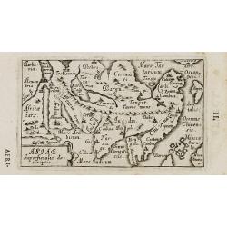
Asiae Superficialis descriptio.
Charming little map of Asia made by Gabriel Bucelin (1599-1681). Bucelin was a Swiss genealogist and an author of several books and a number of manuscript maps of Germany...
Place & Date: Ulm, Johannes Görlin, 1658-1664
Selling price: $160
Sold in 2008
Terra Sancta sine Palestina.
Charming little map of the Holy Land made by Gabriel Bucelin (1599-1681). Bucelin was a Swiss genealogist and an author of several books and a number of manuscript maps o...
Place & Date: Ulm, Johannes Görlin, 1658-1664
Selling price: $135
Sold in 2008
Carta maritima del Golfo di Smirne com anche l'Isola Scio e come fra essa, e la terra ferma di Calaberno si possa veleggiar
Rare chart showing the Gulf of Smyrna (Izmir) and the east coast of the Greek island of Chios. From "Specchio del Mare", ("Mirror of the Sea"). Levant...
Place & Date: Genoa, 1664
Selling price: $425
Sold in 2011
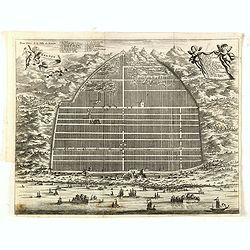
Kanton in platte grondt / Plate forme de la ville de Kanton.
Bird?s-eye view of the city of Canton.From Olfert Dapper mission to China, 1662-1663. Printed by Jacob van Meurs, title of the book: Gedenckwaerdig bedrijf der Nederlands...
Place & Date: Amsterdam 1665
Selling price: $710
Sold
Tabula Geographica Hydrophylacium Asiae Majoris. . .
The Jesuit scholar Athanasius Kircher was one of the first compilers of semi-scientific knowledge about the physical features of the world. This very unusual map depicts ...
Place & Date: Amsterdam, 1665
Selling price: $425
Sold in 2011
Jesu Christi Salvatoris Nostri et Apostolorum Petri et Pauli Mansiones, Itinera Pergrinationes. . .
Showing eastern part of the Mediterranean, including Cyprus, Italy. Lower right hand corner inset plan of Jerusalem. Lower left map of Palestine.
Place & Date: Paris, 1665
Selling price: $65
Sold in 2015
Xantsui.
Beautiful city view in China by John Nieuhoff, an explorer and Dutch diplomat. Published by Pieter van der Aa in his "L'AMBASSADE DE LA COMPAGNIE ORIENTALE" in ...
Place & Date: Leiden, 1665
Selling price: $27
Sold in 2019
Single, China.
Beautiful city view in China by John Nieuhoff, an explorer and Dutch diplomat. Original copper engraving was published by Pieter van der Aa in his "L'AMBASSADE DE LA...
Place & Date: Leiden, 1665
Selling price: $38
Sold in 2017
Peking, China.
Beautiful city view in China by John Nieuhoff, an explorer and Dutch diplomat. Original copper engraving was published by Pieter van der Aa in his "L'AMBASSADE DE LA...
Place & Date: Leiden, 1665
Selling price: $27
Sold in 2016
Kanton in platte grondt / Plate forme de la ville de Kanton.
Bird’s-eye view of the city of Canton.From Olfert Dapper mission to China, 1662-1663. Printed by Jacob van Meurs, title of the book: Gedenckwaerdig bedrijf der Nederlan...
Place & Date: Amsterdam, 1665
Selling price: $400
Sold in 2015
Kanton in platte grondt / Plate forme de la ville de Kanton.
Bird’s-eye view of the city of Canton.From Olfert Dapper mission to China, 1662-1663. Printed by Jacob van Meurs, title of the book: Gedenckwaerdig bedrijf der Nederlan...
Place & Date: Amsterdam, 1665
Selling price: $300
Sold in 2019
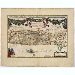
Situs Terrae Promissionis. . .
A truly superb, decorative map with north oriented to the left. It is finely engraved with numerous biblical scenes including the Exodus, the wandering of the Children of...
Place & Date: Amsterdam, 1665
Selling price: $160
Sold in 2017
Tabula Geographica Hydrophylacium Asiae Majoris exhibens, quo Omnia Flumina sive proxime sive remote per occultos maeandros Originem suam Sortiuntur.
Rare and Interesting map showing Asia from Arabia in the west until China, Japan, Korea and Philippines with Indonesia. From Kircher's "Mundus Subterranaeus". T...
Place & Date: Amsterdam, 1665
Selling price: $150
Sold in 2020
Carte du Voyage des Ambassadeurs de la Compagnie Orientale des Provinces Unies, vers le Tartare Empereur de la Chine. . .
A scarce map of China illustrating the Dutch expedition to China led by Johan Nieuhof in 1655-57.
Place & Date: Paris, ca. 1665
Selling price: $240
Sold in 2020
Anaplus Bosphori Thracii..
Detailed map of the Bosporus during ancient time. Lower left Istanbul.
Place & Date: Paris 1666
Selling price: $350
Sold
Anaplus Bosphori Thracii. . .
Detailed map of the Bosporus during ancient time. Lower left Istanbul. Prepared by Guillaume Sanson, the son of Nicolas.
Place & Date: Paris, ca.1666
Selling price: $132
Sold in 2013
A New and Exact Map of Asia and the Islands there unto belonging.
SIGNIFICANTLY SCARCE map of Asia by Václav Hollar, also known as Hollar Wenceslaus, one of finest engravers of his time. Born in Bohemia, he moved to England to become a...
Place & Date: London, ca. 1666
Selling price: $600
Sold in 2016
Mer Noire ou Mer Maievre . . .
Map encompassing part of the Near East and the area comprehended between the Black Sea and the Caspian Sea. Centered on Turkey and Cyprus prepared by N.Sanson and publish...
Place & Date: Paris, P. Mariette, 1667
Selling price: $30
Sold in 2011











![[Hornius Map of the Holy Land, Israel, and Palestine]](/uploads/cache/44765-250x250.jpg)







![[Map covering the area from India till Australia.]](/uploads/cache/36448-250x250.jpg)


