Browse Listings in Asia
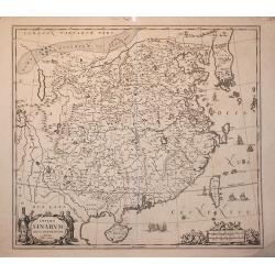
China Veteribus Sinarum Regio.
This was the first of Blaeu's maps of China. In 1655 he was to publish the famous map of Father Martini, with many of the earlier inaccuracies present on this map correct...
Place & Date: Amsterdam, 1653
Selling price: $2550
Sold in 2016
Asia Recens Summa Cura Delineata
After the map by Hondius, from "Théâtre géographique". A rare separately issued map of Asia, by Pierre Mariette, based upon Hondius' map of Asia. The map has...
Place & Date: Paris, 1653
Selling price: $950
Sold in 2016
L'Inde decà et dela le Gange, ou est L'Empire du Grand Mogol.
An excellent mid 17th century map showing the area from Afghanistan and Pakistan in the west, and western China on the east, with most of India and extending north to the...
Place & Date: Paris, 1654
Selling price: $145
Sold in 2017
Les Isles Philippines Molucques et de la Sonde.
Sanson's important mid-seventeenth century map of the East Indies, covering modern Indonesia, the Philippines, Malaysia and parts of Southeast Asia and New Guinea. At a s...
Place & Date: Paris, 1654
Selling price: $1000
Sold in 2017
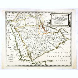
Carte des Trois Arabies. Tiree en Partie de l'Arabe de Nubie, en Partie de Divers autres Autheurs. . .
Rare map of the Arabian Peninsula, first published in 1654 and one of the first large maps focused specifically on the Arabian Peninsula. Sanson's map of the Arabian Peni...
Place & Date: Paris, 1654
Selling price: $1250
Sold in 2016
Carte des Trois Arabies. Tiree en Partie de l'Arabe de Nubie, en Partie de Divers autres Autheurs. . .
Rare map of the Arabian Peninsula, first published in 1654 and one of the first large maps focused specifically on the Arabian Peninsula. Sanson's map of the Arabian Peni...
Place & Date: Paris, 1654
Selling price: $3500
Sold
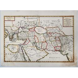
EXPEDITIONS ALEXANDRI MAGNI Per Europam, Assiam et Africam, Tabula Geographica.
A detailed outlined hand-colored map of the region bounded by the Eastern Mediterranean in the West and India in the east, centered on the Arabian Peninsula, Persia and I...
Place & Date: Paris, 1654
Selling price: $100
Sold in 2019
Expeditionis ALEXANDRI MAGNI Per Europa, Asiam et Africam.
Detailed, colored map of the region bounded by the Eastern Mediterranean in the West and India in the east, centered on the Arabian Peninsula, Persia and Iraq.
Place & Date: 1654
Selling price: $40
Sold in 2019
Partie meridionale de L'Inde En deux Presqu'Isles l'une deca et l'autre Gange
A superb example of Sanson's map of the Indian subcontinent and Southeast Asia. With the Dutch and English East India Companies being founded at the turn of the 17th maps...
Place & Date: Paris, 1654
Selling price: $160
Sold in 2023
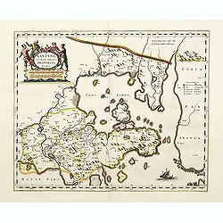
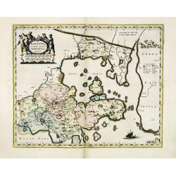
Xantung, sinarum imperii provincia quarta.
Map of the province of Shandong.From the Blaeu\'s \"Novus Atlas Sinensis\". Ornated with the typical high decorative ornated title cartouche together with an mi...
Place & Date: Amsterdam, 1655
Selling price: $1550
Sold in 2008
Quangsi, Sinarum Imperii Provinciae Decimatertia.
A map of a part of China published by J. Blaeu, in the second landmark in the European mapping of China "the Atlas Sinensis" in 1655.
Place & Date: Amsterdam, 1655
Selling price: $210
Sold in 2009
Imperii Sinarum.
A very decorative map of China. In the ocean, six vessels are depicted. Title cartouche on the lower left hand corner.Joannes van Loon was an accomplished mathematician a...
Place & Date: Amsterdam, 1655
Selling price: $650
Sold in 2009
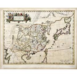
Imperii Sinarum Nova Descriptio
A important general map of China, Korea and Japan, published by Joan Blaeu in the Jesuit Martino Martini's Atlas Sinensis , the first western atlas of China. Incorporates...
Place & Date: Amsterdam, 1655
Selling price: $2650
Sold in 2010
Exactissima Asiae Delineatio..
With a very decorative title cartouche lower left featuring camels, cockatoos and Eastern merchants bartering their wares.
Place & Date: Amsterdam, 1655
Selling price: $450
Sold in 2013
Xensi Imperii Sinarum provincia tertia.
Based on the remarkably accurate compilations of the Jesuit Father Martino Martini during his travels between 1643 and 1650, this map of the Xensi (Shaanxi) province feat...
Place & Date: Amsterdam, 1655
Selling price: $600
Sold in 2015
The History of That Great and Renowned Monarchy of China.
An important account of China, written by the Portuguese Jesuit Alvarez de Semedo (1586-1658), who was stationed in China from 1613 to 1637. On his return to Europe, Seme...
Place & Date: London, 1655
Selling price: $1600
Sold in 2017
Imperii Sinarum Nova Descriptio.
A superb map of the Chinese Empire based on the compilation of the Jesuit Father Martino Martini who travelled through the region between 1643 and 1650.This was a period ...
Place & Date: Amsterdam, 1655
Selling price: $950
Sold in 2017
Xantung Sinarum Imperii Provincia Quarta.
A map of the province of Shandong, China. Many larger cities are named including Tungchang, Cinan, Yencheu. Laicheu and Leaochang. At the upper right side is an engrave...
Place & Date: Amsterdam, 1655
Selling price: $350
Sold in 2018
Fokien, Imperii Sinarum Provincia Undecima.
A map of the Chinese province of Fokien, by Joan Blaeu. Title in a cartouche with Chinese figures at top centre. At top left a cartouche with putti containing mileage sca...
Place & Date: Amsterdam, 1655
Selling price: $580
Sold in 2020
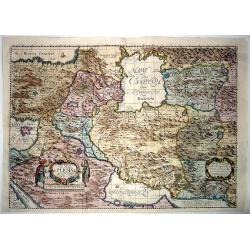
Nova Delineatio PERSIAE et Confiniorum Veteri longe accuratior edita Anno 1655.
The first realistic map of Iran. Highly important regional map of the Persian Empire, published by Adam Olearius in 1656, in his Vermehrte newe Beschreibung der muscowiti...
Place & Date: Schleswig or Hamburg, 1655
Selling price: $950
Sold in 2020
La Chine Royaume. . .
An important and attractive French map of the whole of China, the northern tip of the Philippines, with a strangely curved Korea and an under-sized Taiwan here called &qu...
Place & Date: Paris, 1656
Selling price: $2000
Sold in 2016
India Orientalis nec non Insularum Adiacentium Nova Descriptio.
This superb map of South East Asia presents a detailed image of the sphere of operations and Asian trading empire of the Dutch East India Company. The map extends from In...
Place & Date: Amsterdam, 1656
Selling price: $750
Sold in 2009
Casan Tartacorium.
An early of Kazan, with the Volga river on the left. From "Voyages en Moscovie, Tartarie et Perse, par Adam Olearius".Adam Olearius was a seventeenth-century G...
Place & Date: Paris, Abraham de Wicquefort , 1656
Selling price: $500
Sold in 2010
View of Nisen-Navgorod.
An early of Nisen-Navgorod, on the Volga river. From "Voyages en Moscovie, Tartarie et Perse, par Adam Olearius".Adam Olearius was a seventeenth-century German...
Place & Date: Paris, Abraham de Wicquefort , 1656
Selling price: $850
Sold in 2013
View of Weliki Nowgorod.
An early of Weliki Nowgorod, in the North-West of Russia, on the Volkhov river.From "Voyages en Moscovie, Tartarie et Perse, par Adam Olearius".Adam Olearius w...
Place & Date: Paris, Abraham de Wicquefort , 1656
Selling price: $750
Sold in 2012
Perigrinatie ofte Veertich-Jarige Reyse der Kinderen..
Finely engraved and detailed. Showing the dispersion of the tribes of Israel. With an inset showing the actual lay out of the camp of the Israelis According to the law of...
Place & Date: Amsterdam, Nic. Visscher, c. 1657
Selling price: $210
Sold in 2009
Perigrinatie ofte Veertich-jarige Reyse der Kinderen Israels.
Dutch so-called ' Staten' bibles, published between 1637 and c. 1760, contained 5 maps: The World, ' Paradise', The Perigrinations, The Promised Land Canaan, The Travels ...
Place & Date: Amsterdam, Nic. Visscher, c. 1657
Selling price: $250
Sold
Peregrinatie ofte Veertich-jarige Reyse der Kinderen Israels.
Claes Jansz. Visscher (1587-1652), founder of the publishing house
Place & Date: Amsterdam, 1657
Selling price: $250
Sold
Het Beloofde Landt Canaan door wandelt van onsen Salichmaecker Iesus Christo, neffens syne Apostelen
Claes Jansz. Visscher (1587-1652), founder of the publishing house
Place & Date: Amsterdam, 1657
Selling price: $300
Sold
Geographishe Beschryvinghe van de Wandeling der Apostelen ende de Reysen Pauli . . . door Nicolaes Visscher.
Claes Jansz. Visscher (1587-1652), founder of the publishing house.
Place & Date: Amsterdam, 1657
Selling price: $525
Sold
Mar di India.
This from Johannes Janssonius' important sea-atlas 'De Water-Weereld' covers the area between the Cape of Good Hope, Korea and Korea (INS: CORAI) and Japan.It owes its i...
Place & Date: Amsterdam, 1657
Selling price: $2600
Sold in 2011
Estats de L'Empire du grand Seigneur des Turqs..
A decorative map of the Mediterranean and countries bordering, extending eastwards to include all the Arabian Peninsula. This edition carries the date 1654.Nicolas Sanson...
Place & Date: Paris, 1654-1657
Selling price: $520
Sold in 2013
Isfahan.
Jansson's fantastic town-view of Isfahan from his rare 8 volume "Theatrum Urbium", which was the most comprehensive Dutch town-book of the 17th century. The cit...
Place & Date: Amsterdam, 1657
Selling price: $500
Sold in 2018
Het Beloofde Landt Canaan door wandelt van onsen Salichmaecker Iesu Christo, neffens syne Apostelen.
Showing the travels of Christ and His disciples. With 36 numbered sites and insets of the Birth, Resurrection, Ascension and Pentecost. Orientated with east to the top.
Place & Date: Amsterdam, 1657
Selling price: $100
Sold in 2020
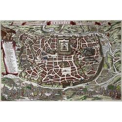
De Heylige en Wytvermaerde stadt Ierusalem Eerst Genaemt Salem, Genesis 14 vers 18
Bird's eye plan of the holy city of Jerusalem with 36 principal sites numbered and keyed to a table in a scroll at left, which is held aloft by an eagle. Biblical scenes ...
Place & Date: Amsterdam, 1657
Selling price: $110
Sold in 2020
La Chine.
A very uncommon map of China by Picart. With rivers, mountains, lakes and many place names given.
Place & Date: Paris, ca. 1657
Selling price: $100
Sold in 2021
Het Beloofde Landt Canaan door wandelt van onsen Salichmaecker Iesus Christo, neffens syne Apostelen
A decorative map depicting the Holy Land with 4 scenes from the life of Christus, 3 cartouches and two fisherman. Claes Jansz. Visscher (1587-1652). The Dutch so-called '...
Place & Date: Amsterdam, 1657
Selling price: $240
Sold in 2021
Palestina, Sive Terrae Sanctae Descriptio.
Oriented to the east, divided into the Tribes on both sides of the Jordan, the shoreline from Sidon to Alexandria. Along the top and the bottom 18 vignettes showing the E...
Place & Date: Amsterdam 1658
Selling price: $3350
Sold
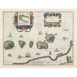
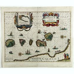
Moluccae Insulae Celeberrimae.
Showing the geographical features of the spice islands, and decorated with ships, sea monsters and a handsome cartouche. In addition to a sumptuous title cartouche, the m...
Place & Date: Amsterdam, 1658
Selling price: $600
Sold
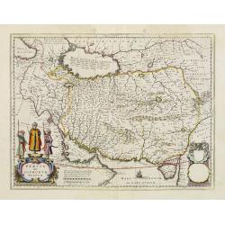
Persia sive Sophorum Regnum.
A finely designed map from the great Blaeu family of Amsterdam. With decorative title cartouche.The cartouches and decoration are colored in an artistic way.The edition w...
Place & Date: Amsterdam, 1658
Selling price: $500
Sold in 2012
Cyprus Insulae.
Blaeu's beautiful map of Cyprus embellished with a very decorative title cartouche, shows Leda being drawn across the sea by a pair of swans.
Place & Date: Amsterdam, 1658
Selling price: $2000
Sold
Moluccae Insulae Celeberrimae.
Showing the geographical features of the spice islands, and decorated with ships, sea monsters and a handsome cartouche. In addition to a sumptuous title cartouche, the m...
Place & Date: Amsterdam, 1658
Selling price: $500
Sold
Nova et accurata Japoniae terrae Esonis, ac Insularum. . .
Johannes Janssonius' important map of Japan, notable for its detail of Hokkaido, the first printed map to use the detailed manuscript charts of Maarten de Vries from his ...
Place & Date: Amsterdam, 1658
Selling price: $1350
Sold in 2011
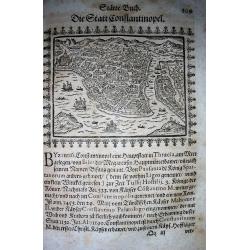
Constantinopolis.
Very rare woodcut birds-eye view of Istanbul/Constantinople. Showing numerous buildings and ships! From Saur's important work "Stätte-Buch... / Beschreibung der f�...
Place & Date: Frankfurt, 1658
Selling price: $325
Sold in 2009
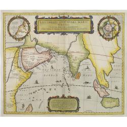
Erythraei sive rubri Maris Periplus. . .
Decorative map covering the north-west coast of Africa, Arabian peninsular, India, Malaysia.Upper right hand corner inset map Hyper Borei , the North Pole after Mercator....
Place & Date: Amsterdam, 1658
Selling price: $110
Sold in 2010
ASIA recens summa cura delineata. Auct. Henr. Hondio.
Henricus Hondius' fine and decorative map of the Continent of Asia depicting a refined Japan and Korea, issued in editions of the Hondius and Janssonius Atlases.French te...
Place & Date: Amsterdam, 1658
Selling price: $600
Sold in 2011
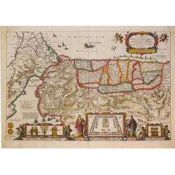
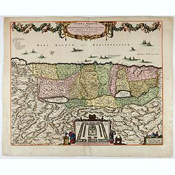
Terra Sancta quae in Sacris Terra Promissionis. . .
Very decorative map of Palestine. Orientated west to the top. The decoration is inspired by the Old Testament. Moses stands to the left of the title cartouche, Aaron to t...
Place & Date: Amsterdam, 1658
Selling price: $350
Sold in 2015
Moluccae Insulae Celeberrimae.
Showing the geographical features of the spice islands, and decorated with ships, sea monsters and a handsome cartouche. In addition to a sumptuous title cartouche, the m...
Place & Date: Amsterdam, 1658
Selling price: $300
Sold in 2022
Chinae Compendiosa Descriptio.
A scarce early map of China with beautiful geographic detail. Published in "Historiae Universalis Auctarium". Page marked "XXVIII".
Place & Date: Ulm, 1658
Selling price: $250
Sold in 2020
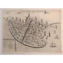
Civitas Acon Sive Ptolomaida.
A very rare plan of Acre, one of the oldest continuously inhabited cities in the world. It shows extensive fortifications, town plan, buildings and a key identifying sign...
Place & Date: Paris, 1658
Selling price: $180
Sold in 2023
Asia recens summa cura delineata Auct. Jud. Hondio
A rare decorative ‘Carte à Figures’ map of Asia, which appeared in the 1659 edition of Pierre D'Avity's Les Etats Empires, Royaumes et Principautez du Monde. The map...
Place & Date: Paris, 1618 but 1659
Selling price: $2200
Sold in 2016
India Orientalis Nova.
Charming uncommon miniature map showing the northern two-thirds of Australia pre-discoveries by Captain Cook, but showing discoveries by Abel Tasman in 1642. The map show...
Place & Date: Amsterdam, 1659
Selling price: $550
Sold in 2017
Terra Sancta sive Promissionis, olim Palestina..
Apparently this same plate was used by later cartographers, such as De Wit. The top portion with cartouche was taken from a John Speed map of the Holy Lands.
Place & Date: Amsterdam, 1659
Selling price: $425
Sold in 2023
Xantung, sinarum imperii provincia quatra.
A map of the northern province ‘Xantung’ of China after the Jesuit Martino Martini.Shows the Great Wall and is centered on the Bohai Sea, and the Shandong and Liaonin...
Place & Date: Amsterdam, ca 1660
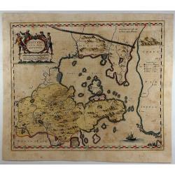
Quantung Imperii Sinarum Provincia duodecima.
A beautifully engraved map of Southern China covering Hainan and the Pearl River Delta with Macao and the islands around present-day Hong Kong.
Place & Date: Amsterdam 1660
Selling price: $1150
Sold
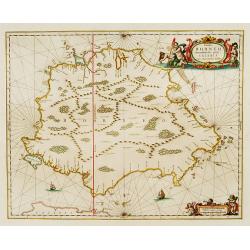
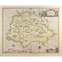
Insula BORNEO et occidentalis pars celibis cum adjacentibus Insulis.
An elegant map of Borneo. The map includes only coastal detail.The beautiful map is richly embellished with two fine cartouches featuring mermaids surrounding the scale o...
Place & Date: Amsterdam 1660
Selling price: $1105
Sold
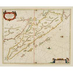
Sumatrae et insularum Locorumque nonnullorum circumiacentium
Fine chart depicting the Island of Sumatra and the southern coasts of Malaysia from Quedo to Johore. North is orientated to the left of the page. Singapore is probably id...
Place & Date: Amsterdam 1660
Selling price: $600
Sold
Turcicum Imperium. Türckische Reijch.
A reduced version of Blaeu's map of the Middle East.The map extends from the Mediterranean to Arabia and is notable for the fine title cartouche bottom left surmounted by...
Place & Date: Frankfurt 1660
Selling price: $360
Sold
Delineatio Indiae Orientalis quaelumen dabit huie itinerario et historijs.
Uncommon map of Asia from a German edition of Olearius' travels.
Place & Date: Germany c.1660
Selling price: $325
Sold
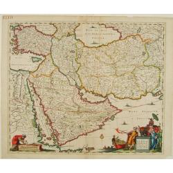
Nova Persiae, Armeniae, Natoliae et Arabiae.
East from Cyprus to Iran with numerous place names and ornamental cartouches below. There are vignettes of sailing ships in sea areas and the land divisions of the time a...
Place & Date: Amsterdam 1660
Selling price: $350
Sold
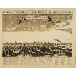
Constantinopolitanae urbis effigies ad vivum expressa.
A rare panoramic view of Istanbul with over the whole length of the lower part 3 columns of poems in Latin, Dutch and French and a numbered key 1-29 to the principal buil...
Place & Date: Amsterdam, 1660
Selling price: $2100
Sold
Sumatrae et insularum Locorumque nonnullorum circumiacentium..
Fine chart depicting the Island of Sumatra and the southern coasts of Malaysia from Quedo to Johore.North is orientated to the left of the page.Singapore is probably iden...
Place & Date: Amsterdam 1660
Selling price: $900
Sold
Nova Persiae, Armeniae, Natoliae et Arabiae.
East from Cyprus to Iran with numerous place names and ornamental cartouches below. There are vignettes of sailing ships in sea areas and the land divisions of the time a...
Place & Date: Amsterdam, 1660
Selling price: $750
Sold in 2013
Pecheli, Xansi, Xantung, Honan, Nanking, In plaga Regni Sinensis..
A map of the northern provinces of China after the Jesuit Martino Martini, Beijing, Shandong, Hanan and Jiangsu.Shows the Great Wall and covers northeastern China includi...
Place & Date: Amsterdam ca 1660
Selling price: $550
Sold
Quantung Imperii Sinarum Provincia duodecima.
A beautifully engraved map of Southern China covering Hainan and the Pearl River Delta with Macao and the islands around present-day Hong Kong.
Place & Date: Amsterdam 1660
Selling price: $1450
Sold
Turcicum imperium.
A Blaeu map with a fine cartouche showing the Turkish Sultan on his throne and allegorical figures. Sailing ships in the Arabian Sea and the Mediterranean. With many pla...
Place & Date: Amsterdam, 1660
Selling price: $400
Sold in 2013
Insula Borneo et Occidentalis Pars Celebis cum Adjacentibus Insulis
Reissue of Jansson map.
Place & Date: Amsterdam, c.1660
Selling price: $700
Sold in 2009
Nova et Accurata Japoniae, Terrae Esonis, ac Insularum Adjacentium ex Novissima Detectione Descriptio. Apud Ioannem Ianssonium
This edition is without text on the back.
Place & Date: Amsterdam, c. 1660
Selling price: $1500
Sold in 2008
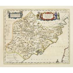
Fokien Imperii Sinarum Provincia undecima.
The province of Fokien lies opposite Taiwan and south of the region described in the above map. The coast is shown from Wen-zhou in the north to Fu-zhou and as far south ...
Place & Date: Amsterdam, 1660
Selling price: $1000
Sold in 2011
Tabula Itineris Decies Mille Graecorum sub Cyro... Per P. du Val. . .
Decorative map of Asia Minor, Cyprus and the neighboring areas, the map features the expedition of Cyprus the Great .Compiled and drawn by Pierre duVal for Janssonius' hi...
Place & Date: Amsterdam, 1660
Selling price: $190
Sold in 2012
Imperii Sinarum.
Very attractive example of Van Loon's map published by Jan Janssonius. Superb coloring.
Place & Date: Amsterdam, c. 1660
Selling price: $1200
Sold
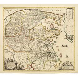
Nanking, sive Kiangnan, Imperii Sinarum Provincia Nona.
A map of Nanking, or Kiangnan, province (roughly corresponding to today's Jiangsu Province and Shanghai Municipality, after the Jesuit Martino Martini.Good detail of Yang...
Place & Date: Amsterdam, ca 1660
Selling price: $2100
Sold in 2013
Pecheli, Xansi, Xantung, Honan, Nanking, In plaga Regni Sinensis..
A map of the northern provinces of China after the Jesuit Martino Martini, Beijing, Shandong, Hanan and Jiangsu.Shows the Great Wall and covers northeastern China includi...
Place & Date: Amsterdam, ca 1660
Selling price: $1250
Sold in 2014
Nanking, sive Kiangnan, Imperii Sinarum Provincia Nona.
A map of Nanking, or Kiangnan, province (roughly corresponding to today's Jiangsu Province and Shanghai Municipality, after the Jesuit Martino Martini.Good detail of Yang...
Place & Date: Amsterdam, ca 1660
Selling price: $1300
Sold in 2015
Turcicum Imperium. Türckische Reijch.
A reduced version of Blaeu's map of the Middle East. The map extends from the Mediterranean to Arabia and is notable for the fine title cartouche bottom left surmounted b...
Place & Date: Frankfurt, 1660
Selling price: $250
Sold in 2015
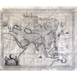
Nova et Exacta Asiae Geographica Descriptio Auct Hugo Allardt
A very rare, large map depicting Asia and an early northern part of Australia.Among the peculiarities of the map are a fine representation of the Philippines, while Korea...
Place & Date: Amsterdam, ca. 1660
Selling price: $750
Sold in 2016
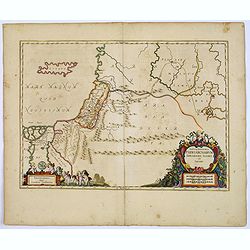
Tabula Itineraria Patriarcharum Abrahami, Isaaci et Jacobi.
The Holy Land and Egypt in left hand part of the map. Showing travels of Abraham, Isaac and Jacob. With some nice decorative cartouches.
Place & Date: Amsterdam, 1660
Selling price: $90
Sold in 2017
MOLUCCAE Insulae Celeberrimae.
A highly decorative map of the "Spice Islands".
Place & Date: Amsterdam, ca. 1660
Selling price: $250
Sold in 2018
Insula Zeilan olim Taprobana nunc incolis tenarisim.
Janssonius' map of Sri Lanka. Including many VOC settlements and forts, several major town marked with a crown. Very decorative item, with two large title and scale carto...
Place & Date: Amsterdam, 1660
Selling price: $600
Sold in 2019
Carta prima Generale dell' Asia.
Rare sea chart of India and Indonesia, in a first state. In outer right part of the Philippines islands with Manila.Engraved by Lucini.Sir Robert Dudley (1573-1649) was t...
Place & Date: Florence 1646/1661
Selling price: $2525
Sold


