Browse Listings in Asia
(Mao. Title in Chinese : 'Chairman Mao Zedong and his close friend comrade Lin Biao reviewing the cultural revolutionary army'.)
Mao zhu xi Chinese communism propaganda poster showing Mao Zedong[a] (1893 – 1976), commonly known as Chairman Mao.Published by Xinhua News agency, which was founded in...
Place & Date: Beijing, 1976
Selling price: $50
Sold in 2018
(Mao. Title in Chinese 'Chairman Mao and his close combat comrade Lin Biao and comrade Zhou Enlai )
Mao zhu xi Chinese communism propaganda poster showing Mao Zedong[a] (1893 – 1976), commonly known as Chairman Mao.Published by Xinhua News agency, which was founded in...
Place & Date: Beijing, 1976
Selling price: $40
Sold in 2018
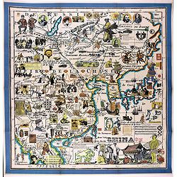
China
Pictorial map by the Italian artist Andrea Pistacchi.
Place & Date: Italy, ca. 1980
Selling price: $230
Sold in 2020
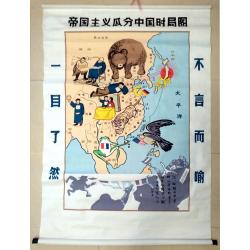
Map of the Imperialist Division of China
Unusual, large silkscreened map of China based on the serio-comic map drawn in 1899 by Tse Tsan-tai, Chinese patriot and co-founder of Hong Kong's South China Morning Po...
Place & Date: China, C. 1960-1980
Selling price: $100
Sold in 2023
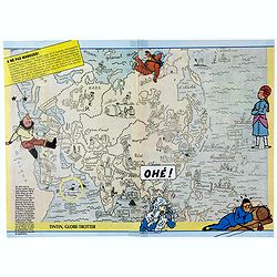
Tintin, Globe-Trotter.
Pictorial map of general Asia, with illustrations of Tintin in different outfits, showing his travels. The French text translation: " On this map of the Orient (Publ...
Place & Date: France, 1986
Selling price: $55
Sold in 2020
The Situation in the Far East. (時局圖)
An unusual rendering of Tse's "Situation in the Far East". Tse Tsan-tai (1872-1939), a Chinese patriot, drew the original political cartoon in Hong Kong in 1899...
Place & Date: China, n.d. but ca. 1980/1990
Selling price: $100
Sold in 2020
Philippine Islands - Luzon Island North of latitude 16°20' north from the United States and Philippine charts to 1980. . . (3805)
A highly corrected version of Admiralty chart 3805 originally published 1 December 1925 under the Superintendence of Captain H.P. Douglas. Edition Date 1991 with further ...
Place & Date: London, 1925 / 1999
Selling price: $100
Sold in 2018
Philippine Islands - Mindoro Strait and Sibuyan Sea. . . (3807)
A highly corrected version of Admiralty chart 3807 originally published 28 August 1923 under the Superintendence of Rear Admiral F.C. Learmonth. Edition Date29th April, 2...
Place & Date: London, 1923 / 2004
Selling price: $100
Sold in 2018
Philippine Islands - Tagolo Point to Cuyo Islands including Cebu, Negros andparts of Panay and Palawan. . . (3809)
A highly corrected version of this oversized Admiralty chart 3809 originally published 19th Augustus 1924 under the Superintendence of Vice Admiral F.C. Learmonth. Editio...
Place & Date: London, 1924 / 2005
Selling price: $130
Sold in 2018
Philippine Islands - Mindanao West Coast - Basilan Strait to Camiguin Island including Tubbataha Reefs. . . (3811)
A highly corrected version of this oversized Admiralty chart 3811 originally published 26th February 1925 under the Superintendence of Captain P.H. Douglas. Edition Date ...
Place & Date: London, 1925 / 2005
Selling price: $100
Sold in 2018
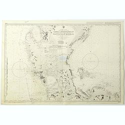
Philippine Islands - Luzon - west and east coast. Cabra I. to S.n Fernando P.t. Diapitan B. to S.n Miguel B. . . (3806)
Detailed chart of Luzon Island with Manila Bay, Cabra Island to S. Fernando Point Diapitan Bay to S. Miguel Bay.A highly corrected version of Admiralty chart 3806 origina...
Place & Date: London, 1922 / 2006
Selling price: $100
Sold in 2018
Map of Tsingtao.
A street map of the city of Tsingtao, published by George G. Telberg's International Bookstore.Litho printed in blue and yellow. Includes all the city's main landmarks: t...
Place & Date: Tsingtao, ca. 1930's
Selling price: $95
Sold in 2019
ANFA. QUIBUSDAM ANAFFA - AZAAMURUM - DIU - GOA fortissima Indiae urbs in Christianorum potestatem anno Salutis 1509. . .
A nice old color example of Braun & Hogenberg's set of Casablanca (Anfa) - Azemmour (Azamor) - Diu - Old Goa (Velha Goa). Text to verso.
Place & Date: Cologne, ca 1572
Selling price: $400
Sold in 2019
CALECHUT CELEBERRI MUM INDIAE EMPORIUM - ORMUS - CANONOR - S. GEORGE Oppidum Mina nunucaptum.
A striking old colored set of four city views, illustrating a trip from Africa to the trading regions of East, from Braun & Hogenberg's Civitates Orbis Terrarum, the ...
Place & Date: Frankfurt, ca 1572
Selling price: $300
Sold in 2019
ADEN.[Yemen] Arabiae Foelicis Emporium Celeberrimi Nominis, quo ex India, Aethiopia ... - MOMBAZA - QUILOA - CEFALA.
A striking, old colored set of four city views. The oldest obtainable printed view of Aden, with smaller views of 3 other African Harbours. The harbour of Aden was among ...
Place & Date: Cologne, ca 1572
Selling price: $400
Sold in 2019
Palestinae sive totius Terrae Promissionis nova descriptio?
A new description of Palestine or the whole Promised Land. The shoreline runs from Berytus (Beirut) to the Nile Delta, reaching inland east of the Jordan and in the south...
Place & Date: Antwerp 1575.
Selling price: $450
Sold
Terra sancta a Petro Laicstain perlustrata..
The Holy Land described by Petrus Laicstain, a Dutch astronomer who collected topographic material on Palestine during his stay there in 1556. Designed by Christian Schro...
Place & Date: Anvers 1612.
Selling price: $500
Sold
GEOGRAPHIAE SACRAE ex Veteri? TABULA PRIMA?
Map of the world according to the Sacred Geography, showing most of the Mediterranean and of the Middle East. Chanaan is shown before the conquest by the Jews. Inset: Isr...
Place & Date: Paris 1662.
Selling price: $250
Sold
Ierusalem.
Engraved bird's eye plan, surrounded by biblical figures and objects, after N. Berchem. French text legends held by winged angels.From the large folio French Elzevier bib...
Place & Date: Leiden, 1669.
Selling price: $300
Sold
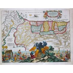
Sortie des Enfans d'Israel hors d'Egypte...
Map of the Holy Land. At the bottom, Moïse is depicted receiving the Tables of the Law on the Sinai Mount while on both sides are represented the scene of the escape out...
Place & Date: Leiden, 1669.
Selling price: $200
Sold
De Stadt Ierusalem zoot Hedendaeghs Bevonden wordt.
View of Modern Jerusalem. Legend along the bottom.From: Olfert Dapper Naukeurige beschryving van gantsch Syrie en Palestyn of Heilige Lant. Pt. II, p.327.Drawn after Bern...
Place & Date: Amsterdam 1677.
Selling price: $300
Sold
Ierusalem.
A panoramic view of the holy city of Jerusalem. With 52 descriptive points key in German and Latin.From: Dapper, Olfert Naukeurige beschryving van gantsch Syrie en Palest...
Place & Date: Amsterdam 1677.
Selling price: $350
Sold
Perigrinatie ofte Veertich-jarige Reyse der Kinderen Israels.
Dutch so-called "Staten" bibles, published between 1637 and c. 1760, contained 5 maps: The World, "Paradise", The Perigrinations, The Promised Land Ca...
Place & Date: H. Keur en M. Doornik, Dordrecht-Amsterdam, 1686.
Selling price: $200
Sold
Jerusalem.
Dutch so-called "Staten" bibles, published between 1637 and c. 1760, contained 5 maps: The World, "Paradise", The Perigrinations, The Promised Land Ca...
Place & Date: Amsterdam, 1690.
Selling price: $150
Sold
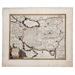
ROYAUME de PERSE avec les Pays Limitrophes et les Places maritimes, suivant les Relations des meilleurs Voyageurs nouvellement.
An attractive hand colored copper engraved map of the old Persian Empire, or modern-day Iran, published in 1719 in Leiden by Pieter van der Aa in the "Les Voyages du...
Place & Date: Leiden, ca 1719
Selling price: $65
Sold in 2019
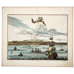
La Ville de l' AMBOINE, Capitale des Isles Molucques.
An attractive hand colored copperplate view of Ambon (Moluccas) by Pierre van der Aa. Shows the capital of Ambon Island with several ships in foreground during the the Du...
Place & Date: Leiden, ca 1719
Selling price: $100
Sold in 2019
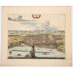
Plan de la Ville de BANTAM, dans l'isle de Java.
An attractive hand colored copperplate view of Bantam by Pierre van der Aa. Shows the village with several ships in foreground during the the Dutch 'golden age' in Indone...
Place & Date: Leiden, ca 1719
Selling price: $150
Sold in 2019
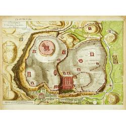
Description de l'ancienne Jerusalem selon Villalpand.
Richly detailed imaginary plan of ancient Jerusalem seen from the east. At bottom center of the plan itself, the Temple of Solomon is shown: upper left, the City of David...
Place & Date: [Paris ca. 1730]
Selling price: $180
Sold
A Map of the Children of Israel's Travels and Marches?
From Augustin Antoine Calmet, A historical, geographical?dictionary of the Holy Bible, London, 1732. Vol. I, between PP. 384-385.
Place & Date: [London 1732]
Selling price: $350
Sold
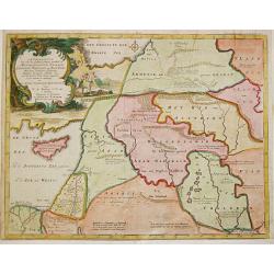
Afbeelding van all de Landen gelegen tusschen de Middellandsche, Zwarte, Caspische, Persische en Rode Zeën.
Willem Albert Bachiene (1712-1783), Dutch geographer in Maastricht. Most important work ' Heilige Geographie', a work on the Holy Land. Mathijs Schalenkamp published in 1...
Place & Date: Gorichem, Nicolaas Goetzee, 1748.
Selling price: $160
Sold
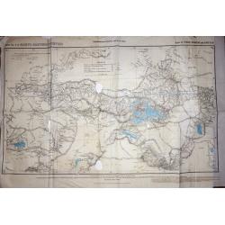
Trigonometrical Branch Survey of India, Sheet No6 of North Eastern Frontier Parts of Tibet, Sikhim and Bhutan
A well-used map of the area surrounding Lhasa. Published under the direction of Colonel G. C. De Pree, Surveyor General of India.
Place & Date: Dehra Dun, 1885
Selling price: $210
Sold in 2016
Carte geologique de l'Indochine. Bang-Kok est.
Geological or soil map showing part of Bangkok , including in the left and right margins a colored legend with signs of the different geological ages. Heliography and pri...
Place & Date: Service geographique de l'Indochine, fevrier 1939.
Selling price: $310
Sold in 2009
Royaume du Cambodge, carte touristique.
Decorative pictorial and Tourist map with points of interest shown pictorially. Figures monuments, animals, and beaches. Scale 1:1,000,000. Tite in upper margin, key at l...
Place & Date: [Phnom Penh, Service ge´ographique des F.A.N.K., 1968]
Selling price: $650
Sold in 2020
Turkey in Asia.
Very detailed map of Turkey. Inset of Cyprus. The map was printed from lithographic stones taken from a hand-engraved steel plate. The cartographer John Bartholomew of Ed...
Place & Date: Edinburg
Selling price: $100
Sold in 2017
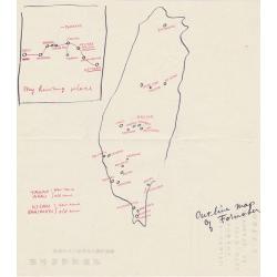
Outline map of Formosa.
An unusual hand drawn map of Formosa.
Place & Date: Kagi City, Formosa
Selling price: $50
Sold in 2019
De Gelegentheyt van t' Paradys en t' Landt Canaan, mitsgaders d' eerst bewoonde Landen der Patriarchen.
Dutch so-called "Staten" bibles, published between 1637 and c. 1760, contained 5 maps: The World, "Paradise", The Perigrinations, The Promised Land Ca...
Place & Date: Amsterdam / Dordrecht, Pieter Keur, Pieter Rotterdam em Pieter Rotterd
Selling price: $201
Sold
De Beschryving van de Reysen Pauli en Van de Andere Apostelen.
The Dutch so-called ' Staten' bibles published between 1637 and c. 1760, contained 5 maps: The World, ' Paradise', The Perigrinations, The Promised Land Canaan, The Trave...
Place & Date: Amsterdam / Dordrecht, Pieter Keur, Pieter Rotterdam en Pieter Rotterd
Selling price: $225
Sold
CONSTANTINOPOLIS.
A striking view of Constantinopolis showing ships and the town's discrits. Folded as issued. On upper right "Pag. 293".
Place & Date: 18th century
Selling price: $200
Sold in 2020






![ADEN.[Yemen] Arabiae Foelicis Emporium Celeberrimi Nominis, quo ex India, Aethiopia ... - MOMBAZA - QUILOA - CEFALA.](/uploads/cache/82806-250x250.jpg)


