Browse Listings in Asia
Turcici Imperii Imago.
From the first edition. A very decorative map. On top of title cartouche the portrait of Sultan Mahumet Turcorum Imperat.More about Mapping of Arabia [+]
Place & Date: Amsterdam, 1630
Selling price: $525
Sold in 2015
IAPONIA.
Early miniature map of Japan and Korea from the rare Cloppenburg edition slightly larger format and more scarce edition of the Mercator/Hondius "Atlas Minor". E...
Place & Date: Amsterdam, 1630
Selling price: $240
Sold in 2016
Cyprus Ins[ula].
A nice map of Cyprus, and in the lower part 6 small insets of: Stalimini, Chius, Mitilene, Negroponte, Cerigo, Rhodus... published in Cloppenburg's rare French version of...
Place & Date: Amsterdam, 1630
Selling price: $350
Sold in 2016
Persici vel Sophorum Regni Typus.
This small map of the Persian Empire is a reduced version of Hondius'.
Place & Date: Amsterdam, 1630
Selling price: $45
Sold in 2018
Tartaria.
Published in Hondius' editions of the Mercator Atlas from 1606 onwards, showing China, Korea and the northern Pacific coast of America showing the two continents separate...
Place & Date: Amsterdam, 1630
Selling price: $165
Sold in 2018
China.
Map of China from the rare Cloppenburg edition slightly larger format and more scarce edition of the Mercator/Hondius "Atlas Minor". Korea is shown as an island...
Place & Date: Amsterdam, 1630
Selling price: $500
Sold in 2018
IAPONIA.
Early miniature map of Japan and Korea from the rare Cloppenburg edition "Atlas Sive Cosmographicae Meditationes De Fabrica Mundi Et Fabricati Figura", slightly...
Place & Date: Amsterdam, 1630
Selling price: $400
Sold in 2019
Cyprus ins.
A nice map of Cyprus, and in the lower part 6 small insets of: Stalimini, Chius, Mitilene, Negroponte, Cerigo, Rhodus... published in Cloppenburg's rare French version of...
Place & Date: Amsterdam, 1630
Selling price: $550
Sold in 2018
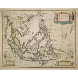
India Orientalis.
Published in Hondius' editions of the Mercator Atlas from 1606 onwards, showing the Indian subcontinent, the Malay Peninsula, Siam and Cambodia, China and the Philippines...
Place & Date: Amsterdam, 1630
Selling price: $1750
Sold in 2019
Iaponia.
One of the most significant maps Hondius the elder added to his first publication of the Mercator atlas in 1606. Based on the 1595 Abraham Ortelius map, but with added de...
Place & Date: Amsterdam, 1630
Selling price: $700
Sold in 2019
Persici vel Sophorum Regni Typus.
This small map of the Persian Empire is a reduced version of Hondius' fine map of the region. It shows the region from the Caspian Sea to the Persian Gulf and across to p...
Place & Date: Amsterdam, 1630
Selling price: $100
Sold in 2021
China / Le Royaume de la Chine.
An attractive miniature map of China from a French edition of the 'Atlas Minor' by Jansson.
Place & Date: Amsterdam, 1630
Selling price: $120
Sold in 2020
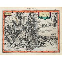
Insulae Indiae Orientalis.
An early and decorative map of South East Asia or Indochina. Shows Indonesia, the Philippines, Malaya, and a part of New Guinea. Filled with islands and names. Latin text...
Place & Date: Amsterdam, ca 1630
Selling price: $150
Sold in 2020
[ Lot of 12 maps / views off India / Sri Lanka] Malabar.
Attractive little map of the southern part of the Indian subcontinent, focusing on the Malabar coast from Goa to Cape Comorin and its important trading posts. Also depict...
Place & Date: Amsterdam, c. 1630
Selling price: $180
Sold in 2023
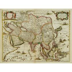
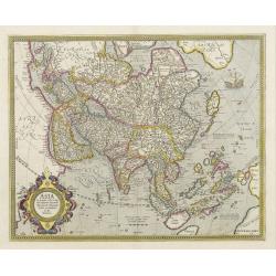
ASIA recens summa cura delineata. Auct. Henr. Hondio.
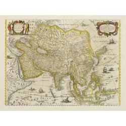
From H. Hondius' Appendix, 1633. Edition without the decorative borders from 1631. Latin text on verso.
Place & Date: Amsterdam 1631
Selling price: $1000
Sold
ASIA recens summa cura delineata. Auct. Henr. Hondio.
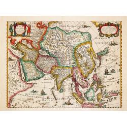
Henricus Hondius' fine and decorative map of the Continent of Asia depicting a refined Japan & Korea, issued in editions of the Hondius & Janssonius Atlases.
Place & Date: Amsterdam 1631
Selling price: $1150
Sold
Asia recens summa cura delineata. Auct. Henr. Hondio.
Henricus Hondius' fine and decorative map of the Continent of Asia depicting a refined Japan & Korea, issued in editions of the Hondius & Janssonius Atlases.Germa...
Place & Date: Amsterdam 1631
Selling price: $700
Sold
Asia recens summa cura delineata.
The standard Asia map in all subsequent Mercator-Hondius maps was published by Hendrick Hondius (1597-1651). In association with Johannes Janssonius, Hendrick continued t...
Place & Date: Amsterdam, 1631
Selling price: $1200
Sold in 2018
Insula Ceilan que Incolis Tenarisin dictur.
An oddly shaped map of the island of Ceylon (Sri Lanka), engraved by Petrus Kaerius with plenty of good detail. Major settlements highlighted in red. In 1607 Jodocus Hon...
Place & Date: Amsterdam, 1631
Selling price: $95
Sold in 2020
Chorographia Terrae Sanctae in Angustiorem Forman Redacta..
Large map of the Holy Land surrounded with panels of vignettes displaying sacred objects including a menorah, the arc of the covenant, the altar of sacrifices, the Tabern...
Place & Date: Antwerp 1632
Selling price: $650
Sold
Asia recens summa cura delineata.
This is the rare early issue with decorative paneled borders. Originally engraved with plans of 6 towns at the top and bottom, c1630, this edition was printed after the l...
Place & Date: Amsterdam 1632
Selling price: $2400
Sold
Asia recens summa cura delineata.
This is the scarce early issue of this "carte à figures"- map with three sided decorative paneled borders. Originally engraved with plans of 6 towns at the top...
Place & Date: Amsterdam, 1632
Selling price: $1850
Sold in 2014
India Orientalis.
The map covers the region from India through southern China and the Philippines including all of the Malay peninsula with parts of northern Sumatra and Borneo. The Gulf o...
Place & Date: Amsterdam, 1632
Selling price: $350
Sold in 2016
Chorographia Terrae Sanctae in Angustiorem formam Redacta et ex Variis Auctoribus a Multis Erroribus Expurgata.
A highly attractive and large map of the Holy Land, printed from two plates joined. The map ranges from Syria and Tyre southward as far as the Sinai, Egypt and Thebes. Th...
Place & Date: Antwerp, 1632
Selling price: $490
Sold in 2021
China.
Important map of China. Besides China, the map depicts Korea as an elongated island and Japan from the Teixeira model of 1595. Decorated with strapwork cartouches, a Euro...
Place & Date: Amsterdam, 1633
Selling price: $3000
Sold in 2013
Ins. Ceilan que incolis Tenarisin dictur.
In 1606 J. Hondius introduced in the Mercator Atlas a separate map of Ceylon. Prepared by Petrus Plancius
Place & Date: Amsterdam 1633
Selling price: $550
Sold
Asia ex magna Orbis terre descriptione Gerardi Mercatoris..
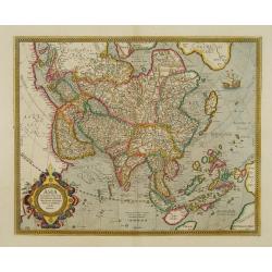
The cartography derives directly from the 1569 Mercator world map and includes the southern landmasses of New Guinea and Terra Australis, the East Indian Islands, the Phi...
Place & Date: Amsterdam 1633
Selling price: $760
Sold
Tartaria.
Published in Hondius' editions of the Mercator Atlas from 1606 onwards, showing China, Korea and the northern Pacific coast of America showing the two continents separate...
Place & Date: Amsterdam 1633
Selling price: $450
Sold
Asia noviter delineata.
Very detailed map of Asia showing animals and natives on the continent, sea monsters, sailing ships and a decorative title cartouche with two natives.During the printing ...
Place & Date: Amsterdam 1633
Selling price: $900
Sold
Asia noviter delineata.
During the printing process the figured borders have been covered. No text on verso. There exists a continent map of the Americas which has been printed in the same way. ...
Place & Date: Amsterdam, 1633
Selling price: $2600
Sold in 2016
Situs Terrae Promissionis.S.S.Bibliorum intelligentiam..
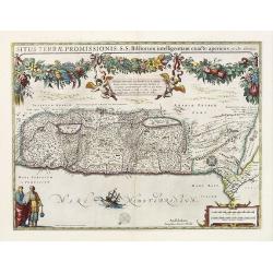
Superb map of the Holy Land, after Adrichom, with north oriented to the left. It is finely engraved with numerous biblical scenes including the Exodus, the wandering of t...
Place & Date: Amsterdam, 1633
Selling price: $1100
Sold in 2020
Asia ex magna Orbis terre descriptione Gerardi Mercatoris..
The cartography derives directly from the 1569 Mercator world map and includes the southern landmasses of New Guinea and Terra Australis, the East Indian Islands, the Phi...
Place & Date: Amsterdam, 1595-1633
Selling price: $1900
Sold in 2008
Asia ex magna Orbis terre descriptione Gerardi Mercatoris..
The cartography derives directly from the 1569 Mercator world map and includes the southern landmasses of New Guinea and Terra Australis, the East Indian Islands, the Phi...
Place & Date: Amsterdam, 1633
Selling price: $1100
Sold
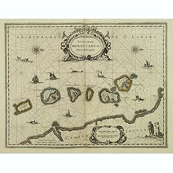
Insularum Moluccarum Nova descriptio.
A decorative map of some of the Spice Islands, off the west coast of the island of Halmahera in the eastern part of the archipelago. The map is oriented with north to the...
Place & Date: Amsterdam, after 1633
Selling price: $500
Sold in 2017
Tartaria.
Published in Hondius' editions of the Mercator Atlas from 1606 onwards, showing China, Korea as an island, and the northern Pacific coast of America showing the two conti...
Place & Date: Amsterdam, 1633
Selling price: $575
Sold in 2015
China.
Important map of China. Besides China, the map depicts Korea as an elongated island and Japan from the Teixeira model of 1595. Decorated with strap work cartouches, a Eur...
Place & Date: Amsterdam, 1633
Selling price: $2300
Sold in 2015
Turcici Imperii Imago.
A very decorative map of the Turkish Empire.
Place & Date: Amsterdam, 1633
Selling price: $515
Sold in 2018
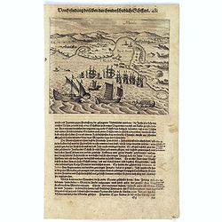
Schlacht for Manille.
Scarce print with German text sheet showing the Dutch anchored near Manila, the Spanish, with 7 soldiers to each Dutchman, tried to conquer the Dutch with their great bat...
Place & Date: Frankfurt, M.Merian, 1633
Selling price: $500
Sold in 2017
Cyprus Ins.
A decorative map of Cyprus, with six inset maps of Stalimini, Chius, Mitilene, Negroponte, Cerigo, and Rhodes.
Place & Date: Amsterdam, 1633
Selling price: $800
Sold in 2017
Manila.
Scarce print with German text sheet showing the harbour of Manila, carefully depicted here, is a good place for ships. The letter ‘A’ is the harbour itself. B: Shows ...
Place & Date: Frankfurt, M.Merian, 1633
Selling price: $800
Sold in 2017
[Islands of Macian and Bacian.]
This shows the features of the islands Macian and Bacian. ‘A’ is the Isle of Macian, with its angle towards noon from the Equator, being 8 minutes from midnight, ‘B...
Place & Date: Frankfurt, M.Merian, 1633
Selling price: $45
Sold in 2023
[Islands of Amboina and Nera.]
On the island of Amboina, the Dutch have a royal castle with a strong fortress. ‘E’ marks some homes of the inhabitants, ‘F’ shows the island itself, along with i...
Place & Date: Frankfurt, M.Merian, 1633
Selling price: $50
Sold in 2023
Portrait of the islands Velas / Ladrones islands.
Magellan first discovered the Ladrones Islands in 1521, who originally named them Velas, after the little local ships with sails. They are, however, believed to be the Ma...
Place & Date: Frankfurt, M.Merian, 1633
Selling price: $105
Sold in 2017
[Lot of 8 maps] Persien - PERSICI VEL SOPHO RUM REGNI TYPUS.
A map of the Persian Empire from the French edition of the Mercator / Hondius Atlas, published by Hendrik Hondius. Ref.: Koeman, Atlantes neerlandic, part II, item [132]....
Place & Date: Amsterdam, 1633
Selling price: $230
Sold in 2023
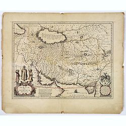
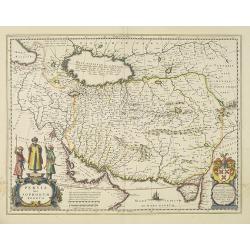
Persia Sive Sophorum Regnum.
A finely designed map of the region stretching from the Caucasus trough Afghanistan an the Arabian Desert to the Indus River from the great Blaeu family of Amsterdam. Wit...
Place & Date: Amsterdam, 1634
Selling price: $250
Sold
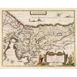
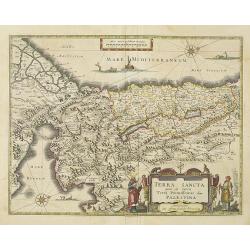
TERRA SANCTA quae in Sacris Terra Promissionis olim PALESTINA.
One of the most decorative Holy Land maps of the period. This map of the Holy Land depicts the tribes of Israel, and the route the children of Israel took from Egypt thro...
Place & Date: Amsterdam, 1634
Selling price: $375
Sold in 2016
China.
An attractive map of China from the 1634 Latin edition of Mercator's Atlas minor, published by Jan Janssonius. During the production of Mercator's large-format atlas, Hon...
Place & Date: Amsterdam, 1634
Selling price: $150
Sold in 2020
Insula Ceilan quae incolis Tenarisin dicitur.
Single page map of Sri Lanka. Latin text on verso.
Place & Date: Amsterdam, J.Janssonius, 1628-1634
Selling price: $96
Sold in 2020
Terra Sancta quae in Sacris Terra Promissionis..
Very decorative map of Palestine. Orientated west to the top. The decoration is inspired by the Old Testament. Moses stands to the left of the title cartouche, Aaron to t...
Place & Date: Amsterdam 1635
Selling price: $500
Sold
Turcicum Imperium.
A very handsome map with a particularly fine cartouche showing the Turkish Sultan on his throne and allegorical figures at either side brandishing weapons. At right is a ...
Place & Date: Amsterdam 1635
Selling price: $1075
Sold
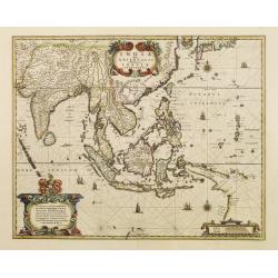
India quae Orientalis..
Extending from India to Japan and showing parts of Australia. It is indeed one of the first printed maps to show identifiable parts of Australia. It was not revised until...
Place & Date: Amsterdam 1635
Selling price: $1225
Sold
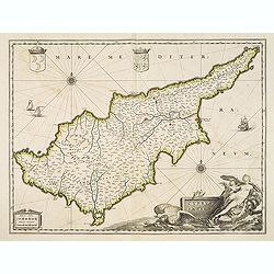
Cyprus Insulae.
Blaeu's beautiful map of Cyprus embellished with a very decorative title cartouche, a scale cartouche, two coats of arms, two wind roses and three sailing ships.
Place & Date: Amsterdam, 1635
Selling price: $3100
Sold in 2016
India quae Orientalis..
Extending from India to Japan and showing parts of Australia. It is indeed one of the first printed maps to show identifiable parts of Australia. It was not revised until...
Place & Date: Amsterdam 1635
Selling price: $1400
Sold
Natolia quae olim Asia Minor.
A finely designed map of Turkey and Cyprus from the great Blaeu family of Amsterdam. The decoration consist of a colored title cartouche, sea monsters, a naval engagement...
Place & Date: Amsterdam, c. 1635
Selling price: $275
Sold in 2016
India quae Orientalis..Insulae Adiacentes.
An important Dutch map of South East Asia, noteworthy for being the first map to include, albeit incompletely, the discoveries made by the Dutch vessel Duyfken in 1605-06...
Place & Date: Amsterdam 1635
Selling price: $1000
Sold
Persia Sive Sophorum Regnum.
Willem Blaeu, founder of the famous publishing firm. Originally publishing pilot-guides, he issued his first atlas, \'Atlantis Appendix\', in 1630, followed by his \"...
Place & Date: Amsterdam, 1635
Selling price: $350
Sold in 2009
Constantinopolitanae urbis effigies ad vivum expressa, quam Turcae Stampoldam vocant. A° MDCXXXV.
Large, decorative view of the city of Constantinople, with legend across the bottom.Copper engraving, printed from 2 plates and originally mounted, by Matthäus Merian.Si...
Place & Date: Frankfurt 1635
Selling price: $1100
Sold
Indiae Orientalis Nova Descriptio
Fine decorative chart of the region including Indochina, the Philippines and the East Indies. Includes the new discoveries in New Guinea made by the Dutch Duyfkens explor...
Place & Date: Amsterdam, 1635
Selling price: $1000
Sold in 2009
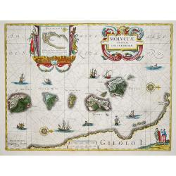
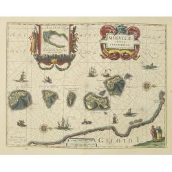
Moluccae Insulae Celeberrimae.
The map shows the islands of Ternate, Tidore, Mot and Makian. In the top right corner an inset map of the island of Bachian is shown. Latin text.
Place & Date: Amsterdam, 1635
Selling price: $350
Sold in 2009
China.
Scarce English version of Hondius’ smaller map of China set in a page of text.
Place & Date: London, c. 1635
Selling price: $150
Sold in 2012
Asia noviter delineata.
With columns of figures on either side depicting the native manners of dress, and nine city plans and views at the top.Japan is shown accurately unusually with Korea as a...
Place & Date: Amsterdam, 1635
Selling price: $2800
Sold in 2010
ASIA noviter delineata Autore Guiljelmo Blaeuw.
A fine example of Willem Blaeu's famous map of Asia. Like the Blaeu Africa map, this is a map that appeals both to a sense of cartographic history and to an aesthetic se...
Place & Date: Amsterdam, (1617) 1634 or 1635
Selling price: $4850
Sold in 2011
Cyprus Insulae.
Blaeu's beautiful map of Cyprus embellished with a very decorative title cartouche, a scale cartouche, two coats of arms, two wind roses and three sailing ships.No text o...
Place & Date: Amsterdam / Paris, ca. 1635
Selling price: $1700
Sold in 2012
ASIA noviter delineata.
The Blaeu Asia map, heightened in gold. With columns of figures on either side depicting the native manners of dress, and nine city plans and views at the top. Japan is s...
Place & Date: Amsterdam, 1635
Selling price: $1950
Sold in 2014
Persia sive Sophorum Regnum.
A finely designed map from the great Blaeu family of Amsterdam. An antique map of Persia that stretches from the Caucasus to Afghanistan, and from the Deserts of Arabia t...
Place & Date: Amsterdam, ca. 1635
Selling price: $80
Sold in 2018
Moluccae Insulae Celeberrimi.
Willem Blaeu's very fine map of the Spice islands, with a detailed map of the Island of Bachian in a handsome border. Further embellished with a large title-cartouche, an...
Place & Date: Amsterdam, ca 1635
Selling price: $500
Sold in 2019
Persia Sive Sophorum Regnum.
In 1636 the by then obsolete map of Persia by Jodocus Hondius is replaced by a new map by J. Janssonius. Embellished with two cartouches.
Place & Date: Amsterdam, 1636
Selling price: $350
Sold
Persia Sive Sophorum Regum.
Decorative map of Persia extending from Saudi Arabia and Turkey to the Indus River, centered on Persia, with the Red Sea and the Persian Gulf in the South and Caspian and...
Place & Date: Frankfurt, 1636
Selling price: $40
Sold in 2011
Turcicum Imperium.
Merian's map of the Turkish Empire, showing the area from Sicily and Italy until the Caspian Sea, the Gulf of Aden, the Red Sea, Socotra Island, and Saudi Arabia.
Place & Date: Frankfurt, ca.1636
Selling price: $66
Sold in 2021
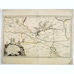
Galatia cujus populi Tolistobogi, Tectosages, Trocmi, mox provincia sub romanis in primam et secundam divisa et in ea romana itineraria ex tabula Peutingeriana. . .
Rare map of northern Turkey, centered around Ancyra (Ankara) and illustrates the provinces inhabited by the three Celtic tribes (Tolistobogi, Tectosages, and Trocmi) that...
Place & Date: Paris, after 1637
Selling price: $30
Sold in 2015
Tartariae sive Magni Chami Imperium.
Fine map of Tartary, including northern part of China, and tip of Korea.
Place & Date: Amsterdam 1638
Selling price: $365
Sold
MOLUCCAE Insulae Celeberrimae.
The earliest full-scale and highly decorative map of the "Spice Islands". In addition to a sumptuous title cartouche, the map features an inset of the Island of...
Place & Date: Amsterdam, 1635-1638
Selling price: $330
Sold
Cyprus Insulae.
Blaeu's beautiful map of Cyprus embellished with a very decorative title cartouche, a scale cartouche, two coats of arms, two wind roses and three sailing ships.As Willem...
Place & Date: Amsterdam, 1638
Selling price: $1300
Sold in 2018
Terra Sancta quae in Sacris Terra Promissionis..
Very decorative map of Palestine. Orientated west to the top. The decoration is inspired by the Old Testament. Moses stands to the left of the title cartouche, Aaron to t...
Place & Date: Amsterdam, 1638
Selling price: $500
Sold in 2013
Natolia, quae olim Asia minor.
A finely designed map of Turkey and Cyprus from the great Blaeu family of Amsterdam.As Willem Blaeu died in 1638 most of his maps are actually published by his son Joan. ...
Place & Date: Amsterdam, 1638
Selling price: $500
Sold in 2010
Persia sive Sophorum Regnum.
A finely designed map from the great Blaeu family of Amsterdam. With decorative title cartouche. With dedication to Theodorus Tholing and dated 1634, in lower right corne...
Place & Date: Amsterdam, 1638
Selling price: $600
Sold in 2010
China Veteribus Sinarum Regio.
This was the first of Blaeu's maps of China. In 1655 he was to publish the famous map of Father Martini, with many of the earlier inaccuracies present on this map correct...
Place & Date: Amsterdam, 1638
Selling price: $1700
Sold in 2010
India quae Orientalis dicitur, et insulae adiacentes.
Extending from India to Japan and showing parts of Australia. It is indeed one of the first printed maps to show identifiable parts of Australia. It was not revised until...
Place & Date: Amsterdam, 1638
Selling price: $1650
Sold in 2010
Moluccae Insulae Celeberrimae.
Showing the geographical features of the islands, and decorated with ships, sea monsters and a handsome cartouche. With an inset of Bachian island.One of the most appeali...
Place & Date: Amsterdam, 1638
Selling price: $850
Sold in 2010
India quae Orientalis dicitur, et insulae adiacentes.
Extending from India to Japan and showing parts of Australia. It is indeed one of the first printed maps to show identifiable parts of Australia. It was not revised until...
Place & Date: Amsterdam, c.1638
Selling price: $2200
Sold in 2011


![Cyprus Ins[ula].](/uploads/cache/38664-250x250.jpg)


![[ Lot of 12 maps / views off India / Sri Lanka] Malabar.](/uploads/cache/20949-250x250.jpg)








![[Islands of Macian and Bacian.]](/uploads/cache/40085-250x250.jpg)
![[Islands of Amboina and Nera.]](/uploads/cache/40086-250x250.jpg)

![[Lot of 8 maps] Persien - PERSICI VEL SOPHO RUM REGNI TYPUS.](/uploads/cache/84286-250x250.jpg)


