Browse Listings in Asia
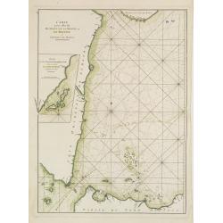
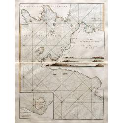
Plan du Port de Rio situé au détroit de Malaca en l'Isle de Bintam. / Plan du Détroit du Gouverneur.
Two French charts on one sheet, to the left a chart of the bay around Batam center on the little island Batam, opposite Singapore. With a lettered key. The chart to the r...
Place & Date: Paris, ca 1775
Selling price: $135
Sold in 2012
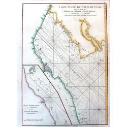
Carte Plate du Golf du Siam avec une partie des Côtes de Malaye et de Camboje depuis l'Isle Timon, jusqu'à celle Condor./ Plan particulier depuis l'Isle Brala jusqu'à la Grande Isle Ridang.
French chart of the gulf of Siam with Malaysia and Cambodia. With inset chart : Plan particulier depuis l'Isle Brala jusqu'à la Grande Isle Ridang. The chart has some ad...
Place & Date: Paris, ca 1775
Selling price: $380
Sold
Carte réduite du Golfe du Bengale depuis l'Isle de Ceylan jusqu'au Golf du Siam?
French chart of Gulf of Bengal. Including the east coast of India with Sri Lanka and the Malay Peninsular till Malacca, Cambodia. Latitude and longitude scales, compass r...
Place & Date: Paris, ca 1775
Selling price: $425
Sold
Carte de la Baye et du Port de Trinquemalay Dans L'Isle de Ceylan.
French chart of the harbour of Trinquemalay on the island of Ceylon. Prepared after Samuel Cornish who was a vice admiral for the English East India company.Latitude and ...
Place & Date: Paris, ca 1775
Selling price: $325
Sold
Carte Plate qui comprend l'Isle de Ceylan, une partie des Côtes de Malabar et de Coromandel.
French chart of Ceylon and southern part of India. Latitude and longitude scales, compass rose and system of rhumb lines, soundings near coast and in bay areas.D' Après ...
Place & Date: Paris, ca 1775
Selling price: $300
Sold
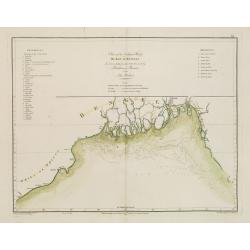
Chart of the Northern Part of the Bay of Bengal.. Plan de la Rivière de Surate.
French chart of the northern part of the bay of Bengal. Laid down from the surveys made by Bartholomen Plaisted and John Ritchie. Milestone chart prepared by Alexander Da...
Place & Date: Paris, ca 1775
Selling price: $150
Sold
Carte réduite de l'Océan Oriental Septentrional qui contient une partie des Côtes d'Afrique, de l'Arabie, de la Perse et celles de l'Indostan.
French of the coast of Indian ocean with a part of Africa, of Arabia of Persia, of India. Latitude and longitude scales, compass rose and system of rhumb lines, sounding...
Place & Date: Paris, ca 1775
Selling price: $160
Sold
Carte d'une partie de la Côte de Cochinchine depuis l'Isle Cham-Collan jusqu'à la Rive du Roi.Plan de l'Isle Condor
French chart of the Cochinchine coast and the Condore Islands. Latitude and longitude scales, compass rose and system of rhumb lines, soundings near coast and in bay area...
Place & Date: Paris, ca 1775
Selling price: $325
Sold
Nouvelle Carte des Mers Comprises entre le Détroit de Banca et P. . . Timon, avec la partie Orientale du Détroit de Malac.
French of the East Coast of Sumatra, the eastern portion of the Strait of Malacca, and the coast of Malaysia, showing strait Banca and island of Pulo Timon. Singapore me...
Place & Date: Paris, ca 1775
Selling price: $2050
Sold in 2011
Carte pour aller du Détroit de la Sonde ou de Batavia au Détroit de Banca.
French of the coast of East Sumatra and North-West part of Java. With inset chart Plan des Isles Remouw, Kandang, High et Voody, situées au Sud-Est de l'Isle de Sumatra...
Place & Date: Paris, ca 1775
Selling price: $175
Sold in 2019
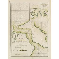
Plan du Détroit de Banca.. / Petit plan du Détroit à l'Est de Banca.
French detailed of the straits between Sumatra and Bangka. With inset : Petit plan du Détroit à l'Est de Banca.. The chart is an updated version of an earlier copper p...
Place & Date: Paris, ca 1775
Selling price: $150
Sold in 2019
Nouveau Plan des Détroits, situés à l'Est de Java et de Madura, nommmés communément les Détroits de Bali et d'entre Pondi et Respondi..
French chart of straits of Bali. With eastern tip of Java, part of Madura and western tip of Bali. Inset chart of harbour of Ballembouang. The chart is giving credit to t...
Place & Date: Paris, ca 1775
Selling price: $190
Sold
Plan des Principaux Ports de la Côte d'Illocos en l'Isle de Lucon.
French sea chart of a small part of the northwest coast of the Philippines main island of Luzon. Latitude and longitude scales, compass rose and system of rhumb lines, so...
Place & Date: Paris, ca 1775
Selling price: $400
Sold in 2008
Plan du Port de Subec en l'Isle de Luçon.
French sea chart of Subic Bay and the town of "Subec". Latitude and longitude scales, compass rose and system of rhumb lines, soundings near coast and in bay ar...
Place & Date: Paris, ca 1775
Selling price: $300
Sold
Plan de la baye et Ville de Manille, Capitale des Isles de Philippines.
French sea chart of the inlet and city of Manille. Prepared by Jacques-François L'Abbé Dicquemare (1733-1789). Latitude and longitude scales, compass rose and system of...
Place & Date: Paris, ca 1775
Selling price: $1300
Sold in 2009
Carte Plate de la Cote Occidentale de l'Isle Sumatra depuis la Riviere de Touroumane jusqu'a la Pointe d'Indrapour...
Highly detailed and large sea-chart showing a part of the Sumatran westcoast. With numerous depth soundings and anchor places, showing even the smallest shoals, to help n...
Place & Date: Paris, c1775
Selling price: $200
Sold in 2008
Plan des Principaux Ports de la Côte d'Illocos en l'Isle de Lucon.
French sea of a small part of the northwest coast of the Philippines main island of Luzon. Latitude and longitude scales, compass rose and system of rhumb lines, soundin...
Place & Date: Paris, Brest, Demonville, 1775
Selling price: $450
Sold in 2014
Carte d'une partie des Côtes de la Chine et des Isles adjacentes depuis l'Isle nommée la Pierre Blanche, jusqu'à celle de l'Artimon.
Most important milestone chart based upon the surveys made from navigational surveys and soundings in 1754, 1759, and 1760 by Alexander Dalrymple. This edition of Dalrymp...
Place & Date: Paris, ca. 1775
Selling price: $2420
Sold in 2010
A chart of the China Sea inscribed to Monsr. D'APRES de MANNEVILLETTE .. To A.Dalrymple.
Most important milestone based upon the surveys made from navigational surveys by Alexander Dalrymple (1737-1808]. He was the first Hydrographer of the British Admiralty...
Place & Date: Paris, ca. 1775
Selling price: $1500
Sold
Carte des Isles Nicobar... (with) Plan particulier du Port compris entre les Isles Nacaveri, Souri, et Tricutte.
French of Isles of Nicobar in Gulf of Bengal near Birmanie and Sumatra. Prepared by Jacques-François L'Abbé Dicquemare (1733-1789). Latitude and longitude scales, comp...
Place & Date: Paris, Brest, chez Demonville, 1775
Selling price: $100
Sold in 2015
Plan de la Rade d'Achem et des Isles Circonvoisines Situées à la partie Nord-ouest de Sumatra.
French large nautical of the Archem coast on the northwestern point of Sumatra.Latitude and longitude scales, compass rose and system of rhumb lines, soundings near coas...
Place & Date: Paris, Brest, chez Demonville, 1775
Selling price: $100
Sold in 2019
Carte Plate qui comprend L'Isle de Ceylan. . .
Chart showing the southern tip of India and Sri Lanka. Latitude and longitude scales, compass rose and system of rhumb lines, soundings near coast and in bay areas.D' Apr...
Place & Date: Paris, 1775
Selling price: $150
Sold in 2021
Plan de la baye et Ville de Manille, Capitale des Isles de Philippines . . .
French sea chart of the inlet and city of Manila with latitude and longitude scales, compass rose and system of rhumb lines, soundings near coast and in bay areas.Publish...
Place & Date: Paris, Brest, Demonville, 1775
Selling price: $1150
Sold in 2012
Carte Plate du Golfe de Siam avec une Partie des Cotes de Malaye et de Camboje, depuis l'Isle Timor jusqu'a celle Condor. . .
French sea chart of the Gulf of Siam. The map shows the coast from the Mekong delta to the Isle of Tioman, near the tip of the Malaysian Peninsula. Soundings and rhumblin...
Place & Date: Paris, Brest, Demonville, 1775
Selling price: $250
Sold in 2014
Plan du port de Subec, en l'Isle de Luçon.
French sea chart of Subic Bay and the town of "Subec", prepared in 1766. Subic is a 1st class municipality in the province of Zambales, Philippines. It is found...
Place & Date: Paris, Brest, Demonville, 1775
Selling price: $475
Sold in 2012
Carte d'une partie des Côtes de la Chine et des Isles adjacentes depuis l'Isle nommée la Pierre Blanche, jusqu'à celle de l'Artimon.
Most important milestone chart based upon the surveys made from navigational surveys and soundings in 1754, 1759, and 1760 by Alexander Dalrymple. This edition of Dalrymp...
Place & Date: Paris, Brest, Demonville, 1775
Selling price: $2600
Sold in 2012
Carte plate du Golfe de Siam, avec une partie des Côtes De Malaye Et De Camboje...
Superb large sea-chart of the Gulf of Siam with coasts of Thailand and Cambodia. Extending from the Mekong delta to Bangkok, and south to the Isle of Tioman. With a large...
Place & Date: Paris, 1775
Selling price: $175
Sold in 2012
Plan de l'Archipel de Merguy, depuis les Isles Moscos jusqu'à l'Isle Domel. / Plan de l'Isle Junkseilon et de son Port. Situés à la côte de Queda... Plan de la Rivière de Surate.
French of the Archipelago of Merguy and the Island of Junkseilon (Phuket) and its port.Latitude and longitude scales, compass rose and system of rhumb lines, soundings n...
Place & Date: Paris, Brest, chez Demonville, 1775
Selling price: $200
Sold in 2012
Plan de Salangor et de la Cote de Malaye depuis la Pointe de Caran jusqu'au Mont Parcelar.
Important early French of Salangor and Coast of Malaye, with two profile views over the coast near Selangor. From the second edition.Latitude and longitude scales, compa...
Place & Date: Paris, Brest, chez Demonville, 1775
Selling price: $170
Sold in 2013
Carte de l'Isle de Java avec les Isles de Banca, de Biliton, et une partie de cellesd de Sumatra et de Bornéo.
French of the Island of Java, Banca, Billiton, and part of Sumatra and Borneo.Latitude and longitude scales, compass rose and system of rhumb lines, soundings near coast...
Place & Date: Paris, Brest, chez Demonville, 1775
Selling price: $180
Sold in 2013
Carte de la Baye de Chin-Chew ou Chang-Chew avec les Isles d'Emowi et de Quemowi ...
A small but very early and interesting map of the coastline from Pu-tay Point, down to the Chin Chew river, with Ko-long-fu, Lakkateyn, Tano-fita, Roo Point, Womends Isle...
Place & Date: Paris, 1738-1775
Selling price: $90
Sold in 2013
Carte de l'Entrée de la riviere de Canton Dressee sur les Observations les plus recentes.
A small but very early and interesting map of the mouth of the Canton River with the island of Macao and the future site of Hong Kong (Sinn-gan-hien). The fortified city ...
Place & Date: Paris, 1738-1775
Selling price: $45
Sold in 2022
A Mar of part of Borneo and the Sooloo Archipelago: Laid down chiefly from observations made in 1761, 2,3, and 4.
Most important milestone based upon the surveys made from navigational surveys in 1761-64 by Alexander Dalrymple (1737-1808]. He was the first hydrographer of the Britis...
Place & Date: Paris, ca 1775
Selling price: $105
Sold in 2014
Carte de la Côte occidentale de l\'Isle de Sumatra. . .
French of the lower west coast of Sumatra. Latitude and longitude scales, compass rose and system of rhumb lines, soundings near coast and in bay areas.D' Après de Mann...
Place & Date: Paris, Brest, chez Demonville, 1775
Selling price: $35
Sold in 2014
Carte de la côte occidentale de l\'isle Sumatra depuis la ligne équinoctiale jusqu\'au détroit de la Sonde
French of the east coast of Sumatra.Latitude and longitude scales, compass rose and system of rhumb lines, soundings near coast and in bay areas.D' Après de Mannevillet...
Place & Date: Paris, Brest, chez Demonville, 1775
Selling price: $40
Sold in 2014
Carte Plate de la partie Septentrionale du Detroit de Malac, depuis la Rade d\'Achem Jusqu\'a Malac.
French of the Malacca Strait north of Malacca, on page (39) from Le Neptune Orientale, 2nd edition. Latitude and longitude scales, compass rose and system of rhumb lines...
Place & Date: Paris, Brest, chez Demonville, 1775
Selling price: $126
Sold in 2014
[Set of six costume plates of the Ottoman Empire.]
Fine and decorative hand colored engraved prints, from "Recueil des differents costumes des principaux Officiers et Magistrats de la Porte...".A complete set of...
Place & Date: Paris, 1775
Selling price: $500
Sold in 2021
Carte des déclinaisons et inclinaisons de l'aiguille aimantée...1775.
Unusual smaller size edition of this sea-chart of the Indian Ocean illustrating the magnetic variations. With large parts of Africa, Arabia, and South East Asia. Rare ...
Place & Date: Paris, c1775
Selling price: $60
Sold in 2020
Carte de l'inde en deça du gange comprenant l'Indoustan.
An interesting map of Hindustan and the River Ganges .Prepared by Jacques Nicolas Bellin after Dutch sources and included in Prévost d' Exile's "Histoire des Voyage...
Place & Date: Paris, 1738-1775
Selling price: $20
Sold in 2020
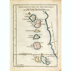
Carte Particuliere Des Isles Moluques. . .
A small interesting map of the islands of Herij, Pottebackers, Ternate, Tidor, Timor, Machian and Bachian. Today the Moluccas are part of Indonesia.Prepared by Jacques Ni...
Place & Date: Paris, 1738-1775
Selling price: $20
Sold in 2014
Carte de l'Inde en deça du Gange comprenant l'Indoustan.
An interesting map of Hindustan and the River Ganges.Prepared by Jacques Nicolas Bellin after Dutch sources and included in Prévost d' Exile's "Histoire des Voyages...
Place & Date: Paris, 1738-1775
Selling price: $20
Sold in 2020
Carte de l'Archipel de St Lazare ou les Isles Marianes.
An interesting map the archipelago of St Lazare or Marianne's islands, on Alsonso P. Lopez maps and the Spanish Jesuits memory .Prepared by Jacques Nicolas Bellin after D...
Place & Date: Paris, 1738-1775
Selling price: $20
Sold in 2017
Carte des Isles Maldives, pour servir à l'Histoire Générale des Voyages.
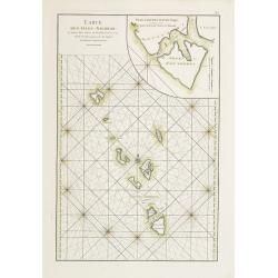
An interesting map of all the islands of the Maldives.Prepared by Jacques Nicolas Bellin after Dutch sources and included in Prévost d' Exile's "Histoire des Voyage...
Place & Date: Paris, 1738-1775
Selling price: $20
Sold in 2014
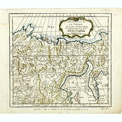
Suite de la carte de La Sibérie et le pays de kamtfchatka.
An interesting map of Siberia, with a view on Ochozk Sea.Prepared by Jacques Nicolas Bellin after Dutch sources and included in Prévost d' Exile's "Histoire des Voy...
Place & Date: Paris, 1738-1775
Selling price: $20
Sold in 2014
Carte de l'Isle de Ceylan, pour servir à l'Histoire Générale des Voyages.
An interesting map of the island of Ceylon which is now known as Sri Lanka, includes rivers mountains forests and symbols for small towns and cities .Prepared by Jacques ...
Place & Date: Paris, 1738-1775
Selling price: $35
Sold in 2014
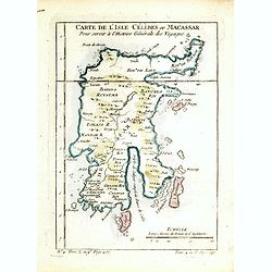
Carte de l'Isle Célèbres ou Macassar, pour servir à l'Histoire Générale des Voyages.
An interesting map of Célèbres island or Macassar, in Indonesia .Prepared by Jacques Nicolas Bellin after Dutch sources and included in Prévost d' Exile's "Histoi...
Place & Date: Paris, 1738-1775
Selling price: $20
Sold in 2016
Carte des Costes de Perse, Gusarat, et Malabar.
An interesting map of the coasts of the Persian Gulf, Iran, Pakistan and Western India including the Maldives Islands .Prepared by Jacques Nicolas Bellin after Dutch sour...
Place & Date: Paris, 1738-1775
Selling price: $20
Sold in 2022
Carte de la Tartarie Occidentale.
An interesting map of Tartary and Siberia.Prepared by Jacques Nicolas Bellin after Dutch sources and included in Prévost d' Exile's "Histoire des Voyages", pub...
Place & Date: Paris, ca. 1775
Selling price: $20
Sold in 2014
Carte de l'inde en deça du gange comprenant la presqu'iIle de l'Inde.
An interesting map of the peninsula of India with Ceylon.Prepared by Jacques Nicolas Bellin after Dutch sources and included in Prévost d' Exile's "Histoire des Voy...
Place & Date: Paris, 1738-1775
Selling price: $45
Sold in 2017
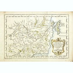
Carte de la Tartare Orientale.
An interesting map of the Eastern Tartary.Prepared by Jacques Nicolas Bellin after Dutch sources and included in Prévost d' Exile's "Histoire des Voyages", pub...
Place & Date: Paris, 1738-1775
Selling price: $20
Sold in 2014
Nieuwe en Naukeurige Kaart van Asia : mit daadelyke ondervindingen en Riesbeschryvingen. . .
Map of Asia with relief shown pictorially. The map is of interest for the use of Zee van Korea, the sea between Korea and Japan.
Place & Date: Amsterdam, 1775
Selling price: $750
Sold in 2015
A chart of the China Sea inscribed to Monsr. D\'APRES de MANNEVILLETTE . . . To A.Dalrymple.
Most important milestone based upon the surveys made from navigational surveys by Alexander Dalrymple (1737-1808]. He was the first Hydrographer of the British Admiralty...
Place & Date: Paris, ca. 1775
Selling price: $615
Sold in 2015
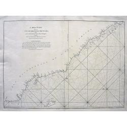
Carte de la Côte de Pégu
Detailed sea-chart of a part of Myanmar from the Irrawaddy Delta through parts of the Yangon, Bago, and Mon regions. A few towns and forts are located inland, including T...
Place & Date: Paris, 1775
Selling price: $36
Sold in 2015
Carte Plate de la partie Septentrionale du Détroit de Malac depuis la Rade d'Achem jusqu'à Malac.
A large sea-chart of the strait of Malacca, with a part of Sumatra and Malaysia. Highly detailed with bays, depth soundings, hazards, islands, rivers, etc. A French sailo...
Place & Date: Paris, 1775
Selling price: $38
Sold in 2018
Carte Réduite du Golfe de Bengale, depuis L'isle de Ceyland jusqu'au Golfe de Siam avec la partie Septentrionale du Détroit de Malac.
A detailed chart of the ocean and coastal areas of the Gulf of Bengal, from the Island of Ceylon to the Gulf of Siam, and part of the straits of Malacca. Includes the coa...
Place & Date: Paris, 1775
Selling price: $85
Sold in 2018
Carte du Détroit de la Sonde depuis la Pointe de Winerou jusqu'à l'Isle du Nord.
A large sea-chart of the Sunda Strait with the south-east coast of Sumatra with today's Bandar Lampung, and the western coast of Java with Bantam. With many rhumb lines, ...
Place & Date: Paris, 1775
Selling price: $65
Sold in 2018
Carte pour aller du Détroit de la Sonde ou de Batavia au Détroit de Banca.
A large sea-chart of easter Sumatra and a part of Java, including Jakarta (Batavia). Shows the track of Julien Crozet in the year 1772. With an inset chart of islands in ...
Place & Date: Paris, 1775
Selling price: $50
Sold in 2018
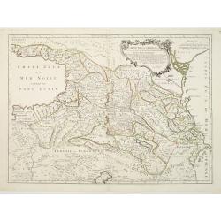
Carte de la Géorgie &c des pays situés entre la Mer Noire et la mer Caspienne.
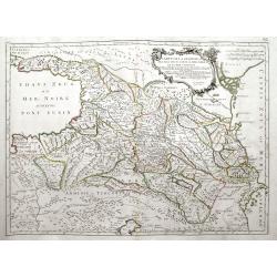
A large, decorative and highly detailed map of the Caucasus region between the Black Sea and the Caspian Sea, including modern day Georgia, Armenia, Azerbaijan, southern ...
Place & Date: Venice, ca. 1775
Selling price: $165
Sold in 2018
Carte Plate du Golfe de Siam avec une Partie des Côtes de Malaye et de Camboje, depuis l'Isle Timon, jusqu'a celle Condor.
A detailed sea chart of the Gulf of Siam. It extends from Bangkok until Timon (Malaysia) and in the east until the Mekong Delta. Filled with depth soundings and rhumb lin...
Place & Date: Paris, ca.1775
Selling price: $200
Sold in 2020
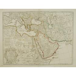
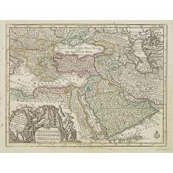
Carte de la Turquie de L\'Arabie et de la Perse.
Fine map of the Turkish Empire. A re-issue by Ph.Buache.
Place & Date: Paris 1776
Selling price: $200
Sold in 2010
Carte de la Géorgie &c. des pays situés entre la Mer Noire et la Mer Caspienne..
Detailed map of Georgia, Armenia and Azerbaijan.Santini gives credit to Homann Heirs in the cartouche.
Place & Date: Venise 1776
Selling price: $200
Sold
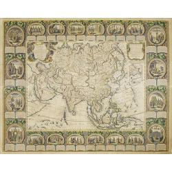
CARTE D'ASIE divisée EN SES PRINCIPAUX ETATS... Par Abbé Clouet. . .
Uncommon and decorative "carte à figures" wall map, prepared by Cloued, with superb decoration. The map is interesting as it shows Korea in the d'Anville type ...
Place & Date: Paris, Mondhare, 1776
Selling price: $12000
Sold
Plan de Constantinonple et du Bosphore de Thrace, D'après celui levé sur les lieux en 1776, par Mr. Kauffer.. [Map in manuscript]
An interesting French manuscript map of the Bosphorus from the Marmara See till the Black Sea. The outlines of Stambol ou Constantinople, At-Meydan ou Hyppodrome, Grand S...
Place & Date: France, later than 1776
Selling price: $2150
Sold
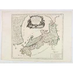
L'Empire Du Japon Divise En Sept Principales Parties..
Santini's Italian published edition of Giles Didier Robert De Vaugondy's map of Japan first appeared in 1778 in the "Atlas Universel".In 1784 Santini sold the p...
Place & Date: Venice, 1776
Selling price: $147
Sold in 2020
L'ASIE Divisée en ses Grandes Régions et Empires Subdivisée en ses Principaux Etats. . .
Originally prepared by J.B. Nolin, and re-issued by Basset. A general map of Asia with two French text columns on either side of the map describing the different regions ...
Place & Date: Paris, 1777
Selling price: $550
Sold in 2009
A View of Schorskarskoi Pagost' and 'A View if Trojesski'.
Fine, hand-colored, copperplate engraving featuring two topographical scenes of Siberia - "view of Schorskarskoi Pagost" & "A view of Trojesski on the ...
Place & Date: London, 1777
Selling price: $90
Sold in 2013
L'Asia divisa ne' suoi principali stati di nuova projezione.
Map showing Asia, with a decorative title cartouche. The map is of interest for the use of East Sea, the sea between Korea and Japan, here called "Mare di Corea"...
Place & Date: Venise, 1777
Selling price: $300
Sold in 2013
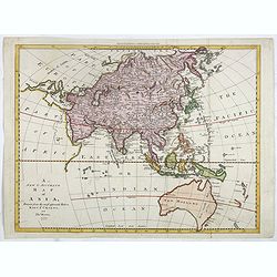
A new & accurate map of Asia, ...
The map is of interest for the use of Sea of Korea, for the sea between Korea and Japan.Map of Asia, with coastlines fairly accurately drawn but the coasts of Australasia...
Place & Date: London, 1777
Selling price: $600
Sold in 2015
L'Asia divisa ne' suoi principali stati di nuova projezione.
Map showing Asia, with a decorative title cartouche. The map is of interest for the use of Mare di Corea for the sea between Korea and Japan.
Place & Date: Venise, 1777
Selling price: $400
Sold in 2014
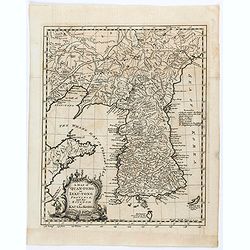
A map of Quang-Tong or Lea-Tonge Province..
Detailed and decorative map of Korea in lower left corner a charming title cartouche. To the right "Sea of Korea".
Place & Date: London, 1777
Selling price: $120
Sold in 2020
A new & accurate map of Asia, Drawn from the most approved modern maps & charts / by Thos. Bowen.
The map is of interest for the use of Sea of Korea, the sea between Korea and Japan.Detailed map of Asia from Saudi Arabia, Persia, Russia, India, China, Japan to Southea...
Place & Date: London, J.Cooke, 1777-1778
Selling price: $600
Sold in 2023
A new & Correct Chart shewing.. Bay of Bengalen..
Important chart of the Bay of Bengal. In upper part inset map of river Ganges. From East India Pilot . Detailed map with compass roses and system of rhumb lines, sounding...
Place & Date: London 1778
Selling price: $490
Sold
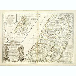
Carte de la terre des Hébreux / La Monarchie des Hébreux..
Two maps of the Holy Land on one sheet. Engraved by the master G.Delahaye and prepared by N.Sanson. In title cartouche lower left Moses and Aaron.
Place & Date: Paris, 1778
Selling price: $300
Sold
Asia cum omnibus Imperiis Provinciis . . .
Miniature map of Asia, a reduction of Seutter's folio map.From Atlas Minor, here published by Johann Martin Will, with his address in bottom center of the map.The cartouc...
Place & Date: Augsburg, J.M.Will, 1778
Selling price: $200
Sold in 2018
Magni Turcarum dominatoris Imperium . .
Uncommon version of this small map of the Ottoman Empire extending from the Balkans and the north African coast through Arabia the Black Sea. Decorated with a small compa...
Place & Date: Augsburg, J.M.Will, 1778
Selling price: $250
Sold in 2008
L'asie divisé suivant l'étendue des Empires et Royaumes qui la partagent et des Dominations établies par les . . .
French map describing Asia with fine cartouche title at bottom left. Surrounded by captions describing the historical and geographical contexts.The map is of interest for...
Place & Date: Paris, 1778
Selling price: $350
Sold in 2012
Vue de Peckin. (Peking)
So-called optical print of Peking published by "Collection des prospects" and engraved by G. B. Leizelt. Title is engraved mirror-imaged along the top. Lower ti...
Place & Date: Augsburg, 1778
Selling price: $200
Sold in 2012
A general chart of the China Sea : drawn from the journals of the European navigators, particularly from those collected by Capt. Hayter.
A scarce and detailed showing China Sea with Taiwan, western part of the Philippines, northern part of Borneo and the coast of South China with Cochinchina. Latitude and...
Place & Date: London, 1778
Selling price: $900
Sold in 2013
China.
Prepared by Thomas Jefferys and Thomas Phinn for Salmon's New Universal Geographical Grammar.
Place & Date: Edinburgh, 1778
Selling price: $50
Sold in 2018
The country Coromandel from the Coleroon to Cape Comorin. . . [with] The carnatic from the Pennar to the Coleroon. .
Coromandel from the Coleroon to Cape Comorin. Elegant map in two sheets compiled for the East-India Company. In lower right margin : Writing by W. Harrison.
Place & Date: London, 1778
Selling price: $105
Sold in 2020












![[Set of six costume plates of the Ottoman Empire.]](/uploads/cache/93775-250x250.jpg)









![Plan de Constantinonple et du Bosphore de Thrace, D'après celui levé sur les lieux en 1776, par Mr. Kauffer.. [Map in manuscript]](/uploads/cache/17483-250x250.jpg)






![The country Coromandel from the Coleroon to Cape Comorin. . . [with] The carnatic from the Pennar to the Coleroon. .](/uploads/cache/40457-250x250.jpg)