Browse Listings in Asia
Damascvs urbs nobilissima ad libanum monteri loti. . . [Damascus]
Uncommon plan of Jerusalem from Francesco Valegio's townbook: Raccolta di le piv illustri et farmose citta di tutto il mondo. On verso another engraving is pasted.
Place & Date: Venice, ca. 1579
Selling price: $100
Sold in 2008
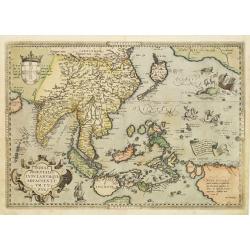
Indiae Orientalis Insularumque Adiacientium Typus.
Famous milestone map of South-East Asia, China, Japan, Indonesia, and the Philippines. The map also includes parts of the West Coast of North America, including several m...
Place & Date: Antwerp, 1579
Selling price: $1000
Sold in 2012
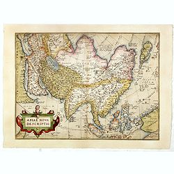
Asiae Nova Descriptio.
Beautifully colored map of Asia from the 1579 edition of Ortelius’Theatrum Orbis Terrarum, the first modern atlas of the world. The map is based upon Ortelius's wall ma...
Place & Date: Antwerp, 1579
Selling price: $900
Sold in 2015
Asiae Nova Descriptio.
Second state. Ortelius' fine map of Asia well represents the continent at a time when Europeans were expanding their power in the far east. The Indian subcontinent and Ma...
Place & Date: Antwerp, 1579
Selling price: $1300
Sold in 2016
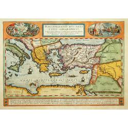
Peregrinationis Divi Pavli Typus Corographicus...
A gorgeous Ortelius map of the travels of St. Paul the Apostle through the Mediterranean, extending west to Italy and east to the Euphrates, including parts of the Red Se...
Place & Date: Antwerp, 1579
Selling price: $575
Sold in 2017
Asiae Nova Descriptio.
Second state. Ortelius' fine map of Asia well represents the continent at a time when Europeans were expanding their power in the far east. The Indian subcontinent and Ma...
Place & Date: Antwerp, 1579
Selling price: $1400
Sold in 2018
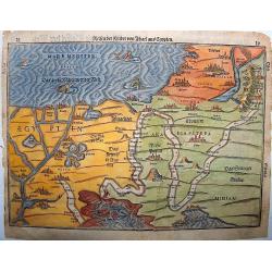
No title (Holy Land)
Attractive full page longitudinal map of Palestine, Syria and Cyprus, cut by Hans Rudolf Manuel Deutsch. The shore line running from Southern Anatolia to the Nile Delta. ...
Place & Date: Basle 1550-1580
Selling price: $220
Sold
Terrae Sanctae Tabula
Attractive woodblock map of the Holy Land drawn with west to the top of the sheet, the map shows the division of the country between the tribes of Israel according to Jos...
Place & Date: Basle c.1580
Selling price: $95
Sold
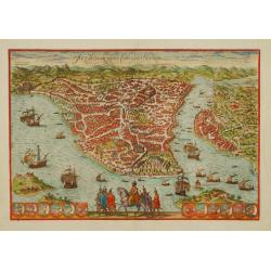
Constantinople.
A fine detailed woodcut bird's-eye view of Istanbul as seen from the usual perspective showing it out on a spur, with Pera across the water to the right. Seemingly, all t...
Place & Date: Basle 1550-1580
Selling price: $460
Sold
Byzantium nunc Constantinopolis.
One of the finest and most sought-after views of Istanbul. Viewed from the village of Scutari, the City is shown with all its fortifications, the original Genoese distric...
Place & Date: Cologne 1580
Selling price: $1365
Sold
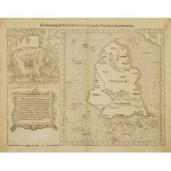
Sumatra ein grosse Insel..
A nice impression of this great map of island of Tabrobana, which was variously thought to be Ceylon or Sumatra.This map depicts Ceylon with the typical misconceptions of...
Place & Date: Basle 1580
Selling price: $200
Sold
Asia wie es jetziger zeit nach den fuernemesten Herzschaften
Map of the continent of Asia, copied after the copper engraved map by Ortelius. It was added to Münster's Cosmographia from 1588 onwards, probably in order to make it mo...
Place & Date: Basle 1580
Selling price: $550
Sold
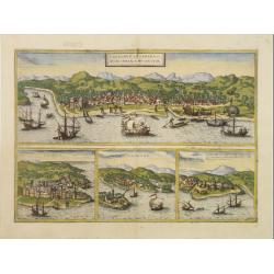
Calechut Celeberri mum Indiae Emporium/ Ormus/ ..
Four panoramic views on one sheet: the upper approximately two-thirds of this double page sheet contains a fine panoramic view of Calicut which is on the west coast of In...
Place & Date: Cologne, 1580
Selling price: $610
Sold in 2018
Byzantium, Nunc Constantinopolis..
One of the finest and most sought-after views of Istanbul. Viewed from the village of Scutari, the City is shown with all its fortifications, the original Genoese distric...
Place & Date: Cologne 1580
Selling price: $2400
Sold
Indiae Orientalis, Insularumque Adiacientium Typus..
Finely handcolored example of Ortelius' map of SE Asia, Japan, and the Philippines, etc. The map includes Beach and other information drawn from Marco Polo.The map also i...
Place & Date: Antwerp 1580
Selling price: $2000
Sold
Calechut Celeberri mum Indiae Emporium/ Ormus/ ..
Four panoramic views on one sheet: The upper approximately two-thirds of this double page sheet contains a fine panoramic view of Calicut which is on the west coast of In...
Place & Date: Cologne 1580
Selling price: $350
Sold
Sumatra ein grosse Insel..
One of the most interesting fruits of the revamping of the Münster Cosmographia in 1588 was this map of the southern Malay Peninsula and Sumatra, one of the earliest to ...
Place & Date: Basle, 1580
Selling price: $400
Sold
Byzantium nunc Constantinopolis.
One of the finest and most sought-after views of Istanbul. Viewed from the village of Scutari, the City is shown with all its fortifications, the original Genoese distric...
Place & Date: Cologne, 1580
Selling price: $1850
Sold in 2008
[Asia Minor - Turkey]
Very early map of the Asian part of Turkey. From his Cosmographia, that great compendium of Renaissance knowledge. An exciting print.Sebastian Münster was born in Nierde...
Place & Date: Basle, 1550-1580
Selling price: $50
Sold in 2011
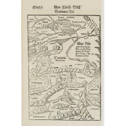
Sarmatia Asie.
The map is showing the area of Armenia and Kazakhstan. From his Cosmographia, that great compendium of Renaissance knowledge. An exciting print.Sebastian Münster was bor...
Place & Date: Basle, 1550-1580
Selling price: $50
Sold in 2008
[Cyprus]
Two woodcuts on one page. In upper part a map of Cyprus, in lower part a jumping deer and a sheep drinking water. The drinking sheep with old pen scratches. From his Cosm...
Place & Date: Basle, 1550-1580
Selling price: $185
Sold in 2008
[Map of the Holy Land, including Cyprus]
Attractive full page longitudinal map of Palestine, Syria and Cyprus, cut by Hans Rudolf Manuel Deutsch. The shore line running from Southern Anatolia to the Nile Delta. ...
Place & Date: Basle 1550-1580
Selling price: $70
Sold in 2008
Asiae nova descriptio.
Beautiful colored map of Asia. From the 1580 German edition of Theatrum Orbis Terrarum by Abraham Ortelius. The cartographical source of this map comes from Ortelius own ...
Place & Date: Antwerp, 1580
Selling price: $1600
Sold in 2009
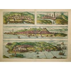
ANFA. / AZAAMURUM. / DIU. / GOA.
Four fine coastal views of these fortified cities, which were important to European trade with Asia. Goa (130x465mm.) and Diu on the western coast of India, together with...
Place & Date: Cologne, 1580
Selling price: $1000
Sold in 2011
Byzantium, Nunc Constantinopolis..
One of the finest and most sought-after views of Istanbul. Viewed from the village of Scutari, the City is shown with all its fortifications, the original Genoese distric...
Place & Date: Cologne, 1580
Selling price: $2500
Sold in 2009
ANFA. / AZAAMURUM. / DIU. / GOA.
Text on the back in Latin.Four fine coastal views of these fortified cities, which were important to European trade with Asia. Goa (130x465mm.) and Diu on the western coa...
Place & Date: Cologne 1580
Selling price: $230
Sold in 2009
Byzantium nunc Constantinopolis.
One of the most sought-after views of Istanbul. Perspective from the village of Scutari, with all its fortifications, the original Genoese district of Galata. Galleons an...
Place & Date: Cologne, 1580
Selling price: $1200
Sold in 2013
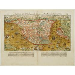
De Graecia Constantinopolitanae urbis effigies, quamhodie sub Turccae inhabitatione habet.
Early bird's eye view of Constantinople. From a French text edition of S. Münster's Cosmographia, which is a short and complete summary of Renaissance knowledge.
Place & Date: Basle, 1550-1580
Selling price: $230
Sold in 2009
Tartariae sive Magni Chami Imperium.
This is a very early depiction of the northern Pacific, with the first mapping of Northwest Coast of America and probably the first map to name California 'C. Califormio'...
Place & Date: Antwerp, 1580
Selling price: $1600
Sold in 2009
Persici.
Abraham Ortelius' map of the Persian empire. The map of the Persian Empire depicts nowadays Iran, Afghanistan, Pakistan, the Caspian Sea and the north eastern tip of the...
Place & Date: Antwerp, c. 1580
Selling price: $120
Sold in 2020
Constantinopel. . .
A fine detailed woodcut bird's-eye view of Istanbul as seen from the usual perspective showing it out on a spur, with Pera across the water to the right. The city plan de...
Place & Date: Basle, 1580
Selling price: $600
Sold
Sumatra Ein Grosse Insel / So Von Den alten Geographen Taprobana
An interesting map of Sumatra and the southern part of Malaysia. Singapore is identified at the tip of Malay peninsula as Cingafufa. Large textual cartouche which quotes ...
Place & Date: Basle, 1580
Selling price: $450
Sold in 2011
Tabula Asiae XII [Sri Lanka -- with Elephant]
Attractive woodblock map, depicting Sri Lanka as known to Ptolemy. Left of the map a large elephant with descriptive text identifies the island of Taprobana with Sumatra ...
Place & Date: Basle, 1580
Selling price: $300
Sold in 2017
Indiae Orientalis, Insularumque Adiacientium Typus. . .
Finely handcolored example of Ortelius' map of SE Asia, Japan, and the Philippines, etc. The map includes Beach and other information drawn from Marco Polo.The map also i...
Place & Date: Antwerp, 1580
Selling price: $1850
Sold in 2012
Byzantium nunc Constantinopolis.
One of the finest and most sought-after views of Istanbul. Viewed from the village of Scutari, the City is shown with all its fortifications, the original Genouse distric...
Place & Date: Cologne, 1580
Selling price: $2000
Sold in 2012
[Asia Minor - Turkey]
Very early map of the Asian part of Turkey. From his Cosmographia, that great compendium of Renaissance knowledge. An exciting print.Sebastian Münster was born in Nierde...
Place & Date: Basle, 1550-1580
Selling price: $20
Sold in 2017
[Cyprus]
Very early map of Cyprus, by Sebastian Münster from his Cosmographia. On a full sheet with text on both sides in German, and a print of deer.
Place & Date: Basel, 1550-1580
Selling price: $80
Sold in 2013
Tabula orientalis regionis Asiae. . .
Central and East Asia. Woodcut map from a Latin edition of Sebastian Münster's Cosmographia, Basel c. 1580. Verso typogr. text: "Nova Tabula Indiae orientalis..&quo...
Place & Date: Basel, c. 1580
Selling price: $700
Sold in 2013
[Dragons and Gryfons].
On recto an early representation of a dragon from India and Ethiopia. VERSO : Snakes and scorpions (65x135 mm) and a griffon.From a French text edition of his Cosmographi...
Place & Date: Basle 1575 - 1580
Selling price: $5
Sold in 2016
Sumatra Ein Grosse Insel / So Von Den alten Geographen Taprobana...
A fine map of what is regarded as the island of Sri Lanka, by the early, important, and influential German cartographer, Sebastian Munster. The map title, in old German s...
Place & Date: Basle ca. 1550 - 1580
Selling price: $170
Sold in 2016
Constantinopel des Griechischen Keijserthumbs Hauptstatt im Lande Thracia am Meere gelegen...
A detailed birds-eye town view of Constantinople/Istanbul and of the Golden Horn. The city plan depicts the markets, homes, palaces and churches, including the famous Hag...
Place & Date: Basle, 1550-1580
Selling price: $250
Sold in 2019
Asia secunda pars terrae in forma Pegasi.
An exceptionally decorative woodcut of Asia in the form of a 'Pegasus'. In the oceans there are several sea monsters. Many major cities are indicated and named. Professio...
Place & Date: Magdeburg, ca. 1580
Selling price: $1100
Sold in 2018
Sumatra Ein Grosse Insel / So Von Den alten Geographen Taprobana...
A fine map of what is regarded as the island of Sri Lanka, by the early, important, and influential German cartographer, Sebastian Münster. The map title, in old German ...
Place & Date: Basle ca. 1550 - 1580
Selling price: $350
Sold in 2018
Byzantium nunc Constantinopolis.
One of the finest and most sought-after views of Istanbul. Viewed from the village of Scutari, the City is shown with all its fortifications, the original Genoese distric...
Place & Date: Cologne, 1580
Selling price: $1500
Sold in 2020
Byzantium nunc Constantinopolis.
One of the finest and most sought-after views of Istanbul. Viewed from the village of Scutari, the City is shown with all its fortifications, the original Genoese distric...
Place & Date: Cologne, 1580
Selling price: $1050
Sold in 2019
Beschreibung des Heiligen Landes.
Heinrich Bünting?s woodcut map of the Holy Land from Itinerarum Saccrae Scripturae, first published in 1581. Palestine is shown on both sides of the River Jordan and is ...
Place & Date: Magdeburg, ca. 1581
Selling price: $200
Sold
Reisen der Kinder Israel aus Egypten.
Travels of the Children of Israel from out of Egypt - is a beautiful late 16th century wood-engraved map.The path of the Israelites is traced starting out at the lower le...
Place & Date: Magdeburg, ca. 1581
Selling price: $190
Sold
Calechut Celeberri mum India Emporium.
A finely rendered presentation of three Indian Ocean port cities and one African, that formed part of the Portuguese maritime empire. The larger upper half plate (Calicut...
Place & Date: Cologne, ca. 1581
Selling price: $525
Sold in 2008
Beschreibung des heiligen Landes Canaan
Decorative colored uncommon woodcut map of Palestine / Israel from "Itinerarium Sacrae Scripturae" by Heinrich Bunting. His work was much valued after the first...
Place & Date: Magdeburg, 1581
Selling price: $500
Sold in 2010
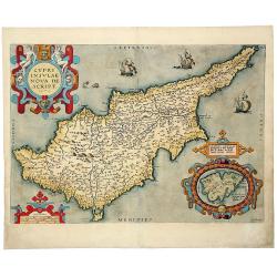
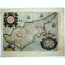
Cypri Insulae Nova descript. 1573.
This is a beautiful copy of a classic map of Cyprus. It is the earliest obtainable version of the best map of Cyprus made to date. Ortelius based his map upon that publis...
Place & Date: Antwerp, 1581
Selling price: $800
Sold in 2014
Asiae Nova Descriptio.
Second plate. Ortelius' fine map of Asia well represents the continent at a time when Europeans were expanding their power in the far east. Nova Guinea, with part of the...
Place & Date: Antwerp, after 1581
Selling price: $1500
Sold in 2016
Asia secunda pars terrae in forma Pegasi. [Asia is presented as the mythical winged horse Pegasus.]
An exceptional, most sought after symbolic map of Asia in the form of a Pegasus. In the seas, several sea monsters; many major cities are indicated and named.Bünting's f...
Place & Date: Magdeburg, ca. 1581
Selling price: $1600
Sold in 2016
Beschreibung des Heiligen Landes.
From the famous "Itinerarium sacrae scripturae" this is a very decorative map of "terra sancta". Note the nice colors. Latin text on verso.
Place & Date: Wittenberg 1581
Selling price: $150
Sold in 2020
Deze tweede Caerte van Asia
Very rare early woodcut map of Asia; on of the earliest maps of the continent.Covers the area from Scandinavia/Egypt to Borneo/Japan. No separate title, only an indicatio...
Place & Date: Magdenburg, after 1581
Selling price: $450
Sold in 2023
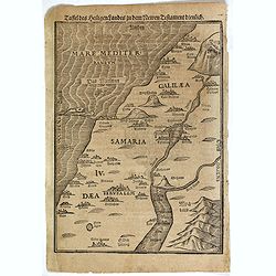
Taffel des Heiligen Landes..
A particularly attractive example of this early wood map of the Holy Land. Shows Palestine on both sides of the Jordan at the time of Jesus, divided into Galilee, Samaria...
Place & Date: Magdeburg 1582
Selling price: $250
Sold
Hierosolymia, Clarissima totius Orientis civitas. . .
Two bird's eye perspectives on one sheet. The left plan shows ancient Jerusalem at the time of Christ. A contemporary view of Jerusalem appears to the right with an attra...
Place & Date: Cologne, 1582
Selling price: $800
Sold in 2017
Taffel des Heiligen Landes. . .
An early wood map of the Holy Land. Shows Palestine on both sides of the Jordan at the time of Jesus, divided into Galilee, Samaria and Judea. German text on versoHeinric...
Place & Date: Magdeburg, ca. 1582
Selling price: $50
Sold in 2018
Reisen der Kinder Israel aus Egypten.
Travels of the Children of Israel from out of Egypt - is a beautiful late 16th century wood-engraved map.The path of the Israelites is traced starting out at the lower le...
Place & Date: Magdeburg, ca. 1582
Selling price: $200
Sold in 2017
Hierosolyma, Clarissima Totius Orientis Civitas Iudaee Metropolis . . .
Early map of Jerusalem from Braun&Hogenberg's Civitates Orbis Terrarum, Köln, 1572/1582. Showing two eras of Jerusalem on one map: Jerusalem from the first century o...
Place & Date: Köln, 1572/1582
Selling price: $325
Sold in 2020
Peregrinatio Divi Pauli Typus Corographicus.
"A splendid map depicting the travels of Paulus. With two fine scenes in top. Showing the countries along the Mediterranean, including Cyprus and Italy. A first edit...
Place & Date: Antwerp 1584
Selling price: $850
Sold
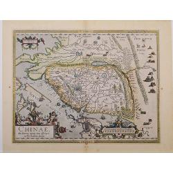
Chinae, olim Sinarum Regionis, nova descriptio. auctore Ludovico Georgio.
The first map of China ever to appear in a Western atlas, west to the top. When this map appeared, it was by far the most accurate one of China.Japan is shown on a curiou...
Place & Date: Antwerp 1584
Selling price: $3850
Sold
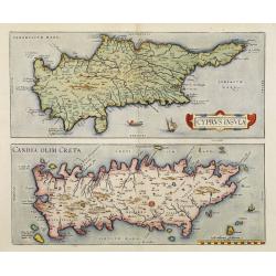
Cyprus Insula / Candia, Olim Creta.
Two maps on one sheet. Copper engraving illustrating Cyprus and Crete, with Latin text on verso. From 1584 onwards editions of the Ortelius atlas no longer included this ...
Place & Date: Antwerp, 1570-1584
Selling price: $1800
Sold in 2008
Chinae, olim Sinarum regionis, nova descriptio. Auctore Ludovico Georgio.
Engraved map of China with an elaborate baroque title and scale cartouches, galleons and masted land-vehicles. Latin text on verso.This map, drawn by Ludovicus Georgius (...
Place & Date: Antwerp, 1584
Selling price: $2700
Sold in 2011
Indiae Orientalis Insularumque Adiacentium Typus.
Finely originally hand colored example of Ortelius' important and highly decorative map of Southeast Asia. The title is set in a decorative strapwork cartouche, coat of a...
Place & Date: Antwerp, 1584
Selling price: $2950
Sold in 2012
Chinae Olim Sinarum Regionis Nova Descriptio auctore Ludovico Georgio.
The first map of China which appeared in a western atlas. From a Latin edition of 1592 (latin text on verso, page 101, last line"moribus exilat...").This map, i...
Place & Date: Antwerp, 1584
Selling price: $3900
Sold in 2017
Chinae, olim Sinarum Regionis, nova descriptio. Auctore Ludovico Georgio.
A first state, the first issue of the first map of China to appear in a Western atlas [without "Las Philippinas"; Latin text to verso, the last line starts &quo...
Place & Date: Antwerp, 1584
Selling price: $3900
Sold in 2018
CYPRI INSULAE NOVA DE SCRIPT 1573 - LEMNOS INSULAE.
A striking, old colored example of this important early map of Cyprus from Ortelius' Theatrum Orbis Terrarum, the first modern atlas of the world. Large inset of Lemnos. ...
Place & Date: Antwerp, 1584
Selling price: $700
Sold in 2019
Reisen der Kinder Israel aus Egypten..
The map illustrates the travels of the Children of Israel out of Egypt. The path of the Israelites is delineated.It starts at the lower left in Egypt, crosses the Red Sea...
Place & Date: Magdeburg, ca. 1585
Selling price: $270
Sold in 2016
Indiae Orientalis, Insularumque Adiacentium Typus
Map of Indonesia. From a French text edition of this illustrated treatise of geography, which is considered as the first modern pocket-atlas.Map engraved by Philip Galle....
Place & Date: Antwerp, 1585
Selling price: $600
Sold in 2017
Jerusalem die heilige viereckete Stadt, in grund gelegt und eigentlich adgemalet.
The woodcut shows an imaginary plan of the Holy City of Jerusalem seen from the east. From the famous Bunting "Itinerarum Sacrae Scripturae".
Place & Date: Magdeburg, 1585
Selling price: $190
Sold in 2021
Reisen der Kinder von Israel aus Egypten
Very decorative example of Bünting's map of the Exodus of the Israelites from Egypt. This very detailed map shows the route of the Israelites in their Exodus from Egypt ...
Place & Date: Magdeburg, 1585
Selling price: $375
Sold in 2021
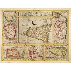
Insularum Aliquot Maris Mediterranei Descriptio.
The decorative composite map of six Mediterranean islands. The larger Sicily map is surrounded by maps of Sardinia, Corfu, Zerbi, Elba, and Malta. Each map is well detail...
Place & Date: Antwerp, 1587
Selling price: $800
Sold
Turcici Imperii Descriptio.
Map of the Middle East, extending from Greece to Arabia and covering the Cradle of Civilisation region. This is a new plate copied from another Ortelius map of 1570 with ...
Place & Date: Antwerp 1587
Selling price: $675
Sold
Palestinae sive totius terrae promissionis nova..
Ortelius famous map of Palestine based on Tilemann Stoltz\'s map, published in 1566. The shoreline runs from Berytus (Beirut) to the Nile Delta, reaching inland east of t...
Place & Date: Antwerp, 1587
Selling price: $900
Sold in 2008
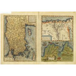
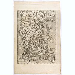
Natoliae Quae Olim Asia Minor, Nova de Scriptio / Carthaginis Celeberrimi Sinus Typus / Aegypti re Centior de Scriptio
Three detailed regional maps by Ortelius, from his Theatrum Orbis Terrarum, the first modern atlas of the world.The first map covers Asia Minor, Cyprus and the Eastern Me...
Place & Date: Antwerp, 1587
Selling price: $210
Sold in 2012
Palestinae sive totius terrae promissionis nova..
Ortelius famous map of Palestine based on Tilemann Stoltz's map, published in 1566. The shoreline runs from Berytus (Beirut) to the Nile Delta, reaching inland east of th...
Place & Date: Antwerp, 1587
Selling price: $750
Sold in 2014
Chinae, olim Sinarum Regionis, nova descriptio. Auctore Ludovico Georgio.
The first map of China ever to appear in a Western atlas, west to the top. When this map appeared, it was by far the most accurate one of China.Japan is shown on a curiou...
Place & Date: Antwerp, 1587
Selling price: $5700
Sold in 2014
Indiae Orientalis, Insularumque Adiacientium Typus. . .
Striking handcolored example of Ortelius' map of SE Asia, Japan, and the Philippines, from the rare French text edition of 1587. The map includes Beach and other informat...
Place & Date: Antwerp, 1587
Selling price: $2390
Sold in 2016
Natoliae Quae Olim Asia Minor, Nova de Scriptio.
Detailed map of Turkey, including Cyprus by Abraham Ortelius, from his "Theatrum Orbis Terrarum", the first modern atlas of the world.East to the top. Latin tex...
Place & Date: Antwerp, 1587
Selling price: $300
Sold in 2015
Indiae Orientalis, Insularumque Adiacientium Typus. . .
Finely hand colored example of Ortelius' map of SE Asia, Japan, and the Philippines, etc from the rare French text edition of 1587. The map includes Beach and other infor...
Place & Date: Antwerp, 1587
Selling price: $2000
Sold in 2018
![Damascvs urbs nobilissima ad libanum monteri loti. . . [Damascus]](/uploads/cache/25315-250x250.jpg)









![[Asia Minor - Turkey]](/uploads/cache/26204-250x250.jpg)
![[Cyprus]](/uploads/cache/26211-250x250.jpg)
![[Map of the Holy Land, including Cyprus]](/uploads/cache/26213-250x250.jpg)




![Tabula Asiae XII [Sri Lanka -- with Elephant]](/uploads/cache/00684-250x250.jpg)


![[Asia Minor - Turkey]](/uploads/cache/32897-250x250.jpg)
![[Cyprus]](/uploads/cache/92347-250x250.jpg)

![[Dragons and Gryfons].](/uploads/cache/14197-250x250.jpg)



![Asia secunda pars terrae in forma Pegasi. [Asia is presented as the mythical winged horse Pegasus.]](/uploads/cache/97237-250x250.jpg)


