Browse Listings in America > South America > Venezuela
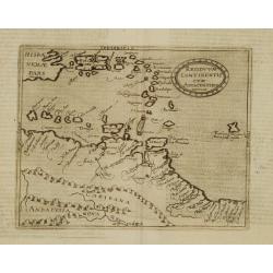
Residuum Continentis cum Adiacentibus Insulis.
Very rare sixteenth century map of Venezuela, including the islands of Curaçao, Bonaire, Aruba and the islands in the Caribbean and Puerto Rico.Published in the German e...
Place & Date: Cologne 1598
Selling price: $950
Sold
Descripcion del audiencia del nuevo Reino 9
Rare map of Venezuela from Novus Orbis, sive Descriptio Indiae Occidentalis. This collection of voyages is often referred to as an edition of Herrera, which is not strict...
Place & Date: Amsterdam 1622
Selling price: $200
Sold
Venezuela, atque Occidentalis Pars Novæ Andalusiae.
Coastline of Venezuela with little interior development. Including Aruba, Bonaire, Curaçao, etc.Scarce map prepared by Hessel Gerritsz (1581-1632), former apprentice of ...
Place & Date: Leiden, Elzevier, 1625
Selling price: $300
Sold in 2013
[Venezuelan Indians kill Spanish Monks.]
Some monks crossed from Cubagua to the Venezuelan mainland to spread the message of Christianity to the Indians. Along with them went other Spaniards who wanted to barter...
Place & Date: Frankfurt, M.Merian, 1633
Selling price: $80
Sold in 2018
[Vespucci visits Paria.]
In his letters, Vespucci describes the natives of this region, as tawney, going about naked and with no pubic hair. They eat whatever the land provides naturally for them...
Place & Date: Frankfurt, M.Merian, 1633
Selling price: $100
Sold in 2017
Tabula Geographica vnova omnium oculis exibens et proponens venssimam descriptionem..
De Bry's important map of the Orinoco Basin and El Dorado, including Venezuela and Guiana. The islands of Aruba, Curaçao, Bonaire, etc in upper left corner.The map inclu...
Place & Date: Frankfurt 1633-1634
Selling price: $1250
Sold
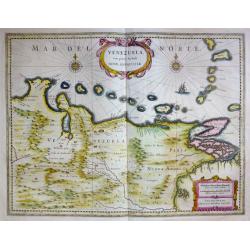
Venezuela, cum parte Australi Novae Andalusiae.
Venezuela, cum parte Australi Novae Andalusiae. A very fine example of Willem Blaeu's map of Venezuela and Columbia, embellished with two cartouches, two compass-roses...
Place & Date: Amsterdam, c. 1635
Selling price: $180
Sold in 2023
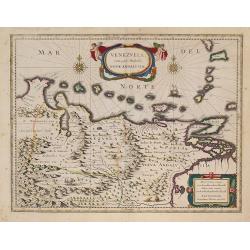
VENEZUELA cum parte Australi Novae Andalusiae.
A nice example of Blaeu's map showing two compass roses, a lovely cartouche and a ship. In the land are shown mountains, trees an exotic bird and a sheep. From the first ...
Place & Date: Amsterdam, 1635
Selling price: $95
Sold in 2020
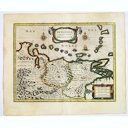
Venezuela cum parte Australi Novae Andalusiae Amstelodami Henricus Hondius Excudit.
A well executed engraved map that covers the Venezuelan coast of South America, east to the mouth of the Orinoco, and including the offshore islands from Aruba through Do...
Place & Date: Amsterdam, 1636
Selling price: $275
Sold in 2016
VENEZUELA, cum parte Australi NOVAE ANDALUSIAE.
A finely engraved, decorative map. The islands Trinidad, Margarita, Aruba and Curaçao are shown as well. With decorative title cartouche.From "le Théâtre du monde...
Place & Date: Amsterdam, 1635-1638
Selling price: $750
Sold in 2012
Venezuela, cum parte Australi novae Andalusiae.
A finely engraved, decorative map with Latin text on the reverse. The islands Trinidad, Margarita, Aruba and Curaçao are shown as well. With decorative title cartouche.A...
Place & Date: Amsterdam, 1638
Selling price: $600
Sold in 2010
Venezuela, cum parte Australi novae Andalusiae.
A finely engraved, decorative map. The islands Trinidad, Margarita, Aruba and Curaçao are shown as well. With decorative title cartouche.
Place & Date: Amsterdam, 1640
Selling price: $430
Sold in 2009
Venezuela cum parte Australi Novae Andalusiae.
Latin text on verso. A finely engraved, decorative map of Venezuela. The islands of Trinidad and Tobago, Margarita, Aruba and Curaçao are shown. Local animals are depict...
Place & Date: Amsterdam, ca. 1640
Selling price: $150
Sold in 2017
Venezuela, cum parte Australi novae Andalusiae.
A finely engraved, decorative map with Latin text on the reverse. The islands Trinidad, Margarita, Aruba and Curaçao are shown as well. With decorative title cartouche.T...
Place & Date: Amsterdam 1640
Selling price: $400
Sold
Venezuela cum parte Australi Novae Andalusiae.
A finely engraved, decorative map with Latin text on the reverse. The islands Trinidad, Margarita, Aruba, Bonaire and Curaçao are shown as well.
Place & Date: Amsterdam, 1650
Selling price: $140
Sold
Venezuela, cum parte Australi novae Andalusiae.
From the first edition of the last part of the Latin "Atlas maior" dedicated to America.A finely engraved, decorative map. The islands Trinidad, Margarita, Arub...
Place & Date: Amsterdam, 1662
Selling price: $500
Sold in 2010
Venezuela cum parte Australi Novae Andalusiae.
Most decorative map with two large cartouches and compass-rose, large group of islands at the mouth of the Orinoco, other islands off Venezuela coast: Margarita, Aruba, C...
Place & Date: Amsterdam, 1671
Selling price: $325
Sold
Castille Neuve ou Castille d' Or.
Copperplate engraved map showing Venezuela, partly Columbia, Jamaica, Hispaniola and Puerto Rico.From the French text edition of Description d'Univers, 1683. by Allain Ma...
Place & Date: Paris 1683
Selling price: $45
Sold
Terre Ferme, Nouveau Royaume de Grenade ?
Fine map of Colombia, Venezuela and the islands of Curaçua, Aruba, Bonaire, etc ... Prepared by N. Sanson. Engraved by A. de Winter.
Place & Date: Amsterdam, 1700
Selling price: $120
Sold in 2009
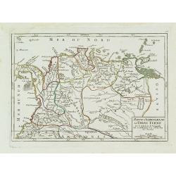
Partie Occidentale de la Terre Ferme.
Small detailed map showing the nor westernmost tip South America. Centered on Venezuela. From Atlas Portatif Universel, by Robert de Vaugondy.Page 106 outside border top ...
Place & Date: Paris, later than 1749
Selling price: $80
Sold in 2011
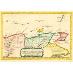
Carte des Provinces des Caracas, Comana et Paria.
Jaques Nicolas Bellin (1702-720) was the most important French hydrographer of the 18th century. Sea-atlas "Hydrographique Français", 1756-65, atlas to accompa...
Place & Date: Paris, c. 1756
Selling price: $140
Sold in 2009
Carte des Provinces des Caracas, Comana et Paria.
Jaques Nicolas Bellin (1702-720) was the most important French hydrographer of the 18th century. Sea-atlas 'Hydrographique Français' , 1756-65, atlas to accompany Prévo...
Place & Date: Paris, c. 1756
Selling price: $100
Sold in 2009
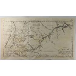
Cours de L'Orenoque Depuis ses Sources Jusqu'a la Mer.
An uncommon copper engraved map of the mouth of the Orinoco River, in South America. The map covers the countries of Colombia and Venezuela. A simple block-style title c...
Place & Date: Paris, 1773
Selling price: $175
Sold in 2020
Carte du Nouvelle Royaume de Grenade, de Andalousie et de la Guyane.
Copper engraved for "Atlas de Toutes les Parties Connues du Globe Terrestre". From Panama to the mouth of the Amazon. BONNE, RIGOBERT (1729-1795). Bonne was �...
Place & Date: Paris, 1780
Selling price: $20
Sold in 2013
Carte de la Terre Ferme, dela Guyane et du Pays des Amazones.
Jean Lattré, Paris-based engraver and publisher. Worked with Robert de Vaugondy, J. Janvier and R. Bonne. " Atlas Monderne', 1771, 1783 , 1793. Rigobert Bonne (1727...
Place & Date: Paris, 1783
Selling price: $200
Sold
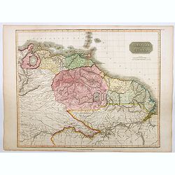
Caraccas and Guiana.
An attractive and very detailed map of Venezuela and Guiana, extending from Martinique in the north as far south northern Brazil, westwards to Lake Maracaibo across to th...
Place & Date: Edinburgh, 1815
Selling price: $45
Sold in 2023
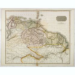
Caraccas and Guiana.
An attractive and detailed map of Venezuela and Guiana, extending Martinique in the north as far south northern Brazil, westwards to Lake Maracaibo across to the Atlantic...
Place & Date: Edinburgh, 1821
Selling price: $80
Sold in 2017
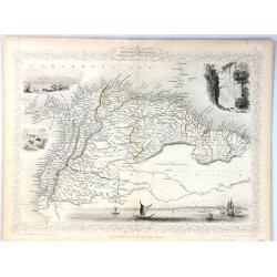
Venezuela, New Granada, Ecuador and the Guayanas
A map of the northern countries of South America including Venezuela, New Granada, Ecuador and The Guayanas.With four decorative vignettes showing Paramaribo, Fall of Bag...
Place & Date: London, 1841
Selling price: $45
Sold in 2018
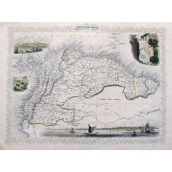
Venezuela, New Granada, Equador, and The Guayanas.
A highly decorative steel-engraved map from Panama to French Guayana. Very detailed with place names, rivers, hills, bays, etc. Attractively illustrated with vignette sty...
Place & Date: London, ca. 1850
Selling price: $60
Sold in 2018
Mapa Fisico y Politico de los Estados Unidos de Venezuela..
Very large fold-out map of Venezuela, including part of Colombia, Brazil and Guyana. With inset front view of the tallest mountains from the Sierra Nevada to Mount Roraim...
Place & Date: Paris, 1934
Selling price: $250
Sold in 2019
Republica de Venezuela.
A beautiful hand colored, hand drawn map of Venezuela, prepared for the Buenos Aires 1939 Philatelic Exhibition, with separate text with details of the country in Spanish...
Place & Date: Buenos Aires, 1939
Selling price: $28
Sold in 2019


![[Venezuelan Indians kill Spanish Monks.]](/uploads/cache/40079-250x250.jpg)
![[Vespucci visits Paria.]](/uploads/cache/40068-250x250.jpg)


