Browse Listings in America > South America > Brazil
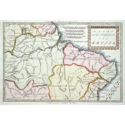
Guiana sive Amazonum Regio.
From : De Nieuwe en Onbekende Weereld published by Jacob van Meurs. Beautiful map of the Guyanas and Brazil, showing the course of the Amazon river and indicates the myth...
Place & Date: Amsterdam, 1671
Selling price: $275
Sold in 2008
ARX NASSOVII
Early copper engraved view of the Fort Nassau, in Pernambuco, Brazil.Very decorative, with detailed sailing ships in the front, one firing its canons. The fort and villag...
Place & Date: London, 1671
Selling price: $120
Sold in 2011
Castrum Mauritij ad Ripam Fluminis S. Francisci.
Impressing copper engraving depicting Fort Maurice, which controlled the ferry on the Rio Francisco.With small letter key at the bottom.
Place & Date: Amsterdam, 1671
Selling price: $200
Sold in 2015
Urbs Salvador.
A handsome copper engraving of the walled city of San Salvador, with a lettered key at the top left corner.Ships and boats fill the harbor in the foreground. From Arnoldu...
Place & Date: Amsterdam, 1671
Selling price: $80
Sold in 2017
S. Salvador.
A very attractive copperplate engraving of the Brazilian city of San Salvador (Sao Salvador de Bahia de Todos os Santos / The Holy Saviour of the Bay of All Saints), in t...
Place & Date: London, ca 1671
Selling price: $100
Sold in 2022
Brasila.
Map of Brazil extending from C. Nasou and Parime Lago to the Mouth of the Rio de la Plata. Oriented with West on top.The cartography of the region is quite primitive. The...
Place & Date: Amsterdam, 1673
Selling price: $156
Sold in 2014
Paskaart van BRASIL van Rio de los Amazones, tot Rio de la Plata.
An eye-catching chart of Brazil. Including 2 compass roses along with a title cartouche.Pieter Goos (ca. 1616-1675) was one of the most important cartographer, engraver, ...
Place & Date: Amsterdam 1675
Selling price: $1600
Sold
Littoria Brasiliae / Pascaert van Brasil.
A truly superb Dutch sea chart of Brazil, with north orientated to the left, published by Frederik de Wit, a man who was rightly famous for his accurate, detailed and hig...
Place & Date: Amsterdam, ca 1675
Selling price: $300
Sold in 2022
Bresil.
Uncommon miniature map of Brazil from Pierre Duval's La Geographie Universeille dated 1676. Following his Cartes de geographie in 1657, Pierre Duval published this smalle...
Place & Date: Paris, 1676
Selling price: $70
Sold in 2008
Nova et Accurata Brasiliae totius tabula.
The map Nova Brasiliae Typus was published by Willem Blaeu in his atlas Appendix in 1630. In 1642 a new, updated map Nova et Accurata Brasiliae with a much more detailed ...
Place & Date: Amsterdam 1680
Selling price: $950
Sold
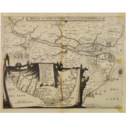
Abbildung der Statt und Vestung Parayba in der Landschaft Brasilia.
Detailed map of the region of Paraiba and the defending forts at the mouth of the River Paraiba.The map illustrates the Dutch incursion into the Portuguese territory and ...
Place & Date: Frankfurt, 1680
Selling price: $200
Sold in 2013
Abbildung der Statt und Vestung Parayba in der Landschaft Brasilia.
In lower part map inset of general map of Brazil.
Place & Date: Frankfurt, 1680
Selling price: $200
Sold in 2008
Pascaert van Brasil-Littora Brasiliae.
Sea chart of the South American coastline from Guyana to Rio de la Plata. East to the top. Embellished with two compass roses and 5 sailing vessels.Oriented with north to...
Place & Date: Amsterdam, 1680
Selling price: $900
Sold
Abbildung der Statt und Vestung Parayba in der Landschaft Brasilia.
Detailed map of the region of Paraiba and the defending forts at the mouth of the River Paraiba.The map illustrates the Dutch incursion into the Portuguese territory and ...
Place & Date: Frankfurt, 1680
Selling price: $300
Sold in 2015
Pas-kaart van .. Brazilia tusschen I.S.Catharina en..
Johannes Van Keulen's superb chart of the entrance of the Rio de la Plata, including inset chart with the town of Boinos Aires. Published in his Zee-Atlas of 1681 and for...
Place & Date: Amsterdam 1681
Selling price: $1465
Sold
Royaume des Amazones.
Peculiar copper engraving showing a small map of the northern part of South America. The map is held by 2 native people with a verdant landscape on the background.From th...
Place & Date: Paris 1683
Selling price: $45
Sold
Bresil.
Interesting early map of Brazil. The wild inland as for example the later state of Mato grosso were still unexplored. The eastern border of Brazil is called Terre Inconnu...
Place & Date: Paris 1683
Selling price: $55
Sold
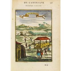
Sucrerie.
A fine and uncommon early 17th century birds-eye view of a Caribbean sugar manufacturing plantation.From the French text edition of Description d'Univers, 1683. by Allain...
Place & Date: Paris 1683
Selling price: $50
Sold
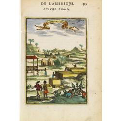
Indigotoire.
Copperplate engraved image of an indigo plantation being worked by slaves under the auspices of colonial power.From the French text edition of Description d'Univers, 1683...
Place & Date: Paris 1683
Selling price: $40
Sold
Bresil.
Alain Manneson Mallet (1603-1706) published in 1683 his ' Description de l' Univers' in 5 volumes. In 1686 a German edition appeared.An attractive little map of Brasil fr...
Place & Date: Paris, 1683
Selling price: $155
Sold in 2008
Bresil.
Interesting early map of Brazil. The wild inland as for example the later state of Mato Grosso was still unexplored. The eastern border of Brazil is called Terre Inconnue...
Place & Date: Paris, 1683
Selling price: $25
Sold in 2023
Corso del Fiume dell Amazoni..
An uncommon map of the northern half of the continent focusing on the course of the Amazon River.Typical of Coronelli's strong engraving style the topographical features ...
Place & Date: Venice 1690
Selling price: $605
Sold
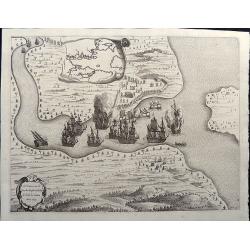
Veroveringe van Rio Grande in Brasil. Anno 1633 Northern Brazil.
A bird's-eye view of the fort (present-day Natal) at the mouth of the Rio Potengi showing the Dutch invasion and capture of the Portuguese fort in 1633. The harbor is fil...
Place & Date: Amsterdam, 1690
Selling price: $130
Sold in 2021
T'Neemen van de Suyker Prysen inde Bay de Tode los Santos Anno 1627.
A nice copper engraving illustrating the Dutch fleet capturing the fort at the entrance to the Baia de Todos os Santos, in northeastern Brazil. The WIC fleet that capture...
Place & Date: Amsterdam, 1690
Selling price: $150
Sold in 2021
Povo [with] Villa d Olinda d Pernambuco.
These splendid views encompass one of the earliest etchings of this region and its cities. Artistically engraved armies, fortresses, and ships. At top is a view of Pov...
Place & Date: Amsterdam, 1690
Selling price: $150
Sold in 2021
Afbeeldinge vande Cabo St. Augustin met Haer Forten.
This fine bird's-eye view portrays the Dutch fleet and the fortresses at Cabo Santo Agostinho. The strapwork title cartouche incorporates a numbered key identifying four ...
Place & Date: Amsterdam, 1690
Selling price: $120
Sold in 2021
Afbeeldinghe van Pariba ende Forten.
This bird's-eye map shows the region of Paraiba and Portuguese fortifications at the mouth of the River Paraiba. A very early view of this region with highly detailed and...
Place & Date: Amsterdam, 1690
Selling price: $120
Sold in 2021
Peru and the Amazones Country.
Detailed copper engraved map showing parts of todays Peru, Ecuador, Bolivia, Brazil, Columbia, Chile and Argentina. From Quito until the mouth of the Amazonas. Includes a...
Place & Date: London, ca. 1701
Selling price: $65
Sold in 2018
Brasil, divided into its Captainships.
Important map of Brazil when it was a Portuguese colony. It depicts the various captainships including Para, Maragnan, Siara, Rio Grande, Paraiba, Tamaraca, Pernambuco, S...
Place & Date: London, 1701
Selling price: $55
Sold in 2019
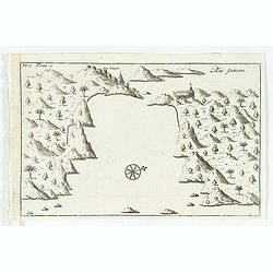
Rio Janeiro.
Simplified bird's-eye view of São Sebastião do Rio de Janeiro and Guanabara Bay, Brazil. Includes compass rose, church, and settlement.From volume two of the French rei...
Place & Date: Amsterdam, E. Roger, 1703
Selling price: $120
Sold in 2012
Rio Janeiro.
Scarce map of the Guanabara Bay with Rio de Janeiro, from Constantin Renneville's "Recueil des voyages qui ont servi a l'etablissement et aux progres de la Compagnie...
Place & Date: Amsterdam, 1703
Selling price: $41
Sold in 2015
Brasilia.
A very fine and decorative map of Brazil. From the book "A Collection of Voyages and Travels" by Churchill, the map came from the section containing a descripti...
Place & Date: London, Printed for A. and J. Churchill, 1703
Selling price: $191
Sold in 2017
Brasilaanze Scheepvaard door Johan Lerius Gedaan uit Vrankryk in' t Jaar 1556.
Pieter van der Aa was a prolific publisher. He published a.o. ' Naaukeurige versameling der gedenkwaardigste zee- en land-reysen', a series of accounts of voyages (1706-0...
Place & Date: Leiden, 1707
Selling price: $250
Sold
Les Provinces de Rio de la Plata.
Extremely rare map of the region including the Paraguay River basin and the Peru-Chilean coast with Lake Titicaca. The Rio de la Plata is boldly shown with many large isl...
Place & Date: Leiden 1714
Selling price: $450
Sold
Cours du Fleuve Maragon Autrement du de Amazones. . .
This was the first close to correct chart of the Maranon territory. The map shows all of northern South America, and locates Lima and Cusco. With a decorative title carto...
Place & Date: London, 1717
Selling price: $150
Sold in 2018
Le Bresil, dont les côtes sont divisées en capitaineries Dressé sur les dernières rélation. . .
Uncommon issue of this fine map of Brazil prepared by Nicolas de Fer, issued by Guillaume Danet.Originally published in atlas Atlas Curieux by N. de Fer in 1700-05, at hi...
Place & Date: Paris, 1719
Selling price: $350
Sold in 2017
S. SALVADOR.
Charming view of Salvador de Bahia, in Brazil, seen from the ocean. With ribbon style title cartouche and 2 cartouches containing a key list. Decorated with 4 European ve...
Place & Date: Amsterdam 1722
Selling price: $160
Sold
Entrée de Rio Janeiro.
Fine view of the entrance of Baía de Guanabara, in Rio de Janeiro.From Voyages de François Coreal aux Indes Occidentales, Contenant ce qu'il y a vû de plus remarquable...
Place & Date: Amsterdam 1722
Selling price: $20
Sold
BAIE de Tous Les SAINS.
Fine view of Baía de Todos os Santos, in Bahia. With the town of Salvador outlined at the entrance of the bay.From Voyages de François Coreal aux Indes Occidentales, Co...
Place & Date: Amsterdam 1722
Selling price: $14
Sold
S. SEBASTIEN.
Charming view of São Sebastião de Rio de Janeiro, taken from the ocean. With ribbon style title cartouche and 2 cartouches containing a lettered key list (A-G). Decorat...
Place & Date: Amsterdam 1722
Selling price: $130
Sold
Le Bresil, suivant les nouvelles observations. . .
Striking copper engraved map surrounded in a large picture-frame style border and title cartouche depicting mining. Great coastal detail with numerous notations concernin...
Place & Date: Leyden, 1728
Selling price: $75
Sold in 2023
Le Bresil. Suivant les nouvelles observations?
Detailed map of Brazil. Decorative cartouche lower right.Although not renowned for the originality of his work, Pieter van der Aa is highly thought of for the design and ...
Place & Date: Amsterdam 1728
Selling price: $90
Sold
Praefecturae de Paraiba, et Rio Grande.
Superb map of the Brazilian coastline including the capitanias of Paraiba and Rio Grande. The map was drawn after actual surveys by Georg Markgraf, Elias Herckmanns and o...
Place & Date: Amsterdam, 1740
Selling price: $1850
Sold in 2013
Praefecturae Paranambucae pars Borealis..
Among the most picturesque of all early maps of the Brazilian coastline covering the capitanias of Pernambuca and I. Tamarica. The upper part is embellished with are rema...
Place & Date: Amsterdam, 1740
Selling price: $1850
Sold in 2013
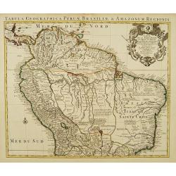
Carte de la Terre Ferme du Perou, du Bresil et du Pays des Amazones.
Large, graphic map of the northern part of South America. It is filled with place names and notations speculating about the Indian tribes and the tributaries to the Amazo...
Place & Date: Amsterdam c. 1745
Selling price: $330
Sold
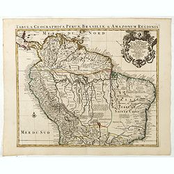
Carte de la Terre Ferme du Perou, du Bresil et du Pays des Amazones.
Large, graphic map of the northern part of South America. It is filled with place names and notations speculating about the Indian tribes and the tributaries to the Amazo...
Place & Date: Amsterdam c. 1745
Selling price: $380
Sold in 2020
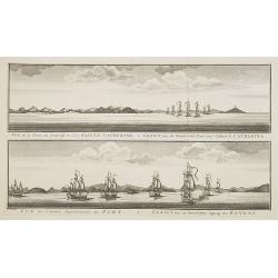
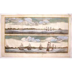
Vue de la Pointe du Nord-Est de l'Isle Sainte Catherine / Gezigt van de Noord-Oost Punt van 't Eiland S. Catharina.
From a Dutch edition of a voyage account. Large size (41 x 27 cm). Showing two views of the Island S. Catharina near Brazil, with ships.
Place & Date: Amsterdam, c. 1750
Selling price: $210
Sold in 2008
Vue de la Cote du N.E. de L'Isle de Ste. Catherine Sur la Cote du Bresil & Vue de L'Entre Septentionale du Port de Ste. Catherine
Two copper engraved views of the Port of Ste. Catherine off the coast of Bresil. Each shows seven two and three masted ships. George Anson, 1st Baron Anson, PC, FRS, RN ...
Place & Date: Paris, 1750
Selling price: $79
Sold in 2015
Painting of Tupinamba cannibals of Brazil set in a local landscape on wooden panel.
The iconography of this painting is derived from one of the plates illustrated in the third volume of "Grands Voyages" by Th. Bry taht was devoted to Brazil (Na...
Place & Date: ca. 1750
Selling price: $3100
Sold in 2023
[lot of 5 maps/prints map of South America] Chili. Paraguay, Brésil, Amazones, et Pérou.
Louis Brion de la Tour (1756-1823), ' Atlas Géneral, Civil et Ecclésiastique', 1766, ' Atlas Général', 1790-98. Louis Charles Desnos (fl.1750-70), Paris-based publish...
Place & Date: Paris, c. 1750
Selling price: $200
Sold in 2022
Pascaerte van Rio Gambia Als meede het Vaerwater tussen Cabo Verde en Brazil.
A highly decorative sea chart of the Atlantic Ocean between Gambia, Cap Verde and Brazil. On top is a figurative scale cartouche flanked with putti and in the lower left...
Place & Date: Amsterdam, 1751
Selling price: $1200
Sold in 2023
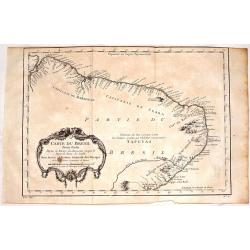
Carte du Bresil, Prem. Partie.
Fine copper engraving of the shoreline of Brasil from the Amazon River to the Bay of All Saints. Decorated by a large floral cartouche. Jacques Nicolas Bellin (1703–17...
Place & Date: Paris, 1754
Selling price: $19
Sold in 2017
Portrait of Johan Maurits van Nassau, governor of the Dutch colony in Brazil in the early 17th century.
Published by Isaac Tirion, Amsterdam ca. 1760, as part of a series of prints of historical figures.
Place & Date: Amsterdam, c.1760
Selling price: $75
Sold in 2008
Portrait of Johan Maurits van Nassau, governor of the Dutch colony in Brazil in the early 17th century.
Published by Isaac Tirion, Amsterdam ca. 1760, as part of a series of prints of historical figures.
Place & Date: Amsterdam, ca. 1760
Selling price: $50
Sold in 2009
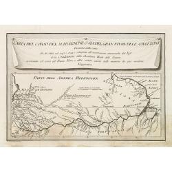
Carta del Corso del maragnone o sia del gran flume dell' Amazonni. . .
Uncommon map of the Amazon by Veremondo Rossi after the important map of Charles Marie de la Condamine (1701-1774) who made a map of the Amazon river in 1745.
Place & Date: c. 1763
Selling price: $65
Sold in 2010
Guyane Portugaise et Partie du Cours de la Riviere des Amazones.
A good engraved map of the Amazon.
Place & Date: Paris, 1764
Selling price: $85
Sold in 2010
[Lot of 9 maps and prints]. Kaart van Brasil en de Aller-heiligen Baay waar aan de Hoofdstad legt van Brazil.
[Lot of 9 maps and prints of Brasil].- Kaart van de Aller-heiligen Baay waar aan de Hoofdstad legt van Brazil. - Carte du Bresil Prem. Partie- Suite du Bresil- Suite du ...
Place & Date: Amsterdam, ca 1770
Selling price: $150
Sold in 2023
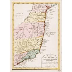
Suite du Bresil ..
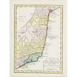
Uncommon edition of this accurate map of part of Brazil.From Atlas Portatif pour servir a l'intelligence de l'Histoire Philosophique et Politique des etablissements et du...
Place & Date: Amsterdam, 1773
Selling price: $150
Sold in 2016
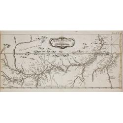
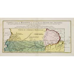
Carte du Cours du Maragnon ou .. Amazones..
Uncommon edition of this map of the river Amazon.From Atlas Portatif pour servir a l'intelligence de l'Histoire Philosophique et Politique des etablissements et du commer...
Place & Date: Amsterdam, 1773
Selling price: $50
Sold in 2018
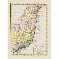
Suite du Bresil Depuis la Baie de Tous les Saints..
Uncommon edition of this accurate map of part of Brazil, from San Salvador till Rio de Janeiro and S.Paulo.From Atlas Portatif pour servir a l\'intelligence de l\'Histoir...
Place & Date: Amsterdam, 1773
Selling price: $180
Sold in 2008
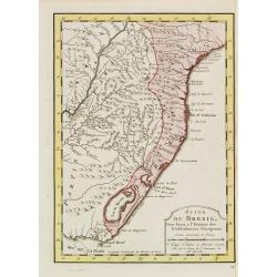
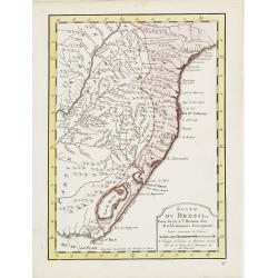
Suite du Bresil ..
Uncommon edition of this accurate map of part of Brazil.From Atlas Portatif pour servir a l\'intelligence de l\'Histoire Philosophique et Politique des etablissements et ...
Place & Date: Amsterdam 1773
Selling price: $150
Sold in 2008
Suite du Bresil Depuis la Baie de Tous les Saints..
Uncommon edition of this accurate map of part of Brazil, from San Salvador till Rio de Janeiro and S.Paulo. In lower right engraved "29b."From Atlas Portatif po...
Place & Date: Amsterdam, 1773
Selling price: $180
Sold
Suite du Bresil..
Uncommon edition of this accurate map of part of Brazil. In lower right engraved "29c."From Atlas Portatif pour servir a l'intelligence de l'Histoire Philosophi...
Place & Date: Amsterdam, 1773
Selling price: $120
Sold
Suite du Bresil . . .
Uncommon edition of this accurate map of part of Brazil.From Atlas Portatif pour servir a l'intelligence de l'Histoire Philosophique et Politique des etablissements et du...
Place & Date: Amsterdam, 1773
Selling price: $26
Sold in 2022
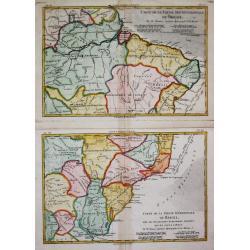
Carte de la Partie Septentrionale / Méridionale du Brésil.
Rigobert Bonne (1727-1795), French cartographer. His maps are found in a.o. Atlas Moderne (1762), Raynal's Histoire Philos. du Commerce des Indes (1774) and Atlas Encyclo...
Place & Date: Paris, c, 1775
Selling price: $175
Sold
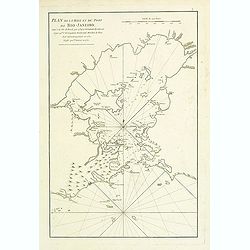
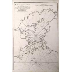
Plan de la Baye et du Port de Rio-Janeiro.
French of mostly focusing on Guanabara bay. Notice the names of the many now famous areas of Rio are already firmly established (Botafogo, Lame, S. Cristovao, Gloria, et...
Place & Date: Paris, Brest, Demonville, 1775
Selling price: $400
Sold in 2021
Plan De La Baye Et Du Port De Rio-Janeiro...
A scarce sea-chart with early mapping of the Guanabara Bay, with Rio De Janeiro. Published in the 1775 in the "Neptune Orientale".Interesting to see the Bay of ...
Place & Date: Paris, 1775
Selling price: $110
Sold in 2016
Kaart van het Noordlijk gedeelte van Bresil.
Uncommon and attractive map of most of Brazil. The directions of the trade winds are shown. Very nice detail of the river systems, mines, forts, missions, and villages. A...
Place & Date: Amsterdam 1785
Selling price: $150
Sold
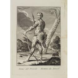
Uomo del Brasile. / Homme du Brasil.
Full portrait of a Brazilian hunter. From "Raccolta di ? stampe." a series of historically significant eighteenth-century copper plate engravings by Venetian en...
Place & Date: Venice, Antonio Zatta, c.1790
Selling price: $300
Sold in 2013
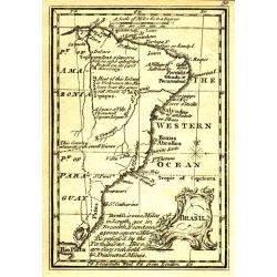
Brasil.
Uncommon miniature map from Gibson's "Atlas Minimus, or a New Set of Pocket Maps of the several Empires, Kingdoms and States of the known World".
Place & Date: London, 1792
Selling price: $30
Sold in 2011
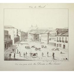
Vue du Bresil - Vue d'une partie de la Rue Direita à Rio-Janeiro
Place & Date: Paris, c. 1820
Selling price: $120
Sold in 2008
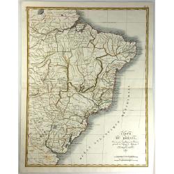
Carte du Bresil, Dressee pouo L'Intelligence de L'histoire Generale des Voyages de Labarpe.
A striking lithograph map of Brazil and the surrounding countries. One of the original maps that show the findings resulting from the voyages of Labarre.
Place & Date: Paris, 1821
Selling price: $100
Sold in 2017
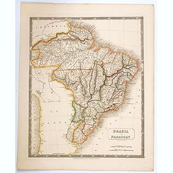
Brazil and Paraguay.
A large, detailed map of Brazil and Paraguay taken from Hall's scarce 'New General Atlas', published just after the Brazilian war of independence, which ceded this enormo...
Place & Date: London, 1825
Selling price: $30
Sold in 2020
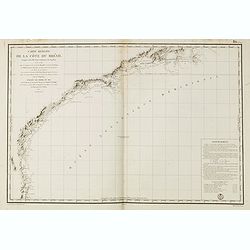
Carte réduite de la cote du Brésil.
Detailed chart of the coast of Brazil. Giving very good detail with soundings. Engraved by M.Ambroise Tardieu, engraver for the Depot Générale de la marine is noted as ...
Place & Date: Paris, 1826
Selling price: $200
Sold in 2015
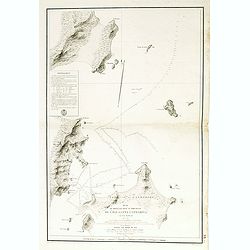
Plan du mouillage situéau . . . Santa Catharina. . .
Detailed chart of the northern coast of Santa Catarina in Brazil. Giving very good detail with soundings. Engraved by M.Ambroise Tardieu, engraver for the Depot Général...
Place & Date: Paris, 1826
Selling price: $100
Sold in 2015
Partie du Brésil. No.18. [28]
PLANO SHEET map of Brazil: No. 28 covering Rio de Janeiro, São Paulo, Vitoria, Belo Horizonte, from his famous Atlas Universel . Printed with number 18, however changed ...
Place & Date: Brussels 1825/1827
Selling price: $250
Sold
[ Hunting scene of Botocudos family, Rio Grande, Brazil ].
Aquatint depicting a hunting scene of a native Botocudos family, Rio Grande, Brazil.Engraved by Gallina.From Giulio Ferrario's work Le Costume Ancien et Moderne ou Histoi...
Place & Date: Milan, 1827
Selling price: $35
Sold in 2018
[ Diamond washing at Madinga Brazil ].
Aquatint depicting diamond washing at Madinga Brazil with the Cerro de Frio mountains in the background.Engraved by Bonatti.From Giulio Ferrario's work Le Costume Ancien ...
Place & Date: Milan, 1827
Selling price: $100
Sold in 2009
[ Monkeys from Brazil ].
Aquatint depicting four species of monkeys: 1. Simia Rosalia, 2. Ouistiti, 3. le Sajou, and 4. le pinche the silver Cinnée monkey.Engraved by Raineri.From Giulio Ferrari...
Place & Date: Milan, 1827
Selling price: $30
Sold in 2016
[ View of the San Fidelis Mission in Brazil ].
Aquatint of a view of the San Fidelis Mission in Brazil.Engraved by Fumagalli.From Giulio Ferrario's work Le Costume Ancien et Moderne ou Histoire du gouvernement, de la ...
Place & Date: Milan, 1827
Selling price: $75
Sold in 2009






![Povo [with] Villa d Olinda d Pernambuco.](/uploads/cache/82460-250x250.jpg)





![[lot of 5 maps/prints map of South America] Chili. Paraguay, Brésil, Amazones, et Pérou.](/uploads/cache/19976-(2)-250x250.jpg)



![[Lot of 9 maps and prints]. Kaart van Brasil en de Aller-heiligen Baay waar aan de Hoofdstad legt van Brazil.](/uploads/cache/19736-250x250.jpg)

![Partie du Brésil. No.18. [28]](/uploads/cache/16364-250x250.jpg)
![[ Hunting scene of Botocudos family, Rio Grande, Brazil ].](/uploads/cache/27297-250x250.jpg)
![[ Diamond washing at Madinga Brazil ].](/uploads/cache/27305-250x250.jpg)
![[ Monkeys from Brazil ].](/uploads/cache/27306-250x250.jpg)
![[ View of the San Fidelis Mission in Brazil ].](/uploads/cache/27310-250x250.jpg)