Browse Listings in America > North America
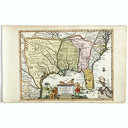
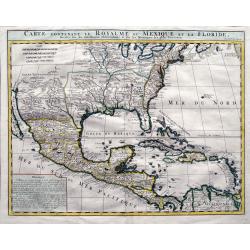
Carte contenant le royaume du Mexique et la Floride.
From Chatelains Atlas Historique. Based upon De L'Isle's landmark map of the region.
Place & Date: Amsterdam, 1719
Selling price: $600
Sold in 2009
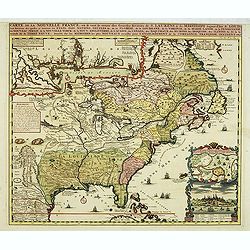
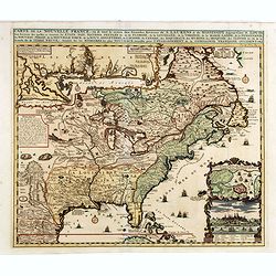
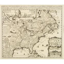
Carte de la Nouvelle Franc, ou se voi le cours des grandes rivieres. . .
Derived from de Fer's 1718 map, from west of the Mississippi it contains a mass of inland detail with notes and vignettes of the indigenous peoples and fauna of North Ame...
Place & Date: Amsterdam, 1719
Selling price: $1750
Sold in 2017
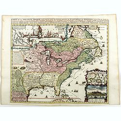
Carte de la Nouvelle Franc où se voit le cours des Grandes Rivières de St Laurens et de Mississipi Aujourd'hui St Louis . . .
Derived from de Fer's 1718 map, from west of the Mississippi it contains a mass of inland detail with notes and vignettes of the indigenous peoples and fauna of North Ame...
Place & Date: Amsterdam, 1719
Selling price: $1500
Sold in 2012
Carte de la Nouvelle France, où se voit le cours des Grandes Rivières de S. Laurens & de Mississipi
An intricate map of eastern North America was copied from De Fer and designed to show the courses of the St. Laurence and the Mississippi rivers. One inset charts the mou...
Place & Date: Amsterdam, 1719
Selling price: $1500
Sold in 2013
L'Amerique Septentrionale qui fait partie des Indes Occidentales..
A handsome miniature-map showing California as an island after Sanson. Sanson's details are generally followed.The British colonies are shown confined east of the Appalac...
Place & Date: Paris, 1719
Selling price: $400
Sold in 2014
Carte De La Nouvelle France, ou se voit le cours des Grandes Rivieres de. S. Laurens & de Mississipi Aujour d'hui S. Louis, Aux Environs des-quelles se trouvent les Etats, Pais, Nations, Peuples &c. de la Floride, de la Louisiane, de la Virginie, de la M
Nice original old color rare single sheet map of the inhabited parts of North America. This map is based on the 4-sheet map by Nicholas De Fer which appeared in 1718.This...
Place & Date: Paris, 1719
Selling price: $990
Sold in 2016
Carte de la Nouvelle France, ou se voi le cours..
Derived from de Fer's 1718 map, from west of the Mississippi it contains a mass of inland detail with notes and vignettes of the indigenous peoples and fauna of North Ame...
Place & Date: Amsterdam, 1719
Selling price: $2000
Sold
Carte de la Nouvelle France, ou se voi le cours..
Derived from de Fer's 1718 map, from west of the Mississippi it contains a mass of inland detail with notes and vignettes of the indigenous peoples and fauna of North Ame...
Place & Date: Amsterdam, 1719
Selling price: $1250
Sold in 2022
Carte de la Nouvelle France, ou se voi le cours. . .
Derived from de Fer's 1718 map, from west of the Mississippi it contains a mass of inland detail with notes and vignettes of the indigenous peoples and fauna of North Ame...
Place & Date: Amsterdam, 1719
Selling price: $1400
Sold in 2019
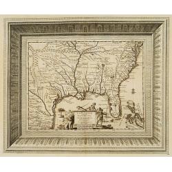
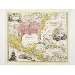
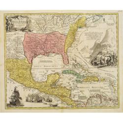
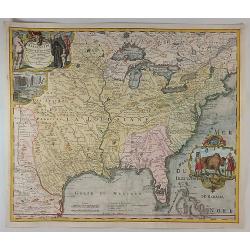
Carte contenant le Royaume du Mexique et la Floride. . .
A double-page engraved map of Texas, Florida, the Gulf Coast, and Central America, based on Guillaume De L'Isle's important Carte du Mexique. It shows parts of the Great ...
Place & Date: Amsterdam, 1719
Selling price: $400
Sold in 2019
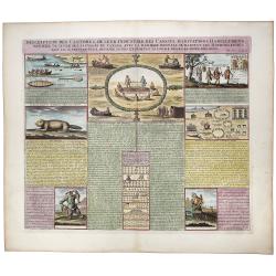
Inscription des Castors & De Leur Industrie des Canots Habitations Habillemens, maniere de vivre des sauvages du Canada. . .
A very unique sheet of various engravings concerning Native American customs and indigenous animals in North America. Includes a large view of an American buffalo and a g...
Place & Date: Paris, ca 1719
Selling price: $130
Sold in 2020
Carte Qui Contient la Mantere don't se Fait La Chasse des Boeufs Sauvages et des Elans, Le Grand Saut de la riviere de Niagar a la danse du Calumet. . .[NIAGARA FALLS..]
A beautiful colored chart showing the Natives of Canada. A very unique sheet of various engravings concerning Native American customs and indigenous animals in North Amer...
Place & Date: Paris, 1719
Selling price: $150
Sold in 2020
L'Amerique Septentrionale qui fait partie des Indes Occidentales . . . [California island]
A fine example of the 1719 Chiquet's map of North America, with the accompanied related engraved French text sheet entitled "Description Abregé de l'Amerique Septen...
Place & Date: Paris, 1719
Selling price: $300
Sold in 2021
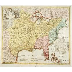
Amplissimae Regionis Mississipi,.. Provinciae Ludovicianae
Attractive map of present-day U.S. from Nouveau Mexico to the Atlantic, centring on the French province of Louisiana, with the English colonies and Spanish Florida indica...
Place & Date: Nuremberg 1720
Selling price: $1575
Sold
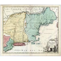
Nova Anglia Septentrionali Americae implantata . . .
German interest in North America was high during the first half of the eighteenth century when Johann Baptiste Homann was the leading German cartographer. During this per...
Place & Date: Nurnberg, 1720
Selling price: $1050
Sold in 2022
Amplissimae Regionis Mississipi,.. Provinciae Ludovicianae.
Attractive map of present-day U.S. from Nouveau Mexico to the Atlantic, centring on the French province of Louisiana, with the English colonies and Spanish Florida indica...
Place & Date: Nuremberg 1720
Selling price: $2500
Sold
Koning en Koningin van de Mississippi.
An Indian couple of the Mississippi area. From a book satirizing the disastrous Mississippi scheme (1718-1720) of the French Compagnie d'Occident and the speculation of i...
Place & Date: Amsterdam, 1720
Selling price: $100
Sold in 2013
Pasquins windkaart op de windnegotie van 't Iaar 1720
Pasquin's wind card on the wind trade of the year 1720. Set of 52 illustrated playing-cards with human figures and a little explanation under each one. Interesting is the...
Place & Date: Amsterdam 1720
Selling price: $1150
Sold
Amplissimae Regionis Mississipi,.. Provinciae Ludovicianae..
Attractive map of present-day U.S. from Nouveau Mexico to the Atlantic, centering on the French province of Louisiana, with the English colonies and Spanish Florida indic...
Place & Date: Nuremberg 1720
Selling price: $2150
Sold
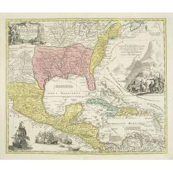
Regni Mexicani seu Novae Hispaniae, Floridae, Novae ..
The map shows the eastern sea board of America, the West Indies and the various estates and countries that border the Gulf of Mexico, with decorative -uncolored- cartouch...
Place & Date: Nuremberg 1720
Selling price: $1200
Sold
Carte de la Nouvelle France, ou se voit le cours des Grandes Rivieres de S. Laurens & de Mississipi..
Derived from de Fer's 1718 map, from west of the Mississippi it contains a mass of inland detail with notes and vignettes of the indigenous peoples and fauna of North Ame...
Place & Date: Amsterdam 1720
Selling price: $1700
Sold
Regni Mexicani seu Novae Hispaniae, Floridae, Novae ..
The map shows the eastern sea board of America, the West Indies and the various estates and countries that border the Gulf of Mexico, with decorative -uncolored- cartouch...
Place & Date: Nuremberg 1720
Selling price: $1900
Sold
Nova Anglia Septentrionali Americae implantata ..
German interest in North America was high during the first half of the eighteenth century when Johan Baptiste Homann was the leading German cartographer. During this peri...
Place & Date: Nuremberg 1720
Selling price: $1700
Sold
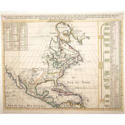
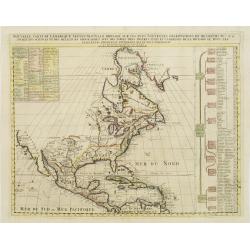
Nouvelle Carte de l' Amerique Septentrionale Dressee sur les plus Nouvelles Observations de Messieurs de l' Academie..
Great map of North America with well developed cartography in the Great Lakes and Mississippi River.It includes all of Central America and the West Indies. The English se...
Place & Date: Amsterdam 1720
Selling price: $600
Sold
Nouvelle Carte de l' Amerique Septentrionale Dressee sur les plus Nouvelles Observations de Messieurs de l' Academie..
Great map of North America with well developed cartography in the Great Lakes and Mississippi River.It includes all of Central America and the West Indies. The English se...
Place & Date: Amsterdam 1720
Selling price: $525
Sold
Amplissimae Regionis Mississipi,.. Provinciae Ludovicianae..
Attractive map of present-day U.S. from Nouveau Mexico to the Atlantic, centering on the French province of Louisiana, with the English colonies and Spanish Florida indic...
Place & Date: Nuremberg 1720
Selling price: $2500
Sold
Regni Mexicani seu Novae Hispaniae, Floridae, Novae ..
The map shows the eastern sea board of America, the West Indies and the various estates and countries that border the Gulf of Mexico, with decorative cartouches. The map ...
Place & Date: Nuremberg 1720
Selling price: $1600
Sold in 2009
Amplissimae Regionis Mississipi,.. Provinciae Ludovicianae..
Attractive map of present-day U.S. from Nouveau Mexico to the Atlantic, centering on the French province of Louisiana, with the English colonies and Spanish Florida indic...
Place & Date: Nuremberg 1720
Selling price: $2530
Sold in 2009
Amplissimae Regionis Mississipi,.. Provinciae Ludovicianae. . .
Attractive map of present-day U.S. from Nouveau Mexico to the Atlantic, centering on the French province of Louisiana, with the English colonies and Spanish Florida indic...
Place & Date: Nuremberg, 1720
Selling price: $2200
Sold in 2019
Regni Mexicani seu Novae Hispaniae, Floridae, Novae . . .
The map shows the eastern sea board of America, the West Indies and the various estates and countries that border the Gulf of Mexico, with decorative -uncolored- cartouch...
Place & Date: Nuremberg, 1720
Selling price: $1750
Sold in 2019
De inbeelding heersseres van't rookverkopers-gild, maald Mississippi hier 't geen Vrankryks schat verspild.
Decorative print published in : Het groote tafereel der dwaasheid : vertoonende de opkomst, voortgang en ondergang der actie, bubbel en windnegotie, in Vrankryk, Engeland...
Place & Date: Amsterdam, 1720
Selling price: $160
Sold in 2010
Nouvelle Carte de l\' Amerique Septentrionale Dressee sur les plus Nouvelles Observations de Messieurs de l\' Academie. . .
Great map of North America with well developed cartography in the Great Lakes and Mississippi River.It includes all of Central America and the West Indies. The English se...
Place & Date: Amsterdam, 1720
Selling price: $210
Sold in 2011
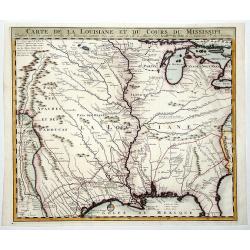
Carte de la Louisiane et du Cours du Mississipi Dressée sur un grand nombre de Memoires.
Anonymous map copied from the important de L'Isle map. The map shows "Natichitoches, éstablissemt. François fait en 1717 par Mr. De Bienville" and routes of e...
Place & Date: Paris, c. 1720
Selling price: $500
Sold in 2012
A new map of the English Empire in America. . .
This fine English map of eastern North America including Canada engraved by John Harris and first published by Robert Morden. John Senex acquired and made minor alteratio...
Place & Date: London, 1720
Selling price: $1400
Sold in 2013
A new map of New France containing Canada, Louisiana &c. in N.th America. . .
A fine map of Canada, Great Lakes and most of South east New Foundland. For this edition the London meridian is used with Deg.West from London and Deg.East from London en...
Place & Date: London, c. 1720
Selling price: $255
Sold in 2013
Nova Anglia Septentrionali Americae implantata ..
German interest in North America was high during the first half of the eighteenth century when Johan Baptiste Homann was the leading German cartographer. During this peri...
Place & Date: Nuremberg, 1720
Selling price: $700
Sold in 2016
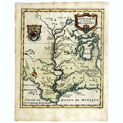
Louisiana by de Rivier Mississippi.
Scarce map of the Mississippi River Valley and Great Lakes regions. The map is primarily based on Hennepin with enlarged Great Lakes and the Mississippi located too far w...
Place & Date: Amsterdam, ca. 1720
Selling price: $1050
Sold in 2016
Regni Mexicani seu Novae Hispaniae, Floridae, Novae ..
The map shows the eastern sea board of America, the West Indies and the various estates and countries that border the Gulf of Mexico, with decorative, uncolored cartouche...
Place & Date: Nuremberg, 1720
Selling price: $900
Sold in 2016
Regni Mexicani seu Novae Hispaniae, Floridae, Novae ..
The map shows the eastern sea board of America, the West Indies and the various estates and countries that border the Gulf of Mexico, with decorative -uncolored- cartouch...
Place & Date: Nuremberg, 1720
Selling price: $1050
Sold in 2016
Lousiana by de Rivier Missisisppi.
A scarce little map of the Mississippi River Valley and western Great Lakes from the book “Het Groote Tafereel der Dwaasheid…” which accounts for the history of Joh...
Place & Date: Amsterdam, 1720
Selling price: $801
Sold in 2019
Amplissimae Regionis Mississipi Seu Provinciae Ludovicianae. . .
An iconic copperplate Map of the Mississippi Valley (United States, Louisiana, Texas, British Colonies) by Johann Baptiste Homann in Nuremberg in 1720. This map is often ...
Place & Date: Nuremberg, 1720
Selling price: $850
Sold in 2017
Amplissimae Regionis Mississipi... (The Bufflao Map).
Homann's important and highly decorative map of the Mississippi River Valley and the Southeast USA. Extends from the Great Lakes until the Bahamas, including Louisiana an...
Place & Date: Nuremberg, c. 1720
Selling price: $850
Sold in 2017
Afbeeldinge van't zeer vermaarde Eiland Geks-Kop. . .
The central map of the island of Madhead is contained in an elaborately engraved cartouche surrounded by scenes of ill-fated investors storming the offices of John Law's ...
Place & Date: Amsterdam, 1720
Selling price: $600
Sold in 2019
CARTE DE LA LOUISIANE ET DU COURS DU MISSISSIPI.
A nice example of Jean Frederic Bernard's rare variant edition of Guillaume De L'Isle's seminal map, one of the most important and influential maps of the 18th Century, w...
Place & Date: Amsterdam, 1720
Selling price: $350
Sold in 2019
Nova Anglia Septentrionali Americae Implantata Anglorumque Coloniis Florentissima Geographice Exhibita.
A decorative map of the New York and New England region.
Place & Date: Nuremberg, ca 1720
Selling price: $700
Sold in 2020
Nouvelle Carte de l' Amerique Septentrionale Dressee sur les plus Nouvelles Observations de Messieurs de l' Academie. . .
A superb map of North America with well developed cartography in the Great Lakes and Mississippi River.It takes in all of Central America and the West Indies. The English...
Place & Date: Amsterdam, 1720
Selling price: $630
Sold in 2020
La Californie ou Nouvelle Caroline.
This fine rare map is a reissue of de Fer's map of 1705 but on a larger scale, and with some notable additions. A boldly engraved and handsome item, the largest scale map...
Place & Date: Paris, 1720
Selling price: $5600
Sold in 2022
Nouvelle Carte de l' Amerique Septentrionale Dressee sur les plus Nouvelles Observations de Messieurs de l' Academie. . .
Great map of North America with well developed cartography in the Great Lakes and Mississippi River.It includes all of Central America and the West Indies. The English se...
Place & Date: Amsterdam, 1720
Selling price: $275
Sold in 2022
Amerique Septentrionale Par N.Sanson d\'Abbeville Geograph du Roy.
A general map of North America showing California as an island but with few names.From the book \"Nouvelle Relation, Contenant LES VOYAGES DE THOMAS GAGE dans la nou...
Place & Date: Amsterdam, 1721
Selling price: $326
Sold
Les Virginiens, adorent le Feu, ...
Print depicting a gathering around a fire in Virginia.
Place & Date: Amsterdam, 1721
Selling price: $30
Sold in 2011
A New Map of Virginia Mary=Land And The Improved Parts of Penn=sylvania & New Jersey Most humbly Inscribed to the Right Hon.ble the Earl of Orkney . . . 1719..
Christopher Browne's map was first published, as a separate issue, in 1685. John Senex obtained the plate and, changed only the imprint, republished it in his atlas of 17...
Place & Date: London, 1721
Selling price: $2400
Sold in 2012
A map of Louisiana and of the Mississipi.
A scarce first English version of the influential map published by Guillaume De L'Isle in 1718.The original was a landmark map in the cartography of the region, centered ...
Place & Date: London, 1721
Selling price: $2400
Sold
Pasquins Windkaart op de Windnegotie van 't Iaar 1720.
Undivided engraved sheet of 54 pictorial playing cards. Engraving on mounted paper.This is an early 18th-century uncut playing card sheet based on the disastrous collapse...
Place & Date: Amsterdam, 1721
Selling price: $800
Sold in 2013
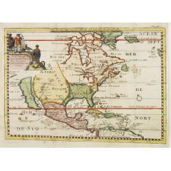
Carte du Gouvernement de l' Amerique [California Island].
An interesting chart depicting the European possessions in North and South America. A wonderful example of Chatelain’s elegant maps. Included in the 1721 edition of the...
Place & Date: Amsterdam, 1721
Selling price: $120
Sold in 2019
Carte du Mexique et de la Floride des Terres Angloises et des Isles Antilles. . .
Covens & Mortier's issue of Delisle's important map showing the south-eastern part of the United States, Mexico and the Caribbean Sea. It is credited with accurately ...
Place & Date: Amsterdam, c. 1722
Selling price: $900
Sold in 2016
North America According to the Latest Observations.
State 1 with north latitude 60 deg. above the Arctic Circle. First issued in: Geography Anatomiz'd... The ninth edition. . . and a set of new maps by Mr. Senex / Patrick ...
Place & Date: London, ca 1722
Selling price: $130
Sold in 2023
L'Amérique Septentrionale suivant Mr. Delisle de l'Académie Royale des Sciences.
A copper engraving map of the North American continent from the atlas Science des personnes de la cour, a rare and richly illustrated handbook for aristocrats at the roya...
Place & Date: Amsterdam, 1723
Selling price: $50
Sold in 2018
Tabula Californiae Anno 1702 ex Autoptica Observatione Delineata a R.P. Chino e S.I.
Map of California based on Kino's map, originally drawn in 1702. Kino's map carefully records the results of nine journeys he made in northwestern Mexico and along the Co...
Place & Date: Augsburg, 1726
Selling price: $750
Sold in 2019
Tabula Californiae, Anno 1702 … Ex autoptica observatione delineata a R.P. Chino e S.I. [The Map of California in 1702 as Observed and Drawn by Father Chino, S. J.]
The much sought after so-called KINO-map of California as a peninsula, a result of Father Kino's travels which misspelled the island-phantasy. This his second map is...
Place & Date: Augsburg & Graetz, 1726
Selling price: $600
Sold in 2021
Passage par Terre a la Californie ..
Father Kino's important map was the first map to accurately depict the region, in particular the relative positions of the Colorado and Gila rivers and the correct locali...
Place & Date: Paris, 1727
Selling price: $275
Sold in 2011
Nouvelle Carte L'Amérique Septentrionale..
Map of Northern America, including northern Venezuela and Baffin Bay. All five of the Great Lakes are present: but Lake Erie is unnamed. The Ohio River is shown, but unna...
Place & Date: Amsterdam 1728
Selling price: $500
Sold
Nouvelle Carte L'Amérique Septentrionale..
Map of Northern America.
Place & Date: Amsterdam 1728
Selling price: $600
Sold
Description de la peche, habillemens..
This sheet contains fourteen vignettes of the Virginia colony after De Bry's engravings of John White's drawings. 130 years later he chose these illustrations because the...
Place & Date: Amsterdam 1728
Selling price: $240
Sold
Carte qui contient..Iles & Terres..L'Amerique..Jamaique..
Eight maps on one sheet. From Chatelain's Atlas Historique et Méthodique. Including maps of Bermuda, Jamaica, New England with Long Island, Carolina, Chesapeake and Dela...
Place & Date: Amsterdam, 1728
Selling price: $420
Sold
Carte qui contient une description des iles & terres que les anglois possedent dans L'Amerique Septentrionale . . . Jamaique. . .
Eight maps on one sheet showing the English colonies in North America including Barbados, Jamaica, New England, Bermuda, part of Canada showing the St. Lawrence River and...
Place & Date: Amsterdam, 1728
Selling price: $400
Sold in 2016
Description de la peche, habillemens ?
This sheet contains fourteen vignettes of the Virginia colony after De Bry's engravings of John White's drawings. 130 years later he chose these illustrations because the...
Place & Date: Amsterdam, 1728
Selling price: $150
Sold in 2009
La Floride suivant les nouvelles observations...
Uncommon edition of this map of Florida. From Le Nouveau Theatre du Monde, ou la Geographie Royale.
Place & Date: Amsterdam, 1728
Selling price: $900
Sold in 2020
Nouvelle Carte Marine de Toute les Cotes de l´Amerique ... / Nieuwe grote en zeer curieuze Paskaart van Geheel WestIndien ...
Large size sea chart of the Caribbean and surrounding coasts, by Gerard van Keulen, son of Johannes Van Keulen. A rare map since these larger-sized sheets were never publ...
Place & Date: 1728
Selling price: $3300
Sold in 2022
Novum Amsterodamum..
A good example of one of the earliest available views of New York. Set in a border with two other prints. To the right a couple from the New England area. In the bottom a...
Place & Date: Leiden 1729
Selling price: $700
Sold
Partie Meridionale de la Virginie et la .. Floride dans L'Amerique septentrionale ..
A scarce and attractive map of the American colonies stretching from Chesapeake Bay through the Carolinas.Geographically based on the Montanus map, which was in turn base...
Place & Date: Amsterdam 1729
Selling price: $700
Sold
Nieu Amsterdam al. New York.
Originally engraved by Carolus Allard's for his Orbis Habitablis the print shows two locals and a distance view of lower Manhattan.From Galerie Agréable du Monde, a sixt...
Place & Date: Leiden 1729
Selling price: $1525
Sold
Partie Meridionale de la Virginie et la .. Floride dans L'Amerique septentrionale ..
Pierre van der AA used the old copper plate of Meurs and re-did the engraving, changed the large pictorial cartouche, a new scale of German and French leagues is provided...
Place & Date: Amsterdam 1729
Selling price: $750
Sold
Land en volk-ondekking in't noorder gedeelte van America door P.Marquette en Joliet.
Interesting map of the Mississippi delta. East to the top. According to the title the information is after P.Marquette and Joliet.This example is unusual in having the ad...
Place & Date: Amsterdam 1729
Selling price: $625
Sold
La Floride, suivant les nouvelles observations?
This splendid map of the southern United States was based on Delisle's influential Carte du Mexique de la Floride.. of 1703. The map is filled with details of early colon...
Place & Date: Amsterdam 1729
Selling price: $500
Sold
L'Amerique Septentrionale suivant les nouvelles observations ..
Splendid map of North America.These separately engraved border frames appear much more uncommon than the standard edition without border frames. From Galerie Agréable du...
Place & Date: Amsterdam 1729
Selling price: $850
Sold
Nouvelle Hollande (a present NOUVELLE-YORK)..
A charming map from the famous Jansson-Visscher series of maps covering the east coast from the Chesapeake Bay to Maine. The map has a particularly large title piece show...
Place & Date: Leiden 1729
Selling price: $1300
Sold
Novum Amsterodamum..
A good example of one of the earliest available views of New York. Set in a border with two other prints. To the right a couple from the New England area. In the bottom a...
Place & Date: Leiden 1729
Selling price: $600
Sold
Land en volk-ondekking in't noorder gedeelte van America door P.Marquette en Joliet.
Interesting map of the Mississippi delta. East to the top. According to the title the information is after P.Marquette and Joliet.This example is unusual in having the ad...
Place & Date: Amsterdam 1729
Selling price: $950
Sold
Nouvelle Hollande (a present NOUVELLE-YORK)..
A charming map from the famous Jansson-Visscher series of maps covering the east coast from the Chesapeake Bay to Maine. The map has a particularly large title piece show...
Place & Date: Leiden 1729
Selling price: $1650
Sold
Virginia and Maryland.
Title: 'VIRGINIA AND MARYLAND by H. Moll Geographer' from 'Atlas minor: or a new and curious set of sixty-two maps...' A charming map in Molls unique style.
Place & Date: London, 1729
Selling price: $400
Sold in 2015




![Carte Qui Contient la Mantere don't se Fait La Chasse des Boeufs Sauvages et des Elans, Le Grand Saut de la riviere de Niagar a la danse du Calumet. . .[NIAGARA FALLS..]](/uploads/cache/83653-250x250.jpg)
![L'Amerique Septentrionale qui fait partie des Indes Occidentales . . . [California island]](/uploads/cache/85233-250x250.jpg)















![Carte du Gouvernement de l' Amerique [California Island].](/uploads/cache/82994-250x250.jpg)


![Tabula Californiae, Anno 1702 … Ex autoptica observatione delineata a R.P. Chino e S.I. [The Map of California in 1702 as Observed and Drawn by Father Chino, S. J.]](/uploads/cache/85891-250x250.jpg)

