Browse Listings in America > Caribbean & Atlantic Ocean
Jamaica from the latest surveys, improved and engraved by Thomas Jefferys. . .
Detailed map of Jamaica, showing parishes, towns and villages, churches, forts, roads, rivers and ponds, harbors, anchorages, soundings, etc.Includes an annotation at upp...
Place & Date: London, 1794
Selling price: $200
Sold in 2018
Map of the Gulf of Mexico, the Islands and Countries Adjacent.
A striking map of the West Indies, Gulf Coast, Florida, etc. Published in the Rev. Dr. Robertson's “History of America”. Includes a compass rose and decorative title ...
Place & Date: London, 1795
Selling price: $99
Sold in 2018
Le Isole Azoridi delineate fulle ultime Osservazioni
Rare Italian map of the Azores. Large scale and very detailed with much of topographical information. Big and decorative title cartouche illustrating a native hunting sce...
Place & Date: Rome, 1798
Selling price: $300
Sold
A Map of the Island of St. Domingo.
An important map of the Caribbean island of St. Domingo (Santo Domingo), or Hispaniola, prepared by Bryan Edwards and published by Englishman John Stockdale in 1800. This...
Place & Date: London, 1800
Selling price: $85
Sold in 2018
Carte Reduite d’une partie du Vieux Canal de Bahama...
This large highly detailed chart of the northern coastline of Cuba and part of the Bahamas was published under the auspices of the Contra-Amiral Decres Ministre de la Mar...
Place & Date: Paris, 1801
Selling price: $300
Sold in 2023
Charte von Jamaica In Kirchspiele eingetheilt und mit den Poststrassen.
General map of Jamaica, shows the postal roads, churches, towns, harbours, rivers, mountains and many other details. One of the earliest obtainable maps of Jamaica to loc...
Place & Date: Weimar, 1805
Selling price: $50
Sold in 2020
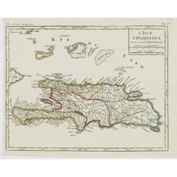
L'Isle St. Domingue Divisée en 5 Département.
Map of the island of Hispaniola, from Atlas de la Géographie de toutes les parties du monde .. Ouvrage destiné pour l'education, et nécessaire aux négocians, aux voya...
Place & Date: Paris, Prudhomme, Levrault, Debray, 1806
Selling price: $17
Sold in 2022
Carte générale de l'Océan Atlantique ou occidental, Dresse au depot general des Cartes Plans et Journaux/de la Marine/en 1786
Seventh edition of this magnificent sea chart of the Atlantic Ocean, covered in rhumb lines. Map flanked with extensive lists of tides, ‘Tables des Latitudes and Longit...
Place & Date: Paris, 1806
Selling price: $500
Sold in 2022
Isle de la Jamaïque.
Map of Jamaica, from Atlas de la Géographie de toutes les parties du monde.. Ouvrage destiné pour l'education, et nécessaire aux négocians, aux voyageurs, aux fonctio...
Place & Date: Paris, Prudhomme, Levrault, Debray, 1806
Selling price: $25
Sold in 2016
(St. Kitts) Appointment of Charles Andrew Mills as the Aid-de-Camp. . .
Unique and rare document: Describes the appointment of Charles Andrew Mills as the Aid-de-Camp (ADC and government representative) of the Caribbean island of St. Christ...
Place & Date: Antigua, 1806
Selling price: $340
Sold in 2016
West Indies & East Indies (2 Maps)
Two separate maps published by Cadell & Davies in London in 1811. One is of the West Indies, and the other is of the East Indies. They were by John Pinkerton and are ...
Place & Date: London, 1811
Selling price: $10
Sold in 2016
Westindien.
A scarce map of South America and Caribbean. Published in “Allgemeiner Atlas” by Johann Walch (1757-1824). He was a cartographer and map publisher active in Augsburg,...
Place & Date: Augsburg, 1812
Selling price: $17
Sold in 2018
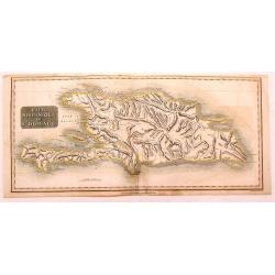
Haiti, Hispaniola or St. Domingo.
Fine Thomson map of Haiti or th island of St. Domingo. Originally paired with the map of Porto Rico, this map has been professionally split into two maps.
Place & Date: Edinburgh, 1814
Selling price: $15
Sold in 2015
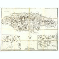
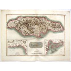
Jamaica.
Large map of the island with insets of 'The Harbour of Bluefields' and 'The Harbours of Kingston and Port Royal'. This map was based on Jefferys' map of 1775. The map is ...
Place & Date: London, 1814
Selling price: $38
Sold in 2017
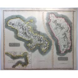
West India Islands - Martinico & Dominica.
A fine example of John Thomson's 1814 map of the West Indian islands of Dominica and Martinique. The map offers detail including individual buildings, villages, hospitals...
Place & Date: Edinbourgh, 1814
Selling price: $20
Sold in 2021
Charte von den Inseln Trinidad, Tabago und Margaretha, dem Busen von Paria, und einem Theile von Cumana.
This uncommon chart incorporates the area from the island of Margarita, off the coast of Venezuela, to Tobago. It includes a portion of the of the Venezuelan coastline an...
Place & Date: Weimar, 1814
Selling price: $135
Sold in 2020
Martinico & Dominica.
Two superb maps on one sheet, of two Carribean Islands. 'Martinico' is Martinique (French) and Dominica (English). Below the Martinique map, there is an inset map of the...
Place & Date: Liverpool, 1815
Selling price: $17
Sold in 2021
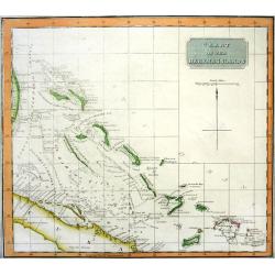
CHART OF THE BAHAMA ISLANDS
Rare chart of the Bahamas, includgin part of Cuba and the Turks & Caicos. Excellent detail with depth soundings and shipping channels indicated. On of the best maps a...
Place & Date: Edinburgh, 1816
Selling price: $220
Sold
Jamaica.
Fine hand-colored map featuring the island of Jamaica. Inserts of the Harbour of Bluefields and The Harbours of Kingston & Port Royal. From Thomson's "New Genera...
Place & Date: Edinburgh, 1817
Selling price: $26
Sold in 2016
West Indies Islands - Guadeloupe, Mariegalante & Antigua.
A fine Thomson map of the West Indies islands of Guadeloupe, Mariegalante and Antigua. The map is simple, clean and elegant. John Thomson (1777-c1840), was a Scottish ca...
Place & Date: Edinburgh, 1817
Selling price: $115
Sold in 2015
West India Islands - Martinico & Dominica.
Two maps of West India Islands including Martinico and Dominica. Features an inset of cul de Sac Royal (Modern day Fort-de France). Issued in Thomson's "NEW GENERAL ...
Place & Date: Edinburgh, 1817
Selling price: $131
Sold in 2015
West India Islands.
Map of four islands in the Caribbean: Grenada. Tobago. Trinidad. Curacao (with) Fort Amsterdam.Title above: 'West India Islands'. At bottom centre: 'Drawn & engraved ...
Place & Date: Edinburgh, London, Dublin, 1816/1817
Selling price: $120
Sold in 2022
Carte réduite de l'océan Atlantique méridional. . .
Map showing the southern part of South America and Africa, including the Falkland islands. Issued by "Depot Général de la Marine", the official French Governm...
Place & Date: Paris, 1818
Selling price: $100
Sold in 2011
Map of the Route of Columbus, on arriving among the Bahama Islands.
An interesting map of the route Christopher Columbus took when he arrived in the Bahamas. Map extent includes Jamaica, most of Cuba, Saint Domingo, The Caycos Islands, th...
Place & Date: Philadelphia, 1820
Selling price: $75
Sold in 2018
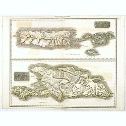
Porto Rico and Virgin Isles / Haiti, Hispaniola...
A map of three interesting West Indian Islands by the Edinburg cartographer John Thomson. Lightly hand colored. Relief shown by hachures.John Thomson was one of the leadi...
Place & Date: Edinburgh, 1821
Selling price: $100
Sold in 2016
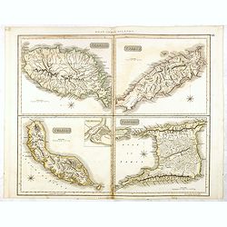
Grenada / Tobago / Curaçao / Trinidad.
A delightfully detailed map of four West Indian islands by John Thomson. The map displays excellent detail concerning each of the islands, including an inset plan of Fort...
Place & Date: Edenburgh, 1821
Selling price: $150
Sold in 2016
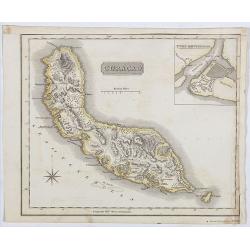
Curaçao.
A delightfully detailed map the West Indian island Curaçao by John Thomson. The map displays excellent detail concerning, including an inset plan of Fort Amsterdam in Cu...
Place & Date: Edenburgh, 1821
Selling price: $150
Sold in 2019
Guadaloupe / Marie Galante / Antigua.
A very finely engraved and detailed map, of both French and English islands in the West Indies. The map is mostly of Guadeloupe, with inset maps of Marie Galante and Anti...
Place & Date: Edinburgh, 1821
Selling price: $60
Sold in 2021
Carta del Oceano Atlantico Setentrional, con las Derrotas que siguió Dn. Cristobal Colon ..
Map of the North Atlantic Ocean, illustrating Christopher Columbus' routes to the New World in 1492, 1495, 1498, 1502.POublished by the "Deposito Hidrografico" ...
Place & Date: Madrid 1825
Selling price: $110
Sold
Carte Geographique, Statistique et Historique de Cuba.
A nice detailed map of the island of Cuba, from Buchon's Atlas Gégraphique Statistique, historique et chronologique des deux Ameriques et des isles adjacentes traduit de...
Place & Date: Paris, 1825
Selling price: $60
Sold in 2019
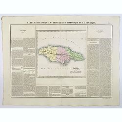
Carte Geographique, Statistique et Historique de la Jamaique.
A nice detailed map of the island of Jamaica, from Buchon's Atlas Gégraphique Statistique, historique et chronologique des deux Ameriques et des isles adjacentes traduit...
Place & Date: Paris, 1825
Selling price: $125
Sold in 2023
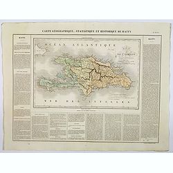
Carte Geographique, Statistique et Historique de Haity.
A nice detailed map of the island of Haiti, from Buchon's Atlas Gégraphique Statistique, historique et chronologique des deux Ameriques et des isles adjacentes traduit d...
Place & Date: Paris, 1825
Selling price: $50
Sold in 2019
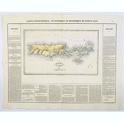
Carte Geographique, Statistique et Historique de Porto-Rico.
A nice detailed map of the island of Porto-Rico, and the Virgin Islands, from Buchon's Atlas Gégraphique Statistique, historique et chronologique des deux Ameriques et d...
Place & Date: Paris, 1825
Selling price: $50
Sold in 2019
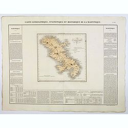
Carte Geographique, Statistique et Historique de la Martinique.
A nice detailed map of the island of Martinique, from Buchon's Atlas Gégraphique Statistique, historique et chronologique des deux Ameriques et des isles adjacentes trad...
Place & Date: Paris, 1825
Selling price: $50
Sold in 2019
Carta Di S. Domingo / Carta Delle Isole Antille. [Set of 2 maps]
Set of two maps of St. Domingo and Antilles. Size of St. Domingo is 335mm x 410mm and size of Antilles is 415mm x 340mm.From "Nuovo Atlante di Geografia Universale.....
Place & Date: Milan, Batelli, 1825
Selling price: $70
Sold in 2021
[ Cotton preparation ].
Aquatint depicting cotton preparation.Engraved by Fumagalli.From Giulio Ferrario's work Le Costume Ancien et Moderne ou Histoire du gouvernement, de la milice, de la reli...
Place & Date: Milan, 1827
Selling price: $80
Sold in 2020
[ Caribs idoles and weapons ].
Aquatint depicting Caribs' idoles and weapons. Engraved by Raineri.From Giulio Ferrario's work Le Costume Ancien et Moderne ou Histoire du gouvernement, de la milice, de ...
Place & Date: Milan, 1827
Selling price: $25
Sold in 2020
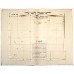
Amer. Sep. Grandes Antilles. No. 73.
Large lithographed map featuring the southern portion of the Grand Antilles Islands including the Banc Pedro Group. This map is part of Vandermaelen's world maps produced...
Place & Date: Brusselles, 1827
Selling price: $25
Sold in 2018
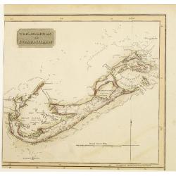
The Bermudas or Summer Islands.
Somewhat later but very finely engraved and detailed map, including roads, of Bermuda. Part from a sheet with other maps of Cuba and the Bahamas, from the east coast of F...
Place & Date: Edinburgh 1829
Selling price: $100
Sold
Baie de la praya. (Ile San lago.).
View of the Cape Verde from Voyage de la corvette l’Astrolabe exécuté par Ordre du Roi pendant les années 1826 – 1827 – 1828 – 1829 sous le commandement de M. ...
Place & Date: Paris, 1830
Selling price: $40
Sold in 2011
VUE DE L'ETABLISSEMENT DES MISSIONS À ST. JOHNS DANS L'ISLE D'ANTIGOA AUX INDES ORIENTALES
Extremely rare and important aquatint view of Antigua! Based on original works by L. Stobwasser, engraved by Franz Hegi. Illustrates a scene of island life with slaves ...
Place & Date: Basle, 1835
Selling price: $500
Sold in 2009
Vue de Gracehill dans l'Isle d'Antigoa...
Extremely rare and important aquatint view of Antigua!Based on original works by L. Stobwasser, engraved by Hürlimann.Illustrates a scene of island life at the Gracehill...
Place & Date: Basle, 1835
Selling price: $660
Sold in 2009
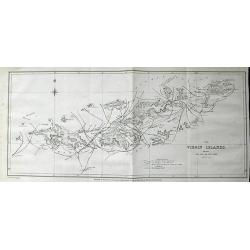
The Virgin Islands, shewing The Set of The Tide amongst them. . .
Highly important lithograph map of the Virgin Islands, published by John Murray. Extending from Green and Brigantine Islands just east of St. Thomas to Virgin Gorda in th...
Place & Date: London, 1835
Selling price: $164
Sold in 2011
Port Louis à l'ile de France. (Mauritius)
Aquatint by Sigismond Himely (1801-1872) after Walter Paris (fl.1849-1891) published in "Laplace, Voyage autour du monde" by Sainson. Rare view of Port Louis on...
Place & Date: Paris, 1835
Selling price: $310
Sold in 2011
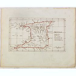
TRINIDAD . . .
Finely executed pend drawing in brown ink with coast line in red color. Scale is in English miles. Underneath the title an explanation.
Place & Date: ca. 1835
Selling price: $120
Sold in 2015
Habana. 2a Vista tomada desde Casa-Blanca.
Decorative view of Havana harbor, by Frederico Mialhe (1810-1881), with his signature on stone lower right. Lithographed by L. Marquier Ce de Lamparillo No. 96. From the ...
Place & Date: Havana, 1838
Selling price: $600
Sold in 2010
Habana. 2a Vista tomada desde Casa-Blanca.
Decorative view of Havana harbor, by Frederico Mialhe (1810-1881), with his signature on stone lower right. Lithographed by L. Marquier Ce de Lamparillo No. 96. From the ...
Place & Date: Havana, 1838
Selling price: $500
Sold in 2010
Habana. 2a Vista tomada desde Casa-Blanca.
Decorative view of Havana harbor, by Frederico Mialhe (1810-1881), with his signature on stone lower right. Lithographed by L. Marquier Ce de Lamparillo No. 96. From the ...
Place & Date: Havana, 1838
Selling price: $500
Sold in 2010
Habana. 2a Vista tomada desde Casa-Blanca.
Decorative view of Havana harbor, by Frederico Mialhe (1810-1881), with his signature on stone lower right. Lithographed by L. Marquier Ce de Lamparillo No. 96. From the ...
Place & Date: Havana, 1838
Selling price: $600
Sold in 2010
Habana. 2a Vista tomada desde Casa-Blanca.
Decorative view of Havana harbor, by Frederico Mialhe (1810-1881), with his signature on stone lower right. Lithographed by L. Marquier Ce de Lamparillo No. 96. From the ...
Place & Date: Havana, 1838
Selling price: $700
Sold in 2010
Habana. 2a Vista tomada desde Casa-Blanca.
Decorative view of Havana harbor, by Frederico Mialhe (1810-1881), with his signature on stone lower right. Lithographed by L. Marquier Ce de Lamparillo No. 96. From the ...
Place & Date: Havana, 1838
Selling price: $600
Sold in 2010
Carte des Grandes Antilles (Cuba, Haïti, Jamaïque, Archipel de Bahama..
Decorative focused on the Greater Antilles. Showing towns, banks, isles and soundings made in meters.Relief shown by hachures. Prepared by M. Keller, hydrographer and en...
Place & Date: Paris, 1843
Selling price: $325
Sold in 2012
WEST INDIEN.
A large map of Florida, the Bahamas, the Caribbean Islands, and parts of Central America and South America.Highly detailed with many place names given. colors indicate th...
Place & Date: Weimar, 1844
Selling price: $100
Sold in 2018
West India Islands.
A large-scale map of Florida, and the Caribbean, while also showing portions of Yucatan, Honduras, Guatemala, Panama, Cartagena and Venezuela, courtesy of the Johnston pu...
Place & Date: Edinburgh, ca 1844
Selling price: $55
Sold in 2023
Arribo de Albina Steffanoni a la Isla de CUBA. 1848.
Fine manuscript map of Cuba made on the occasion of the visit of soprano Balbina Steffenone to Cuba in 1848. The map is carefully drawn and heightened by watercolors, orn...
Place & Date: Habana, 1848
Selling price: $500
Sold in 2022
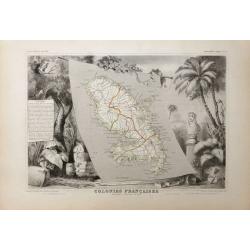
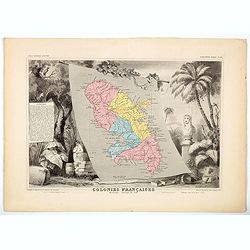
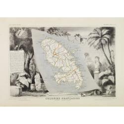
Colonies Françaises. Martinique - Amérique du Sud.
A very decorative 19th century map of the Martinique Island. The map is surrounded by the products of the island like tobacco, sugar, etc. A decoration of trees and birds...
Place & Date: Paris 1850
Selling price: $90
Sold
Colonies Françaises (en Amérique.)
A very decorative 19th century map showing the islands of St Martin, St Pierre et Miquelon and Terra Nova. Includes also Guyana. The map is surrounded by portraits, anima...
Place & Date: Paris 1850
Selling price: $100
Sold
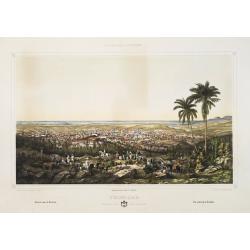
A view general of the City de Havana of Amerique. / Vue generale de ..
Very decorative and colorful panoramic view over Havana harbour. Engraved for a Vue d'Optique, it was designed to be viewed in a special apparatus that gave the scene a s...
Place & Date: Ca. 1850
Selling price: $100
Sold
Cercanias de Baracoa ?
From Album pintoresco de la isla de Cuba - La Havane.
Place & Date: Hamburg and Berlin, c.1850
Selling price: $150
Sold in 2009
El Zapateado ?
From Album pintoresco de la isla de Cuba - La Havane.
Place & Date: Hamburg and Berlin, c.1850
Selling price: $105
Sold in 2009
West India Islands.
Beautiful map of the Caribbean - from Florida to Venezuela. Decorated with the embellished borders, a view of Kingston in Jamaica, sailing ships, and a native couple. Exc...
Place & Date: London, ca. 1850
Selling price: $33
Sold in 2016
Colonies Françaises (en Amérique.)
A very decorative 19th-century map showing the French Colonies in the Americas, the islands of St Martin, St Pierre et Miquelon and Terra Nova. Includes also Guyana. The ...
Place & Date: Paris, 1850
Selling price: $16
Sold in 2021
Jamaica
Fantastic map of Jamaica from the famous Atlas by John Tallis & company published in London & New York around 1850.It shows the island in great detail, filled wit...
Place & Date: London & New York, c1851
Selling price: $44
Sold in 2021
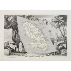
Colonies Françaises Martinique. Amérique du Sud. N°90.
Map of Martinique.A very decorative 19th century map of Martinique Island. The map is surrounded by the products of the island like tobacco, sugar, etc. A decoration of t...
Place & Date: Paris, A. Combette, 1852
Selling price: $90
Sold in 2018
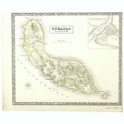
Curacao to Holland.
A detailed map of the island of Curaçao
Place & Date: Liverpool, 1852
Selling price: $70
Sold in 2016
Maury's wind & current chart 3rd edition 1849. no.8 series A. [with] Maury's wind & current chart 3rd edition 1852. no.2 series A. [with] Storm and rain chart of the north Atlantic. . .
Three rare charts with winds and currents in the North Sea and Atlantic Ocean. - Maury's wind & current chart 3rd edition 1849. no.8 series A. - Maury's wind & c...
Place & Date: USA, 1849, 1852
Selling price: $300
Sold in 2017
Posesiones de America : Isla de Cuba. . .
Wall size map of land areas showing all of Cuba, part of Florida Keys plus San Adios and Salvador Grande in the Bahamas.Minute topographical, political, and hydrographic ...
Place & Date: Madrid, 1853
Selling price: $750
Sold in 2023
Der Atlantische Ocean
A very interesting map of the Atlantic Ocean, showing several routes (with dates) between Europe and the Americas. Includes the tracks of Columbus' first voyage, Humboldt...
Place & Date: Gotha, 1853
Selling price: $32
Sold in 2016
A detailed map of the island of Curaçao.
A detailed map of the island of Curaçao showing settlements, roads, and the topography. An inset shows Fort Amsterdam with the battery, gallows, and fortifications.
Place & Date: Liverpool, George Philip and Son, 1853
Selling price: $100
Sold in 2022
West India Islands
A superb map of the West Indies and the tip of Florida - Venezuela, drawn and engraved by William Hughes – Sidney Hall steel engraved. Published by Adam & Charles B...
Place & Date: Edinburgh, 1854
Selling price: $50
Sold in 2016
West India Islands
This is the uncommon and slightly later edition by Rapkin based on Tallis' maps. The vignettes have been removed and the map is issued in black and white. The map extends...
Place & Date: London 1855
Selling price: $85
Sold
Vista de la iglesia mayor y de la ermita del buenviaje.
Decorative view of the High Church and the Hermitage of Good Voyages at San Juan de los Remedios, by un unknown lithographer after Frederico Mialhe (1810-1881).He is know...
Place & Date: Havana, ca. 1855
Selling price: $500
Sold in 2010
La Habana: vista general tomada desde la entrada del puerto.
A splendid, large lithographed view of the city of Havana as seen from the north, beautifully and subtly colored. The viewer is situated above the sea, looking into the m...
Place & Date: Havana, Sergio Martin, 1856
Selling price: $3000
Sold
Cardenas Vista general tomada desde la Bahia.
A splendid, large lithographed view of the city of Cardenas, beautifully and subtly colored. The viewer is situated above the sea, looking to the harbour. Dozens of boats...
Place & Date: Havana, Sergio Martin, 1856
Selling price: $2000
Sold
Trinidad Vista general tomada desde la loma de la Vijia.
A splendid, large lithographed view of the city of Trinidad, beautifully and subtly colored. The town is seen from above with in the background the Ocean. People in local...
Place & Date: Havana, Gobierno, 1856
Selling price: $2000
Sold
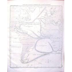
Carte des Courants Generaux dans L'Ocean Anlantique.
Fine lithographed sea chart by Depot des Cartes et Plans de la Marine featuring the sea currents in the Atlantic Ocean. It was engraved by Jacobs from drawings by Charles...
Place & Date: Paris, 1856
Selling price: $99
Sold in 2016
Colonies Françaises. Martinique. Amérique du Sud.
Beautiful map from one of the finest decorative atlases of the nineteenth century. The map is surrounded with engravings depicting the countryside with trade goods includ...
Place & Date: Paris 1856
Selling price: $80
Sold in 2016
Colonies Françaises (en Amérique).
Beautiful map from one of the finest decorative atlases of the nineteenth century. A highly decorative 19th century map showing the islands of St Martin, St Pierre et Miq...
Place & Date: Paris 1856
Selling price: $60
Sold in 2016
Colonies Francaises en Amérique: Guadeloupe, Marie-Galante, St Martin, La Désirade, Les Saintes, Anguilla.
Beautiful map from one of the finest decorative atlases of the nineteenth century. A highly decorative 19th century map showing the islands of Guadeloupe, Marie-Galante, ...
Place & Date: Paris 1856
Selling price: $65
Sold in 2016
Colonies Francaises - Martinique Amerique du Sud.
A beautiful map from one of the finest decorative atlases of the nineteenth century. The map is surrounded with engravings depicting the countryside with trade goods incl...
Place & Date: Paris, 1856
Selling price: $17
Sold in 2020











![Carta Di S. Domingo / Carta Delle Isole Antille. [Set of 2 maps]](/uploads/cache/45844-250x250.jpg)
![[ Cotton preparation ].](/uploads/cache/27340-250x250.jpg)
![[ Caribs idoles and weapons ].](/uploads/cache/27336-250x250.jpg)








![Maury's wind & current chart 3rd edition 1849. no.8 series A. [with] Maury's wind & current chart 3rd edition 1852. no.2 series A. [with] Storm and rain chart of the north Atlantic. . .](/uploads/cache/39424-250x250.jpg)


